Article

Prospects for a Megacity Region Transition in Australia: A Preliminary Examination of Transport and Communication Drivers

1
Centre for Urban Transitions, Swinburne University of Technology, Melbourne 3122, Australia
2
Faculty of Architecture, Building and Planning, The University of Melbourne, Parkville 3052, Australia
*
Author to whom correspondence should be addressed.
Sustainability 2024, 16(9), 3712; https://doi.org/10.3390/su16093712
Submission received: 25 March 2024 / Revised: 19 April 2024 / Accepted: 25 April 2024 / Published: 29 April 2024

Abstract

:
Australian governments continue to search for a model capable of planning future urban settlements at an extended spatial scale (the mega-metropolitan region) to accommodate high population growth more sustainably. Attempts at decentralisation over the past half century have failed, as state capital cities continue to sprawl in an unsustainable manner and increase their primacy at the expense of regional cities. This paper examines how two technologies, broadband and fast rail—both infrastructures capable of re-shaping space–time relationships—could underpin a transition of Australia’s largest capital cities into megacity regions by functionally integrating regional cities into their core metropolitan agglomerations. With the Melbourne megacity region as a spatial framework, changes in population and economic development are examined for Melbourne and several regional cities in Victoria following the introduction of regional fast rail (RFR) and broadband. The impact of high-speed rail (HSR) for intercity corridors in southeast England is analysed as a possible analogue for future application in Victoria. The results revealed that RFR primarily served to extend capital city suburban development. Only HSR had the capacity to ‘punch through’ and boost growth for ‘basic’ new economy industries in ‘on-line’ urban centres in corridors linked to London. High-speed broadband proved most attractive to Melbourne’s agglomeration of high-skilled information workers. Lower speed broadband services were more uniformly taken up across all centres. This discussion speculates on the impacts of these and other green economy and digitalisation drivers on prospects for a future megacity region transition in Victoria.

Graphical Abstract

1. Introduction

Metropolitan primacy has been the principal feature of Australia’s system of settlement since the mid-20th century [1]. Population growth reached record levels in 2023, with much of it concentrated in the nation’s largest cities of Melbourne and Sydney. Regional cities lagged significantly in comparison [2]. The most recent international benchmarking study of metropolitan Melbourne, which compared its performance with a group of 20 highly rated peer cities, revealed its rate of car-dependent sprawl continues to be fastest, placing increased pressure on the development of accessible housing, intra-urban travel, and liveability [3].
These results are not new and echo studies outlined in the next section that highlight the need for a new vision and planning strategies capable of sustainable densification of existing capital cities as well as increased decentralisation of their population and industry to regional cities.
In this context, there have been increasing calls for a national vision and plan for its future settlement system focusing especially on the major fast-growing capital cities and their relationship with regional centres located within a 100 km to 250 km radius [4,5,6,7,8,9]. These reports have noted that Australia’s population has been growing more rapidly than other comparable advanced economies, with two thirds of the population increase occurring in Sydney, Melbourne, and southeast Queensland, intensifying pressure on infrastructure, housing, and services. At the same time, regional cities have been calling for larger populations to support their economies and communities [10,11]. As Future Earth and the Australian Academy of Science [6] (p. 13) have stated: “Encouraging a productive balance of our national population between major centres and the regions has proven difficult without a coherent national strategy to manage our population distribution and development of urban areas, we will be at a distinct competitive disadvantage”. This is a sentiment reiterated in a Future Earth (2023) update [5], following the COVID-19 urban system shock.
Attempts at decentralisation are proving to be the most intractable. This paper focuses on advances in transport and communication technologies considered fundamental to the successful settlement transition of Melbourne to a mega-metropolitan region, functionally integrated with its key regional cities in respect of information economy industries. Improvements in transport and communication technologies deliver space–time compression by shrinking the time it takes to travel or communicate between places [12].
Three research questions were identified for examination associated with transport and communication drivers supporting the development of a spatially extensive Melbourne mega-metropolitan region:
  • Whether introduction of ‘fast rail’, connecting Melbourne with regional cities at operating speeds of less than 100 km/h, provided sufficient savings in travel times to stimulate population and employment growth in the non-metropolitan centres.
  • Whether introduction of broadband services across Victoria at different operating speeds ranging from 12 Mbps to 1000 Mbps has been associated with uniform rates of take-up in metropolitan compared to regional centres.
  • Whether positive population and employment impacts associated with the introduction of HSR (>200 km/h) for intercity rail corridors in SE England represent an analogue for future HSR projects linking Melbourne and its regional cities.

2. Background

Australian Bureau of Statistics (ABS) projections indicate that future population growth will continue to favour the five largest capital cities, rising from 64% of the national population in 2017 to 71% by 2066 [13]. Melbourne is projected to be the largest city in Australia by 2066 with a population between 10.2 and 12.2 million, up from 4.8 million in 2017. Immigration has been a major driver of this growth, with over 80% of new arrivals choosing to locate in the major cities [14]. Over the last 20 years, Australia’s capital cities have grown faster than rest-of-state areas (except during the COVID-19 pandemic) and a reversion to the long-term trend is now projected to continue [15] (p. 55). The Centre for Population’s Population Statement [16] (p. 1) indicates that ‘capital cities and regional areas are projected to return to normal patterns of population growth as net overseas migration returns and internal migration returns to pre-pandemic patterns’. The latest data, however, reveal that Australia has reached historically high levels of immigration [17].
Most government population projections reflect a strong path dependency—an expected continuation of recent trends, for the most part, into the future [18]. Under these federal and state government scenarios, Melbourne and Sydney are expected to attain ‘megacity’ status—defined as cities with over 10 million people—within 50 years. Business as usual (BAU) spatial patterns of urban development for metropolitan and non-metropolitan regions are expected to reflect these projections. Table 1 indicates that Melbourne’s growth will continue at a higher rate than its nearby regions, reflecting increased infill development associated with apartment construction in the inner city and an increased interest in peri-urban living stimulated by COVID-19. Table 2 summarises key socio-demographic indicators for Melbourne and Victoria’s principal regional cities. These illustrate prevailing trends of metropolitan primacy and the increasing strength of the capital city’s agglomeration economy. They also mask problems that are increasing for Australian cities on a megacity trajectory. These have been acknowledged most recently by contributors to the Parliament of Australia’s inquiry [7] into the Australian Government’s role in the development of cities and include a wide range of sustainability issues that have also featured in every Australian State of Environment Report on Human Settlements and Built Environment since 1996 [19].
Does a BAU pattern of settlement development represent an optimal scenario for Australia’s largest capital cities and regional cities into the future? Greenfield development in the designated outer metropolitan growth areas combined with inner metropolitan infill and continued peri-urban development on the urban fringe are projected to be the principal absorbers of population growth to 2036. Under the current urban policy settings, this can be expected to perpetuate sprawl for cities that already have among the largest urban, ecological, and carbon footprints in the world [22]. Strategic plans for Australia’s major metropolitan areas are attempting to create more compact cities via urban infill—encouraging populations inwards and upwards rather than outwards—but are falling short of their targets [23,24]. Such population and settlement trajectories will also perpetuate current urban–regional disparities in economic and socio-demographic development. For example, over the decade to 2019, SGS Economics & Planning [25] assessed Melbourne’s contribution to national gross domestic product (GDP) growth at 20.1% compared to the rate of 2.8% for regional Victoria. The share of R&D expenditure was 89% for Melbourne versus 11% for the rest of Victoria [26] while population shares were 77% and 23%, respectively [18].
Since the 1950s there have been regular calls for more comprehensive settlement policies capable of addressing the growing economic divide between cities and regions [27,28]. In the early 1970s, decentralisation of manufacturing and service industries was a focus for the Federal Labour’s Department of Urban and Regional Development’s (DURD) attempt from 1972 to 1975 to grow two regional centres (Albury–Wodonga and Bathurst–Orange) into inland cities. These plans were not realised [29], a result that has weighed against subsequent attempts at decentralisation. It has been argued, however, that decentralisation should not be ‘rendered conceptually unable to be rehabilitated in a meaningful way… otherwise, it feeds into a fatalistic, passive view of change and governance, which in practice means both enshrining the status quo and predisposing urban growth forms and terms dictated primarily by market forces, rather than broader social needs’ [30] (p. 10).
The projected doubling of population in Australia’s major cities over the next 50 years, amplified by the challenges of climate change adaptation and sustainable urban development more broadly, warrants a level of national settlement planning and new forms of urban governance not witnessed in post-war Australia. The dramatic industry and technology transitions over the past 50 years—to a digitalised information and knowledge-based economy coupled with broadband network access and high-speed transport—has the capacity for extension to a re-shaping of Australia’s national space-economy/settlement system. The Department of Prime Minister and Cabinet’s [31] release of Planning for Australia’s Future Population reinforces the key challenges as managing city growth; delivering a national population and planning framework; better connecting regional Australia with opportunities for growth; and developing a federal–state governance framework to manage growth. The COVID-19 shock prompted the establishment of a National Cabinet of federal and state government leaders—a new governance framework—to tackle the pandemic as a mission-scale planning challenge. Post pandemic, the National Cabinet agreed to a National Planning Reform Blueprint that targets those urban planning mechanisms embedded in local strategic plans seen to be inhibiting urban development [32]. It is unclear at the time of writing, however, whether this retains a dominant metropolitan focus, where housing shortages are most acute, or will embrace regional centres as well. Recent pronouncements by the Victorian Government [33] indicated that a new Plan Melbourne strategy extending to 2050 will expand its scope and scale beyond the capital city to ‘cover the whole state … the plan will set our regions and rural areas up to thrive’. However, within months of that posting, the state government had axed its funding for fast rail to the regional city of Geelong [34] and re-directed it to kick-start a massive orbital rail loop project for Melbourne [35] designed to connect the city’s middle ring suburbs—a continuation of capital-city-centric infrastructure investment.
This paper is a response to elements of this challenge. The megacity region (MCR) is a 21st century settlement model capable of accommodating future population and employment growth in the major capital cities and their hinterland regional cities, providing a spatial template for centralisation with decentralisation and a break from the urban development patterns of the past 50 years. Several interconnected drivers have underpinned the global growth of megacities and megacity regions to date, in addition to population and immigration. Foremost among them are technology transitions in communications and transport, and ‘post-industrial’ transitions associated with the emergence and growth of information, knowledge, and creative industries. In combination they stimulate the emergence of agglomeration economies that reflect the benefits of co-location of firms servicing these core industry sectors as well as many others that employ producer services as key inputs. These are sectors of industry are currently not well represented in regional cities in Australia.
Increased globalisation of trade has also reinforced the roles of megacities in managing and accommodating the associated international flows of goods, services, people, capital, and information [36,37].

2.1. Industrial Transitions

Kelly et al. [38]. (p. 1) summarised the evolution of industry and urban settlement in Australia: “Until the early 20th century, one in three workers were employed in primary industry and almost half of the population lived on rural properties or in towns of less than 3000. By 1960 manufacturing had grown to make up almost 30 percent of GDP and employ one in four Australians, with a big presence in suburban areas”. Today, Australia’s metropolitan areas with populations above half a million account for two thirds of national GDP [39] and the largest two cities contributed three quarters of national GDP growth in 2018–2019 (Melbourne 40% and Sydney 33%) [25].
Australia’s post-industrial transition to an information and advanced services economy saw core information industries and knowledge-oriented organisations concentrate their economic activities in the CBDs and inner suburbs of the larger cities, having displaced manufacturing industries and their workforces [40]. Large cities are also now defined according to their roles in global economies and networks, acting as command-and-control centres in managing the flows of information, capital, skills, and power [37,41,42]. Leveraging agglomeration economies, they attract industries that benefit from spatial clustering and economies of scale in locations where there is an associated concentration of human capital, which encourages knowledge spillovers between firms and increased creativity and innovation [43]. There has been a well-established trend of information and knowledge firms locating in areas with high liveability and residential amenity combined with good access to cultural and higher educational services—locations that have proven to be attractive to the highly skilled and remunerated labour force as places to live. Research by Florida [44,45] and Donegan et al. [46], writing on the creative economy, have identified a set of additional ‘big city’ attributes that are attractive to the ‘creative class’ and millennials and reflect more open and socially inclusive societies characterised by higher levels of ethnic mix and LGBTI tolerance. Regional cities in Australia are currently not well represented by either traditional or non-traditional indicators attractive to new economy businesses [25]. Until economic opportunities for such workforces are decentralised, populations are unlikely to disperse, and big cities will keep on growing for the reasons outlined.
A ranking of Australia’s 25 largest urban centres in terms of their information and knowledge intensity [47] revealed three distinct categories: the five high ranking cities of Sydney, Melbourne, Canberra, Brisbane, and Perth; a noticeable break to four middle ranking cities (Adelaide, Darwin, Sunshine Coast, and Gold Coast–Tweed), and a long tail of 15 relatively weak cities (including Geelong, Albury–Wodonga, Ballarat, and Bendigo). In the context of current growth industry trajectories, an ability to encourage employment and population movement to regional centres is unlikely to be realised on a scale necessary to reduce development pressures on the big cities or support the economic transition of outlying regional cities to knowledge-based industries, despite the significant political representation of regions at the ministerial level in federal and state parliaments [48]. Human and financial capital will continue to flow in response to the competitive advantage of regions, and the most attractive regional city municipalities will be those with a strong ‘metropolitan’ profile [49].
Alternative futures are possible, necessitating speculation on the implications that a 21st century urban sustainability transition including increased telecommuting and transition to a green economy has for future megacity regional planning and development.

2.2. Technology Transitions

New transport technologies have played a fundamental role in radically changing the form, fabric, and footprint of cities over centuries [50]. In the period between 1850 and 1950, fixed rail trams and trains supported corridor development with typical densities between 35 and 100 persons per hectare, with higher-density walking fabric around transit stops. The increased speed of transit allowed urban development to extend 20 km or more from the city centre. From the 1950s onward, with the advent of mass automobile production, individualised motor transport meant that city growth was no longer constrained to fixed rail corridors. In these new kinds of cities, population densities fell to less than 35 persons per hectare (low-density sprawl) because the flexibility and speed of cars (averaging 50–80 km/h on uncongested roads) allowed residents to live well beyond a 20 km radius from the city centre. Anthropological limits to the average length of time workers are prepared to travel to work continue to act as one of the key triggers for urban transitions, whether that be further suburbanisation (new greenfield cities), re-urbanisation (inner city densification), or new connections to regional cities. It is in relation to the latter transition that high-speed rail (HSR) has emerged more recently as a technology driver not only of intercity and inter-regional transport but also as a basis for megacity region transformation—in Japan, Western Europe, China, South Korea, and USA (but, despite several attempts, not in Australia [51,52]). High-speed rail typically operates at speeds in the range from 250 to 350 Km/h, significantly higher than regional fast rail services operating in Victoria. A key focus of this paper involves examining whether there is significant growth in population and employment in Victoria’s regional cities following connection to higher speed rail services.
Advances in modern communications technologies and associated infrastructures have also been important in the development of human settlement, especially over the past 30–40 years, a period that has witnessed transformational advances in telematic services: from analogue to digital, from fixed to mobile, from the emergence of networked computing and the internet—and its subsequent global spread on high-speed broadband networks [53]. Initial ‘high-speed’ communications (circa 2 Mbps) were exclusively city-based [54], but the nbn™ network, when proposed in 2009 as a 100 Mbps service, was seen by the Australian Government and regional agencies as a means of creating a level playing field spatially in relation to information and job access—removing a digital divide [10]. The roll-out of the nbn™ network over the past decade has been relatively rapid and is examined in a section that follows. Whether broadband is a necessary catalyst for accelerating non-metropolitan development is a key question. Routine (back office) activities are readily decentralised—often to overseas locations. Advanced information, knowledge, and creative industries have non-routine activities at their core that have benefited from propinquity, enabling frequent face-to-face meetings. Until COVID-19, telepresence does not appear to have provided a good substitute for a range of face-to-face meetings or a complete platform for telework that is totally removed from the business and social connections of the office. Recent research, however, shows that the psychological and organisational drivers of teleworkers have fundamentally shifted due to experience with the practices established during the pandemic [55,56]—attitudes, norms, competencies, technologies, and organisational acceptance have changed. Furthermore, the Productivity Commission (2021) is largely positive about the likely long-term impacts on productivity from greater adoption of telework, and business are adopting new workplace policies that allow greater flexibility, yet are also looking to entice workers back in the office with quality office spaces [57]. The long-term impact on urbanisation patterns is yet to play out, and there are risks that could see greater urban sprawl and unintended consequences unless there is more investment and strategic planning for the growth and development of regional economic centres [58].

3. Materials and Methods

In this article, the socio-spatial impact of three infrastructure-related technological interventions—broadband, fast rail, and HSR—are examined empirically to assess the extent to which they have induced measurable shifts in population and employment following their development. In all cases, change over a minimum of a decade was assessed employing Before versus After Impact Analysis (BAIA). This is an impact evaluation approach that explores the value of an indicator before and after “an intervention” or an “event”. Here, the BAIA methodology explores population growth, as well as demographic and employment outcomes arising from changes in access to broadband, fast rail, and HSR, i.e., a natural experiment, where the counterfactual is represented by areas where access to these technologies did not significantly increase, or at least did not happen to the same degree.
BAIA emerged as the most appropriate method for undertaking a descriptive empirical assessment of interventions such as those in scope for this paper [59]. Each intervention had a clear starting date and provided a suitable period of elapsed time for revealing the extent of change in outcome variables at the municipal scale or equivalent capable of being assessed for each intervention. Further details on the analytical methods are outlined in Section 3.2.

3.1. The Spatial Context

The two future settlement scenarios for Melbourne and regional Victoria identified as the focus for analysis are those defined in recent reports by Bolleter et.al [60] and Infrastructure Victoria [61]. The first is a continuation of a business as usual scenario—sustained rapid growth and sprawl of Melbourne with continued weak connections to regional cities. The second involves a settlement transition, similar in significance to the industrial transitions and technological transitions referred to earlier, namely, transition to a megacity region.

3.1.1. Business as Usual: Melbourne and the Regions

This scenario is predicated upon population projections from state and federal agencies referred to earlier. Under this scenario, growth continues to concentrate in the largest cities, especially the capitals, such as Melbourne. It can be expected that regional population growth will continue to be slower and more incremental under this scenario due to the narrower and more localised economic bases in most regional cities and their relatively poor access to the capital city. Previous agricultural functions have diminished, and their attraction has swung to those population segments attracted by ‘tree change’ or ‘sea change’ lifestyles, rather than those seeking 21st century employment opportunities, career advancement, and ‘urban lifestyles’ concentrated in the large cities. Human and financial capital is expected to continue to flow in response to the competitive advantage of regions, and the most attractive regional cities will be those with a strong ‘metropolitan’ profile [49] reflecting a skills base that is core to 21st century economic development [62]. Major regional centres over 100 km from capital cities, however, will remain outside the city’s functional urban region for daily commutes because the speed of current road and rail networks fail to deliver the ’30-min city’ to such regions [63,64].
Travel time budgets of urban populations have been a consistent driver of how cities have developed over centuries. Urban settlements have evolved in response to the underlying transport and communication modes of the era, creating, in turn, the walking city, the transit city (rail), and the auto city—all conforming to Marchetti’s anthropological constant [65]: a universal travel time budget averaging about 60 min per day for the journey to and from work. Each era has expanded the footprint of cities and influenced their urban forms and fabrics [50]. With the widespread adoption of telework during and since the COVID-19 pandemic, the geographical implications on travel budgets (i.e., relating to Marchetti’s constant) are yet to be fully understood. When commuters can travel to work less frequently, the average distance per trip that commuters are willing to travel increases, thus allowing them to potentially move further away from workplaces [66,67].
Figure 1 outlines the approximate extent of metropolitan Melbourne in terms of commuting distance to its central business district. Distance–time contours (isochrones) were drawn using methods in Pérez, Quintana, and Pastor [68] and Whitten [69] to approximate ‘door-to-door’ travel times from the centre of each regional and suburban locality to central Melbourne. Highlighted isochrones delineate between different commuting dynamics: the 45 min isochrone approximates the outer boundary of regular, daily commuting and the 90 min isochrone approximates the geography of long-distance commuting involving some telecommuting. The results conform broadly to the daily commuting experience of urban Australia (p. 5), with peri-urban areas like Bacchus Marsh and Gisborne falling within an average 45 min one-way commute and regional cities like Geelong, Ballarat, Bendigo, and Traralgon/Latrobe Valley falling within an extended commute. The authors note that these intervals are indicative only and that commuting to Melbourne can impose much higher time costs [70].
The Government of Victoria’s latest vision for Melbourne in Plan Melbourne 2017–2050 [71] suggests that the expected population growth to over 8 million will be accommodated within metropolitan boundaries as currently outlined and largely supported by planned road and rail networks that are city focused. There is no indication of future transport network planning that would support the transition to a Melbourne megacity region (MMR) of over 10 million people by 2066 [13], strategically and functionally integrated with its hinterland regional cities.

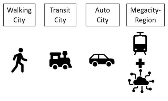
3.1.2. Melbourne Megacity Region

Accelerating population and urban growth since the second world war, combined with technological and industrial drivers of urban transitions (outlined in the next section), have stimulated the development, worldwide, of new functional spatial settlement networks linking multiple urban centres that have become integrated into what have been termed megacity regions (MCRs), occupying urban footprints of unprecedented scale. Multiple terms have been advanced for these spatial systems (e.g., megapolitan, megalopolis, megaregion, mega-metropolitan), but ‘megacity region’ has emerged as a preferred descriptor [72,73]. After an extensive review and synthesis of city-region literature, Hall and Pain [36] (p. 815) concludes: ‘the megacity region is the emerging form at the start of the 21st century and is likely, on all realistic scenarios, to become steadily more dominant in the course of the next half century’. They do, however, remark on the variability of location, scale, and urban forms of MCRs, ranging from those based on a single dominant city (e.g., the Paris region) to a polycentric city region (e.g., Randstad).
More recently, scholarly interest has continued in relation to the concept of the megacity region as a new scale of settlement for the 21st century. The OECD [74] (p. 24) undertook a review of the megaregion concept based on settlement developments in Europe and North America. It identified the technology and transport drivers enabling populations and businesses to connect over greater distances more effectively than has been previously possible, while also pointing to the fact that “empirical evidence on the economic and social benefits of megaregions as well as successful governance arrangements at this scale are lacking”. A more recent review [75] focuses on future urban trends in the United States and argues that megaregions represent a principal instrument for national settlement policy, planning, and investment—a spatial framework capable of steering future urban development towards higher levels sustainability, resilience, and equity.
The second settlement scenario identified in this paper, therefore, conceives of a Melbourne megacity region that incorporates several provincial cities within the state of Victoria that are not currently part of a functional urban region centred on its capital city but are located within 100 km to 250 km of the capital city’s central business district. Four MCRs were envisaged as part of Australia’s settlement futures in the 2006 National State of Environment Human Settlements Report [76]. A similar set of MCRs are also featured in Archer et al. [4]. In these studies, the Melbourne MCR extends from the Bellarine Peninsula in the west to the Mornington Peninsula in the east—an arc of some 300 km. An MCR transition needs to be underpinned by a 21st century transport and communication platform of HSR and broadband communications, together with a broader underpinning geographic and economic plan (featuring key industry drivers) capable of supporting future sustainable settlement development at this scale. The concepts of MCR and HSR have been the focus of recent commentary linked to the future planning of Melbourne and Sydney [9,77,78]. In June 2023, a new High-Speed Rail Authority was established by Prime Minister Albanese with the challenging task of ‘bringing high-speed rail to reality’ [51]. Its current scope, however, is restricted to the Sydney–Newcastle corridor in the state of New South Wales [79].
HSR achieving operational speeds much faster than the current ‘regional fast rail’ speeds in Victoria (averaging between 70 and 100 km/h) will be required. At speeds of 350 km/h envisaged for the first HSR proposal developed for Australia in the 1980s, Victoria’s regional cities would be transformed into the equivalent of middle-ring Melbourne suburbs where 30 min commute-to-work times satisfy Marchetti’s anthropocentric principle for a transition in settlement patterns (see [65,80], and Figure 2), and a transition in employment linked to an agglomeration economy demonstrated to be attractive to information and knowledge industries and workers [81]. Regional cities in Australia are currently not well represented by either traditional or non-traditional indicators attractive to new economy businesses and employees [25,62]. Until economic activity is decentralised, populations are unlikely to disperse, and big cities will keep on growing and sprawling for the reasons outlined.

3.2. Proposed Analytics

The objective of this paper is to contribute to an evidence base (currently lacking) to assist in the creation of future long-term planning strategies needed to guide Australia’s 21st century settlement system, where a step-change is required at the spatial scale of urban development capable of more effectively connecting the fast-growing major capital cities with their lagging regional centres located 100 to 250 km away. Given the paper’s relevance to an MCR vision and strategy, high-speed rail (HSR) and broadband network access are key technologies capable of delivering the required space–time compression to facilitate the development of a functional urban region of this scale.

3.2.1. Regional Fast Rail

The paper reports on analyses that examined changes in population and employment growth in Victoria’s regional centres following the introduction of regional fast rail (RFR) in 2005–2006. Operating at speeds of up to 100 km/h, RFR is not a radical space-transforming intervention, but it can reveal the impact of incremental improvements in travel times from Melbourne to regional centres. The principal routes are identified in Figure 1. To analyse the influence of RFR on population and employment growth, data for ‘online’ Local Government Areas (LGAs) connected to the RFR network were compared to data for ‘offline’ LGAs not connected to the network. Data for periods both before and after the introduction of RFR were analysed. Key economic indicators for Victoria were sourced from Australian Bureau of Statistics (ABS) census data for LGAs for the years specified in each table. The methods used to model the Victorian transport network and produce the isochrone maps are detailed in Whitten [63]. Data on the spatial structure and mobility characteristics of the transport network were obtained from the Victorian Government Department of Transport (DoT) and VicRoads via data.vic.gov.au and the Commonwealth Government Public Sector Mapping Agency (PSMA) via the Australian Urban Research Infrastructure Network (AURIN).

3.2.2. Broadband

The paper presents data on consumer take-up on the roll-out of the national broadband network (nbn™) in Melbourne and across Victoria’s major regional cities from its inception in 2012 up to 2021. This provided alignment with the ABS national censuses of 2011 and 2021, enabling analyses of the shifts in population and employment. A contract was negotiated with Telstra, the organisation that was responsible for designing, building, and operating Australia’s National Broadband Network as the nation’s wholesale broadband provider. An agreement was negotiated with NBN Co., Ltd. for their provision of data on the total number of activated subscribers in December of each year, aggregated to ABS census boundaries aligned with the Melbourne Statistical Division and each of the regional cities in the study. Data were provided for both residential and commercial customers in the following speed tiers (Mbps): 12, 25, 50, 100, and 200–1000.

3.2.3. High-Speed Rail (UK)

The paper also examined growth in population and employment after 2005 following the construction of high-speed rail (HSR) in several corridors of southeast England centred on London as a possible analogue for impacts on regional settlement in selected development corridors in Victoria, centred on Melbourne (see Figure 3). This allows a contribution to be made to local debates concerning the pros and cons of HSR and the new geographies and economies it may help create. The same method used to analyse the influence of RFR on regional centres in Victoria was used to compare the data for online and offline LADs in southeast England before and after the introduction of HSR.
The final section of the paper was necessarily speculative (both are in the final references Hall 2009 [72], Frantzeskaki et al. [82]). It briefly identifies emerging green economy transitions such as a circular economy and renewable-energy-based decarbonisation that require allocations of space much larger than the existing Melbourne metropolitan area can supply and continued expansion of digitalisation across all sectors of industry, facilitating workplace–residence transitions that were enabled by telework from home during COVID-19 to become a more permanent feature of future information, knowledge-based, and creative industries established at a distance from current capital city concentrations. It also highlights the need for integrated, multi-sector MCR development and the creation of a new model of governance capable of planning and managing urban transitions at this scale—what Mazzucato [83,84] terms a mission-oriented challenge.

4. Analyses and Results

4.1. Exploring the Impacts of Regional Fast Rail on Regional Population and Employment Growth in Victoria

Despite the Commonwealth Government’s plan to ‘have faster, more efficient, and reliable journey times along strategic corridors connecting major regional centres with capital cities’ [31] (p. 29), there is limited empirical research highlighting the potential for non-metropolitan urban growth linked to faster regional rail or HSR in Australia.
In this paper, empirical data and analyses are presented that seek to illustrate the strength of any link between the introduction of RFR in Victoria and subsequent growth in population and employment of regional cities within their respective megacity region corridors.—specifically, the change in population and employment occurring between 2006 and 2021 (see Table 3 for a list of cities and indicative rail service speeds and Figure 1 for the rail corridors). It is expected, based on the study’s hypothesis, that the introduction of fast rail should boost population growth as well as employment rates, especially in highly qualified information economy jobs.
The jurisdictions in focus include Local Government Areas (LGAs) incorporated into metropolitan Melbourne as well as regional cities in the railway corridors of Geelong, Ballarat, Bendigo, Shepparton, Albury-Wodonga, and Latrobe (comprising the cities of Moe, Morwell, and Traralgon), which are all connected to the Southern Cross Station in Melbourne’s CBD. However, it should be noted that, as of early 2020, the RFR network delivered the following average end-to-end speeds: Geelong 81 km/h, Ballarat 96 km/h, Bendigo 89 km/h, and Traralgon 71 km/h (significantly below the maximum speeds possible).
Figure 4 graphs annual average population growth in selected LGAs in the decade after RFR was commissioned in 2005–2006. It includes metropolitan LGAs connected to the suburban rail network yet traversed by RFR corridors. LGAs are organized by distance from central Melbourne to capture the potential influence of enhanced connectivity on population growth. The results show that metropolitan LGAs designated as growth areas, including Hume, Melton, Whittlesea, Wyndham, and Casey, are the principal absorbers of population and that regional LGAs lag comparatively behind. However, rates of population growth in LGAs connected to the RFR network mostly within 150 km or 90 min travel time by train outperform LGAs not connected to the network. Online cities within 150 km of central Melbourne experienced average annual population growth rates between 2% and 3% p.a., well above Victorian Government [20] forecasts, while offline cities beyond 150 km exhibited growth rates of between 0% and 1% p.a. Growth rates hollow out around Shepparton and Wangaratta, located between 150 km and 250 km from central Melbourne, and recover around Wodonga, which, combined with its twin-city Albury in New South Wales, has a larger population size and stronger economy.
Based on these analyses, differences in population growth rates between online and offline LGAs appear to be, at least in part, attributable to distance from central Melbourne CBD and pre-existing regional dynamics rather than to connectivity improvements enabled by RFR. The potential influence of RFR on population growth is shown in Figure 5, which graphs total population change for the same sample of LGAs in the decades before and after RFR was commissioned. Compared to Figure 4, it shows that population growth in offline LGAs remained constant in the before and after periods, while population growth in most online LGAs jumped in the decade after 2005–2006. These trends suggest that online LGAs like Geelong, Ballarat, and Bendigo have benefited from Melbourne’s rapid population growth to a greater degree than offline urban centres.
Table 4 shows that annual average employment growth in producer services for the decade after the introduction of RFR followed a similar pattern, hollowing out for LGAs located between 150 km and 250 km from Melbourne. Furthermore, changes to employment growth in the decades before and after the introduction of RFR are on average greater for online LGAs than offline LGAs (except for Latrobe—a region dominated by the fossil fuel industry and economically challenged by the closure of mines and brown-coal-fired power stations).
Annual average employment growth increased approximately 2.3% p.a. or higher for online LGAs, compared to 1.2% for offline LGAs, but offline LGAs between 150 km and 250 km from Melbourne experienced changes between 0% and 0.75% p.a. These findings suggest a relationship between RFR and enhanced population and employment growth prospects for most regional cities connected to the network. The gap between online and offline centres in relation to average annual growth rates in producer services employment was greater than for people-serving jobs, which are tied more closely to the demands of the local resident population (see Table 4). Results from this analysis suggest that RFR positively influenced population and employment growth, especially in the higher skilled producer service sectors in non-metropolitan regions, with year-on-year growth rates typically twice as strong in online LGAs (except Latrobe) than offline LGAs.

4.2. Broadband Uptake: An Indicator of Telecommuting Capacity, Human Capital, Industry Structure Potential?

Australia’s nbn™ network has, since 2009, aimed to deliver a fast, reliable, and secure broadband network to all residential and business premises across Australia. As of late 2020, the project was deemed complete [87] and the aim of delivering uniform access to broadband services across the urban/regional divide (as illustrated in [53]) was delivered to specification. Australia’s nbn™ network has since been complemented via technological advances in satellite internet systems, such as Starlink, that have provided fast internet anywhere in Australia since 2021. A partnership with Telstra will boost fast internet connectivity for rural and remote areas less well served by high-speed nbn fibre networks.
Broadband connection data supplied by NBN Co. for the Melbourne Statistical Division (MSD) and Victoria’s six regional cities enabled an examination of trends in take-up between 2012 and 2021 (Table 5). From a relatively slow start, connection rates accelerated rapidly from 2014. By the end of 2021, there were almost 1.9 million properties connected to the nbn™ network in Melbourne and the regional cities. MSD had an 88% share of activated nbn™ network connections, compared to a 78% share of the population. This finding mirrors earlier studies [54] that revealed that information economy indicators were superior differentiators of leading urban economic performance compared to traditional population indicators. Lagging Victorian regional cities on this basis were Shepparton and Latrobe with 1.1 and 1.2% of nbn™ network connections, reflecting centres with an economic base strongly reliant on rural and fossil fuel industries, respectively. However, with particular reference to broadband uptake as an indicator of information economies and, therefore, capacity for employment in specialised services, as of 2021, the level of Geelong, Ballarat, and Bendigo’s connections to the nbn™ network had jumped from near zero in 2012 to 22.6%, 24.5%, and 25.1% (respectively) of their populations, with Melbourne at 35.3%. This indicates a sharp rise in regional capacity for telecommuting and engagement in information services across all centres.
Over this period, higher speed services were being offered and connected over the national nbn™ network [88]. Table 6 reveals that for Victoria over 94.4% of nbn™ network connections were at download speeds of 100 Mbps or less and 83.7% of all connections were to residential consumers, with little variation in rates of take-up between urban centres within this customer segment. The major contrast between the regional cities and Melbourne is in relation to connection speed, where the gap is greatest for the highest bandwidth tiers (>100 Mbps), with Melbourne taking a 95.8% share of such services. Higher bandwidth allows users to upload and download larger amounts of data faster to their workstations and provides support for multiple digital devices and collaboration tools without experiencing a delay—a driver of productivity and creativity. High-speed networks provide the ITC platform that supports a 21st century extension of the information economy, together with the emerging Internet of Things (IoT), part of the fourth industrial revolution (Industry 4.0 [89]). Notwithstanding, there are speeds >100 Mb/s available to the regions, indicating infrastructural support for high-tech industries.
Unlike Table 6, which revealed no significant difference between Melbourne and provincial cities in the uptake of residential nbn connections, Table 7 indicates a major contrast for business connections—further evidence that major capital cities continue to act as engines of bandwidth-hungry information economy industries in Australia. Clearly, access to broadband communications appears to be a necessary but not sufficient condition to drive decentralisation of industry.
Table 8 reveals that over 40% of Melbourne’s workforce, in 2021, was classed as highly skilled (broadly defined by ANZSCO as the sum of the occupation groups ‘Manager’ and ‘Professional’), notably higher than Victoria’s regional cities but not reflective of the much larger gap related to broadband business connections outlined previously (Table 7), suggesting that such networks may be more strongly linked to a narrower set of high-tech and creative industry occupations. What the table does illustrate is the more recent growth in Geelong’s skilled workforce. As Victoria’s second largest city, and located geographically closest to Melbourne, the indicators presented in this paper suggest that the Geelong corridor should be first in line for an HSR upgrade within the Melbourne megacity region. The fact that the Geelong Mega-rail project has stalled reflects the fact that, to date, all HSR projects have been business ventures narrowly scoped on value uplift around key rail stations, lacking connection to long-term, mission-oriented strategic settlement planning, which is largely absent at the scale of the megaregion in Australia.

4.3. Assessing Impact of HSR in Southeast England: An Analogue for Selected Corridors in Victoria?

In this section, results are presented regarding the extent to which HSR has catalysed growth in two HSR corridors centred on London as a potential analogue for future MCR corridor development in Victoria.
Internationally, studies by Preston and Wall [91], Thomas and O’Donoghue [92], and Vickerman [93] indicate that the introduction of HSR coincides with an uptick in social and economic indicators in cities connected to such networks. However, the development benefits can be quite concentrated and do not translate to positive region-wide outcomes, with communities in metropolitan regions generally benefitting more than communities in outlying regions. In Australia, most recent publications related to decentralisation are speculative in nature [78,94,95,96,97,98] or support status quo policies favouring investment in metropolitan road and rail projects over HSR [99]. What is in question is whether regional cities and towns linked to Melbourne via HSR in a future MCR would become dormitories for metropolitan workers or be capable of attracting new 21st century jobs and employment as well as population growth.
Before proceeding with these analyses, it is important to note the obvious differences in urban geography. In the UK, for example, the populations of Greater London (8.8 million) and the Birmingham metropolitan area (1.1 million) in 2017 [100] were much larger, respectively, than the populations of Greater Melbourne (4.5 million) and Geelong (233,429) in 2016 [85]. The density and spread of urban settlements in the two regions are also quite different. Cities surrounding Greater London, known as Local Area Districts (LADs), are more numerous and have larger population sizes than regional cities surrounding Greater Melbourne. The nearness of non-metropolitan LADs to London and Birmingham could also be expected to increase opportunities for productivity spillovers compared to the situation in Victoria, where Melbourne is the single dominant urban centre. There are, however, shared characteristics that are relevant to this study.
Urban growth in both regions exhibits strong core–periphery tendencies. Greater London’s population grew by approximately 14% between 2005 and 2017, twice the national average of approximately 7% [86]. Around that same time, Greater Melbourne’s population grew by approximately 33% between 2006 and 2016, approximately twice the Australian national average of 17% (derived from [85,101]). Finally, although London’s present-day population is much larger than Melbourne’s, the latter city is projected to double in size by 2066, to between 8.6 million and 12.2 million ([13], low and high projections). To put this in context, Greater London grew by only 1.57 million or 23.7% between 1981 and 2011 and, in that same time, Milton Keynes doubled in size from 122,016 to 248,821 (derived from [102,103]). These core–periphery dynamics are pertinent to this study because Milton Keynes was similar in size in 1981 to present-day Ballarat and Bendigo, which HSR could bring to within 45 min travel time of central Melbourne.
For this study, the change in population and employment was examined in LADs situated in two HSR corridors in the UK selected as potential analogues for the five rail corridors in Victoria. Both corridors terminate in central London (again, see Figure 3): one includes a section of the West Coast Main Line (WCML) connecting Birmingham, Rugby, Coventry, and Milton Keynes to St Pancras Station; the other is a section of the southeastern line connecting Ashford and Ebbsfleet to Stratford and St Pancras Stations. Analyses were undertaken on the WCML and southeastern lines before and after the time each were upgraded (June 2005 and June 2009, respectively) to provide faster and more frequent commuter services.
The method used by Chen and Hall [104], designed to assess the influence of HSR on the economic geography of Britain as reflected in population and jobs growth, was adopted in this study. They designated urban centres within the two corridors as either ‘online’ or ‘offline’ in relation to proximity to a HSR service in their search for evidence of impact. Furthermore, as an important point of difference to Chen and Hall, this study used data points from ‘before’ and ‘after’ the introduction of upgraded rail services. In both UK and Australian studies reported here, the data are limited to that available from the national statistics agencies in both countries.
Figure 6 profiles average annual population growth for LADs along the WCML and southeastern line between 2005 and 2017. The results show that online LADs mostly outperformed offline LADs after HSR was introduced, achieving population growth rates between 1.75% and 2.25% p.a. Most offline LADs have a growth ceiling of 1.5% p.a. and a trend line of growth that approximates 1%. There are some exceptions, but the general pattern seems clear. One outlier in the results is Leicester, which is not connected to the two HSR corridors analysed in this study but occupies a node in the national transport network where major north–south and east–west corridors intersect. Improvements to transport connectivity have clearly influenced the growth prospects of online LADs compared to their offline counterparts. In addition, online LADs between 50 km and 150 km of central London compete quite strongly for population growth against outer metropolitan LADs.
Figure 7 profiles average annual population growth for the same set of LADs in the periods before and after high-speed commuter services were introduced to the WCML and southeastern line. Differences between online and offline LADs for the period between 2005 and 2017 reinforce the relationship between improved transport connectivity and population growth. LADs are organised in order of distance to central London to illustrate how ‘peaks’ and ‘troughs’ in growth rates are restructured around central London and online LADs along both corridors. The pattern of results suggests that HSR has supported strategic planning outcomes including the concentration of growth within existing metropolitan areas (London and Birmingham), renewal of post-war new towns and post-industrial cities (Milton Keynes and Coventry), and preservation of culturally and ecologically valuable landscapes (LADs between Dartford and Milton Keynes that are inside London’s Green Belt). Although still quite centralized, the restructuring of growth around online LADs outside of Greater London speaks to the region-shaping potential of HSR, especially during periods of urban expansion. This is a key take away from this analysis, especially considering the significant levels of long-term population growth expected in Melbourne in the coming decades.
Trends in average annual employment growth between 2006 and 2016 indicate an even greater concentration of economic growth towards Greater London and online LADs. Table 9, which samples the seven highest-performing LADs in each geographic category, shows the relationship between employment growth and distance from central London. Compared to results for average annual population growth, which indicate a weak relationship between growth rates in online LADs and distance from central London (see Figure 7), employment growth is stronger for online cities within 100 km of London than for online cities further away. However, analysing the rates of employment growth in the producer services sector shows that online LADs, across the board, experienced a stronger shift towards information and knowledge-based industries between 2005 and 2018 than offline LADs and, in some instances, outperformed LADs in outer metropolitan areas. Producer services as a share of total employment increased in six out of seven online LADs and six out of seven outer metropolitan LADs in the sample, reinforcing the relationship between HSR development and growth in knowledge-based industries. In contrast, results for the highest-performing offline LADs were not as strong, with approximately half of the sample expanding the proportion of employment in producer services.

5. Discussion

Enabling regional cities to participate more equally in future population and economic growth, especially where industries will be increasingly more reliant on innovation in digitalised information and knowledge platforms irrespective of sectoral applications—what Batty [105] has termed the fifth long wave of innovation—needs to be a continuing focus. Here, providing working and living environments, delivering residential amenities, enabling telepresence, as well proving transport for regular face-to-face meetings fundamental to creative, non-routine forms of work are critical. Broadband delivers the former and HSR the latter technological underpinnings.
As a case study with relevance to international audiences, this paper has sought to shed light on the extent to which recent enhancements in faster rail and broadband services connecting Victoria’s largest regional cities with Melbourne has resulted in any discernible shift in their involvement in information economy industries, where they had seen to be lagging. The results indicate that both RFR and NBN have strengthened Melbourne’s economic and growth capacity. RFR has extended the commuter field for outer metropolitan and peri-urban residents but lacks the speed of HSR to effectively ‘punch through’ to the regional cities. The results also show that high-speed broadband has witnessed stronger demand from Melbourne compared to regional-based domestic and commercial customers—a reflection that regional cities in Victoria mostly house ‘population-serving’ as contrasted with ‘producer-services’ industries. At the same time, Geelong is a second-tier regional city located closest to Melbourne that has attracted significant employment growth, followed by Ballarat and Bendigo, with Latrobe and Shepparton remaining largely unchanged. This is also reflected in the differential growth of their high-skilled workforces. Broadband, in and of itself, is unlikely to create this transition. Broadband appears to be a necessary but not sufficient condition.
The need for a corridor-specific focus for future MCR planning was another clear message to emerge from this study. In this context, the Geelong corridor stands out as a leading contender for HSR and transformation into an MCR. A future Melbourne–Sydney HSR connection via Shepparton and Albury–Wodonga would engage those northern corridors, as would the original 1980s VFT route east via the Latrobe Valley, Gippsland Lakes, and the NSW south coast. Characterising processes of uneven spatial development as “inexorable” to cast shade on the development prospects of regional communities (see [99]) perhaps misses a crucial point about HSR development: it restructures the spatial economy of cities and regions and, when planned well, can engender a more environmentally sustainable and economically cohesive settlement system.
Results from the transport case studies reported in this paper indicate that faster rail services connecting capital cities with their hinterland regions can provide a measurable boost to population and jobs in ‘online’ regional centres compared to those that are ‘offline’. Further research, drawing on more comprehensive data sets to control for a range of regional and economic processes, is needed to establish this effect comprehensively.
In the areas designated as online (with access to NBN and RFR), the employment growth has been particularly strong for information and knowledge workers in producer service industries. Recognition of this potential to begin to shape the future economic structure of cities and regions—as a more integrated megacity (corridor-aligned set of regions)—should encourage policy makers in Australia, and elsewhere, to move beyond conventional zero-sum-game thinking about critical infrastructure development, which typically pits cities against regions, and to instead better understand how communities on both sides of the existing settlement growth divide can grow stronger together.
A forced transition to telecommuting for information workers during COVID-19 has realised a long-held proposition, dating to 1976 [106], that telework could fundamentally change relationships between where people live and work. Until COVID-19, utilising telematics by information workers provided some opportunities for more flexible and out-of-hours working while still strongly anchored to an office. Newton and Wulff (1999) [107] found that only 3% of full-time workers in a national ABS survey worked from home all of the time, 24% some of the time, and 73% none of the time; but, there was a preference by 42% to do more work at home (see also Global Workplace Analytics [108]). The severe and prolonged COVID-19 pandemic, however, has identified clear opportunities associated with the prospects of a more permanent shift in regime from the daily work commute to one that is more flexible and hybrid for many (i.e., where employees work from the office some days and at home others) [109]. Significantly larger proportions now prefer to work from home to a considerable extent and feel competent and confident about continuing with the practice [55,56]. This also has implications for a shift in locational preferences for residences and workplaces, including towards regional locations as has been suggested by Denham [58] as a possible if not likely outcome, especially for knowledge workers. Yet, it is unclear whether telepresence can substitute satisfactorily for face-to-face engagement in non-routine commercially driven workplaces where creativity and innovation are core components. Also, a revision of Marchetti’s anthropological constant is required in relation to job types, where longer but less frequent commutes associated with hybrid (or entirely remote) working models have become common. At present, the jury is still out on the strength of this in Australia [110,111], but it will remain as a factor in longer-term strategic urban and regional planning.
The following set of remarks continues in a speculative vein, since they are germane to the planning of future pathways for megacity regions. They include economic and environmental transitions that will drive future urban development, future governance structures, and planning processes that require a capacity to be transformative—beyond current business as usual practice.
The first set of future drivers are associated with a transition to smart and sustainable urban development—a meshing of the fifth long wave of digital innovation with the sixth long wave of innovation related to the increasing demands for sustainable development [112]—a transition now recognised as fundamental to countering climate change. The transition to a green economy [113] has renewable energy at its core but extends well beyond this into all sectors of the economy. These include the built environment industries of transport, building and construction, materials manufacturing, and utilities (water and waste), which have large ecological and carbon footprints but also present new business and employment opportunities for delivering positive eco-efficient outcomes for cities and regions [114]. The transition to renewable energy and a decarbonised built environment [115] represents a major challenge for an Australian economy dominated by the fossil fuel industry. Regional cities that form part of an HSR corridor that enable relatively fast commute times to a major city will be well-positioned to pioneer and host a new generation of green economy businesses. Foremost among these, perhaps, involves the creation of a circular economy cluster of industries, creating wealth from waste streams currently going to landfill—food waste, organic waste, construction and demolition waste, liquid and solid industrial waste streams—enabling circular economy businesses to develop based on management of the life cycle of natural resources extending from extraction to manufacturing, recycling, and remanufacturing (producing new products as part of an eco-industrial cluster based on industrial symbiosis; see [116]).
As climate change is likely to disrupt global food supply chains with increasing frequency and severity, local food production becomes more important [117]. With the imperative of maintaining or growing local food production, in the context of Melbourne, more intensive food production in the corridor should also be planned to meet the demands of a future 8–10 million megacity region population, using irrigation from treated sewerage from metro and regional populations—reducing the carbon footprint of fresh food distribution and consumption and reducing demand on potable water supplies in a warming, drying climate. These industries are land-intensive and not capable of being accommodated within existing metropolitan boundaries. The land use planning and governance issues associated with MCR are significant and challenging—but, the benefits are likely to be equally significant economically, environmentally, and socially.
To these ends, calls have been intensifying for national leadership in city and regional planning in Australia and internationally. Multiple failed attempts at decentralisation of settlements and the economy, a common goal in many countries, have bedevilled governments in Australia for more than 50 years in seeking to narrow disparities in growth and economic wellbeing between large capital cities and regional cities. Over the past 15 years, Australia’s metropolitan growth rates have been among the highest in the OECD, driven by historically high levels of immigration focused on Sydney and Melbourne [14], putting major pressures on metropolitan planning and delivery in areas related to housing, urban infrastructure (especially transport), and population services [118]. Currently, in Australia, there is a federal planning deficit that encompasses both cities and regions. To address this challenge requires integrated multi-sectoral spatial planning and governance on a scale, thus far, missing in Australia [119,120]: what has been termed mission-scale planning [82,83,84]. As Buxton [95] has argued, such strategic planning would require the integration of sectoral and spatial planning goals across metropolitan and non-metropolitan geographies. As reviews of megacity planning have revealed, issues of governance (especially across spatial scales) are problematic both internationally [73] and in Australia [121]. Establishing appropriate governance structures for long-term strategic policymaking, planning, and management of MCRs represents a challenge to century-long protocols of federal–state–municipal relationships—or what Hall and Pain [36] (p. 178) call ‘the mismatch between functional and territorial logics’. In Australia, however, this needs to extend beyond market-initiated infrastructure projects, typical of HSR initiatives since the 1980s, which are not embedded in broader-based land use, transport, housing, and next-generation industrial development planning led by governments and co-designed and co-produced with industry and the community. Strategic planning of this genre needs to identify the key economic and socio-technical drivers of future urban and economic development and link these to the competitive advantages and future needs of Australia’s cities and regions and, in the context of Melbourne’s MCR, specific HSR corridors where plans and priorities need to be established.
Planning of large, fast-growing, and increasingly complex cities is not at crisis point yet, but a consensus has been growing that a new vision and model is critically needed for mission-scale planning of the future development of Australia’s megacities and their regions. This study contributes evidence for government stakeholders considering commencement of the long term multi-sectoral and multi-scale urban planning required for unprecedented levels of population growth experienced by the nation’s two largest capital cities in the 21st century [Melbourne and Sydney], projected to continue in the 21st century. Australia needs to add its name to the growing international list of countries with an interest in megacity region settlement planning.

Author Contributions

Conceptualization, P.N. and J.W.; methodology, P.N., J.W., S.G., M.R. and M.M.; formal analysis, P.N., J.W., S.G., M.R. and M.M.; data curation, S.G., M.R. and P.N.; writing—original draft preparation, P.N. and J.W.; writing—review and editing, P.N., J.W., S.G. and M.M.; visualization, J.W. and S.G. All authors have read and agreed to the published version of the manuscript.

Funding

This research received no external funding.

Institutional Review Board Statement

Not applicable.

Informed Consent Statement

Not applicable.

Data Availability Statement

The data that support the findings of this study may be made available from the corresponding author upon request.

Acknowledgments

The authors gratefully acknowledge the contribution that NBN Co. has made to this paper by providing data on the residential and commercial broadband connections undertaken on an annual basis from 2012 to 2021 for Melbourne and Victoria’s major regional cities.

Conflicts of Interest

The authors declare no conflict of interest.

References

  1. Bureau of Infrastructure Transport and Regional Economics. The Evolution of Australian Towns; Department of Infrastructure and Regional Development: Canberra, Australia, 2014.
  2. Centre for Population. Regional Population, 2022–23; Australian Government: Canberra, Australia, 2024.
  3. Committee for Melbourne. Benchmarking Melbourne 2024; Committee for Melbourne: Melbourne, Australia, 2024. [Google Scholar]
  4. Archer, J.; Houghton, K.; Vonthethoff, B. Regional Population Growth—Are We Ready? The Economics of Alternative Australian Settlement Patterns; The National Academies of Sciences, Engineering, and Medicine: Canberra, Australia, 2019. [Google Scholar]
  5. Future Earth Australia. 2023 Update: Sustainable Cities and Regions. 10-Year Strategy to Enable Urban Systems Transformation; Future Earth Australia: Canberra, Australia, 2023. [Google Scholar]
  6. Future Earth Australia: The Australian Academy of Science. Sustainable Cities and Regions: 10 Year Strategy to Enable Urban Systems Transformation; Future Earth Australia: The Australian Academy of Science: Canberra, Australia, 2019. [Google Scholar]
  7. Parliament of Australia. Building Up & Moving Out. Inquiry into the Australian Government’s Role in the Development of Cities; House of Representatives Standing Committee on Infrastructure, Transport and Cities, Ed.; Commonwealth of Australia: Canberra, Australia, 2018.
  8. Planning Institute of Australia [PIA]. Through the Lens: The Tipping Point; Planning Institute of Australia [PIA]: Canberra, Australia, 2018. [Google Scholar]
  9. SGS Economics & Planning. Reimagining Australia’s South-East: Prepared for the Committee for Melbourne; SGS Economics & Planning: Melbourne, Australia, 2020. [Google Scholar]
  10. Regional Australia Institute. The Future of Work: Setting Kids up for Success; Regional Australia Institute: Canberra, Australia, 2016. [Google Scholar]
  11. Regional Cities Victoria [RCV]. Growing our Regions, Growing Victoria: RCV Strategic Priorities 2017–2018; Regional Cities Victoria [RCV]: Melbourne, Australia, 2017. [Google Scholar]
  12. Rogers, A.; Castree, N.; Kitchin, R. A Dictionary of Human Geography; Oxford University Press: Oxford, UK, 2013. [Google Scholar]
  13. Australian Bureau of Statistics [ABS]. Population Projections Australia, 2017 to 2066; Australian Bureau of Statistics [ABS]: Canberra, Australia, 2018.
  14. Levin, I.; Nygaard, C.; Gifford, S.; Newton, P. (Eds.) Migration and Urban Transitions in Australia; Palgrave Macmillan: Singapore, 2022. [Google Scholar]
  15. Australian Government. Intergenerational Report 2023: Australia’s Future to 2063; Australian Government: Canberra, Australia, 2023.
  16. Center for Population. 2022 Population Statement; Center for Population: Canberra, Australia, 2022.
  17. Hare, J.; Kehoe, J. Australia has reached ‘peak migration’. Australian Financial Review, 24 November 2023. [Google Scholar]
  18. Australian Bureau of Statistics [ABS]. 3101.0—Australian Demographic Statistics, June 2018; Australian Bureau of Statistics [ABS]: Canberra, Australia, 2018.
  19. Australian Government. The State of Australia’s Environment. Available online: https://soe.dcceew.gov.au/ (accessed on 12 March 2024).
  20. Victorian Government. Victoria in Future 2019. Population Projections 2016 to 2056; Department of Environment, Land, Water and Planning: Melbourne, Australia, 2019.
  21. Australian Bureau of Statistics [ABS]. Census DataPacks. Available online: https://www.abs.gov.au/census/find-census-data/datapacks?release=2021&product=TSP&geography=ALL&header=S (accessed on 12 March 2024).
  22. Newton, P. Liveable and Sustainable? Socio-Technical Challenges for Twenty-First-Century Cities. J. Urban Technol. 2012, 19, 81–102. [Google Scholar] [CrossRef]
  23. Newton, P.; Glackin, S. Understanding Infill: Towards New Policy and Practice for Urban Regeneration in the Established Suburbs of Australia’s Cities. Urban Policy Res. 2014, 32, 121–143. [Google Scholar] [CrossRef]
  24. Newton, P.; Newman, P.; Glackin, S.; Thomson, G. Greening the Greyfields: New Models for Regenerating the Middle Suburbs of Low-Density Cities; Palgrave Macmillan: Singapore, 2022. [Google Scholar]
  25. SGS Economics & Planning. Economic Performance of Australia’s Cities and Regions, 2018–2019; SGS Economics & Planning: Melbourne, Australia, 2019. [Google Scholar]
  26. Hassan, S.; Bucifal, S.; Drake, P.; Hendrickson, L. Australian Geography of Innovative Entrepreneurship. Research Paper 3/2015; Department of Industry and Science: Canberra, Australia, 2015. [Google Scholar]
  27. Bolleter, J.; Freestone, R. Planning for a Continent of Cities: Long-Range Scenarios for Australian Urbanisation; SGS Economics & Planning: Perth, Australia, 2024. [Google Scholar]
  28. Hugo, G. Is decentralisation the answer? In Productivity Commission, A ‘Sustainable’ Population? In Key Policy Issues, Roundtable Proceedings; Productivity Commission: Canberra, Australia, 2011; pp. 133–170. [Google Scholar]
  29. Bolleter, J. The Ghost Cities of Australia: A Survey of New City Proposals and Their Lessons for Australia’s 21st Century Development; Springer: Cham, Switzerland, 2018. [Google Scholar]
  30. Piko, L.; Taylor, E.; Horne, R. Balance Victoria: Prospects for Decentralisation; Centre for Urban Research, RMIT University: Melbourne, Australia, 2019. [Google Scholar]
  31. Department of Prime Minister and Cabinet. Planning for Australia’s Population Future; Department of Prime Minister and Cabinet: Canberra, Australia, 2019.
  32. Albanese, A. Meeting of National Cabinet—Working Together to Deliver Better Housing Outcomes; Office of the Australian Prime Minister: Canberra, Australia, 2023. [Google Scholar]
  33. Victorian Government. A Long Term Housing Plan. Available online: https://www.vic.gov.au/long-term-housing-plan (accessed on 14 March 2024).
  34. Godde, C. Bitter blow’: Geelong to Melbourne fast-rail link axed. The Canberra Times, 16 November 2023. [Google Scholar]
  35. Kolovos, B. Victoria announces first large Suburban Rail Loop contract amid ‘excessive secrecy’ concerns. The Guardian, 12 December 2023. [Google Scholar]
  36. Hall, P.; Pain, K. The Polycentric Metropolis: Learning from Mega-City Regions in Europe; Easthscan: London, UK, 2006. [Google Scholar]
  37. Taylor, P.J.; Ni, P.; Derudder, B.; Hayler, M.; Huang, J.; Witlox, F. Global Urban Analysis A Survey of Cities in Globalization; Routledge: London, UK, 2015. [Google Scholar]
  38. Kelly, J.-F.; Donegan, P.; Chisholm, C.; Oberklaid, M. Mapping Australia’s Economy: Cities as Engines of Prosperity; Grattan Institute: Melbourne, Australia, 2014. [Google Scholar]
  39. Organisation for Economic Cooperation and Development [OECD]. Regions and Cities at a Glance 2018—AUSTRALIA; OECD Publishing: Paris, France, 2018. [Google Scholar]
  40. Gipps, P.; Brotchie, J.; Henshaw, D.; Newton, P.; O’Connor, K. The Journey to Work: Employment and the Changing Structure of Australian Cities; Australian Housing and Urban Research Institute: Melbourne, Australia, 1997. [Google Scholar]
  41. Sassen, S. The Global City: New York, Tokyo, London; Princeton University Press: London, UK, 2001. [Google Scholar]
  42. Scott, A.J. Global City-Regions: Trends, Theory, Policy; Oxford University Press: Oxford, UK, 2001. [Google Scholar]
  43. Glaeser, E.L. Triumph of the City; Penguin Press: New York, NY, USA, 2011. [Google Scholar]
  44. Florida, R. The Rise of the Creative Class: And How It’s Transforming Work, Leisure, Community and Everyday Life; Basic Books: New York, NY, USA, 2002. [Google Scholar]
  45. Florida, R. The Changing Geography of America’s Creative Class. Available online: https://www.bloomberg.com/news/articles/2019-08-27/the-changing-geography-of-america-s-creative-class?embedded-checkout=true (accessed on 14 March 2024).
  46. Donegan, M.; Drucker, J.; Goldstein, H.; Lowe, N.; Malizia, E. Which Indicators Explain Metropolitan Economic Performance Best? Traditional or Creative Class. J. Am. Plan. Assoc. 2008, 74, 80–195. [Google Scholar] [CrossRef]
  47. Pratchett, L.; Hu, R.; Walsh, M.; Tuli, S. The Knowledge City Index: A Tale of 25 Cities in Australia; The neXus Research Centre, Faculty of Business, Government and Law: Canberra, Australia, 2017. [Google Scholar]
  48. Beer, A. Regional Australia Is Calling the Shots Now More than Ever. Available online: https://theconversation.com/regional-australia-is-calling-the-shots-now-more-than-ever-110432 (accessed on 2 June 2020).
  49. Regional Australia Institute. [In]Sights for Competitive Regions: Demography; Regional Australia Institute: Canberra, Australia, 2015. [Google Scholar]
  50. Thomson, G.; Newton, P.; Newman, P. Urban Regeneration and Urban Fabrics in Australian Cities. J. Urban Regen. Renew. 2017, 10, 169–190. [Google Scholar]
  51. Laird, P. Can the New High Speed Rail Authority Deliver after 4 Decades of Costly Studies? Available online: https://theconversation.com/can-the-new-high-speed-rail-authority-deliver-after-4-decades-of-costly-studies-206287 (accessed on 14 March 2024).
  52. Newton, P. Delays at Canberra: Why Australia Should Have Built Fast Rail Decades Ago. Available online: https://theconversation.com/delays-at-canberra-why-australia-should-have-built-fast-rail-decades-ago-57733 (accessed on 14 March 2024).
  53. Newton, P. Telematic Underpinnings of the Information Economy. In Cities of the 21st Century: New Technologies and Spatial Systems; Brotchie, J., Batty, M., Hall, P., Newton, P., Eds.; Longman Cheshire: Melbourne, Australia, 1991. [Google Scholar]
  54. Newton, P. Changing Places? Households, Firms and Urban Hierarchies in the Information Age. In Cities in Competition: Productive and Sustainable Cities for the 21st Century; Brotchie, J., Batty, M., Blakely, E., Hall, P., Newton, P., Eds.; Longman Australia: Melbourne, Australia, 1995. [Google Scholar]
  55. Jain, T.; Currie, G.; Aston, L. COVID and working from home: Long-term impacts and psycho-social determinants. Transp. Res. Part A Policy Pract. 2022, 156, 52–68. [Google Scholar] [CrossRef]
  56. Moglia, M.; Glackin, S.; Hopkins, J.L. The Working-from-Home Natural Experiment in Sydney, Australia: A Theory of Planned Behaviour Perspective. Sustainability 2022, 14, 13997. [Google Scholar] [CrossRef]
  57. PWC. 2023 Future of Work Outlook. Available online: https://www.pwc.com.au/important-problems/future-of-work/2023-Future-of-Work-Outlook.pdf (accessed on 14 March 2024).
  58. Denham, T. The limits of telecommuting: Policy challenges of counterurbanisation as a pandemic response. Geogr. Res. 2021, 59, 514–521. [Google Scholar] [CrossRef]
  59. White, W.; Sinha, S.; Flanagan, A. A Review of the State of Impact Evaluation; Independent Evaluation Group: Washington, DC, USA, 2006. [Google Scholar]
  60. Bolleter, J.; Edwards, N.; Freestone, R.; Nichols, D.; Hooper, P. Evaluating scenarios for twenty-first century Australian settlement planning: A Delphi study with planning experts. Int. Plan. Stud. 2022, 27, 231–252. [Google Scholar] [CrossRef]
  61. Infrastructure Victoria. Choosing Victoria’s Future. 5 Development Scenarios. Available online: https://www.infrastructurevictoria.com.au/project/choosing-victorias-future/ (accessed on 27 October 2023).
  62. Department of the Treasury. Working Future: The Australian Government’s White Paper on Jobs and Opportunities; Australian Government: Canberra, Australia, 2023.
  63. Australian Railway Association and ARUP. Faster Rail Report. Bringing Australia’s Rail Network Up to Speed; ARA and ARUP: Canberra, Australia, 2021. [Google Scholar]
  64. Organisation for Economic Cooperation and Development [OECD]. Redefining Urban: A New Way to Measure Metropolitan Areas; OECD: Paris, France, 2012. [Google Scholar]
  65. Marchetti, C. Anthropological invariants in travel behavior. Technol. Forecast. Soc. Chang. 1994, 47, 75–88. [Google Scholar] [CrossRef]
  66. Moeckel, R. Working from Home: Modeling the Impact of Telework on Transportation and Land Use. Transp. Res. Procedia 2017, 26, 207–214. [Google Scholar] [CrossRef]
  67. Moser, J.; Wenner, F.; Thierstein, A. Working From Home and COVID-19: Where Could Residents Move to? Urban Plan. 2022, 7, 15–34. [Google Scholar] [CrossRef]
  68. Pérez, E.O.; Santiago, M.Q.; Pastor, I.O. Road and Railway Accessibility Atlas of Spain. J. Maps 2011, 7, 31–41. [Google Scholar] [CrossRef]
  69. Whitten, J. The influence of Melbourne-Sydney intercity high-speed rail on spatial accessibility: An analysis of current proposals. In Proceedings of the 9th State of Australian Cities Conference, Perth, Australia, 30 November–5 December 2019. [Google Scholar]
  70. de Silva, H.; Lightfoot, A. Commuting to work by private vehicle in Melbourne: Trends and policy implications. In Proceedings of the Australasian Transport Research Forum, Canberra, Australia, 29 September–1 October 2010. [Google Scholar]
  71. Victoria State Government. Plan Melbourne 2017–2050; Victoria State Government: Melbourne, Australia, 2017.
  72. Hall, P. Looking Backward, Looking Forward: The City Region of the Mid-21st Century, Regional Studies. Reg. Stud. 2009, 43, 803–817. [Google Scholar] [CrossRef]
  73. Neumann, M.; Hull, A. The Futures of the City Region. Reg. Stud. 2009, 43, 777–787. [Google Scholar] [CrossRef]
  74. Glocker, D. The Rise of Megaregions: Delineating a New Scale of Economic Geography. CFE Working Paper; OECD Publishing: Paris, France, 2018. [Google Scholar]
  75. Yaro, R.; Zhang, M.; Steiner, F. Megaregions and America’s Future; Lincoln Institute of Land Policy: New York, NY, USA, 2022. [Google Scholar]
  76. Newton, P. Australian State of the Environment Report: Human Settlements Theme Commentary. Available online: https://webarchive.nla.gov.au/awa/20120319025906/http://www.environment.gov.au/soe/2006/publications/commentaries/settlements/index.html (accessed on 14 March 2024).
  77. Committee for Sydney. The Sandstone Megaregion: Uniting Newcastle—Central Coast—Sydney—Wollongong; Committee for Sydney: Sydney, Australia, 2018. [Google Scholar]
  78. Johnston, P. Hyperconnected Regional Settlements Could Take Pressure off Melbourne and Sydney. Available online: https://www.thefifthestate.com.au/urbanism/planning/hyperconnected-regional-settlements-could-take-pressure-off-melbourne-and-sydney (accessed on 18 June 2020).
  79. High Speed Rail Authority, HRSA. Corporate Plan 2023–24 to 2026–27; Australian Government: Canberra, Australia, 2023.
  80. Newton, P.; Brotchie, J.; Gipps, P. (Eds.) Cities in Transition: Changing Economic and Technological Processes and Australia’s Settlement System; Environment Australia: Canberra, Australia, 1997. [Google Scholar]
  81. Brotchie, J.; Hall, P.; Newton, P. The Transition to an Information Society. In The Spatial Impact of Technological Change; Brotchie, J., Hall, P., Newton, P., Eds.; Methuen: New York, NY, USA, 1987. [Google Scholar]
  82. Frantzeskaki, N.; Newton, P.; Moglia, M.; Pineda-Pinto, M.; Prasad, D. (Eds.) Future City Making. Frontiers of Mission-Oriented Research for Urban Transitions; Springer Nature: London, UK, 2024. [Google Scholar]
  83. Mazzucato, M. Mission-Oriented Research and Innovation in the European Union. A Problem-Solving Approach to Fuel Innovation-Led Growth; European Commission: Brussels, Belgium, 2018. [Google Scholar]
  84. Mazzucato, M. Mission Economy. A Moonshot Guide to Changing Capitalism; Penguin: Sydney, Australia, 2021. [Google Scholar]
  85. Australian Bureau of Statistics [ABS]. Census DataPack for Urban Centres and Localities, Victoria, 2016; Commonwealth of Australia: Canberra, Australia, 2016.
  86. Office for National Statistics [ONS]. Estimates of the Population for the UK, England and Wales, Scotland and Northern Ireland; Government of the United Kingdom: London, UK, 2020.
  87. Snape, J. Satellite, Fixed Wireless, Fibre and Mobile Broadband: Australia’s Internet Technologies Compared for You. Available online: https://www.abc.net.au/news/2021-01-16/fixed-wireless-fibre-satellite-nbn-explained/13046584 (accessed on 14 March 2024).
  88. National Broadband Network [NBN]. Financial Reports. Available online: https://www.nbnco.com.au/corporate-information/about-nbn-co/corporate-plan/financial-reports (accessed on 14 March 2024).
  89. Philbeck, T.; Davis, N. The Fourth Industrial Revolution: Shaping New Era. J. Int. Aff. 2018, 72, 17–22. [Google Scholar]
  90. Australian Bureau of Statistics [ABS]. How ANZSCO Works; Commonwealth of Australia: Canberra, Australia, 2021.
  91. Preston, J.; Wall, G. The Ex-ante and Ex-post Economic and Social Impacts of the Introduction of High-speed Trains in South East England. Plan. Pract. Res. 2008, 23, 403–422. [Google Scholar] [CrossRef]
  92. Thomas, P.; O’Donoghue, D. The Channel Tunnel: Transport patterns and regional impacts. J. Transp. Geogr. 2013, 31, 104–112. [Google Scholar] [CrossRef]
  93. Vickerman, R. High-speed Rail and Regional Development: The Case of Intermediate Stations. J. Transp. Geogr. 2015, 42, 157–165. [Google Scholar] [CrossRef]
  94. Brown, M. Can Urban Congestion Really Be Solved with High Speed Rail? Available online: https://www.thefifthestate.com.au/columns/spinifex/can-urban-congestion-really-be-solved-with-high-speed-rail (accessed on 14 March 2024).
  95. Buxton, M. This Is How Regional Rail Can Help Ease Our Big Cities’ Commuter Crush. Available online: https://theconversation.com/this-is-how-regional-rail-can-help-ease-our-big-cities-commuter-crush-81902 (accessed on 14 March 2024).
  96. Collins, J. The Regions Can Take More Migrants and Refugees, with a Little Help. Available online: https://theconversation.com/the-regions-can-take-more-migrants-and-refugees-with-a-little-help-121942 (accessed on 4 June 2020).
  97. Denham, T.; Dodson, J. Regional Cities Beware—Fast Rail Might Lead to Disadvantaged Dormitories, Not Booming Economies. The Conversation. Available online: https://theconversation.com/regional-cities-beware-fast-rail-might-lead-to-disadvantaged-dormitories-not-booming-economies-119090 (accessed on 13 March 2024).
  98. Searle, G. Making Small Cities Bigger Will Help Better Distribute Australia’s 25 Million People. Available online: https://theconversation.com/making-small-cities-bigger-will-help-better-distribute-australias-25-million-people-101180 (accessed on 14 March 2024).
  99. Terrill, M.; Moran, G.; Crowley, T. Fast Train Fever: Why Renovated Rail Might Work But Bullet Trains Wont; Grattan Institute: Melbourne, Australia, 2020. [Google Scholar]
  100. Office for National Statistics [ONS]. Population Estimates for the UK, England and Wales, Scotland and Northern Ireland: Mid-2017. Available online: https://www.ons.gov.uk/releases/populationestimatesforukenglandandwalesscotlandandnorthernirelandmid2017 (accessed on 22 February 2020).
  101. Australian Bureau of Statistics [ABS]. Census of Population and Housing—Local Government Areas Time Series Profile, 2006; Australian Government: Canberra, Australia, 2007.
  102. NOMIS. Annual Population Survey—Usual Resident Population by District, 2011 (KS101EW). Available online: https://www.nomisweb.co.uk/census/2011/ks101ew (accessed on 10 March 2019).
  103. NOMIS. Annual Population Survey—Industry of Employment by District, 2004 to 2018. Available online: https://www.nomisweb.co.uk/home/detailedstats.asp (accessed on 10 March 2019).
  104. Chen, C.; Hall, P. The Impacts of High-speed Trains on British Economic Geography: A study of the UK’s InterCity 125/225 and its Effects. J. Transp. Geogr. 2011, 19, 689–704. [Google Scholar] [CrossRef]
  105. Batty, M. Inventing Future Cities; The MIT Press: Cambridge, MA, USA, 2018. [Google Scholar]
  106. Nilles, J. Telecommunications-Transportation Tradeoff: Options for Tomorrow; John Wiley & Sons, Inc.: New York, NY, USA, 1976. [Google Scholar]
  107. Newton, P.; Wulff, M. Working at Home: Emerging Trends and Spatial Implications. In Houses and Jobs in Cities and Regions; O’Connor, K., Ed.; University of Queensland Press: Brisbane, Australia, 1999. [Google Scholar]
  108. Global Workplace Analytics. Latest Work-At-Home, Telecommuting, Mobile Work and Remote Work Statistics. Available online: https://globalworkplaceanalytics.com/telecommuting-statistics (accessed on 14 March 2024).
  109. Barraro, J.; Bloom, N.; Davis, S. Why Working from Home Will Stick; National Bureau of Economic Research: Chicago, IL, USA, 2020. [Google Scholar]
  110. Davies, A. Has COVID Really Caused an Exodus from Our Cities? In Fact, Moving to the Regions Is Nothing New. Available online: https://theconversation.com/has-covid-really-caused-an-exodus-from-our-cities-in-fact-moving-to-the-regions-is-nothing-new-154724 (accessed on 14 March 2024).
  111. Real Insurance. The Real Australian Commute Report. Available online: https://www.realinsurance.com.au/documents/the-real-australian-commute-report-whitepaper.pdf (accessed on 14 March 2024).
  112. Hargroves, K.; Smith, M. The Natural Advantage of Nations: Business Opportunities, Innovation and Governance in the 21st Century; Earthscan: London, UK, 2005. [Google Scholar]
  113. UNEP. Towards a Green Economy: Pathways to Sustainable Development and Poverty Eradication; UNEP: Paris, Freance, 2011. [Google Scholar]
  114. Newton, P.; Newman, P. Critical Connections: The role of the built environment sector in delivering green cities and a green economy. Sustainability 2015, 7, 9417–9443. [Google Scholar] [CrossRef]
  115. Newton, P.; Prasad, D.; Sproul, A.; White, S. (Eds.) Decarbonising the Built Environment. Charting the Transition; Palgrave Macmillan, Springer Nature: Singapore, 2019. [Google Scholar]
  116. Murray, D. Sydney’s New Industry Leading Automated Recycling Facility. Available online: https://thefifthestate.com.au/waste/sydneys-new-industry-leading-automated-recycling-facility (accessed on 14 March 2024).
  117. Malik, A.; Li, M.; Lenzen, M.; Fry, J.; Liyanapathirana, N.; Beyer, K.; Boylan, S.; Lee, A.; Raubenheimer, D.; Geschke, A.; et al. Impacts of climate change and extreme weather on food supply chains cascade across sectors and regions in Australia. Nat. Food 2022, 3, 631–643. [Google Scholar] [CrossRef]
  118. Newton, P.; Doherty, P. The challenges to urban sustainability and resilience. In Resilient Sustainable Cities: A Future; Newton, P., Pearson, L., Roberts, P., Eds.; Routledge: London, UK, 2014; pp. 7–18. [Google Scholar]
  119. Moonen, T. Mega Metropolitan Areas: Planning for Growth, Managing for the Future. Available online: https://blogs.worldbank.org/sustainablecities/how-manage-urban-expansion-mega-metropolitan-areas (accessed on 14 March 2024).
  120. Newton, P.; Frantzeskaki, N. Creating a National Urban Research and Development Platform for Advancing Urban Experimentation. Sustainability 2021, 13, 530. [Google Scholar] [CrossRef]
  121. Tomlinson, R.; Spiller, M. Australia’s Metropolitan Imperative. An Agenda for Governance Reform; CSIRO Publishing: Melbourne, Australia, 2018. [Google Scholar]
Figure 1. Geography of a future Melbourne megacity region with major rail corridors and travel isochrones. Source: authors.
Sustainability 16 03712 g001
Figure 2. Space-shrinking impacts of high-speed ground transportation for Victoria’s regional cities (source [80], Figure 1).
Sustainability 16 03712 g002
Figure 3. Selected HSR corridors and LADs in southeast England, United Kingdom. Source: the authors.
Sustainability 16 03712 g003
Figure 4. Population growth in selected LGAs, Victoria, 1996 to 2006 and 2006 to 2016. Source: authors.
Sustainability 16 03712 g004
Figure 5. Average annual population growth in selected LGAs, Victoria, 2006 to 2016. Source: authors.
Sustainability 16 03712 g005
Figure 6. Annual average population growth in selected LADs, southeast England, 2005 to 2017. Source: graph derived by authors from ONS 2010 (unformatted data file) and ONS 2018 (Table 2).
Sustainability 16 03712 g006
Figure 7. Population growth in selected LADs, southeast England, 1993 to 2005 and 2005 to 2017. Sources: graph derived by authors from ONS 2004 (unformatted data table), ONS 2010 (unformatted data table), and ONS 2018 (Table 2). Note: LADs serviced by high-speed rail in upper case.
Sustainability 16 03712 g007
Table 1. Projected annual average population growth by geography—Victoria, 2018 to 2036.
GeographyAverage Annual Growth (%)
2018–2036 (%)2021–2036 (%)
Metropolitan Melbourne
Inner Melbourne LGAs2.42.7
Established Melbourne LGAs1.21.1
Outer Metropolitan Growth Areas3.02.9
Peri-urban LGAs1.82.7
Non-metropolitan Regions
Regional City LGAs1.51.4
Other Regional LGAs0.30.5
Source: 2018–2036 projections are based on Victorian government data [20] and revised projections (2021–2036) were provided by Department of Transport and Planning Victoria (October 2023).
Table 2. Summary of key economic indicators by geography—Victoria.
RegionPopulation 2021 *Average Median Personal Income
($2021, ann.) *
Average Median Household Income
($2021, ann.) *
Ave House Price ($M)
(2019) **
Average
Commute
Distance
**
Inner Melbourne1,141,000$55,800$106,0001.1549.5
Outer Melbourne3,692,000$42,500$98,4000.77617.2
Principal regional cities695,000$38,300$74,8000.34415.9
Notes: principal regional cities are the LGAs of Geelong, Ballarat, Bendigo, Shepparton, Wodonga, and Latrobe; population is based on ‘Place of Usual Residence’ in the 2021 Census. Sources: * [21], ** Table 5 in [4].
Table 3. Key attributes of rail corridors in Victoria and the United Kingdom.
Anchor City/
Destination City
2021
Population
Max. Speed (km/h)Date
Opened
Melbourne to:4,833,000--
Geelong271,000160September 2006
Ballarat113,800160December 2005
Bendigo121,500160February 2006
Shepparton68,400100–130N.A.
Wodonga43,300100N.A.
Latrobe77,300160October 2006
London to:8,800,000--
Birmingham1,145,000200December 2005
Ashford133,000230June 2009
Sources: ABS [85] and ONS [86].
Table 4. Employment and industrial change in selected Local Government Areas, Victoria, 2006 to 2021.
LGA NameDist. to Melb.Total EmploymentEmployment in Producer Service Sectors *Employment in People Serving Sectors *
(km)2021Avg Ann. Growth 2006–20212021Avg Ann. Growth 2006–20212021Avg Ann. Growth 2006–2021
Hume31102,8923.513,393444,7874.3
Melton3481,4425.411,3005.535,8376.3
Whittlesea35107,0554.514,700549,9695.7
Wyndham36135,8256.426,2138.157,7726.8
Greater Geelong60129,5872.816,5103.269,7923.4
Macedon Ranges7525,2792.238813.111,4732.4
Moorabool7918,429320303.182303.6
Mitchell8523,5043.621524.310,5983.5
Surf Coast10918,7694.12841697194.4
Ballarat11953,1042.359341.830,1502.8
Mount Alexander12385701.610923.844802.1
Hepburn12971591.59793.535221.7
Baw Baw13226,6023.126383.612,1983.8
Strathbogie14049251.34472.620832.3
Greater Bendigo14256,2992.163671.729,8782.5
Latrobe15532,1390.82849016,6081.4
Golden Plains15712,3413.311773.655564.1
Colac-Otway16310,6420.99390.646140.9
Pyrenees16630321.21961.412342.2
Central Goldfields17146930.93190.223691.8
Campaspe17917,3680.612600.677411.3
Corangamite18575830.14551.227100.7
Greater Shepparton20030,1361.126720.414,1691.7
Loddon2093085−0.21590.410300.4
Benalla21562510.45071.228610.2
Wellington22019,3150.813670.495821.3
Ararat22349730.42750.624450.9
Wangaratta24014,0430.812271.272931.4
Moyne243853916052.534731.8
Warrnambool26017,3051.515760.897501.9
Gannawarra2884391−0.7269−0.417310.1
Indigo29183661.27102.240681.4
Wodonga30320,6891.71777−0.211,4962.3
East Gippsland37619,1901.315011.598291.5
Swan Hill38698660.57070.439240.4
Online LGA average10841,5012.448282.721,4902.8
Offline LGA average19226,1491.733682.139242.2
Online LGA median11926,6022.328493,112,1982.8
Offline LGA median19311,4921.210781.246121.7
Source: ABS TableBuilder, Counting Persons, Place of Usual Residence database, 2006; ABS Time Series Profile, 2021. Notes: ‘Online’ regional cities and LGAs are in bold and ‘offline’ regional cities and LGAs are in standard case; * the producer services sector comprises ‘Financial and Insurance Services’, ’Information, Media and Telecommunications’, ‘Professional, Scientific and Technical Services’, and ‘Administrative and Support Services’ industries; the people serving sector comprises ‘Accommodation and Food’, ‘Retail Trade’, ‘Health Care and Social Assistance’, ‘Arts and Recreation Services’, ‘Education and Training’, and ‘Rental, Hiring and Real Estate’ (ABS Australian and New Zealand Standard Industrial Classification (ANZSIC)).
Table 5. nbn™ broadband network connections 2012–2020 (TC4).
2012201420162018202020212021% Share Connections2021 Pop (‘000)% Pop. ShareRatio of NBN Connection to Pop. Share
Geelong0636687831,92258,19862,8623.32784.80.69
Ballarat315557119,97229,82036,99638,4662.01572.60.81
Bendigo036890326,33036,40938,1742.01522.60.81
Shepparton0186315,70218,59219,67920,1251.11302.20.50
Latrobe0168529321,06422,18322,7351.22714.60.28
Albury Wodonga1275453933,12535,65236,9172.02864.80.42
Melbourne247346,129212,204685,6091,551,3281,666,31988.4471478.41.12
Total278955,010265,491846,4621,760,4451,885,5981006010100
Source: authors compiled from NBN Co. (December 2021) who supplied connections data in response to a special request; population data from DELWP Victoria in Future 2019 [20]. Note: TC4 relates to Traffic Class 4, services designed for business internet and standard data services. The data reported are for the highest download speed service delivered to a specific active location/address [i.e., there may be multiple services to a particular location]; the data are a snapshot of the data captured at end of December in each year.
Table 6. Total nbn™ network connections by speed tier, December 2021.
Speed (Mbps)Max TC4 12,25Max TC4 50,100Max TC4 250–1000Total Connections
CityN%N%N%N% Residential
Geelong17,2924.844,9173.26530.662,86285.6
Ballarat97542.726,9501.917621.738,46684.2
Bendigo95932.728,2392.03420.338,17485.8
Shepparton45451.314,4231.011571.120,12579.8
Latrobe77002.114,8721.01630.222,73586.6
Albury-Wodonga92842.627,2281.94050.436,91783.6
Melbourne301,97183.81,262,51089.0101,83895.81,666,31983.6
Total360,139100.01,419,1391.0106,3201.01,885,59883.7
Source: authors compiled from NBN Co. data (December 2021).
Table 7. Business nbn connections by speed tier, December 2021.
Speed (Mbps)Max TC4 12,25Max TC4 50,100Max TC4 250–1000
CityN%N%N%
Geelong16233.973542.9530.3
Ballarat11422.746761.92491.6
Bendigo9002.245071.8250.2
Shepparton7481.820950.82221.5
Latrobe7131.723110.9130.1
Albury-Wodonga10332.549732.0390.3
Melbourne35,53185.2223,80189.614,57896.0
Total41,690100.0249,717100.015,179100.0
Source: authors compiled from NBN Co. data (December 2021).
Table 8. Regional profiles of employment and occupation, Victoria, 2011–2021.
CityTotal
Employed
Persons 2021
Total Full Time Employed
Persons
2021
High-Skilled
Workforce 2021
% Change:
Total
Employed
2011–2021
% Change:
Full Time
Employed 2011–2021
% Change:
High-Skilled Workforce 2011–2021
N%
Melbourne2,403,2001,444,700981,30040.826.619.640.8
Ballarat53,10029,70018,10034.225.618.335.7
Bendigo56,30031,50018,30032.523.116.830.5
Geelong129,60072,00044,30034.235.827.655.8
Latrobe32,10018,000820025.66.20.111.5
Shepparton30,10017,900960031.813.18.713.7
Wodonga20,70012,500580028.322.517.231.1
Notes: ‘Melbourne’ equals the sum of the 31 LGAs that comprise the metropolitan area; ‘High-skilled’ is the sum of the occupation groups ‘Managers’ and ‘Professionals’ in the ABS ‘Australian and New Zealand Standard Classification of Occupations’ (ANZSCO): the occupations in these two ANZSCO categories have been assigned the highest skill levels by the ABS [90]. Percentages calculated from unrounded figures. Source: ABS Time Series Profile, 2021 [21].
Table 9. Employment and industrial change in selected LADs, southeast England, 2006 to 2016 and 2005 to 2018.
LAD NameDist. to
London
Total EmploymentEmployment in Producer
Service Sectors (Cat. K–N)
(km)20062016% p.a.20052018% p.a.
Barnet18138,000167,0001.633,50053,1004.5
Harrow2283,00089,0000.620,80031,8004.1
Barking and Dagenham2351,00064,0002.0960014,3003.8
Bexley2473,00088,0001.620,20021,5000.5
Hillingdon27201,000206,0000.215,60022,0003.2
Havering2986,00097,0001.019,60033,0005.3
Dartford3953,00070,0003.2580012,7009.2
Milton Keynes86144,000200,0003.918,40028,2004.1
Ashford9656,00070,0002.584004900−3.2
Kettering12939,00049,0002.0510053000.3
Rugby13848,00053,0001.0430063003.6
Coventry153156,000174,0001.214,20021,5004.0
Blaby15950,00059,0001.467005000−2.0
North Warwickshire17138,00050,0002.4250040004.6
Solihull177113,000128,0001.016,60016,8000.1
Bromsgrove18641,00051,0001.9640070000.7
Lichfield19449,00056,0001.1650073000.9
Birmingham205543,000576,0000.657,30074,2002.3
Sources: NOMIS (2019) [103]. Notes: The table samples the seven highest-performing LADs in each geographic category; ‘online’ LADs are in bold and ‘offline’ LADs are in standard case. Producer services sectors comprise financial and insurance activities, real estate activities, professional scientific and technical activities, and administrative and support service activities (ONS Standard Industrial Classification (SIC) Categories K to N).
Disclaimer/Publisher’s Note: The statements, opinions and data contained in all publications are solely those of the individual author(s) and contributor(s) and not of MDPI and/or the editor(s). MDPI and/or the editor(s) disclaim responsibility for any injury to people or property resulting from any ideas, methods, instructions or products referred to in the content.

