


Remote Sens. 2024, 16(10), 1692; https://doi.org/10.3390/rs16101692 (registering DOI) - 9 May 2024
Abstract
Binary tropical cyclones (BTCs) typically refer to the coexistence of two tropical cyclones (TCs) within a specific distance range, often resulting in disastrous rainstorms in coastal areas of China. However, the differences in rainfall and underlying causes between BTC-influenced typhoons and general typhoons
[...] Read more.
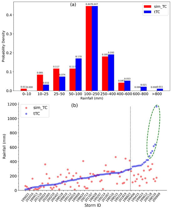
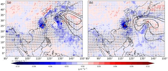
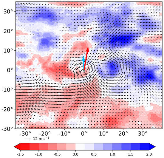
Binary tropical cyclones (BTCs) typically refer to the coexistence of two tropical cyclones (TCs) within a specific distance range, often resulting in disastrous rainstorms in coastal areas of China. However, the differences in rainfall and underlying causes between BTC-influenced typhoons and general typhoons remain unclear. In this article, the TC closer to the rainfall center in the BTC is referred to as the target typhoon (tTC), while the other is termed the accompanying typhoon (cmp_TC). This study compares and analyzes the rainfall differences and potential causes of tTCs and similar typhoons (sim_TC) with a comparable track but which are unaffected by BTCs from 1981 to 2020. The results show that: (1) On average, tTCs and cmp_TCs experience 18.79% heavier maximum daily rainfall compared to general TCs, with a significantly increased likelihood of rainfall ≥250 mm. (2) Given similar tracks, the average rainfall for tTCs (212.62 mm) is 30.2% heavier than that for sim_TCs (163.30 mm). (3) The analysis of potential impact factors on rainfall (translation speed, intensity, direction change) reveals that sim_TCs move at an average of 21.38 km/h, which is about 19.66% faster than the 17.87 km/h of tTCs, potentially accounting for the observed differences in rainfall. (4) Further investigation into the causes of west–east oriented BTC rainfall in the Northern Fujian (N_Fujian) region suggests that water vapor transport and slowing down of the translation speed are the possible mechanisms of BTC influence. Specifically, 80% of tTCs receive water vapor from the direction of their cmp_TC, and the steering flow for tTC is only 59.88% of that for sim_TC.
Full article
(This article belongs to the Special Issue Remote Sensing of Precipitation Extremes)
►
Show Figures

Figure 1


