


Atmosphere 2024, 15(5), 573; https://doi.org/10.3390/atmos15050573 - 07 May 2024
Abstract
The goal was to model irrigated (IBY) and rainfed (RBY) bean yields in central (Culiacán) and southern (Rosario) Sinaloa state as a function of the essential climate variables soil moisture, temperature, reference evapotranspiration, and precipitation. For Sinaloa, for the period 1982–2013 (October–March), the
[...] Read more.
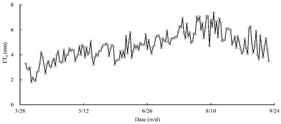
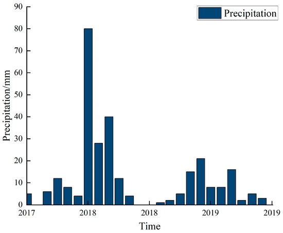
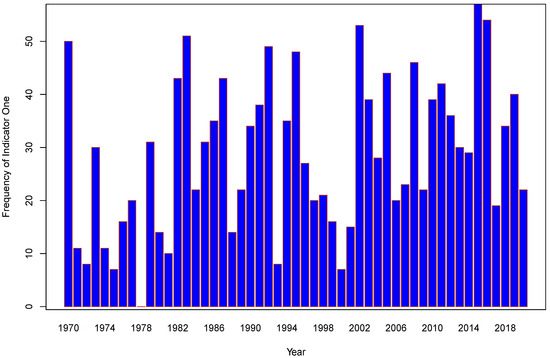
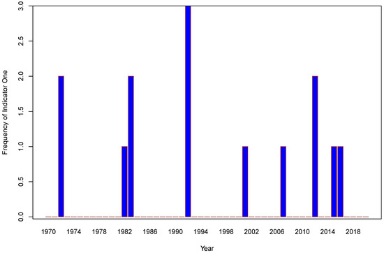
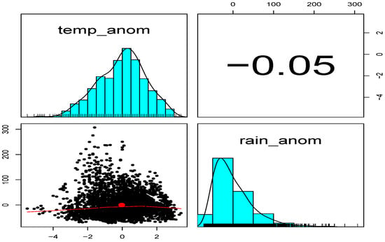
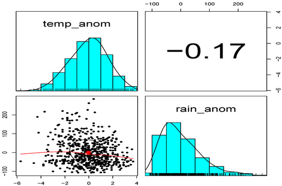
The goal was to model irrigated (IBY) and rainfed (RBY) bean yields in central (Culiacán) and southern (Rosario) Sinaloa state as a function of the essential climate variables soil moisture, temperature, reference evapotranspiration, and precipitation. For Sinaloa, for the period 1982–2013 (October–March), the following were calculated: (a) temperatures, (b) average degree days for the bean, (c) cumulative reference evapotranspiration, and (d) cumulative effective precipitation. For essential climate variables, (e) daily soil moisture obtained from the European Space Agency and (f) IBY and RBY from the Agrifood and Fisheries Information Service were used. Multiple linear regressions were significant for predicting IBY–RBY (dependent variables) as a function of essential climate variables (independent variables). The four models obtained were significantly predictive: IBY–Culiacán (Pearson correlation (PC) = 0.590 > Pearson critical correlation (CPC) = |0.349|), RBY–Culiacán (PC = 0.734 > CPC = |0.349|), IBY–Rosario (PC = 0.621 > CPC = |0.355|), and RBY–Rosario (PC = 0.532 > CPC = |0.349|). Due to the lack of irrigation depth data, many studies only focus on modeling RBY; this study is the first in Sinaloa to predict IBY and RBY based on essential climate variables, contributing to the production of sustainable food.
Full article
(This article belongs to the Section Climatology)


