Urban and Peri-Urban Agriculture in Developing Countries Studied using Remote Sensing and In Situ Methods

Abstract
:1. Introduction
2. Objectives
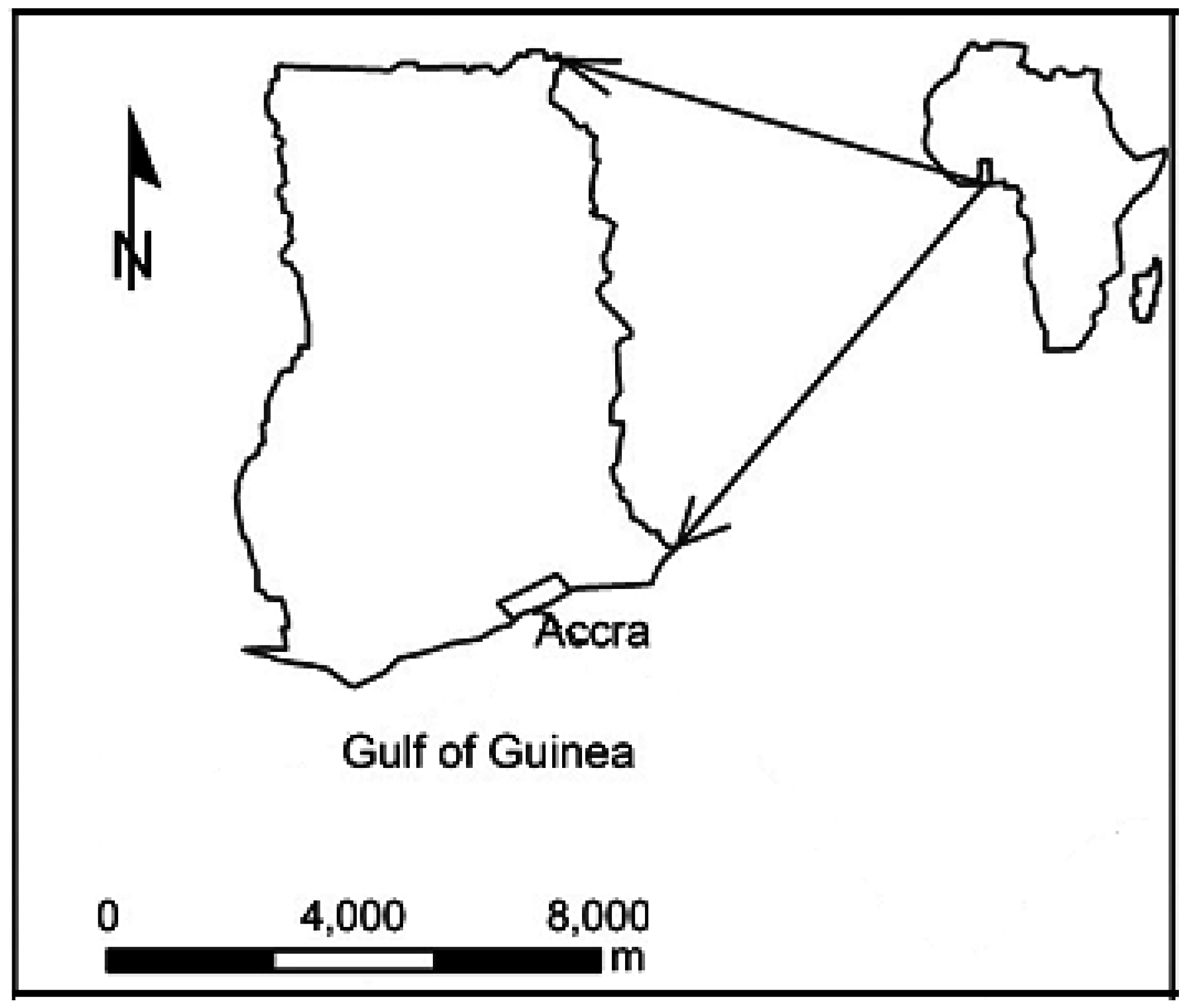
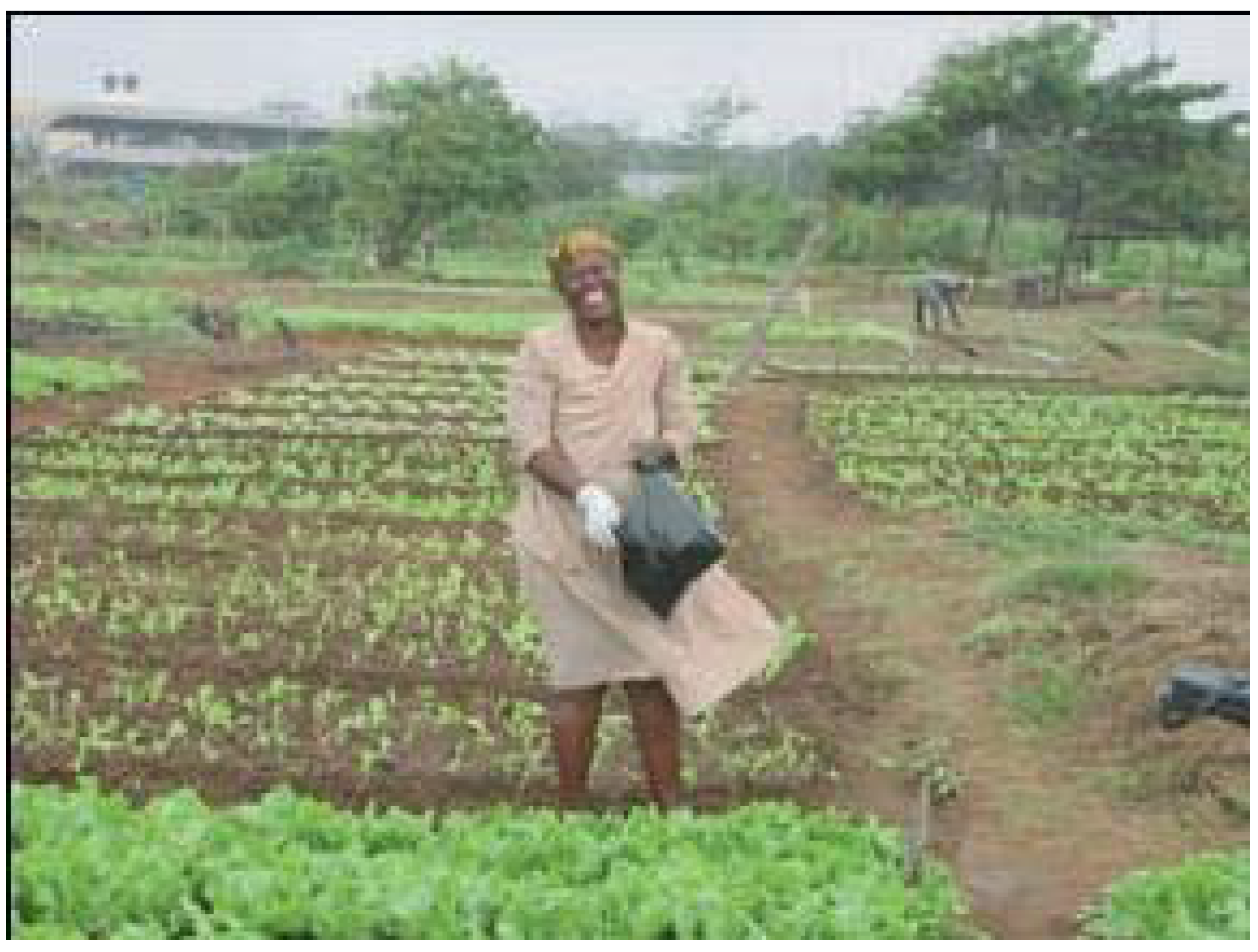
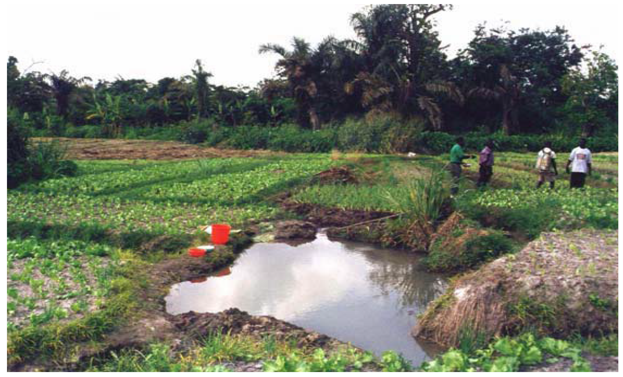
3. Study Area


4. Methods
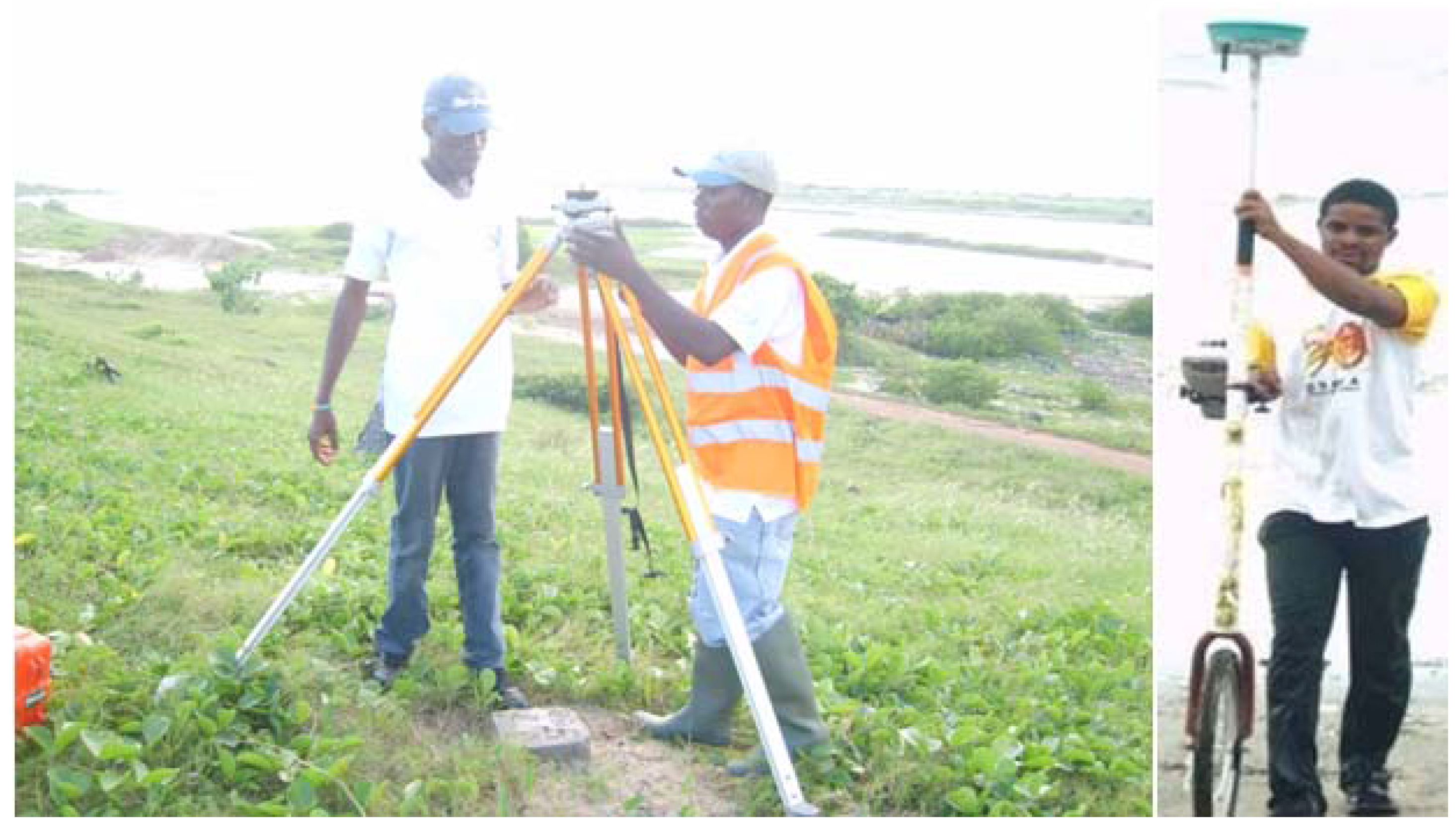
4.1. Physical Survey

4.2. Digitising
4.3. Photogrammetry
4.4. Remote Sensing

| Methods | Types | Data sources | Advantages | Disadvantages |
|---|---|---|---|---|
| Photogrammetric | Analog/ Analytical | Aerial photos | Relatively fast | Expensive |
| Digital | Aerial photos/ | Accurate | Photo distortions | |
| Multispectral imagery | Wide coverage | |||
| Digitising | Manual/Scanning | Historic maps | Ability to correct errors | Labour intensive |
| Correct distortions | Slow | |||
| Reliable | Depend on map accuracy | |||
| Physical survey | Planetable | Field measurement | Higher accuracy | Very tedious |
| Time consuming | ||||
| Expensive |
5. Discussion
6. Conclusions
References
- Smit, J.; Ratta, A.; Asr, J. Urban Agriculture, Food, Jobs and Sustainable Cities; UNDP Habitat II Series; UNDP: New York, NY, USA, 1996. [Google Scholar]
- Sub-Saharan Africa: From Crisis to Sustainable Growth; The World Bank: Washington, DC, USA, 1989.
- Fournier, F. The city: so human an ecosystem. Nat. Res. 1996, 32, 1–16. [Google Scholar]
- Allen, A. Environmental planning and management of the peri-urban interface. In Proceedings of the Conference on Rural-Urban Encounters: Managing the Environment of the Peri-urban Interface, London, UK, November 2001.
- McGee, T.G.; Robinson, I.M. The Mega-Urban Regions of Southeast Asia; UBC Press: Vancouver, Canada, 1995. [Google Scholar]
- Sullivan, W.C.; Lovell, S.T. Improving the visual quality of commercial development at the rural-urban fringe. Landscape Urban Plan. 2006, 77, 152–166. [Google Scholar] [CrossRef]
- Brook, R.M.; Davila, J.D. The Peri-Urban Interface: A Tale of Two Cities; School of Agricultural and Forest Sciences, University of Wales and Development Planning Unit, University College London: London, UK, 2000. [Google Scholar]
- De Bon, H. Safe and year round vegetable production in peri-urban areas. In Proceedings of the National Workshop, RIFAV and CIRAD, Hanoi, Vietnam, December 1999.
- Neuppenau, E.A. Agro-ecologically oriented land use and the creation of viable rural urban interfaces. In 2nd Newsletter Peri-Urban Development in South East Asia; RAUF: Leusden, The Netherlands, 2002. [Google Scholar]
- Etuah-Jackson, I.; Klaassen, W.P.; Awuye, J.A. Turning Municipal Waste into Compost: the Case of Accra. In Waste Composting for Urban and Peri-urban Agriculture: Closing the Rural-Urban Nutrient Cycle in Sub-Saharan Africa; Drechsel, P., Kunze, D., Eds.; CABI Publishing: Wallingford, UK, 2001; pp. 84–95. [Google Scholar]
- Borne, F.; Satornkich, J.P.; Anwar, S.M. Plant modeling for landscape changes visualization: application to a peri-urban agricultural area. In Proceedings of the International Symposium on Plant Growth Modeling, Simulation, Visualization and Their Applications PMA03 Conference, Beijing, China, October 2003.
- Midmore, D.J.; Jansen, H.G.P.; Dumsday, R.G. Soil erosion and environmental impact of vegetable production in the Cameron Highlands, Malaysis. Agr. Ecosyst. Environ. 1996, 60, 29–46. [Google Scholar] [CrossRef]
- Rees, W.E. Why Urban Agriculture? Notes for the IDRC Development Forum on Cities Feeding People: A Growth Industry. Vancouver, BC. City Farmer: Canada's Office of Urban Agriculture, Vancouver, BC, Canada, 1997. Available online: http://www.cityfarmer.org/rees.html (assessed on 19 August 2009).
- Bryld, E. Potentials, problems, and policy implications for urban agriculture in developing countries. J. Agr. Human Values 2003, 20, 79–86. [Google Scholar] [CrossRef]
- Koont, S. The Urban Agriculture of Havana. 2009. Available online: http://www.monthlyreview.org/090119koont.php (accessed on 17/11/2009).
- Appeaning Addo, K. Detection, Measurement and Prediction of Shoreline Change in Accra, Ghana; Lambert Academic Publishing: Saarbrücken, Germany, 2009. [Google Scholar]
- Stefanov, W.L.; Ramsey, M.S.; Christensen, P.R. Monitoring urban land cover change: an expert system approach to land cover classification of semiarid to arid urban centers. Remote Sens. Environ. 2001, 77, 173–185. [Google Scholar] [CrossRef]
- Weng, Q. Landuse change analysis in the Zhujiang delta of China using satellite remote sensing, GIS and stochastic modeling. J. Environ. Manag. 2002, 64, 273–284. [Google Scholar] [CrossRef]
- Herold, M.; Goldstein, N.; Clarke, K. The spatiotemporal form of urban growth: measurement, analysis and modeling. Remote Sens. Environ. 2003, 86, 286–302. [Google Scholar] [CrossRef]
- Cofie, O.; Veenhuizen, R.; Drechsel, P. Contribution of urban and peri-urban agriculture to food security in sub-Saharan Africa. In Africa session of 3rd World Water Forum, Kyoto, Japan, March 2003.
- GSS (Ghana Statistical Services). 2000 Population and Housing Census: Summary Report of Final Results, Accra, Ghana, 2002.
- Duedall, I.W.; Maul, G.A. Demography of coastal populations. encyclopaedia of coastal science. In Encyclopedia of Coastal Science; Encyclopedia of Earth Sciences Series; Schwartz, M.L., Ed.; Springer: Dordrecht, the Netherlands, 2005; pp. 368–374. [Google Scholar]
- Asomani-Boateng, R. Urban cultivation in Accra: an examination of the nature, practices, problems, potentials and urban planning implications. Habitat Int. 2002, 26, 591–607. [Google Scholar] [CrossRef]
- Obosu-Mensah, K. Food Production in Urban Areas. A Study of Urban Agriculture in Accra, Ghana; Ashgate Publishing: Aldershot, England, UK, 1999; p. 227. [Google Scholar]
- Danso, G.; Drechsel, P.; Fialor, S.; Giordano, M. Estimating the demand for municipal waste compost via farmers’ willingness to pay in three Ghanaian cities. Waste Manag. 2006, 10, 1400–1409. [Google Scholar] [CrossRef] [PubMed]
- Nugent, R.A. Using economic analysis to measure the sustainability of urban and peri urban agriculture: a comparison of cost-benefit and contingent valuation analyses. In Proceedings of the CIP-SUIPA and ETC-RUAF Workshop on Appropriate Methodology in Urban Agriculture Research, Planning, Implementation and Evaluation, Nairobi, Kenya, October 2001.
- Cofie, O.; Drechsel, P.; Obuobie, E.; Danso, G.; Keraita, B. Environmental sanitation and urban agriculture in Ghana. In Proceedings of 29th WEDC International Conference Ghana: Towards the Millennium Development Goals, Abuja, Nigeria, September 2003.
- Danso, G.; Keraita, B.; Afrane, A. Farming Systems in (Peri) Urban Accra, Ghana: Special Focus on Its Profitability, Wastewater Use and Added Malaria Risks; IWMI Internal Report, Ghana Office: Ghana, 2002; p. 73. [Google Scholar]
- Zakaria, S.; Lamptey, M.G.; Maxwell, D. Urban agriculture in accra: a descriptive analysis. In Urban Agriculture in the Greater Metropolitan Area; Klemesu-Armar, M., Maxwell, D., Eds.; Noguchi Memorial Institute for Medical Research: University of Ghana, Legon, Ghana, 1998. [Google Scholar]
- Armar-Klemesu, M.; Maxwell, D. Urban agriculture as an assist strategy, supplementing income and diets. A case study of Accra. In Growing Cities, Growing Food; Bakker, N., Dubelling, M., Gündel, S., Sabel-Koschella, U., Zeeuw, H., Eds.; DSE: Feldafing, Germany, 2000; pp. 183–205. [Google Scholar]
- Mougeot, L.J.A. Urban agriculture: definition, presence, potentials and risks, main policy challenges. In Proceedings of International Workshop on Growing Cities Growing Food: Urban Agriculture on the Policy Agenda, La Habana, Cuba, October 1999.
- Cofie, O. Emerging Issues in Urban and Peri-Urban Agriculture (UPA) in West Africa. Available online: http://ruaf.iwmi.org/Data/Sites/4/PDFs/UPA%20Briefing%20note.pdf (accessed on 10 September 2009).
- RAUF Foundation, Accra-Ghana, 2005. Available online: http://www.ruaf.org/node/498 (Accessed on 9 September 2009).
- Klinkenberg, E.; McCall, P.J.; Wilson, M.D.; Amerasinghe, F.P.; Donnelly, M.J. Impact of urban agriculture on malaria vectors in Accra, Ghana. Malaria J. 2008, 7, 151. [Google Scholar] [CrossRef] [PubMed]
- Chimhowu, A.; Gumbo, D. Urban agriculture: southern and eastern Africa. In Urban Environment; Mougeot, L., Masse, D., Eds.; IDRC: Ottawa, Canada, 1993. [Google Scholar]
- Petrie, G.; Kennie, T.J.M. Terrain Modelling in Surveying and Civil Engineering; Whittles Publishing: London, UK, 1990. [Google Scholar]
- Pequet, D.J.; Boyle, A.R. Raster scanning, processing and plotting of cartographic documents. In Proceedings of Cartography, Williamsville, NY, USA, 1984.
- Moore, L.J. Shoreline mapping techniques. J. Coastal Res. 2000, 16, 111–124. [Google Scholar]
- Thieler, E.R.; Danforth, W.W. Historical shoreline mapping 1. Improving techniques and reducing positioning errors. J. Coastal Res. 1994, 10, 549–563. [Google Scholar]
- Wolf, P.R.; Dewitt, B.A. Elements of Photogrammetry (with Applications in GIS), 3rd ed.; McGraw-Hill: New York, NY, USA, 2000. [Google Scholar]
- Thieler, E.R.; Hapke, C.J. Photgrammetry. In Encyclopedia of Coastal Science; Encyclopedia of Earth Sciences Series; Schwartz, M.L., Ed.; Springer: Dordrecht, the Netherlands, 2005; pp. 323–327. [Google Scholar]
- Leatherman, S.P. Historical and projected shoreline mapping. In Proceedings of the Coastal Zone ’83, San Diego, CA, USA, June 1983; pp. 2902–2910.
- Graham, D.; Sault, M.; Bailey, J.C. National ocean service shoreline: past, present, and future. J. Coastal Res. 2003, 38, 14–32. [Google Scholar]
- Morton, R.A.; Speed, F.M. Evaluation of shoreline and legal boundaries controlled by water levels on sandy beaches. J. Coastal Res. 1998, 14, 1373–1384. [Google Scholar]
- Buckley, S.J. Geomatics Data Fusion Technique for Change Monitoring. Ph.D. Dissertation, Newcastle University, Newcastle, UK, 2003. [Google Scholar]
- Seto, K.C.; Woodcock, C.E.; Song, C.; Huang, X.; Lu, J.; Kaufmann, R.K. Monitoring land-use change in the Pearl River Delta using Landsat TM. Int. J. Remote Sens. 2002, 23, 1985–2004. [Google Scholar] [CrossRef]
- Yuliang, Q.; Buzhou, M.; Jiuiiang, F. Study on monitoring farmland by using remote sensing and GIS in Shanxi China. Adv. Smce Res. 2000, 26, 1059–1064. [Google Scholar] [CrossRef]
- Dongus, S.; Drescher, A.W. The use of GIS, GPS and aerial imagery for mapping urban agricultural activities on open space in cities. GIS Development Weekly 2006, 2. Available online: http://www.gisdevelopment.net/application/agriculture/overview/me05_108b.htm (accessed on 15 September 2009). [Google Scholar]
- Kemeling, I. Mapping Urban and Peri-Urban Agricultural Areas in Ouagadougou, Burkina Faso. Centre for Geo-Information, Wageningen, The Netherlands, 2001. [Google Scholar]
- Lambin, E.F.; Ehrlich, D. Land-cover changes in Sub-Saharan Africa (1982–1991): application of a change index based on remotely sensed surface temperature and vegetation indices at a continental scale. Remote Sens. Environ. 1997, 61, 181–200. [Google Scholar] [CrossRef]
- Rembold, F.; Carnicelli, S.; Nori, M.; Ferrari, A. Use of aerial photographs, Landsat TM imagery and multidisciplinary field survey for land-cover change analysis in the lakes region (Ethiopia). Int. J. Appl. Earth Obs. Geoinform. 2000, 2, 181–189. [Google Scholar] [CrossRef]
- Mendoza, J.E.; Etter, R. Multitemporal analysis (1940–1996) of land cover changes in the southwestern Bogota highplain (Colombia). Landscape Urban Plan. 2002, 59, 147–158. [Google Scholar] [CrossRef]
- Palmer, A.R.; Van Rooyen, A.F. Detecting vegetation change in the southern Kalahari using Landsat TM data. J. Arid Environ. 1998, 39, 143–153. [Google Scholar] [CrossRef]
- Ram, B.; Kolarkar, A.S. Remote sensing application in monitoring land-use changes in arid Rajasthan. Int. J. Remote Sens. 1993, 14, 3191–3220. [Google Scholar] [CrossRef]
- Sadek, S.H.A. Use of landsat imagery for monitoring agricultural expansion of East and West Nile Delta, Egypt. Egypt. J. Soil Sci. 1993, 33, 23–24. [Google Scholar]
- Lenney, M.P.; Woodcock, C.E.; Collins, J.B.; Hamdi, H. The status of agricultural lands in Egypt: the use of multi temporal NDVI features derived from Landsat TM. Remote Sens. Environ. 1996, 56, 8–20. [Google Scholar] [CrossRef]
- Jansen, H.G.P.; Bouman, B.A.M.; Schipper, R.A.; Hengsdijk, H.; Nieuwenhuyse, A. An interdisciplinary approach to regional land use analysis using GIS, with applications to the Atlantic Zone of Costa Rica. Agr. Econom. 2005, 32, 87–104. [Google Scholar] [CrossRef]
© 2010 by the author; licensee Molecular Diversity Preservation International, Basel, Switzerland. This article is an open-access article distributed under the terms and conditions of the Creative Commons Attribution license (http://creativecommons.org/licenses/by/3.0/).
Share and Cite
Appeaning Addo, K. Urban and Peri-Urban Agriculture in Developing Countries Studied using Remote Sensing and In Situ Methods. Remote Sens. 2010, 2, 497-513. https://doi.org/10.3390/rs2020497
Appeaning Addo K. Urban and Peri-Urban Agriculture in Developing Countries Studied using Remote Sensing and In Situ Methods. Remote Sensing. 2010; 2(2):497-513. https://doi.org/10.3390/rs2020497
Chicago/Turabian StyleAppeaning Addo, Kwasi. 2010. "Urban and Peri-Urban Agriculture in Developing Countries Studied using Remote Sensing and In Situ Methods" Remote Sensing 2, no. 2: 497-513. https://doi.org/10.3390/rs2020497