Next Issue
Volume 8, March
Previous Issue
Volume 8, January
 
 
remotesensing-logo

Journal Browser

Journal Browser

Remote Sens., Volume 8, Issue 2 (February 2016) – 83 articles

Cover Story (view full-size image): 
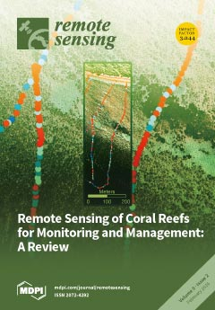
Coral reefs are in decline worldwide and face stresses at all scales, from coastal development and overexploitation to global warming and ocean acidification. Monitoring reef status by manual surveys provides data at localised scales which is not cost-effective for the regional and global scales at which reefs are threatened. Satellite imagery has now been leveraged for reef applications for over 40 years with a multitude of sensor and algorithm developments. We review the historical and state-of-the-art achievements and remaining challenges, over the range of monitoring objectives from the physical and biological composition of the reef to the ocean environment in which they occur. Of increasing importance is the aim to go beyond basic maps, to concepts relevant to stakeholders, policy makers and public communication: such as biodiversity, environmental threats and ecosystem services. View this paper
  • Issues are regarded as officially published after their release is announced to the table of contents alert mailing list.
  • You may sign up for e-mail alerts to receive table of contents of newly released issues.
  • PDF is the official format for papers published in both, html and pdf forms. To view the papers in pdf format, click on the "PDF Full-text" link, and use the free Adobe Reader to open them.
Order results
Result details
Section
Select all
Export citation of selected articles as:
2818 KiB  
Article
Remote Sensing of Soil Alkalinity and Salinity in the Wuyu’er-Shuangyang River Basin, Northeast China
by Lin Bai, Cuizhen Wang, Shuying Zang, Yuhong Zhang, Qiannan Hao and Yuexiang Wu
Remote Sens. 2016, 8(2), 163; https://doi.org/10.3390/rs8020163 - 20 Feb 2016
Cited by 57 | Viewed by 10369
Abstract
The Songnen Plain of the Northeast China is one of the three largest soda saline-alkali regions worldwide. To better understand soil alkalinization and salinization in this important agricultural region, it is vital to explore the distribution and variation of soil alkalinity and salinity [...] Read more.
The Songnen Plain of the Northeast China is one of the three largest soda saline-alkali regions worldwide. To better understand soil alkalinization and salinization in this important agricultural region, it is vital to explore the distribution and variation of soil alkalinity and salinity in space and time. This study examined soil properties and identified the variables to extract soil alkalinity and salinity via physico-chemical, statistical, spectral, and image analysis. The physico-chemical and statistical results suggested that alkaline soils, coming from the main solute Na2CO3 and NaHCO3 in parent rocks, characterized the study area. The pH and electric conductivity (EC ) were correlated with both narrow band and broad band reflectance. For soil pH, the sensitive bands were in short wavelength (VIS) and the band with the highest correlation was 475 nm (r = 0.84). For soil EC, the sensitive bands were also in VIS and the band with the highest correlation was 354 nm (r = 0.84). With the stepwise regression, it was found that the pH was sensitive to reflectance of OLI band 2 and band 6, while the EC was only sensitive to band 1. The R2Adj (0.73 and 0.72) and root mean square error (RMSE) (0.98 and 1.07 dS/m) indicated that, the two stepwise regression models could estimate soil alkalinity and salinity with a considerable accuracy. Spatial distributions of soil alkalinity and salinity were mapped from the OLI image with the RMSE of 1.01 and 0.64 dS/m, respectively. Soil alkalinity was related to salinity but most soils in the study area were non-saline soils. The area of alkaline soils was 44.46% of the basin. Highly alkaline soils were close to the Zhalong wetland and downstream of rivers, which could become a severe concern for crop productivity in this area. Full article
(This article belongs to the Special Issue Remote Sensing Applied to Soils: From Ground to Space)
Show Figures

Graphical abstract

3525 KiB  
Article
Comparing and Combining Remotely Sensed Land Surface Temperature Products for Improved Hydrological Applications
by Robert M. Parinussa, Venkat Lakshmi, Fiona Johnson and Ashish Sharma
Remote Sens. 2016, 8(2), 162; https://doi.org/10.3390/rs8020162 - 20 Feb 2016
Cited by 22 | Viewed by 6081
Abstract
Land surface temperature (LST) is an important variable that provides a valuable connection between the energy and water budget and is strongly linked to land surface hydrology. Space-borne remote sensing provides a consistent means for regularly observing LST using thermal infrared (TIR) and [...] Read more.
Land surface temperature (LST) is an important variable that provides a valuable connection between the energy and water budget and is strongly linked to land surface hydrology. Space-borne remote sensing provides a consistent means for regularly observing LST using thermal infrared (TIR) and passive microwave observations each with unique strengths and weaknesses. The spatial resolution of TIR based LST observations is around 1 km, a major advantage when compared to passive microwave observations (around 10 km). However, a major advantage of passive microwaves is their cloud penetrating capability making them all-weather sensors whereas TIR observations are routinely masked under the presence of clouds and aerosols. In this study, a relatively simple combination approach that benefits from the cloud penetrating capacity of passive microwave sensors was proposed. In the first step, TIR and passive microwave LST products were compared over Australia for both anomalies and raw timeseries. A very high agreement was shown over the vast majority of the country with R2 typically ranging from 0.50 to 0.75 for the anomalies and from 0.80 to 1.00 for the raw timeseries. Then, the scalability of the passive microwave based LST product was examined and a pixel based merging approach through linear scaling was proposed. The individual and merged LST products were further compared against independent LST from the re-analysis model outputs. This comparison revealed that the TIR based LST product agrees best with the re-analysis data (R2 0.26 for anomalies and R2 0.76 for raw data), followed by the passive microwave LST product (R2 0.16 for anomalies and R2 0.66 for raw data) and the combined LST product (R2 0.18 for anomalies and R2 0.62 for raw data). It should be noted that the drop in performance comes with an increased revisit frequency of approximately 20% compared to the revised frequency of the TIR alone. Additionally, this comparison against re-analysis data was subdivided over Australia’s major climate zones and revealed that the relative agreement between the individual and combined LST products against the re-analysis data is consistent over these climate zones. These results are also consistent for both the anomalies and the raw time series. Finally, two examples were provided that demonstrate the proposed merging approach including an example for the Hunter Valley floods along Australia’s central coast that experienced significant flooding in April 2015. Full article
Show Figures

Graphical abstract

5505 KiB  
Article
Tree Species Abundance Predictions in a Tropical Agricultural Landscape with a Supervised Classification Model and Imbalanced Data
by Sarah J. Graves, Gregory P. Asner, Roberta E. Martin, Christopher B. Anderson, Matthew S. Colgan, Leila Kalantari and Stephanie A. Bohlman
Remote Sens. 2016, 8(2), 161; https://doi.org/10.3390/rs8020161 - 19 Feb 2016
Cited by 63 | Viewed by 8594
Abstract
Mapping species through classification of imaging spectroscopy data is facilitating research to understand tree species distributions at increasingly greater spatial scales. Classification requires a dataset of field observations matched to the image, which will often reflect natural species distributions, resulting in an imbalanced [...] Read more.
Mapping species through classification of imaging spectroscopy data is facilitating research to understand tree species distributions at increasingly greater spatial scales. Classification requires a dataset of field observations matched to the image, which will often reflect natural species distributions, resulting in an imbalanced dataset with many samples for common species and few samples for less common species. Despite the high prevalence of imbalanced datasets in multiclass species predictions, the effect on species prediction accuracy and landscape species abundance has not yet been quantified. First, we trained and assessed the accuracy of a support vector machine (SVM) model with a highly imbalanced dataset of 20 tropical species and one mixed-species class of 24 species identified in a hyperspectral image mosaic (350–2500 nm) of Panamanian farmland and secondary forest fragments. The model, with an overall accuracy of 62% ± 2.3% and F-score of 59% ± 2.7%, was applied to the full image mosaic (23,000 ha at a 2-m resolution) to produce a species prediction map, which suggested that this tropical agricultural landscape is more diverse than what has been presented in field-based studies. Second, we quantified the effect of class imbalance on model accuracy. Model assessment showed a trend where species with more samples were consistently over predicted while species with fewer samples were under predicted. Standardizing sample size reduced model accuracy, but also reduced the level of species over- and under-prediction. This study advances operational species mapping of diverse tropical landscapes by detailing the effect of imbalanced data on classification accuracy and providing estimates of tree species abundance in an agricultural landscape. Species maps using data and methods presented here can be used in landscape analyses of species distributions to understand human or environmental effects, in addition to focusing conservation efforts in areas with high tree cover and diversity. Full article
(This article belongs to the Special Issue Remote Sensing of Biodiversity)
Show Figures

Graphical abstract

10795 KiB  
Article
Dynamic Mapping of Evapotranspiration Using an Energy Balance-Based Model over an Andean Páramo Catchment of Southern Ecuador
by Galo Carrillo-Rojas, Brenner Silva, Mario Córdova, Rolando Célleri and Jörg Bendix
Remote Sens. 2016, 8(2), 160; https://doi.org/10.3390/rs8020160 - 19 Feb 2016
Cited by 40 | Viewed by 7345
Abstract
Understanding of evapotranspiration (ET) processes over Andean mountain environments is crucial, particularly due to the importance of these regions to deliver water-related ecosystem services. In this context, the detection of spatio-temporal changes in ET remains poorly investigated for specific Andean ecosystems, like the [...] Read more.
Understanding of evapotranspiration (ET) processes over Andean mountain environments is crucial, particularly due to the importance of these regions to deliver water-related ecosystem services. In this context, the detection of spatio-temporal changes in ET remains poorly investigated for specific Andean ecosystems, like the páramo. To overcome this lack of knowledge, we implemented the energy-balance model METRIC with Landsat 7 ETM+ and MODIS-Terra imagery for a páramo catchment. The implementation contemplated adjustments for complex terrain in order to obtain daily, monthly and annual ET maps (between 2013 and 2014). In addition, we compared our results to the global ET product MOD16. Finally, a rigorous validation of the outputs was conducted with residual ET from the water balance. ET retrievals from METRIC (Landsat-based) showed good agreement with the validation-related ET at monthly and annual steps (mean bias error <8 mm·month−1 and annual deviation <17%). However, METRIC (MODIS-based) outputs and the MOD16 product were revealed to be unsuitable for our study due to the low spatial resolution. At last, the plausibility of METRIC to obtain spatial ET retrievals using higher resolution satellite data is demonstrated, which constitutes the first contribution to the understanding of spatially-explicit ET over an alpine catchment in the neo-tropical Andes. Full article
Show Figures

Graphical abstract

13126 KiB  
Article
A Comparative Study of Cross-Product NDVI Dynamics in the Kilimanjaro Region—A Matter of Sensor, Degradation Calibration, and Significance
by Florian Detsch, Insa Otte, Tim Appelhans and Thomas Nauss
Remote Sens. 2016, 8(2), 159; https://doi.org/10.3390/rs8020159 - 19 Feb 2016
Cited by 27 | Viewed by 8358
Abstract
While satellite-based monitoring of vegetation activity at the earth’s surface is of vital importance for many eco-climatological applications, the degree of agreement among certain sensors and products providing estimates of the Normalized Difference Vegetation Index (NDVI) has been found to vary considerably. In [...] Read more.
While satellite-based monitoring of vegetation activity at the earth’s surface is of vital importance for many eco-climatological applications, the degree of agreement among certain sensors and products providing estimates of the Normalized Difference Vegetation Index (NDVI) has been found to vary considerably. In order to assess the extent of such differences in highly heterogeneous terrain, we analyze and compare intra-annual seasonal fluctuations and long-term monotonic trends (2003–2012) in the Kilimanjaro region, Tanzania. The considered NDVI datasets include the Moderate Resolution Imaging Spectroradiometer (MODIS) products from Terra and Aqua, Collections 5 and 6, and the 3rd Generation Global Inventory Modeling and Mapping Studies (GIMMS) product. The degree of agreement in seasonal fluctuations is assessed by calculating a pairwise Index of Association (IOAs), whereas long-term trends are derived from the trend-free pre-whitened Mann–Kendall test. On the seasonal scale, the two Terra-MODIS products (and, accordingly, the two Aqua-MODIS products) are best associated with each other, indicating that the seasonal signal remained largely unaffected by the new Collection 6 calibration approach. On the long-term scale, we find that the negative impacts of band ageing on Terra-MODIS NDVI have been accounted for in Collection 6, which now distinctly outweighs Aqua-MODIS in terms of greening trends. GIMMS NDVI, by contrast, fails to capture small-scale seasonal and trend patterns that are characteristic for the highly fragmented landscape which is likely owing to the coarse spatial resolution. As a short digression, we also demonstrate that the amount of false discoveries in the determined trend fraction is distinctly higher for p < 0.05 ( 52.6 % ) than for p < 0.001 ( 2.2 % ) which should point the way for any future studies focusing on the reliable deduction of long-term monotonic trends. Full article
(This article belongs to the Special Issue Multi-Sensor and Multi-Data Integration in Remote Sensing)
Show Figures

Graphical abstract

6170 KiB  
Article
Evaluation of VIIRS and MODIS Thermal Emissive Band Calibration Stability Using Ground Target
by Sriharsha Madhavan, Jake Brinkmann, Brian N. Wenny, Aisheng Wu and Xiaoxiong Xiong
Remote Sens. 2016, 8(2), 158; https://doi.org/10.3390/rs8020158 - 19 Feb 2016
Cited by 17 | Viewed by 6513
Abstract
The S-NPP Visible Infrared Imaging Radiometer Suite (VIIRS) instrument, a polar orbiting Earth remote sensing instrument built using a strong MODIS background, employs a similarly designed on-board calibrating source—a V-grooved blackbody for the Thermal Emissive Bands (TEB). The central wavelengths of most VIIRS [...] Read more.
The S-NPP Visible Infrared Imaging Radiometer Suite (VIIRS) instrument, a polar orbiting Earth remote sensing instrument built using a strong MODIS background, employs a similarly designed on-board calibrating source—a V-grooved blackbody for the Thermal Emissive Bands (TEB). The central wavelengths of most VIIRS TEBs are very close to those of MODIS with the exception of the 10.7 µm channel. To ensure the long term continuity of climate data records derived using VIIRS and MODIS TEB, it is necessary to assess any systematic differences between the two instruments, including scenes with temperatures significantly lower than blackbody operating temperatures at approximately 290 K. Previous work performed by the MODIS Characterization Support Team (MCST) at NASA/GSFC used the frequent observations of the Dome Concordia site located in Antarctica to evaluate the calibration stability and consistency of Terra and Aqua MODIS over the mission lifetime. The near-surface temperature measurements from an automatic weather station (AWS) provide a direct reference useful for tracking the stability and determining the relative bias between the two MODIS instruments. In this study, the same technique is applied to the VIIRS TEB and the results are compared with those from the matched MODIS TEB. The results of this study show a small negative bias when comparing the matching VIIRS and Aqua MODIS TEB, implying a higher brightness temperature for S-VIIRS at the cold end. Statistically no significant drift is observed for VIIRS TEB performance over the first 3.5 years of the mission. Full article
(This article belongs to the Collection Visible Infrared Imaging Radiometers and Applications)
Show Figures

Graphical abstract

4238 KiB  
Article
The Fisher Kernel Coding Framework for High Spatial Resolution Scene Classification
by Bei Zhao, Yanfei Zhong, Liangpei Zhang and Bo Huang
Remote Sens. 2016, 8(2), 157; https://doi.org/10.3390/rs8020157 - 19 Feb 2016
Cited by 88 | Viewed by 7089
Abstract
High spatial resolution (HSR) image scene classification is aimed at bridging the semantic gap between low-level features and high-level semantic concepts, which is a challenging task due to the complex distribution of ground objects in HSR images. Scene classification based on the bag-of-visual-words [...] Read more.
High spatial resolution (HSR) image scene classification is aimed at bridging the semantic gap between low-level features and high-level semantic concepts, which is a challenging task due to the complex distribution of ground objects in HSR images. Scene classification based on the bag-of-visual-words (BOVW) model is one of the most successful ways to acquire the high-level semantic concepts. However, the BOVW model assigns local low-level features to their closest visual words in the “visual vocabulary” (the codebook obtained by k-means clustering), which discards too many useful details of the low-level features in HSR images. In this paper, a feature coding method under the Fisher kernel (FK) coding framework is introduced to extend the BOVW model by characterizing the low-level features with a gradient vector instead of the count statistics in the BOVW model, which results in a significant decrease in the codebook size and an acceleration of the codebook learning process. By considering the differences in the distributions of the ground objects in different regions of the images, local FK (LFK) is proposed for the HSR image scene classification method. The experimental results show that the proposed scene classification methods under the FK coding framework can greatly reduce the computational cost, and can obtain a better scene classification accuracy than the methods based on the traditional BOVW model. Full article
Show Figures

Graphical abstract

5023 KiB  
Article
Impacts of Re-Vegetation on Surface Soil Moisture over the Chinese Loess Plateau Based on Remote Sensing Datasets
by Qiao Jiao, Rui Li, Fei Wang, Xingmin Mu, Pengfei Li and Chunchun An
Remote Sens. 2016, 8(2), 156; https://doi.org/10.3390/rs8020156 - 19 Feb 2016
Cited by 33 | Viewed by 6848
Abstract
A large-scale re-vegetation supported by the Grain for Green Project (GGP) has greatly changed local eco-hydrological systems, with an impact on soil moisture conditions for the Chinese Loess Plateau. It is important to know how, exactly, re-vegetation influences soil moisture conditions, which not [...] Read more.
A large-scale re-vegetation supported by the Grain for Green Project (GGP) has greatly changed local eco-hydrological systems, with an impact on soil moisture conditions for the Chinese Loess Plateau. It is important to know how, exactly, re-vegetation influences soil moisture conditions, which not only crucially constrain growth and distribution of vegetation, and hence, further re-vegetation, but also determine the degree of soil desiccation and, thus, erosion risk in the region. In this study, three eco-environmental factors, which are Soil Water Index (SWI), the Normalized Difference Vegetation Index (NDVI), and precipitation, were used to investigate the response of soil moisture in the one-meter layer of top soil to the re-vegetation during the GGP. SWI was estimated based on the backscatter coefficient produced by the European Remote Sensing Satellite (ERS-1/2) and Meteorological Operational satellite program (MetOp), while NDVI was derived from SPOT imageries. Two separate periods, which are 1998–2000 and 2008–2010, were selected to examine the spatiotemporal pattern of the chosen eco-environmental factors. It has been shown that the amount of precipitation in 1998–2000 was close to that of 2008–2010 (the difference being 13.10 mm). From 1998–2000 to 2008–2010, the average annual NDVI increased for 80.99%, while the SWI decreased for 72.64% of the area on the Loess Plateau. The average NDVI over the Loess Plateau increased rapidly by 17.76% after the 10-year GGP project. However, the average SWI decreased by 4.37% for two-thirds of the area. More specifically, 57.65% of the area on the Loess Plateau experienced an increased NDVI and decreased SWI, 23.34% of the area had an increased NDVI and SWI. NDVI and SWI decreased simultaneously for 14.99% of the area, and the decreased NDVI and increased SWI occurred at the same time for 4.02% of the area. These results indicate that re-vegetation, human activities, and climate change have impacts on soil moisture. However, re-vegetation, which consumes a large quantity of soil water, may be the major factor for soil moisture change in most areas of the Loess Plateau. It is, therefore, suggested that Soil Moisture Content (SMC) should be kept in mind when carrying out re-vegetation in China’s arid and semi-arid regions. Full article
(This article belongs to the Special Issue Remote Sensing of Forest Health)
Show Figures

Graphical abstract

6765 KiB  
Article
Representation of Block-Based Image Features in a Multi-Scale Framework for Built-Up Area Detection
by Zhongwen Hu, Qingquan Li, Qian Zhang and Guofeng Wu
Remote Sens. 2016, 8(2), 155; https://doi.org/10.3390/rs8020155 - 18 Feb 2016
Cited by 20 | Viewed by 7351
Abstract
The accurate extraction and mapping of built-up areas play an important role in many social, economic, and environmental studies. In this paper, we propose a novel approach for built-up area detection from high spatial resolution remote sensing images, using a block-based multi-scale feature [...] Read more.
The accurate extraction and mapping of built-up areas play an important role in many social, economic, and environmental studies. In this paper, we propose a novel approach for built-up area detection from high spatial resolution remote sensing images, using a block-based multi-scale feature representation framework. First, an image is divided into small blocks, in which the spectral, textural, and structural features are extracted and represented using a multi-scale framework; a set of refined Harris corner points is then used to select blocks as training samples; finally, a built-up index image is obtained by minimizing the normalized spectral, textural, and structural distances to the training samples, and a built-up area map is obtained by thresholding the index image. Experiments confirm that the proposed approach is effective for high-resolution optical and synthetic aperture radar images, with different scenes and different spatial resolutions. Full article
Show Figures

Graphical abstract

6414 KiB  
Article
Extracting Soil Water Holding Capacity Parameters of a Distributed Agro-Hydrological Model from High Resolution Optical Satellite Observations Series
by Sylvain Ferrant, Vincent Bustillo, Enguerrand Burel, Jordy Salmon-Monviola, Martin Claverie, Nathalie Jarosz, Tiangang Yin, Vincent Rivalland, Gérard Dedieu, Valerie Demarez, Eric Ceschia, Anne Probst, Ahmad Al-Bitar, Yann Kerr, Jean-Luc Probst, Patrick Durand and Simon Gascoin
Remote Sens. 2016, 8(2), 154; https://doi.org/10.3390/rs8020154 - 17 Feb 2016
Cited by 20 | Viewed by 8892
Abstract
Sentinel-2 (S2) earth observation satellite mission, launched in 2015, is foreseen to promote within-field decisions in Precision Agriculture (PA) for both: (1) optimizing crop production; and (2) regulating environmental impacts. In this second scope, a set of Leaf Area Index (LAI) derived from [...] Read more.
Sentinel-2 (S2) earth observation satellite mission, launched in 2015, is foreseen to promote within-field decisions in Precision Agriculture (PA) for both: (1) optimizing crop production; and (2) regulating environmental impacts. In this second scope, a set of Leaf Area Index (LAI) derived from S2 type time-series (2006–2010, using Formosat-2 satellite) is used to spatially constrain the within-field crop growth and the related nitrogen contamination of surface water simulated at a small experimental catchment scale with the distributed agro-hydrological model Topography Nitrogen Transfer and Transformation (TNT2). The Soil Water Holding Capacity (SWHC), represented by two parameters, soil depth and retention porosity, is used to fit the yearly maximum of LAI (LAX) at each pixel of the satellite image. Possible combinations of soil parameters, defining 154 realistic SWHC found on the study site are used to force spatially homogeneous SWHC. LAX simulated at the pixel level for the 154 SWHC, for each of the five years of the study period, are recorded and hereafter referred to as synthetic LAX. Optimal SWHCyear_I,pixel_j, corresponding to minimal difference between observed and synthetic LAXyear_I,pixel_j, is selected for each pixel, independent of the value at neighboring pixels. Each re-estimated soil maps are used to re-simulate LAXyear_I. Results show that simulated and synthetic LAXyear_I,allpixels obtained from SWHCyear_I,allpixels are close and accurately fit the observed LAXyear_I,allpixels (RMSE = 0.05 m2/m2 to 0.2 and R2 = 0.99 to 0.94), except for the year 2008 (RMSE = 0.8 m2/m2 and R2 = 0.8). These results show that optimal SWHC can be derived from remote sensing series for one year. Unique SWHC solutions for each pixel that limit the LAX error for the five years to less than 0.2 m2/m2 are found for only 10% of the pixels. Selection of unique soil parameters using multi-year LAX and neighborhood solution is expected to deliver more robust soil parameters solutions and need to be assessed further. The use of optical remote sensing series is then a promising calibration step to represent crop growth within crop field at catchment level. Nevertheless, this study discusses the model and data improvements that are needed to get realistic spatial representation of agro-hydrological processes simulated within catchments. Full article
(This article belongs to the Special Issue Remote Sensing in Precision Agriculture)
Show Figures

Graphical abstract

4749 KiB  
Article
Quantifying the Daytime and Night-Time Urban Heat Island in Birmingham, UK: A Comparison of Satellite Derived Land Surface Temperature and High Resolution Air Temperature Observations
by Juliana Antunes Azevedo, Lee Chapman and Catherine L. Muller
Remote Sens. 2016, 8(2), 153; https://doi.org/10.3390/rs8020153 - 17 Feb 2016
Cited by 129 | Viewed by 14740
Abstract
The Urban Heat Island (UHI) is one of the most well documented phenomena in urban climatology. Although a range of measurements and modelling techniques can be used to assess the UHI, the paucity of traditional meteorological observations in urban areas has been an [...] Read more.
The Urban Heat Island (UHI) is one of the most well documented phenomena in urban climatology. Although a range of measurements and modelling techniques can be used to assess the UHI, the paucity of traditional meteorological observations in urban areas has been an ongoing limitation for studies. The availability of remote sensing data has therefore helped fill a scientific need by providing high resolution temperature data of our cities. However, satellite-mounted sensors measure land surface temperatures (LST) and not canopy air temperatures with the latter being the key parameter in UHI investigations. Fortunately, such data is becoming increasingly available via urban meteorological networks, which now provide an opportunity to quantify and compare surface and canopy UHI on an unprecedented scale. For the first time, this study uses high resolution air temperature data from the Birmingham Urban Climate Laboratory urban meteorological network and MODIS LST to quantify and identify the spatial pattern of the daytime and night-time UHI in Birmingham, UK (a city with an approximate population of 1 million). This analysis is performed under a range of atmospheric stability classes and investigates the relationship between surface and canopy UHI in the city. A significant finding of this work is that it demonstrates, using observations, that the distribution of the surface UHI appears to be clearly linked to landuse, whereas for canopy UHI, advective processes appear to play an increasingly important role. Strong relationships were found between air temperatures and LST during both the day and night at a neighbourhood scale, but even with the use of higher resolution urban meteorological datasets, relationships at the city scale are still limited. Full article
Show Figures

Graphical abstract

13842 KiB  
Article
Satellite-Based Thermophysical Analysis of Volcaniclastic Deposits: A Terrestrial Analog for Mantled Lava Flows on Mars
by Mark A. Price, Michael S. Ramsey and David A. Crown
Remote Sens. 2016, 8(2), 152; https://doi.org/10.3390/rs8020152 - 17 Feb 2016
Cited by 5 | Viewed by 5913
Abstract
Orbital thermal infrared (TIR) remote sensing is an important tool for characterizing geologic surfaces on Earth and Mars. However, deposition of material from volcanic or eolian activity results in bedrock surfaces becoming significantly mantled over time, hindering the accuracy of TIR compositional analysis. [...] Read more.
Orbital thermal infrared (TIR) remote sensing is an important tool for characterizing geologic surfaces on Earth and Mars. However, deposition of material from volcanic or eolian activity results in bedrock surfaces becoming significantly mantled over time, hindering the accuracy of TIR compositional analysis. Moreover, interplay between particle size, albedo, composition and surface roughness add complexity to these interpretations. Apparent Thermal Inertia (ATI) is the measure of the resistance to temperature change and has been used to determine parameters such as grain/block size, density/mantling, and the presence of subsurface soil moisture/ice. Our objective is to document the quantitative relationship between ATI derived from orbital visible/near infrared (VNIR) and thermal infrared (TIR) data and tephra fall mantling of the Mono Craters and Domes (MCD) in California, which were chosen as an analog for partially mantled flows observed at Arsia Mons volcano on Mars. The ATI data were created from two images collected ~12 h apart by the Advanced Spaceborne Thermal Emission and Reflection Radiometer (ASTER) instrument. The results were validated with a quantitative framework developed using fieldwork that was conducted at 13 pre-chosen sites. These sites ranged in grain size from ash-sized to meter-scale blocks and were all rhyolitic in composition. Block size and mantling were directly correlated with ATI. Areas with ATI under 2.3 × 10⁻² were well-mantled with average grain size below 4 cm; whereas values greater than 3.0 × 10⁻² corresponded to mantle-free surfaces. Correlation was less accurate where checkerboard-style mixing between mantled and non-mantled surfaces occurred below the pixel scale as well as in locations where strong shadowing occurred. However, the results validate that the approach is viable for a large majority of mantled surfaces on Earth and Mars. This is relevant for determining the volcanic history of Mars, for example. Accurate identification of non-mantled lava surfaces within an apparently well-mantled flow field on either planet provides locations to extract important mineralogical constraints on the individual flows using TIR data. Full article
(This article belongs to the Special Issue Volcano Remote Sensing)
Show Figures

Graphical abstract

3683 KiB  
Article
Mapping Urban Land Use by Using Landsat Images and Open Social Data
by Tengyun Hu, Jun Yang, Xuecao Li and Peng Gong
Remote Sens. 2016, 8(2), 151; https://doi.org/10.3390/rs8020151 - 17 Feb 2016
Cited by 310 | Viewed by 33803
Abstract
High-resolution urban land use maps have important applications in urban planning and management, but the availability of these maps is low in countries such as China. To address this issue, we have developed a protocol to identify urban land use functions over large [...] Read more.
High-resolution urban land use maps have important applications in urban planning and management, but the availability of these maps is low in countries such as China. To address this issue, we have developed a protocol to identify urban land use functions over large areas using satellite images and open social data. We first derived parcels from road networks contained in Open Street Map (OSM) and used the parcels as the basic mapping unit. We then used 10 features derived from Points of Interest (POI) data and two indices obtained from Landsat 8 Operational Land Imager (OLI) images to classify parcels into eight Level I classes and sixteen Level II classes of land use. Similarity measures and threshold methods were used to identify land use types in the classification process. This protocol was tested in Beijing, China. The results showed that the generated land use map had an overall accuracy of 81.04% and 69.89% for Level I and Level II classes, respectively. The map revealed significantly more details of the spatial pattern of land uses in Beijing than the land use map released by the government. Full article
Show Figures

Graphical abstract

3587 KiB  
Article
The Potential of Autonomous Ship-Borne Hyperspectral Radiometers for the Validation of Ocean Color Radiometry Data
by Vittorio E. Brando, Jenny L. Lovell, Edward A. King, David Boadle, Roger Scott and Thomas Schroeder
Remote Sens. 2016, 8(2), 150; https://doi.org/10.3390/rs8020150 - 16 Feb 2016
Cited by 42 | Viewed by 7656
Abstract
Calibration and validation of satellite observations are essential and on-going tasks to ensure compliance with mission accuracy requirements. An automated above water hyperspectral radiometer significantly augmented Australia’s ability to contribute to global and regional ocean color validation and algorithm design activities. The hyperspectral [...] Read more.
Calibration and validation of satellite observations are essential and on-going tasks to ensure compliance with mission accuracy requirements. An automated above water hyperspectral radiometer significantly augmented Australia’s ability to contribute to global and regional ocean color validation and algorithm design activities. The hyperspectral data can be re-sampled for comparison with current and future sensor wavebands. The continuous spectral acquisition along the ship track enables spatial resampling to match satellite footprint. This study reports spectral comparisons of the radiometer data with Visible Infrared Imaging Radiometer Suite (VIIRS) and Moderate Resolution Imaging Spectroradiometer (MODIS)-Aqua for contrasting water types in tropical waters off northern Australia based on the standard NIR atmospheric correction implemented in SeaDAS. Consistent match-ups are shown for transects of up to 50 km over a range of reflectance values. The MODIS and VIIRS satellite reflectance data consistently underestimated the in situ spectra in the blue with a bias relative to the “dynamic above water radiance and irradiance collector” (DALEC) at 443 nm ranging from 9.8 × 10⁻⁴ to 3.1 × 10⁻³ sr−1. Automated acquisition has produced good quality data under standard operating and maintenance procedures. A sensitivity analysis explored the effects of some assumptions in the data reduction methods, indicating the need for a comprehensive investigation and quantification of each source of uncertainty in the estimate of the DALEC reflectances. Deployment on a Research Vessel provides the potential for the radiometric data to be combined with other sampling and observational activities to contribute to algorithm development in the wider bio-optical research community. Full article
(This article belongs to the Collection Visible Infrared Imaging Radiometers and Applications)
Show Figures

Graphical abstract

4160 KiB  
Article
Moving Towards Dynamic Ocean Management: How Well Do Modeled Ocean Products Predict Species Distributions?
by Elizabeth A. Becker, Karin A. Forney, Paul C. Fiedler, Jay Barlow, Susan J. Chivers, Christopher A. Edwards, Andrew M. Moore and Jessica V. Redfern
Remote Sens. 2016, 8(2), 149; https://doi.org/10.3390/rs8020149 - 16 Feb 2016
Cited by 73 | Viewed by 12477
Abstract
Species distribution models are now widely used in conservation and management to predict suitable habitat for protected marine species. The primary sources of dynamic habitat data have been in situ and remotely sensed oceanic variables (both are considered “measured data”), but now ocean [...] Read more.
Species distribution models are now widely used in conservation and management to predict suitable habitat for protected marine species. The primary sources of dynamic habitat data have been in situ and remotely sensed oceanic variables (both are considered “measured data”), but now ocean models can provide historical estimates and forecast predictions of relevant habitat variables such as temperature, salinity, and mixed layer depth. To assess the performance of modeled ocean data in species distribution models, we present a case study for cetaceans that compares models based on output from a data assimilative implementation of the Regional Ocean Modeling System (ROMS) to those based on measured data. Specifically, we used seven years of cetacean line-transect survey data collected between 1991 and 2009 to develop predictive habitat-based models of cetacean density for 11 species in the California Current Ecosystem. Two different generalized additive models were compared: one built with a full suite of ROMS output and another built with a full suite of measured data. Model performance was assessed using the percentage of explained deviance, root mean squared error (RMSE), observed to predicted density ratios, and visual inspection of predicted and observed distributions. Predicted distribution patterns were similar for models using ROMS output and measured data, and showed good concordance between observed sightings and model predictions. Quantitative measures of predictive ability were also similar between model types, and RMSE values were almost identical. The overall demonstrated success of the ROMS-based models opens new opportunities for dynamic species management and biodiversity monitoring because ROMS output is available in near real time and can be forecast. Full article
(This article belongs to the Special Issue Remote Sensing of Biodiversity)
Show Figures

Graphical abstract

5485 KiB  
Article
IKONOS Image-Based Extraction of the Distribution Area of Stellera chamaejasme L. in Qilian County of Qinghai Province, China
by Jingzhong Li, Yongmei Liu, Chonghui Mo, Lei Wang, Guowei Pang and Mingming Cao
Remote Sens. 2016, 8(2), 148; https://doi.org/10.3390/rs8020148 - 16 Feb 2016
Cited by 8 | Viewed by 6086
Abstract
Stellera chamaejasme L. (S. chamaejasme) is one of the primary toxic grass species (poisonous plants) distributed in the alpine meadows of Qinghai Province, China. In this study, according to the distinctive phenological characteristics of S. chamaejasme, the spectral differences between S. chamaejasme in [...] Read more.
Stellera chamaejasme L. (S. chamaejasme) is one of the primary toxic grass species (poisonous plants) distributed in the alpine meadows of Qinghai Province, China. In this study, according to the distinctive phenological characteristics of S. chamaejasme, the spectral differences between S. chamaejasme in the full-bloom stage and other pasture grasses were analyzed and the red, blue, and near-infrared bands of IKONOS image were determined as the diagnostic bands of S. chamaejasme recognition. Feature indexes related to S. chamaejasme were established using the diagnostic bands, and \(NDVI_{blue} = (\rho_{nir} − \rho_{blue})/(\rho_{nir} + \rho_{blue})\) obtained as S. chamaejasme sensitive index based on the linear regression analysis between the indexes derived from field spectra and the actual cover fraction of S. chamaejasme communities. The distribution area of S. chamaejasme was extracted by using the index \(NDVI_{blue}\) derived from IKONOS multispectral image in Qilian County of Qinghai Province, China and the verified result reached an overall accuracy of 90.71%. The study indicated that high resolution multispectral satellite images (such as IKONOS images) had significant potential in remote sensing recognition of toxic grass species. Full article
Show Figures

Graphical abstract

12352 KiB  
Article
Diurnal Variability of Turbidity Fronts Observed by Geostationary Satellite Ocean Color Remote Sensing
by Zifeng Hu, Delu Pan, Xianqiang He and Yan Bai
Remote Sens. 2016, 8(2), 147; https://doi.org/10.3390/rs8020147 - 16 Feb 2016
Cited by 34 | Viewed by 6786
Abstract
Monitoring front dynamics is essential for studying the ocean’s physical and biogeochemical processes. However, the diurnal displacement of fronts remains unclear because of limited in situ observations. Using the hourly satellite imageries from the Geostationary Ocean Color Imager (GOCI) with a spatial resolution [...] Read more.
Monitoring front dynamics is essential for studying the ocean’s physical and biogeochemical processes. However, the diurnal displacement of fronts remains unclear because of limited in situ observations. Using the hourly satellite imageries from the Geostationary Ocean Color Imager (GOCI) with a spatial resolution of 500 m, we investigated the diurnal displacement of turbidity fronts in both the northern Jiangsu shoal water (NJSW) and the southwestern Korean coastal water (SKCW) in the Yellow Sea (YS). The hourly turbidity fronts were retrieved from the GOCI-derived total suspended matter using the entropy-based algorithm. The results showed that the entropy-based algorithm could provide fine structure and clearly temporal evolution of turbidity fronts. Moreover, the diurnal displacement of turbidity fronts in NJSW can be up to 10.3 km in response to the onshore-offshore movements of tidal currents, much larger than it is in SKCW (around 4.7 km). The discrepancy between NJSW and SKCW are mainly caused by tidal current direction relative to the coastlines. Our results revealed the significant diurnal displacement of turbidity fronts, and highlighted the feasibility of using geostationary ocean color remote sensing technique to monitor the short-term frontal variability, which may contribute to understanding of the sediment dynamics and the coupling physical-biogeochemical processes. Full article
(This article belongs to the Special Issue Remote Sensing of Biogeochemical Cycles)
Show Figures

Graphical abstract

9452 KiB  
Article
The Combined Use of Airborne Remote Sensing Techniques within a GIS Environment for the Seismic Vulnerability Assessment of Urban Areas: An Operational Application
by Antonio Costanzo, Antonio Montuori, Juan Pablo Silva, Malvina Silvestri, Massimo Musacchio, Fawzi Doumaz, Salvatore Stramondo and Maria Fabrizia Buongiorno
Remote Sens. 2016, 8(2), 146; https://doi.org/10.3390/rs8020146 - 16 Feb 2016
Cited by 16 | Viewed by 7492
Abstract
The knowledge of the topographic features, the building properties, and the road infrastructure settings are relevant operational tasks for managing post-crisis events, restoration activities, and for supporting search and rescue operations. Within such a framework, airborne remote sensing tools have demonstrated to be [...] Read more.
The knowledge of the topographic features, the building properties, and the road infrastructure settings are relevant operational tasks for managing post-crisis events, restoration activities, and for supporting search and rescue operations. Within such a framework, airborne remote sensing tools have demonstrated to be powerful instruments, whose joint use can provide meaningful analyses to support the risk assessment of urban environments. Based on this rationale, in this study, the operational benefits obtained by combining airborne LiDAR and hyperspectral measurements are shown. Terrain and surface digital models are gathered by using LiDAR data. Information about roads and roof materials are provided through the supervised classification of hyperspectral images. The objective is to combine such products within a geographic information system (GIS) providing value-added maps to be used for the seismic vulnerability assessment of urban environments. Experimental results are gathered for the city of Cosenza, Italy. Full article
Show Figures

Graphical abstract

4758 KiB  
Article
Assessing the Effects of Suomi NPP VIIRS M15/M16 Detector Radiometric Stability and Relative Spectral Response Variation on Striping
by Zhuo Wang and Changyong Cao
Remote Sens. 2016, 8(2), 145; https://doi.org/10.3390/rs8020145 - 15 Feb 2016
Cited by 48 | Viewed by 6268
Abstract
Modern satellite radiometers have many detectors with different relative spectral response (RSR). Effect of RSR differences on striping and the root cause of striping in sensor data record (SDR) radiance and brightness temperature products have not been well studied. A previous study used [...] Read more.
Modern satellite radiometers have many detectors with different relative spectral response (RSR). Effect of RSR differences on striping and the root cause of striping in sensor data record (SDR) radiance and brightness temperature products have not been well studied. A previous study used MODTRAN radiative transfer model (RTM) to analyze striping. In this study, we make efforts to find the possible root causes of striping. Line-by-Line RTM (LBLRTM) is used to evaluate the effect of RSR difference on striping and the atmospheric dependency for VIIRS bands M15 and M16. The results show that previous study using MODTRAN is repeatable: the striping is related to the difference between band-averaged and detector-level RSR, and the BT difference has some atmospheric dependency. We also analyzed VIIRS earth view (EV) data with several striping index methods. Since the EV data is complex, we further analyze the onboard calibration data. Analysis of Variance (ANOVA) test shows that the noise along track direction is the major reason for striping. We also found evidence of correlation between solar diffuser (SD) and blackbody (BB) for detector 1 in M15. Digital Count Restoration (DCR) and detector instability are possibly related to the striping in SD and EV data, but further analysis is needed. These findings can potentially lead to further SDR processing improvements. Full article
(This article belongs to the Collection Visible Infrared Imaging Radiometers and Applications)
Show Figures

Graphical abstract

2622 KiB  
Article
Examining the Spectral Separability of Prosopis glandulosa from Co-Existent Species Using Field Spectral Measurement and Guided Regularized Random Forest
by Nyasha Mureriwa, Elhadi Adam, Anshuman Sahu and Solomon Tesfamichael
Remote Sens. 2016, 8(2), 144; https://doi.org/10.3390/rs8020144 - 15 Feb 2016
Cited by 24 | Viewed by 6373
Abstract
The invasive taxa of Prosopis is rated the world’s top 100 unwanted species, and a lack of spatial data about the invasion dynamics has made the current control and monitoring methods unsuccessful. This study thus tests the use of in situ spectroscopy data [...] Read more.
The invasive taxa of Prosopis is rated the world’s top 100 unwanted species, and a lack of spatial data about the invasion dynamics has made the current control and monitoring methods unsuccessful. This study thus tests the use of in situ spectroscopy data with a newly-developed algorithm, guided regularized random forest (GRRF), to spectrally discriminate Prosopis from coexistent acacia species (Acacia karroo, Acacia mellifera and Ziziphus mucronata) in the arid environment of South Africa. Results show that GRRF was able to reduce the high dimensionality of the spectroscopy data and select key wavelengths (n = 11) for discriminating amongst the species. These wavelengths are located at 356.3 nm, 468.5 nm, 531.1 nm, 665.2 nm, 1262.3 nm, 1354.1 nm, 1361.7 nm, 1376.9 nm, 1407.1 nm, 1410.9 nm and 1414.6 nm. The use of these selected wavelengths increases the overall classification accuracy from 79.19% and a Kappa value of 0.7201 when using all wavelengths to 88.59% and a Kappa of 0.8524 when the selected wavelengths were used. Based on our relatively high accuracies and ease of use, it is worth considering the GRRF method for reducing the high dimensionality of spectroscopy data. However, this assertion should receive considerable additional testing and comparison before it is accepted as a substitute for reliable high dimensionality reduction. Full article
(This article belongs to the Special Issue Field Spectroscopy and Radiometry)
Show Figures

Graphical abstract

2845 KiB  
Article
Sub-Pixel Classification of MODIS EVI for Annual Mappings of Impervious Surface Areas
by Narumasa Tsutsumida, Alexis Comber, Kirsten Barrett, Izuru Saizen and Ernan Rustiadi
Remote Sens. 2016, 8(2), 143; https://doi.org/10.3390/rs8020143 - 15 Feb 2016
Cited by 20 | Viewed by 7113
Abstract
Regular monitoring of expanding impervious surfaces areas (ISAs) in urban areas is highly desirable. MODIS data can meet this demand in terms of frequent observations but are lacking in spatial detail, leading to the mixed land cover problem when per-pixel classifications are applied. [...] Read more.
Regular monitoring of expanding impervious surfaces areas (ISAs) in urban areas is highly desirable. MODIS data can meet this demand in terms of frequent observations but are lacking in spatial detail, leading to the mixed land cover problem when per-pixel classifications are applied. To overcome this issue, this research develops and applies a spatio-temporal sub-pixel model to estimate ISAs on an annual basis during 2001–2013 in the Jakarta Metropolitan Area, Indonesia. A Random Forest (RF) regression inferred the ISA proportion from annual 23 values of MODIS MOD13Q1 EVI and reference data in which such proportion was visually allocated from very high-resolution images in Google Earth over time at randomly selected locations. Annual maps of ISA proportion were generated and showed an average increase of 30.65 km2/year over 13 years. For comparison, a series of RF per-pixel classifications were also developed from the same reference data using a Boolean class constructed from different thresholds of ISA proportion. Results from per-pixel models varied when such thresholds change, suggesting difficulty of estimation of actual ISAs. This research demonstrated the advantages of spatio-temporal sub-pixel analysis for annual ISAs mapping and addresses the problem associated with definitions of thresholds in per-pixel approaches. Full article
Show Figures

Graphical abstract

5884 KiB  
Article
The Added Value of Stratified Topographic Correction of Multispectral Images
by Ion Sola, María González-Audícana and Jesús Álvarez-Mozos
Remote Sens. 2016, 8(2), 131; https://doi.org/10.3390/rs8020131 - 15 Feb 2016
Cited by 8 | Viewed by 4461
Abstract
Satellite images in mountainous areas are strongly affected by topography. Different studies demonstrated that the results of semi-empirical topographic correction algorithms improved when a stratification of land covers was carried out first. However, differences in the stratification strategies proposed and also in the [...] Read more.
Satellite images in mountainous areas are strongly affected by topography. Different studies demonstrated that the results of semi-empirical topographic correction algorithms improved when a stratification of land covers was carried out first. However, differences in the stratification strategies proposed and also in the evaluation of the results obtained make it unclear how to implement them. The objective of this study was to compare different stratification strategies with a non-stratified approach using several evaluation criteria. For that purpose, Statistic-Empirical and Sun-Canopy-Sensor + C algorithms were applied and six different stratification approaches, based on vegetation indices and land cover maps, were implemented and compared with the non-stratified traditional option. Overall, this study demonstrates that for this particular case study the six stratification approaches can give results similar to applying a traditional topographic correction with no previous stratification. Therefore, the non-stratified correction approach could potentially aid in removing the topographic effect, because it does not require any ancillary information and it is easier to implement in automatic image processing chains. The findings also suggest that the Statistic-Empirical method performs slightly better than the Sun-Canopy-Sensor + C correction, regardless of the stratification approach. In any case, further research is necessary to evaluate other stratification strategies and confirm these results. Full article
Show Figures

Graphical abstract

6639 KiB  
Article
JPSS-1 VIIRS Pre-Launch Response Versus Scan Angle Testing and Performance
by David Moyer, Jeff McIntire, Hassan Oudrari, James McCarthy, Xiaoxiong Xiong and Frank De Luccia
Remote Sens. 2016, 8(2), 141; https://doi.org/10.3390/rs8020141 - 12 Feb 2016
Cited by 32 | Viewed by 5328
Abstract
The Visible Infrared Imaging Radiometer Suite (VIIRS) instruments on-board both the Suomi National Polar-orbiting Partnership (S-NPP) and the first Joint Polar Satellite System (JPSS-1) spacecraft, with launch dates of October 2011 and December 2016 respectively, are cross-track scanners with an angular swath of [...] Read more.
The Visible Infrared Imaging Radiometer Suite (VIIRS) instruments on-board both the Suomi National Polar-orbiting Partnership (S-NPP) and the first Joint Polar Satellite System (JPSS-1) spacecraft, with launch dates of October 2011 and December 2016 respectively, are cross-track scanners with an angular swath of ±56.06°. A four-mirror Rotating Telescope Assembly (RTA) is used for scanning combined with a Half Angle Mirror (HAM) that directs light exiting from the RTA into the aft-optics. It has 14 Reflective Solar Bands (RSBs), seven Thermal Emissive Bands (TEBs) and a panchromatic Day Night Band (DNB). There are three internal calibration targets, the Solar Diffuser, the BlackBody and the Space View, that have fixed scan angles within the internal cavity of VIIRS. VIIRS has calibration requirements of 2% on RSB reflectance and as tight as 0.4% on TEB radiance that requires the sensor’s gain change across the scan or Response Versus Scan angle (RVS) to be well quantified. A flow down of the top level calibration requirements put constraints on the characterization of the RVS to 0.2%–0.3% but there are no specified limitations on the magnitude of response change across scan. The RVS change across scan angle can vary significantly between bands with the RSBs having smaller changes of ~2% and some TEBs having ~10% variation. Within a band, the RVS has both detector and HAM side dependencies that vary across scan. Errors in the RVS characterization will contribute to image banding and striping artifacts if their magnitudes are above the noise level of the detectors. The RVS was characterized pre-launch for both S-NPP and JPSS-1 VIIRS and a comparison of the RVS curves between these two sensors will be discussed. Full article
(This article belongs to the Collection Visible Infrared Imaging Radiometers and Applications)
Show Figures

Graphical abstract

7512 KiB  
Article
Evaluation of Simplified Polarimetric Decomposition for Soil Moisture Retrieval over Vegetated Agricultural Fields
by Hongquan Wang, Ramata Magagi, Kalifa Goita, Thomas Jagdhuber and Irena Hajnsek
Remote Sens. 2016, 8(2), 142; https://doi.org/10.3390/rs8020142 - 10 Feb 2016
Cited by 35 | Viewed by 6478
Abstract
This paper investigates a simplified polarimetric decomposition for soil moisture retrieval over agricultural fields. In order to overcome the coherent superposition of the backscattering contributions from vegetation and underlying soils, a simplification of an existing polarimetric decomposition is proposed in this study. It [...] Read more.
This paper investigates a simplified polarimetric decomposition for soil moisture retrieval over agricultural fields. In order to overcome the coherent superposition of the backscattering contributions from vegetation and underlying soils, a simplification of an existing polarimetric decomposition is proposed in this study. It aims to retrieve the soil moisture by using only the surface scattering component, once the volume scattering contribution is removed. Evaluation of the proposed simplified algorithm is performed using extensive ground measurements of soil and vegetation characteristics and the time series of UAVSAR (Uninhabited Aerial Vehicle Synthetic Aperture Radar) data collected in the framework of SMAP (Soil Moisture Active Passive) Validation Experiment 2012 (SMAPVEX12). The retrieval process is tested and analyzed in detail for a variety of crops during the phenological stages considered in this study. The results show that the performance of soil moisture retrieval depends on both the crop types and the crop phenological stage. Soybean and pasture fields present the higher inversion rate during the considered phenological stage, while over canola and wheat fields, the soil moisture can be retrieved only partially during the crop developing stage. RMSE of 0.06–0.12 m3/m3 and an inversion rate of 26%–38% are obtained for the soil moisture retrieval based on the simplified polarimetric decomposition. Full article
Show Figures

Graphical abstract

2735 KiB  
Article
L-Band Polarimetric Target Decomposition of Mangroves of the Rufiji Delta, Tanzania
by Ian Brown, Simon Mwansasu and Lars-Ove Westerberg
Remote Sens. 2016, 8(2), 140; https://doi.org/10.3390/rs8020140 - 09 Feb 2016
Cited by 23 | Viewed by 7876
Abstract
The mangroves of the Rufiji Delta are an important habitat and resource. The mangrove forest reserve is home to an indigenous population and has been under pressure from an influx of migrants from the landward side of the delta. Timely and effective forest [...] Read more.
The mangroves of the Rufiji Delta are an important habitat and resource. The mangrove forest reserve is home to an indigenous population and has been under pressure from an influx of migrants from the landward side of the delta. Timely and effective forest management is needed to preserve the delta and mangrove forest. Here, we investigate the potential of polarimetric target decomposition for mangrove forest monitoring and analysis. Using three ALOS PALSAR images, we show that L-band polarimetry is capable of mapping mangrove dynamics and is sensitive to stand structure and the hydro-geomorphology of stands. Entropy-alpha-anisotropy and incoherent target decompositions provided valuable measures of scattering behavior related to forest structure. Little difference was found between Yamaguchi and Arii decompositions, despite the conceptual differences between these models. Using these models, we were able to differentiate the scattering behavior of the four main species found in the delta, though classification was impractical due to the lack of pure stands. Scattering differences related to season were attributed primarily to differences in ground moisture or inundation. This is the first time mangrove species have been identified by their scattering behavior in L-band polarimetric data. These results suggest higher resolution L-band quad-polarized imagery, such as from PALSAR-2, may be a powerful tool for mangrove species mapping. Full article
(This article belongs to the Special Issue Remote Sensing of Mangroves: Observation and Monitoring)
Show Figures

Graphical abstract

2828 KiB  
Article
An Overview of the Joint Polar Satellite System (JPSS) Science Data Product Calibration and Validation
by Lihang Zhou, Murty Divakarla and Xingpin Liu
Remote Sens. 2016, 8(2), 139; https://doi.org/10.3390/rs8020139 - 08 Feb 2016
Cited by 40 | Viewed by 8357
Abstract
The Joint Polar Satellite System (JPSS) will launch its first JPSS-1 satellite in early 2017. The JPSS-1 and follow-on satellites will carry aboard an array of instruments including the Visible Infrared Imaging Radiometer Suite (VIIRS), the Cross-track Infrared Sounder (CrIS), the Advanced Technology [...] Read more.
The Joint Polar Satellite System (JPSS) will launch its first JPSS-1 satellite in early 2017. The JPSS-1 and follow-on satellites will carry aboard an array of instruments including the Visible Infrared Imaging Radiometer Suite (VIIRS), the Cross-track Infrared Sounder (CrIS), the Advanced Technology Microwave Sounder (ATMS), and the Ozone Mapping and Profiler Suite (OMPS). These instruments are similar to the instruments currently operating on the Suomi National Polar-orbiting Partnership (S-NPP) satellite. In preparation for the JPSS-1 launch, the JPSS program at the Center for Satellite Applications and Research (JSTAR) Calibration/Validation (Cal/Val) teams, have laid out the Cal/Val plans to oversee JPSS-1 science products’ algorithm development efforts, verification and characterization of these algorithms during the pre-launch period, calibration and validation of the products during post-launch, and long-term science maintenance (LTSM). In addition, the team has developed the necessary schedules, deliverables and infrastructure for routing JPSS-1 science product algorithms for operational implementation. This paper presents an overview of these efforts. In addition, this paper will provide insight into the processes of both adapting S-NPP science products for JPSS-1 and performing upgrades for enterprise solutions, and will discuss Cal/Val processes and quality assurance procedures. Full article
(This article belongs to the Collection Visible Infrared Imaging Radiometers and Applications)
Show Figures

Graphical abstract

9149 KiB  
Article
Soumi NPP VIIRS Day/Night Band Stray Light Characterization and Correction Using Calibration View Data
by Shihyan Lee and Changyong Cao
Remote Sens. 2016, 8(2), 138; https://doi.org/10.3390/rs8020138 - 08 Feb 2016
Cited by 33 | Viewed by 7451
Abstract
The Soumi NPP VIIRS Day/Night Band (DNB) nighttime imagery quality is affected by stray light contamination. In this study, we examined the relationship between the Earth scene stray light and the signals in VIIRS’s calibrators to better understand stray light characteristics and to [...] Read more.
The Soumi NPP VIIRS Day/Night Band (DNB) nighttime imagery quality is affected by stray light contamination. In this study, we examined the relationship between the Earth scene stray light and the signals in VIIRS’s calibrators to better understand stray light characteristics and to improve upon the current correction method. Our analyses showed the calibrator signal to be highly predictive of Earth scene stray light and can provide additional stray light characteristics that are difficult to obtain from Earth scene data alone. In the current stray light correction regions (mid-to-high latitude), the stray light onset angles can be tracked by calibration view data to reduce correction biases. In the southern hemisphere, it is possible to identify the angular extent of the additional stray light feature in the calibration view data and develop a revised correction method to remove the additional stray light occurring during the southern hemisphere springtime. Outside of current stray light correction region, the analysis of calibration view data indicated occasional stray light contamination at low latitude and possible background biases caused by Moon illumination. As stray light affects a significant portion of nighttime scenes, further refinement in characterization and correction is important to ensure VIIRS DNB imagery quality for Soumi NPP and future missions. Full article
(This article belongs to the Collection Visible Infrared Imaging Radiometers and Applications)
Show Figures

Graphical abstract

2630 KiB  
Article
Assessment of the Suomi NPP VIIRS Land Surface Albedo Data Using Station Measurements and High-Resolution Albedo Maps
by Yuan Zhou, Dongdong Wang, Shunlin Liang, Yunyue Yu and Tao He
Remote Sens. 2016, 8(2), 137; https://doi.org/10.3390/rs8020137 - 08 Feb 2016
Cited by 25 | Viewed by 5494
Abstract
Land surface albedo (LSA), one of the Visible Infrared Imaging Radiometer Suite (VIIRS) environmental data records (EDRs), is a fundamental component for linking the land surface and the climate system by regulating shortwave energy exchange between the land and the atmosphere. Currently, the [...] Read more.
Land surface albedo (LSA), one of the Visible Infrared Imaging Radiometer Suite (VIIRS) environmental data records (EDRs), is a fundamental component for linking the land surface and the climate system by regulating shortwave energy exchange between the land and the atmosphere. Currently, the improved bright pixel sub-algorithm (BPSA) is a unique algorithm employed by VIIRS to routinely generate LSA EDR from VIIRS top-of-atmosphere (TOA) observations. As a product validation procedure, LSA EDR reached validated (V1 stage) maturity in December 2014. This study summarizes recent progress in algorithm refinement, and presents comprehensive validation and evaluation results of VIIRS LSA by using extensive field measurements, Moderate Resolution Imaging Spectroradiometer (MODIS) albedo product, and Landsat-retrieved albedo maps. Results indicate that: (1) by testing the updated desert-specific look-up-table (LUT) that uses a stricter standard to select the training data specific for desert aerosol type in our local environment, it is found that the VIIRS LSA retrieval accuracy is improved over a desert surface and the absolute root mean square error (RMSE) is reduced from 0.036 to 0.023, suggesting the potential of the updated desert LUT to the improve the VIIRS LSA product accuracy; (2) LSA retrieval on snow-covered surfaces is more accurate if the newly developed snow-specific LUT (RMSE = 0.082) replaces the generic LUT (RMSE = 0.093) that is employed in the current operational LSA EDR production; (3) VIIRS LSA is also comparable to high-resolution Landsat albedo retrieval (RMSE < 0.04), although Landsat albedo has a slightly higher accuracy, probably owing to higher spatial resolution with less impacts of mixed pixel; (4) VIIRS LSA retrievals agree well with the MODIS albedo product over various land surface types, with overall RMSE of lower than 0.05 and the overall bias as low as 0.025, demonstrating the comparable data quality between VIIRS and the MODIS LSA product. Full article
Show Figures

Graphical abstract

6782 KiB  
Article
Deformation and Source Parameters of the 2015 Mw 6.5 Earthquake in Pishan, Western China, from Sentinel-1A and ALOS-2 Data
by Yangmao Wen, Caijun Xu, Yang Liu and Guoyan Jiang
Remote Sens. 2016, 8(2), 134; https://doi.org/10.3390/rs8020134 - 08 Feb 2016
Cited by 59 | Viewed by 9119
Abstract
In this study, Interferometric Synthetic Aperture Radar (InSAR) was used to determine the seismogenic fault and slip distribution of the 3 July 2015 Pishan earthquake in the Tarim Basin, western China. We obtained a coseismic deformation map from the ascending and descending Sentinel-1A [...] Read more.
In this study, Interferometric Synthetic Aperture Radar (InSAR) was used to determine the seismogenic fault and slip distribution of the 3 July 2015 Pishan earthquake in the Tarim Basin, western China. We obtained a coseismic deformation map from the ascending and descending Sentinel-1A satellite Terrain Observation with Progressive Scans (TOPS) mode and the ascending Advanced Land Observation Satellite-2 (ALOS-2) satellite Fine mode InSAR data. The maximum ground uplift and subsidence were approximately 13.6 cm and 3.2 cm, respectively. Our InSAR observations associated with focal mechanics indicate that the source fault dips to southwest (SW). Further nonlinear inversions show that the dip angle of the seimogenic fault is approximate 24°, with a strike of 114°, which is similar with the strike of the southeastern Pishan fault. However, this fault segment responsible for the Pishan event has not been mapped before. Our finite fault model reveals that the peak slip of 0.89 m occurred at a depth of 11.6 km, with substantial slip at a depth of 9–14 km and a near-uniform slip of 0.2 m at a depth of 0–7 km. The estimated moment magnitude was approximately Mw 6.5, consistent with seismological results. Full article
(This article belongs to the Special Issue Remote Sensing in Tibet and Siberia)
Show Figures

Graphical abstract

1821 KiB  
Article
Airborne Hyperspectral Data Predict Fine-Scale Plant Species Diversity in Grazed Dry Grasslands
by Thomas Möckel, Jonas Dalmayne, Barbara C. Schmid, Honor C. Prentice and Karin Hall
Remote Sens. 2016, 8(2), 133; https://doi.org/10.3390/rs8020133 - 08 Feb 2016
Cited by 42 | Viewed by 6923
Abstract
Semi-natural grasslands with grazing management are characterized by high fine-scale species richness and have a high conservation value. The fact that fine-scale surveys of grassland plant communities are time-consuming may limit the spatial extent of ground-based diversity surveys. Remote sensing tools have the [...] Read more.
Semi-natural grasslands with grazing management are characterized by high fine-scale species richness and have a high conservation value. The fact that fine-scale surveys of grassland plant communities are time-consuming may limit the spatial extent of ground-based diversity surveys. Remote sensing tools have the potential to support field-based sampling and, if remote sensing data are able to identify grassland sites that are likely to support relatively higher or lower levels of species diversity, then field sampling efforts could be directed towards sites that are of potential conservation interest. In the present study, we examined whether aerial hyperspectral (414–2501 nm) remote sensing can be used to predict fine-scale plant species diversity (characterized as species richness and Simpson’s diversity) in dry grazed grasslands. Vascular plant species were recorded within 104 (4 m × 4 m) plots on the island of Öland (Sweden) and each plot was characterized by a 245-waveband hyperspectral data set. We used two different modeling approaches to evaluate the ability of the airborne spectral measurements to predict within-plot species diversity: (1) a spectral response approach, based on reflectance information from (i) all wavebands, and (ii) a subset of wavebands, analyzed with a partial least squares regression model, and (2) a spectral heterogeneity approach, based on the mean distance to the spectral centroid in an ordinary least squares regression model. Species diversity was successfully predicted by the spectral response approach (with an error of ca. 20%) but not by the spectral heterogeneity approach. When using the spectral response approach, iterative selection of important wavebands for the prediction of the diversity measures simplified the model but did not improve its predictive quality (prediction error). Wavebands sensitive to plant pigment content (400–700 nm) and to vegetation structural properties, such as above-ground biomass (700–1300 nm), were identified as being the most important predictors of plant species diversity. We conclude that hyperspectral remote sensing technology is able to identify fine-scale variation in grassland diversity and has a potential use as a tool in surveys of grassland plant diversity. Full article
(This article belongs to the Special Issue Remote Sensing of Biodiversity)
Show Figures

Graphical abstract

Previous Issue
Next Issue
Back to TopTop