Next Issue
Volume 6, September
Previous Issue
Volume 6, March


Climate, Volume 6, Issue 2 (June 2018) – 35 articles

Cover Story (view full-size image): 
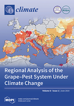
Of fruit crops, grape is the most largely cultivated and has the highest economic importance globally; it is part of the Mediterranean bio-cultural heritage that is threatened by climate change. However, the analysis of the climate effects on grape and other crop and natural ecosystems on a regional scale has been vexing. Here, we review how sparse physiologically based demographic models (PBDM, http://www.casasglobal.org) in the context of the geographic information system GRASS GIS (https://grass.osgeo.org) can be used to examine the effects of the extant weather and climate change on the dynamics of the interaction between grape and European grapevine moth across the Euro-Mediterranean region. Further, by including management-relevant complexity in a mechanistic way, the PBDM/GIS system provides the basis for a regional bioeconomic analysis of the grape system and a template for similar analyses [...] Read more.
Order results
Result details
Section
Select all
Export citation of selected articles as:
25 pages, 21043 KiB  
Article
Air-Temperature Response to Neighborhood-Scale Variations in Albedo and Canopy Cover in the Real World: Fine-Resolution Meteorological Modeling and Mobile Temperature Observations in the Los Angeles Climate Archipelago
by Haider Taha, Ronnen Levinson, Arash Mohegh, Haley Gilbert, George Ban-Weiss and Sharon Chen
Climate 2018, 6(2), 53; https://doi.org/10.3390/cli6020053 - 17 Jun 2018
Cited by 17 | Viewed by 5681
Abstract
To identify and characterize localized urban heat- and cool-island signals embedded within the temperature field of a large urban-climate archipelago, fine-resolution simulations with a modified urbanized version of the WRF meteorological model were carried out as basis for siting fixed weather monitors and [...] Read more.
To identify and characterize localized urban heat- and cool-island signals embedded within the temperature field of a large urban-climate archipelago, fine-resolution simulations with a modified urbanized version of the WRF meteorological model were carried out as basis for siting fixed weather monitors and designing mobile-observation transects. The goal was to characterize variations in urban heat during summer in Los Angeles, California. Air temperatures measured with a shielded sensor mounted atop an automobile in the summers of 2016 and 2017 were compared to model output and also correlated to surface physical properties focusing on neighborhood-scale albedo and vegetation canopy cover. The study modeled and measured the temperature response to variations in surface properties that already exist in the real world, i.e., realistic variations in albedo and canopy cover that are attainable through current building and urban design practices. The simulated along-transect temperature from a modified urbanized WRF model was compared to the along-transect observed temperature from 15 mobile traverses in one area near downtown Los Angeles and another in an inland basin (San Fernando Valley). The observed transect temperature was also correlated to surface physical properties characterizations that were developed for input to the model. Both comparisons were favorable, suggesting that (1) the model can reliably be used in siting fixed weather stations and designing mobile-transect routes to characterize urban heat and (2) that except for a few cases with opposite co-varying influences, the correlations between observed temperature and albedo and between observed temperature and canopy cover were each negative, ranging from −1.0 to −9.0 °C per 0.1 increase in albedo and from −0.1 to −2.2 °C per 0.1 increase in canopy cover. Observational data from the analysis domains pointed to a wind speed threshold of 3 m/s. Below this threshold the variations in air temperature could be explained by land use and surface properties within a 500-m radius of each observation point. Above the threshold, air temperature was influenced by the properties of the surface within a 1-km upwind fetch. Of relevance to policy recommendations, the study demonstrates the significant real-world cooling effects of increasing urban albedo and vegetation canopy cover. Based on correlations between the observed temperature (from mobile transects) and surface physical properties in the study domains, the analysis shows that neighborhood-scale (500-m) cooling of up to 2.8 °C during the daytime can be achieved by increasing albedo. A neighborhood can also be cooled by up to 2.3 °C during the day and up to 3.3 °C at night by increasing canopy cover. The analysis also demonstrates the suitability of using fine-resolution meteorological models to design mobile-transect routes or site-fixed weather monitors in order to quantify urban heat and the efficacy of albedo and canopy cover countermeasures. The results also show that the model is capable of accurately predicting the geographical locations and the magnitudes of localized urban heat and cool islands. Thus the model results can also be used to devise urban-heat mitigation measures. Full article
Show Figures

Figure 1

17 pages, 3205 KiB  
Article
A New Radiative Model Derived from Solar Insolation, Albedo, and Bulk Atmospheric Emissivity: Application to Earth and Other Planets
by Luke Swift
Climate 2018, 6(2), 52; https://doi.org/10.3390/cli6020052 - 14 Jun 2018
Cited by 1 | Viewed by 6767
Abstract
This study develops an equilibrium radiative model based on a quasi-adiabatic atmosphere that quantifies the average surface flux of a planetary body as a function of absorbed solar radiation P and the bulk emissivity of the atmosphere with respect to surface radiation [...] Read more.
This study develops an equilibrium radiative model based on a quasi-adiabatic atmosphere that quantifies the average surface flux of a planetary body as a function of absorbed solar radiation P and the bulk emissivity of the atmosphere with respect to surface radiation  ε. The surface flux is then given by  P/(1ε), and I define the scaling term 1/(1ε) as the greenhouse factor. The model is applied to all of the rocky planets in the solar system to determine their greenhouse factors, and accounts for the diversity of planetary surface fluxes. The model is modified to allow for a top of atmosphere non-equilibrium state, which when compared with a recent observation-based model of the Earth energy budget, predicts the Earth’s radiative fluxes to within the uncertainty ranges of that model. The model developed in this study is able to quantify the changes in Earth’s surface flux caused by changes in bond albedo and atmospheric bulk emissivity by using the surface temperature, ocean heat content, incoming solar radiation and outgoing longwave radiation records. The model indicates an increase in absorbed solar radiation over the time period from 1979–2015 of the order of 3 W/m2, which was caused by a decrease in planetary bond albedo. The time-series albedo generated by the model is in agreement with Clouds and Earth’s Radiant Energy System (CERES) derived albedo over the period from 2000–2015. The model also indicates a slight decrease in atmospheric bulk emissivity over the same period. Since atmospheric bulk emissivity is a function of the sum of all of the greenhouse gas species, a simultaneous decrease in atmospheric water vapor may offset the effect of the well-documented increase in the non-condensing greenhouse gases over the period, and result in an overall net decrease in bulk emissivity. Atmospheric water vapor datasets partially support the conclusion, with the International Satellite Cloud Climatology Project (ISCCP) data supporting a decrease. The NASA Water Vapor Project (NVAP-M) data supports a decrease in atmospheric water content over the period 1998–2008, but not over the longer period of 1988–2008. The model indicates that the decrease in planetary albedo was the driver for the increased surface flux over the stated period. Full article
Show Figures

Figure 1

36 pages, 5089 KiB  
Article
Multi-Decadal Trend and Decadal Variability of the Regional Sea Level over the Indian Ocean since the 1960s: Roles of Climate Modes and External Forcing
by Weiqing Han, Detlef Stammer, Gerald A. Meehl, Aixue Hu, Frank Sienz and Lei Zhang
Climate 2018, 6(2), 51; https://doi.org/10.3390/cli6020051 - 08 Jun 2018
Cited by 32 | Viewed by 9371
Abstract
Previous studies suggest that anthropogenic warming has affected the multi-decadal trend patterns of sea level over the Indian Ocean (IO). This effect, however, has not been quantified. Using observational datasets combined with large ensemble experiments from two climate models, this paper assesses the [...] Read more.
Previous studies suggest that anthropogenic warming has affected the multi-decadal trend patterns of sea level over the Indian Ocean (IO). This effect, however, has not been quantified. Using observational datasets combined with large ensemble experiments from two climate models, this paper assesses the effects of natural internal variability versus external forcing on the observed, multi-decadal trend pattern and the decadal sea level anomaly (SLA) of the IO since the 1960s. Because the global mean sea level rise (SLR), which results largely from external forcing, has been removed before the examination, the paper focuses on the regionally uneven distribution of trend and SLA. The impacts of climate modes are quantified using a Bayesian Dynamic Linear Model. For the regional trend pattern of 1958–2005, the effects of internal variability dominate external forcing. Over the Seychelles area where sea-level variations obtain the maximum, internal variability (external forcing) contributes 81% (19 ± 2.4%) of the observed trend. For decadal SLA, internal variability is the predominant cause, with a standard deviation (STD) ratio of externally forced/observed SLA being 18 ± 17% over Seychelles and 17 ± 11% near the Indonesian Throughflow (ITF) area. Climate modes account for most observed SLA during boreal winter, with the total effects of decadal ENSO, Indian Ocean Dipole (IOD), and monsoon accounting for 78–86% of the observed STD near the Seychelles region, ITF area, and coasts of Sumatra and the Bay of Bengal. During summer, climate modes explain 95% of observed STD near the ITF but only 58–67% in other regions. Decadal ENSO dominates the SLA in the south tropical IO for both seasons and near the coasts of Sumatra and the Bay during winter. Decadal IOD and monsoon, however, control the coastal SLA during summer. Remote and local winds over the IO are the main drivers for decadal SLA, while the Pacific influence via the ITF is strong mainly in the southeast basin. Full article
(This article belongs to the Special Issue Decadal Variability and Predictability of Climate)
Show Figures

Figure 1

12 pages, 3498 KiB  
Article
Multifractal Analysis of High-Frequency Temperature Time Series in the Urban Environment
by Stavroula Karatasou and Mat Santamouris
Climate 2018, 6(2), 50; https://doi.org/10.3390/cli6020050 - 08 Jun 2018
Cited by 9 | Viewed by 4365
Abstract
Continuous monitoring systems have been regarded as a very useful tool to provide continuous high-frequency measurements of many parameters. Here, we analyze high-frequency time series of air temperature measurements, recorded every 10 min during 2003 in Athens (Greece) by an online monitoring system [...] Read more.
Continuous monitoring systems have been regarded as a very useful tool to provide continuous high-frequency measurements of many parameters. Here, we analyze high-frequency time series of air temperature measurements, recorded every 10 min during 2003 in Athens (Greece) by an online monitoring system for the urban environment. We propose a set of time series analysis techniques, where missing data are well respected and information concerning the system’s dynamics is preserved. A power spectral density analysis is performed over time scales spanning from 10 min to several days. A scale-invariant behavior of the form E ( f ) f β is revealed for scales below 9 h. Over this scaling range, we have performed structure functions analysis, and shown that air temperature data exhibit turbulent-like intermittent properties with multi-fractal statistics. The multifractal exponents obtained possess some similarities with passive scalar turbulence results. Although we illustrate the proposed approach using air temperature data, the method can be used as an efficient tool to analyse other environmental parameters monitored in urban environment. Full article
Show Figures

Figure 1

16 pages, 261 KiB  
Article
An Empirical Comparison of Carbon Credit Projects under the Clean Development Mechanism and Verified Carbon Standard
by Andrea Von Avenarius, Thattekere Settygowda Devaraja and Rüdiger Kiesel
Climate 2018, 6(2), 49; https://doi.org/10.3390/cli6020049 - 04 Jun 2018
Cited by 2 | Viewed by 5722
Abstract
Carbon credit projects generate carbon credits by abating greenhouse gas emissions. Carbon credits can then be traded on carbon markets or immobilized in order to compensate for caused emissions. The Clean Development Mechanism (CDM) and Verified Carbon Standard (VCS), as the two most [...] Read more.
Carbon credit projects generate carbon credits by abating greenhouse gas emissions. Carbon credits can then be traded on carbon markets or immobilized in order to compensate for caused emissions. The Clean Development Mechanism (CDM) and Verified Carbon Standard (VCS), as the two most important carbon credit mechanisms, are investigated and compared regarding the success of projects. We define success as the fulfilling of the ex-ante emission abatement estimation and apply regression analyses to explain its variation on a project level by technology, location, scale, duration and participation. The results are discussed in detail on technology level for wind power, energy efficiency, hydro power as well as biomass projects and are compared with regard to CDM and VCS. Our main results indicate that large scale projects often compensate for their under-performance due to economies of time. Furthermore, the duration of projects, their location and structure of participants have significant influence on the success of the projects. The sign of the coefficients of explanatory variables are broadly in line with intuition and related literature, although, due to data availability, they are not always highly significant statistically. Full article
Show Figures

Figure 1

26 pages, 5600 KiB  
Article
Seasonal Drought Forecasting for Latin America Using the ECMWF S4 Forecast System
by Hugo Carrão, Gustavo Naumann, Emanuel Dutra, Christophe Lavaysse and Paulo Barbosa
Climate 2018, 6(2), 48; https://doi.org/10.3390/cli6020048 - 01 Jun 2018
Cited by 11 | Viewed by 5057
Abstract
Meaningful seasonal prediction of drought conditions is key information for end-users and water managers, particularly in Latin America where crop and livestock production are key for many regional economies. However, there are still not many studies of the feasibility of such a forecasts [...] Read more.
Meaningful seasonal prediction of drought conditions is key information for end-users and water managers, particularly in Latin America where crop and livestock production are key for many regional economies. However, there are still not many studies of the feasibility of such a forecasts at continental level in the region. In this study, precipitation predictions from the European Centre for Medium Range Weather (ECMWF) seasonal forecast system S4 are combined with observed precipitation data to generate forecasts of the standardized precipitation index (SPI) for Latin America, and their skill is evaluated over the hindcast period 1981–2010. The value-added utility in using the ensemble S4 forecast to predict the SPI is identified by comparing the skill of its forecasts with a baseline skill based solely on their climatological characteristics. As expected, skill of the S4-generated SPI forecasts depends on the season, location, and the specific aggregation period considered (the 3- and 6-month SPI were evaluated). Added skill from the S4 for lead times equaling the SPI accumulation periods is primarily present in regions with high intra-annual precipitation variability, and is found mostly for the months at the end of the dry seasons for 3-month SPI, and half-yearly periods for 6-month SPI. The ECMWF forecast system behaves better than the climatology for clustered grid points in the North of South America, the Northeast of Argentina, Uruguay, southern Brazil and Mexico. The skillful regions are similar for the SPI3 and -6, but become reduced in extent for the severest SPI categories. Forecasting different magnitudes of meteorological drought intensity on a seasonal time scale still remains a challenge. However, the ECMWF S4 forecasting system does capture the occurrence of drought events for the aforementioned regions and seasons reasonably well. In the near term, the largest advances in the prediction of meteorological drought for Latin America are obtainable from improvements in near-real-time precipitation observations for the region. In the longer term, improvements in precipitation forecast skill from dynamical models, like the fifth generation of the ECMWF seasonal forecasting system, will be essential in this effort. Full article
(This article belongs to the Special Issue Climate and Atmospheric Dynamics and Predictability)
Show Figures

Figure 1

16 pages, 1748 KiB  
Article
Defining the Requirements of an Information System for Climate Change Adaptation in the Mountain Communities of Dolakha, Nepal
by Adish Khezri, Rohan Bennett and Jaap Zevenbergen
Climate 2018, 6(2), 47; https://doi.org/10.3390/cli6020047 - 01 Jun 2018
Cited by 3 | Viewed by 4136
Abstract
Community-based Adaptation Programs (CAPs) that involve the participation of communities are being actively promoted in mountainous areas. These areas are climate sensitive and are often heavily influenced by landslides, floods, and drought. This research indicates that designers of adaptation programs seek to develop [...] Read more.
Community-based Adaptation Programs (CAPs) that involve the participation of communities are being actively promoted in mountainous areas. These areas are climate sensitive and are often heavily influenced by landslides, floods, and drought. This research indicates that designers of adaptation programs seek to develop and implement CAPs based on international viewpoint and their obligations, but not community requirements. Such CAPs create uneven access to information resources for communities and do not implicitly reduce community vulnerability. In response, the research proposes the establishment of an Information System (IS) to support delivery of reliable climate adaptation services to mountain communities. This research uses Nepal as a case study that experiences a lack of effective adaptation programs due to its varied topography, prevalent climate-related disasters, and barriers in capacity building and institutional development. The results of the analyses indicate that the national level focuses on preparing adaptation action plans, whilst district levels and Non-Governmental Organization (NGO) focus on facilitating adaptation implementation for community and individuals. Additionally, the results reveal that an IS can enhance the design and implementation of CAP. Finally, the results are used to articulate prioritized services for an IS to assist communities who are in the greatest need of climate service delivery. Full article
Show Figures

Figure 1

15 pages, 5129 KiB  
Article
Temporal and Spatial Ozone Distribution over Egypt
by Muhammed El-Tahan
Climate 2018, 6(2), 46; https://doi.org/10.3390/cli6020046 - 29 May 2018
Cited by 3 | Viewed by 4771
Abstract
The long-term temporal trends and spatial distribution of Ozone (O3) over Egypt is presented using monthly data from both the Atmospheric Infrared Sounder (AIRS) and the model Modern-Era Retrospective analysis for Research and Applications (MERRA) datasets. The twelve-year monthly record (2005–2016) [...] Read more.
The long-term temporal trends and spatial distribution of Ozone (O3) over Egypt is presented using monthly data from both the Atmospheric Infrared Sounder (AIRS) and the model Modern-Era Retrospective analysis for Research and Applications (MERRA) datasets. The twelve-year monthly record (2005–2016) of the Total Ozone Column (TOC) has a spatial resolution of 1 × 1° from AIRS and 0.5 × 0.625° from the MERRA-2 dataset. The average monthly, seasonal and interannual time series are analyzed for their temporal trends, while the seasonal average spatial distributions are compared. It was found that MERRA-2 underestimated AIRS measurements. Both AIRS and MERRA-2 have their minimum monthly averages of TOC in February 2013. The maximum monthly average TOC from AIRS is 321.48 DU in July 2012, while that from MERRA-2 is 303.48 in April 2011. Full article
(This article belongs to the Special Issue Air Pollution and Plant Ecosystems)
Show Figures

Figure 1

19 pages, 747 KiB  
Article
Sensitivity of the Madden Julian Oscillation to Ocean Warming in a Lagrangian Atmospheric Model
by Patrick Haertel
Climate 2018, 6(2), 45; https://doi.org/10.3390/cli6020045 - 28 May 2018
Cited by 10 | Viewed by 3692
Abstract
The Madden Julian Oscillation (MJO) is the largest contributor to intraseasonal weather variations in the tropics. It is associated with a broad region of enhanced rainfall that moves slowly eastward over the Indian and western Pacific Oceans, which has global impacts on atmospheric [...] Read more.
The Madden Julian Oscillation (MJO) is the largest contributor to intraseasonal weather variations in the tropics. It is associated with a broad region of enhanced rainfall that moves slowly eastward over the Indian and western Pacific Oceans, which has global impacts on atmospheric circulations. A number of recent observational and modeling studies have suggested that the MJO is becoming stronger as the oceans warm. In this study, the author explores the sensitivity of the MJO to ocean warming in a recently developed Lagrangian Atmospheric Model (LAM), which has been shown to simulate robust and realistic MJOs in previous work. Numerical simulations suggest that ocean warming leads to more frequent and intense MJOs that propagate more rapidly and cover a larger region of the tropics. The strengthening of the MJO is attributed to enhanced surface fluxes of moisture coming from the warmer ocean waters. While the LAM simulations have a number of limitations owing to idealized physical parameterizations and the use of prescribed sea surface temperatures, they provide additional evidence that the MJO will strengthen if the oceans continue to warm, and they also shed light on the mechanism of this strengthening. Full article
Show Figures

Figure 1

19 pages, 2154 KiB  
Article
Farmer Perceptions and Climate Change Adaptation in the West Africa Sudan Savannah: Reality Check in Dassari, Benin, and Dano, Burkina Faso
by Daniel Callo-Concha
Climate 2018, 6(2), 44; https://doi.org/10.3390/cli6020044 - 25 May 2018
Cited by 31 | Viewed by 6183
Abstract
Climate change is a great threat to the already climate-unstable West Africa. Current and potential impacts are especially hard on farming in the Sudan savannah, thus adaptation is widely advised and encouraged, and already occurring. In the study sites Dassari, Benin, and Dano, [...] Read more.
Climate change is a great threat to the already climate-unstable West Africa. Current and potential impacts are especially hard on farming in the Sudan savannah, thus adaptation is widely advised and encouraged, and already occurring. In the study sites Dassari, Benin, and Dano, Burkina Faso, farmers’ climate change perceptions and practiced coping measures were qualitatively and quantitatively recorded. Analyses included statistical testing to detach anecdotal responses from factual decisions. Results reveal that responses regarding climate change perception and adaptation are frequently subjective, conjectural and inconsistent. Farmers’ acknowledge that adaptations to climate change impacts are diverse, but site specific. Measures do not causally respond to the type of hazard, nor to its impacts, but instead tend to address wide-ranging demands, such as household food security, income generation and capitalization. Hence, causally linking hazards, impacts and responses can be misleading, and measures can thus be ineffective. After our findings, key qualities of effective coping measures are short-term economic returns, compatibility with local ecological, social and institutional settings and agreeing with the customary farming traditions. With respect to operability, the national agricultural extension services are still the most relevant instances. Considering these aspects can support local farming adaptation and also increase the general resilience of the households. Full article
Show Figures

Figure 1

14 pages, 6406 KiB  
Article
Influence of Decadal Climate Variability on Growing Degree Day, Precipitation, and Drought in Crop-Growing Seasons
by Theepakorn Jithitikulchai
Climate 2018, 6(2), 43; https://doi.org/10.3390/cli6020043 - 18 May 2018
Cited by 3 | Viewed by 4494
Abstract
Knowledge on the impact of climate variability on the decadal timescale is important for policy makers and planners in order for them to make decisions in a range of sectors, including agriculture, water resources, energy, and infrastructure. This study estimates the effects of [...] Read more.
Knowledge on the impact of climate variability on the decadal timescale is important for policy makers and planners in order for them to make decisions in a range of sectors, including agriculture, water resources, energy, and infrastructure. This study estimates the effects of the ocean-related decadal climate variability (DCV) on growing degree day, precipitation, and drought in the crop-growing seasons of major crops in the United States. The empirical results illustrate that DCV phase combinations are associated with variations in growing degree day, precipitation, and drought across the country using county-level data from 1950 to 2015. There are spatially-differentiated effects on the climate of major production areas of corn, soybeans, and wheat. The annual oscillations in growing degree day, precipitation, and drought reach extreme severity in some DCV scenarios. The results would facilitate the adoption of coping mechanisms with the potential to develop climate risk resiliency for agricultural planning and policy. Full article
(This article belongs to the Special Issue Decadal Variability and Predictability of Climate)
Show Figures

Figure 1

9 pages, 3340 KiB  
Article
Feasibility of Predicting Vietnam’s Autumn Rainfall Regime Based on the Tree-Ring Record and Decadal Variability
by Yan Sun, S. -Y. Simon Wang, Rong Li, Brendan M. Buckley, Robert Gillies and Kyle G. Hansen
Climate 2018, 6(2), 42; https://doi.org/10.3390/cli6020042 - 16 May 2018
Cited by 1 | Viewed by 3455
Abstract
We investigate the feasibility of developing decadal prediction models for autumn rainfall ( R A ) over Central Vietnam by utilizing a published tree-ring reconstruction of October–November (ON) rainfall derived from the earlywood width measurements from a type of Douglas-fir (Pseudotsuga sinensis [...] Read more.
We investigate the feasibility of developing decadal prediction models for autumn rainfall ( R A ) over Central Vietnam by utilizing a published tree-ring reconstruction of October–November (ON) rainfall derived from the earlywood width measurements from a type of Douglas-fir (Pseudotsuga sinensis). Autumn rainfall for this region accounts for a large percentage of the annual total, and is often the source of extreme flooding. Central Vietnam’s R A is characterized by a pronounced decadal oscillation signal. We use the decadal mode of R A along with its notable autocorrelation and significant cross-correlation with basin-wide Pacific sea surface temperature (SST) variability, to develop four discrete time-series models. The sparse autoregressive model, with Pacific SST as an external variable, accounts for most of the autoregressive R A , while taking advantage of the predictability from the basin-wide Pacific climate oscillation. Using this model, the decadal prediction of R A can be reasonably achieved with a 10-year-ahead forecasting skill score (SS) about 0.46. We therefore suggest, with this paper, that forecasting R A for Central Vietnam for multiple years ahead is possible using a time-series model. Full article
(This article belongs to the Special Issue Decadal Variability and Predictability of Climate)
Show Figures

Figure 1

19 pages, 1593 KiB  
Review
Effect of Climate Change on the Yield of Cereal Crops: A Review
by Jin Wang, Sai Kranthi Vanga, Rachit Saxena, Valérie Orsat and Vijaya Raghavan
Climate 2018, 6(2), 41; https://doi.org/10.3390/cli6020041 - 15 May 2018
Cited by 162 | Viewed by 31981
Abstract
By the end of this century, the average global temperature is predicted to rise due to the increasing release of greenhouse gases (GHGs) into the atmosphere. This change in climate can reduce agricultural yields, resulting in food insecurity. However, agricultural activities are one [...] Read more.
By the end of this century, the average global temperature is predicted to rise due to the increasing release of greenhouse gases (GHGs) into the atmosphere. This change in climate can reduce agricultural yields, resulting in food insecurity. However, agricultural activities are one of the major contributors of GHGs and lower yields can trigger increased activity to meet the demand for food, resulting in higher quantities of GHGs released into the atmosphere. In this paper, we discuss the growth requirements and greenhouse gas release potential of staple cereal crops and assess the impact of climate change on their yields. Potential solutions for minimizing the influence of climate change on crop productivity are discussed. These include breeding to obtain cereals that are more tolerant to conditions caused by climate change, increased production of these new cultivars, improved irrigation, and more effective use of fertilizers. Furthermore, different predictive models inferred that climate change would reduce production of major cereal crops, except for millets due to their ability to grow in variable climatic conditions, and in dry areas due to a strong root system. Moreover, millets are not resource-intensive crops and release fewer greenhouse gases compared to other cereals. Therefore, in addition to addressing food security, millets have an enormous potential use for reducing the impact of agriculture on global warming and should be grown on a global scale as an alternative to major cereals and grains. Full article
Show Figures

Figure 1

13 pages, 3993 KiB  
Article
Vulnerability of Structural Concrete to Extreme Climate Variances
by Sakdirat Kaewunruen, Lei Wu, Keiichi Goto and Yanuar Muhammad Najih
Climate 2018, 6(2), 40; https://doi.org/10.3390/cli6020040 - 12 May 2018
Cited by 33 | Viewed by 6815
Abstract
For modern infrastructures, structural concrete has been widely adopted for various components and structures such as railway stations, platforms, walkways, railway bridges, tunnelling, concrete sleepers, concrete foundation of overhead wiring structures, etc. These infrastructures are subject to various changes of time, operation, and [...] Read more.
For modern infrastructures, structural concrete has been widely adopted for various components and structures such as railway stations, platforms, walkways, railway bridges, tunnelling, concrete sleepers, concrete foundation of overhead wiring structures, etc. These infrastructures are subject to various changes of time, operation, and environment. Environmental conditions are a considerably influential factor to life cycle and durability of concrete structures. This study aims at identifying the influence of climate change on the performance and durability of concrete structures using statistical regression analysis of a number of pertinent experimental and field data. The study into the influence of elevated temperature on compressive strength and splitting tensile strength also has been carried out using experimental data on the basis of environmental temperature and relative humidity, as well as CO2 concentration to the concrete carbonation and steel corrosion rates. The results indicate that environmental temperature, CO2 concentration, and a certain range of relative humidity play an important role in the concrete carbonation rates. Temperature and relative humidity affect the rate of steel corrosion as well. In addition, it is found that there exists a nearly direct correlation between the environmental temperature and the concrete carbonation rates, as well as the corrosion rate of steel embedded in concrete from 25 °C to 60 °C, and a nearly inverse proportion between the environmental relative humidity and the concrete carbonization from 48.75% to 105%. Indeed, the results exhibit that even in extreme natural high temperature, the capacity of compressive strength and splitting tensile strength is not affected significantly. Full article
Show Figures

Figure 1

26 pages, 8400 KiB  
Article
Clustering Indian Ocean Tropical Cyclone Tracks by the Standard Deviational Ellipse
by Md. Shahinoor Rahman, Ruixin Yang and Liping Di
Climate 2018, 6(2), 39; https://doi.org/10.3390/cli6020039 - 11 May 2018
Cited by 19 | Viewed by 6650
Abstract
The standard deviational ellipse is useful to analyze the shape and the length of a tropical cyclone (TC) track. Cyclone intensity at each six-hour position is used as the weight at that location. Only named cyclones in the Indian Ocean since 1981 are [...] Read more.
The standard deviational ellipse is useful to analyze the shape and the length of a tropical cyclone (TC) track. Cyclone intensity at each six-hour position is used as the weight at that location. Only named cyclones in the Indian Ocean since 1981 are considered for this study. The K-means clustering algorithm is used to cluster Indian Ocean cyclones based on the five parameters: x-y coordinates of the mean center, variances along zonal and meridional directions, and covariance between zonal and meridional locations of the cyclone track. Four clusters are identified across the Indian Ocean; among them, only one cluster is in the North Indian Ocean (NIO) and the rest of them are in the South Indian Ocean (SIO). Other characteristics associated with each cluster, such as wind speed, lifespan, track length, track orientation, seasonality, landfall, category during landfall, total accumulated cyclone energy (ACE), and cyclone trend, are analyzed and discussed. Cyclone frequency and energy of Cluster 4 (in the NIO) have been following a linear increasing trend. Cluster 4 also has a higher number of landfall cyclones compared to other clusters. Cluster 2, located in the middle of the SIO, is characterized by the long track, high intensity, long lifespan, and high accumulated energy. Sea surface temperature (SST) and outgoing longwave radiation (OLR) associated with genesis of TCs are also examined in each cluster. Cyclone genesis is co-located with the negative OLR anomaly and the positive SST anomaly. Localized SST anomalies are associated with clusters in the SIO; however, TC geneses of Cluster 4 are associated with SSTA all over the Indian Ocean (IO). Full article
Show Figures

Figure 1

1 pages, 136 KiB  
Erratum
Erratum: Norman C. Treloar. Deconstructing Global Temperature Anomalies: An Hypothesis. Climate 2017, 5, 83
by Climate Editorial Office
Climate 2018, 6(2), 38; https://doi.org/10.3390/cli6020038 - 11 May 2018
Viewed by 2286
Abstract
The authors would like to correct Section 1.2 of this article [1] as follows[...] Full article
25 pages, 5750 KiB  
Article
A Multi-Criteria Approach to Achieve Constrained Cost-Optimal Energy Retrofits of Buildings by Mitigating Climate Change and Urban Overheating
by Fabrizio Ascione, Nicola Bianco, Gerardo Maria Mauro, Davide Ferdinando Napolitano and Giuseppe Peter Vanoli
Climate 2018, 6(2), 37; https://doi.org/10.3390/cli6020037 - 08 May 2018
Cited by 29 | Viewed by 4575
Abstract
About 40% of global energy consumption is due to buildings. For this reason, many countries have established strict limits with regard to building energy performance. In fact, the minimization of energy consumption and related polluting emissions is undertaken in the public perspective with [...] Read more.
About 40% of global energy consumption is due to buildings. For this reason, many countries have established strict limits with regard to building energy performance. In fact, the minimization of energy consumption and related polluting emissions is undertaken in the public perspective with the main aim of fighting climate change. On the other hand, it is crucial to achieve financial benefits and proper levels of thermal comfort, which are the principal aims of the private perspective. In this paper, a multi-objective multi-stage approach is proposed to optimize building energy design by addressing the aforementioned public and private aims. The first stage implements a genetic algorithm by coupling MATLAB® and EnergyPlus pursuing the minimization of energy demands for space conditioning and of discomfort hours. In the second stage, a smart exhaustive sampling is conducted under MATLAB® environment with the aim of finding constrained cost-optimal solutions that ensure a drastic reduction of global costs as well as of greenhouse gas (GHG) emissions. Furthermore, the impact of such solutions on heat emissions into the external environment is investigated because these emissions highly affect urban overheating, external human comfort and the livability of our cities. The main novelty of this approach is the possibility to properly conjugate the public perspective (minimization of GHG emissions) and the private one (minimization of global costs). The focus on the reduction of heat emissions, in addition to the assessment of energy demands and GHG emissions, is novel too for investigations concerning building energy efficiency. The approach is applied to optimize the retrofit of a reference building related to the Italian office stock of the 1970s. Full article
Show Figures

Figure 1

17 pages, 1451 KiB  
Article
On-Farm Evaluation of the Potential Use of Greenhouse Gas Mitigation Techniques for Rice Cultivation: A Case Study in Thailand
by Noppol Arunrat, Sukanya Sereenonchai and Nathsuda Pumijumnong
Climate 2018, 6(2), 36; https://doi.org/10.3390/cli6020036 - 02 May 2018
Cited by 9 | Viewed by 3996
Abstract
Environmental and socio-economic evaluations that imply techniques for mitigating greenhouse gas (GHG) emissions from rice cultivation are a challenging and controversial issue. This study was designed to investigate the potential use of mitigation techniques for rice cultivation. Mid-season drainage (MD), using ammonium sulfate [...] Read more.
Environmental and socio-economic evaluations that imply techniques for mitigating greenhouse gas (GHG) emissions from rice cultivation are a challenging and controversial issue. This study was designed to investigate the potential use of mitigation techniques for rice cultivation. Mid-season drainage (MD), using ammonium sulfate instead of urea (AS), and site-specific nutrient management (SSNM) were chosen as mitigation techniques. Data were collected using field surveys and structured questionnaires at the same 156 farms, covering four crop years. The GHG emissions were evaluated based on the concept of the life cycle assessment of the GHG emissions of products. The farmers’ assessments of mitigation techniques, with multiple criteria evaluation, were obtained by face-to-face interviews. Opinions on all mitigation techniques were requested two times covering four years with the same 156 farm owners. The multinomial logistic regression model was used to examine the factors influencing the farmers’ decisions. The results show that SSNM was evaluated as the highest abatement potential (363.52 kgCO2eq ha−1), the negative value of abatement cost (−2565 THB ha−1), and the negative value of the average abatement cost (−14 THB kgCO2eq−1). Among the different techniques, SSNM was perceived as the most suitable one, followed by MD and AS. Highly significant factors influencing decision making consisted of planted area, land size, farmer liability, farmer perception of yield, and GHG emissions. Subsidies or cost-sharing measures to convince farmers to adopt new techniques can enhance their practices, and more support for the development of water systems can increase their availability. Full article
(This article belongs to the Special Issue Sustainable Agriculture for Climate Change Adaptation)
Show Figures

Figure 1

23 pages, 10795 KiB  
Article
Simulating the Impacts of Tree, C3, and C4 Plant Functional Types on the Future Climate of West Africa
by Christiana Funmilola Olusegun, Philip G. Oguntunde and Emiola O. Gbobaniyi
Climate 2018, 6(2), 35; https://doi.org/10.3390/cli6020035 - 02 May 2018
Cited by 4 | Viewed by 5073
Abstract
This study investigates the future climatic impacts of different percentages of trees/shrubs, C4 and C3 plant functional types (PFTs) over the West Africa region. The ratio of co-existence among the different PFTs was done as a representation of agri-silviculture practices over the region. [...] Read more.
This study investigates the future climatic impacts of different percentages of trees/shrubs, C4 and C3 plant functional types (PFTs) over the West Africa region. The ratio of co-existence among the different PFTs was done as a representation of agri-silviculture practices over the region. Nine sensitivity experiments of different percentages of trees/shrubs, and C4 and C3 PFTs were carried out with a regional climate model (RegCM4) driven by Global Climate Model (HADGEM2-ES) outputs. These experiments were carried out along the Guinea Savana zone of West Africa using both prescribed and dynamic vegetation options of the model. The model simulated the seasonal evolution of precipitation and temperature fields quite well, with correlations greater than 0.8, but exhibited cold and wet biases of about 1–2 °C and 1–4 mm/day, respectively. Widespread warming (1–3 °C) and drying (1–2 mm/day) is projected in the near future across most parts of West Africa all year round. The West African future climate change associated with the different percentages of trees/shrubs, and C4 and C3 PFTs varied with the vegetation state (prescribed or dynamic) and model domain sizes. The prescribed vegetation experiments induced cooling of about 0.5–2 °C in most areas along the designated agri-silviculture zone, except Liberia and Sierra Leone. Similarly, enhanced precipitation occurred over most parts of Ghana and coastal parts of Nigeria (0.5–3 mm/day). On the other hand, the dynamic vegetation option did not exhibit pronounced changes in temperature and precipitation, except with a larger domain size. This study suggests the implementation of agri-silviculture as a mitigation and adaptation land-use practice across West Africa if drought-tolerant crops and the deciduous trees are adopted. Full article
Show Figures

Figure 1

23 pages, 1464 KiB  
Article
Evaluation of Small-Scale Fishers’ Perceptions on Climate Change and Their Coping Strategies: Insights from Lake Malawi
by Moses Majid Limuwa, Bishal Kumar Sitaula, Friday Njaya and Trond Storebakken
Climate 2018, 6(2), 34; https://doi.org/10.3390/cli6020034 - 30 Apr 2018
Cited by 36 | Viewed by 8282
Abstract
The effects of climate change have negatively affected Malawi’s agricultural production. In this context, fisheries have been providing alternative livelihoods. However, there is a knowledge gap around the responses of small-scale fishers to climate-related changes. Therefore, a study was conducted on the Western [...] Read more.
The effects of climate change have negatively affected Malawi’s agricultural production. In this context, fisheries have been providing alternative livelihoods. However, there is a knowledge gap around the responses of small-scale fishers to climate-related changes. Therefore, a study was conducted on the Western shores of Lake Malawi between August 2015 and April 2016. The study evaluated the perceived effects of climate change on small-scale fishers and their coping strategies by employing a wide range of methods for data collection and analysis. The study used explorative surveys, household surveys, focus group discussions and key informant interviews to collect data. The study randomly sampled 112 household heads who owned either fishing gear or a fishing vessel or both. Content analysis for themes was used to analyse the qualitative data. The Mann–Kendal Test was used to analyse trends in meteorological data, and binary logistic regression was used to determine factors that influence coping with low fish catches. Despite the respondents noticing an increased incidence of extreme weather events and low fish catches, their perceptions could not be validated using time series meteorological data. However, such perceptions were influenced by experience from long-time exposure to extreme weather events and to low fish catches. The majority of the fishers had adjusted to these changes by increasing their fishing time, using highly efficient illegal fishing nets, expanding farming land, operating small businesses and undertaking casual labour in agriculture and fishing activities. The fishers’ propensity to adjust to these changes increased due to the presence of the following factors: older age of household head, higher education level, being married and having an annual income. In contrast, being a member of fish conservation club decreased the probability of adjusting. This study emphasizes the need to be cautious when defining and framing perceptions of local communities on extreme weather events as data obtained could be misleading. Furthermore, a multi-sectoral approach to balance sustainable livelihoods and management of fisheries is needed. These findings provide theoretical and practical lessons that can inform design, planning and implementation of policies that enhance adaptive capacity in fisheries and promote sustainable livelihoods in sub-Saharan Africa. Full article
(This article belongs to the Special Issue Climate Services for Local Disaster Risk Reduction in Africa)
Show Figures

Figure 1

22 pages, 3899 KiB  
Article
Intercomparison of Univariate and Joint Bias Correction Methods in Changing Climate From a Hydrological Perspective
by Olle Räty, Jouni Räisänen, Thomas Bosshard and Chantal Donnelly
Climate 2018, 6(2), 33; https://doi.org/10.3390/cli6020033 - 26 Apr 2018
Cited by 25 | Viewed by 5076
Abstract
In this paper, the ability of two joint bias correction algorithms to adjust biases in daily mean temperature and precipitation is compared against two univariate quantile mapping methods when constructing projections from years 1981–2010 to early (2011–2040) and late (2061–2090) 21st century periods. [...] Read more.
In this paper, the ability of two joint bias correction algorithms to adjust biases in daily mean temperature and precipitation is compared against two univariate quantile mapping methods when constructing projections from years 1981–2010 to early (2011–2040) and late (2061–2090) 21st century periods. Using both climate model simulations and the corresponding hydrological model simulations as proxies for the future in a pseudo-reality framework, these methods are inter-compared in a cross-validation manner in order to assess to what extent the more sophisticated methods have added value, particularly from the hydrological modeling perspective. By design, bi-variate bias correction methods improve the inter-variable relationships in the baseline period. Cross-validation results show, however, that both in the early and late 21st century conditions the additional benefit of using bi-variate bias correction methods is not obvious, as univariate methods have a comparable performance. From the evaluated hydrological variables, the added value is most clearly seen in the simulated snow water equivalent. Although not having the best performance in adjusting the temperature and precipitation distributions, quantile mapping applied as a delta change method performs well from the hydrological modeling point of view, particularly in the early 21st century conditions. This suggests that retaining the observed correlation structures of temperature and precipitation might in some cases be sufficient for simulating future hydrological climate change impacts. Full article
(This article belongs to the Special Issue Climate Variability and Change in the 21th Century)
Show Figures

Figure 1

15 pages, 281 KiB  
Article
The Effects of Changing Climate and Market Conditions on Crop Yield and Acreage Allocation in Nepal
by Ram N. Acharya
Climate 2018, 6(2), 32; https://doi.org/10.3390/cli6020032 - 26 Apr 2018
Cited by 7 | Viewed by 3894
Abstract
This study examines the impact of changing climate and product market conditions on crop yield and land allocations in Nepal. Zellner’s seemingly unrelated regression approach is used to estimate the acreage and yield functions. The potential impact of price endogeneity on estimated parameters [...] Read more.
This study examines the impact of changing climate and product market conditions on crop yield and land allocations in Nepal. Zellner’s seemingly unrelated regression approach is used to estimate the acreage and yield functions. The potential impact of price endogeneity on estimated parameters is corrected using an instrumental variable method. The results show that farm input prices and output prices play a crucial role in determining acreage allocation. While the variation in daily temperature during planting season affects acreage allocations for all crops except wheat, the total precipitation is critical for upland crops, particularly for millet. Literacy rate and the number of rainy days significantly affect yield for most crops. Moreover, the rising winter warming is enhancing wheat and potato yields. The results also show that a ten percent decrease in the number of rainy days during the growing season is likely to reduce yields for rice, maize, and wheat by 4.8, 1.7, and 0.8 percent, respectively. Full article
(This article belongs to the Special Issue Social-Ecological Systems, Climate and Global Change Impacts)
23 pages, 6729 KiB  
Article
Projected Changes in Precipitation, Temperature, and Drought across California’s Hydrologic Regions in the 21st Century
by Minxue He, Andrew Schwarz, Elissa Lynn and Michael Anderson
Climate 2018, 6(2), 31; https://doi.org/10.3390/cli6020031 - 23 Apr 2018
Cited by 7 | Viewed by 6623
Abstract
This study investigated potential changes in future precipitation, temperature, and drought across 10 hydrologic regions in California. The latest climate model projections on these variables through 2099 representing the current state of the climate science were applied for this purpose. Changes were explored [...] Read more.
This study investigated potential changes in future precipitation, temperature, and drought across 10 hydrologic regions in California. The latest climate model projections on these variables through 2099 representing the current state of the climate science were applied for this purpose. Changes were explored in terms of differences from a historical baseline as well as the changing trend. The results indicate that warming is expected across all regions in all temperature projections, particularly in late-century. There is no such consensus on precipitation, with projections mostly ranging from −25% to +50% different from the historical baseline. There is no statistically significant increasing or decreasing trend in historical precipitation and in the majority of the projections on precipitation. However, on average, precipitation is expected to increase slightly for most regions. The increases in late-century are expected to be more pronounced than the increases in mid-century. The study also shows that warming in summer and fall is more significant than warming in winter and spring. The study further illustrates that, compared to wet regions, dry regions are projected to become more arid. The inland eastern regions are expecting higher increases in temperature than other regions. Particularly, the coolest region, North Lahontan, tends to have the highest increases in both minimum and maximum temperature and a significant amount of increase in wet season precipitation, indicative of increasing flood risks in this region. Overall, these findings are meaningful from both scientific and practical perspectives. From a scientific perspective, these findings provide useful information that can be utilized to improve the current flood and water supply forecasting models or develop new predictive models. From a practical perspective, these findings can help decision-makers in making different adaptive strategies for different regions to address adverse impacts posed by those potential changes. Full article
(This article belongs to the Special Issue Climate Variability and Change in the 21th Century)
Show Figures

Figure 1

26 pages, 2845 KiB  
Article
Evaluation of Statistical-Downscaling/Bias-Correction Methods to Predict Hydrologic Responses to Climate Change in the Zarrine River Basin, Iran
by Farzad Emami and Manfred Koch
Climate 2018, 6(2), 30; https://doi.org/10.3390/cli6020030 - 20 Apr 2018
Cited by 14 | Viewed by 6492
Abstract
Modeling the hydrologic responses to future changes of climate is important for improving adaptive water management. In the present application to the Zarrine River Basin (ZRB), with the major reach being the main inflow source of Lake Urmia (LU), firstly future daily temperatures [...] Read more.
Modeling the hydrologic responses to future changes of climate is important for improving adaptive water management. In the present application to the Zarrine River Basin (ZRB), with the major reach being the main inflow source of Lake Urmia (LU), firstly future daily temperatures and precipitation are predicted using two statistical downscaling methods: the classical statistical downscaling model (SDSM), augmented by a trend-preserving bias correction, and a two-step updated quantile mapping (QM) method. The general circulation models (GCM) input to SDSM are climate predictors of the Canadian Earth System Model (CanESM2) GCM under the representative concentration pathway (RCP) emission scenarios, RCP45 and RCP85, whereas that to the QM is provided by the most suitable of several Climate Model Intercomparison Project Phase 5 (CMIP5) GCMs under RCP60, in addition. The performances of the two downscaling methods are compared to each other for a past “future” period (2006–2016) and the QM is found to be better and so is selected in the subsequent ZR streamflow simulations by means of the Soil and Water Assessment Tool (SWAT) hydrological model, calibrated and validated for the reference period (1991–2012). The impacts of climate change on the hydrologic response of the river basin, specifically the inflow to the Boukan Reservoir, the reservoir-dependable water release (DWR), are then compared for the three RCPs in the near- (2020–2038), middle- (2050–2068) and far- (2080–2098) future periods assuming (1) the “current” consumptive demand to be continued in the future, and (2) a more conservative “recommended” demand. A systematic future shortage of the available water is obtained for case (1) which can be mitigated somewhat for (2). Finally, the SWAT-predicted ZRB outflow is compared with the Montana-based estimated environmental flow of the ZR. The latter can successfully be sustained at good and fair levels for the near- and middle-future periods, but not so for the summer months of the far-future period, particularly, for RCP85. Full article
(This article belongs to the Special Issue Modified Hydrological Cycle under Global Warming)
Show Figures

Figure 1

24 pages, 28712 KiB  
Article
Climate Change Adaptation of Alpine Ski Tourism in Spain
by Luís Campos Rodrigues, Jaume Freire-González, Aina González Puig and Ignasi Puig-Ventosa
Climate 2018, 6(2), 29; https://doi.org/10.3390/cli6020029 - 17 Apr 2018
Cited by 22 | Viewed by 7297
Abstract
Mountain ecosystems are considered to be vulnerable to climate change, with potential detrimental effects including the reduction of the snow seasons, the gradual retreat of glaciers, and changes in water storage and availability. One vulnerable sector to climate change is winter tourism, with [...] Read more.
Mountain ecosystems are considered to be vulnerable to climate change, with potential detrimental effects including the reduction of the snow seasons, the gradual retreat of glaciers, and changes in water storage and availability. One vulnerable sector to climate change is winter tourism, with some resorts likely to experience a significant reduction in the length of the skiing seasons and snow recreation areas throughout this century. This study assessed the vulnerability of 31 Spanish alpine ski resorts to climate change and evaluated the potential socio-economic and environmental implications of several adaptation measures. Results show that lower-altitude areas such as the Cantabrian Mountains and the Iberian System could be more vulnerable to climate change than higher-altitude areas of the Catalan Pyrenees or the Penibaetic System. Adaptation initiatives may include, inter alia, the production of artificial snow, the protection and conservation of the snow coverage area, and the diversification of recreation activities offered during the whole year. The study concludes that the design and implementation of adaptation strategies have to be adequate to the level of vulnerability associated with each resort as well as minimize their potential socio-economic and environmental costs. Full article
Show Figures

Figure 1

19 pages, 14387 KiB  
Article
Land Surface Temperature Variation Due to Changes in Elevation in Northwest Vietnam
by Thanh Noi Phan, Martin Kappas and Trong Phuong Tran
Climate 2018, 6(2), 28; https://doi.org/10.3390/cli6020028 - 13 Apr 2018
Cited by 33 | Viewed by 6477
Abstract
Land surface temperature (LST) is one of the most important variables for applications relating to the physics of land surface processes. LST rapidly changes in both space and time, and knowledge of LST and its spatiotemporal variation is essential to understand the interactions [...] Read more.
Land surface temperature (LST) is one of the most important variables for applications relating to the physics of land surface processes. LST rapidly changes in both space and time, and knowledge of LST and its spatiotemporal variation is essential to understand the interactions between human activity and the environment. This study investigates the spatiotemporal variation of LST according to changes in elevation. The newest version (version 6) of MODIS LST data for 2015 was used. An area of 40,000 km2 (200 × 200 km2) in northwest Vietnam with elevations ranging from 8 m to 3165 m was chosen as a case study. Our results showed that the drop in LST with increased elevation varied throughout the year during both the daytime and nighttime. The monthly averages in 2015 and an altitude increase of 1000 m resulted in a decrease in LST ranging from 3.8 °C to 6.1 °C and 1.5 °C to 5.8 °C for the daytime and nighttime, respectively. This suggests that in any study relating to the spatial distribution of LST, the effect of elevation on LST should be considered. In addition, the effects of land use/cover and elevation distribution on the relationship between LST and elevation are discussed. Full article
Show Figures

Graphical abstract

14 pages, 4873 KiB  
Article
Vulnerability Assessment of the Livelihoods in Tanzania’s Semi-Arid Agro-Ecological Zone under Climate Change Scenarios
by Msafiri Y. Mkonda and Xinhua He
Climate 2018, 6(2), 27; https://doi.org/10.3390/cli6020027 - 11 Apr 2018
Cited by 5 | Viewed by 6662
Abstract
Despite the established literature on the vulnerability to climate change in various parts of Tanzania, it is worthwhile to assess the extent of this vulnerability of the peoples’ livelihoods and predict its future outcome. This is particularly important in the vulnerable ecosystems, that [...] Read more.
Despite the established literature on the vulnerability to climate change in various parts of Tanzania, it is worthwhile to assess the extent of this vulnerability of the peoples’ livelihoods and predict its future outcome. This is particularly important in the vulnerable ecosystems, that is, the semi-arid zones of Tanzania where the people’s livelihoods are highly attached to the declining local condition. The present study aims to assess the livelihoods vulnerability in Kongwa District, the semi-arid zone of Central Tanzania. In doing so, a wide range of methods were employed during data collection and analyses including surveys, informative interviews, discussions and observation. The study sampled 400 (≤10%) respondents during a survey. The Mann-Kendall Test with SPSS V20, Microsoft Excel and Theme content techniques were used for data analyses. The results indicate that climate stress has adversely impacted the quality of soil, vegetation, crop yields and intensified environmental degradation. Since most people depend upon the mentioned affected aspects, it is expected that also the level of livelihood vulnerability has elevated. Further, this situation has greatly contributed to increased poverty and thus, propagates the “tragedy of the common” to the available environmental resources. As a response to increased vulnerability, some farmers have abandoned thousands of hectares of agricultural farms that seemed to be less productive. Despite this, slight measures have been taken by both the government and other key stakeholders to limit vulnerability. The findings of this study provide a theoretical and practical basis for coordinating a sustainable man-environment relationship, ensuring the sustainability of the environment which is the major source of peoples’ livelihoods. Full article
(This article belongs to the Special Issue Social-Ecological Systems, Climate and Global Change Impacts)
Show Figures

Graphical abstract

16 pages, 27360 KiB  
Article
Lighting Implications of Urban Mitigation Strategies through Cool Pavements: Energy Savings and Visual Comfort
by Giuseppe Rossi, Paola Iacomussi and Michele Zinzi
Climate 2018, 6(2), 26; https://doi.org/10.3390/cli6020026 - 07 Apr 2018
Cited by 17 | Viewed by 5139
Abstract
Cool materials with higher solar reflectance compared with conventional materials of the same color are widely used to maintain cooler urban fabrics when exposed to solar irradiation and to mitigate the Urban Heat Island (UHI). Photo-catalytic coatings are also useful to reduce air [...] Read more.
Cool materials with higher solar reflectance compared with conventional materials of the same color are widely used to maintain cooler urban fabrics when exposed to solar irradiation and to mitigate the Urban Heat Island (UHI). Photo-catalytic coatings are also useful to reduce air pollutants. Many studies related to these topics have been carried out during the past few years, although the lighting implication of reflective coatings have hardly been explored. To investigate these aspects, reflective coatings were applied on portions of a road and intensely analyzed in a laboratory and on the field. The applied cool coatings were found to have much higher solar and lighting reflectance than the existing road, which lead to lower surface temperatures up to 9 °C. Non-significant variations of chromaticity coordinates were measured under different lighting conditions. However, these materials showed a relevant variation of directional properties depending on the lighting and observation conditions with respect to conventional pavements. The optical behavior of these materials affects the uniformity of visions for drivers and requires ad-hoc installation of light sources. On the other hand, potential energy savings of up to 75% were calculated for the artificial lighting of a reference road. Full article
Show Figures

Figure 1

17 pages, 26686 KiB  
Article
Study of Mesoscale Cloud System Oscillations Capable of Producing Convective Gravity Waves
by Stavros Kolios
Climate 2018, 6(2), 25; https://doi.org/10.3390/cli6020025 - 04 Apr 2018
Cited by 4 | Viewed by 2924
Abstract
Mesoscale Convective cloud Systems (MCSs) are frequent in the greater area of the Mediterranean basin throughout the year. During their lifecycle, they can oscillate and produce vertically propagated, atmospheric gravity waves. This study is an effort to detect MCSs with oscillating behavior around [...] Read more.
Mesoscale Convective cloud Systems (MCSs) are frequent in the greater area of the Mediterranean basin throughout the year. During their lifecycle, they can oscillate and produce vertically propagated, atmospheric gravity waves. This study is an effort to detect MCSs with oscillating behavior around the Mediterranean, capable of producing convectively driven gravity waves (CGWs). Furthermore, typical MCS characteristics were calculated to identify the dynamics and the profile of the convective areas which can generate CGWs. Areal changes of the convective cloud tops in 15-min time-steps during the whole lifecycle of the MCSs were calculated to define the MCS oscillations. It was concluded that the MCSs that develop during nighttime as well as in the cold season of the year seem to contribute significantly to CGW production. Topography and specific sea areas like the Adriatic and the Ionian Sea play a catalytic role in triggering MCSs, which seem to contribute to CGW generation. Full article
Show Figures

Figure 1

12 pages, 15355 KiB  
Article
Subjective Human Perception of Open Urban Spaces in the Brazilian Subtropical Climate: A First Approach
by João Paulo Assis Gobo, Emerson Galvani and Cássio Arthur Wollmann
Climate 2018, 6(2), 24; https://doi.org/10.3390/cli6020024 - 03 Apr 2018
Cited by 15 | Viewed by 4361
Abstract
This research concerns a first approach to adapt the thermal comfort bands of the Physiological Equivalent Temperature (PET), New Standard Effective Temperature (SET), and Predicted Mean Vote (PMV) indices to Santa Maria’s population, Rio Grande do Sul, Brazil, on the basis of the [...] Read more.
This research concerns a first approach to adapt the thermal comfort bands of the Physiological Equivalent Temperature (PET), New Standard Effective Temperature (SET), and Predicted Mean Vote (PMV) indices to Santa Maria’s population, Rio Grande do Sul, Brazil, on the basis of the application of perception/sensation questionnaires to inhabitants while, at the same time, recording meteorological attribute data. Meteorological and thermal sensation data were collected from an automatic weather station installed on paved ground in the downtown area, which contained the following sensors: a scale gauge; a global radiation sensor; a temperature and humidity sensor; a speed and wind direction sensor; a gray globe thermometer. First of all, air temperature, gray globe temperature, relative air humidity, wind speed, wind gust, global solar radiation and precipitation were collected. People were interviewed using a questionnaire adapted from the model established by ISO 10551. The results demonstrated the efficiency of the linear regression model and the adequacy of the interpretive indexes, presenting results different from those analyzed by other authors in different climatic zones. These differences meet the analyzed literature and attest to the effectiveness of the calibration method of the PET, SET, and PMV indices for the Brazilian subtropical climate. After calibration, the PET index hit rate increased from 32.8% to 69.3%. The SET index, which had an initial hit rate of 34.6% before calibration, reached a hit-rate of 64.9%, while the PMV index increased from 35.9% to 58.7%. Full article
Show Figures

Figure 1

Previous Issue
Next Issue
Back to TopTop