Next Issue
Volume 1, June


Urban Sci., Volume 1, Issue 1 (March 2017) – 10 articles

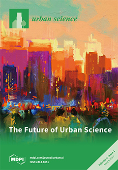
Cover Story (view full-size image): Urban Science is a scholarly international journal which provides a platform for the exchange of theories, ideas, methods, analysis, and comparative studies of urban and regional development. It is a peer-reviewed, open access journal that publishes high-quality original articles, theoretical essays, critical reviews, research notes, and short communications. Its broad definition of “science” includes both quantitative and qualitative methods of social, environmental, and spatial analysis. There is no restriction on the length of the papers. (Image Copyright 2017 From Explorations in Urban Theory by Michael Peter Smith. Reproduced by permission of Taylor and Francis Group, LLC, a division of Informa plc.) View the paper
  • Issues are regarded as officially published after their release is announced to the table of contents alert mailing list.
  • You may sign up for e-mail alerts to receive table of contents of newly released issues.
  • PDF is the official format for papers published in both, html and pdf forms. To view the papers in pdf format, click on the "PDF Full-text" link, and use the free Adobe Reader to open them.
Order results
Result details
Select all
Export citation of selected articles as:
4828 KiB  
Article
Urban Heat Island Assessment Using the Landsat 8 Data: A Case Study in Shenzhen and Hong Kong
by Jinyeu Tsou, Jing Zhuang, Yu Li and Yuanzhi Zhang
Urban Sci. 2017, 1(1), 10; https://doi.org/10.3390/urbansci1010010 - 20 Mar 2017
Cited by 38 | Viewed by 7363
Abstract
In this study, we assess the urban heat island (UHI) effect using remote sensing data, a phenomenon emerging under the background of global warming and urbanization. With the rapid development of satellite technology, remote sensing images are widely applied to evaluate the UHI [...] Read more.
In this study, we assess the urban heat island (UHI) effect using remote sensing data, a phenomenon emerging under the background of global warming and urbanization. With the rapid development of satellite technology, remote sensing images are widely applied to evaluate the UHI effect on rapidly-urbanized areas in recent years. In the study, we applied Landsat 8 data to estimate the land surface temperature (LST) in the case study of Shenzhen and Hong Kong. The methods of the mono-window algorithm (MWA), single-channel method (SCM), Qin’s split-window algorithm (SWA-Q) and Sobrino’s split-window algorithm (SWA-S) are used to calculate the LST from Landsat 8 data on 29 November 2013, 16 November 2014, 18 October 2015, and 7 February 2016. The results show that LST retrievals by SWA-Q are better than those of the other algorithms in the case study of Shenzhen and Hong Kong. From 2013 to 2016, the high-LST zones or UHIs in Shenzhen and Hong Kong are substantially identical. Although the LST is not obviously correlated with vegetation distribution, the growth condition of vegetation may impact the distribution of the UHI, and the high LST is slightly correlated to the high atmospheric particulate concentration. Additionally, in general, Shenzhen and Hong Kong are weak UHI regions and the UHI-affected area in Shenzhen is larger than that in Hong Kong from 2013 to 2016. Full article
Show Figures

Figure 1

2600 KiB  
Article
The Urban Heat Island Effect in the City of Valencia: A Case Study for Hot Summer Days
by Annamária Lehoczky, José A. Sobrino, Dražen Skoković and Enric Aguilar
Urban Sci. 2017, 1(1), 9; https://doi.org/10.3390/urbansci1010009 - 16 Feb 2017
Cited by 26 | Viewed by 16631
Abstract
Extreme heat poses significant risks to the world’s growing urban population, and the heat stress to human health is likely to escalate with the anthropogenically increased temperatures projected by climate models. Thus, the additional heat from the urban heat island (UHI) effect needs [...] Read more.
Extreme heat poses significant risks to the world’s growing urban population, and the heat stress to human health is likely to escalate with the anthropogenically increased temperatures projected by climate models. Thus, the additional heat from the urban heat island (UHI) effect needs to be quantified, including the spatial pattern. This study focuses on the city of Valencia (Spain), investigating the intensity and spatial pattern of UHI during three consecutive hot summer days accompanying a heat record. For the analysis, long-term in situ measurements and remote sensing data were combined. The UHI effect was evaluated using two approaches: (a) based on air temperature (AT) time-series from two meteorological stations and (b) using land surface temperature (LST) images from MODIS products by NASA with 1 km resolution. The strongest nighttime UHI estimated from AT was 2.3 °C, while the most intense surface UHI calculated as the difference between the LST of urban and rural regions (defined by NDVI) was 2.6 °C—both measured during the night after the record hot day. To assess the human thermal comfort in the city the Discomfort Index was applied. With the increasing number of tropical nights, the mitigation of nighttime UHI is a pressing issue that should be taken into consideration in climate-resilient urban planning. Full article
(This article belongs to the Special Issue Urban Thermal Environment under Global Warming Pressure)
Show Figures

Figure 1

2437 KiB  
Article
Human Thermal Conditions and North Europeans’ Web Searching Behavior (Google Trends) on Mediterranean Touristic Destinations
by Ioannis Charalampopoulos, Panagiotis T. Nastos and Eleni Didaskalou
Urban Sci. 2017, 1(1), 8; https://doi.org/10.3390/urbansci1010008 - 10 Feb 2017
Cited by 8 | Viewed by 3741
Abstract
Global economy, trade and other human activities are affected by the behaviour and the psychology of the individuals [1–3]. Knowing the influential factors, which contribute to the perception, behaviour and psychology, a positive reinforcement to the economic cycle could be possible [2,4,5]. Human [...] Read more.
Global economy, trade and other human activities are affected by the behaviour and the psychology of the individuals [1–3]. Knowing the influential factors, which contribute to the perception, behaviour and psychology, a positive reinforcement to the economic cycle could be possible [2,4,5]. Human behaviour is affected by a wide set of factors, some of them being the social and environmental conditions. The expression of behaviour is frequently reflected as wishes, desires and preferences which drive to everyday choices and actions. Scientists have already described the influence of the environmental conditions, especially weather, on the psychology and behaviour via conscious and subconscious functions [6–9]. The essential datasets for the analysis of weather influence on human life are the meteorological data, along with archives of medical registries, psychiatric hospital databases, and police stations’ records [9–17] or structured questionnaires completed by individuals in open public spaces [18–20]. The major drawback of those datasets is that are fragmented and more or less biased by several known and unknown factors [9,21,22] such as the unknown physical, mental and psychological conditions of interviewees along with their acclimatization level when we referred to structured questionnaires [7,23]. An essential part of individuals’ lifestyle (as a part of their behaviour) is the choice of summer vacation destinations. It is known that tourism, especially summer tourism, can be described by the Triple S (Sun, Sea and Sand), which is an abundant feature of the Mediterranean region [24,25]. Many of the major tourism factors for the triple S depend on weather and local climate. Tourist decision making with respect to the destination choice could be supported by specific indices such as, among others, the Tourism Climate Index (TCI) developed by Mieczkowski [26], the Climate Index for Tourism [27] and the ClimateTourism/Transfer-Information-Scheme [25,28,29]. Further, the application of new tools and applications such as Decision Support Systems (DSS) takes into account distinct criteria in a decision making process about preliminary ratting destinations [30]. DSS are usually refers to demand-oriented systems such as destination management or consumer-oriented travel-counselling systems [31]. A DSS is usually built to support the solution of a certain problem or to evaluate an opportunity, through the design of computer models and the simulation of real-life experiences [32]. DSSs continue to improve the quality of decisions by standardizing the process and logic information managers’ choices and making the criteria for determining appropriate outcomes systematic [33]. To investigate the relation between the outdoor thermal conditions and the individuals’ desires related to the summer holidays, we examined the searching frequency of specific keywords as retrieved by the Google Trends service and the values of human thermal index Physiological Equivalent Temperature (PET) during the simultaneous time period. The summer holidays terms, thereafter keywords, were a set of famous summer holiday destinations over Mediterranean Sea and northern coastal European regions, accompanied by some very common words linked with the summer. The results indicate a clearly positive relation between the searched keywords and the PET values. Full article
Show Figures

Figure 1

5407 KiB  
Article
Physical Flood Vulnerability Mapping Applying Geospatial Techniques in Okazaki City, Aichi Prefecture, Japan
by Andi Besse Rimba, Martiwi Diah Setiawati, Abu Bakar Sambah and Fusanori Miura
Urban Sci. 2017, 1(1), 7; https://doi.org/10.3390/urbansci1010007 - 28 Jan 2017
Cited by 65 | Viewed by 9761
Abstract
Flooding has been increasing since 2004 in Japan due to localized heavy rainfall and geographical conditions. Determining areas vulnerable to flooding as one element of flood hazard maps related to disaster management for urban development is necessary. This research integrated Remote Sensing data, [...] Read more.
Flooding has been increasing since 2004 in Japan due to localized heavy rainfall and geographical conditions. Determining areas vulnerable to flooding as one element of flood hazard maps related to disaster management for urban development is necessary. This research integrated Remote Sensing data, the Geography Information System (GIS) method and Analytical Hierarchy Process (AHP) calculation to determine the physical flood-vulnerable area in Okazaki City. We developed this research by applying data from the Geospatial Information Authority of Japan (GSI) to generate the slope map and drainage density; AMEDAS (Automated Meteorological Data Acquisition System) from the Japan Meteorological Agency (JMA) to generate the rainfall data; Soil map from the Ministry of Land, Infrastructure, Transport and Tourism (MLIT) data; and Sentinel-2 imagery to generate the land cover map. We applied the AHP calculation for weighting pairwise the parameters by comparing five iterations of the normalized matrix. We utilized the spatial analysis tool in ArcGIS to run the pairwise comparison to adjudicate the distribution of flooding according to the AHP procedure. The percentage of relative weight was slope (43%), drainage density (20%), rainfall intensity (17%), then both infiltration rate and land cover (10%). The consistency value was reasonable: consistency index (CI—0.007) and consistency ratio (CR—0.6%). We generated high accuracy for flood vulnerability prediction; 0.88 for Probability of Detection (POD), 0.28 for Probability of False Detection (POFD), 0.44 for Critical Success Index (CSI), 1.9 for Bias, and 95 of Area under Curve (AUC). The flood vulnerability was matched to the flood inundation survey of Okazaki City in August 2008 and indicated an excellent Relative Operating Characteristic (ROC). Full article
Show Figures

Figure 1

4812 KiB  
Article
Estimation of Particulate Matter Impact on Human Health within the Urban Environment of Athens City, Greece
by Konstantinos P. Moustris, Kleopatra Ntourou and Panagiotis T. Nastos
Urban Sci. 2017, 1(1), 6; https://doi.org/10.3390/urbansci1010006 - 20 Jan 2017
Cited by 10 | Viewed by 4229
Abstract
The main objective of this work is the assessment of the annual number of hospital admissions for respiratory diseases (HARD) due to the exposure to inhalable particulate matter (PM10), within the greater Athens area (GAA), Greece. To achieve this aim, on [...] Read more.
The main objective of this work is the assessment of the annual number of hospital admissions for respiratory diseases (HARD) due to the exposure to inhalable particulate matter (PM10), within the greater Athens area (GAA), Greece. To achieve this aim, on the one hand, time series of the particulate matter with aerodynamic diameter less than 10 μm (PM10) recorded in six monitoring stations located in the GAA, for a 13-year period 2001–2013, have been statistically analyzed. On the other hand, the AirQ2.2.3 software developed by the World Health Organization (WHO) was used to evaluate adverse health effects by PM10 in the GAA during the examined period. The results show that, during the examined period, PM10 concentrations present a significant decreasing trend. Also, the mean annual HARD cases per 100,000 inhabitants ranged between 20 (suburban area) and 40 (city center area). Approximately 70% of the annual HARD cases are due to city center residents. In all examined sites, a declining trend in the annual number of HARD cases appears. Moreover, a strong relation between the annual number of HARD cases and the annual number of days exceeding the European Union daily PM10 threshold value was found. Full article
(This article belongs to the Special Issue Urban Thermal Environment under Global Warming Pressure)
Show Figures

Figure 1

8366 KiB  
Article
Barcelona’s New Chinatown: Chinese Strategies in the Housing Market in Barcelona and Globalization
by Sergi Martínez-Rigol, Lluís Frago, Alejandro Morcuende, Carles Carreras and Gonzalo Bernardos
Urban Sci. 2017, 1(1), 5; https://doi.org/10.3390/urbansci1010005 - 20 Jan 2017
Cited by 3 | Viewed by 5749
Abstract
Globalization of the urban real estate market, which was originally local, has generated new capital flows worldwide that have reinforced the secondary circuit. Barcelona has not been immune to this process, at least since Spain’s integration into the European Union in 1986. Many [...] Read more.
Globalization of the urban real estate market, which was originally local, has generated new capital flows worldwide that have reinforced the secondary circuit. Barcelona has not been immune to this process, at least since Spain’s integration into the European Union in 1986. Many legal changes in foreign investment regulations have been introduced in Spain, especially in the housing market. The latest major investments in real estate have been made by former socialist countries, notably the People’s Republic of China and Russia, which both belong to the BRICS group. Chinese localization strategies have been more concentrated. With this theoretical background, the aim of the paper is to analyze the strategies of these recent appropriations of Barcelona’s residential space, in the framework of other economic Chinese investments and in competition with other Mediterranean ports. The main conclusion of this study is related to the definition of arcelona’s Chinatown, its changing location, and processes of social differentiation. Full article
Show Figures

Figure 1

25475 KiB  
Technical Note
Urban Soundscapes: Characterization of a Pedestrian Tourist Route in Sorrento (Italy)
by Francesco Aletta, Giovanni Brambilla, Luigi Maffei and Massimiliano Masullo
Urban Sci. 2017, 1(1), 4; https://doi.org/10.3390/urbansci1010004 - 02 Dec 2016
Cited by 14 | Viewed by 5541
Abstract
The tourist experience of built environments has received a lot of attention in tourism marketing and management research. Several studies have shown that the environmental qualities of a place can contribute to its aesthetic appreciation and overall expectation of tourists. Such aesthetic qualities, [...] Read more.
The tourist experience of built environments has received a lot of attention in tourism marketing and management research. Several studies have shown that the environmental qualities of a place can contribute to its aesthetic appreciation and overall expectation of tourists. Such aesthetic qualities, such as cenery and soundscapes, should thus be regarded as key components of tourists’ satisfaction. This study proposes that a soundscape approach could be a suitable tool in tourism management, due to its general purpose of enhancing the users’ experience of a place, taking into account the acoustic dimension of the environment. Within this framework, this paper describes the characterization of the soundscape of a pedestrian tourist route in Sorrento (Italy). For this purpose, a group of acoustics experts, architects, and planners used the soundwalk method to collect recordings and perceptual data about the sound environment along a pre-defined tourist path. The results suggest that the tourists’ perceptual construct is underpinned by both visual and aural elements contributing to soundscape appreciation. Full article
Show Figures

Figure 1

1233 KiB  
Article
Urban Heat Island Intensification during Hot Spells—The Case of Paris during the Summer of 2003
by Koen De Ridder, Bino Maiheu, Dirk Lauwaet, Ioannis A. Daglis, Iphigenia Keramitsoglou, Kostas Kourtidis, Paolo Manunta and Marc Paganini
Urban Sci. 2017, 1(1), 3; https://doi.org/10.3390/urbansci1010003 - 24 Nov 2016
Cited by 34 | Viewed by 7985
Abstract
Heat waves are projected to become more frequent, longer-lasting, and intense. At the same time, urban areas are confronted with the urban heat island (UHI) phenomenon, which adds to the thermal stress experienced during hot spells. Focusing on the Paris area during the [...] Read more.
Heat waves are projected to become more frequent, longer-lasting, and intense. At the same time, urban areas are confronted with the urban heat island (UHI) phenomenon, which adds to the thermal stress experienced during hot spells. Focusing on the Paris area during the hot summer of 2003, we investigated the influence of heat waves on UHI intensity, i.e., the urban-rural temperature contrast. In a first step, this was done based on observed temperatures from an urban and a rural site, showing that per C increase in the daytime temperature, the nighttime UHI intensity increased by 0.086 C. Recognizing the limited spatial representativeness of the urban experimental site, located in a park, we then performed simulations with an urban climate model, covering the wider Paris area for the summer of 2003. First, a validation was done using the aforementioned temperature measurements to do so. Subsequently, we estimated the sensitivity of the nighttime UHI intensity with respect to the daytime temperature, this time using simulated temperatures of the densely built-up areas in the center of Paris, yielding an increase of UHI intensity of 0.19 C per C increase in the daytime temperature. While these results only apply to the domain and period studied, they do confirm recent reports that the UHI intensity increases during heat waves. The results also show that for the cooler parts of the urban fabric (e.g., parks), the UHI intensification during heat waves is around half of that of the dense urban fabric, thus providing some insights into possible mitigation strategies for the future. Full article
(This article belongs to the Special Issue Urban Thermal Environment under Global Warming Pressure)
Show Figures

Figure 1

4278 KiB  
Article
Research by Design: Proposition for a Methodological Approach
by Rob Roggema
Urban Sci. 2017, 1(1), 2; https://doi.org/10.3390/urbansci1010002 - 12 Sep 2016
Cited by 57 | Viewed by 12545
Abstract
In this article, the many definitions of research by design are used to build a coherent model for a research by design process. Three phases are identified, each with their own characteristics and types of activities: the pre-design, the design and the post-design [...] Read more.
In this article, the many definitions of research by design are used to build a coherent model for a research by design process. Three phases are identified, each with their own characteristics and types of activities: the pre-design, the design and the post-design phase. In combination with several practical examples of design-led research projects and design studios, these phases are adhered to practical activities and outcomes. Using all this information, the article concludes with proposing a renewed definition of research by design. Full article
Show Figures

Figure 1

140 KiB  
Editorial
The Future of Urban Science
by Michael Peter Smith
Urban Sci. 2017, 1(1), 1; https://doi.org/10.3390/urbansci1010001 - 07 Jun 2016
Cited by 60 | Viewed by 3521
Abstract
Urban Science is a scholarly international journal which provides a platform for the exchange of theories, ideas, methods, analysis, and comparative studies of urban and regional development.[...] Full article
Next Issue
Back to TopTop