Next Issue
Volume 2, December
Previous Issue
Volume 2, June


Urban Sci., Volume 2, Issue 3 (September 2018) – 43 articles

Cover Story (view full-size image): 
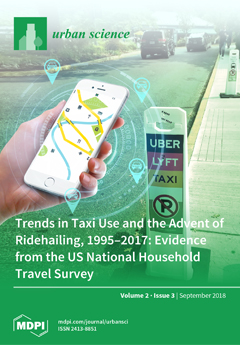
Ridehailing has dramatically changed the for-hire vehicle market. We use a new dataset, the 2017 National Household Travel Survey, to explore this trend in the US. Since 2008, for-hire vehicle travel has doubled in the US. 10% of Americans use ridehailing in a given month. This growth has not been evenly distributed; it is concentrated among high-income households and young people and in dense urban neighborhoods. Transit users tend to be heavier users of ridehailing, and ridehailing is often combined with other modes for a single tour. View the paper here.
  • Issues are regarded as officially published after their release is announced to the table of contents alert mailing list.
  • You may sign up for e-mail alerts to receive table of contents of newly released issues.
  • PDF is the official format for papers published in both, html and pdf forms. To view the papers in pdf format, click on the "PDF Full-text" link, and use the free Adobe Reader to open them.
Order results
Result details
Select all
Export citation of selected articles as:
23 pages, 1749 KiB  
Article
Land-Use Planning Methodology and Middle-Ground Planning Theories
by Alexandros Ph. Lagopoulos
Urban Sci. 2018, 2(3), 93; https://doi.org/10.3390/urbansci2030093 - 19 Sep 2018
Cited by 6 | Viewed by 5002
Abstract
This paper argues that a monolithic land-use planning “grand narrative” is not sufficiently flexible, but that the fragmentation into innumerable “small narratives” goes against any sense of the existence of an established domain of knowledge. Its aim is to explore the epistemological possibility [...] Read more.
This paper argues that a monolithic land-use planning “grand narrative” is not sufficiently flexible, but that the fragmentation into innumerable “small narratives” goes against any sense of the existence of an established domain of knowledge. Its aim is to explore the epistemological possibility for “middle ground” theories. The methodology adopted for this purpose is to take as a standard reference the methodological components of comprehensive/procedural planning and to measure against them the methodologies proposed by a corpus of other major land-use planning approaches. The outcome of this comparison is that for more than half a century, planning theories in the field of urban and regional planning have been revolving incessantly around the methodological components of the comprehensive model, which seem, at least at the present stage of our knowledge, to be the universal nucleus of the land-use planning enterprise. This paper indicates on this basis the prerequisites for the construction of middle-ground land-use planning theories and how we can pass from the formal contextual variants to real life contexts through the original articulation of planning theory with input from the findings of the actual planning systems. Full article
Show Figures

Figure 1

16 pages, 3094 KiB  
Article
Urban Heritage as a Generator of Landscapes: Building New Geographies from Post-Urban Decline in Detroit
by Ryan Locke, Michael Mehaffy, Tigran Haas and Krister Olsson
Urban Sci. 2018, 2(3), 92; https://doi.org/10.3390/urbansci2030092 - 19 Sep 2018
Cited by 6 | Viewed by 4859
Abstract
At this historical moment, the urban planning and design professions are confronted with the twin challenges of unprecedented rapid urbanization on the one hand, and declining post-industrial regions on the other. In this environment, there are many different and often conflicting ideas about [...] Read more.
At this historical moment, the urban planning and design professions are confronted with the twin challenges of unprecedented rapid urbanization on the one hand, and declining post-industrial regions on the other. In this environment, there are many different and often conflicting ideas about urban heritage and its relevance for contemporary urban planning and design. In this paper, we look for commonalities and a way forward from among a range of competing urban design models. We examine the illustrative case study of the geography and landscape of Detroit, USA. We consider seven contemporary urban planning and design ideals that dominate the contemporary planning and design discourse and their different views of the past and urban heritage in relation to the approaches in Detroit. From these, we draw a synthesis approach, making several recommendations and observations with a focus on the capacities of so-called “placemaking” approaches. In this paper, urban heritage is understood and examined as contributing a pattern of infrastructure that provides a helpful supportive framework, and (importantly) a set of structural limitations (e.g., historic plot boundaries), that can serve as a generative resource for new urban planning and design. We conclude that the necessary framework for democratic participation and opportunity within urban space can be provided most directly by leveraging the assets of urban heritage. Full article
Show Figures

Figure 1

15 pages, 7632 KiB  
Article
Measuring Urban Renewal: A Dual Kernel Density Estimation to Assess the Intensity of Building Renovation—Case Study in Lisbon
by Filipe J. S. Brandão, Ricardo M. Correia and Alexandra Paio
Urban Sci. 2018, 2(3), 91; https://doi.org/10.3390/urbansci2030091 - 19 Sep 2018
Cited by 2 | Viewed by 4078
Abstract
In the cities of post-industrialized countries, renovation is the main part of building construction activity and has a major urban impact. Measuring this ongoing phenomenon and its distribution is of great usefulness for municipality urban planning and public policies. In this context, it [...] Read more.
In the cities of post-industrialized countries, renovation is the main part of building construction activity and has a major urban impact. Measuring this ongoing phenomenon and its distribution is of great usefulness for municipality urban planning and public policies. In this context, it is essential to introduce tools and processes that can allow for describing and predict how building renovation evolves. Open databases have become a valuable resource for observing processes and interactions in urban context. Data-driven analysis methods were used to directly interact with open city data, thus aiming to propose an alternative building renovation approach based on data gathering, parametric modeling, and visualization. Kernel Density Estimation (KDE) is an efficient tool that overcomes incomplete data, as not all renovation is reported to city halls. This article presents a preliminary study on a method of measuring building renovation intensity using the city of Lisbon building permit alphanumerical and spatial database as a case study. Full article
(This article belongs to the Special Issue Formalizing Urban Methodologies)
Show Figures

Figure 1

26 pages, 1550 KiB  
Commentary
Exploring the Phenomenon of Zero Waste and Future Cities
by Jonathon Hannon and Atiq U. Zaman
Urban Sci. 2018, 2(3), 90; https://doi.org/10.3390/urbansci2030090 - 18 Sep 2018
Cited by 28 | Viewed by 13411
Abstract
The evolving phenomenon of zero waste encompasses the theory, practice, and learning of individuals, families, businesses, communities, and government organisations, responding to perceptions of crisis and failure around conventional waste management. The diverse and growing body of international zero waste experience, can be [...] Read more.
The evolving phenomenon of zero waste encompasses the theory, practice, and learning of individuals, families, businesses, communities, and government organisations, responding to perceptions of crisis and failure around conventional waste management. The diverse and growing body of international zero waste experience, can be portrayed as both, an entirely new and alternative waste management paradigm, and or, interpreted as overlapping, extending, and synergetic with a general evolution towards more sustainable waste/resource management practices. Combining the terms zero and waste provokes creative, intellectual, and pragmatic tensions, which provide a contemporary axis for necessary debate and innovation in this sphere of resource management. This commentary draws on an interdisciplinary perspective and utilises some elements of the critique of zero waste, as a lens to examine and better understand this heterogeneous global community of practice. In particular, how the concept and implementation of a zero waste goal can increase community engagement and be a catalyst for the design and management of a more circular urban metabolism and hence, more adaptive, resilient, and sustainable future (zero waste) cities. Full article
(This article belongs to the Special Issue Future Cities: Concept, Planning, and Practice)
Show Figures

Figure 1

36 pages, 517 KiB  
Article
Accessory Dwelling Units as Low-Income Housing: California’s Faustian Bargain
by Darrel Ramsey-Musolf
Urban Sci. 2018, 2(3), 89; https://doi.org/10.3390/urbansci2030089 - 18 Sep 2018
Cited by 7 | Viewed by 8757
Abstract
In 2003, California allowed cities to count accessory dwelling units (ADU) towards low-income housing needs. Unless a city’s zoning code regulates the ADU’s maximum rent, occupancy income, and/or effective period, then the city may be unable to enforce low-income occupancy. After examining a [...] Read more.
In 2003, California allowed cities to count accessory dwelling units (ADU) towards low-income housing needs. Unless a city’s zoning code regulates the ADU’s maximum rent, occupancy income, and/or effective period, then the city may be unable to enforce low-income occupancy. After examining a stratified random sample of 57 low-, moderate-, and high-income cities, the high-income cities must proportionately accommodate more low-income needs than low-income cities. By contrast, low-income cities must quantitatively accommodate three times the low-income needs of high-income cities. The sample counted 750 potential ADUs as low-income housing. Even though 759 were constructed, no units were identified as available low-income housing. In addition, none of the cities’ zoning codes enforced low-income occupancy. Inferential tests determined that cities with colleges and high incomes were more probable to count ADUs towards overall and low-income housing needs. Furthermore, a city’s count of potential ADUs and cities with high proportions of renters maintained positive associations with ADU production, whereas a city’s density and prior compliance with state housing laws maintained negative associations. In summary, ADUs did increase local housing inventory and potential ADUs were positively associated with ADU production, but ADUs as low-income housing remained a paper calculation. Full article
Show Figures

Figure 1

10 pages, 2520 KiB  
Article
Domesticity On-Demand: The Architectural and Urban Implications of Airbnb in Melbourne, Australia
by Jacqui Alexander
Urban Sci. 2018, 2(3), 88; https://doi.org/10.3390/urbansci2030088 - 12 Sep 2018
Cited by 5 | Viewed by 5187
Abstract
The home-sharing platform, Airbnb, is disrupting the social and spatial dynamics of cities. While there is a growing body of literature examining the effects of Airbnb on housing supply in first-world, urban environments, impacts on dwellings and dwelling typologies remain underexplored. This research [...] Read more.
The home-sharing platform, Airbnb, is disrupting the social and spatial dynamics of cities. While there is a growing body of literature examining the effects of Airbnb on housing supply in first-world, urban environments, impacts on dwellings and dwelling typologies remain underexplored. This research paper investigates the implications of “on-demand domesticity” in Australia’s second largest city, Melbourne, where the uptake of Airbnb has been enthusiastic, rapid, and unregulated. In contrast to Airbnb’s opportunistic use of existing housing stock in other global cities, the rise of short-term holiday rentals and the construction of new homes in Melbourne has been more symbiotic, perpetuating, and even driving housing models—with some confronting results. This paper highlights the challenges and opportunities that Airbnb presents for the domestic landscape of Melbourne, exposing loopholes and grey areas in the planning and building codes which have enabled peculiar domestic mutations to spring up in the city’s suburbs, catering exclusively to the sharing economy. Through an analysis of publically available spatial data, including GIS, architectural drawings, planning documents, and building and planning codes, this paper explores the spatial and ethical implications of this urban phenomenon. Ultimately arguing that the sharing economy may benefit from a spatial response if it presents a spatial problem, this paper proposes that strategic planning could assist in recalibrating and subverting the effects of global disruption in favor of local interests. Such a framework could limit the pernicious effects of Airbnb, while stimulating activity in areas in need of rejuvenation, representing a more nuanced, context-specific approach to policy and governance. Full article
(This article belongs to the Special Issue Sharing Cities Shaping Cities)
Show Figures

Figure 1

16 pages, 3066 KiB  
Article
Development of a Measure of Permeability between Private and Public Space
by Patrícia Alonso de Andrade, Meta Berghauser Pont and Luiz Amorim
Urban Sci. 2018, 2(3), 87; https://doi.org/10.3390/urbansci2030087 - 12 Sep 2018
Cited by 10 | Viewed by 4955
Abstract
This article focuses on the development of a measure for frontage permeability, which we argue is needed to complement existing metrics used to describe urban environments and assess, amongst others, social performativity. Built density and street network centrality are two characteristics often discussed [...] Read more.
This article focuses on the development of a measure for frontage permeability, which we argue is needed to complement existing metrics used to describe urban environments and assess, amongst others, social performativity. Built density and street network centrality are two characteristics often discussed in relation to urban vitality. However, high densities and high centrality do not always result in higher urban vitality, which can be partially explained by a typical densification model often used in Brazil and in some other Latin-American cities with high-rise residential buildings. To understand the relation between urban form and social performativity, the metrics for density and network centrality are thus not sufficient and we propose to add two other urban form properties: frontage permeability and plot size. The hypothesis is that the mentioned densification model combines higher density with larger plots and lower permeability. Many scholars have shown that higher density is often associated with increased urban vitality, but larger plots are said to have the opposite effect and in Latin American cities, it is observed that lower vitality is found where buildings have less permeable frontages. This research aims at studying the combined effect of density, permeability, and plot size on urban vitality or, more generally, social performativity. However, there is no well-developed method to measure frontage permeability. Therefore, this article first presents a method to measure frontage permeability, both in qualitative and quantitative terms. This measure is then combined with existing measures of density and plot size to analyse how these three urban form metrics relate to each other. In a forthcoming paper, pedestrian observation data will be added to the analysis, to be able to give more insight in the relation between the three urban form metrics and urban vitality using pedestrian counts as proxy. We will show that the developed measure seems to be coherent and effective in describing permeability. Further, the preliminary results confirm the hypothesis that the Brazilian densification model with high-rise residential buildings generates a decrease in frontage permeability, although it does not appear to significantly change plot sizes. Full article
(This article belongs to the Special Issue Formalizing Urban Methodologies)
Show Figures

Figure 1

12 pages, 3051 KiB  
Article
Alexander’s Theories Applied to Urban Design
by Alice Rauber and Romulo Krafta
Urban Sci. 2018, 2(3), 86; https://doi.org/10.3390/urbansci2030086 - 12 Sep 2018
Cited by 3 | Viewed by 4451
Abstract
Christopher Alexander has presented key concepts, such as wholeness, centres, and harmony-seeking computations, related to the coherence reached by a system. Wholeness is the global structural character of a given configuration existing in space. According to Alexander, wholeness is measurable although we do [...] Read more.
Christopher Alexander has presented key concepts, such as wholeness, centres, and harmony-seeking computations, related to the coherence reached by a system. Wholeness is the global structural character of a given configuration existing in space. According to Alexander, wholeness is measurable although we do not have a mathematical language to describe it yet. Some authors have proposed a network perspective to address this problem. However, it is still poorly developed. This paper discusses how to improve the network approach already suggested in the literature. The aim is contributing to the debate on how to operationalise Alexander’s theories through a network perspective. We check out different descriptive systems and different centrality measures, which can be used to reveal the spatial relationship between urban entities and its hierarchy. The main conclusion is that centrality measures seem to offer an opportunity to get closer to Alexander’s concepts. However, a key point to move forward is a deeper investigation on how to describe the urban elements, how to identify spatial differentiation, and how to visualize the results. The relevance of such kind of research is the possibility of using those insights as analytical methods for supporting urban design. Full article
(This article belongs to the Special Issue Formalizing Urban Methodologies)
Show Figures

Figure 1

25 pages, 745 KiB  
Article
Reuse Choice, Flood Risk and Resilience, and Characteristics of Counties with Brownfield Cleanups
by Ann M. M. Carroll and Norma F. Kanarek
Urban Sci. 2018, 2(3), 85; https://doi.org/10.3390/urbansci2030085 - 04 Sep 2018
Cited by 1 | Viewed by 3404
Abstract
Limited research has examined brownfields clean-up, reuse choice and associations with flood risk or resilience. This cross-sectional analysis examines counties with U.S. Environmental Protection Agency (EPA) funded brownfield cleanups initiated from 2005 through 2009 and assesses the county-level relationship of green reuse with [...] Read more.
Limited research has examined brownfields clean-up, reuse choice and associations with flood risk or resilience. This cross-sectional analysis examines counties with U.S. Environmental Protection Agency (EPA) funded brownfield cleanups initiated from 2005 through 2009 and assesses the county-level relationship of green reuse with flood risk while accounting for county factors of resources, environmental stressors, race and ethnicity, location, and structural characteristics, as modified from the Gee and Payne-Sturges conceptual model of community environmental health. Flood plain designation predicted a three-fold odds of green reuse alone (OR = 2.96 [95% CI, 1.31–6.66]) and green with other reuses (OR = 2.88 [95% CI, 1.07–7.75]). Green reuse alone was influenced negatively when a county had an eastern or western US location or a larger proportion of population aged 5–24 and positively when population education levels were higher. Among counties with green and other reuse, low education was predictive. Conceptually, decisions for green reuse alone were driven by resources and location while decisions for green and other reuse were driven by resources, location and environmental stressors. Full article
(This article belongs to the Special Issue Urban Landscape Degradation and Restoration)
Show Figures

Figure 1

20 pages, 2603 KiB  
Article
Partnerships for Private Transit Investment—The History and Practice of Private Transit Infrastructure with a Case Study in Perth, Australia
by Sebastian Davies-Slate and Peter Newman
Urban Sci. 2018, 2(3), 84; https://doi.org/10.3390/urbansci2030084 - 03 Sep 2018
Cited by 5 | Viewed by 8417
Abstract
Urban transit planning is going through a transition to greater private investment in many parts of the world and is now on the agenda in Australia. After showing examples of private investment in transit globally, the paper focuses on historical case studies of [...] Read more.
Urban transit planning is going through a transition to greater private investment in many parts of the world and is now on the agenda in Australia. After showing examples of private investment in transit globally, the paper focuses on historical case studies of private rail investment in Western Australia. These case studies mirror the historical experience in rapidly growing railway cities in Europe, North America, and Asia (particularly Japan), and also the land grant railways that facilitated settlement in North America. The Western Australian experience is noteworthy for the small but rapidly growing populations of the settlements involved, suggesting that growth, rather than size, is the key to successfully raising funding for railways through land development. The paper shows through the history of transport, with particular reference to Perth, that the practice of private infrastructure provision can provide lessons for how to enable this again. It suggests that new partnerships with private transport investment as set out in the Federal Government City Deal process, should create many more opportunities to improve the future of cities through once again integrating transit, land development, and private finance. Full article
(This article belongs to the Special Issue Future Cities: Concept, Planning, and Practice)
Show Figures

Figure 1

21 pages, 4630 KiB  
Article
Coworking, the Sharing Economy, and the City: Which Role for the ‘Coworking Entrepreneur’?
by Giacomo Durante and Margherita Turvani
Urban Sci. 2018, 2(3), 83; https://doi.org/10.3390/urbansci2030083 - 03 Sep 2018
Cited by 30 | Viewed by 6882
Abstract
Sharing economy platforms enabled by information and communication technologies (ICTs) are facilitating the diffusion of collaborative workplaces. Coworking spaces are emerging as a distinctive phenomenon in this context, not only fostering knowledge transfer and facilitating innovation, but also affecting the urban and socio-economic [...] Read more.
Sharing economy platforms enabled by information and communication technologies (ICTs) are facilitating the diffusion of collaborative workplaces. Coworking spaces are emerging as a distinctive phenomenon in this context, not only fostering knowledge transfer and facilitating innovation, but also affecting the urban and socio-economic fabric contributing to urban regeneration processes at both the local scale and the city scale. Although the positive impacts of coworking on the urban environment are documented, there is still little or no evidence of the economic viability of coworking businesses, and a “coworking bubble” has been evoked. Given the lack of data, a national survey was set up of Italian coworking businesses, aimed at assessing the relevance of internal organizational factors (size, occupancy, profitability, services provided) for the sustainability of coworking businesses. By presenting the results of the survey, we argue that the sustainability and viability of the coworking model is highly dependent on internal factors, strictly related to the entrepreneurial action of coworking managers. Full article
(This article belongs to the Special Issue Sharing Cities Shaping Cities)
Show Figures

Figure 1

9 pages, 10145 KiB  
Article
Extension of Space Syntax Methods to Generic Urban Variables
by Roberto D’Autilia and Marco Spada
Urban Sci. 2018, 2(3), 82; https://doi.org/10.3390/urbansci2030082 - 31 Aug 2018
Cited by 5 | Viewed by 4507
Abstract
We studied generalization of a method for extending configurational studies to variables that are not exclusively geographical, in order to allow investigation of generic relationships in the built environment. We observed a number of limitations of the classical approach of configurational studies and [...] Read more.
We studied generalization of a method for extending configurational studies to variables that are not exclusively geographical, in order to allow investigation of generic relationships in the built environment. We observed a number of limitations of the classical approach of configurational studies and we considered how a complex analytical method could be implemented in the study of non-topological variables, such as land use, noise pollution and financial or property rents. In order to do this, we established a system of relationships based on a labeled primary graph. Categorization of the labels of the links was performed on a generic variable, specifically, the predominant use of roads. The graph was then contracted using an optimization algorithm, which we describe. The algorithm allows the network to be reduced to a more streamlined system that can better analyze the relationships between the different categories. Application of the method showed that it is faster to identify weaknesses in urban networks, and then take measures to resolve them. The case study concerns the pedestrianization of the Colosseum area in Rome. Full article
Show Figures

Figure 1

19 pages, 1457 KiB  
Article
Determining Factors for Slum Growth with Predictive Data Mining Methods
by John Friesen, Lea Rausch, Peter F. Pelz and Johannes Fürnkranz
Urban Sci. 2018, 2(3), 81; https://doi.org/10.3390/urbansci2030081 - 29 Aug 2018
Cited by 13 | Viewed by 5432
Abstract
Currently, more than half of the world’s population lives in cities. Out of these more than four billion people, almost one quarter live in slums or informal settlements. In order to improve living conditions and provide possible solutions for the major problems in [...] Read more.
Currently, more than half of the world’s population lives in cities. Out of these more than four billion people, almost one quarter live in slums or informal settlements. In order to improve living conditions and provide possible solutions for the major problems in slums (e.g., insufficient infrastructure), it is important to understand the current situation of this form of settlement and its development. There are many different models that attempt to simulate the development of slums. In this paper, we present data mining models that correlate information about the temporal development of slums with other economic, ecologic, and demographic factors in order to identify dependencies. Different learning algorithms, such as decision rules and decision trees, are used to learn descriptive models for slum development from data, and the results are evaluated with commonly used attribute evaluation methods known from data mining. The results confirm various previously made statements about slum development in a quantitative way, such as the fact that slum development is very strongly linked to the demographic development of a country. Applying the introduced classification models to the most recent data for different regions, it can be shown that the slum development in Africa is expected to be above average. Full article
(This article belongs to the Special Issue Urban Modeling and Simulation)
Show Figures

Figure 1

12 pages, 743 KiB  
Article
Who Is At Risk of Migrating? Developing Synthetic Populations to Produce Efficient Domestic Migration Rates Using the American Community Survey
by Phillip Granberry, Christina Kim, Matthew Resseger, Jonathan Lee, Alvaro Lima and Kevin Kang
Urban Sci. 2018, 2(3), 80; https://doi.org/10.3390/urbansci2030080 - 29 Aug 2018
Viewed by 2640
Abstract
Success in producing a population projection predominately depends on the accuracy of its migration rates. In developing an interregional, cohort-component projection methodology for the U.S. city of Boston, Massachusetts, we created an innovative approach for producing domestic migration rates with synthetic populations using [...] Read more.
Success in producing a population projection predominately depends on the accuracy of its migration rates. In developing an interregional, cohort-component projection methodology for the U.S. city of Boston, Massachusetts, we created an innovative approach for producing domestic migration rates with synthetic populations using 1-year, American Community Survey (ACS), and Public Use Microdata Samples (PUMS). Domestic in- and out-migration rates for Boston used 2007–2014 ACS data and developed synthetic Boston and United States populations to serve as denominators for calculating these rates. To assess the reliability of these rates, we compared the means and standard deviations of eight years of these rates (2007–2014) with synthetic populations by single-year ages for females and males to rates produced from two ACS samples using the same migration data in the numerator but the prior year’s age data in the denominator. We also compared results of population projections for 2015 using these different migration rates to several 2015 U.S. Census Bureau population estimates for Boston. Results suggested our preferred rates with synthetic populations using one ACS sample for each year’s migration rates were more efficient than alternative rates using two ACS samples. Projections using these rates with synthetic populations more accurately projected Boston’s 2015 population than an alternative model with rates using the prior year’s age data. Full article
Show Figures

Figure 1

23 pages, 368 KiB  
Article
Trends in Taxi Use and the Advent of Ridehailing, 1995–2017: Evidence from the US National Household Travel Survey
by Matthew Wigginton Conway, Deborah Salon and David A. King
Urban Sci. 2018, 2(3), 79; https://doi.org/10.3390/urbansci2030079 - 28 Aug 2018
Cited by 116 | Viewed by 14140
Abstract
The advent of ridehailing services such as Uber and Lyft has expanded for-hire vehicle travel. We use data from the 2017 National Household Travel Survey (NHTS) to investigate the extent of this expansion in the United States. We report changes in the for-hire [...] Read more.
The advent of ridehailing services such as Uber and Lyft has expanded for-hire vehicle travel. We use data from the 2017 National Household Travel Survey (NHTS) to investigate the extent of this expansion in the United States. We report changes in the for-hire vehicle market since ridehailing services became available and statistically estimate the determinants of ridehailing use. From 2009–2017, the for-hire vehicle market share doubled. While for-hire vehicles still only account for 0.5% of all trips, the percent of all Americans who use ridehailing in any given month is nearly 10%. Within the for-hire vehicle market, this trend of growth has not been uniformly distributed across demographic groups or geographies; it has been greater in mid-sized and large cities, and among younger individuals and wealthier households. This suggests that understanding the equity implications of ridehailing is an important avenue for research. Multivariate analysis provides evidence that both transit and nonmotorized transport use are correlated with ridehailing use, that ridehailing has a negative relationship with vehicle ownership, and that residents of denser areas have higher ridehailing use. Given the rapid growth of ridehailing, it has become important for cities to include for-hire vehicles in their planning going forward. These NHTS data provide a starting point, but more detailed and frequent data collection is needed to fully understand this many-faceted, rapidly-changing market. Full article
Show Figures

Figure 1

19 pages, 4779 KiB  
Article
Quantifying Urban Surroundings Using Deep Learning Techniques: A New Proposal
by Deepank Verma, Arnab Jana and Krithi Ramamritham
Urban Sci. 2018, 2(3), 78; https://doi.org/10.3390/urbansci2030078 - 28 Aug 2018
Cited by 5 | Viewed by 4354
Abstract
The assessments on human perception of urban spaces are essential for the management and upkeep of surroundings. A large part of the previous studies is dedicated towards the visual appreciation and judgement of various physical features present in the surroundings. Visual qualities of [...] Read more.
The assessments on human perception of urban spaces are essential for the management and upkeep of surroundings. A large part of the previous studies is dedicated towards the visual appreciation and judgement of various physical features present in the surroundings. Visual qualities of the environment stimulate feelings of safety, pleasure, and belongingness. Scaling such assessments to cover city boundaries necessitates the assistance of state-of-the-art computer vision techniques. We developed a mobile-based application to collect visual datasets in the form of street-level imagery with the help of volunteers. We further utilised the potential of deep learning-based image analysis techniques in gaining insights into such datasets. In addition, we explained our findings with the help of environment variables which are related to individual satisfaction and wellbeing. Full article
Show Figures

Figure 1

22 pages, 273 KiB  
Article
Principles for Integrating the Implementation of the Sustainable Development Goals in Cities
by Robert Weymouth and Janette Hartz-Karp
Urban Sci. 2018, 2(3), 77; https://doi.org/10.3390/urbansci2030077 - 27 Aug 2018
Cited by 17 | Viewed by 4691
Abstract
The implementation of the UN’s Sustainable Development Goals in the urban centres of the world is one of the most consequential and ambitious projects that the nations of the world have undertaken. Guidance for achieving the goals in an integrated way that creates [...] Read more.
The implementation of the UN’s Sustainable Development Goals in the urban centres of the world is one of the most consequential and ambitious projects that the nations of the world have undertaken. Guidance for achieving the goals in an integrated way that creates true sustainability is currently lacking because of the wicked nature of the problem. However, its wickedness highlights the critical importance of governance and decision-making processes for such integration, including the relationship between governments and their citizens. In particular, there is strong evidence to suggest that managing wicked problems like the SDGs is best done through forms of democracy that are deliberative, representative and influential. Called “deliberative democracy”, we draw on an existing body of research and case studies of deliberative democracy in action to apply its principles to a step-by-step process for the implementation and integration of the Goals in Cities. The paper concludes with the beginnings of a framework based on deliberative democratic principles, and an outline of methods for the scaling and expansion of the implementation process to cope with the global nature of the problem. Full article
19 pages, 1943 KiB  
Article
The Effects of Inequality, Density, and Heterogeneous Residential Preferences on Urban Displacement and Metropolitan Structure: An Agent-Based Model
by Geoff Boeing
Urban Sci. 2018, 2(3), 76; https://doi.org/10.3390/urbansci2030076 - 27 Aug 2018
Cited by 6 | Viewed by 3525
Abstract
Urban displacement—when a household is forced to relocate due to conditions affecting its home or surroundings—often results from rising housing costs, particularly in wealthy, prosperous cities. However, its dynamics are complex and often difficult to understand. This paper presents an agent-based model of [...] Read more.
Urban displacement—when a household is forced to relocate due to conditions affecting its home or surroundings—often results from rising housing costs, particularly in wealthy, prosperous cities. However, its dynamics are complex and often difficult to understand. This paper presents an agent-based model of urban settlement, agglomeration, displacement, and sprawl. New settlements form around a spatial amenity that draws initial, poor settlers to subsist on the resource. As the settlement grows, subsequent settlers of varying income, skills, and interests are heterogeneously drawn to either the original amenity or to the emerging human agglomeration. As this agglomeration grows and densifies, land values increase, and the initial poor settlers are displaced from the spatial amenity on which they relied. Through path dependence, high-income residents remain clustered around this original amenity for which they have no direct use or interest. This toy model explores these dynamics, demonstrating a simplified mechanism of how urban displacement and gentrification can be sensitive to income inequality, density, and varied preferences for different types of amenities. Full article
Show Figures

Figure 1

17 pages, 3842 KiB  
Article
The Centrality of (Vocational-Oriented) Knowledge Assessing Location and Configuration of Polytechnic Institutes in Portugal
by Mafalda Toscano, Luísa Cannas da Silva and Teresa Valsassina Heitor
Urban Sci. 2018, 2(3), 75; https://doi.org/10.3390/urbansci2030075 - 27 Aug 2018
Cited by 1 | Viewed by 2863
Abstract
Knowledge and creative businesses and industries have been at the core of discussions for urban renewal strategies worldwide. Educational facilities and the businesses they attract are key elements in urban dynamics, helping to promote urban diversity and contributing to enhancing the areas where [...] Read more.
Knowledge and creative businesses and industries have been at the core of discussions for urban renewal strategies worldwide. Educational facilities and the businesses they attract are key elements in urban dynamics, helping to promote urban diversity and contributing to enhancing the areas where they are imbedded. In Portugal, the higher education system follows a binary structure, in which institutions are divided into Universities and Polytechnics. The latter, whose mission is creating vocational-oriented knowledge, grounded on the specific needs of the regions they are in, are key regional drivers, with the possibility of becoming developers and promotors at a regional scale, affecting urban life and urban quality. This paper aims at exploring the location of polytechnic institutions within their hosting cities, attempting to understand location patterns and similarities among different institutions, as well as envisaging the impact of such a location in the engagement with the hosting city. The research is developed at two scales: the first (a) focuses on the location of the institution in its hosting city, while the second (b) focuses on the relative deepness of the internal spaces of the institution. This research aims at providing a methodology for general characterization of regionally oriented higher education institutions in terms of their location within urban systems, as well as exploring the spatial organization of the interior of the institutions analyzed. Full article
(This article belongs to the Special Issue Formalizing Urban Methodologies)
Show Figures

Figure 1

6 pages, 182 KiB  
Editorial
Urban Heat Island and Mitigation Technologies in Asian and Australian Cities—Impact and Mitigation
by Junjing Yang and Mat Santamouris
Urban Sci. 2018, 2(3), 74; https://doi.org/10.3390/urbansci2030074 - 23 Aug 2018
Cited by 13 | Viewed by 5200
(This article belongs to the Special Issue Urban Heat Island and Mitigation Technologies—Impact and Mitigation)
14 pages, 1422 KiB  
Concept Paper
A Conceptual Urban Quality Space-Place Framework: Linking Geo-Information and Quality of Life
by Pablo F. Cabrera-Barona and Helena Merschdorf
Urban Sci. 2018, 2(3), 73; https://doi.org/10.3390/urbansci2030073 - 23 Aug 2018
Cited by 14 | Viewed by 9184
Abstract
Space and place are key concepts for understanding the functionality of social and environmental interactions. Cities are complex social-ecological systems where space–place interactions can be interpreted by means of quality of life. Firstly, we present several quality-of-life concepts that can be linked to [...] Read more.
Space and place are key concepts for understanding the functionality of social and environmental interactions. Cities are complex social-ecological systems where space–place interactions can be interpreted by means of quality of life. Firstly, we present several quality-of-life concepts that can be linked to space and place concepts. Secondly, we develop an analysis about space and place interactions, and how the social aspects, such as the sense of place, and physical aspects, such as urban spaces, are associated with quality of life and inclusive places. Thirdly, we state how the quality of life definitions of livability and life-ability are linked to the space and place concepts, and how this link can support the understanding of quality of life in cities, considering spatial thinking. Fourthly, we expand geo-information theories to a space–place approach of urban quality of life. Finally, we discuss how the developed conceptual framework can be applied to interpret the smart city. This paper contributes to the construction of new epistemologies that could support a more holistic understanding of the cities and a more social and humanistic use of geo-information and technology. Full article
Show Figures

Figure 1

15 pages, 1441 KiB  
Review
Food and Nutrition Security as a Measure of Resilience in the Barents Region
by Dele Raheem
Urban Sci. 2018, 2(3), 72; https://doi.org/10.3390/urbansci2030072 - 22 Aug 2018
Cited by 9 | Viewed by 4984
Abstract
Food and nutrition security builds resilience in a society when people have access to safe and nutritious foods. The Barents region, covering the Northern parts of Finland, Norway, and Sweden, and the North-western part of Russia, seeks common goals that include the well-being [...] Read more.
Food and nutrition security builds resilience in a society when people have access to safe and nutritious foods. The Barents region, covering the Northern parts of Finland, Norway, and Sweden, and the North-western part of Russia, seeks common goals that include the well-being of the region’s inhabitants by ensuring preservation of local culture and social and environmental sustainability. This paper reviews existing literature on food and nutrition security in relation to building resilience and promoting well-being in the region. Amongst the local communities, traditional foods have served as a major source of healthy diet that ensures food security. Access to secure, nutritious, and healthy food is one of the aspects offering greater human security and societal stability. Traditional food has served as a major source of healthy diet, in particular, in the remote sparsely populated Barents region and amongst the local communities of the region. However, there is concern about global climate change and its effect on the region and pollution from human activities, such as the extractive industrial activities, that are detrimental to safe and secure food supply chain. In this paper, I highlight the contribution of traditional foods to food security in the Barents region. In addition, the paper emphasized that value addition to these traditional foods will help to stimulate the economy by creating new jobs. Ultimately, ensuring food and nutrition security in a sustainable way within the region will help to build resilience and promote culture and ecology with a view to offering greater human and societal security. Full article
(This article belongs to the Special Issue Urban Food Security)
Show Figures

Figure 1

20 pages, 4712 KiB  
Article
SNAPScapes: Using Geodemographic Segmentation to Classify the Food Access Landscape
by Elizabeth Major, Elizabeth C. Delmelle and Eric Delmelle
Urban Sci. 2018, 2(3), 71; https://doi.org/10.3390/urbansci2030071 - 21 Aug 2018
Cited by 10 | Viewed by 5240
Abstract
Scholars are in agreement that the local food environment is shaped by a multitude of factors from socioeconomic characteristics to transportation options, as well as the availability and distance to various food establishments. Despite this, most place-based indicators of “food deserts”, including those [...] Read more.
Scholars are in agreement that the local food environment is shaped by a multitude of factors from socioeconomic characteristics to transportation options, as well as the availability and distance to various food establishments. Despite this, most place-based indicators of “food deserts”, including those identified as so by the US Department of Agriculture (USDA), only include a limited number of factors in their designation. In this article, we adopt a geodemographic approach to classifying the food access landscape that takes a multivariate approach to describing the food access landscape. Our method combines socioeconomic indicators, distance measurements to Supplemental Nutrition Assistance Program (SNAP) participating stores, and neighborhood walkability using a k-means clustering approach and North Carolina as a case study. We identified seven distinct food access types: three rural and four urban. These classes were subsequently prioritized based on their defining characteristics and specific policy recommendations were identified. Overall, compared to the USDA’s food desert calculation, our approach identified a broader swath of high-needs areas and highlights neighborhoods that may be overlooked for intervention when using simple distance-based methods. Full article
(This article belongs to the Special Issue Urban Food Security)
Show Figures

Figure 1

9 pages, 706 KiB  
Article
Use of Social Media to Enhance Consumers’ Options for Food Quality in the United Arab Emirates (UAE)
by Eihab Fathelrahman and Aydin Basarir
Urban Sci. 2018, 2(3), 70; https://doi.org/10.3390/urbansci2030070 - 14 Aug 2018
Cited by 5 | Viewed by 5079
Abstract
The objective of this research was to study the behavior and attitudes of consumers from the United Arab Emirates towards using the World Wide Web (WWW) for ordering food online, as well as their perception of social media’s (e.g., Facebook, Twitter, Instagram, and [...] Read more.
The objective of this research was to study the behavior and attitudes of consumers from the United Arab Emirates towards using the World Wide Web (WWW) for ordering food online, as well as their perception of social media’s (e.g., Facebook, Twitter, Instagram, and WhatsApp) impact on increasing their knowledge about their food quality options. This research question targets social media’s role in aiding consumer decision-making with regard to enhanced food quality choices and thus enhanced food security. The results of this study showed that about 50% of the respondents frequently use a website to order food online in the study area. The analysis of the survey results showed a strong correlation between the frequency of food ordered online by consumers and the number of consumers who sought specific information about food quality, such as those who wished to obtain information about special diets for both medical and non-medical purposes. A strong correlation was also found to exist between the frequency of ordering food online and consumers who often inquired about buying organic food. Furthermore, the authors found the potential and the need for more transparency and enhancement when exchanging information between online food providers and consumers, in order to achieve the country’s food security goal of better consumer access to food quality information. Full article
(This article belongs to the Special Issue Urban Food Security)
Show Figures

Figure 1

24 pages, 2559 KiB  
Article
Can Shrinking Cities Demolish Vacancy? An Empirical Evaluation of a Demolition-First Approach to Vacancy Management in Buffalo, NY, USA
by Russell Weaver and Jason Knight
Urban Sci. 2018, 2(3), 69; https://doi.org/10.3390/urbansci2030069 - 13 Aug 2018
Cited by 9 | Viewed by 4057
Abstract
Publicly-funded demolition of vacant structures is an essential tool used in shrinking cities to eliminate nuisances and, often, reduce vacancy rates. Concerning the latter, however, when shrinking cities implement large-scale demolition programs independent of complementary planning efforts, it is reasonable to expect impacts [...] Read more.
Publicly-funded demolition of vacant structures is an essential tool used in shrinking cities to eliminate nuisances and, often, reduce vacancy rates. Concerning the latter, however, when shrinking cities implement large-scale demolition programs independent of complementary planning efforts, it is reasonable to expect impacts on vacancy to be negligible. Among other reasons, demolition operates only on the outflow of existing vacant structures and largely fails to grapple with inflows that add to vacancy over time. This article evaluates an ambitious demolition program in Buffalo, NY, USA, that sought, explicitly, to lower the municipality’s overall vacancy rate. Evidence from statistical changepoint models and Granger tests suggest that, while Buffalo’s overall vacancy rate, measured as undeliverable postal addresses, appeared to decrease around the time of the program, the drop was not linked to elevated demolition activity. The same finding holds for the subarea in which demolitions were spatiotemporally clustered. Although this lack of efficacy is potentially because the city failed to demolish its targeted number of structures, we argue that the likelier explanation is that demolition was not part of a holistic planning strategy. These results have important implications for using large-scale demolition programs as standalone vacancy management policies in shrinking cities. Full article
Show Figures

Figure 1

19 pages, 1338 KiB  
Article
Sharing and Riding: How the Dockless Bike Sharing Scheme in China Shapes the City
by Yiyun Sun
Urban Sci. 2018, 2(3), 68; https://doi.org/10.3390/urbansci2030068 - 09 Aug 2018
Cited by 55 | Viewed by 9837
Abstract
Over the last three years, the dockless bike sharing scheme has become prevalent in the context of the boom in the sharing economy, the wide use of mobile online payment, the increasing environmental awareness and the inherent market demand. This research takes Beijing [...] Read more.
Over the last three years, the dockless bike sharing scheme has become prevalent in the context of the boom in the sharing economy, the wide use of mobile online payment, the increasing environmental awareness and the inherent market demand. This research takes Beijing as a case study, investigates the users’ characteristics, their behaviour change, and perceptions of dockless bike sharing scheme by the quantitative survey, and then analyzes the reasons behind it and how it has changed the residents’ life in Beijing. This new kind of dockless shared bikes, with great advantages of accessibility, flexibility, efficiency and affordability, helps to solve the ‘last mile’ problem, reduce the travel time, and seems to be very environmentally-friendly and sustainable. However, with the help of interview and document analysis, this research finds that the shared bikes are not the effective alternative for the frequent car-users. Nevertheless, it also has numerous negative consequences such as ‘zombie’ bikes blocking the sidewalks and vandalism to the bikes. The public is also worried about their quality and safety, especially the issues of ‘right of way’. How to coordinate and solve these problems is not only related to the future direction of the dockless bike sharing scheme but also to the vital interests of the general public. Therefore, it is important to emphasize that governments, enterprises, and the public participate in multi-party cooperation and build synergic governance networks to carry forward the advantages and avoid the negative effects of the new bike sharing system. Full article
(This article belongs to the Special Issue Sharing Cities Shaping Cities)
Show Figures

Figure 1

25 pages, 1334 KiB  
Review
Access to Urban Green Space in Cities of the Global South: A Systematic Literature Review
by Alessandro Rigolon, Matthew H. E. M. Browning, Kangjae Lee and Seunguk Shin
Urban Sci. 2018, 2(3), 67; https://doi.org/10.3390/urbansci2030067 - 08 Aug 2018
Cited by 184 | Viewed by 19204
Abstract
This review examines disparities in access to urban green space (UGS) based on socioeconomic status (SES) and race-ethnicity in Global South cities. It was motivated by documented human health and ecosystem services benefits of UGS in Global South countries and UGS planning barriers [...] Read more.
This review examines disparities in access to urban green space (UGS) based on socioeconomic status (SES) and race-ethnicity in Global South cities. It was motivated by documented human health and ecosystem services benefits of UGS in Global South countries and UGS planning barriers in rapidly urbanizing cities. Additionally, another review of Global North UGS studies uncovered that high-SES and White people have access to a higher quantity of higher quality UGSs than low-SES and racial-ethnic minority people but that no clear differences exist regarding who lives closer to UGS. Thus, we conducted a systematic review to uncover (1) whether UGS inequities in Global North cities are evident in Global South cities and (2) whether inequities in the Global South vary between continents. Through the PRISMA approach and five inclusion criteria, we identified 46 peer-reviewed articles that measured SES or racial-ethnic disparities in access to UGS in Global South cities. We found inequities for UGS quantity (high-SES people are advantaged in 85% of cases) and UGS proximity (74% of cases). Inequities were less consistent for UGS quality (65% of cases). We also found that UGS inequities were consistent across African, Asian, and Latin American cities. These findings suggest that Global South cities experience similar inequities in UGS quantity and quality as Global North cities, but that the former also face inequities in UGS proximity. Full article
Show Figures

Figure 1

16 pages, 4662 KiB  
Article
Maintaining Comfortable Summertime Indoor Temperatures by Means of Passive Design Measures to Mitigate the Urban Heat Island Effect—A Sensitivity Analysis for Residential Buildings in the City of Vienna
by Doris Österreicher and Stefan Sattler
Urban Sci. 2018, 2(3), 66; https://doi.org/10.3390/urbansci2030066 - 08 Aug 2018
Cited by 13 | Viewed by 4334
Abstract
The waste heat generated from the use of air conditioning systems in cities significantly contributes to the urban heat island effect (UHI) during the summer months. Thus, one of the key measures to mitigate this effect is to limit the use of active [...] Read more.
The waste heat generated from the use of air conditioning systems in cities significantly contributes to the urban heat island effect (UHI) during the summer months. Thus, one of the key measures to mitigate this effect is to limit the use of active cooling systems. In the city of Vienna, air conditioning units are common in nonresidential buildings, but have so far been much less installed in residential buildings. This is mainly due to the fact that the Viennese summertime climate is still considered to be relatively comfortable and planning guidelines related to energy efficiency are already strict, resulting in high-quality buildings in regard to thermal performance. However, during the last decade, an increase in summertime temperatures and so called “tropical nights” has been recorded in Vienna and subsequently the postconstruction installation of air conditioning systems in residential buildings has significantly increased. In a study undertaken for the City of Vienna, a series of passive design measures have been simulated with current and future climate scenarios in order to determine the most effective combination of architecturally driven actions to avoid the use of air conditioning systems in residential buildings whilst maintaining comfortable indoor temperatures. Full article
(This article belongs to the Special Issue Urban Heat Island and Mitigation Technologies—Impact and Mitigation)
Show Figures

Figure 1

21 pages, 1808 KiB  
Article
Towards a Better Understanding of Public Transportation Traffic: A Case Study of the Washington, DC Metro
by Robert Truong, Olga Gkountouna, Dieter Pfoser and Andreas Züfle
Urban Sci. 2018, 2(3), 65; https://doi.org/10.3390/urbansci2030065 - 07 Aug 2018
Cited by 5 | Viewed by 4673
Abstract
The problem of traffic prediction is paramount in a plethora of applications, ranging from individual trip planning to urban planning. Existing work mainly focuses on traffic prediction on road networks. Yet, public transportation contributes a significant portion to overall human mobility and passenger [...] Read more.
The problem of traffic prediction is paramount in a plethora of applications, ranging from individual trip planning to urban planning. Existing work mainly focuses on traffic prediction on road networks. Yet, public transportation contributes a significant portion to overall human mobility and passenger volume. For example, the Washington, DC metro has on average 600,000 passengers on a weekday. In this work, we address the problem of modeling, classifying and predicting such passenger volume in public transportation systems. We study the case of the Washington, DC metro exploring fare card data, and specifically passenger in- and outflow at stations. To reduce dimensionality of the data, we apply principal component analysis to extract latent features for different stations and for different calendar days. Our unsupervised clustering results demonstrate that these latent features are highly discriminative. They allow us to derive different station types (residential, commercial, and mixed) and to effectively classify and identify the passenger flow of “unknown” stations. Finally, we also show that this classification can be applied to predict the passenger volume at stations. By learning latent features of stations for some time, we are able to predict the flow for the following hours. Extensive experimentation using a baseline neural network and two naïve periodicity approaches shows the considerable accuracy improvement when using the latent feature based approach. Full article
(This article belongs to the Special Issue The Future of Urban Transportation and Mobility Systems)
Show Figures

Figure 1

13 pages, 738 KiB  
Article
Spatial Agency: Creating New Opportunities for Sharing and Collaboration in Older People’s Cohousing
by Mark Hammond
Urban Sci. 2018, 2(3), 64; https://doi.org/10.3390/urbansci2030064 - 02 Aug 2018
Cited by 7 | Viewed by 4089
Abstract
Older people’s cohousing enables individuals to share spaces, resources, activities, and knowledge to expand their capability to act in society. Despite the diverse social, economic, and ethical aims that inform the creation of every cohousing community, there is often a disconnect between the [...] Read more.
Older people’s cohousing enables individuals to share spaces, resources, activities, and knowledge to expand their capability to act in society. Despite the diverse social, economic, and ethical aims that inform the creation of every cohousing community, there is often a disconnect between the social discourse developed by cohousing groups and the architectural spaces they create. This is a consequence of the building development process in cohousing, in which groups of older people are tasked with making decisions with considerable spatial implications prior to any collaboration with an architect. The concept of “spatial agency” offers an alternative model for the creation of cohousing, in which the expansion of architectural practice beyond aesthetic and technical building design enables social and spatial considerations to be explored contemporaneously. This study uses a two-year design-research collaboration with a cohousing group in Manchester, UK, to test the opportunities and constraints posed by a “spatial agency” approach to cohousing. The collaboration demonstrated how spatial agency enables both the architect and cohouser to act more creatively through a mutual sharing of knowledge, and, in doing so, tests new opportunities of sharing that are currently outside the cohousing orthodoxy. Full article
(This article belongs to the Special Issue Sharing Cities Shaping Cities)
Show Figures

Figure 1

Previous Issue
Next Issue
Back to TopTop