Next Issue
Volume 1, December


Heritage, Volume 1, Issue 1 (September 2018) – 12 articles

Cover Story (view full-size image): 
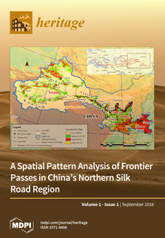
Dozens of frontier passes were built at critical intersections along China’s Northern Silk Road (CNSR) dating back to 114 B.C. To understand the defense and trading systems in ancient times, in this study, a scale-optimization archaeological predictive model based on binary logistic regression (BLR) was proposed to investigate the spatial pattern of frontier passes along the CNSR corridor. The results demonstrated that (i) a culture clustering phenomenon is evident, in particular in regions that cross the 400-mm precipitation line; (ii) regions with a high–medium probability of site occurrence are assembled along the Great Wall and CNSR routes (particularly in the western section), revealing the potential of the developed model for reconstructing Silk Road routes. View this paper
  • Issues are regarded as officially published after their release is announced to the table of contents alert mailing list.
  • You may sign up for e-mail alerts to receive table of contents of newly released issues.
  • PDF is the official format for papers published in both, html and pdf forms. To view the papers in pdf format, click on the "PDF Full-text" link, and use the free Adobe Reader to open them.
Order results
Result details
Section
Select all
Export citation of selected articles as:
18 pages, 11357 KiB  
Article
Assessing the Main Frequencies of Modern and Historical Buildings Using Ambient Noise Recordings: Case Studies in the Historical Cities of Crete (Greece)
by Margarita Moisidi, Filippos Vallianatos and Maria Rosaria Gallipoli
Heritage 2018, 1(1), 171-188; https://doi.org/10.3390/heritage1010012 - 15 Aug 2018
Cited by 5 | Viewed by 3037
Abstract
Monitoring seismic structural response is an essential issue in earthquake risk assessments and mitigation studies for monumental buildings in order to undertake earthquake disaster management. This study aims at identifying the resonant frequency of soil and modern and historical buildings in three major [...] Read more.
Monitoring seismic structural response is an essential issue in earthquake risk assessments and mitigation studies for monumental buildings in order to undertake earthquake disaster management. This study aims at identifying the resonant frequency of soil and modern and historical buildings in three major municipalities of Crete (Heraklion, Chania, and Rethymno) using ambient noise recordings (microtremors) considering the importance of soil–structure interaction to seismic structural response, particularly for historical buildings and monumental structures. In this study, ambient noise recordings have been processed through Horizontal to Vertical Spectral Ratios (H/V) to preliminarily examine the main frequencies and to examine whether the building has its main frequency close to that of the soil in order to identify potential resonance phenomena. Numerous ambient noise recordings were recorded on the soil, in the basement, and at each n-floor of the buildings. The incorporation of local site conditions and soil-building resonance phenomena into the urban planning development of Crete regarding earthquake risk assessments is necessary. In this direction, microtremors can be used as an effective tool to support civil protection preparation and operational decision-making in terms of earthquake disaster, specifically in the area of Crete, which is characterized by high seismic activity and a high cultural monuments capacity. Full article
Show Figures

Figure 1

8 pages, 5273 KiB  
Technical Note
Non-Invasive Moisture Detection for the Preservation of Cultural Heritage
by Pier Matteo Barone and Carlotta Ferrara
Heritage 2018, 1(1), 163-170; https://doi.org/10.3390/heritage1010011 - 10 Aug 2018
Cited by 9 | Viewed by 3367
Abstract
Moisture damage is the most critical issue regarding the preservation and integrity of cultural heritage sites. The electromagnetic (EM) sensitivity to the presence of moisture, in both soils and structural materials, is a well-known phenomenon. Thereby, studying the EM response to the presence [...] Read more.
Moisture damage is the most critical issue regarding the preservation and integrity of cultural heritage sites. The electromagnetic (EM) sensitivity to the presence of moisture, in both soils and structural materials, is a well-known phenomenon. Thereby, studying the EM response to the presence of moisture, in order to prevent the damages done to sites of cultural heritage, is a well-established method. This paper will discuss the ability of a geophysical non-destructive technique (NDT), present in a Ground Penetrating Radar (GPR) system, to investigate a very precious building in Rome that is affected by a moisture problem (the Turkish Room at Villa Medici). This geophysical instrument is able to locate and estimate the extent of water ingression, which can aid in the development of restoration plans before permanent damage occurs. The main objective of this paper is to help restorers understand the related hazards, due to the presence of moisture in the wall structures, in real-time and to rapidly and non-invasively develop strategies for the preservation of cultural heritage sites. Full article
Show Figures

Figure 1

21 pages, 8278 KiB  
Article
Cultural Routes in Kynouria of Arcadia: Geospatial Database Design and Software Development for Web Mapping of the Spatio-Historical Information
by Lampros Boukouvalas, Gregory Grigorakakis and Andreas Tsatsaris
Heritage 2018, 1(1), 142-162; https://doi.org/10.3390/heritage1010010 - 20 Jul 2018
Cited by 4 | Viewed by 4836
Abstract
On the occasion of Kynouria and in order to achieve the protection and projection of antiquities, a web-based model is proposed for highlighting individual monuments and archaeological sites, having in mind the historical and archaeological evidence of the region, the topography, the demographic [...] Read more.
On the occasion of Kynouria and in order to achieve the protection and projection of antiquities, a web-based model is proposed for highlighting individual monuments and archaeological sites, having in mind the historical and archaeological evidence of the region, the topography, the demographic profile, and the tourist infrastructure, and combining them with the development programs for cultural routes. Therefore, creating suitable databases and mapping the monuments in the area are key prerequisites of the process, as they contribute to an objective assessment of the current situation and to make rational decisions. In this frame, modern technology provides some important planning tools (GIS, GPS, and OMS) that allow for the recording and mapping of data, viewing the relationships between them in the area where they appear, and managing their projection. The complete study of Kynouria’s archaeological routes contains the implementation of a website using free or open-source software, which should include all the necessary procedures and the historical and archaeological information material (text, maps, and photographs). Full article
Show Figures

Graphical abstract

20 pages, 3388 KiB  
Article
Abalone in Diasporic Chinese Culture: The Transformation of Biocultural Traditions through Engagement with the Western Australian Environment
by Li Chen and John Charles Ryan
Heritage 2018, 1(1), 122-141; https://doi.org/10.3390/heritage1010009 - 19 Jul 2018
Cited by 3 | Viewed by 5934
Abstract
In October 2017, the Department of Primary Industries and Regional Development of Western Australia (WA) promulgated a new regulation on recreational abalone harvesting. A notable change was that, from 2017 on, the annual fishing season in the West Coast Zone was reduced to [...] Read more.
In October 2017, the Department of Primary Industries and Regional Development of Western Australia (WA) promulgated a new regulation on recreational abalone harvesting. A notable change was that, from 2017 on, the annual fishing season in the West Coast Zone was reduced to four days, from every December on Saturdays only. During the last decade, WA’s abalone fishing regulations have been overhauled frequently because of depleting local stocks. Worldwide, the marine heatwave resulting from climate change and illegal overfishing are considered the two principal reasons for abalone’s decline. Today, the highly lucrative abalone market has attracted more participants in recreational fishing in Perth, WA. Based on Asian natural heritage traditions and employing a multispecies sensory ethnographic methodology, this article provides an in-depth case study of the interaction between the local Chinese diaspora and the environment as represented in abalone harvesting practices. Between 2014 and 2016, the authors conducted one-on-one and focus group interviews with Chinese immigrants to Perth, WA, and also participated in abalone harvesting. The analysis reveals a suite of environmental influences on local Chinese diasporic life through heterogeneous forms of interaction between abalone and Perth-area Chinese immigrants. Full article
Show Figures

Figure 1

22 pages, 14157 KiB  
Article
Hydraulic Chiefdoms in the Eastern Andean Highlands of Colombia
by Michael P. Smyth
Heritage 2018, 1(1), 100-121; https://doi.org/10.3390/heritage1010008 - 11 Jul 2018
Cited by 1 | Viewed by 4091
Abstract
The natural and cultural heritage of the Valley of Leiva in the Eastern Colombian Andes is closely tied to the Colonial town of Villa de Leyva. The popular tourist destination with rapid economic development and agricultural expansion contrasts sharply with an environment of [...] Read more.
The natural and cultural heritage of the Valley of Leiva in the Eastern Colombian Andes is closely tied to the Colonial town of Villa de Leyva. The popular tourist destination with rapid economic development and agricultural expansion contrasts sharply with an environment of limited water resources and landscape erosion. The recent discovery of Prehispanic hydraulic systems underscore ancient responses to water shortages conditioned by climate change. In an environment where effective rainfall and erosion are problematic, irrigation was vital to human settlement in this semi-arid highland valley. A chiefly elite responded to unpredictable precipitation by engineering a hydraulic landscape sanctioned by religious cosmology and the monolithic observatory at El Infiernito, the Stonehenge of Colombia. Early Colonial water works, however, transformed Villa de Leyva into a wheat breadbasket, though climatic downturns and poor management strategies contributed to an early 17th century crash in wheat production. Today, housing construction, intensive agriculture, and environmental instability combine to recreate conditions for acute water shortages. The heritage of a relatively dry valley with a long history of hydraulic chiefdoms, of which modern planners seem unaware, raises concerns for conservation and vulnerability to climate extremes and the need for understanding the prehistoric context and the magnitude of water availability today. This paper examines human ecodynamic factors related to the legacy of Muisca chiefdoms in the Leiva Valley and relevant issues of heritage in an Andean region undergoing rapid socio-economic change. Full article
Show Figures

Figure 1

12 pages, 5019 KiB  
Article
Glocal Participatory System for the Recording, Documentation and Promotion of Cultural Heritage: A Greek Case-Study
by Dimitris Psychogyios and Nick Poulakis
Heritage 2018, 1(1), 88-99; https://doi.org/10.3390/heritage1010007 - 26 Jun 2018
Cited by 2 | Viewed by 2972
Abstract
The recording, documentation and promotion of local cultural heritage has been the subject of significant research from scientists from various fields such as architecture, anthropology, history, folklore, ethnomusicology, and museology. This paper argues that digital technologies could have a catalytic role concerning the [...] Read more.
The recording, documentation and promotion of local cultural heritage has been the subject of significant research from scientists from various fields such as architecture, anthropology, history, folklore, ethnomusicology, and museology. This paper argues that digital technologies could have a catalytic role concerning the operational part of a holistic–interdisciplinary approach to the maintenance of cultural heritage. Simultaneous and bidirectional recording, documentation and promotion of human histories, material elements of space, personal and collective memories, music, dance, singing and other performances, customs, traditions etc. has the effect of improving the understanding of each place and, therefore, contributing to the establishment of sustainable living conditions and environmental balance. At the same time, it facilitates the process of presenting the place’s local identity as well as its tangible and intangible cultural heritage. The paper proposes the design, the creation and the pilot operation of a glocal hybrid (physical and digital) participatory system for monitoring cultural heritage, which consists of (a) spatial recording and projection constructions (open micro-labs); (b) research and documentation centers; and (c) digital databases and mobile applications for interconnection and diffusion of digital content. The system’s implementation domain is considered to be “historic urban landscapes”, i.e., geographical areas with particular cultural features such as traditional settlements, monuments and historical centers, regarded as exceptional universal heritage. In particular, the project’s prime exemplary pilot setup is considered to be operated in specific Greek areas of cultural importance. Full article
Show Figures

Figure 1

31 pages, 17992 KiB  
Article
Implementing Sustainability in Retrofitting Heritage Buildings. Case Study: Villa Antoniadis, Alexandria, Egypt
by Ahmed M. R. Khalil, Naglaa Y. Hammouda and Khaled F. El-Deeb
Heritage 2018, 1(1), 57-87; https://doi.org/10.3390/heritage1010006 - 22 May 2018
Cited by 13 | Viewed by 9819
Abstract
Sustainable design is believed to stand on the opposite side of heritage conservation. This view is supported by the fact that sustainable design requires invasive measures to implement new technologies and treatments that challenge the principle of minimum intervention in heritage conservation. Another [...] Read more.
Sustainable design is believed to stand on the opposite side of heritage conservation. This view is supported by the fact that sustainable design requires invasive measures to implement new technologies and treatments that challenge the principle of minimum intervention in heritage conservation. Another point of view sees heritage conservation as an already act of sustainable development that protects and preserves social and cultural resources such as heritage buildings and their intangible values. On the other hand, research and practice have proven that heritage buildings can be the subjects of sustainable design projects that achieve outstanding measures of sustainability and energy efficiency while not compromising the authenticity of the heritage value of the building. This sustainable conservation reaches its peak in adaptive-reuse projects of heritage buildings as reusing the building guarantees its ongoing maintenance and promotes its social, cultural and economic values to society, while giving it the ability to withstand modern users’ comfort and energy efficiency standards. This research presents a case study of the adaptive-reuse project of Villa Antoniadis in Alexandria; a heritage building built in the mid-nineteenth century and in the process of a major adaptive-reuse project. The history and significance of the building will be studied as well as the conservation values of the current project, then some proposals for interventions that could achieve more energy efficiency for the project while conserving the building are discussed. The research included a simulation of the building, using building energy modelling software for the current adaptive-reuse project as a base case, and the hypothetical application of different proposed sustainable interventions such as thermal insulation, double glazing, shading, lighting control, natural ventilation, and photovoltaic energy generation, where the energy savings potentials for each proposed intervention were studied. The simulation proved a possible reduction of 36.5% in the cooling, heating and lighting energy consumption as well as generated 74.7% of the energy required for cooling, heating and lighting from renewable energy sources. Full article
Show Figures

Figure 1

10 pages, 3521 KiB  
Case Report
Conservation of a Wooden Tomb-Marker from the Jewish Cemetery of Algarrobos in Argentina
by Paula V. Alfieri, Rosana Lofeudo, Guadalupe Canosa, Fabian Iloro and Luis P. Traversa
Heritage 2018, 1(1), 47-56; https://doi.org/10.3390/heritage1010005 - 22 May 2018
Cited by 1 | Viewed by 3715
Abstract
The state of conservation of some tombs in the Jewish Cemetery of Algarrobos in Colonia Mauricio, Buenos Aires, Argentina was evaluated. A lot of material was found, but only two tomb-markers were done on wood. They were in a state of serious deterioration, [...] Read more.
The state of conservation of some tombs in the Jewish Cemetery of Algarrobos in Colonia Mauricio, Buenos Aires, Argentina was evaluated. A lot of material was found, but only two tomb-markers were done on wood. They were in a state of serious deterioration, so these were defined as an object of study. The tomb-markers, which had been established by the Jewish immigrants from Russia at the end 19th century, were made of South American tree known as Aspidosperma Quebracho Blanco and suffered both biological (from fungal decay and insect attack) and mechanical deterioration (cracks and fissures due to weathering, and discoloration due to ultraviolet radiation). Thus, the aim of this paper was the conservation of one of the two remaining wooden tomb-markers found, using impregnant based on non-toxic siloxanes employing sol-gel technology in order to increase the readability of epitaphs and reliefs found at the tomb-marker. The treatment with this modern technology resulted in the excellent performance of wooden tomb-maker conservation. The structural consolidation and cracks sealing were achieved. It avoided the detachment of material and the appearance of natural veins; furthermore, it improved the reading of the epitaphs and reliefs. Full article
Show Figures

Figure 1

2 pages, 169 KiB  
Editorial
Heritage—An Open Access Journal of Knowledge, Conservation, and Management of Cultural and Natural Heritage
by Francesco Soldovieri and Nicola Masini
Heritage 2018, 1(1), 45-46; https://doi.org/10.3390/heritage1010004 - 14 May 2018
Viewed by 3316
Abstract
Over the last fifteen years, studies on cultural heritage (CH) have assumed a methodological, cultural, and scientific perspective, aimed at creating an area in which to carry out frontier research to be replicated in other domains [...] Full article
12 pages, 1428 KiB  
Article
Biological Profile Estimation Based on Footprints and Shoeprints from Bracara Augusta Figlinae (Brick Workshops)
by Luís Miguel Marado and Jorge Ribeiro
Heritage 2018, 1(1), 33-44; https://doi.org/10.3390/heritage1010003 - 14 May 2018
Cited by 2 | Viewed by 4198
Abstract
Biological profile estimation is an important task of biological and forensic anthropologists. This includes sex, age, ancestry, and body morphology. In bioarchaeology, the biological profile is useful to analyze paleodemography, secular trends, paleopathology, and genetic processes, for example. Foot dimensions, footprints, and shoeprints [...] Read more.
Biological profile estimation is an important task of biological and forensic anthropologists. This includes sex, age, ancestry, and body morphology. In bioarchaeology, the biological profile is useful to analyze paleodemography, secular trends, paleopathology, and genetic processes, for example. Foot dimensions, footprints, and shoeprints can vary according to stature, age, sex, and body weight. The objective is to estimate these parameters in possible laterarii (brickworkers) from five footprints and seven shoeprints found in Roman bricks from Bracara Augusta. Estimation methods were applied to footprint and shoeprint measurements concerning foot length, foot breath, heel breadth, and length from heel to each finger. Three non-adult individuals were aged 1 to 4/5 years and were between 79.7 and 112.5 cm (±7.7 cm) tall. Five adults were likely female individuals, with statures between 144.2 and 159.9 cm. Methods were selected from samples preferably biologically similar to Portuguese people. This pioneer analysis provides biological insight on the Bracara Augusta laterarii and the population inhabiting Northwestern Iberia during Roman times. As a result of taphonomic constraints (cremation, soil acidity, and humidity), coeval osteological materials are hardly recovered, which further increases the relevance of this approach. Future research on methods based on Portuguese foot dimensions is essential. Full article
(This article belongs to the Special Issue Heritage and Territory)
Show Figures

Figure 1

18 pages, 5352 KiB  
Article
A Spatial Pattern Analysis of Frontier Passes in China’s Northern Silk Road Region Using a Scale Optimization BLR Archaeological Predictive Model
by Xiaokun Zhu, Fulong Chen and Huadong Guo
Heritage 2018, 1(1), 15-32; https://doi.org/10.3390/heritage1010002 - 20 Mar 2018
Cited by 9 | Viewed by 4649
Abstract
In China’s Northern Silk Road (CNSR) region, dozens of frontier passes built and fortified at critical intersections were exploited starting at approximately 114 B.C. to guarantee caravan safety. Understanding the pattern of these pass sites is helpful in understanding the defense and trading [...] Read more.
In China’s Northern Silk Road (CNSR) region, dozens of frontier passes built and fortified at critical intersections were exploited starting at approximately 114 B.C. to guarantee caravan safety. Understanding the pattern of these pass sites is helpful in understanding the defense and trading system along the Silk Road. In this study, a scale optimization Binary Logistic Regression (BLR) archaeological predictive model was proposed to study the spatial pattern of CNSR frontier passes for understanding the critical placement of ancient defense and trading pass sites. Three hundred and fifty sample locations and 17 natural proxies were input into the model. Four strongly correlated factors were reserved as independent variables to construct the model, which was validated by 150 surveyed data and Kvamme’s Gain statistics. According to the variable selection and model optimization, the best spatial scale varies with the stability of the variables, such as 50 m and 1000 m, respectively, for the terrain and non-terrain variables. Clustering characteristics were identified with division overlapped with a 400 mm precipitation line using the site sensibility map. The high and medium probability areas were assembled along the Great Wall and the CNSR routes, especially in the western part, revealing that the model is also helpful to reconstruct the Silk Road routes. Full article
Show Figures

Figure 1

14 pages, 17591 KiB  
Article
Integrated Investigation of Built Heritage Monuments: The Case Study of Paphos Harbour Castle, Cyprus
by Vasiliki Lysandrou, Athos Agapiou, Manolis Ioannides, Nikolaos Kantiranis, Eleftherios Charalambous and Diofantos Hadjimitsis
Heritage 2018, 1(1), 1-14; https://doi.org/10.3390/heritage1010001 - 14 Mar 2018
Cited by 4 | Viewed by 4160
Abstract
The state of preservation of built heritage monuments is often evaluated by means of several destructive techniques, which are mainly focused on the analysis of small parts of the monuments’ construction materials. The necessary sampling for the accomplishment of these destructive analyses is [...] Read more.
The state of preservation of built heritage monuments is often evaluated by means of several destructive techniques, which are mainly focused on the analysis of small parts of the monuments’ construction materials. The necessary sampling for the accomplishment of these destructive analyses is usually restricted to confined parts of a monument, since monuments are usually under protective legislation, and therefore only indicative of larger areas. Current research attempts to enhance the results of provided by destructive methods, using non-destructive image processing techniques. Towards this end, the potential use of image processing based on rectified images is examined, along with material sampling and laboratory analyses as part of a multi-disciplinary methodology for the investigation of Paphos (Cyprus) Harbour Castle. This approach has been adopted in order to map the degradation patterns observed on the monument’s masonry walls, minimizing destructive methods and attempting to visualize the results of the monument as a whole. The combination of both analytical and non-destructive techniques resulted in the acquisition of large amounts of information, permitting the evaluation of applied non-destructive techniques for the study of the deterioration present on a monument’s external surfaces. This approach led to the assessment of the overall state of preservation of the masonry walls of the structure in an extended scale covering all external façades in a semi-automatic way. Full article
(This article belongs to the Collection Feature Papers)
Show Figures

Figure 1

Next Issue
Back to TopTop