Permafrost Landscapes: Classification and Mapping

A special issue of Geosciences (ISSN 2076-3263).

Deadline for manuscript submissions: closed (31 October 2018) | Viewed by 29865

Special Issue Editor


E-Mail Website
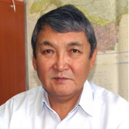
Guest Editor
Melnikov Permafrost Institute, Russian Academy of Sciences, Yakutsk 677010, Russia
Interests: permafrost landscape; classification; mapping; dynamics; climate change; anthropogenic disturbance; satellite images; thermokarst; yedoma
Special Issues, Collections and Topics in MDPI journals

Special Issue Information

Dear Colleagues,

This Special Issue of Geosciences aims to gather high-quality original research articles and reviews of permafrost landscapes studies.

Classification and mapping of permafrost landscapes is of importance in the knowledge of permafrost. The ongoing negative processes from anthropogenic influence and recent climate changes mainly depend on permafrost landscapes. Distribution of the ground ice content and temperature and the active layer thickness determine the development of permafrost landscapes.

Traditional methods, remote sensing, GIS, and analog and mathematical prediction can be used for theoretical and methodological studies for classification and mapping of permafrost landscapes. In this Special Issue, classification and mapping of not only modern permafrost landscapes, but also landscapes of the past and future is encouraged.

Therefore, I invite you to submit articles on your recent research concerning the above and/or the following topics on permafrost landscapes:

  • Theory of classifications
  • Methods of mapping
  • Fieldwork
  • GIS-analysis of the spatial-temporary state
  • Assessment of natural or anthropogenic risks and sustainability
  • Retro-analysis and forecasting

I also encourage you to send me a short abstract outlining the purpose of the research and the principal results obtained, in order to verify at an early stage if the contribution you intend to submit fits with the objectives of the Special Issue.

Dr. Alexander N. Fedorov
Guest Editor

Manuscript Submission Information

Manuscripts should be submitted online at www.mdpi.com by registering and logging in to this website. Once you are registered, click here to go to the submission form. Manuscripts can be submitted until the deadline. All submissions that pass pre-check are peer-reviewed. Accepted papers will be published continuously in the journal (as soon as accepted) and will be listed together on the special issue website. Research articles, review articles as well as short communications are invited. For planned papers, a title and short abstract (about 100 words) can be sent to the Editorial Office for announcement on this website.

Submitted manuscripts should not have been published previously, nor be under consideration for publication elsewhere (except conference proceedings papers). All manuscripts are thoroughly refereed through a single-blind peer-review process. A guide for authors and other relevant information for submission of manuscripts is available on the Instructions for Authors page. Geosciences is an international peer-reviewed open access monthly journal published by MDPI.

Please visit the Instructions for Authors page before submitting a manuscript. The Article Processing Charge (APC) for publication in this open access journal is 1800 CHF (Swiss Francs). Submitted papers should be well formatted and use good English. Authors may use MDPI's English editing service prior to publication or during author revisions.

Keywords

  • Permafrost landscape
  • Classification
  • Mapping
  • Remote sensing
  • GIS analysis
  • Climate change
  • Ground temperature
  • Active layer thickness
  • Ice content

Published Papers (7 papers)

Order results
Result details
Select all
Export citation of selected articles as:

Editorial

Jump to: Research

3 pages, 142 KiB  
Editorial
Permafrost Landscapes: Classification and Mapping
by Alexander N. Fedorov
Geosciences 2019, 9(11), 468; https://doi.org/10.3390/geosciences9110468 - 06 Nov 2019
Cited by 7 | Viewed by 2268
Abstract
Permafrost landscapes occupy 25% of the world’s land area. The formation, dynamics, and evolution of these landscapes are greatly controlled by permafrost processes and thus require special approaches to classification and mapping. Alases, pingoes, edoma, thermokarst mounds, stone streams, low-centre polygonal tundra, and [...] Read more.
Permafrost landscapes occupy 25% of the world’s land area. The formation, dynamics, and evolution of these landscapes are greatly controlled by permafrost processes and thus require special approaches to classification and mapping. Alases, pingoes, edoma, thermokarst mounds, stone streams, low-centre polygonal tundra, and other surface features are associated with the presence of permafrost. Permafrost degradation and greenhouse gas emission due to global climate warming are among the major potential dangers facing the world. Improvements in knowledge about permafrost landscapes are therefore increasingly important. This special issue, titled “Permafrost Landscapes: Classification and Mapping”, presents articles on classification, mapping, monitoring, and stability assessment of permafrost landscapes, providing an overview of current work in the most important areas of cold regions research. Full article
(This article belongs to the Special Issue Permafrost Landscapes: Classification and Mapping)

Research

Jump to: Editorial

30 pages, 19459 KiB  
Article
Diagnostics and Mapping of Geoecological Situations in the Permafrost Zone of Russia
by Nellie Tumel and Larisa Zotova
Geosciences 2019, 9(8), 353; https://doi.org/10.3390/geosciences9080353 - 11 Aug 2019
Cited by 8 | Viewed by 5621
Abstract
The diagnosis of the geoecological state of natural landscapes during the economic development of the permafrost zone should be established by assessing destructive cryogenic processes. Furthermore, the geoecological state should be considered in terms of landscape resistance to an increase in cryogenic processes. [...] Read more.
The diagnosis of the geoecological state of natural landscapes during the economic development of the permafrost zone should be established by assessing destructive cryogenic processes. Furthermore, the geoecological state should be considered in terms of landscape resistance to an increase in cryogenic processes. In this paper, we examine and determine lithocryogenic stability parameters, including permafrost distribution over an area, annual mean temperature, ice content (humidity), and the protective properties of the vegetation. Activation of cryogenic processes in Western Siberia was estimated in terms of the area, development rate and attenuation, natural landscape damage, and hazards to engineering and mining facility operations. The evaluation procedure and the improvement in expert numerical scores are shown. A number of approved methods are proposed for creating assessment maps at various scales using landscape indication methods, decoded satellite images, expert assessments, statistical calculations, and analysis of spatial geographical information systems. Methodical techniques for digital geocryological mapping on the basis of the landscape are presented at scales from 1:3,000,000 to 1:20,000,000. All the maps were created by the authors and can be used for a wide range of applications, including design, survey organizations, and education. Full article
(This article belongs to the Special Issue Permafrost Landscapes: Classification and Mapping)
Show Figures

Figure 1

7 pages, 402 KiB  
Article
The Use of the Value of Heat Cycle to Assess the Energy Stability of Permafrost Soils at the Change of Conditions on the Surface
by Anatoly Kulikov, Nimazhap Badmaev, Darima Sympilova and Ayur Gyninova
Geosciences 2019, 9(3), 112; https://doi.org/10.3390/geosciences9030112 - 01 Mar 2019
Cited by 5 | Viewed by 2449
Abstract
The basis for assessing the stability of geosystems to changes in external heat cycle conditions is the calculation method. It is shown that permafrost soils are characterized by increased values of annual heat cycle QY ≥ 300 MJ/m2, i.e., half-sum [...] Read more.
The basis for assessing the stability of geosystems to changes in external heat cycle conditions is the calculation method. It is shown that permafrost soils are characterized by increased values of annual heat cycle QY ≥ 300 MJ/m2, i.e., half-sum of heat arrival and flow rate per year. This is due to the high heat consumption for melting soils (QPh = 0.7–0.8 QY) and warming them in the negative temperature range (QF). The heat cycle in frozen soil (QF) always has more heat cycle than in the thawed soil (QH). The condition QF > QH means the dominance of processes occurring at negative temperature, and the difference QF − QH is a quantitative assessment of the energy stability of soils to changes in heat exchange conditions on the surface. Full article
(This article belongs to the Special Issue Permafrost Landscapes: Classification and Mapping)
Show Figures

Figure 1

10 pages, 7012 KiB  
Article
Monitoring Network for Atmospheric and Soil Parameters Measurements in Permafrost Area of Buryatia, Russian Federation
by Nimazhap Badmaev and Aleksandr Bazarov
Geosciences 2019, 9(1), 6; https://doi.org/10.3390/geosciences9010006 - 21 Dec 2018
Cited by 13 | Viewed by 2601
Abstract
The monitoring network for the measurement of atmospheric and soil climate parameters was created at the southern boundary of the permafrost zone within the territory of the Republic of Buryatia, Russian Federation. Based on the obtained data, the processes of soil freezing and [...] Read more.
The monitoring network for the measurement of atmospheric and soil climate parameters was created at the southern boundary of the permafrost zone within the territory of the Republic of Buryatia, Russian Federation. Based on the obtained data, the processes of soil freezing and thawing were studied. Negative temperatures in cold soils occurred within 5.5–6 months, whereas the subsoil was in a thawed state most of the year. On the contrary, permafrost-affected soils were thawed for 4.5–5 months, remaining frozen in the subsoil for most of the year. We propose referring to the observed spatial–temporal differences in the temperature dynamics as the “mirror imaging” of the distribution of heat and cold (frost) in the studied soils of the permafrost zone. Full article
(This article belongs to the Special Issue Permafrost Landscapes: Classification and Mapping)
Show Figures

Figure 1

14 pages, 5563 KiB  
Article
Mapping Mountain Permafrost Landscapes in Siberia Using Landsat Thermal Imagery
by Svetlana V. Kalinicheva, Alexander N. Fedorov and Mikhail N. Zhelezniak
Geosciences 2019, 9(1), 4; https://doi.org/10.3390/geosciences9010004 - 20 Dec 2018
Cited by 10 | Viewed by 4061
Abstract
Intensive development of South Yakutia, a mountainous area in the Russian sporadic permafrost zone, must be founded on knowledge about regional permafrost conditions. New permafrost maps for mountainous areas in South Yakutia (the Elkon Mountains and the Olekma-Chara Upland) are presented that provide [...] Read more.
Intensive development of South Yakutia, a mountainous area in the Russian sporadic permafrost zone, must be founded on knowledge about regional permafrost conditions. New permafrost maps for mountainous areas in South Yakutia (the Elkon Mountains and the Olekma-Chara Upland) are presented that provide a more detailed and updated description of permafrost distribution in the area than those that were hitherto available. These maps are based on the previously-developed and tested method of detecting permafrost and unfrozen ground using Landsat-5/TM satellite data with relatively high resolution. The method represents a scheme for permafrost identification based on a set of landscape indicators: terrain elevation, slope angle and exposition, vegetation, snow cover, and land surface temperature (LST). A correlation analysis of satellite data to full-scale field data has been carried out for the two areas under consideration. Indicator properties of LST obtained by Landsat-5/TM Band 6 Infrared have been characterized in detail for detection and regional mapping of permafrost. The effect of landscape factors (landscape cryo-indicators) on ground temperature and condition, frozen or unfrozen reflected in LST intensity, is demonstrated. Full article
(This article belongs to the Special Issue Permafrost Landscapes: Classification and Mapping)
Show Figures

Figure 1

17 pages, 3161 KiB  
Article
Permafrost-Landscape Map of the Republic of Sakha (Yakutia) on a Scale 1:1,500,000
by Alexander N. Fedorov, Nikolay F. Vasilyev, Yaroslav I. Torgovkin, Alena A. Shestakova, Stepan P. Varlamov, Mikhail N. Zheleznyak, Viktor V. Shepelev, Pavel Y. Konstantinov, Svetlana S. Kalinicheva, Nikolay I. Basharin, Viktor S. Makarov, Innokenty S. Ugarov, Peter V. Efremov, Radomir N. Argunov, Larisa S. Egorova, Vera V. Samsonova, Andrey G. Shepelev, Alexander I. Vasiliev, Rosaliya N. Ivanova, Alexey A. Galanin, Vasily M. Lytkin, Georgy P. Kuzmin and Viktor V. Kunitskyadd Show full author list remove Hide full author list
Geosciences 2018, 8(12), 465; https://doi.org/10.3390/geosciences8120465 - 07 Dec 2018
Cited by 43 | Viewed by 8736
Abstract
The history of permafrost landscape map compilation is related to the study of ecological problems with permafrost. Permafrost-landscape studies are now widely used in geocryological mapping. Permafrost-landscape classifications and mapping are necessary for studying the trends in development of the natural environment in [...] Read more.
The history of permafrost landscape map compilation is related to the study of ecological problems with permafrost. Permafrost-landscape studies are now widely used in geocryological mapping. Permafrost-landscape classifications and mapping are necessary for studying the trends in development of the natural environment in northern and high-altitude permafrost regions. The cryogenic factor in the permafrost zone plays a leading role in the differentiation of landscapes, so it must be considered during classification construction. In this study, a map’s special content was developed using publications about Yakutian nature, archive sources from academic institutes, the interpretation of satellite images, and special field studies. Overlays of 20 types of terrain, identified by geological and geomorphological features, and 36 types of plant groupings, allowed the systematization of permafrost temperature and active layer thickness in 145 landscape units with relatively homogeneous permafrost-landscape conditions in the Sakha (Yakutia) Republic. This map serves as a basis for applied thematic maps related to the assessment and forecast of permafrost changes during climate warming and anthropogenic impacts. Full article
(This article belongs to the Special Issue Permafrost Landscapes: Classification and Mapping)
Show Figures

Figure 1

11 pages, 2590 KiB  
Article
Landscape Microzones within Thermokarst Depressions of Central Yakutia under Present Climatic Conditions
by Alexey Desyatkin, Fumiaki Takakai and Maya Nikolaeva
Geosciences 2018, 8(12), 439; https://doi.org/10.3390/geosciences8120439 - 27 Nov 2018
Cited by 9 | Viewed by 3110
Abstract
Thermokarst (alas) of Central Yakutia is an intrazonal dynamic landscape in the form of rounded depressions with peculiar soils and meadow vegetation, microclimate, and fauna that are very different from the surrounding typical taiga landscapes. During the formation of alas depression, complete processing [...] Read more.
Thermokarst (alas) of Central Yakutia is an intrazonal dynamic landscape in the form of rounded depressions with peculiar soils and meadow vegetation, microclimate, and fauna that are very different from the surrounding typical taiga landscapes. During the formation of alas depression, complete processing of thawed ground with the formation of new soils occurs and entirely changes the biogeochemical cycle. Because this system is closed, all water-soluble substances, such as N/C and soluble salts, etc., accumulate inside the depression. Using standard methods and instruments, we measured the main properties of alas soils. Depending on the hydrothermal and physicochemical regimes, thawing depth, and greenhouse gas (GHG) flux, three main belts of soils and vegetation were distinguished within the alas: (1) steppe meadow, located on most elevated places, not sufficiently moistened, with alas steppe soils and steppe vegetation; (2) middle meadow, located lower than stepped meadow in elevation, normally moist, with alas sod-meadow soils and highest productivity vegetation; and (3) wet meadow, located around the lake, excessively moistened, with alas marshy sod-meadow soils and marsh vegetation. Therefore, the soils of wet and real meadows, due to the abundance of organic matter, are significant sources of CO2 and CH4, especially in humid years. Under the climate warming observed over recent decades in this territory, the alas ecosystem has undergone considerable change. Thus, the classification and mapping of belts within the alas can have both applied and fundamental importance. Full article
(This article belongs to the Special Issue Permafrost Landscapes: Classification and Mapping)
Show Figures

Figure 1

Back to TopTop