Coasts 2024, 4(2), 366-391; https://doi.org/10.3390/coasts4020019 - 10 May 2024
Abstract
►
Show Figures
Estuaries that become closed from the ocean through the formation of a sand bar are particularly susceptible to degradation and often experience poor water quality and fish kills. Sampling was conducted seasonally for two years in the deeper waters of the Vasse–Wonnerup (southwestern
[...] Read more.
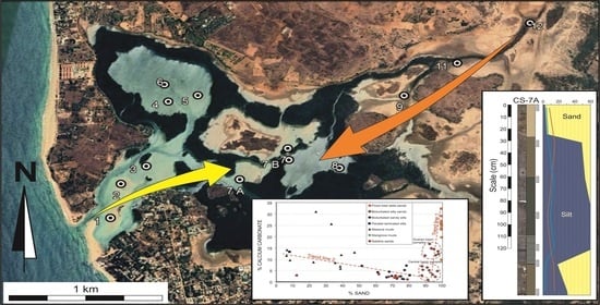
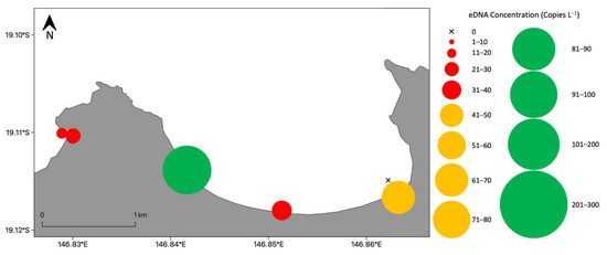
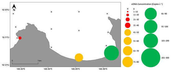
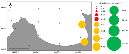
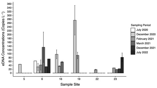
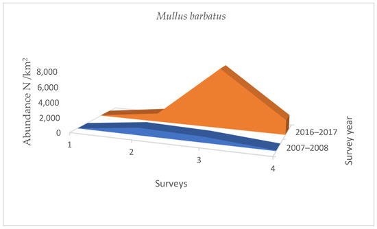
Estuaries that become closed from the ocean through the formation of a sand bar are particularly susceptible to degradation and often experience poor water quality and fish kills. Sampling was conducted seasonally for two years in the deeper waters of the Vasse–Wonnerup (southwestern Australia) after a large fish mortality event to identify the fish species present and determine if richness, abundance, diversity and faunal composition differed among regions and over time. Species richness, abundance and diversity were far greater in the downstream regions than in the upstream regions, reflecting patterns in salinity. Catch rates of two marine estuarine-opportunist mugilids (Mugil cephalus and Aldrichetta forsteri) and an estuarine-resident sparid (Acanthopagrus butcheri), which were the species most affected by the mortality event, were relatively stable. It is suggested that before sampling commenced, mugilids had entered the estuary following an artificial sand bar breach, while the loss of 0+ (new recruits) A. butcheri in the mortality event and subsequent recruitment failure prevented stocks from increasing. Temporal shifts in fish composition were driven by less abundant species, which utilized the estuary more opportunistically. Increases in the occurrences and abundances of these species coincided with an open bar and salinities close to those of seawater. The data also show how the estuary responds to differing hydrodynamic phases and artificial breaches.
Full article

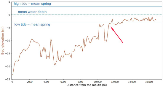
Figure 1


