1. Introduction
Ecosystem services are the benefits humans receive from natural processes and structures of an ecosystem [
1,
2]. However, because of human alteration, many ecosystem services are increasingly threatened [
3]. As such, there has been a growing interest in the role of conservation, planning, and management of forests to sustain and optimize ecosystem service provision. Key to this approach is the need to quantify bundles of ecosystem services, their interactions, and their biophysical drivers in a spatially explicit manner [
4,
5,
6].
Quantifying and mapping ecosystem services and goods are gaining interest as means to inform conservation and management approaches, including programs to financially compensate owners of biological resources (e.g., forest property owners) for conserving or managing their land to provide sustained levels of ecosystem services (
i.e., payment for ecosystem services) [
7]. For example, simulation models coupled with spatial analyses have been used to quantify the capacity and economic value of a forest ecosystem to regulate water flows [
7]. Similar studies have also used this approach to analyze and identify specific areas where conservation interventions were most feasible and cost-effective in providing bundles of ecosystem services [
5,
8]. Additionally, mapping of ecosystem services has been used in environmental assessments to identify locations of specific ecosystem structures and their functional contribution to key goods and services [
9,
10] and for identifying hotspots for such ecosystem provisioning [
6].
Forests provide multiple ecosystem services (e.g., carbon sequestration, water yield, and timber), although landowners have historically been compensated solely for timber products. The timber industry is economically important to the US southeast [
11,
12]. Indeed, forest industry in the State of Florida, United States (USA) contributes to its economy by providing more than 64,000 jobs and accounts for US $13 billion in the state’s gross domestic product [
13]. While timber production is the primary forest industry’s objective, many studies recognize the role of pine plantations in contributing to carbon sequestration [
14]. Carbon sequestration is also a key ecosystem service provided by forests and landowners can be incentivized for efforts to conserve, manage, and improve their forest lands [
15] in the form of carbon offsets [
11].
Water yield (
i.e., water made available to aquifers and water bodies) of a system results from the difference between precipitation and evapotranspiration (ET), and is also a key ecosystem service provided by forests [
16]. Several studies discuss how this ecosystem service can be negatively affected by increased forest stocking and plantation management [
17,
18,
19], which can vary depending on specific forest structures [
20]. McLaughlin
et al. [
21] suggested that management schemes that control key structural attributes (e.g., canopy and understory leaf area index, basal area) can help increase water yield from both plantation and natural forests.
Forest structure attributes like leaf area affect forest functions such as water use, tree growth, and primary productivity [
22,
23]. Leaf Area Index (LAI), defined as the ratio of leaf area to ground area for broadleaf plant canopies or projected needle forests [
23,
24], is a key metric used to estimate forest ecosystem functions and is strongly related to other structural attributes, such as basal area, which also influences carbon storage processes and timber yields [
21,
25]. Thus, basal area and LAI together are metrics for estimating the effects of biophysical and anthropogenic influences, or drivers, on water yield and aboveground biomass (e.g., carbon, timber) in forests. As such, they can be used to map, quantify, and understand interactions among these three ecosystem services [
26].
Understanding ecosystem service interactions represents a challenge in land management decision-making [
27,
28]. Specifically, ecosystem services interact when the level of provision of one service directly affects the level of another service [
27]. The interaction can either be a trade-off or synergy. Trade-off occurs when production of one ecosystem service compromises the provision of other services. Conversely, a synergy occurs when the productions of multiple ecosystem services either increase or are provided at similar levels. Changes in ecosystem services provisioning and their interactions result from influences of anthropogenic (e.g., management activities) and biophysical (e.g., forest structures and disturbances) drivers [
27,
29,
30,
31]. As such, analyses of the interactions among key ecosystem services can provide useful information on how drivers or managing for one service can affect the provision of other services [
16].
Studies have previously defined ecosystem services trade-offs and identified spatial patterns at the landscape scale among bundles of ecosystem services for several ecosystem types [
6,
27,
32]. Such studies, however, are often based on land cover data, ecosystem service proxies, and graphical analyses. This use of land use/land cover (LULC) data is most commonly cross-sectional and dependent on satellite imagery acquired at one point in time. Thus, the LULC data does not reflect within class variability as they fail to depict small grain temporal and spatial variability due to factors such as age or disturbance. This is specifically true when broad LULC classes and/or low frequency updates are used, which is often the case in ecosystem service quantification and trade-off studies [
32]. As such, LULC data have been reported to neglect temporal and spatial changes in ecosystem functions [
4] and are a poor fit for actual field data and identifying local or regional trends [
33]. A recent study has utilized geostatistical analysis to identify clusters (e.g., hot spots) of ecosystem services [
25]. In this study, once ecosystem service clusters were identified, they were analyzed against management drivers, socio-ecological or regulatory dynamics, and/or spatial concordance. Therefore, georeferenced, measured forest structure data for a specific ecosystem type can in-turn better identify specific areas of trade-offs and synergies and provide for a better understanding of the biotic and abiotic drivers affecting these changes [
8,
34,
35,
36].
To better understand trade-offs and synergies among a bundle of ecosystem services, it is imperative to also analyze the anthropogenic and biophysical drivers behind their ecosystem interactions [
26,
27], but studies that account for these interactions and influences are still limited [
4]. The use of Geographic Information System (GIS) [
29,
37] coupled with available plot-level measurements (e.g., forest inventory data), however, can facilitate the development of models that use local-scale ecosystem structural attributes and ecosystem functional relationships (e.g., allometric biomass-carbon equations and LAI-ET relationships) to better quantify ecosystem services provision in specific areas [
26,
38].
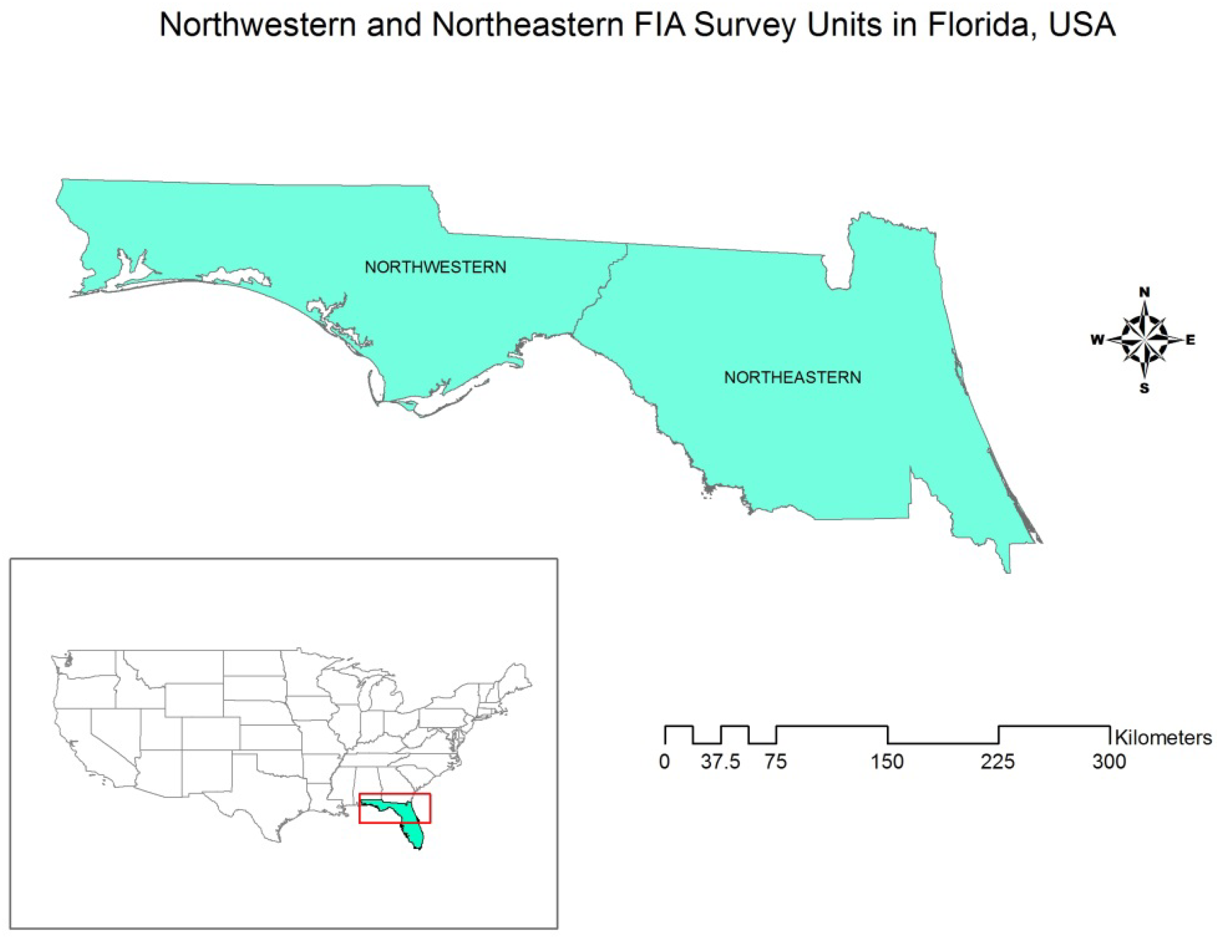
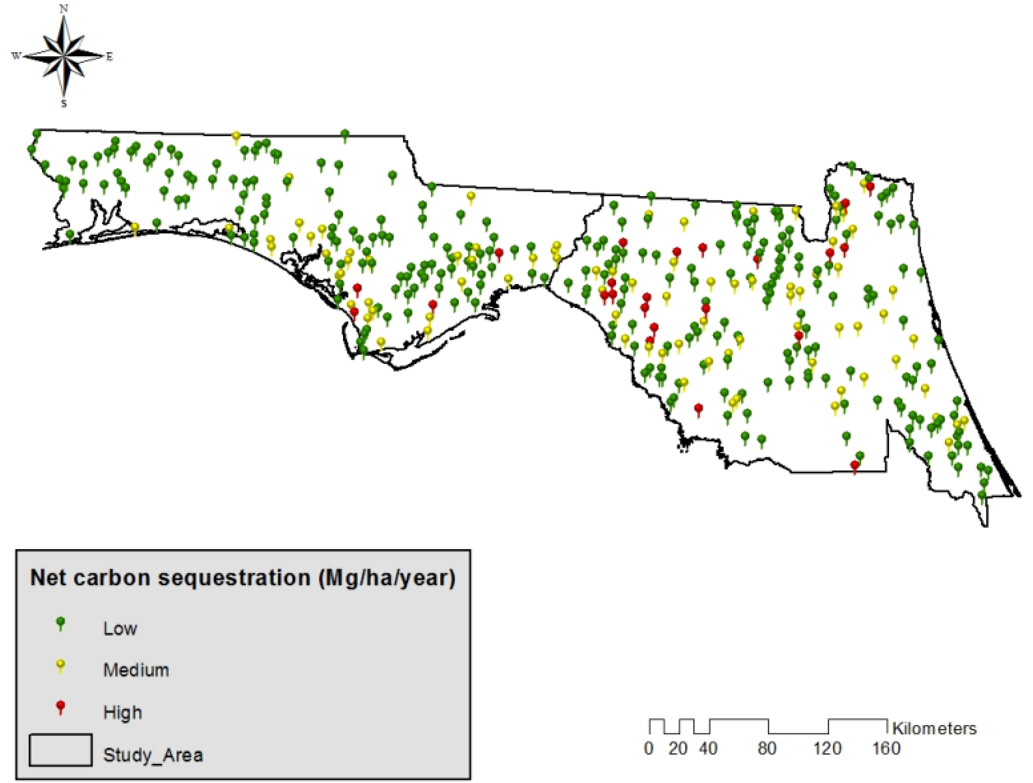
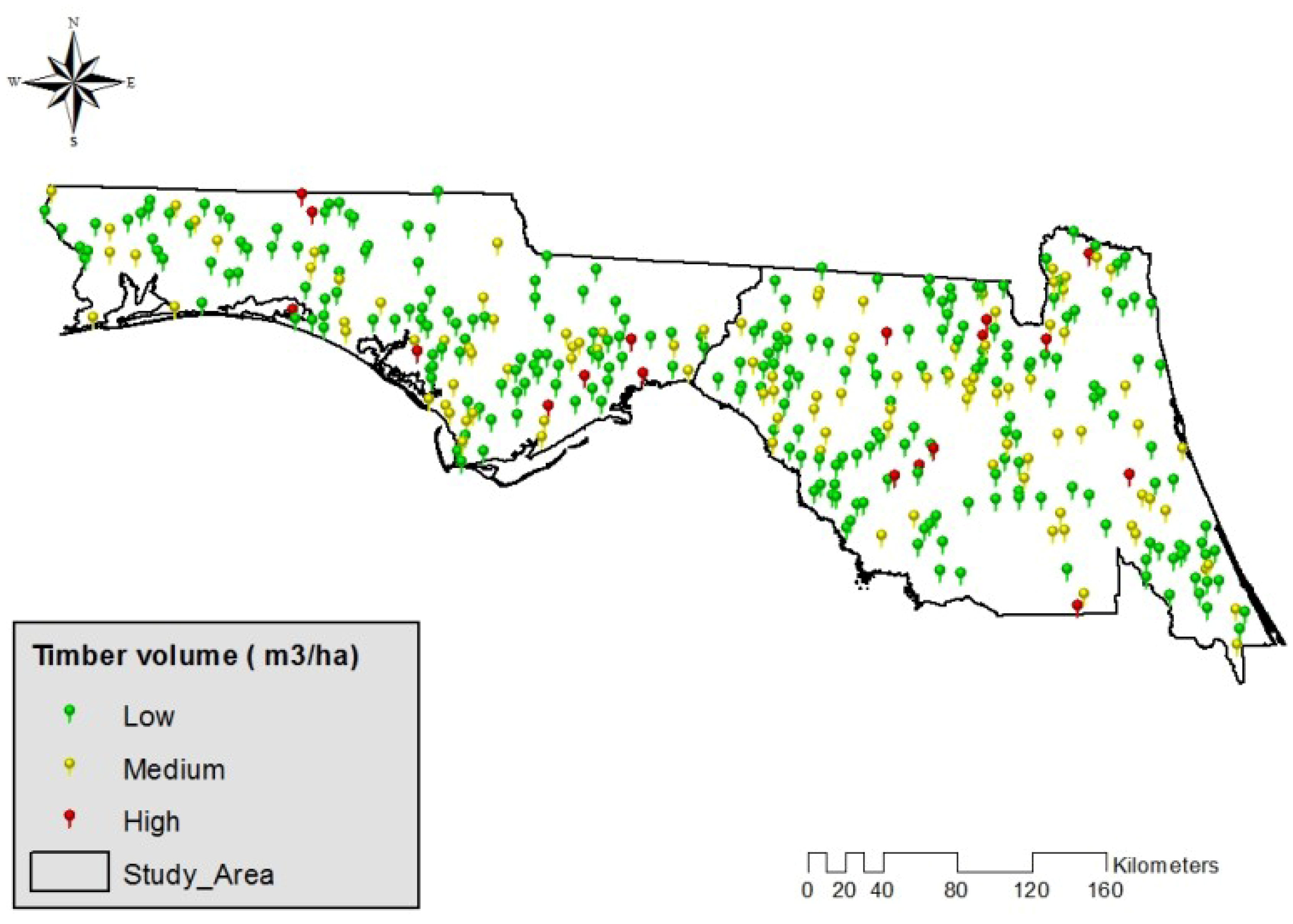
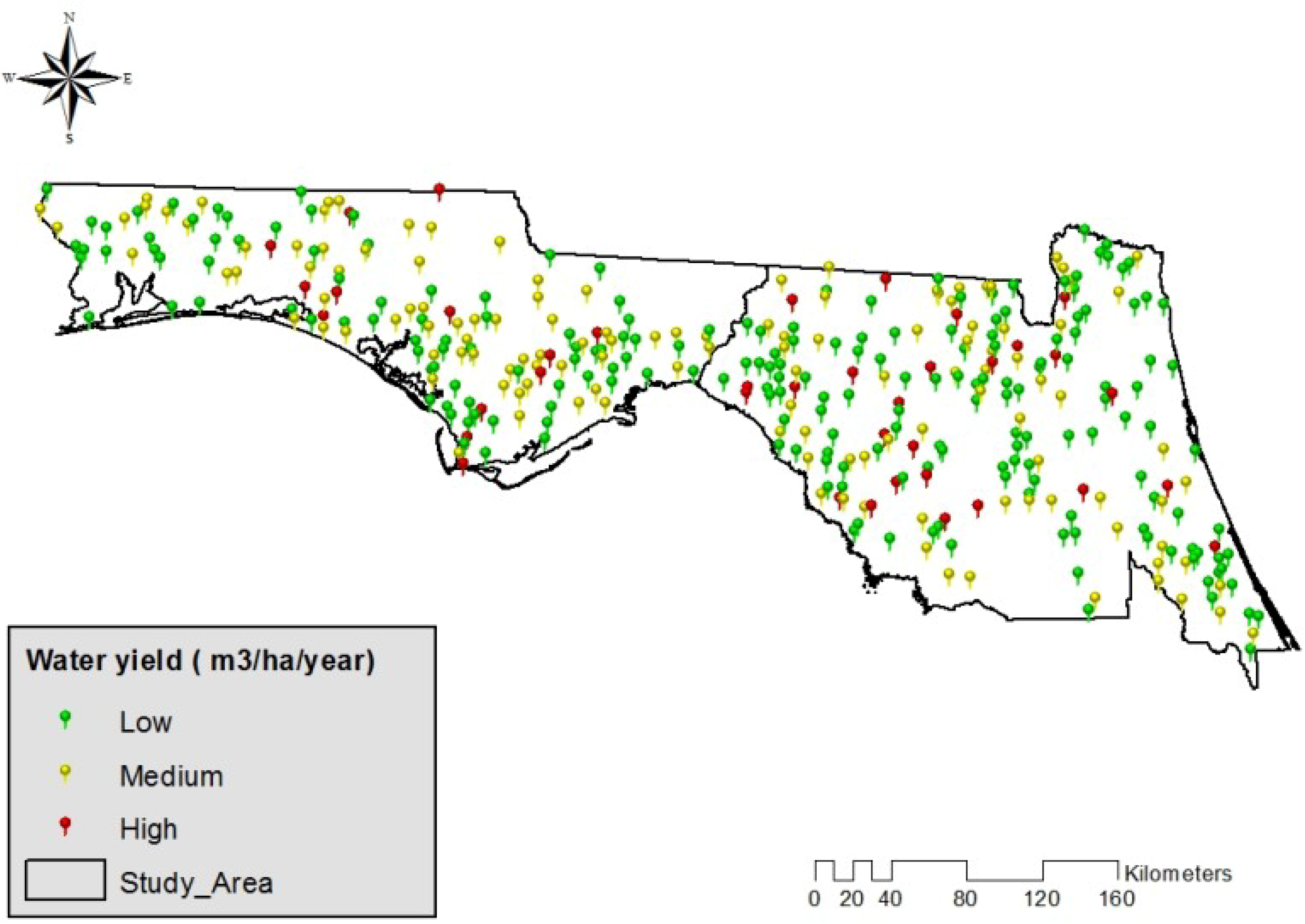
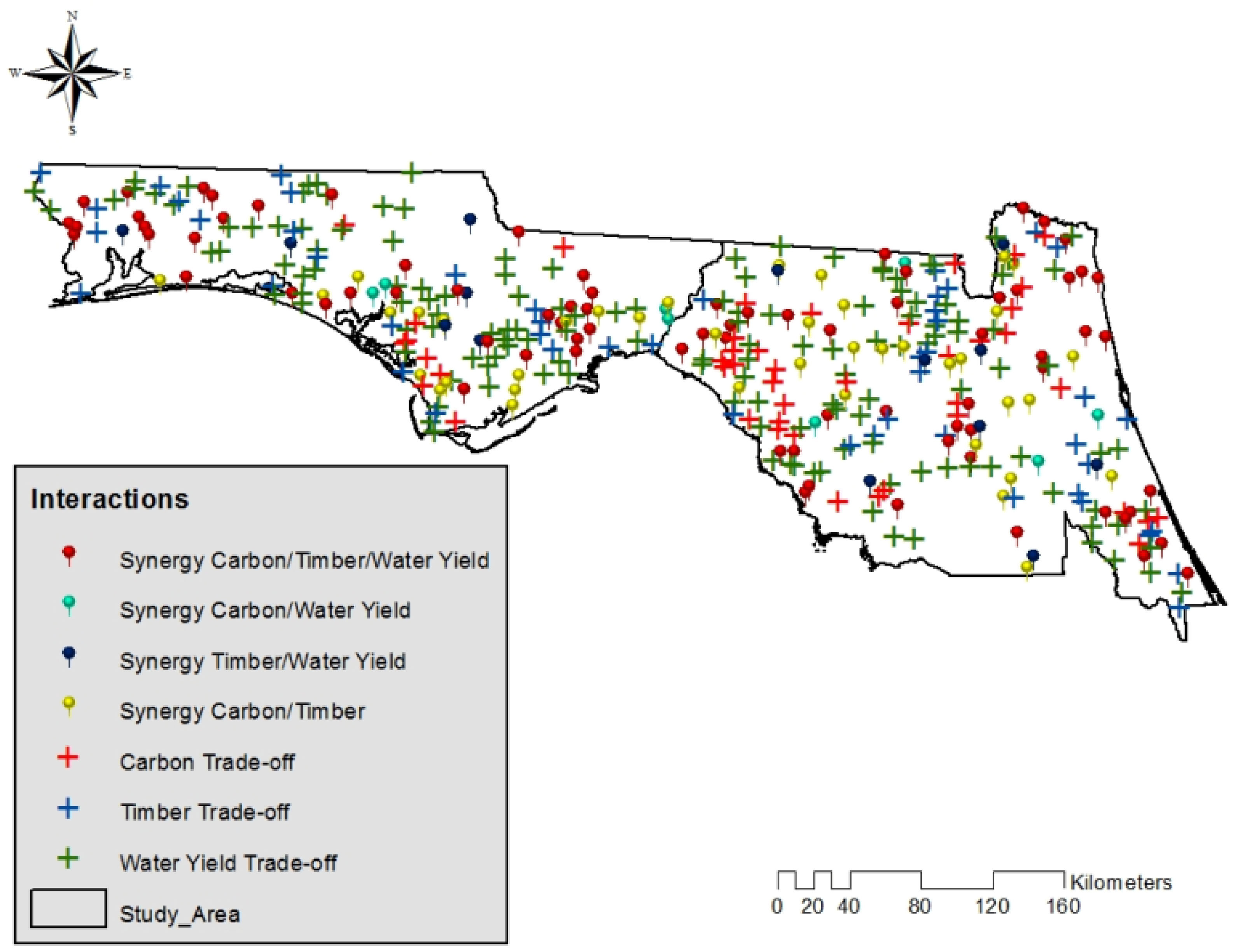
The aim of this study was to analyze carbon sequestration, timber production, and water yield interactions in slash pine (Pinus elliottii) ecosystems in north Florida, USA. The analysis was based on plot-level forest inventory data, ecological function models, and a ranking-classification framework. Additionally, we statistically analyzed common biophysical and forest management drivers affecting these interactions. The specific objectives of this study were to: (1) quantify plot-level timber, carbon, and water yield provision levels; (2) develop a ranking-classification framework to analyze interactions (i.e., trade-offs and synergies) among these ecosystem services and their spatial distribution; and (3) statistically analyze the effect of forest management and biophysical drivers on individual ecosystem services and their interactions.
4. Conclusions
While our study focused on understanding management influences on ecosystem service interactions at the plot scale, our modeling approach and the availability of nation-wide FIA plot-level data means our framework can be easily scaled-up and used to guide forest management at the state, ecoregion, or biome level. Indeed, the use of FIA forest inventory data for regional and state-level applications is one of the program’s key missions [
40,
42]. Regional goals could determine if management should focus on synergies (e.g., Type 111) or maximization of other highly valued services (e.g., C sequestration at the expense of water yield). Accordingly, forest stand prescriptions and landscape level management activities could focus on the most influential drivers to best meet these regional goals [
31]. Most importantly, using field measurements and site-specific information—as opposed to the use of land cover-based proxies—to better understand how land management influences the relative provisioning among ecosystem services is critical [
33], and this study provides a framework to do so.
There has been increased interest in forest C sequestration and timber production because of their influential effects on climate change and in providing energy alternatives and other market and profit opportunities [
52,
54]. At the same time, water yield is a highly valued service by society [
52]. Thus, the framework developed in this study can be used to assess, map and manage subtropical ecosystems for optimal provision of these three and other services. The framework could also provide the necessary information needed for production functions and metrics related to the economic valuation of trade-offs among these ecosystem services [
54]. This study also provides a repeatable and simplified approach to identify specific areas where synergies occur among different ecosystems services provided by a forest stand dominated by a single tree species (
i.e., pine plantations). Our simplified approach can facilitate the quantification of not only ecosystem services but also their different provision levels, management drivers, and locations of synergistic interactions, providing an important tool to better guide multiple-use forest management objectives.


