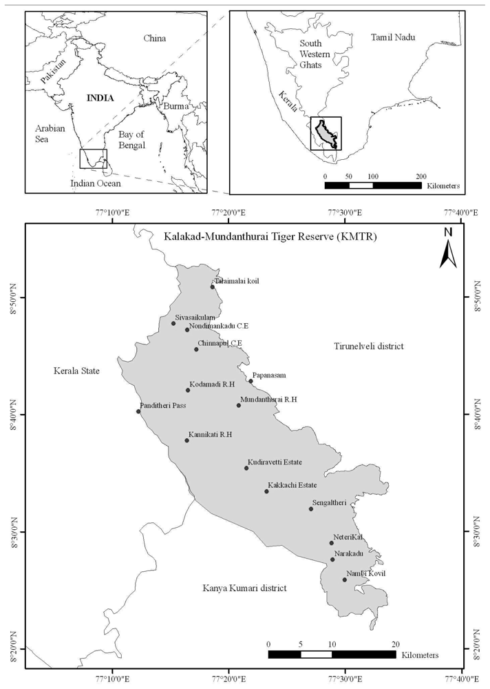
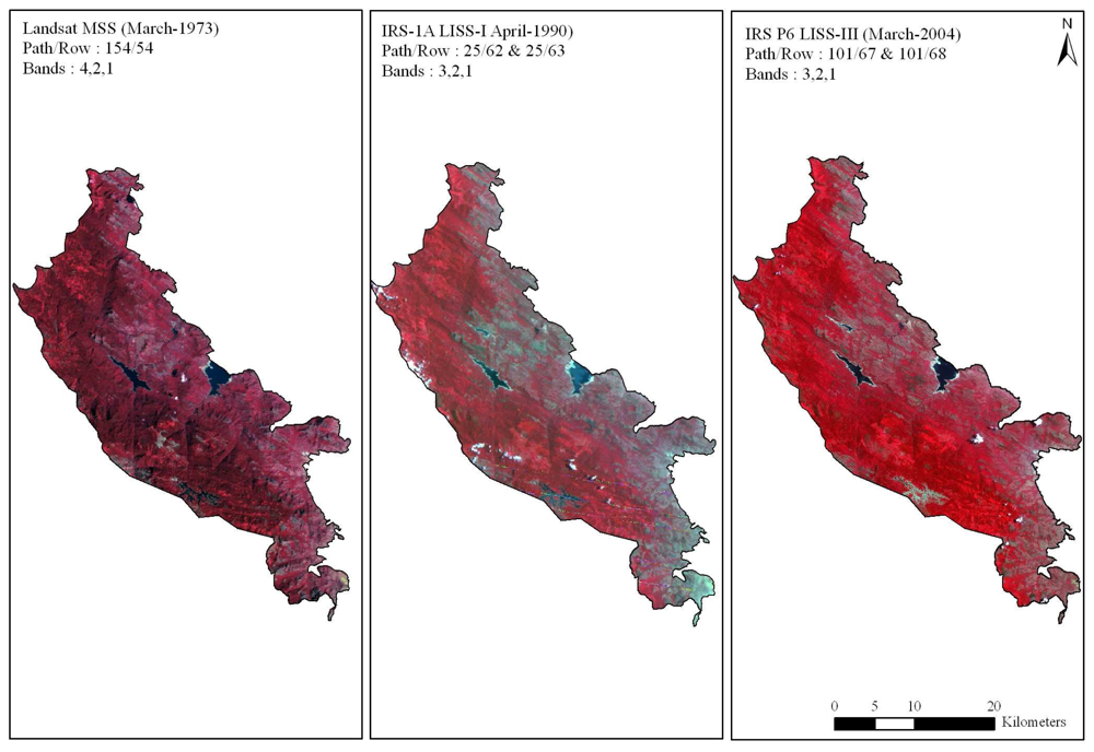
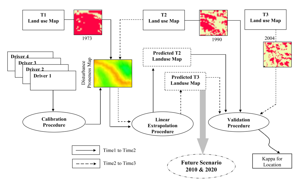
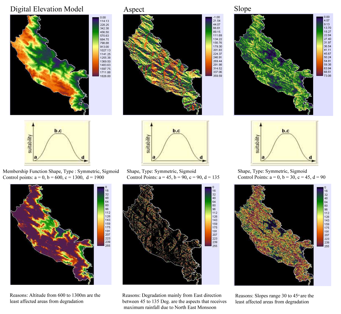
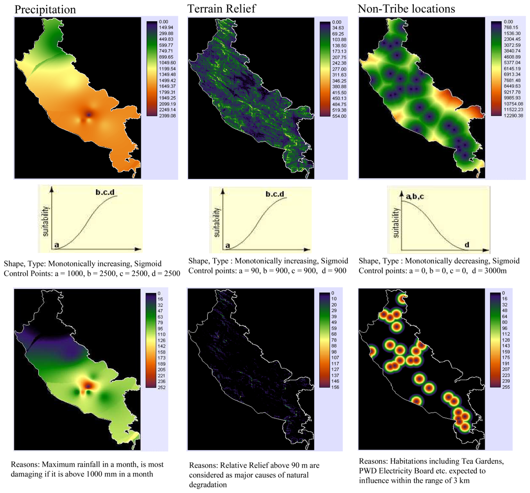
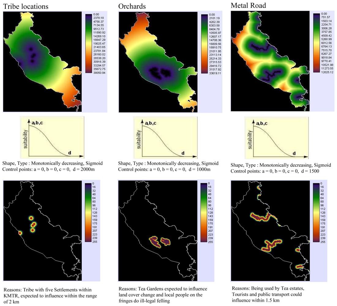
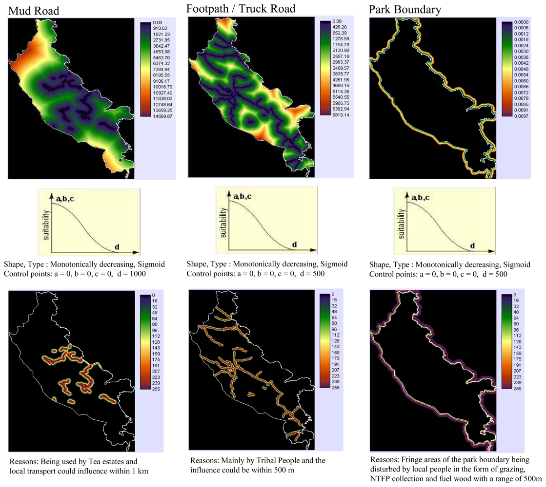
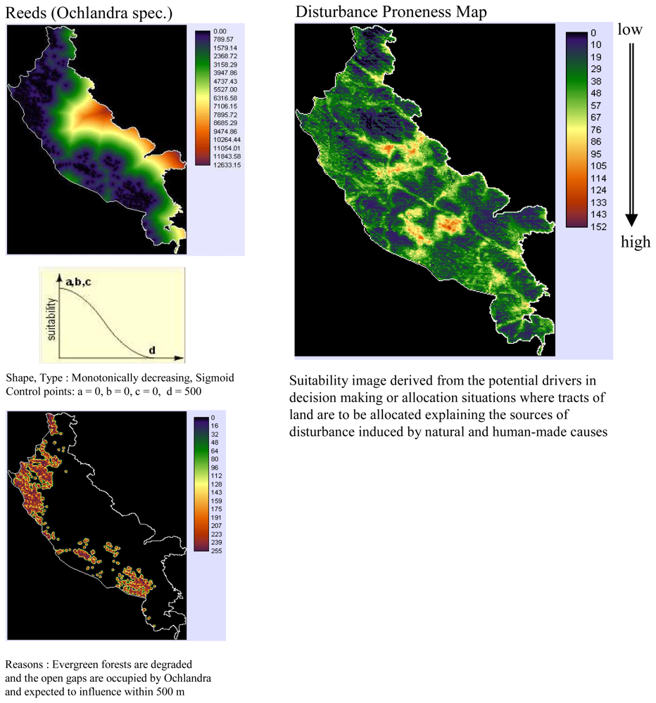
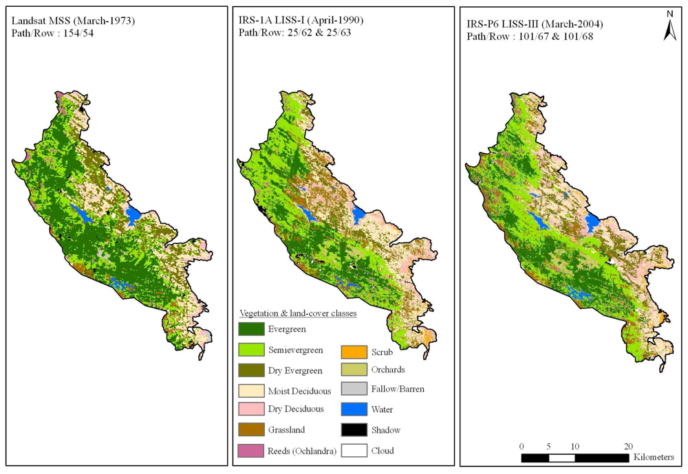
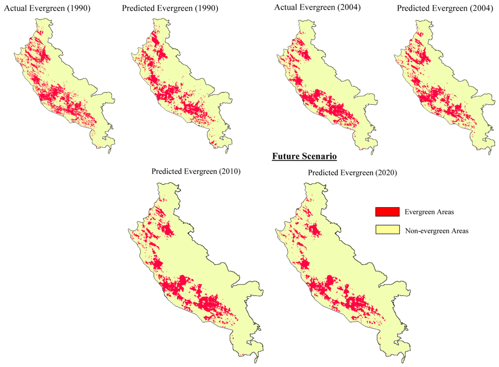
Modelling Spatial and Temporal Forest Cover Change Patterns (1973-2020): A Case Study from South Western Ghats (India)


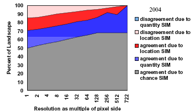
Abstract
Share and Cite
Giriraj, A.; Irfan-Ullah, M.; Murthy, M.S.R.; Beierkuhnlein, C. Modelling Spatial and Temporal Forest Cover Change Patterns (1973-2020): A Case Study from South Western Ghats (India). Sensors 2008, 8, 6132-6153. https://doi.org/10.3390/s8106132
Giriraj A, Irfan-Ullah M, Murthy MSR, Beierkuhnlein C. Modelling Spatial and Temporal Forest Cover Change Patterns (1973-2020): A Case Study from South Western Ghats (India). Sensors. 2008; 8(10):6132-6153. https://doi.org/10.3390/s8106132
Chicago/Turabian StyleGiriraj, Amarnath, Mohammed Irfan-Ullah, Manchi Sri Ramachandra Murthy, and Carl Beierkuhnlein. 2008. "Modelling Spatial and Temporal Forest Cover Change Patterns (1973-2020): A Case Study from South Western Ghats (India)" Sensors 8, no. 10: 6132-6153. https://doi.org/10.3390/s8106132
APA StyleGiriraj, A., Irfan-Ullah, M., Murthy, M. S. R., & Beierkuhnlein, C. (2008). Modelling Spatial and Temporal Forest Cover Change Patterns (1973-2020): A Case Study from South Western Ghats (India). Sensors, 8(10), 6132-6153. https://doi.org/10.3390/s8106132