
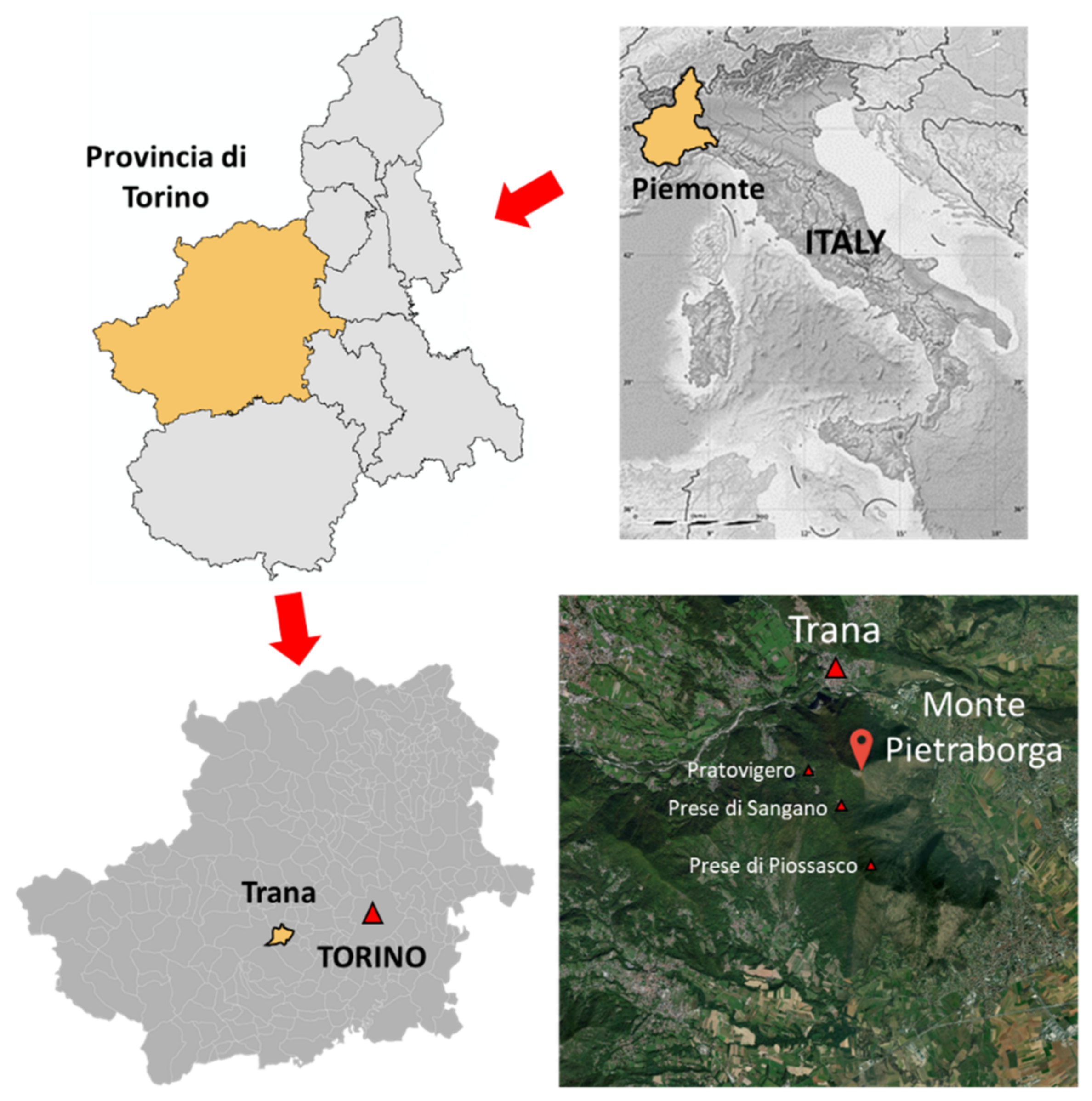
Evaluation of Different LiDAR Technologies for the Documentation of Forgotten Cultural Heritage under Forest Environments


Abstract
Share and Cite
Maté-González, M.Á.; Di Pietra, V.; Piras, M. Evaluation of Different LiDAR Technologies for the Documentation of Forgotten Cultural Heritage under Forest Environments. Sensors 2022, 22, 6314. https://doi.org/10.3390/s22166314
Maté-González MÁ, Di Pietra V, Piras M. Evaluation of Different LiDAR Technologies for the Documentation of Forgotten Cultural Heritage under Forest Environments. Sensors. 2022; 22(16):6314. https://doi.org/10.3390/s22166314
Chicago/Turabian StyleMaté-González, Miguel Ángel, Vincenzo Di Pietra, and Marco Piras. 2022. "Evaluation of Different LiDAR Technologies for the Documentation of Forgotten Cultural Heritage under Forest Environments" Sensors 22, no. 16: 6314. https://doi.org/10.3390/s22166314
APA StyleMaté-González, M. Á., Di Pietra, V., & Piras, M. (2022). Evaluation of Different LiDAR Technologies for the Documentation of Forgotten Cultural Heritage under Forest Environments. Sensors, 22(16), 6314. https://doi.org/10.3390/s22166314