Remote Sens. 2020, 12(16), 2546; https://doi.org/10.3390/rs12162546 - 7 Aug 2020
Cited by 59 | Viewed by 23306
Abstract
Space-based radar sensors have transformed Earth observation since their first use by Seasat in 1978. Radar instruments are less affected by daylight or weather conditions than optical counterparts, suitable for continually monitoring the global biosphere. The current trends in synthetic aperture radar (SAR)
[...] Read more.
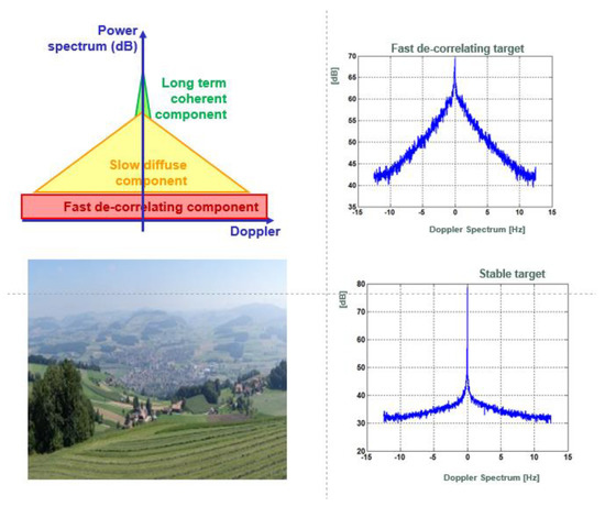
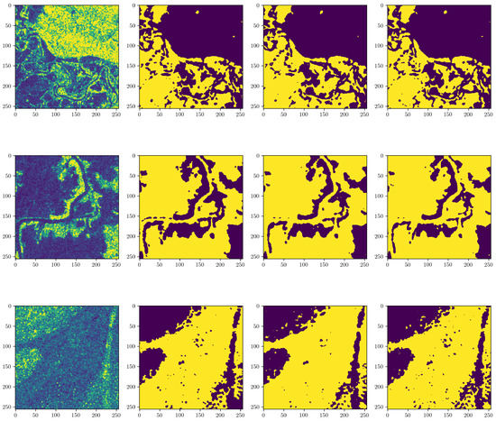
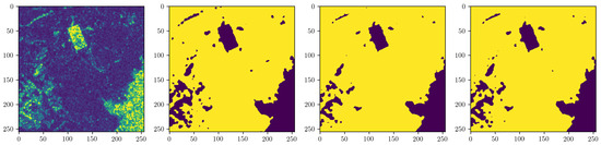
Space-based radar sensors have transformed Earth observation since their first use by Seasat in 1978. Radar instruments are less affected by daylight or weather conditions than optical counterparts, suitable for continually monitoring the global biosphere. The current trends in synthetic aperture radar (SAR) platform design are distinct from traditional approaches in that miniaturized satellites carrying SAR are launched in multiples to form a SAR constellation. A systems engineering perspective is presented in this paper to track the transitioning of space-based SAR platforms from large satellites to small satellites. Technological advances therein are analyzed in terms of subsystem components, standalone satellites, and satellite constellations. The availability of commercial satellite constellations, ground stations, and launch services together enable real-time SAR observations with unprecedented details, which will help reveal the global biomass and their changes owing to anthropogenic drivers. The possible roles of small satellites in global biospheric monitoring and the subsequent research areas are also discussed.
Full article
(This article belongs to the Special Issue Global Biospheric Monitoring with Remote Sensing)
►
Show Figures

Figure 1


