Article

Long Distance Ground Target Tracking with Aerial Image-to-Position Conversion and Improved Track Association
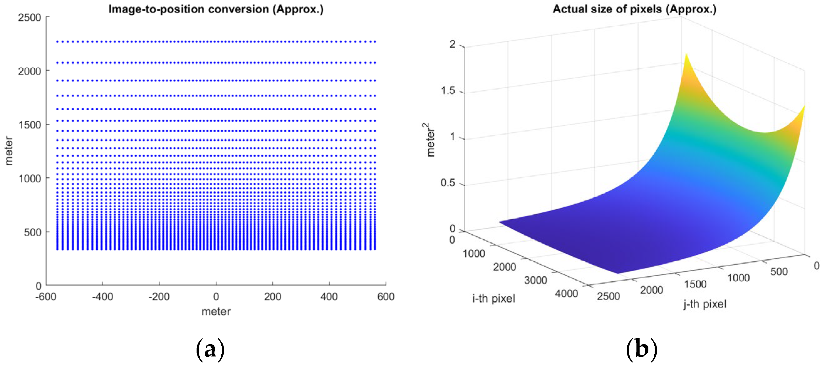
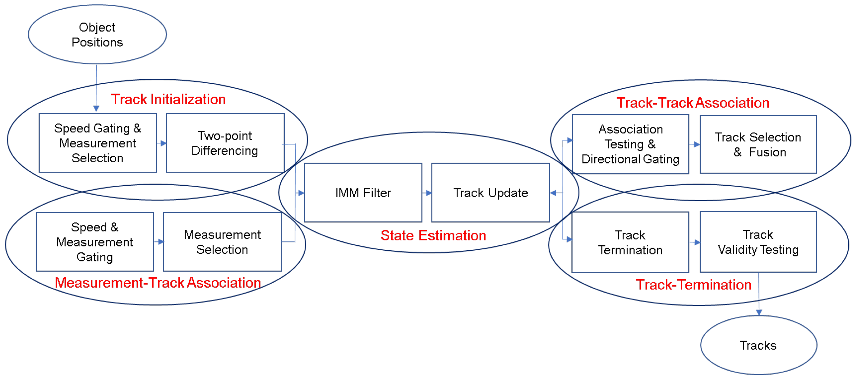
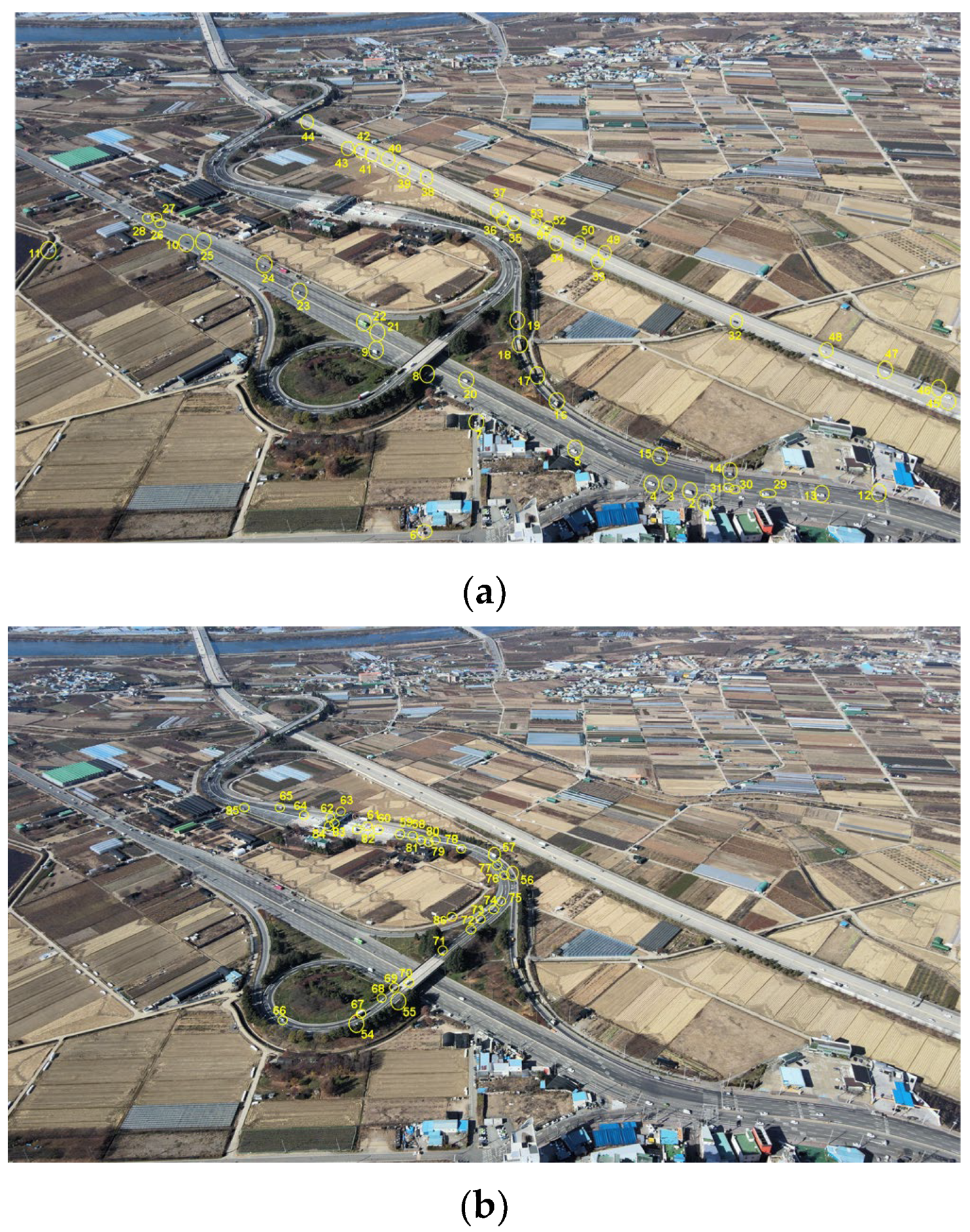
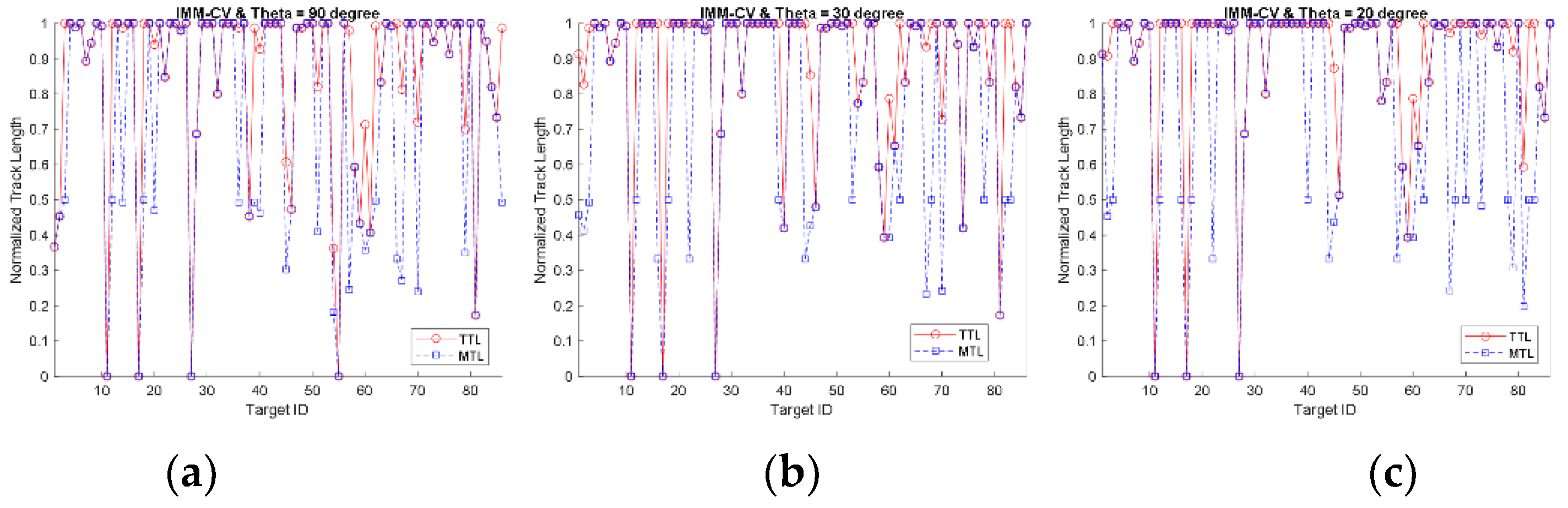
School of AI, Daegu University, Gyeongsan 38453, Korea
Drones 2022, 6(3), 55; https://doi.org/10.3390/drones6030055
Submission received: 7 February 2022 / Revised: 22 February 2022 / Accepted: 22 February 2022 / Published: 23 February 2022
(This article belongs to the Special Issue Feature Papers of Drones)

Abstract

A small drone is capable of capturing distant objects at a low cost. In this paper, long distance (up to 1 km) ground target tracking with a small drone is addressed for oblique aerial images, and two novel approaches are developed. First, the coordinates of the image are converted to real-world based on the angular field of view, tilt angle, and altitude of the camera. Through the image-to-position conversion, the threshold of the actual object size and the center position of the detected object in real-world coordinates are obtained. Second, the track-to-track association is improved by adopting the nearest neighbor association rule to select the fittest track among multiple tracks in a dense track environment. Moving object detection consists of frame-to-frame subtraction and thresholding, morphological operation, and false alarm removal based on object size and shape properties. Tracks are initialized by differencing between the two nearest points in consecutive frames. The measurement statistically nearest to the state prediction updates the target’s state. With the improved track-to-track association, the fittest track is selected in the track validation region, and the direction of the displacement vector and velocity vectors of the two tracks are tested with an angular threshold. In the experiment, a drone hovered at an altitude of 400 m capturing video for about 10 s. The camera was tilted 30° downward from the horizontal. Total track life (TTL) and mean track life (MTL) were obtained for 86 targets within approximately 1 km of the drone. The interacting multiple mode (IMM)-CV and IMM-CA schemes were adopted with varying angular thresholds. The average TTL and MTL were obtained as 84.9–91.0% and 65.6–78.2%, respectively. The number of missing targets was 3–5; the average TTL and MTL were 89.2–94.3% and 69.7–81.0% excluding the missing targets.
Keywords: small drone; long-distance surveillance; ground target tracking; track-to-track association; image-to-position conversion small drone; long-distance surveillance; ground target tracking; track-to-track association; image-to-position conversion

