
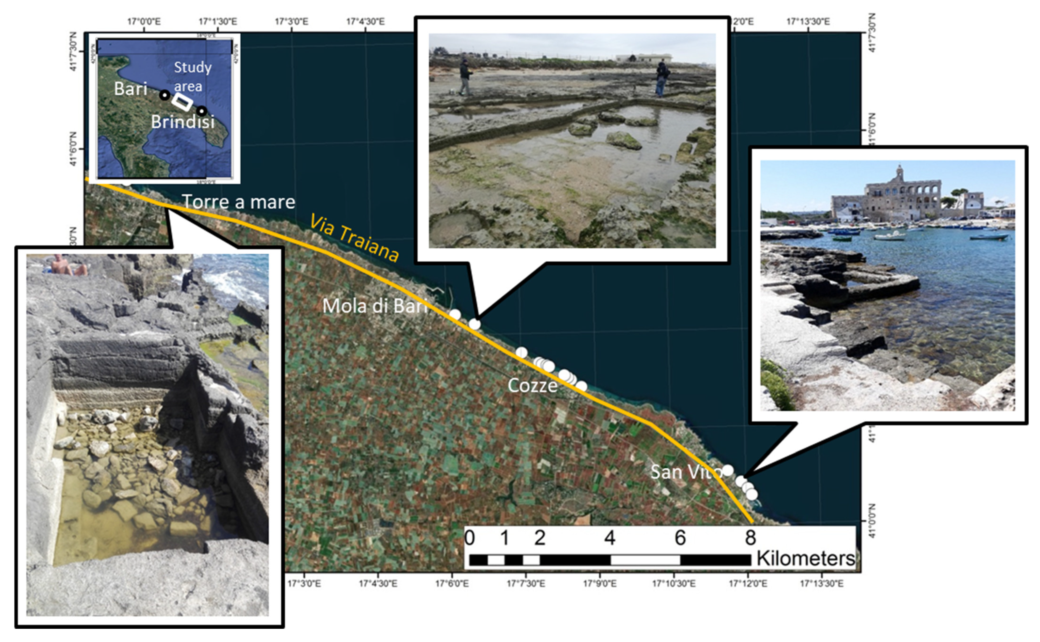
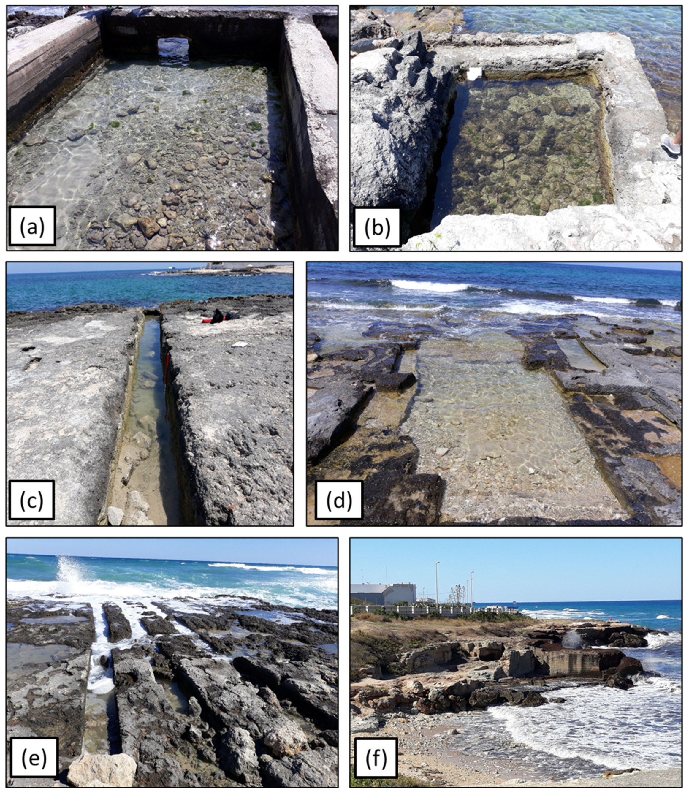
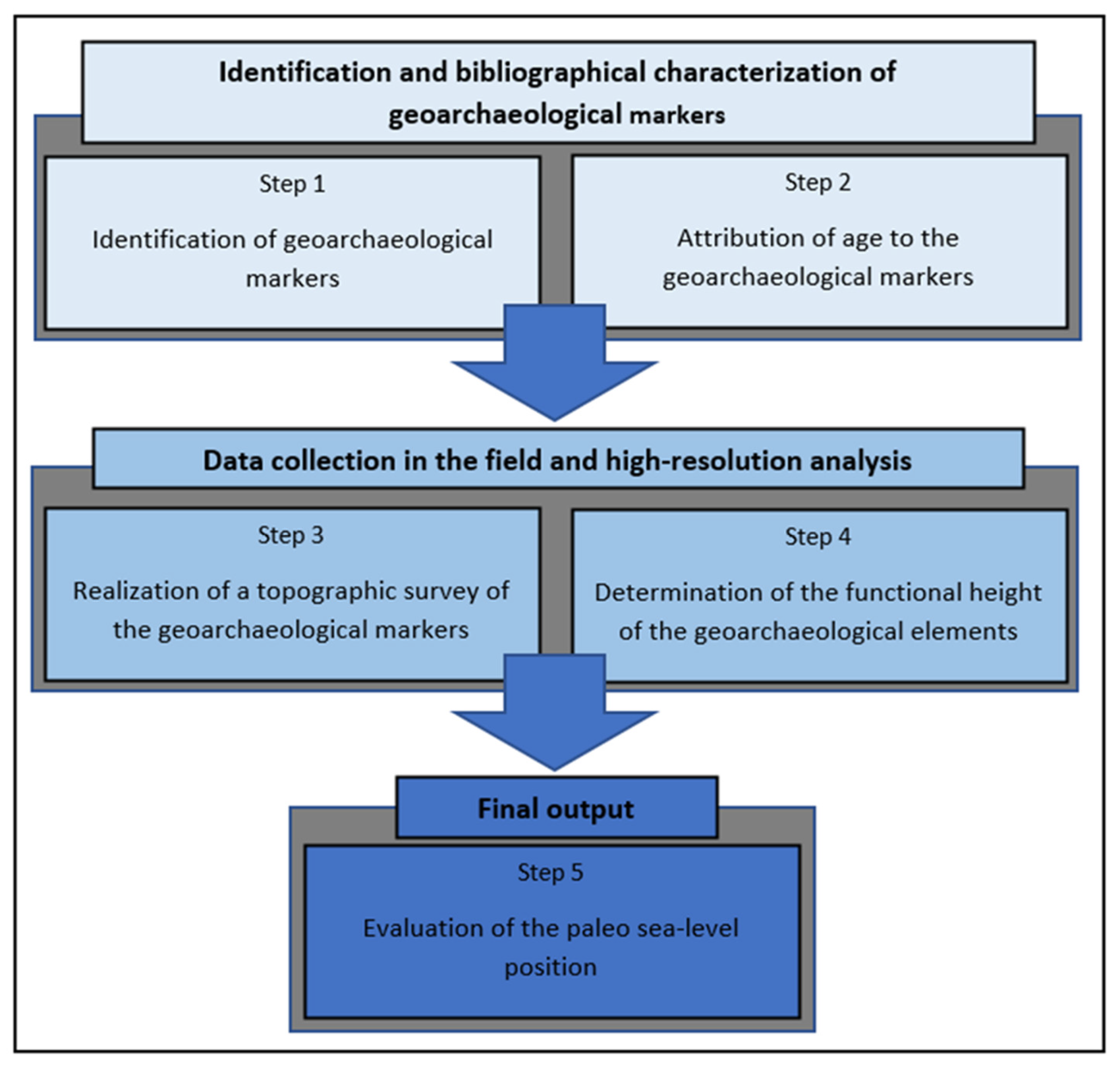
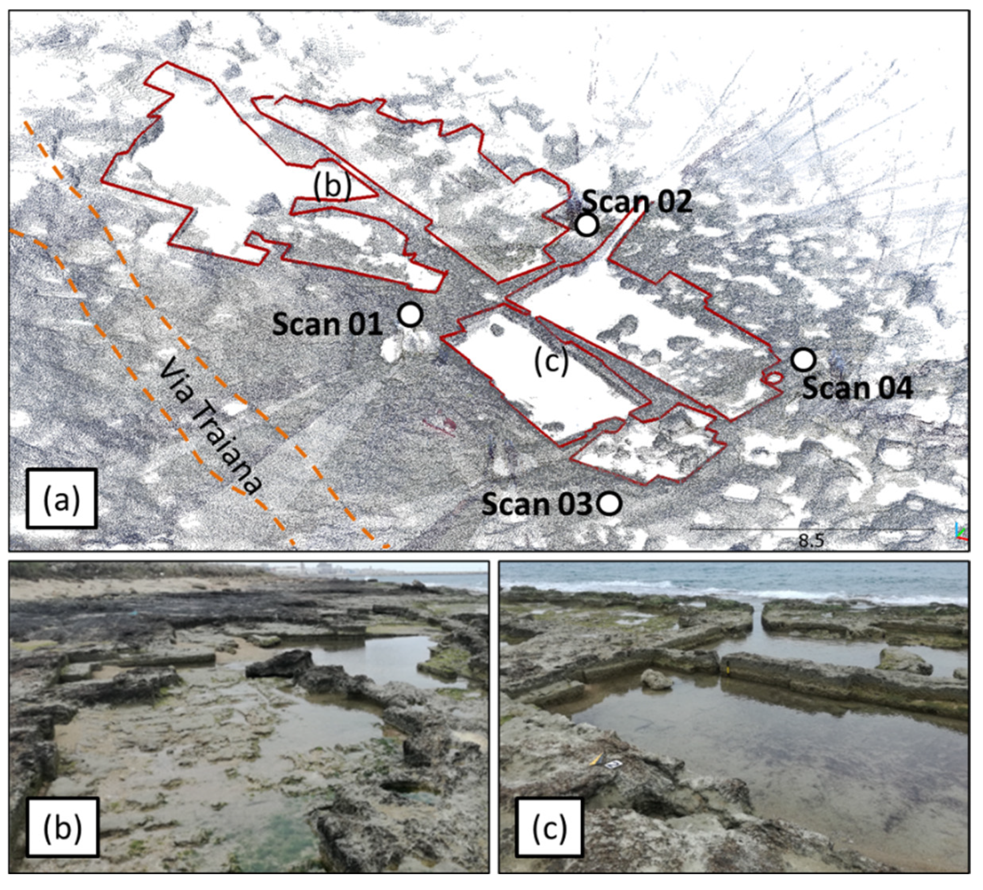
Coastal Quarries as Relative Sea-Level Markers: A Methodological Approach Applied in the Apulia Region (Southern Italy)

 ,
, 
 and
and 
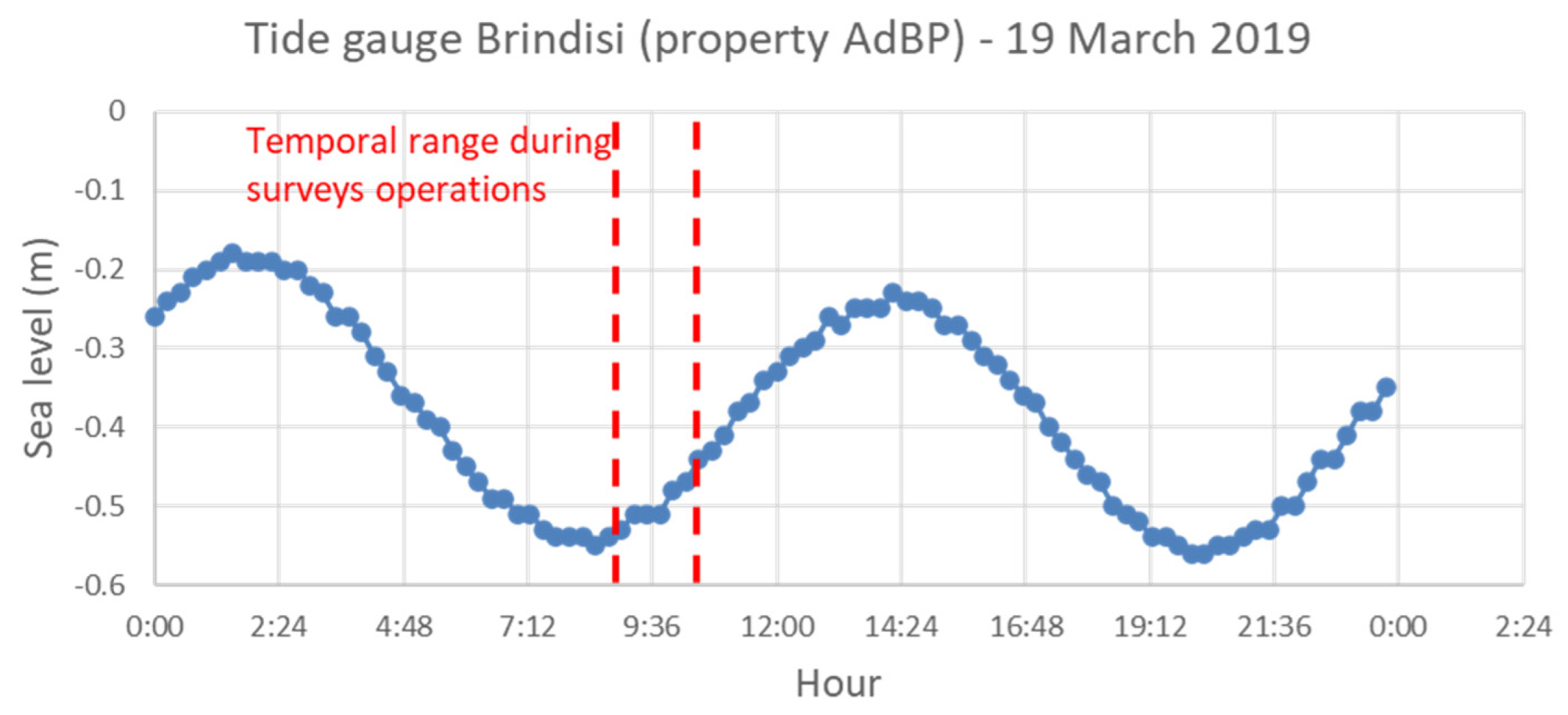
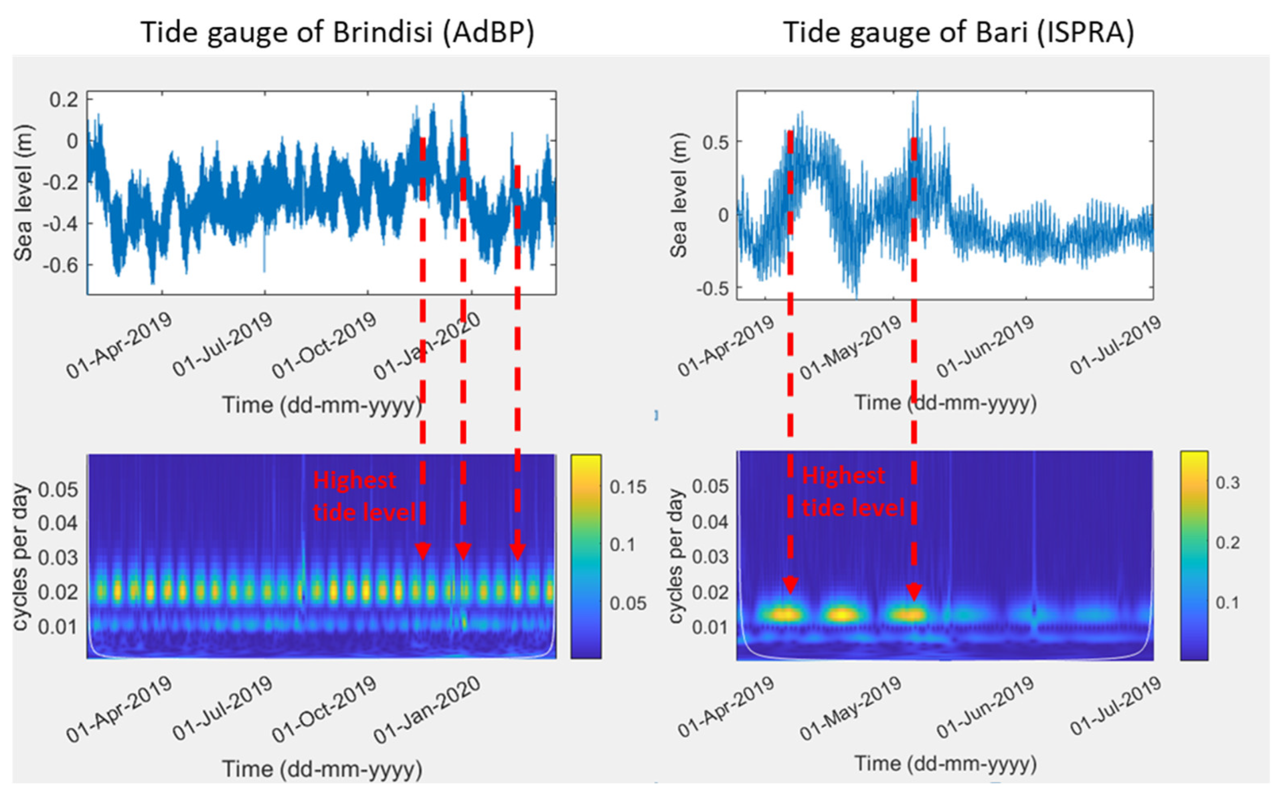
Abstract
Share and Cite
Scardino, G.; Piscitelli, A.; Locuratolo, G.; Scicchitano, G.; Rizzo, A. Coastal Quarries as Relative Sea-Level Markers: A Methodological Approach Applied in the Apulia Region (Southern Italy). Oceans 2022, 3, 172-188. https://doi.org/10.3390/oceans3020013
Scardino G, Piscitelli A, Locuratolo G, Scicchitano G, Rizzo A. Coastal Quarries as Relative Sea-Level Markers: A Methodological Approach Applied in the Apulia Region (Southern Italy). Oceans. 2022; 3(2):172-188. https://doi.org/10.3390/oceans3020013
Chicago/Turabian StyleScardino, Giovanni, Arcangelo Piscitelli, Giuseppe Locuratolo, Giovanni Scicchitano, and Angela Rizzo. 2022. "Coastal Quarries as Relative Sea-Level Markers: A Methodological Approach Applied in the Apulia Region (Southern Italy)" Oceans 3, no. 2: 172-188. https://doi.org/10.3390/oceans3020013
APA StyleScardino, G., Piscitelli, A., Locuratolo, G., Scicchitano, G., & Rizzo, A. (2022). Coastal Quarries as Relative Sea-Level Markers: A Methodological Approach Applied in the Apulia Region (Southern Italy). Oceans, 3(2), 172-188. https://doi.org/10.3390/oceans3020013