Published in Remote Sensing, the paper by Rudiyanto et al. forms the basis of Paddy Watch, a project that won funding from the Group on Earth Observations and Google Earth Engine. Paddy Watch will develop the world’s first real-time monitoring platform for rice fields globally. This ambitious project will help realise the Zero Hunger target of the United Nations 2030 Agenda for Sustainable Development Goals.
We gladly invite you to read this article:
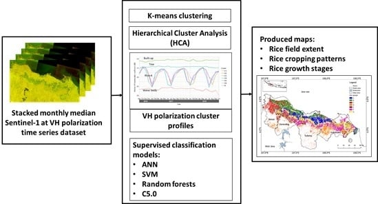
Automated Near-Real-Time Mapping and Monitoring of Rice Extent, Cropping Patterns, and Growth Stages in Southeast Asia Using Sentinel-1 Time Series on a Google Earth Engine Platform
by Rudiyanto, Budiman Minasny, Ramisah M. Shah, Norhidayah Che Soh, Chusnul Arif, and Budi Indra Setiawan.
The authors said:
“Accurate and up-to-date information on how much rice has been planted and how much harvest can be achieved is crucial to achieving global food and water security Working with our partners (Sydney Institute of Agriculture, Universiti Malaysia Terengganu, IADA Ketara Malaysia, Indonesian Center for Agricultural Land Resources Research and Development, The Institute of Soil Science, Chinese Academy of Sciences, Indian Agricultural Research Institute, and Remote sensing-based Information and Insurance for Crops in Emerging Countries Vietnam), we will use the Google Earth Engine to build the first real-time mobile application that will allow farmers, agricultural scientists, non-government organisations and government planners to manage land use to ensure food security in the world’s rice bowls.”
If you would like to learn more about this award, please click here: https://www.earthobservations.org/article.php?id=447
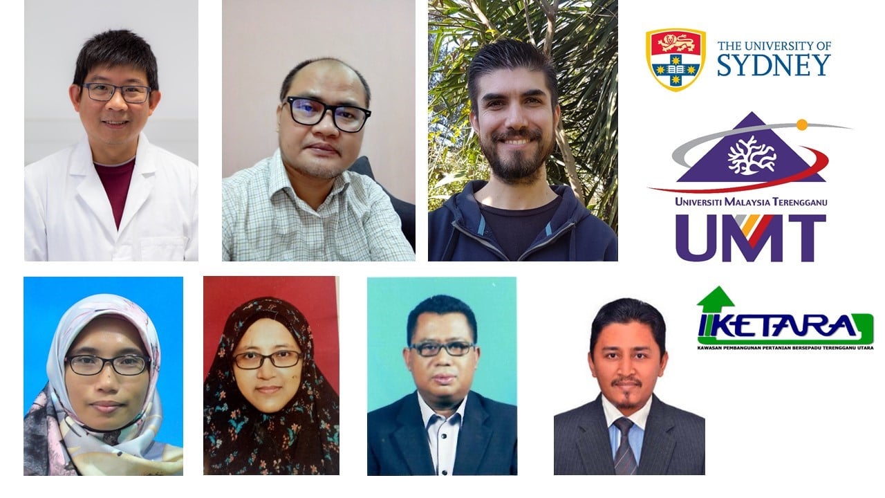
Top row, left to right: Researchers: Budiman Minasny (Sydney Institute of Agriculture), Rudiyanto (Universiti Malaysia Terengganu), and Jose Padarian (Sydney University).
Bottom row, left to right: Field validation team: Ramisah Mond Sah and Norhidayah Che Soh (Universiti Malaysia Terengganu), and Shukran Abdul Rahman and Mohd Rosmaini Bin Mat Nawi (IADA Ketara, Malaysia).