1. Introduction
Remote sensing is an essential tool in ensuring the successful implementation of strategies for the sustainable development of nature and society. High-precision remote sensing models, parameter inversion, and the validation of remote sensing products are among the important frontier scientific issues [
1]. A pioneer in the geometric-optical modeling of vegetation, the late Xiaowen Li, working with his mentor Prof Alan Strahler and numerous colleagues, developed a series of geometric-optical models for vegetation canopies and hybrid models of geometric optical-radiative transfer that are widely used in operational remote sensing algorithms for the retrieval of global surface albedo products. As a chief scientist, he led several research efforts that focused on quantitative remote sensing modeling, inversion, and the applications of retrieved data. His outstanding achievements include contributions to bidirectional reflectance distribution modeling, directional thermal emission modeling, an understanding of the effects of different spatial and temporal scales in remote sensing data, the development of the theory underlying quantitative inversion theory using prior knowledge, and the completion of comprehensive field experiments in remote sensing. Xiaowen Li was not only an outstanding scientist inthe field of remote sensing and geography, but was also an eminent writer of popular science. He was known as a teacher, researcher, scholar, and mentor who was always ready to help others. Herein is a brief summary of his life and his major contributions to remote sensing science.
2. Biography of Xiaowen Li
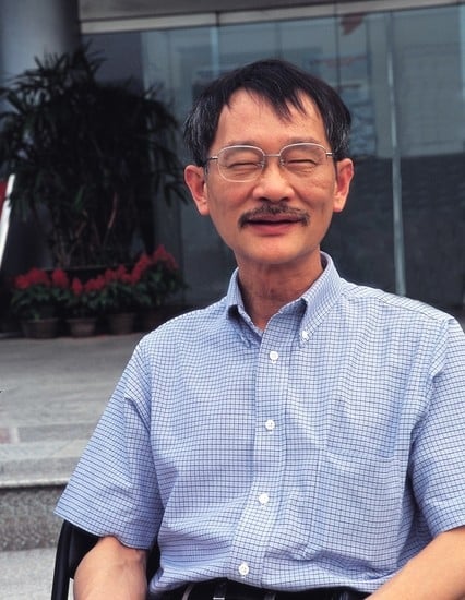
Xiaowen Li (
Figure 1) graduated from the Chengdu Telecommunication Engineering Institute (now the University of Electronic Science and Technology of China, UESTC) in 1968 and was admitted to graduate studies at the Institute of Geography, Chinese Academy of Sciences, in 1978. In 1979, supported by government grants for study abroad programs, he enrolled at the University of California, Santa Barbara, and earned a Master of Science degree in geography in 1981, another Master of Science degree in electronics and computer engineering in 1985, and a doctoral degree in geography in 1985 while under the mentorship of Alan Strahler.
In 1986, he joined Prof. Strahler at the Department of Geography, Boston University (BU), as a researcher and research professor. For over a decade at BU, he served on numerous doctoral committees and published some of his seminal work on geometric optics. During this period, Xiaowen Li regularly traveled to China, holding positions as an associate researcher at the Institute of Remote Sensing Applications, Chinese Academy of Sciences, and as a researcher at the Key Laboratory of Remote Sensing Information Science of the Chinese Academy of Sciences. Beginning in 1999, he became a senior faculty member at Beijing Normal University, where he founded the Research Center for Remote Sensing and Geographic Information Systems (GIS). His eminence was recognized by the Ministry of Education and he was made a Distinguished Professor of the Chang Jiang Scholars Program. In 2001, he was elected as an Academician to the Chinese Academy of Sciences. From 2002–2007, he was the director of the Institute of Remote Sensing Applications of the Chinese Academy of Sciences. In 2003, he facilitated cooperative efforts between the Key Laboratory of Remote Sensing Information Science of the Chinese Academy of Sciences and the Research Center for Remote Sensing and Geographic Information System of Beijing Normal University, establishing the State Key Laboratory of Remote Sensing Science, and in 2005, he founded an innovation team for the Ministry of Education. A devoted alumnus of UESTC, he actively promoted its development in geoscience by founding the Institute of Land Surface Space Information Research in 2004 and serving as its director. In 2012, he became the first dean of the School of Resources and Environment at UESTC.
Xiaowen Li was enthusiastic about making science more accessible to the public. On 29 July 2007, he created his blog on ScienceNet.cn. He called himself “Huang Laoxie”, a fictional character in the Legends of the Condor Heroes authored by Jin Yong, a renowned Chinese martial arts novelist whom he admired. Under the cyber-name of “Lix”, Xiaowen Li authored almost 2000 articles covering a wide range of areas, including popular science, hot-button issues in science, and comments on scientific programs, as well as views on social issues and current affairs. He divided his blog into six categories: Daily LifeBits & Pieces, A Look at History, Make ScienceNet Widely Known, Letters from Abroad, Explanatory Notes of Lectures, and Quirky Ideas. Through these channels, he exchanged views with netizens of ScienceNet. He showed great care and attention to young researchers and actively participated in various activities organized by ScienceNet [
2].
In 2014, he delivered a lecture at the University of Chinese Academy of Sciences, where he was bestowed the nickname of the “Cloth Shoes Academician” because of his unpretentious look—cloth shoes and simple clothes. He sent a clear message that scientists should be dedicated to their own work with no interest in seeking fame and fortune. This view was highly praised by his fellow netizens in particular. Following his death in 2015, numerous netizens on ScienceNet wrote memorial blogs expressing their condolences and reverence for him [
3].
3. Geometric-Optical Bidirectional Reflectance Modeling of Vegetation Canopies
Because of the three-dimensional structure of vegetation, anisotropic canopy reflectance in remote sensing observations is characterized by the bidirectional reflectance distribution function (BRDF) [
4]. Multi-angle remote sensing plays an important role in the development of algorithms for the retrieval of various surface biophysical parameters that are influenced by reflectance anisotropy. Although radiative transfer theory was introduced into the field of land surface remote sensing in the 1960s, the basic assumption that underlies it—of volumetric scattering into and within a horizontally homogeneous medium—had greatly limited its scope of application. During his study in the United States, Xiaowen Li took part in numerous National Aeronautics and Space Administration (NASA) projects which greatly contributed to the generation of the Moderate Resolution Imaging Spectroradiometer (MODIS) albedo products [
5]. He also conducted in-depth field and theoretical research on the geometric-optical bidirectional reflectance modeling of vegetation. He believed that at the remote sensing pixel scale, the key to the directional reflectance of vegetation lay in its surface structure.
The Li–Strahler geometric-optical (GO) model [
6] was created by defining the geometric structure of tree crowns, individually and in stands, to describe the radiative interaction of vegetation surfaces. This model successfully described the anisotropic reflectance characteristics of vegetation surfaces. The paper describing the GO model was selected for the milestone series by the International Society for Optical Engineering (SPIE) because of the model’s ability to capture the angular and spatial variabilities of reflectance using simple geometries defined by canopy architecture 6.
An early mathematical model of the reflectance of a discontinuous forest canopy was proposed that treated trees as randomly distributed green cones on a contrasting background [
7]. It was derived directly from the canopy scale, rather than on the scale of crop leaves and stems as defined by earlier efforts such as the Egbert model [
8]. Inversion of this model allowed the direct calculation of the height and spacing of trees from remotely sensed reflectance values. Subsequently, this application of GO modelling methodology was adopted by Li and Strahler [
6,
9] for remote sensing image analysis. The models initially used cone geometry to simplify conifer tree crowns; however, the models were sufficiently general and robust for application to other geometric shapes and mixtures of simple shapes. The models simulated the angular distribution patterns of reflected solar radiance from forests and explained the major portions of the variance in a remotely sensed image of a forest stand.
Li et al. [
10] further modeled the tree crown as an ellipsoid, which simplified the geometric projection and complexity of computation of the vegetation canopy. Furthermore, by taking into account mutual shadowing and the shadow overlap between incident and reflected directions, he developed the geometric-optical mutual shadowing model (GOMS). This work led to the derivation of several geometric-optical scattering kernels [
11] and the development of the operational algorithm of the MODIS BRDF/Albedo [
5]. This product has been widely utilized, especially in modeling terrestrial carbon and energy cycle dynamics and in characterizing the functioning of various ecosystems. The GOMS model has been further refined in order to describe the directional reflectance signatures of mountainous areas [
12,
13] and to contribute to the inversion of forest structure parameters such as the leaf area index (LAI) [
14].
Li’s recognition that the geometry of individual plants and their spacing is essential to the modeling of the gap frequency, which in turn is a key element in modeling the response of plant canopies to radiation, represented a major breakthrough in canopy remote sensing. Thus, Li et al. [
15] proposed a method of modeling the probability of gaps occurring in a discontinuous vegetation canopy. This provides a quantitative understanding of how the gap probability of a generally discontinuous canopy differs from that of a generally continuous canopy. It also demonstrated that it was crucial to link geometrical optics with radiative transfer theory and led to the foundation of the later geometric optical radiative transfer (GORT) model [
16], which described the effects of three-dimensional canopy structure on the radiation environment and allowed for the characterization of the heterogeneous radiation environment of natural vegetation at the forest stand scale. The GORT model treats vegetation canopies as assemblages of randomly distributed tree crowns that are ellipsoidal in shape, wherein the tree crowns are filled with leaves that absorb and scatter radiation passing through the crown. Principles of radiative transfer are used in describing the multiple scattering of leaves inside the crowns and the multiple scattering among crowns and the ground surface. The GORT model was extended to include the vertical probability distribution profile of the canopy, greatly improving the remote sensing inversion of forest structure parameters [
17,
18].
4. Thermal Infrared Emission Directionality Modeling
Research on the directional signatures of thermal infrared emission remote sensing has been relatively less developed compared to that of visible and near-infrared remote sensing. Li et al. [
19] noted that when the accuracy required of land surface temperature retrieval from thermal remote sensing is not high, the concept of composite emissivity or equivalent emissivity could be employed by researchers, and the ambiguity in the definition of emissivity may be reasonable. Otherwise, the applicability of Planck’s Law at the pixel scale must be taken into account when remote sensing errors of land surface temperature of less than 1K are needed.
The pixel size in thermal infrared remote sensing is typically tens of meters to several kilometers. When large areas of water, desert, snow, and lush grass land are taken into consideration, the problem of mixed pixels is impossible to avoid. As for the effects of scale in Planck’s Law, Li et al. [
20] noted that under non-isothermal conditions, Planck’s Law is not applicable to the equivalent emissivity; otherwise, the average pixel temperature will change abnormally with wavelength and viewing angle. Li was convinced that the definition of effective or equivalent emissivity at non-isothermal surface temperature was fundamental in exploring the directional mechanism of surface thermal emission [
21]. Based on both multiple scattering and the temperature differences in the system, he proposed the concept of an apparent emissivity increment and then introduced a non-isothermal surface emissivity model, which combined multiple scattering and non-isothermal conditions for the first time [
19,
21]. Li et al. [
22] demonstrated that the apparent emissivity increment is caused by two factors: the temperature differences of mixed pixels and the multiple scattering of three-dimensional (3D) structures captured in the pixels. Without a loss in generality, the equivalent emissivity of non-isothermal surface pixels can then be defined as the emissivity under the same temperature assumption of pixels, plus the apparent emissivity increment due to temperature differences under particular conditions (such as the materials, structures, and temperature distributions).The introduction of this increment term clearly explains the reason why the radiation of non-isothermal surface pixels is different from those of isothermal ones. It retains the universality of Planck’s Law, while also maintaining the independence of material emissivity. The apparent increment in emissivity due to temperature differences is then used to cope with the spectral and directional variations of thermal radiation caused by non-isothermal surfaces.
Li et al. [
20] investigated the effects of scale for Planck’s Law on non-isothermal blackbody surface and proposed a scale correction formula for real-surface thermal radiation [
23]. Subsequently, Liu et al. [
24] extracted the directional signatures of thermal infrared radiation of typical ground objects on the basis of experimental observations from an airborne camera. Chen et al. [
25] and Yan et al. [
26] made substantial improvements to the thermal radiation model to accommodate crown row structure. By considering crop gap probability both in the direction of sunlight and of the observation, they developed the bidirectional gap probability thermal radiation model, based on the model of discrete vegetation gap probability [
15], and the cross-correlation probability of continuous vegetation, which has been demonstrated to better explain vegetation hotspots [
25,
26]. Recent research on the directional mechanism of thermal infrared radiation and the thermal infrared radiation directionality model on heterogeneous surfaces holds great promise [
27].
5. Quantitative Remote Sensing Inversion Theory
The accumulation of multi-angle remote sensing data creates an opportunity for researchers to retrieve various biophysical parameters of the land surface through the inversion of bidirectional reflectance models. However, the implementation of quantitative methods in remote sensing remains difficult. Some theoretical guidance must to be obtained from the perspective of information theory, and a great deal of research has been focused on the operational practice of inversions [
28,
29,
30].
In general, it is extremely difficult to obtain sufficiently distributed multi-angle data from single orbital overpasses of one of the modern operational satellites. Furthermore, such overpasses are rarely coincident with the main solar principal plane [
31] and in the vicinity of the hotspot [
32]. Even when sequential overpasses are utilized to improve multi-angle sampling, it is difficult to accurately estimate these information-rich attributes of the surface anisotropy [
9]. It is worth noting that the accuracy of hotspot reflection often determines the precision of ground clumping parameter inversions [
33,
34]. In addition, even when orbital mechanics cooperate, the effects of clouds and aerosols make the acquisition of sufficient multi-angle data difficult [
29,
35,
36].
Therefore, in order to solve these practical problems in remote sensing inversion, Xiaowen Li and a close colleague, Jindi Wang, proposed a fusion scheme involving multi-angle and multispectral remote sensing information [
37]. For quantitative remote sensing inversion, Li et al. [
38] and Gao et al. [
39] summarized a data-enabled decision-making process to meet an inversion target, and implemented a multistage inversion strategy, featuring the division of the dataset and parameter set, based on the parameter uncertainty and its sensitivity matrix. In response to these theoretical problems in remote sensing inversion, Li et al. [
30] further summarized the major difficulties in this field, and noted the importance of introducing prior knowledge and its role in infinite-solution inversion. According to the concept of a “hard boundary” applied to prior knowledge, the “soft boundary” of parameters is constructed by the average expectations and uncertainties of parameters. This theoretically provided a method of introducing prior knowledge into the task of remote sensing inversion, enriching the inversion scheme with accumulated knowledge and enabling the reasonable and effective use of limited remote sensing information. Xiaowen Li believed that it is extremely important to measure the uncertainty of inversion parameters for any remote sensing inversion scheme, and explained that such uncertainty depends not only on the confidence in the prior knowledge, but also on the amount of available inversion data. He also explored the applicability of such a model, the influence of signal noise in the data, ways of acquiring appropriate prior knowledge, and the sensitivity of to-be-inverted parameters of the model to the data. Based on a form of joint probability distribution of data space and parameter space, he outlined an idea for describing this overall uncertainty, which has facilitated next-stage inversion strategies based on the stage inversion results and the uncertainty of inversion parameters.
Li et al. [
40] proposed a new method of accumulating prior knowledge for BRDF retrieval. Using the example of a kernel-driven model inversion, prior knowledge was applied to the inversion of the surface spectral albedo based on Bayesian theory so as to improve the inversion robustness and its accuracy in the case of limited direct acquisition. By employing this prior knowledge, Gao et al. [
41] used information inversion theory and proposed a “minimum variance” inversion principle by considering the errors of factors derived from models and measurements, in order to address problems of unstable inversion results when small samples were selected for the kernel-driven model inversion based only on the least squares method.
Yan et al. [
42] noted that the relative positional relationship of the vegetation reflection spectrum curve can be used as prior knowledge in vegetation structure inversion. In the same year, they analyzed the applicability of existing constrained optimization methods in remote sensing inversion and proposed the concept of a penalty matrix from two perspectives [
43]: an increase in inversion speed and a reduction of the ill-posed characteristics of the optimization method. Qin et al. [
44] introduced the ensemble Kalman filter to achieve the inversion of surface parameters, which obtained effective inversion results while providing the posterior distribution of prior knowledge. Wang et al. [
45] proposed a complete regularization theory for ill-posed inversions of surface parameters based on a regularization strategy. Zhao et al. [
46] studied the role of regularization parameters in determining linear regularization inversion, and proposed a regularization parameter determination method based on the maximization reduction of Shannon entropy. Zhao et al. [
47] also developed a quantitative method of determining the regularization parameter (the prior information ratio) in an iterative process for nonlinear, ill-posed problems, which was based on information utilization in the inversion process expressed by the Shannon’s entropy reduction method.
Inversion is the essential characteristic of quantitative remote sensing [
48]. How to quantitatively estimate the biophysical parameters of land surfaces with limited remotely sensed observation of the surface and under unfavorable observation sensing conditions is the primary task of quantitative remote sensing. Therefore, the application of prior knowledge to the inversion process can provide important and necessary step information. Quoting Confucius, Xiaowen Li stated [
35]: “When you know a thing, to hold that you know it; and when you do not know a thing, to allow that you do not know it—this is knowledge.” Based on multiyear data derived through satellite, airborne, and ground-based experiments, prior knowledge of ground objects can be accumulated to provide important support for remote sensing inversions.
6. Spatiotemporal Scale Effects in Remote Sensing Data
One of the essential problems in remote sensing research is related to scale: Do the laws of physics and the principles at the pixel scale need to be corrected, and if so, how? The Li–Strahler geometric-optical model explains non-Lambertian signatures on the pixel scale by using the four-component variance in different directions, based on the Lambertian assumption of crown and above-ground surfaces [
5]. This model emphasizes that the Lambertian condition may prevail within the pixel, while non-Lambertian signatures will exist at the pixel scale overall.
In order to clarify the generality of scale effects in remote sensing science, Li et al. [
19,
23] described the effects of scale caused by the three-dimensional structure inside a pixel by using a cross-valley example, which imagines a remote sensing pixel at the top of a 90° north–south valley, containing both east- and west-facing slopes, and with both the sun and the sensor in the vertical plane of the valley. Although both the slope surfaces are Lambertian in reflectance, the surface reflection of the entire pixel no longer has a Lambertian property as a whole.
Xiaowen Li believed that many laws and principles of physics have been generalized, and deduced under specific experimental conditions. Therefore, they may only be applicable in homogeneous media or surfaces [
23]. Given the complexity of terrestrial surfaces at the pixel scale of remote sensing, these laws and principles may not be still applicable to this scale; and if not, how might they be corrected? This remains a fundamental challenge that quantitative remote sensing must confront. An example of a scale-dependent physical law is Beer’s Law. While Beer’s Law works well in the atmosphere and in the oceans, there is a clear scale problem when it is applied to vegetation [
49,
50]; especially when the pixel spatial resolution is coarser than that of plant structures, Beer’s Law must be scaled up [
5]. Taking another example, the reciprocity principle is the cornerstone of radiative transfer theory. Xiaowen Li and Zhengming Wan demonstrated that the thermodynamic proof of Siegel and Howell was incorrect [
51]. Snyder also proposed light reversal proof of the reciprocity principle, attempting to strictly extend the principle to the pixel scale [
52]. Li et al. [
20] noted that light reversal is in conflict with the law of the conservation of energy when homogeneous illumination produces spatially inhomogeneous reflections due to multiple scattering on the pixel.
The key issue of scale restricts the development of quantitative remote sensing. Li et al. [
23] explained the change of quantity connotation, the change of quantity nature, and the applicability of physical laws at different scales through the geometric-optical model. He made preliminary efforts in establishing a scale-related and quantitative theoretical system for remote sensing, explaining the spatiotemporal scale effects of variable surface elements from point to surface, and studying the scaling model and information conversion model, all of which represent substantial progress [
21].
The second issue in quantitative remote sensing is scale transfer. Xiaowen Li summarized the main problems of globally oriented quantitative remote sensing research as follows [
53]: (1) The quantitative remote sensing products generated at different resolutions and from different remote sensing data are inconsistent with each other and with most traditional point observations. (2) Although remote sensing finds increasingly wide application, it is difficult to meet different spatiotemporal resolution and span requirements of users of different remote sensing products. This leads to: (a) Compared with the ability of remote sensing satellites to acquire data, the automation and quantification of remote sensing data and even the ability to understand remote sensing data and its effective use are far from sufficient. (b) Quantitative remote sensing research is not systematic and universally applicable as researchers often do their own work without interacting with their colleagues. Such fragmentation makes it difficult to make systematic and major achievements.
Xiaowen Li believed that the key to solve the afore mentioned problems relied on reliable, convenient, and self-consistent scale transfer. He further clarified that the scientific task of remote sensing is to achieve an understanding and transformation between the given spatiotemporal scale of high technology and that of geoscience applications. The remote sensing scale is physical and geometric in nature. Its physical nature can be interpreted as the phenomenon that shows differences in geophysical properties inverted from the remote sensing data of different resolutions. Its geometric nature presents different geometric signatures (e.g., the extent of cultivated land area) measured by pixels of different sizes, which is solved by surface descriptions, such as fractal dimensions and interdisciplinary geosciences. The accuracy of remote sensing inversion is determined by the physical nature of the remote sensing scale, making it a unique scale issue inherent to remote sensing itself.
Xiaowen Li tried to put forward a basic concept of a remote sensing trend surface in order to solve the physical scale effects and develop a framework for remote sensing geoscience cognition [
54]. By drawing inspiration from the idea of a trend surface in geography, the remote sensing trend surface recognizes the uniqueness of the remote sensing scale issue and aims to construct a set of prior knowledge data with high spatiotemporal resolution without scale error. The trend is then obtained by summarizing and understanding various data, products, and models through geoscience, and remote sensing principles and methods. Therefore, the remote sensing trend surface gives priority to the construction, utilization, and accumulation of prior knowledge, while emphasizing interdisciplinary research within the geosciences. These efforts are conducive to solving the scaling issue in remote sensing.
7. Quantitative Remote Sensing Experiments
Remote sensing experiments can provide satellite, airborne, and ground observation data for the construction of remote sensing models suitable for ecological environmental applications, the evaluation of inversion algorithms, scale transfer mechanism analysis, and calibration and product validation. Xiaowen Li attached great importance to the role of remote sensing experiments in quantitative remote sensing research and repeatedly emphasized that “researchers must bear models in mind before an experiment is conducted”.
For example, during the process of constructing the geometric-optical model, Li’s core research achievement, the importance of observations stands out. After years of accumulating observation data and conducting scientific analyses, Xiaowen Li and Alan Strahler developed a series of geometric-optical models. Therefore, it can be concluded that remote sensing research should always undergo two crucial phases: first, gaining an objective understanding of the real world through observation, and then constructing models using appropriate mathematical and physical methods.
For the third phase of remote sensing research, namely the evaluation of models, observations are also indispensable. In the early 1990s, Xiaowen Li and his team collaborated with the Changchun Institute of Optics and Fine Mechanics of the Chinese Academy of Sciences to establish an indoor bidirectional reflectance observation laboratory at the Jingyuetan Experimental Station of Changchun, China. Dedicated to studying the distribution signatures of discontinuous canopy reflectance and its relationship with canopy geometry, their joint efforts also enabled the first international multi-angle remote sensing seminar to be held in Beijing. From May to October of 1995 and in August of 1996, Xiaowen Li and his team designed a simultaneous airborne and ground-based measurements experiment at the apple orchards of Xishatun Village, Changping District, Beijing, in China. The observation data were then used to validate the GOMS and GORT models [
9,
16]. The accumulation of sufficient multi-angle remote sensing data created numerous possibilities for scientists to retrieve various biophysical parameters of land surfaces through the use of bidirectional reflectance models [
55].
Xiaowen Li and colleagues paid great attention to the role of quantitative remote sensing experiments. In China, Li was involved in organizing a series of simultaneous airborne, satellite-borne, and ground-based remote sensing experiments at places such as the Shunyi district of Beijing and the Poyang Lake Basin in Jiangxi Province [
56], accumulating substantial and valuable data for the development of remote sensing models and the evaluation of algorithms. To further combine quantitative remote sensing with other disciplines, such as ecohydrology, two-phase experiments of the Heihe River Basin were conducted. By employing ground-based and airborne platforms, as well as active and passive remote sensing instruments, the researchers made a number of findings during this comprehensive experiment. Furthermore, they created a platform for theoretical validation, established scientific data sets, and enhanced quantitative remote sensing research and its applications in ecohydrology through information sharing [
57,
58].
8. Conclusions
Remote sensing radiative transfer modeling, quantitative inversion, spatiotemporal scale effects in remote sensing data, comprehensive field experiments, and product validation lie at the forefront of remote sensing science. Among the most important and lasting contributions Xiaowen Li made to the field are:
- (1)
The construction of a series of geometric-optical models and hybrid models of geometric optical and radiative transfer, which led to kernel-driven bidirectional reflectance models and the foundations of global bidirectional reflectance distribution functions and albedo products.
- (2)
The definition of thermal infrared emissivity for inhomogeneous surfaces by the establishment of a conceptual model of thermal infrared radiation directivity for inhomogeneous surfaces, the development of an airborne multi-angle multispectral imaging system, and work in new fields of study and ways of examining thermal infrared radiation directionality mechanisms and multi-angle thermal infrared remote sensing.
- (3)
Noting the importance of prior knowledge and its role in inversion; then, developing the theory and method of quantitative remote sensing inversion based on prior knowledge, proposing a multi-stage inversion strategy featuring the division of datasets and parameter sets (based on parameter uncertainty and sensitivity matrices), and presiding over the development of the spectrum knowledge database of China for typical ground objects.
- (4)
Promoting research into the effects of scale and scale transfer in remote sensing, inducing the spatiotemporal scale issue of quantitative remote sensing and focusing on two aspects: the scale and scale transfer of remote sensing physical models, and the establishment of a universal theoretical framework for remote sensing scale transfer.
- (5)
Organizing and conducting comprehensive experiments of quantitative remote sensing in the Shunyi district of Beijing and Poyang Lake of Jiangxi, as well as comprehensive experiments in the ecohydrology of the Heihe River Basin. All of these efforts have resulted in substantial amounts of valuable data for the development of remote sensing models and algorithm evaluation and have fostered the further development of remote sensing science in ecohydrology.
The quantification of remote sensing applications is an important component of science and technology and will continue to play an increasingly important role in the study of Earth system science and global change. The contributions and achievements of Xiaowen Li and his fellow researchers in remote sensing mechanism modeling, quantitative inversion, the development of an understanding of the effects of different SPATIOTEMPORAL scales in remote sensing data, the design of remote sensing experiments, and product validation have all strengthened and deepened our understanding of remote sensing and its application to the global sustainable development of humankind.

 ,
, 

