Assessing the Impact of Tides and Atmospheric Fronts on Submesoscale Physical and Bio-Optical Distributions near a Coastal Convergence Zone

 , , ,
, , ,
Abstract
: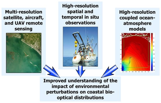
1. Introduction
2. Methods and Data
2.1. In Situ Data
2.2. Modeling
3. Results
3.1. Mooring Results—Turbidity/Diver Visibility
3.2. Mooring Results—Physical Properties
3.3. Nepheloid Layer Development/Decay
3.4. Model Heat Flux and Vertical Structure
4. Discussion
5. Conclusions
Author Contributions
Funding
Acknowledgments
Conflicts of Interest
References
- Mobley, C.D. Light and Water: Radiative Transfer in Natural Waters; Academic: New York, NY, USA, 1994; p. 592. [Google Scholar]
- Mascarenhas, V.; Keck, T. Marine Optics and Ocean Color Remote Sensing. In Proceedings of the YOUMARES 8—Oceans Across Boundaries: Learning from Each Other, Kiel, Germany, 13–15 September 2017; pp. 41–54. [Google Scholar]
- Kirk, J.T. Light and Photosynthesis in Aquatic Ecosystems; Cambridge University Press: Cambridge, UK, 1994; p. 509. [Google Scholar]
- Falkowski, P.G.; Raven, J.A. Aquatic Photosynthesis; Princeton University Press: Princeton, NJ, USA, 2007; p. 483. [Google Scholar]
- Zhang, Y.; Liu, M.; Qin, B.; Feng, S. Photochemical degradation of chromophoric-dissolved organic matter exposed to simulated UV-B and natural solar radiation. Hydrobiologia 2009, 627, 159–168. [Google Scholar] [CrossRef]
- Vodacek, A.; Blough, N.V.; DeGrandpre, M.D.; DeGrandpre, M.D.; Nelson, R.K. Seasonal variation of CDOM and DOC in the Middle Atlantic Bight: Terrestrial inputs and photooxidation. Limnol. Oceanogr. 1997, 42, 674–686. [Google Scholar] [CrossRef] [Green Version]
- Werdell, P.J.; McKinna, L.I.W.; Boss, E.; Ackleson, S.G.; Craig, S.E.; Gregg, W.W.; Lee, Z.; Maritorena, S.; Roesler, C.S.; Rousseaux, C.S.; et al. An overview of approaches and challenges for retrieving marine inherent optical properties from ocean color remote sensing. Prog. Oceanogr. 2018, 160, 186–212. [Google Scholar] [CrossRef] [PubMed]
- Yoder, J.A.; McClain, C.R.; Blanton, J.O.; Oeymay, L.Y. Spatial scales in CZCS-chlorophyll imagery of the southeastern US continental shelf. Limnol. Oceanogr. 1987, 32, 929–941. [Google Scholar] [CrossRef]
- Denman, K.L.; Abbott, M.R. Time evolution of surface chlorophyll patterns from cross-spectrum analysis of satellite color images. J. Geophys. Res. Oceans 1988, 93, 6789–6798. [Google Scholar] [CrossRef]
- Chang, G.C.; Dickey, T.D.; Schofield, O.M.; Weidemann, A.D.; Boss, E.; Pegau, W.S.; Moline, M.A.; Glenn, S.M. Nearshore physical processes and bio-optical properties in the New York Bight. J. Geophys. Res. Oceans 2002, 107, 16-1–16-16. [Google Scholar] [CrossRef] [Green Version]
- Babin, M.; Stramski, D.; Ferrari, G.M.; Claustre, H.; Bricaud, A.; Obolensky, G.; Hoepffner, N. Variations in the light absorption coefficients of phytoplankton, nonalgal particles, and dissolved organic matter in coastal waters around Europe. J. Geophys. Res. Oceans 2003, 108. [Google Scholar] [CrossRef]
- Vantrepotte, V.; Brunet, C.; Mériaux, X.; Lécuyer, E.; Vellucci, V.; Santer, R. Bio-optical properties of coastal waters in the Eastern English Channel. Estuar. Coast. Shelf Sci. 2007, 72, 201–212. [Google Scholar] [CrossRef]
- Henry, W.K. Some Aspects of the Fate of Cold Fronts in the Gulf of Mexico. Mon. Weather Rev. 1979, 107, 1078–1082. [Google Scholar] [CrossRef] [Green Version]
- Riddick, C.A.L.; Hunter, P.D.; Tyler, A.N.; Martinez-Vicente, V.; Horváth, H.; Kovács, A.W.; Vörös, L.; Preston, T.; Présing, M. Spatial variability of absorption coefficients over a biogeochemical gradient in a large and optically complex shallow lake. J. Geophys. Res. Oceans 2015, 120, 7040–7066. [Google Scholar] [CrossRef] [Green Version]
- Zhang, Y.; Qin, B.; Zhu, G.; Gao, G.; Luo, L.; Chen, W. Effect of sediment resuspension on underwater light field in shallow lakes in the middle and lower reaches of the Yangtze River: A case study in Longgan Lake and Taihu Lake. Sci. China Ser. D 2006, 49, 114–125. [Google Scholar] [CrossRef]
- Liu, X.; Zhang, Y.; Wang, M.; Zhou, Y. High-frequency optical measurements in shallow Lake Taihu, China: Determining the relationships between hydrodynamic processes and inherent optical properties. Hydrobiologia 2014, 724, 187–201. [Google Scholar] [CrossRef]
- Smart, J.H. How accurately can we predict optical clarity in the littorals? Johns Hopkins Appl. Tech. Dig. 2004, 25, 112–120. [Google Scholar]
- Ziervogel, K.; Dike, C.; Asper, V.; Montoya, J.; Battles, J.; D’souza, N.; Passow, U.; Diercks, A.; Esch, M.; Joye, S.; et al. Enhanced particle fluxes and heterotrophic bacterial activities in Gulf of Mexico bottom waters following storm-induced sediment resuspension. Deep Sea Res. Part II Top. Stud. Oceanogr. 2016. [Google Scholar] [CrossRef]
- Johnson, D.R.; Weidemann, A.; Pegau, W.S. Internal tidal bores and bottom nepheloid layers. Cont. Shelf Res. 2001, 21, 1473–1484. [Google Scholar] [CrossRef]
- Pineda, J. Internal tidal bores in the nearshore: Warm-water fronts, seaward gravity currents and the onshore transport of neustonic larvae. J. Mar. Res. 1994, 52, 427–458. [Google Scholar] [CrossRef] [Green Version]
- Reeves, A.D.; Duck, R.W. Density fronts: Sieves in the estuarine sediment transfer system? Phys. Chem. Earth Part B Hydrol. Oceans Atmos. 2001, 26, 89–92. [Google Scholar] [CrossRef]
- Hodur, R.M. The Naval Research Laboratory’s coupled ocean/atmosphere mesoscale prediction system (COAMPS). Mon. Weather Rev. 1997, 125, 1414–1430. [Google Scholar] [CrossRef]
- Chen, S.; Cummings, J.; Doyle, J.; Hodur, R.; Holt, T.; Liou, C.S.; Liu, M.; Mirin, A.; Ridout, J.; Schmidt, J.; et al. COAMPS Version 3 Model Description—General Theory and Equations; NRL/PU/7500--04–488; Naval Research Laboratory: Washington, DC, USA, 2003; p. 141. [Google Scholar]
- Small, R.J.; Carniel, S.; Campbell, T.; Teixeira, J.; Allard, R. The response of the Ligurian and Tyrrhenian Seas to a summer Mistral event: A coupled atmosphere–ocean approach. Oceans Model. 2012, 48, 30–44. [Google Scholar] [CrossRef] [Green Version]
- Gould, R.W.; Book, J.W.; Hulbert, M.S.; Quaid, A.J.; Smith, R.H.; Hughes, E.W.; McCormick, B.L.; McNeal, D.N.; Harrington, J.C. System and Method for Bio-Optical Environmental Reconnaissance. U.S. Patent US9501450B2, 22 November 2016. [Google Scholar]
- Smith, T.A.; Jolliff, J.K.; Walker, N.D.; Anderson, S. Biophysical Submesoscale Processes in the Wake of Hurricane Ivan: Simulations and Satellite Observations. J. Mar. Sci. Eng. 2019, 7, 378. [Google Scholar] [CrossRef] [Green Version]
- Daley, R.; Barker, E. NAVDAS: Formulation and Diagnostics. Mon. Weather Rev. 2001, 129, 869–883. [Google Scholar] [CrossRef]
- Martin, P.J. Description of the Navy Coastal Ocean Model Version 1.0; NRL/FR/732–0-9962; Naval Research Laboratory: Washington, DC, USA; Stennis Space Center: Hancock County, MS, USA, 2000.
- Booij, N.; Ris, R.C.; Holthuijsen, L.H. A third-generation wave model for coastal regions: 1. Model description and validation. J. Geophys. Res. Oceans 1999, 104, 7649–7666. [Google Scholar] [CrossRef] [Green Version]
- Tolman, H.L. User Manual and System Documentation of WAVEWATCH III Version 4.18; NOAA/NWS/NCEP: College Park, MD, USA, 2014; p. 311. [Google Scholar]
- Collins, N.; Theurich, G.; DeLuca, C.; Suarez, M.; Trayanov, A.; Balaji, V.; Li, P.; Yang, W.; Hill, C.; da Silva, A. Design and Implementation of Components in the Earth System Modeling Framework. Int. J. High Perform. Comput. Appl. 2005, 19, 341–350. [Google Scholar] [CrossRef] [Green Version]
- Hogan, T.F.; Liu, M.; Ridout, J.A.; Peng, M.S.; Whitcomb, T.R.; Ruston, B.C.; Reynolds, C.A.; Eckermann, S.D.; Moskaitis, J.R.; Baker, N.L. The navy global environmental model. Oceanography 2014, 27, 116–125. [Google Scholar] [CrossRef]
- Metzger, E.J.; Helber, R.W.; Hogan, P.J.; Posey, P.G.; Thoppil, P.G.; Townsend, T.L.; Wallcraft, A.J. Global Ocean. Forecast. System 3.1 Validation Testing; Naval Research Laboratory: Washington, DC, USA; Stennis Space Center: Hancock County, MS, USA, 2017.
- Fox, D.N.; Barron, C.N.; Carnes, M.R.; Booda, M.; Peggion, G.; Van Gurley, J. The Modular Ocean Data Assimilation System. Oceanography 2002, 15, 22–28. [Google Scholar] [CrossRef]
- Cummings, J.A. Operational multivariate ocean data assimilation. Q. J. R. Meteor. Soc. 2005, 131, 3583–3604. [Google Scholar] [CrossRef] [Green Version]
- Zaneveld, J.R.; Pegau, W. Robust underwater visibility parameter. Opt. Express 2003, 11, 2997–3009. [Google Scholar] [CrossRef]
- Gostiaux, L.; van Haren, H. Extracting Meaningful Information from Uncalibrated Backscattered Echo Intensity Data. J. Atmos. Oceans Technol. 2010, 27, 943–949. [Google Scholar] [CrossRef]
- Gommenginger, C.; Chapron, B.; Hogg, A.; Buckingham, C.; Fox-Kemper, B.; Eriksson, L.; Soulat, F.; Ubelmann, C.; Ocampo-Torres, F.; Nardelli, B.B.; et al. SEASTAR: A Mission to Study Ocean Submesoscale Dynamics and Small-Scale Atmosphere-Ocean Processes in Coastal, Shelf and Polar Seas. Front. Mar. Sci. 2019, 6. [Google Scholar] [CrossRef] [Green Version]
- Biscaye, P.E.; Anderson, R.F.; Deck, B.L. Fluxes of particles and constituents to the eastern United States continental slope and rise: SEEP—I. Cont. Shelf Res. 1988, 8, 855–904. [Google Scholar] [CrossRef]
- Biscaye, P.E.; Flagg, C.N.; Falkowski, P.G. The shelf edge exchange processes experiment, SEEP-II: An introduction to hypotheses, results and conclusions. Deep Sea Res. Part II Top. Stud. Oceanogr. 1994, 41, 231–252. [Google Scholar] [CrossRef]
- Trowbridge, J.H.; Nowell, A.R.M. An introduction to the Sediment TRansport Events on Shelves and Slopes (STRESS) program. Cont. Shelf Res. 1994, 14, 1057–1061. [Google Scholar] [CrossRef]
- Dickey, T.D.; Williams, A.J., III. Interdisciplinary ocean process studies on the New England shelf. J. Geophys. Res. Oceans 2001, 106, 9427–9434. [Google Scholar] [CrossRef]
- Gould, R.W.; Arnone, R.A. Remote sensing estimates of inherent optical properties in a coastal environment. Remote Sens. Environ. 1997, 61, 290–301. [Google Scholar] [CrossRef]
- Gould, R.W.; Arnone, R.A. Three-dimensional modelling of inherent optical properties in a coastal environment: Coupling ocean colour imagery and in situ measurements. Int. J. Remote Sens. 1998, 19, 2141–2159. [Google Scholar] [CrossRef]
- Dickey, T.D. Studies of Coastal Ocean Dynamics and Processes Using Emerging Optical Technologies. Oceanography 2004, 17, 9–13. [Google Scholar] [CrossRef] [Green Version]
- Schofield, O.; Bergmann, T.; Bissett, P.; Grassle, J.F.; Haidvogel, D.B.; Kohut, J.; Moline, M.; Glenn, S.M. The Long-term Ecosystem Observatory: An integrated coastal observatory. IEEE J. Oceans Eng. 2002, 27, 146–154. [Google Scholar] [CrossRef]
- Wilkin, J.L.; Arango, H.G.; Haidvogel, D.B.; Lichtenwalner, C.S.; Glenn, S.M.; Hedström, K.S. A regional ocean modeling system for the Long-term Ecosystem Observatory. J. Geophys. Res. Oceans 2005, 110. [Google Scholar] [CrossRef] [Green Version]
- Dickey, T.; Banner, M.L.; Bhandari, P.; Boyd, T.; Carvalho, L.; Chang, G.; Chao, Y.; Czerski, H.; Darecki, M.; Dong, C.; et al. Introduction to special section on Recent Advances in the Study of Optical Variability in the Near-Surface and Upper Ocean. J. Geophys. Res. Oceans 2012, 117. [Google Scholar] [CrossRef] [Green Version]
- Chang, G.; Jones, C.; Twardowski, M. Prediction of optical variability in dynamic nearshore environments. Methods Oceanogr. 2013, 7, 63–78. [Google Scholar] [CrossRef]
- Wamsley, T.V.; Godsey, E.S.; Bunch, B.W.; Chapman, R.S.; Gravens, M.B.; Grzegorzewski, A.S.; Johnson, B.D.; King, D.B.; Permenter, R.L.; Tillman, D.H.; et al. Mississippi Coastal Improvements Program; Evaluation of Barrier Island Restoration Efforts; ERDC TR-13-12; U.S. Army Corps of Engineers, Engineer Research and Development Center: Vicksburg, MS, USA, 2013. [Google Scholar]
- FitzHarris, M.; Godsey, E. Mississippi Coastal Improvements Program, Barrier Island Restoration Project, Offshore Sand Borrow Investigation, 2010–2014: Geotechnical Engineering Report; U.S. Army Corps of Engineers: Washington, DC, USA, 2015. [Google Scholar]
- Hoge, F.E.; Wright, C.W.; Krabill, W.B.; Buntzen, R.R.; Gilbert, G.D.; Swift, R.N.; Yungel, J.K.; Berry, R.E. Airborne lidar detection of subsurface oceanic scattering layers. Appl. Opt. 1988, 27, 3969–3977. [Google Scholar] [CrossRef] [PubMed]
- Verspecht, F.; Pattiaratchi, C. On the significance of wind event frequency for particulate resuspension and light attenuation in coastal waters. Cont. Shelf Res. 2010, 30, 1971–1982. [Google Scholar] [CrossRef]
- Moeller, C.C.; Huh, O.K.; Roberts, H.H.; Gumley, L.E.; Menzel, W.P. Response of Louisiana coastal environments to a cold front passage. J. Coast. Res. 1993, 434–447. [Google Scholar]
- Huh, O.K.; Rouse, L.J., Jr.; Walker, N.D. Cold air outbreaks over the northwest Florida continental shelf: Heat flux processes and hydrographic changes. J. Geophys. Res. Oceans 1984, 89, 717–726. [Google Scholar] [CrossRef]
- Nowlin, W.D., Jr.; Parker, C.A. Effects of a Cold-Air Outbreak on Shelf Waters of the Gulf of Mexico. J. Phys. Oceanogr. 1974, 4, 467–486. [Google Scholar] [CrossRef]
- Dagg, M.J. Physical and biological responses to the passage of a winter storm in the coastal and inner shelf waters of the northern Gulf of Mexico. Cont. Shelf Res. 1988, 8, 167–178. [Google Scholar] [CrossRef]
- Villanueva, E.E.; Mendoza, V.M.; Adem, J. Sea surface temperature and mixed layer depth changes due to cold-air outbreak in the Gulf of Mexico. Atmofera 2010, 23, 325–346. [Google Scholar]
- Joshi, I.; D’Sa, E. Seasonal Variation of Colored Dissolved Organic Matter in Barataria Bay, Louisiana, Using Combined Landsat and Field Data. Remote Sens. 2015, 7, 12478. [Google Scholar] [CrossRef] [Green Version]
- D’Sa, E.J.; Miller, R.L.; Del Castillo, C. Bio-optical properties and ocean color algorithms for coastal waters influenced by the Mississippi River during a cold front. Appl. Opt. 2006, 45, 7410–7428. [Google Scholar] [CrossRef]


| Mooring | Latitude | Longitude | Near Surface | Near Bottom | Bottom ADCP |
|---|---|---|---|---|---|
| LM1 (6.1 m) | 30°15.982′ | −88°49.474′ | C6P, CTD, ac9, ECO bb3, ECO FL3, camera | C6P, CTD, camera | |
| LM2 (6.0 m) | 30°16.013′ | −88°47.185′ | lost at sea | ||
| LM3 (6.0 m) | 30°13.992′ | −88°50.811′ | C6P, CTD | C6P, CTD | 600 kHz, 2 min sampling, 0.5 m vertical resolution, wave pack |
| LM4 (7.6 m) | 30°14.010′ | −88°48.467′ | C6P, CTD | C6P, CTD | |
| LM5 (11.1 m) | 30°12.632′ | −88°51.538′ | C6P, CTD, camera | C6P, CTD, camera | 500 kHz 5-beam, 20 min sampling, 0.5 m vertical resolution, wave pack |
| LM6 (10.8 m) | 30°12.572′ | −88°49.497′ | C6P, CTD | CTD | |
| BP1 (6.8 m) | 30°15.887′ | −88°51.532′ | CTD | 1000 kHz 5-beam, 20 min sampling, 0.25 m vertical resolution, wave pack | |
| BP2 (11.3 m) | 30°12.455′ | −88°47.147′ | Profiler: CTD, BAM, OCR 507, ECO bb3, ECO FL3 | 1200 kHz, 2 min sampling, 0.25 m vertical resolution, wave pack | |
© 2020 by the authors. Licensee MDPI, Basel, Switzerland. This article is an open access article distributed under the terms and conditions of the Creative Commons Attribution (CC BY) license (http://creativecommons.org/licenses/by/4.0/).
Share and Cite
Gould, R.W., Jr.; Anderson, S.; Lewis, M.D.; Miller, W.D.; Shulman, I.; Smith, G.B.; Smith, T.A.; Wang, D.W.; Wijesekera, H.W. Assessing the Impact of Tides and Atmospheric Fronts on Submesoscale Physical and Bio-Optical Distributions near a Coastal Convergence Zone. Remote Sens. 2020, 12, 553. https://doi.org/10.3390/rs12030553
Gould RW Jr., Anderson S, Lewis MD, Miller WD, Shulman I, Smith GB, Smith TA, Wang DW, Wijesekera HW. Assessing the Impact of Tides and Atmospheric Fronts on Submesoscale Physical and Bio-Optical Distributions near a Coastal Convergence Zone. Remote Sensing. 2020; 12(3):553. https://doi.org/10.3390/rs12030553
Chicago/Turabian StyleGould, Richard W., Jr., Stephanie Anderson, M. David Lewis, W. David Miller, Igor Shulman, Geoffrey B. Smith, Travis A. Smith, David W. Wang, and Hemantha W. Wijesekera. 2020. "Assessing the Impact of Tides and Atmospheric Fronts on Submesoscale Physical and Bio-Optical Distributions near a Coastal Convergence Zone" Remote Sensing 12, no. 3: 553. https://doi.org/10.3390/rs12030553