Next Issue
Volume 2, September
Previous Issue
Volume 2, March


GeoHazards, Volume 2, Issue 2 (June 2021) – 7 articles

Cover Story (view full-size image): 
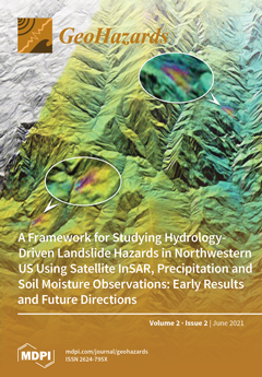
Precipitation is a major hydrologic trigger for landslides around the world. This paper outlines a framework to study the linkage between precipitation and landslide hazards over the northwestern US using satellite remote sensing techniques, including Interferometric Synthetic Aperture Radar (InSAR) methods, Tropical Rainfall Measuring Mission (TRMM) precipitation products, and Soil Moisture Active Passive (SMAP) data, along with correlation analysis and numerical modeling and simulation. View this paper
  • Issues are regarded as officially published after their release is announced to the table of contents alert mailing list.
  • You may sign up for e-mail alerts to receive table of contents of newly released issues.
  • PDF is the official format for papers published in both, html and pdf forms. To view the papers in pdf format, click on the "PDF Full-text" link, and use the free Adobe Reader to open them.
Order results
Result details
Select all
Export citation of selected articles as:
16 pages, 6874 KiB  
Article
A Quantitative Approach to Assess Seismic Vulnerability of Touristic Accommodations: Case Study in Montreal, Canada
by Thomas Candela, Philippe Rosset and Luc Chouinard
GeoHazards 2021, 2(2), 137-152; https://doi.org/10.3390/geohazards2020008 - 16 Jun 2021
Cited by 2 | Viewed by 3152
Abstract
In many places of the world, the interruption of touristic activities in the aftermath of a catastrophic earthquake is often neglected in the evaluation of seismic risks; however, these activities can account for a significant proportion of short-term and long-term economic impacts for [...] Read more.
In many places of the world, the interruption of touristic activities in the aftermath of a catastrophic earthquake is often neglected in the evaluation of seismic risks; however, these activities can account for a significant proportion of short-term and long-term economic impacts for these regions. In the last decade, several rapid visual screening techniques have been developed to define the typology of buildings and to estimate their seismic vulnerability and potential for damage. We adapted the existing screening procedures that have been developed for generic buildings to specific circumstances that are most common for tourist accommodations. The proposed approach considered six criteria related to structural and nonstructural elements of buildings, as well as local soil conditions. A score was assigned to each criterion as a function of the capacity of the elements to resist ground shaking. A vulnerability index in four levels of building vulnerability was developed combining the scores of the six criteria. The approach was tested in a pilot area of Montreal to a set of 70 typical buildings grouped in four categories based on their accommodation capacity. In Montreal, tourism is an important source of income for the city where 351,000 room-nights were booked with total stay expenditures of CAD 4.9 billion in 2019. The results indicated potential significant disruptions in activities related to tourism; 46% of the buildings investigated have a high to very high vulnerability index. Among them, 4/5 are located in the old city and 1/5 in the downtown area of the pilot zone. Full article
Show Figures

Figure 1

17 pages, 2116 KiB  
Article
Improving Community Resilience and Emergency Plans by Mapping Risk and Preparedness at the Neighborhood Scale
by Yaron Finzi, Noam Ganz, Yoash Limon and Sebastian Langer
GeoHazards 2021, 2(2), 120-136; https://doi.org/10.3390/geohazards2020007 - 4 Jun 2021
Cited by 2 | Viewed by 3760
Abstract
People living in areas of significant seismic risk seldom undertake sufficient preparations to safeguard their families. This is most problematic in remote communities such as those along the Dead Sea Fault, Israel, where self-reliance is a key factor in coping with disasters. To [...] Read more.
People living in areas of significant seismic risk seldom undertake sufficient preparations to safeguard their families. This is most problematic in remote communities such as those along the Dead Sea Fault, Israel, where self-reliance is a key factor in coping with disasters. To facilitate individual and familial involvement in earthquake preparedness in remote areas, we designed a tool for self-assessment of risk and preparedness. The personalized risk assessment is based on national hazard and building standards, and on personal input regarding structure characteristics. The risk and preparedness evaluations enhance awareness and provide immediate feedback to help users improve familial preparedness. The spatial analysis of the data collected is used to form high-resolution maps that expose specific challenges for emergency responses. A study conducted in the town of Mitzpe Ramon exposed neighborhoods with a relatively high risk of damage and low preparedness. Integrating these results with seasonal stress-factors such as peak tourism and extreme weather, provides new and important insights into the ability of the local community and emergency forces to cope with multihazard situations. An analysis of the heterogeneous distribution of expected hardship within a community should be implemented worldwide to improve risk mitigation. Full article
Show Figures

Figure 1

19 pages, 9300 KiB  
Article
Seismic Vulnerability Assessment and Strengthening Interventions of Structural Units of a Typical Clustered Masonry Building in the Campania Region of Italy
by Antonio Formisano, Nicola Chieffo and Generoso Vaiano
GeoHazards 2021, 2(2), 101-119; https://doi.org/10.3390/geohazards2020006 - 2 Jun 2021
Cited by 7 | Viewed by 3025
Abstract
The present paper aims at inspecting the structural behaviour of a typical masonry aggregate located in the historical centre of Cercola, a municipality in the province of Naples. The clustered building under study consists of four structural units mutually connected to each other [...] Read more.
The present paper aims at inspecting the structural behaviour of a typical masonry aggregate located in the historical centre of Cercola, a municipality in the province of Naples. The clustered building under study consists of four structural units mutually connected to each other made of tuff stone and deformable floors. Two distinct structural units, namely in heading and intermediate places, in both isolated and aggregate conditions, are examined to estimate the influence of structural positions on the global seismic response of the examined case study buildings. For this purpose, non-linear static analyses are performed using the 3MURI software. Pushover analyses are conducted to both evaluate the seismic behaviour of examined structural units and improve their earthquake performances while considering proper retrofit interventions on vertical and horizontal structures. The analysis results are plotted in terms of risk factor, stiffness, and ductility. Finally, a set of fragility functions are derived to point out the structural response of the case study buildings before and after retrofit interventions. From the achieved results, it is highlighted that retrofit interventions improve the structural performances of the buildings, especially those of structural units in aggregate conditions. Full article
Show Figures

Figure 1

21 pages, 10213 KiB  
Article
Status of Mean Sea Level Rise around the USA (2020)
by Phil J. Watson
GeoHazards 2021, 2(2), 80-100; https://doi.org/10.3390/geohazards2020005 - 19 May 2021
Cited by 7 | Viewed by 3120
Abstract
The potential threats to the USA from current and projected sea level rise are significant, with profound environmental, social and economic consequences. This current study continues the refinement and improvement in analysis techniques for sea level research beyond the Fourth US National Climate [...] Read more.
The potential threats to the USA from current and projected sea level rise are significant, with profound environmental, social and economic consequences. This current study continues the refinement and improvement in analysis techniques for sea level research beyond the Fourth US National Climate Assessment (NCA4) report by incorporating further advancements in the time series analysis of long tide gauge records integrated with an improved vertical land motion (VLM) assessment. This analysis has also been synthesised with an updated regional assessment of satellite altimetry trends in the sea margins fringing the USA. Coastal margins more vulnerable to the threats posed by rising sea levels are those in which subsidence is prevalent, higher satellite altimetry trends are evident and higher ‘geocentric’ velocities in mean sea level are being observed. The evidence from this study highlights key spatial features emerging in 2020, which highlight the northern foreshore of the Gulf Coast and along the east coast of the USA south of the Chesapeake Bay region being more exposed to the range of factors exacerbating threats from sea level rise than other coastlines at present. The findings in this study complement and extend sea level research beyond NCA4 to 2020. Full article
Show Figures

Figure 1

17 pages, 4615 KiB  
Article
Multiscale Quantification of Tsunami Hazard Exposure in a Pacific Small Island Developing State: The Case of Samoa
by Shaun Williams, Ryan Paulik, Rebecca Weaving, Cyprien Bosserelle, Josephina Chan Ting, Kieron Wall, Titimanu Simi and Finn Scheele
GeoHazards 2021, 2(2), 63-79; https://doi.org/10.3390/geohazards2020004 - 11 May 2021
Cited by 7 | Viewed by 4095
Abstract
This study presents a scenario-based approach for identifying and comparing tsunami exposure across different sociopolitical scales. In Samoa, a country with a high threat to local tsunamis, we apply scenarios for the 2009 South Pacific tsunami inundation at different grid resolutions (50 and [...] Read more.
This study presents a scenario-based approach for identifying and comparing tsunami exposure across different sociopolitical scales. In Samoa, a country with a high threat to local tsunamis, we apply scenarios for the 2009 South Pacific tsunami inundation at different grid resolutions (50 and 10 m) to quantify building and road exposure at the national, district and village levels. We show that while the coarser 50 m model is adequate for use in the rapid identification of exposure at the national and district levels, it can overestimate exposure by up to three times more at the village level. Overestimation typically occurs in areas characterized by flat, low-lying, gentle-rising terrain. Overall, a 35% increase in buildings exposed to the 50 m model is observed compared with the 10 m scenario on southeast Upolu island. Similarly, a 31% increase in road exposure is observed for the 50 m scenario. These observations are discussed within the context of tsunami evacuation planning and logistics. Notwithstanding the variability in exposure, a precautionary approach leads us to conclude that while higher-resolution models are recommended where available data and/or financial resources permit, the absence of such datasets should not preclude the use of coarser hazard datasets in risk assessments. Finer-resolution models provide more credence in detailed local-level exposure evaluation. While the results of this study are specific to the Samoan context, the results can be applied to the multiscale assessment of tsunami risk exposure in similar hazard contexts. Full article
(This article belongs to the Special Issue Modelling and Numerical Simulation of Tsunami)
Show Figures

Figure 1

22 pages, 8243 KiB  
Article
Displacement Analyses for a Natural Slope Considering Post-Peak Strength of Soils
by Chien-Li Lo and Ching-Chuan Huang
GeoHazards 2021, 2(2), 41-62; https://doi.org/10.3390/geohazards2020003 - 1 May 2021
Viewed by 2833
Abstract
A natural slope undergoing recurrent movements caused by rainfall-induced groundwater table rises is studied using a novel method. The strength and displacement parameters are back-calculated using a force-equilibrium-based finite displacement method (FFDM) based on the first event of slope movement recorded in the [...] Read more.
A natural slope undergoing recurrent movements caused by rainfall-induced groundwater table rises is studied using a novel method. The strength and displacement parameters are back-calculated using a force-equilibrium-based finite displacement method (FFDM) based on the first event of slope movement recorded in the monitoring period. Slope displacements in response to subsequent rainfall-induced groundwater table rises are predicted using FFDM based on the back-calculated material parameters. Important factors that may influence the accuracy of slope displacement predictions, namely, the curvature of the Mohr-Coulomb (M-C) failure envelope and post-peak strength softening, are investigated. It is found that the accuracy of slope displacement predictions can be improved by taking into account post-peak stress-displacement relationship in the analysis. The accuracy of slope displacement predictions is not influenced by the curvature of the M-C failure envelope in the displacement analysis. Full article
Show Figures

Figure 1

24 pages, 5611 KiB  
Review
A Framework for Studying Hydrology-Driven Landslide Hazards in Northwestern US Using Satellite InSAR, Precipitation and Soil Moisture Observations: Early Results and Future Directions
by Zhong Lu and Jinwoo Kim
GeoHazards 2021, 2(2), 17-40; https://doi.org/10.3390/geohazards2020002 - 22 Apr 2021
Cited by 12 | Viewed by 3297
Abstract
The mountainous Pacific Northwest is prone to heavy winter rainfall, resulting in hundreds of landslides per year, human casualties, and billions of dollars of property damage. Precipitation is a major hydrologic trigger for landslides in the northwestern US and around the world. This [...] Read more.
The mountainous Pacific Northwest is prone to heavy winter rainfall, resulting in hundreds of landslides per year, human casualties, and billions of dollars of property damage. Precipitation is a major hydrologic trigger for landslides in the northwestern US and around the world. This paper reviews existing literature to outline a framework to study the linkage between precipitation and landslide hazards over the northwestern US using satellite remote sensing techniques including interferometric synthetic aperture radar (InSAR) methods, Tropical Rainfall Measuring Mission (TRMM) satellite precipitation products, and Soil Moisture Active Passive (SMAP) satellite soil moisture data, along with correlation analysis and numerical modeling. InSAR time-series displacements provide an indication of landslide occurrence and extent, and help characterize the basal slip surface and slide-body volume based on the law of mass conservation. Precipitation and soil moisture sensed from the space and ground contribute to creating hydrogeological models associated with water infiltration. These crucial parameters are tracked through correlation and slope stability analysis to understand landslide dynamics. We highlight the results on mapping landslides over the state of Washington and analyses at a few select sites over southern Washington and southwestern Oregon. We conclude that satellite observations of landslide motions and the attributing hydrological variables from both radar and optical images improve our understanding of the inter-relationships between the hydrologic processes along with topographic and geologic settings, and the landslide kinematics and mechanisms inferred from time-series measurements and landslide modeling on a regional scale. Full article
Show Figures

Figure 1

Previous Issue
Next Issue
Back to TopTop