Groundwater Flow

A special issue of Hydrology (ISSN 2306-5338).

Deadline for manuscript submissions: closed (28 February 2017) | Viewed by 43633

Special Issue Editor


grade E-Mail Website
Guest Editor
Natural and Agricultural Sciences and Institute for Groundwater Studies (IGS), University of the Free State, Bloemfontein, South Africa
Interests: methods and application of nonlinear equation; fractional calculus and their applications to real world problems; application of partial; ordinary and fractional differential equation to groundwater problems; perturbation and asymptotic methods; iteration methods for differential equations; numerical method for partial differential equations; numerical methods for ordinary differential equations; analytical methods for partial differential equation; analytical methods for ordinary differential equation; integral transforms; groundwater flow models; groundwater transport models
Special Issues, Collections and Topics in MDPI journals

Special Issue Information

Dear Colleagues,

The groundwater is one of the most important precious sources of fresh water. The groundwater flow is part of streamflow that has infiltrated the ground, entered the phreatic zone, and been discharged into a stream channel, via springs or seepage water. Understanding the complex movements, interactions and feedbacks between water and the geological formation, called an aquifer, and also ecosystems, is an essential challenge for geo-hydrology and for process hydrology generally. Our contemporary discernments of these procedures are characteristically limited by our powerlessness to witness everything, universally, all of the time. In recent decades there has been significant improvement in hydrological field observation, modeling using mathematical tools, analyses, and numerical and analytical methods. These developments offer new displays for modeling hydrological systems, leading to new insights into their functioning and new approaches to process modeling to obtain better prediction.

This Special Issue is devoted to the collection of the latest developments and applications of these numerical and analytical methods to improve our understanding of groundwater flow models. We invite scholars working in this field to consider submitting their latest results including but not limiting to:

  • Innovative uncertainties evaluation and analysis techniques;
  • Novel combinations of existing techniques;
  • Groundwater modeling
  • Numerical methods for groundwater models
  • Analytical methods for groundwater models
  • Heterogeneity
  • Soil water modeling
  • Model of groundwater pollution

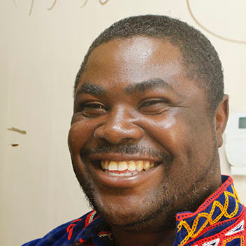
Prof. Dr. Abdon Atangana
Guest Editor

Manuscript Submission Information

Manuscripts should be submitted online at www.mdpi.com by registering and logging in to this website. Once you are registered, click here to go to the submission form. Manuscripts can be submitted until the deadline. All submissions that pass pre-check are peer-reviewed. Accepted papers will be published continuously in the journal (as soon as accepted) and will be listed together on the special issue website. Research articles, review articles as well as short communications are invited. For planned papers, a title and short abstract (about 100 words) can be sent to the Editorial Office for announcement on this website.

Submitted manuscripts should not have been published previously, nor be under consideration for publication elsewhere (except conference proceedings papers). All manuscripts are thoroughly refereed through a single-blind peer-review process. A guide for authors and other relevant information for submission of manuscripts is available on the Instructions for Authors page. Hydrology is an international peer-reviewed open access monthly journal published by MDPI.

Please visit the Instructions for Authors page before submitting a manuscript. The Article Processing Charge (APC) for publication in this open access journal is 1800 CHF (Swiss Francs). Submitted papers should be well formatted and use good English. Authors may use MDPI's English editing service prior to publication or during author revisions.

Published Papers (8 papers)

Order results
Result details
Select all
Export citation of selected articles as:

Research

Jump to: Other

2785 KiB  
Article
Understanding the Effects of Parameter Uncertainty on Temporal Dynamics of Groundwater-Surface Water Interaction
by Gopal Chandra Saha, Jianbing Li and Ronald W. Thring
Hydrology 2017, 4(2), 28; https://doi.org/10.3390/hydrology4020028 - 12 May 2017
Cited by 6 | Viewed by 4603
Abstract
This study presents the understanding of temporal dynamics of groundwater-surface water (GW-SW) interaction due to parameter uncertainty by using a physically-based and distributed gridded surface subsurface hydrologic analysis (GSSHA) model combined with a Monte Carlo simulation. A study area along the main stem [...] Read more.
This study presents the understanding of temporal dynamics of groundwater-surface water (GW-SW) interaction due to parameter uncertainty by using a physically-based and distributed gridded surface subsurface hydrologic analysis (GSSHA) model combined with a Monte Carlo simulation. A study area along the main stem of the Kiskatinaw River of the Kiskatinaw River watershed, Northeast British Columbia, Canada, was used as a case study. Two different greenhouse gas (GHG) emission scenarios (i.e., A2: heterogeneous world with self-reliance and preservation of local identities, and B1: a more integrated and environmental-friendly world) of the Special Report on Emissions Scenarios (SRES) from the Fourth Assessment Report of the Intergovernmental Panel on Climate Change (IPCC) for 2013 were used as case scenarios. Before conducting uncertainty analysis, a sensitivity analysis was performed to find the most sensitive parameters to the model output (i.e., mean monthly groundwater contribution to stream flow). Then, a Monte Carlo simulation was used to conduct the uncertainty analysis. The uncertainty analysis results under both case scenarios revealed that the pattern of the cumulative relative frequency distribution of the mean monthly and annual groundwater contributions to stream flow varied monthly and annually, respectively, due to the uncertainties of the sensitive model parameters. In addition, the pattern of the cumulative relative frequency distribution of a particular month’s groundwater contribution to the stream flow differed significantly between both scenarios. These results indicated the complexities and uncertainties in the GW-SW interaction system. Therefore, it is of necessity to use such uncertainty analysis results rather than the point estimates for better water resources management decision-making. Full article
(This article belongs to the Special Issue Groundwater Flow)
Show Figures

Figure 1

3184 KiB  
Article
Field Analysis of Stepwise Effective Thermal Conductivity along a Borehole Heat Exchanger under Artificial Conditions of Groundwater Flow
by Yoshitaka Sakata, Takao Katsura, Katsunori Nagano and Manabu Ishizuka
Hydrology 2017, 4(2), 21; https://doi.org/10.3390/hydrology4020021 - 29 Mar 2017
Cited by 14 | Viewed by 4983
Abstract
Heat advection caused by groundwater flow can potentially improve the performance of a borehole heat exchanger. However, the required flow velocity is not achieved under most natural conditions. This study focuses on artificial groundwater flow generated by pumping and investigates the associated effect [...] Read more.
Heat advection caused by groundwater flow can potentially improve the performance of a borehole heat exchanger. However, the required flow velocity is not achieved under most natural conditions. This study focuses on artificial groundwater flow generated by pumping and investigates the associated effect in a lowland area near the Toyohira River alluvial fan, Sapporo, Japan. Thermal response test results are compared under natural and artificial groundwater flow conditions. A pumping well is constructed one meter from the borehole. Temperature profiles are measured in the U-tube during testing, using a pair of optic fiber distributed temperature sensors. The effective thermal conductivity is calculated from the profiles obtained in each 10-m sub-layer; this thermal conductivity is termed the stepwise thermal conductivity. Additionally, the upward flow velocity in the pumping well is measured to estimate the mean groundwater flow velocity at the borehole. The results show that effective thermal conductivity increases at depths less than 50 m, where the pumping creates mean velocities greater than 0.1 m d−1 in each sub-layer (1.5 md−1 on average). Thus, a borehole length of 50 m is more reasonable at the test site for its efficiency in a ground source heat pump system coupled with the pumping well than that used. Full article
(This article belongs to the Special Issue Groundwater Flow)
Show Figures

Figure 1

6016 KiB  
Article
Simulation of Groundwater Mounding Due to Irrigation Practice: Case of Wastewater Reuse Engineering Design
by Yohannes Yihdego
Hydrology 2017, 4(2), 19; https://doi.org/10.3390/hydrology4020019 - 23 Mar 2017
Cited by 14 | Viewed by 5060
Abstract
Mounding often occurs beneath engineering structures designed to infiltrate reuse water. AQTESOLV software and a spreadsheet solution for Hantush, together with soil moisture water balance (SWAGMAN farm model), were used for quantitatively predicting the height and extent of groundwater mounding underground to assess [...] Read more.
Mounding often occurs beneath engineering structures designed to infiltrate reuse water. AQTESOLV software and a spreadsheet solution for Hantush, together with soil moisture water balance (SWAGMAN farm model), were used for quantitatively predicting the height and extent of groundwater mounding underground to assess the groundwater-flow simulations of infiltration from a hypothetical irrigation site. Horizontal and vertical permeability, aquifer thickness, specific yield, and basin geometry are among the aquifer and recharge properties inputs. For 2.2 ha sites, the maximum heights of the simulated groundwater mound ranges up to 0.29 m. The maximum areal extent of groundwater mounding measured from the edge of the infiltration basins of 0.24 m ranges from 0 to 75 m. Additionally, the simulated height and extent of the groundwater mounding associated with a hypothetical irrigation infiltration basin for 2.2 ha development may be applicable to sites of different sizes, using the recharge rate estimated from the SWAGMAN farm model. For example, for a 2.2 ha site with a 0.0002 m/day recharge rate, the irrigation infiltration basin design capacity (and associated groundwater mound) would be the same as for a 1.1 ha site with a 0.0004 m/day recharge rate if the physical characteristics of the aquifer are unchanged. The study claimed that the present modelling approach overcomes the complications of solving the Hantush equation for transient flow. The approach utilised in this study can be applied for other purposes such as measuring the feasibility of infiltrating water, attenuation zone, risk mitigation essential for decision-makers and planning regulators in terms of environmental effects and water use efficiency. Full article
(This article belongs to the Special Issue Groundwater Flow)
Show Figures

Figure 1

4986 KiB  
Article
Radioactive Seepage through Groundwater Flow from the Uranium Mines, Namibia
by Tamiru Abiye and Ignatius Shaduka
Hydrology 2017, 4(1), 11; https://doi.org/10.3390/hydrology4010011 - 15 Feb 2017
Cited by 12 | Viewed by 5782
Abstract
The study focused on the seepage of uranium from unlined tailing dams into the alluvial aquifer in the Gawib River floodplain in Namibia where the region solely relies on groundwater for its economic activities as a result of arid climatic condition. The study [...] Read more.
The study focused on the seepage of uranium from unlined tailing dams into the alluvial aquifer in the Gawib River floodplain in Namibia where the region solely relies on groundwater for its economic activities as a result of arid climatic condition. The study reviewed previous works besides water sample collection and analyses for major ions, metals and environmental isotopes in addition to field tests on physico-chemical parameters (pH, Electrical Conductivity, Redox and T). Estimation of seepage velocity (true velocity of groundwater flow) has been conducted in order to understand the extent of radioactive plume transport. The hydrochemistry, stable isotopes and tritium results show that there is uranium contamination from the unlined uranium tailings in the Gawib shallow aquifer system which suggests high permeability of the alluvial aquifer facilitating groundwater flow in the arid region. The radioactive contaminants could spread into the deeper aquifer system through the major structures such as joints and faults. The contamination plume could also spread downstream into the Swakop River unless serious interventions are employed. There is also a very high risk of the plume to reach the Atlantic Ocean through seasonal flash floods that occurs in the area. Full article
(This article belongs to the Special Issue Groundwater Flow)
Show Figures

Graphical abstract

11658 KiB  
Article
Highlighting the Role of Groundwater in Lake– Aquifer Interaction to Reduce Vulnerability and Enhance Resilience to Climate Change
by Yohannes Yihdego, John A Webb and Babak Vaheddoost
Hydrology 2017, 4(1), 10; https://doi.org/10.3390/hydrology4010010 - 13 Feb 2017
Cited by 24 | Viewed by 7022
Abstract
method is presented to analyze the interaction between groundwater and Lake Linlithgow (Australia) as a case study. A simplistic approach based on a “node” representing the groundwater component is employed in a spreadsheet of water balance modeling to analyze and highlight the effect [...] Read more.
method is presented to analyze the interaction between groundwater and Lake Linlithgow (Australia) as a case study. A simplistic approach based on a “node” representing the groundwater component is employed in a spreadsheet of water balance modeling to analyze and highlight the effect of groundwater on the lake level over time. A comparison is made between the simulated and observed lake levels over a period of time by switching the groundwater “node “on and off. A bucket model is assumed to represent the lake behaviour. Although this study demonstrates the understanding of Lake Linlithgow’s groundwater system, the current model reflects the contemporary understanding of the local groundwater system, illustrates how to go about modeling in data-scarce environments, and provides a means to assess focal areas for future data collection and model improvements. Results show that this approach is convenient for getting first‐hand information on the effect of groundwater on wetland or lake levels through lake water budget computation via a node representing the groundwater component. The method can be used anywhere and the applicability of such a method is useful to put in place relevant adaptation mechanisms for future water resources management, reducing vulnerability and enhancing resilience to climate change within the lake basin. Full article
(This article belongs to the Special Issue Groundwater Flow)
Show Figures

Figure 1

653 KiB  
Article
Exact and Approximate Solutions of Fractional Partial Differential Equations for Water Movement in Soils
by Ninghu Su
Hydrology 2017, 4(1), 8; https://doi.org/10.3390/hydrology4010008 - 25 Jan 2017
Cited by 4 | Viewed by 4462
Abstract
This paper presents solutions of the fractional partial differential equation (fPDE) for analysing water movement in soils. The fPDE explains processes equivalent to the concept of symmetrical fractional derivatives (SFDs) which have two components: the forward fractional derivative (FFD) and backward fractional derivative [...] Read more.
This paper presents solutions of the fractional partial differential equation (fPDE) for analysing water movement in soils. The fPDE explains processes equivalent to the concept of symmetrical fractional derivatives (SFDs) which have two components: the forward fractional derivative (FFD) and backward fractional derivative (BFD) of water movement in soils with the BFD representing the micro-scale backwater effect in porous media. The distributed-order time-space fPDE represents water movement in both swelling and non-swelling soils with mobile and immobile zones with the backwater effect operating at two time scales in large and small pores. The concept of flux-concentration relation is now updated to account for the relative fractional flux of water movement in soils. Full article
(This article belongs to the Special Issue Groundwater Flow)
Show Figures

Figure 1

2692 KiB  
Article
Revisiting Cent-Fonts Fluviokarst Hydrological Properties with Conservative Temperature Approximation
by Philippe Machetel and David A. Yuen
Hydrology 2017, 4(1), 6; https://doi.org/10.3390/hydrology4010006 - 24 Jan 2017
Cited by 1 | Viewed by 4587
Abstract
We assess the errors produced by considering temperature as a conservative tracer in fluviokarst studies. Heat transfer that occurs between karstic Conduit System (CS) and Porous Fractured Matrix (PFM) is the reason why one should be careful in making this assumption without caution. [...] Read more.
We assess the errors produced by considering temperature as a conservative tracer in fluviokarst studies. Heat transfer that occurs between karstic Conduit System (CS) and Porous Fractured Matrix (PFM) is the reason why one should be careful in making this assumption without caution. We consider the karstic aquifer as an Open Thermodynamic System (OTS), which boundaries are permeable to thermal energy and water. The first principle of thermodynamics allows considering the enthalpy balance between the input and output flows. Combined with a continuity equation this leads to a two-equation system involving flows and temperatures. Steady conditions are approached during the recession period or during particular phases of pumping test experiments. After a theoretical study of the error induced by the conservative assumption in karst, we have applied the method to revisit the data collected during a complete campaign of pumping test. The method, restricted to selected data allowed retrieving values of base flow, mixing of flow, intrusions of streams, and aquifer answer to drawdown. The applicability of the method has been assessed in terms of propagation of the temporal fluctuations trough the solving but also in terms of conservative assumption itself. Our results allow retrieving the main hydrological properties of the karst as observed on field (timed volumetric samplings, geochemical analyses, step pumping test and allogenic intrusion of streams). This consistency argues in favor of the applicability of the conservative temperature method to investigating fluviokarst systems under controlled conditions. Full article
(This article belongs to the Special Issue Groundwater Flow)
Show Figures

Figure 1

Other

Jump to: Research

2069 KiB  
Case Report
Groundwater Resources Assessment and Impact Analysis Using a Conceptual Water Balance Model and Time Series Data Analysis: Case of Decision Making Tool
by Yohannes Yihdego and Alamgir Khalil
Hydrology 2017, 4(2), 25; https://doi.org/10.3390/hydrology4020025 - 14 Apr 2017
Cited by 12 | Viewed by 6206
Abstract
The allocation of groundwater resources has been a challenge for many years due to its unforeseen side effect and lag time issues, which are often overlooked. The full impact of groundwater utilization/abstraction takes time to realize its effect at its full. In this [...] Read more.
The allocation of groundwater resources has been a challenge for many years due to its unforeseen side effect and lag time issues, which are often overlooked. The full impact of groundwater utilization/abstraction takes time to realize its effect at its full. In this paper, long-term effects and groundwater dynamics were assessed using a water balance model and a time series analysis, respectively. Undeveloped groundwater systems are commonly found in a state of equilibrium, where, on average, equal amounts of water are recharged and discharged. A water budget is a static accounting of the state of the system at a given time, often before the system is developed. Water balance analysis was carried out together with the groundwater through flow, hydrograph, and surface-groundwater interaction analysis (base flow index) to develop a conceptual water balance model, which is a very basic representation of a complex natural aquifer system and is instrumental to constrain and build a robust numerical model that can be readily justified and updated. A noble approach was employed to assess and constrain the discharge coming out of the model area to sustain the lake level, located to the north of the study area, using the whole lake catchment and lake water balance analysis. Based on the lake water balance, there is a deficit between input and output computation, and hence there should be a groundwater input to sustain the historical lake area. The analysis showed that the model area contributes 40% of the lake catchment, and hence the portion of the groundwater inflow feeding the lake was computed. This is one of the means to constrain the discharge, which adds more confidence to the recharge estimation. This is very important because the size of a sustainable groundwater development usually depends on how much of the discharge from the system can be captured by the development. Capture is independent of the recharge. Instead, it depends on the dynamic response of the aquifer system to the development. The idea that knowing the recharge is important in determining the size of a sustainable groundwater development is a myth and has no basis. The important entity in determining how a groundwater system reaches a new equilibrium is capture. How capture occurs in an aquifer system is a dynamic process. Following this study, lake water balance assessment was indirectly considered as prior information for the numerical model calibration of the discharge from the model area using a conductance parameter. Conductance is a key parameter to estimate the discharge volume together with the change in the simulated hydraulic head between time steps. The water balance error highlights which one is more sensitive, and this could help to assist in planning for future data collection/field work and where to invest the money. The water balance computation helps to figure out the degree of surface-groundwater interaction, uncertainty, sensitive parameter, helps in the decision to invest time and money, and operates as a cross check with other analytical or numerical modelling. Full article
(This article belongs to the Special Issue Groundwater Flow)
Show Figures

Figure 1

Back to TopTop