
Remark: Evaluation of the Habitat and Potential of Taxus chinensis var. mairei in the Jiangnan Hilly Region

 ,
, 
 ,
,
Abstract
1. Introduction
2. Materials and Methods
2.1. Study Area
2.2. Species Distribution Data
2.3. Selection and Processing of Environmental Variables
2.4. MaxEnt Model
2.5. Model Accuracy Test
2.6. Classification of Suitable Habitats
3. Results
3.1. Response of T. chinensis to Ecological Factors
3.2. Simulation of Suitable Habitat for T. chinensis in the Present Period
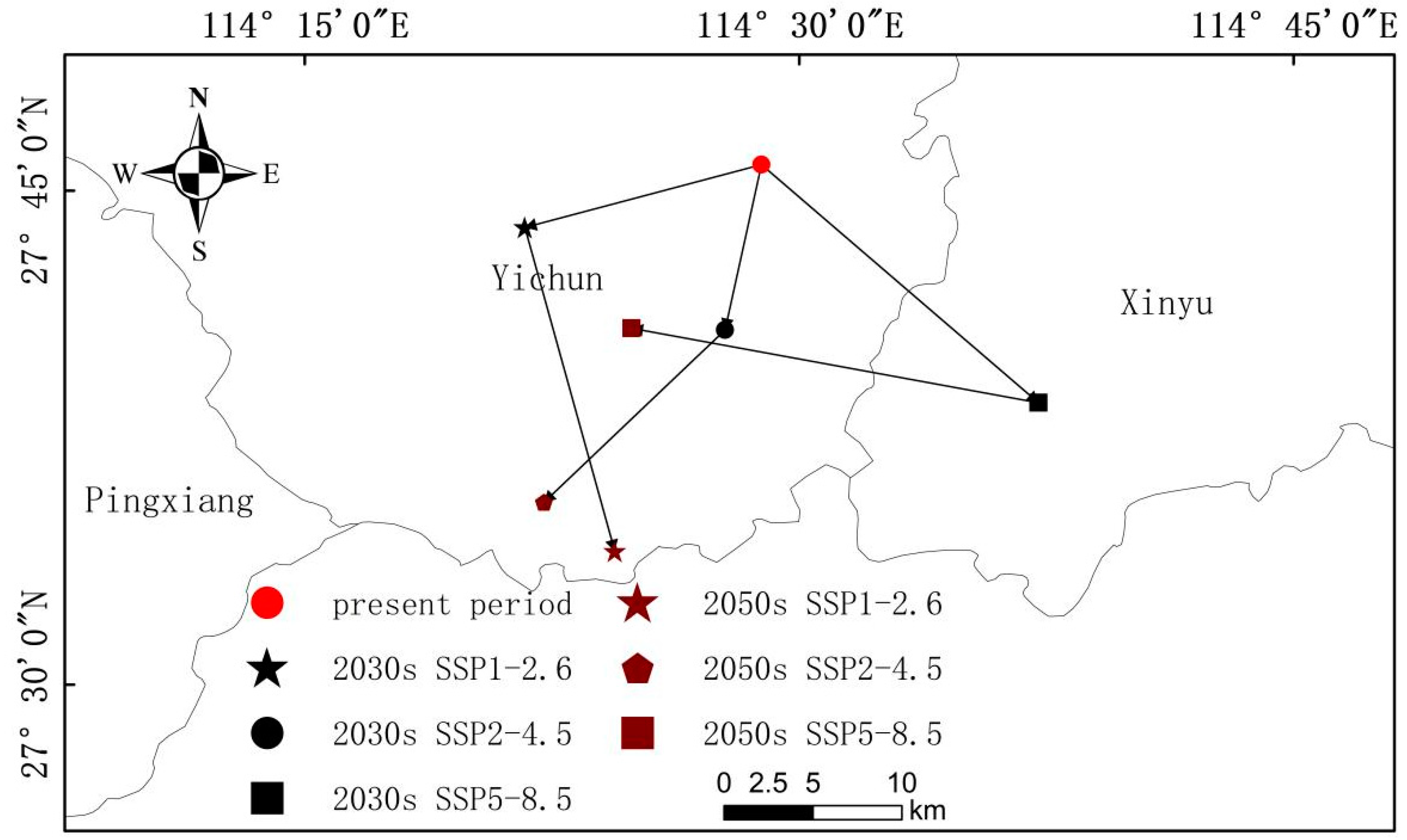
3.3. Future Changes in Suitable Habitat for T. chinensis
4. Discussion
4.1. Major Environmental Factors Constraining the Suitable Habitat for T. chinensis
4.2. Evolution of Distribution of T. chinensis under Future Climate Scenarios
4.3. Conservation Measures for T. chinensis
5. Conclusions
Author Contributions
Funding
Data Availability Statement
Acknowledgments
Conflicts of Interest
References
- Liao, W.B.; Zhang, X.Z.; Sun, Z.R. Importance and exigency on study of protection biology of anticancer plant Taxus mairei. Ecol. Sci. 1996, 2, 19–22. [Google Scholar]
- Zhang, J.T.; Ru, W.M. Population characteristics of endangered species Taxus chinensis var. mairei and its conservation strategy in Shanxi, China. Popul. Ecol. 2010, 52, 407–416. [Google Scholar] [CrossRef]
- Chen, X.; Xu, X.; Yuan, H.; Luo, T.; Cui, H.; Zhu, T.; Li, S.; Liu, Y.; Lin, T.; Qiao, T.; et al. Nigrospora musae Causing T. mairei stem blight in Sichuan, China. Plant Dis. 2023, 107, 4032. [Google Scholar] [CrossRef] [PubMed]
- Bao, W.K.; Chen, Q.H. Present status, problems, and further development strategies on natural TAXUS resource and their exploitation in China. J. Nat. Resour. 1998, 4, 88–93. [Google Scholar]
- Elith, J.; Leathwick, J.R. Species distribution models: Ecological explanation and prediction across space and time. Annu. Rev. Ecol. Evol. Syst. 2009, 40, 677–697. [Google Scholar] [CrossRef]
- Busby, J.R. Bioclim: A bioclimate analysis and prediction system. Plant Prot. Q. 1991, 6, 8–9. [Google Scholar]
- Elith, J.; Graham, C.H.; Anderson, R.P.; Dudik, M.; Ferrier, S.; Guisan, A.; Hijmans, R.J.; Huettmann, F.; Leathwick, J.R.; Lehmann, A. Novel methods improve prediction of species’ distributions from occurrence data. Ecography 2006, 2, 29. [Google Scholar] [CrossRef]
- Stockwell, D.; Peters, D.P. The GARP modelling system: Problems and solutions to automated spatial prediction. Int. J. Geogr. Inf. Sci. 1999, 13, 143–158. [Google Scholar] [CrossRef]
- Hirzel, A.H.; Hausser, J.; Chessel, D.; Perrin, N. Ecological-niche factor analysis: How to compute habitat-suitability maps without absence data? Ecology 2002, 83, 2027–2036. [Google Scholar] [CrossRef]
- Zhao, Q.; Li, H.; Chen, C.; Fan, S.; Wei, J.; Cai, B.; Zhang, H. Potential Global Distribution of Paracoccus marginatus, under Climate Change Conditions, Using MaxEnt. Insects 2024, 15, 98. [Google Scholar] [CrossRef]
- Ahmadi, M.; Hemami, M.R.; Kaboli, M.; Shabani, F. MaxEnt brings comparable results when the input data are being completed; Model parameterization of four species distribution models. Ecol. Evol. 2023, 13, e9827. [Google Scholar] [CrossRef] [PubMed]
- Zhang, W.P.; Hu, Y.Y.; Li, Z.H.; Feng, X.P.; Li, D.W. Predicting suitable distribution areas of Juniperus przewalskii in Qinghai Province under climate change scenarios. Ying Yong Sheng Tai Xue Bao 2021, 32, 2514–2524. [Google Scholar] [CrossRef] [PubMed]
- Guo, J.; Liu, X.P.; Zhang, Q.; Zhang, D.F.; Xie, C.X.; Liu, X. Prediction for the potential distribution area of Codonopsis pilosula at global scale based on Maxent model. Ying Yong Sheng Tai Xue Bao 2017, 28, 992–1000. [Google Scholar] [CrossRef] [PubMed]
- Li, Y.C.; Li, M.Y.; Li, C.; Liu, Z.Z. Optimized Maxent model predictions of climate change impacts on the suitable distribution of Cunninghamia lanceolata in China. Forests 2020, 11, 302. [Google Scholar] [CrossRef]
- Meena, R.K.; Bhandari, M.S.; Thakur, P.K.; Negi, N.; Pandey, S.; Kant, R.; Sharma, R.; Sahu, N.; Avtar, R. MaxEnt-Based Potential Distribution Mapping and Range Shift under Future Climatic Scenarios for an Alpine Bamboo Thamnocalamus spathiflorus in Northwestern Himalayas. Land 2024, 13, 931. [Google Scholar] [CrossRef]
- Zhang, L.; Jiang, B.; Meng, Y.; Jia, Y.; Xu, Q.; Pan, Y. The Influence of Climate Change on the Distribution of Hibiscus mutabilis in China: MaxEnt Model-Based Prediction. Plants 2024, 13, 1744. [Google Scholar] [CrossRef]
- Chen, G.Y. Analysis on the influence of the climate changes on the global vegetation. IOP Conf. S. Earth Environ. Sci. 2020, 546, 032049. [Google Scholar] [CrossRef]
- Gao, R.M.; Shi, X.D.; Fan, L.Y.; Sun, Y.Y.; Guo, X.H. Natural distribution and community ecological characteristics of Taxus chinensis var. mairei in Shanxi Province, China. Ying Yong Sheng Tai Xue Bao 2016, 27, 1820–1828. [Google Scholar] [CrossRef] [PubMed]
- Li, Y.H.; Zhang, L.J.; Zhu, W.B.; Zhang, J.J.; Xu, S.B.; Zhu, L.Q. Changes of Taxus chinensis var. mairei habitat distribution under global climate change. J. Nat. Resour. 2021, 36, 783–792. [Google Scholar] [CrossRef]
- Wu, X.T.; Wang, M.Q.; Li, X.Y.; Yan, Y.D.; Dai, M.J.; Xie, W.Y.; Zhou, X.F.; Zhang, D.L.; Wen, Y.F. Response of distribution patterns of two closely related species in Taxus genus to climate change since last inter-glacial. Ecol. Evol. 2022, 12, e9302. [Google Scholar] [CrossRef]
- Cao, J.W.; Liu, C.L.; Wu, Y.; LI, H.A.; Yin, D.J.; Wu, X.L.; Wu, L.S.; Xu, W. Effects of different rooting agent concentration and different substrate types oncuttings rooting of Taxus wallichiana var. Marirei. J. Cent. S. Univ. For. Technol. 2013, 33, 10–14. [Google Scholar]
- Li, N.W.; Hu, S.N.; Shu, X.C.; Qing, W.; Bing, X.; Feng, P. Genetic diversity and structure analyses of wild and ex-situ conservation populations of Taxus chinensis var. mairei based on ISSR marker. J. Plant Resour. Environ. 2011, 20, 25–30. [Google Scholar] [CrossRef]
- Zhang, D.Q.; Zhou, N. Genetic diversity and population structure of the endangered conifer Taxus wallichiana var. mairei (Taxaceae) revealed by simple sequence repeat (SSR) markers. Biochem. Syst. Ecol. 2013, 49, 107–114. [Google Scholar] [CrossRef]
- Lange, B.M.; Conner, C.F. Taxanes and taxoids of the genus Taxus—A comprehensive inventory of chemical diversity. Phytochemistry 2021, 190, 112829. [Google Scholar] [CrossRef] [PubMed]
- Shi, Q.W.; Oritani, T.; Sugiyama, T.; Horiguchi, T.; Murakami, R.; Zhao, D.; Oritani, T. Three new taxane diterpenoids from the seeds of Taxus yunnanensis Cheng et al. K. Fu and T. cuspidata Sieb et Zucc. Tetrahedron 1999, 55, 8365–8376. [Google Scholar] [CrossRef]
- Xiong, X.Y.; Gou, J.B.; Liao, Q.G.; Li, Y.L.; Zhou, Q.; Bi, G.; Li, C.; Du, R.; Wang, X.; Sun, T.; et al. The Taxus genome provides insights into paclitaxel biosynthesis. Nat. Plants 2021, 7, 1026–1036. [Google Scholar] [CrossRef] [PubMed]
- O’Neill, B.C.; Tebaldi, C.; van Vuuren, D.P.; Eyring, V.; Friedlingstein, P.; Hurtt, G.; Knutti, R.; Kriegler, E.; Lamarque, J.-F.; Lowe, J.; et al. The scenario model intercomparison project (ScenarioMIP) for CMIP6. Geosci. Model Dev. 2016, 9, 3461–3482. [Google Scholar] [CrossRef]
- Chen, B.B. Molecular Phylogeographic and Genetic Diversity of Taxus L. Taxaeae 2017 in China. Ph.D. Thesis, Chinese Academy of Forestry, Beijing, China, 2017. [Google Scholar]
- Fu, X.F. Diversity of Arbuscular Mycorrhizal Fungi in Rhizosphere Soil of Taxus chinensis var. mairei and the Inoculation Effects of PSB and AMF on Host Plant. Master’s Thesis, Shanxi Normal University, Xi’an, China, 2018. [Google Scholar]
- Wang, Y.; Zhang, R.; Feng, J.G.; Zhou, H.M.; Meng, X.D.; Zhou, Z.C. Analysis on growth difference of Taxus wallichiana var. mairei from different provenances and selection of fast-growing provenances at early age. J. Plant Resour. Environ. 2012, 21, 41–47. [Google Scholar]
- Xie, W.D. Resource Status and Distribution Characteristics of Taxus chinensis var. mairei in Nanling Mountain. Ph.D. Thesis, Central South University of Forestry and Technology, Changsha, China, 2017. [Google Scholar]
- Zhang, X.M.; Li, D.Z.; Gao, L.M. Phylogeographical Study on Taxus wallichiana var. mairei (Lemée & Léveillé) L.K.Fu & Nan Li. Acta Bot. Boreali-Occident. Sin. 2012, 32, 1983–1989. [Google Scholar]
- Byeon, D.H.; Kim, S.H.; Jung, J.M.; Jung, S.; Kim, K.H.; Lee, W.H. Climate-based ensemble modelling to evaluate the global distribution of Anoplophora glabripennis (Motschulsky). Agric. For. Entomol. 2021, 23, 569–583. [Google Scholar] [CrossRef]
- Srivastava, V.; Roe, A.D.; Keena, M.A.; Hamelin, R.C.; Griess, V.C. Oh the places they’ll go: Improving species distribution modelling for invasive forest pests in an uncertain world. Biol. Invasions 2021, 23, 297–349. [Google Scholar] [CrossRef]
- Phillips, S.J.; Anderson, R.P.; Schapire, R.E. Maximum entropy modeling of species geographic distributions. Ecol. Model. 2006, 190, 231–259. [Google Scholar] [CrossRef]
- Liu, Y.; Miao, C.; Wang, H.S. Influence of climate change on distribution of suitable areas of Larix plantation in China. Acta Ecol. Sin. 2023, 43, 9686–9698. [Google Scholar]
- Zhang, K.; Liu, Z.; Abdukeyum, N.; Ling, Y. Potential Geographical Distribution of Medicinal Plant Ephedra sinica Stapf under Climate Change. Forests 2022, 13, 2149. [Google Scholar] [CrossRef]
- Yi, Y.J.; Cheng, X.; Yang, Z.F. Maxent modeling for predicting the potential distribution of endangered medicinal plant (H. riparia Lour) in Yunnan, China. Ecological engineering. J. Ecotechnology 2016, 92, 260–269. [Google Scholar]
- Peterson, A.T.; Soberón, J.; Pearson, R.G.; Anderson, R.P.; Martínez-Meyer, E.; Nakamura, M.; Araújo, M.B. Ecological Niches and Geographic Distributions; Princeton University Press: Princeton, NJ, USA, 2011. [Google Scholar] [CrossRef]
- Li, Y.J.; De, Y.J.; Liu, Y.X.; Zhang, G.S. Suitability region for Xanthoceras sorbifolium Bunge in inner Mongolia based onMaxEnt and ArcGlS models. J. West China For. Sci. 2021, 50, 66–73+81. [Google Scholar] [CrossRef] [PubMed]
- Cai, Q.Q.; An, M.T.; Yu, J.H.; Tian, L.; Wu, M.X. Suitable habitat prediction of Pinus kwangtungensis in China under climate change. J. Shaanxi Norm. Univ. (Nat. Sci. Ed.) 2024, 52, 90–102. [Google Scholar]
- Zhou, B.J.; Wang, Y.J.; Ma, C.L.; Fan, Z.F.; Zheng, J.H. Analysis of potential habitat of Torreya yunnanensis based on MaxEnt and ArcGlS. Acta Ecol. Sin. 2022, 42, 4485–4493. [Google Scholar]
- Xie, C.P. The Geographical Distribution of Taxus wallichiana var. mairei and Recommendations Concerning lts Protection in China. J. Sichuan Agric. Univ. 2013, 31, 277–282. [Google Scholar]
- Ru, W.M.; Zhang, J.T.; Zhang, F.; Zhang, G.P. Eco-environmental characteristics and endangered causes of Taxus mairei, an endemic to China. Bull. Bot. Res. 2006, 5, 624–628. [Google Scholar]


| Variable Type | Environmental Variable | Descriptions |
|---|---|---|
| Climate factor | Bio_1 | Annual mean temperature (°C) |
| Bio_2 | Mean diurnal range (°C) | |
| Bio_3 | Isothermality [(Bio_2/Bio_7) × 100] | |
| Bio_4 | Standard deviation of seasonal variation of temperature | |
| Bio_5 | Maximum temperature of warmest month (°C) | |
| Bio_6 | Minimum temperature of coldest month (°C) | |
| Bio_7 | Temperature annual range (Bio_5/Bio_6) (°C) | |
| Bio_8 | Mean temperature of wettest quarter (°C) | |
| Bio_9 | Mean temperature of driest quarter (°C) | |
| Bio_10 | Mean temperature of warmest quarter (°C) | |
| Bio_11 | Mean temperature of coldest quarter (°C) | |
| Bio_12 | Annual precipitation (mm) | |
| Bio_13 | Precipitation of wettest period (mm) | |
| Bio_14 | Precipitation of driest period (mm) | |
| Bio_15 | Precipitation seasonality variation coefficient | |
| Bio_16 | Precipitation of wettest quarter (mm) | |
| Bio_17 | Precipitation of driest quarter (mm) | |
| Bio_18 | Precipitation of warmest quarter (mm) | |
| Bio_19 | Precipitation of coldest quarter (mm) | |
| Terrain factor | Alt | Altitude (m) |
| Slo | Slope (%) | |
| Asp | Aspect (°) | |
| Soil factor | Drainage | Drainage class |
| REF_DEPTH | Reference soil depth | |
| AWC_Class | Available water capacity range | |
| phase | Soil phase | |
| gravel | Gravel content | |
| Sand | Sand content | |
| Silt | Silt content | |
| Clay | Clay content | |
| REF_BULK | Reference bulk density | |
| OC | Organic carbon | |
| PH_H2O | pH (H2O) | |
| CEC_Clay | Copper ethylenediamine complex (clay) | |
| CEC_soil | Copper ethylenediamine complex (soil) | |
| BS | Base saturation | |
| CaCO3 | Calcium carbonate | |
| CaSO4 | Gypsum | |
| ESP | Sodicity (Soil exchangeable sodium percentage) | |
| ECe | Conductivity |
| Variable Type | Environmental Variable |
|---|---|
| Climate factor | Bio_4 |
| Bio_5 | |
| Bio_11 | |
| Bio_12 | |
| Bio_13 | |
| Bio_15 | |
| Bio_18 | |
| Bio_19 | |
| Terrain factor | Alt |
| Asp | |
| AWC_Class | |
| Silt | |
| Soil factor | Clay |
| OC | |
| BS | |
| CaCO3 |
| Environmental Variable | Contribution Rate (%) |
|---|---|
| Bio_18 | 14.2 |
| Bio_15 | 9.1 |
| Asp | 8.2 |
| Alt | 8.0 |
| Bio_5 | 7.4 |
| BS | 6.6 |
| Bio_4 | 6.2 |
| CaCO3 | 5.9 |
| Bio_11 | 5.9 |
| Bio_19 | 5.7 |
| Slo | 5.2 |
| Bio_12 | 5.0 |
| Clay | 4.8 |
| AWC_Class | 3.2 |
| OC | 2.5 |
| Silt | 2.1 |
| Environment Variable | Optimal Range | Optimal Value |
|---|---|---|
| Bio_18 | 508.3–629.2 mm | 543.1 mm |
| Bio_15 | 37.2–41.0, 53.8–62.7 | 61.0 |
| Asp | 8.4–33.1°, 244.4–355.3° | 15.7° |
| Alt | 111.7–1351.2 m | 1078.9 m |
| Bio_5 | 20.5–29.7 °C, 33.8–35.9 °C | 34.6 °C |
| BS | 71.2–110.0 | 100.2 |
| Province | Low Habitat Suitability | Medium Habitat Suitability | High Habitat Suitability |
|---|---|---|---|
| Zhejiang | 3.32 × 10⁴ km2 | 2.59 × 10⁴ km2 | 1.14 × 10⁴ km2 |
| Anhui | 1.28 × 10⁴ km2 | 0.79 × 10⁴ km2 | 0.32 × 10⁴ km2 |
| Jiangxi | 7.20 × 10⁴ km2 | 5.42 × 10⁴ km2 | 1.56 × 10⁴ km2 |
| Guangdong | 1.22 × 10⁴ km2 | 0.99 × 10⁴ km2 | 0.34 × 10⁴ km2 |
| Guangxi | 2.74 × 10⁴ km2 | 1.65 × 10⁴ km2 | 0.77 × 10⁴ km2 |
| Hunan | 7.37 × 10⁴ km2 | 4.43 × 10⁴ km2 | 1.65 × 10⁴ km2 |
| Hubei | 1.44 × 10⁴ km2 | 1.29 × 10⁴ km2 | 0.70 × 10⁴ km2 |
| Fujian | 3.38 × 10⁴ km2 | 3.47 × 10⁴ km2 | 0.85 × 10⁴ km2 |
| Guizhou | 1.18 × 10⁴ km2 | 0.61 × 10⁴ km2 | 0.08 × 10⁴ km2 |
| Chongqing | 0.84 × 10⁴ km2 | 1.05 × 10⁴ km2 | 0.15 × 10⁴ km2 |
| Period | Present Period | 2030s | 2050s | ||||
|---|---|---|---|---|---|---|---|
| SSP1-2.6 | SSP2-4.5 | SSP5-8.5 | SSP1-2.6 | SSP2-4.5 | SSP5-8.5 | ||
| Low habitat suitability | 30.04 | 32.18 | 28.51 | 30.73 | 32.12 | 15.97 | 31.30 |
| Medium habitat suitability | 23.33 | 24.36 | 28.25 | 25.04 | 25.03 | 26.04 | 27.55 |
| High habitat suitability | 7.56 | 6.88 | 8.14 | 6.47 | 7.42 | 9.15 | 8.15 |
| Overall habitat suitability | 60.93 | 63.41 | 64.89 | 62.24 | 64.57 | 51.16 | 67.00 |
Disclaimer/Publisher’s Note: The statements, opinions and data contained in all publications are solely those of the individual author(s) and contributor(s) and not of MDPI and/or the editor(s). MDPI and/or the editor(s) disclaim responsibility for any injury to people or property resulting from any ideas, methods, instructions or products referred to in the content. |
© 2024 by the authors. Licensee MDPI, Basel, Switzerland. This article is an open access article distributed under the terms and conditions of the Creative Commons Attribution (CC BY) license (https://creativecommons.org/licenses/by/4.0/).
Share and Cite
Bao, R.; Liu, J.; Liu, X.; Zhao, X.; Xia, X.; Wang, C. Remark: Evaluation of the Habitat and Potential of Taxus chinensis var. mairei in the Jiangnan Hilly Region. Forests 2024, 15, 1238. https://doi.org/10.3390/f15071238
Bao R, Liu J, Liu X, Zhao X, Xia X, Wang C. Remark: Evaluation of the Habitat and Potential of Taxus chinensis var. mairei in the Jiangnan Hilly Region. Forests. 2024; 15(7):1238. https://doi.org/10.3390/f15071238
Chicago/Turabian StyleBao, Ruyi, Jiufen Liu, Xiaohuang Liu, Xiaofeng Zhao, Xueqi Xia, and Chao Wang. 2024. "Remark: Evaluation of the Habitat and Potential of Taxus chinensis var. mairei in the Jiangnan Hilly Region" Forests 15, no. 7: 1238. https://doi.org/10.3390/f15071238
APA StyleBao, R., Liu, J., Liu, X., Zhao, X., Xia, X., & Wang, C. (2024). Remark: Evaluation of the Habitat and Potential of Taxus chinensis var. mairei in the Jiangnan Hilly Region. Forests, 15(7), 1238. https://doi.org/10.3390/f15071238