Article

Remark: Evaluation of the Habitat and Potential of Taxus chinensis var. mairei in the Jiangnan Hilly Region

1
School of Earth Science and Resources, China University of Geosciences (Beijing), Beijing 100083, China
2
Key Laboratory of Coupled Processes and Effects of Natural Resource Elements, Beijing 100055, China
3
Command Center for Comprehensive Natural Resource Investigations, China Geological Survey, Beijing 100055, China
*
Authors to whom correspondence should be addressed.
Forests 2024, 15(7), 1238; https://doi.org/10.3390/f15071238
Submission received: 26 June 2024 / Revised: 9 July 2024 / Accepted: 11 July 2024 / Published: 16 July 2024
(This article belongs to the Section Forest Ecology and Management)

Abstract

:
Taxus chinensis var. mairei is an endangered tree species endemic to China; it has important ornamental, timber, and medicinal value. In this work, based on a MaxEnt model, the Jiangnan hilly region was used as the study area, and geographic, climatic, soil, and vegetation data were synthesized to simulate the present area of suitable habitat for T. chinensis; the key environmental factors that constrain its habitat expansion were also explored. Additionally, the potential future distribution of this species under different climate-change scenarios was predicted. The results showed that the six variables making the highest contribution to T. chinensis habitat suitability were the precipitation of the warmest quarter (14.2%), precipitation seasonality variation coefficient (9.1%), aspect (8.2%), altitude (8%), maximum temperature of the warmest month (7.4%), and base saturation (6.6%). Ideal areas have middle elevations, northeastern or northwestern slopes, warmest quarterly precipitation of 508.3–629.2 mm, maximum temperature in the warmest month of 34.6–35.9 °C, and relatively moist soil. The current area of suitable habitat is 6.09 × 10⁵ km2, of which the area of high suitability is 7.56 × 10⁴ km2; this is mainly concentrated in the southwestern part of Hunan, the southwestern part of Jiangxi Province, and the northern part of Zhejiang. Under the SSP2-4.5 climate scenario, the area of high habitat suitability increases; under both the SSP1-2.6 and SSP5-8.5 climate scenarios, the suitable habitat area expands similarly. The direction of the center-of-mass migration of T. chinensis under different climate scenarios is somewhat different from that caused by the uncertainty of human activities and climate warming. This paper clarifies the distribution of suitable habitat and future potential for T. chinensis in the Jiangnan hilly region, providing a theoretical basis for habitat management of this species.

1. Introduction

Taxus chinensis var. mairei is a unique Tertiary relict tree species in China that is known as the “living fossil of the plant kingdom”. It has attracted much attention because it is rare and endangered, and it is used for ornamental, timber, and medicinal purposes. T. chinensis has a beautiful crown, hard wood, and red heartwood, which can be processed into high-quality furniture. Its leaves, branches, stem, and bark are rich in paclitaxel and docetaxel, which have therapeutic effects in the treatment of ovarian cancer, breast cancer, lung cancer, hepatocellular carcinoma, and other cancers and difficult diseases [1]. This species has attracted much attention since it was included in the list of national Class I key wild plants for protection by China’s State Forestry Administration in 1999, and it was included in the Appendix II list by the Convention on International Trade in Endangered Species of Wild Fauna and Flora (CITES) in 2004. Currently, T. chinensis is mainly found in the hilly areas of Jiangnan, south of the Yellow River [2], such as Anhui, Zhejiang, Guangdong, Guangxi, etc. It is also found in India, Myanmar, Malaysia, Indonesia, and the Philippines [3]. Because of its wide range of uses and high ornamental value, since the 1970s, it has frequently been subjected to large-scale logging and destruction. According to the survey, it is estimated that there were 1.35 × 10⁴ plants in about 9 × 10⁶ km2 in 16 counties of five prefectures in the Hengduan Mountain area of western Yunnan, but tens of thousands of T. chinensis have been peeled off and their leaves and branches have been chopped off in recent years [4]. Excessive exploitation and use by humans, coupled with its low natural reproduction capacity, have led to a gradual decrease in its distribution area, and it is endangered in the wild. It is thus crucial to determine the potential area of suitable habitat T. chinensis and its influencing factors.
Species distribution models (SDMs) are now widely used tools for understanding the potential distributions of species and the factors influencing them. They are based on the interrelationships between species distributions and environmental variables, and they are used to simulate the distribution of a species’ potentially suitable habitat and characterize that species’ preference for its environment through the probability of it existing in a given area [5]. Commonly used SDMs include the Biological Climatic Model (BioCLIM) [6], Maximum Entropy model (MaxEnt) [7], Genetic Algorithm for Rule-set Production (GARP) [8], Ecological Niche Factor Analysis (ENFA) [9], Generalized Linear Models (GLM), and Random Forest (RF). Among these, MaxEnt is widely used. MaxEnt is a machine-learning approach that estimates a target probability distribution by calculating the probability distribution of maximum entropy. Compared to other methods, MaxEnt has the advantages of using presence-only occurrence data, the ability to use both continuous and categorical variables, effective control of model fit through certain parameter settings, and simplicity of operation and repeated runs to test model robustness [10]. It has been shown to perform better than other SDMs due to its ability to maintain high prediction accuracy with small samples [11], and it has thus been widely used in research considering the prediction of suitable habitats and conservation for species including the Qilian cypress [12], Codonopsis pilosula [13], Cunninghamia lanceolata [14], Thamnocalamus spathiflorus [15], and Hibiscus mutabilis [16].
According to the IPCC’s Sixth Assessment Report on Climate Change, it is projected that global atmospheric warming will exceed 1.5 °C by the end of the 22nd century. As a core driver of vegetation change, the resulting dramatic fluctuations in climate will have profound impacts on the growth environment and physiological attributes of vegetation through temperature stress, water stress, phenological changes, and changes in sunshine duration and light intensity [17]. To date, studies of T. chinensis in China have mainly focused on resource distribution [4,18,19,20], breeding techniques [21], genealogical structure [22,23], and chemical composition [24,25,26], while few researchers have examined the changes in suitable habitat for T. chinensis in the context of climate change; however, gaining a deeper understanding of this would help to improve the management and protection of this endangered species.
To this end, the work described in this paper used simulated future climate data corresponding to the three shared socioeconomic pathways, SSP1-2.6, SSP2-4.5, and SSP5-8.5, under the Beijing Climate Center Climate System Model-Medium Resolution of the Coupled Model Intercomparison Project Phase 6 (BCC-CSM2-MR of CMIP6). SSP1-2.6 represents a sustainable development pathway with low greenhouse gas (GHG) emissions and a temperature increase controlled below 2 °C by 2100; SSP2-4.5 represents a moderate development pathway with medium GHG emissions and a temperature increase controlled below 3 °C by 2100; and SSP5-8.5 represents the conventional development pathway with high GHG emissions and a temperature increase controlled below 5 °C by 2100 [27].
This study explored the dominant factors affecting the geographic distribution of T. chinensis and simulated the spatial distribution of its current suitable habitat using a MaxEnt model based on data relating to climate, topography, soil, and other environmental characteristics. Additionally, using the future climate data outlined above, the evolution trends of suitable habitat for T. chinensis under the influence of climate change in the 2030s and 2050s were predicted with a view towards deepening the understanding of the theoretical mechanisms underlying potential changes in its distribution.

2. Materials and Methods

2.1. Study Area

The Jiangnan hilly region is located south of the middle and lower reaches of the Yangtze River, north of the Nanling Mountains, west of the Wuyi and Tianmu Mountains, and east of the Xuefeng Mountains. It encompasses most or part of the provinces of Zhejiang, Anhui, Jiangxi, Guangdong, Guangxi, Hunan, Hubei, Fujian, Guizhou, and Chongqing (Figure 1). The total land area of the study region is 7.20 × 10⁵ km2, accounting for 7.5% of the total land area of the country. The terrain mainly consists of low hills between 200 and 500 m, with numerous red basins. The region has a typical subtropical monsoon climate, with hot and long-lasting summers and warm winters, with average annual temperatures ranging from 16 to 20 °C, and an average annual precipitation of 1300 to 1800 mm. The study area is located in the Central Subtropical Evergreen Broadleaf Forest to Red Loam Zone of China, and broadleaf evergreen trees dominate the natural vegetation. It is densely populated and economically developed, and it is one of China’s important agricultural areas. In addition, the area is rich in unique plant and animal species, including the Chinese water leek, T. chinensis, abies beshanzuensis, black muntjac, white-necked long-tailed pheasant, and other endemic species in China; it is therefore regarded as one of the important gene pools of plant and animal germplasm resources in China.

2.2. Species Distribution Data

The geographic distribution points of T. chinensis were mainly obtained from the Digital Herbarium of China (https://www.cvh.ac.cn (accessed on 25 November 2023)), the Global Biodiversity Information Service Network Platform (https://www.gbif.org (accessed on 25 November 2023)), and relevant literature [28,29,30,31,32]. For records with only place names, the distribution coordinates were obtained using the Baidu map. Similar points were removed according to the principle of retaining only one valid distribution point within each 1 km grid square. Finally, 158 valid records of T. chinensis were obtained (Figure 1).

2.3. Selection and Processing of Environmental Variables

The environmental data used in this evaluation included three major categories: climate, terrain, and soil factors. Climate data for the current period (1970–2000) and two future periods (the 2030s [average for 2021–2040] and 2050s [average for 2041–2060]) were obtained from the World Climate Database (https://www.worldclim.org (accessed on 30 November 2023)), which includes 19 variables, such as annual mean temperature (Bio_1), mean diurnal range (Bio_2), and isothermality (Bio_3). Three socioeconomic pathways (SSP1-2.6, SSP2-4.5, and SSP5-8.5) under the BCC-CSM2-MR of CMIP6 (as outlined above) were used for the future simulated climate data. The terrain-factor data were obtained from the national digital elevation model 1 km data released by the Resource and Environmental Science Data Centre of the Chinese Academy of Sciences (https://www.gbif.org (accessed on 30 November 2023)), which includes three variables: altitude, slope, and aspect. Soil-factor data were obtained from the Chinese soil dataset (v1.1) published by the National Research Centre for Glacial Permafrost and Desert Science (https://www.crensed.ac.cn (accessed on 30 November 2023)); this is based on the World Soil Database, which contains 17 variables, such as drainage class (Drainage), reference soil depth (REF_DEPTH), and available water capacity range (AWC_Class) (Table 1).
All the environmental variables were processed using ArcGIS 10.2, and the geographic coordinate system was standardized as WGS_1984 with a spatial resolution of 1 km. Finally, the data were exported in ASCII format.

2.4. MaxEnt Model

First, the T. chinensis distribution point data and all environmental variables were imported into the MaxEnt 3.4.1 software to establish the initial model, and the weight of each ecological factor was evaluated using the jackknife method to remove the factors with lower contribution rates. Second, to avoid overfitting, the environmental variables were examined by Spearman correlation analysis using the SPSS software (Version number: IBM SPSS Statistics 26) package, according to the principle of correlation coefficients of environmental variables not exceeding 0.80 [33]. If the correlation coefficient |r| between two environmental factors was greater than 0.80, the factors that contributed less to the MaxEnt model predictions and had little ecological significance were preferentially excluded [34]. Finally, the factors with high influence on the potential habitat area of T. chinensis were screened out, and the retained dominant environmental factors were imported into the model again to obtain the end results.
The relevant parameters of the model run were set as follows: 75% of the distributed data was used as the training set for model prediction and 25% was used as the test set to verify the feasibility of the model; the maximum background value was set to 10,000 and the run was repeated ten times; and the rest of the parameters were selected as their default values [35].

2.5. Model Accuracy Test

The area under the receiver operating characteristic (ROC) curve (AUC) can be used to assess the accuracy of the prediction results of a model [36]. AUC values fall in the range of 0–1: the closer the value is to 1, the higher the prediction accuracy of the model [37]. If AUC < 0.6, the model prediction is considered to be inaccurate; in the range of 0.6–0.7, the model prediction accuracy is poor; the range of 0.7–0.8 indicates fair accuracy; the range of 0.8–0.9 indicates good accuracy; and when AUC > 0.9, the accuracy of the model prediction is excellent [38,39].

2.6. Classification of Suitable Habitats

Under the premise of reliable model prediction results, the simulated suitable-habitat results were imported into ArcGIS for spatial analysis. Based on the concept of ecological similarity, the predicted results were reclassified into four classes: ≤0.1 for non-suitable habitat; 0.1–0.3 for low habitat suitability; 0.3–0.5 for medium habitat suitability; and ≥0.5 for high habitat suitability [40]. Finally, maps of the distribution of suitable habitat for T. chinensis were drawn.

3. Results

3.1. Response of T. chinensis to Ecological Factors

The 39 environmental variables were imported into the MaxEnt software for the ten operational runs, and the importance of each environmental factor was comprehensively assessed through its model contribution rate and the replacement of important values. Significantly correlated factors were eliminated through correlation analysis to avoid overfitting of the model, and 16 main variables were finally obtained for analyzing the distribution of suitable habitat for T. chinensis (Table 2). The final modeled ROC is shown in Figure 2; this has an AUC value of 0.881, which is significantly higher than that of random prediction (AUC = 0.5). The AUC value results illustrated that the predictions of the model were acceptable. The model was stable over the ten repeated runs, indicating that the data met the requirements of the MaxEnt model and that the prediction results are accurate.
The environmental factors and their contribution rates are shown in Table 3. The six variables with the highest contribution rates—53.5% cumulatively—are the precipitation in the warmest quarter (Bio_18), the precipitation seasonality variation coefficient (Bio_15), the aspect (Asp), the altitude (Alt), the maximum temperature of the warmest month (Bio_5), and the base saturation (BS). In the knife-cut test (Figure 3), the model had the highest gains when precipitation of the warmest quarter (Bio_18) was used alone, indicating that this factor provided the most useful information for the suitability analysis; when the precipitation seasonality variation coefficient (Bio_15) was not used, the model’s gains were reduced the most, suggesting that this factor possesses the most information not available in the other variables.
The response curves for the main environmental factors (Figure 4) can be used to reflect the tolerance of the target species to environmental variables and habitat preference; this can provide a clear understanding of the relationship between the probability of the existence of T. chinensis and various environmental factors. A threshold for the value of the probability of occurrence ≥ 0.5 was used as the threshold to determine the univariate range suitable for T. chinensis, and the peak value of the probability of occurrence for each environmental variable was used as the optimal value to obtain the ideal ecological characteristics of areas suitable for T. chinensis.
The results (Table 4) show that the optimal range of the precipitation of the warmest quarter (Bio_18) suitable for T. chinensis growth was 508.3–629.2 mm; the probability of the presence of T. chinensis was found to increase with increasing precipitation in the range of 315–543.1 mm, and the probability of existence then decreased with increasing precipitation above this range. The optimal ranges of the precipitation seasonality variation coefficient (Bio_15) were 37.2–41.0 and 53.8–62.7; after reaching the optimal value of 61.0, the probability of the presence of T. chinensis decreased with increasing coefficient of variation. The optimal ranges of aspect (Asp) were 8.4–33.1° and 244.4–355.3°, while the optimal range of altitude (Alt) was 111.7–1351.2 m. The optimum ranges of the maximum temperature of warmest month (Bio_5) were 20.5–29.7 °C and 33.8–35.9 °C, and the probability of T. chinensis being present was as high as 96% when the temperature was in the range of 34.6–35.9 °C. The optimum range of BS was 71.2–110.

3.2. Simulation of Suitable Habitat for T. chinensis in the Present Period

The results shown in Figure 5 indicate that the area suitable for T. chinensis is 6.09 × 10⁵ km2, accounting for 84.67% of the study area. Among these regions, the area of high habitat suitability is 7.56 × 10⁴ km2, which is 10.5% of the study area. Overall, the area of suitable habitat presents as an S-shaped curve; this is mainly concentrated in the southwestern part of Hunan, the southwestern part of Jiangxi Province, and the northern part of Zhejiang, and sporadically in the northern part of the two provinces, the southern part of Anhui, and the junction of the southern part of Hubei Province and the eastern part of Chongqing Municipality. The area of medium habitat suitability is 2.23 × 10⁵ km2, accounting for 32.42% of the study region; most of this is located around the edges of the highly suitable habitat and at the junctions of various provinces. The area of low habitat suitability was 3.00 × 10⁵ km2, which is 41.74% of the study area, and this was mainly located in the central part of Hunan, as well as in the northwestern part of Jiangxi, the western part of Fujian Province, and Zhejiang Province. The area of non-suitable habitat was 1.10 × 10⁵ km2, accounting for about 15.41% of the study area; this was scattered but mainly concentrated in the northeast of Zhejiang Province, the central part of Hunan Province, and the central part of the two provinces. The area of suitable habitat for T. chinensis in each province is shown in Table 5.

3.3. Future Changes in Suitable Habitat for T. chinensis

By simulating three different climate scenarios for the next two time periods—SSP1-2.6, SSP2-4.5, and SSP5-8.53—a total of six models of potentially suitable areas for T. chinensis in the future were obtained (Figure 6). The average AUC values of all these models were greater than 0.8, indicating that the prediction results are valid. Generally speaking, the regions of high habitat suitability are still located in Anhui, Zhejiang, Fujian, Hubei, and Guangdong, and the areas of medium habitat suitability are concentrated at the border areas of each province; the area of low habitat suitability is extensive.
Comparing the changes in the areas of suitable habitat for T. chinensis in Jiangnan hilly region in the two periods (Table 6), we found that there were significant differences under the different climate scenarios. The overall area of suitable habitat of the T. chinensis basically showed an increasing trend. Under SSP1-2.6, the areas of high habitat suitability in the 2030s were larger than those in the 2050s. Under climate scenario SSP2-4.5, the area of high habitat suitability in the 2030s significantly exceeds that of the 2050s; however, the overall area is lower than that in the previous period, and this is mainly attributed to a significant decrease in the area of low habitat suitability in the 2050s. Under the SSP5-8.5 scenario, the total area of suitable habitat and the area of high habitat suitability in the 2030s are higher than those in 2050s; in particular, the area of high habitat suitability has a significant increase from 6.47 × 10⁴ to 8.15 × 10⁴ km2. In summary, the choice of shared socioeconomic pathway will diversely affect the extent of the suitable habitat for T. chinensis.
The shape of the areas of suitable habitat for T. chinensis in the Jiangnan hilly region is not regular. Calculating and analyzing the center of mass of these areas and changes in its migration under different climate scenarios in the present and the future can help to explain the mechanisms of changes in suitable habitat. Figure 7 shows that the center-of-mass in the current period is in Yichun City, Jiangxi Province, at 114.48° E, 27.76° N. Under the SSP1-2.6 climate scenario, the center of mass in the next two time periods shifts in a southwesterly direction, but it is still in Yichun City. Under the SSP2-2.5 climate scenario, after the center of mass migrates to the southwest in the 2030s, it continues to migrate further in the same direction in the 2050s without leaving Yichun City. Under the SSP5-8.5 climate scenario, the center of mass migrates southeastward to Xinyu City, Jiangxi Province, in the 2030s, and it then moves back northwestward to Yichun City in the 2050s.

4. Discussion

4.1. Major Environmental Factors Constraining the Suitable Habitat for T. chinensis

The geographic distribution of plants on the regional scale is the result of the combined effects of various environmental factors; among these, the hydrothermal conditions are the main factors affecting the growth and distribution of plants, and there are large variations in the effects of precipitation and temperature on different species [41]. For example, Zhou et al. [42] used the MaxEnt model to study the potential habitat distribution area of Torreya yunnanensis, and their results showed that the effect of precipitation was higher than that of temperature. In the present study, the environmental factors affecting T. chinensis were also assessed using the jackknife module of the MaxEnt model, and it was found that precipitation factors had a greater influence on its distribution than temperature, with the precipitation in the warmest season being the most important factor. Higher temperatures in summer accelerate water evaporation, leading to lower water content within the soil and trees, thus inhibiting tree growth. More precipitation at this time can effectively alleviate the stress of plant water deficit, so the distribution of T. chinensis was mainly affected by the amount of precipitation in the warmest season.
The preferences of plants for environmental factors determine, to a certain extent, the geographic range that is suitable for them. Under the MaxEnt simulations, T. chinensis has stringent requirements for water and heat conditions, and its current and future areas of suitable habitat are mainly located in humid subtropical regions. This is consistent with the results of Xie [43], who reviewed all the geographic distribution data of T. chinensis within China and found that subtropical locations were dominant. In terms of topography, the results showed that the optimal ranges of slope direction were between 8.4° and 33.1° or 244.4° and 355.3°, and the ideal elevation range was between 111.7 and 1351.2 m; this means that semi-positive slopes or semi-shaded slopes of mountains at middle elevations are more favorable for the growth of T. chinensis. In addition, it has been shown that T. chinensis prefers habitat conditions with high soil moisture, good fertility, and strong drainage [44]; as such, base soil saturation will limit its growth and development.

4.2. Evolution of Distribution of T. chinensis under Future Climate Scenarios

Changes in climate will cause changes in the distribution patterns of species, resulting in their expansion, contraction, or stabilization. The distribution range of areas of high habitat suitability for T. chinensis predicted under different future climate scenarios does not significantly shift; it is still likely to be found in the northern part of Guangdong and Guangxi, the southern part of Zhejiang, the southern part of Hubei, the eastern part of Chongqing, and localized areas of Jiangxi. This is more similar to the result of Xie Weidong [31] on the distribution pattern of T. chinensis through the Penman vegetation-climate classification system, Holdridge life zone classification system, and Kira temperature index. The complex topography of these areas is a key factor in the formation of diverse microclimates, while regional microclimates help to stabilize large-scale climate fluctuations and provide stable climatic habitats for various organisms.
Compared with the current climate conditions, areas of high habitat suitability increase under the SSP2-4.5 climate scenario, and the suitable habitat also expands under the two future climate scenarios of SSP1-2.6 and SSP5-8.5. In this work, we found that precipitation in the warmest quarter is the key factor limiting the spread of habitat for T. chinensis, and the increasing precipitation under a high-CO2-emission scenario may be the main reason for the segment-by-segment increase of suitable habitat area for T. chinensis. Under the different climate scenarios, the center of mass of T. chinensis habitat generally migrates to the southwest, but the migration distance is not large; it also migrates to lower latitudes with the warming of the climate in the 2030s, and it migrates to higher latitudes in the 2050s. There are certain differences in the direction of center-of-mass migration, and these are probably caused by uncertainty relating to human activities and climate warming. Therefore, in order to better protect this rare tree species in the face of increasing climate warming in the future, consideration should be given to establishing artificial conservation bases at high altitudes and using the existing suitable habitat as a key conservation area.
Because the actual distribution of species is affected by many factors, the actual increase in the area of suitable habitat may not be consistent with the simulation results obtained in this study; the probability is that the area of suitable habitat will be reduced, and a large number of studies also show that the natural succession of T. chinensis is in decline. Combined with Figure 5 and Figure 6, it is most appropriate to establish conservation bases for T. chinensis in Hunan, Jiangxi, Fujian, southwestern Hubei, northern Zhejiang, and northern Guangxi in China.

4.3. Conservation Measures for T. chinensis

For the protection of T. chinensis, in situ protection should be increased, and existing resources should be registered and managed. Since the range of T. chinensis often overlaps with the range of residential activities [43], human behaviors such as mountain clearing and land reclamation seriously threaten its natural habitat. It is thus necessary to actively undertake scientific explorations to understand the existing resources, and the protection of nature reserves, protection sites, and natural forest communities distributed over large areas should be strengthened to prevent further deterioration of T. chinensis habitat. The results of this study can help to guide the scope of future practical research to further explore and discover the distribution points of T. chinensis.
Research on the introduction of cultivation and artificial breeding should also be increased. T. chinensis has pollination barriers, low seed yield, a low retention rate, and deep dormancy characteristics; its seedling mortality rate is extremely high, and the habitat requirements are strict [31]. Some tree species that must be relocated can be introduced to suitable habitats according to the predicted results of the MaxEnt model. As such, research on propagation techniques for T. chinensis should be strengthened, including breaking seed dormancy, improving the seedling emergence rate, seedling cutting, and cell culture, etc., so as to improve the seedling resources of T. chinensis as much as possible. The main environmental variables extracted in this study can provide a theoretical basis for constructing the appropriate environment for T. chinensis breeding areas. The climatic conditions in the areas of high habitat suitability are more amenable to the growth and development of T. chinensis, and the relevant departments should pay notable attention to this; human and material resources should be organized to carry out scientific management and targeted introduction and expansion of seedlings.

5. Conclusions

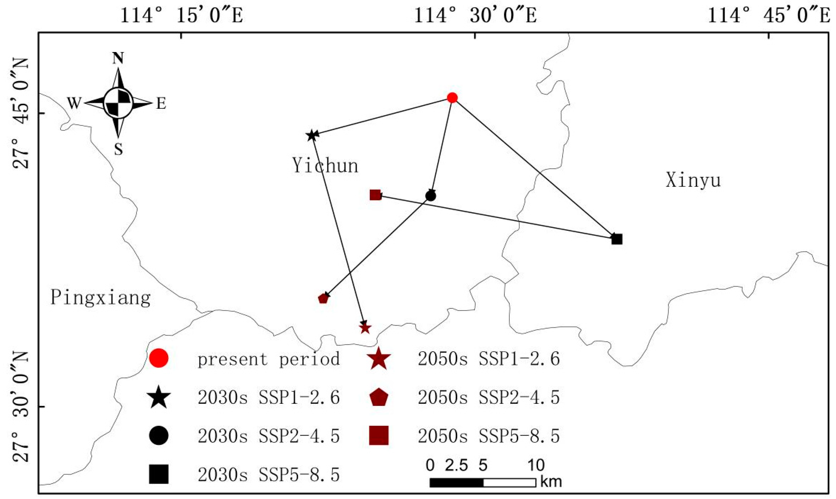
In this study, zones of potential ecological suitability for T. chinensis in the hilly area of Jiangnan and their influencing factors were modeled using meteorological data for three time periods in the present (1970–2000) and the future (2030s and 2050s) in combination with topographic and soil data. MaxEnt results show AUC = 0.848, the model prediction accuracy is high, and the prediction results are credible, from which the main conclusions can be summarized as follows.
The main environmental factors affecting the distribution of T. chinensis, in descending order, are Bio_18, Bio_15, Asp, Alt, Bio_5, and BS. According to the single-factor analysis, areas with medium altitude, a northeast or northwest slope orientation, a warmest quarterly precipitation between 508.3 and 629.2 mm, a maximum temperature in the warmest month between 34.6 and 35.9 °C, and relatively moist soil are most suitable for growing T. chinensis.
The results show that the area of suitable habitat for T. chinensis is 6.09 × 10⁵ km2, and this is widely distributed across the whole study area. The area of high habitat suitability is 7.56 × 10⁴ km2, and this is concentrated in northern Guangdong, northern Guangxi, southern Hubei, eastern Chongqing, southern Zhejiang, southern Jiangxi, western Fujian, and southern Hunan, and these are the key regions for in situ investigations.
With the warming of the climate, the original area of suitable habitat for T. chinensis remains unchanged, and the general trend is actually an increase.
Finally, although this study compared and screened 16 climate, topography, and soil factors for simulation, some more important environmental factors were still neglected. These include the intensity of human activities, biological invasion, and other factors. Follow-up studies can add these factors to further improve the accuracy and credibility of the predictions of the MaxEnt model.

Author Contributions

All authors contributed extensively to this work. Conceptualization, R.B. and X.Z.; methodology, R.B. and X.X.; software, R.B. and J.L.; investigation, R.B. and J.L.; resources, R.B.; data curation, R.B. and X.Z.; writing—original draft preparation, R.B. and X.Z.; writing—review and editing, J.L., X.X. and X.L.; project administration, X.L.; funding acquisition, X.L., J.L., X.X. and C.W. All authors have read and agreed to the published version of the manuscript.

Funding

This research was funded by the Geological Survey Project of China Geological Survey (DD20230112; DD20230514; DD20242769; DD20242543) and the open project of Key Laboratory of Ecological Geochemistry of the Ministry of Natural Resources, “Study on the heavy metal migration and enrichment of soil heavy metals and bioeffectiveness of cropland in typical area of north Henan Province” (ZSDHJJ202303).

Data Availability Statement

All data generated or analyzed during this study are included in this published article.

Acknowledgments

The authors thank everyone who helped.

Conflicts of Interest

The authors declare no conflict of interest.

References

  1. Liao, W.B.; Zhang, X.Z.; Sun, Z.R. Importance and exigency on study of protection biology of anticancer plant Taxus mairei. Ecol. Sci. 1996, 2, 19–22. [Google Scholar]
  2. Zhang, J.T.; Ru, W.M. Population characteristics of endangered species Taxus chinensis var. mairei and its conservation strategy in Shanxi, China. Popul. Ecol. 2010, 52, 407–416. [Google Scholar] [CrossRef]
  3. Chen, X.; Xu, X.; Yuan, H.; Luo, T.; Cui, H.; Zhu, T.; Li, S.; Liu, Y.; Lin, T.; Qiao, T.; et al. Nigrospora musae Causing T. mairei stem blight in Sichuan, China. Plant Dis. 2023, 107, 4032. [Google Scholar] [CrossRef] [PubMed]
  4. Bao, W.K.; Chen, Q.H. Present status, problems, and further development strategies on natural TAXUS resource and their exploitation in China. J. Nat. Resour. 1998, 4, 88–93. [Google Scholar]
  5. Elith, J.; Leathwick, J.R. Species distribution models: Ecological explanation and prediction across space and time. Annu. Rev. Ecol. Evol. Syst. 2009, 40, 677–697. [Google Scholar] [CrossRef]
  6. Busby, J.R. Bioclim: A bioclimate analysis and prediction system. Plant Prot. Q. 1991, 6, 8–9. [Google Scholar]
  7. Elith, J.; Graham, C.H.; Anderson, R.P.; Dudik, M.; Ferrier, S.; Guisan, A.; Hijmans, R.J.; Huettmann, F.; Leathwick, J.R.; Lehmann, A. Novel methods improve prediction of species’ distributions from occurrence data. Ecography 2006, 2, 29. [Google Scholar] [CrossRef]
  8. Stockwell, D.; Peters, D.P. The GARP modelling system: Problems and solutions to automated spatial prediction. Int. J. Geogr. Inf. Sci. 1999, 13, 143–158. [Google Scholar] [CrossRef]
  9. Hirzel, A.H.; Hausser, J.; Chessel, D.; Perrin, N. Ecological-niche factor analysis: How to compute habitat-suitability maps without absence data? Ecology 2002, 83, 2027–2036. [Google Scholar] [CrossRef]
  10. Zhao, Q.; Li, H.; Chen, C.; Fan, S.; Wei, J.; Cai, B.; Zhang, H. Potential Global Distribution of Paracoccus marginatus, under Climate Change Conditions, Using MaxEnt. Insects 2024, 15, 98. [Google Scholar] [CrossRef]
  11. Ahmadi, M.; Hemami, M.R.; Kaboli, M.; Shabani, F. MaxEnt brings comparable results when the input data are being completed; Model parameterization of four species distribution models. Ecol. Evol. 2023, 13, e9827. [Google Scholar] [CrossRef] [PubMed]
  12. Zhang, W.P.; Hu, Y.Y.; Li, Z.H.; Feng, X.P.; Li, D.W. Predicting suitable distribution areas of Juniperus przewalskii in Qinghai Province under climate change scenarios. Ying Yong Sheng Tai Xue Bao 2021, 32, 2514–2524. [Google Scholar] [CrossRef] [PubMed]
  13. Guo, J.; Liu, X.P.; Zhang, Q.; Zhang, D.F.; Xie, C.X.; Liu, X. Prediction for the potential distribution area of Codonopsis pilosula at global scale based on Maxent model. Ying Yong Sheng Tai Xue Bao 2017, 28, 992–1000. [Google Scholar] [CrossRef] [PubMed]
  14. Li, Y.C.; Li, M.Y.; Li, C.; Liu, Z.Z. Optimized Maxent model predictions of climate change impacts on the suitable distribution of Cunninghamia lanceolata in China. Forests 2020, 11, 302. [Google Scholar] [CrossRef]
  15. Meena, R.K.; Bhandari, M.S.; Thakur, P.K.; Negi, N.; Pandey, S.; Kant, R.; Sharma, R.; Sahu, N.; Avtar, R. MaxEnt-Based Potential Distribution Mapping and Range Shift under Future Climatic Scenarios for an Alpine Bamboo Thamnocalamus spathiflorus in Northwestern Himalayas. Land 2024, 13, 931. [Google Scholar] [CrossRef]
  16. Zhang, L.; Jiang, B.; Meng, Y.; Jia, Y.; Xu, Q.; Pan, Y. The Influence of Climate Change on the Distribution of Hibiscus mutabilis in China: MaxEnt Model-Based Prediction. Plants 2024, 13, 1744. [Google Scholar] [CrossRef]
  17. Chen, G.Y. Analysis on the influence of the climate changes on the global vegetation. IOP Conf. S. Earth Environ. Sci. 2020, 546, 032049. [Google Scholar] [CrossRef]
  18. Gao, R.M.; Shi, X.D.; Fan, L.Y.; Sun, Y.Y.; Guo, X.H. Natural distribution and community ecological characteristics of Taxus chinensis var. mairei in Shanxi Province, China. Ying Yong Sheng Tai Xue Bao 2016, 27, 1820–1828. [Google Scholar] [CrossRef] [PubMed]
  19. Li, Y.H.; Zhang, L.J.; Zhu, W.B.; Zhang, J.J.; Xu, S.B.; Zhu, L.Q. Changes of Taxus chinensis var. mairei habitat distribution under global climate change. J. Nat. Resour. 2021, 36, 783–792. [Google Scholar] [CrossRef]
  20. Wu, X.T.; Wang, M.Q.; Li, X.Y.; Yan, Y.D.; Dai, M.J.; Xie, W.Y.; Zhou, X.F.; Zhang, D.L.; Wen, Y.F. Response of distribution patterns of two closely related species in Taxus genus to climate change since last inter-glacial. Ecol. Evol. 2022, 12, e9302. [Google Scholar] [CrossRef]
  21. Cao, J.W.; Liu, C.L.; Wu, Y.; LI, H.A.; Yin, D.J.; Wu, X.L.; Wu, L.S.; Xu, W. Effects of different rooting agent concentration and different substrate types oncuttings rooting of Taxus wallichiana var. Marirei. J. Cent. S. Univ. For. Technol. 2013, 33, 10–14. [Google Scholar]
  22. Li, N.W.; Hu, S.N.; Shu, X.C.; Qing, W.; Bing, X.; Feng, P. Genetic diversity and structure analyses of wild and ex-situ conservation populations of Taxus chinensis var. mairei based on ISSR marker. J. Plant Resour. Environ. 2011, 20, 25–30. [Google Scholar] [CrossRef]
  23. Zhang, D.Q.; Zhou, N. Genetic diversity and population structure of the endangered conifer Taxus wallichiana var. mairei (Taxaceae) revealed by simple sequence repeat (SSR) markers. Biochem. Syst. Ecol. 2013, 49, 107–114. [Google Scholar] [CrossRef]
  24. Lange, B.M.; Conner, C.F. Taxanes and taxoids of the genus Taxus—A comprehensive inventory of chemical diversity. Phytochemistry 2021, 190, 112829. [Google Scholar] [CrossRef] [PubMed]
  25. Shi, Q.W.; Oritani, T.; Sugiyama, T.; Horiguchi, T.; Murakami, R.; Zhao, D.; Oritani, T. Three new taxane diterpenoids from the seeds of Taxus yunnanensis Cheng et al. K. Fu and T. cuspidata Sieb et Zucc. Tetrahedron 1999, 55, 8365–8376. [Google Scholar] [CrossRef]
  26. Xiong, X.Y.; Gou, J.B.; Liao, Q.G.; Li, Y.L.; Zhou, Q.; Bi, G.; Li, C.; Du, R.; Wang, X.; Sun, T.; et al. The Taxus genome provides insights into paclitaxel biosynthesis. Nat. Plants 2021, 7, 1026–1036. [Google Scholar] [CrossRef] [PubMed]
  27. O’Neill, B.C.; Tebaldi, C.; van Vuuren, D.P.; Eyring, V.; Friedlingstein, P.; Hurtt, G.; Knutti, R.; Kriegler, E.; Lamarque, J.-F.; Lowe, J.; et al. The scenario model intercomparison project (ScenarioMIP) for CMIP6. Geosci. Model Dev. 2016, 9, 3461–3482. [Google Scholar] [CrossRef]
  28. Chen, B.B. Molecular Phylogeographic and Genetic Diversity of Taxus L. Taxaeae 2017 in China. Ph.D. Thesis, Chinese Academy of Forestry, Beijing, China, 2017. [Google Scholar]
  29. Fu, X.F. Diversity of Arbuscular Mycorrhizal Fungi in Rhizosphere Soil of Taxus chinensis var. mairei and the Inoculation Effects of PSB and AMF on Host Plant. Master’s Thesis, Shanxi Normal University, Xi’an, China, 2018. [Google Scholar]
  30. Wang, Y.; Zhang, R.; Feng, J.G.; Zhou, H.M.; Meng, X.D.; Zhou, Z.C. Analysis on growth difference of Taxus wallichiana var. mairei from different provenances and selection of fast-growing provenances at early age. J. Plant Resour. Environ. 2012, 21, 41–47. [Google Scholar]
  31. Xie, W.D. Resource Status and Distribution Characteristics of Taxus chinensis var. mairei in Nanling Mountain. Ph.D. Thesis, Central South University of Forestry and Technology, Changsha, China, 2017. [Google Scholar]
  32. Zhang, X.M.; Li, D.Z.; Gao, L.M. Phylogeographical Study on Taxus wallichiana var. mairei (Lemée & Léveillé) L.K.Fu & Nan Li. Acta Bot. Boreali-Occident. Sin. 2012, 32, 1983–1989. [Google Scholar]
  33. Byeon, D.H.; Kim, S.H.; Jung, J.M.; Jung, S.; Kim, K.H.; Lee, W.H. Climate-based ensemble modelling to evaluate the global distribution of Anoplophora glabripennis (Motschulsky). Agric. For. Entomol. 2021, 23, 569–583. [Google Scholar] [CrossRef]
  34. Srivastava, V.; Roe, A.D.; Keena, M.A.; Hamelin, R.C.; Griess, V.C. Oh the places they’ll go: Improving species distribution modelling for invasive forest pests in an uncertain world. Biol. Invasions 2021, 23, 297–349. [Google Scholar] [CrossRef]
  35. Phillips, S.J.; Anderson, R.P.; Schapire, R.E. Maximum entropy modeling of species geographic distributions. Ecol. Model. 2006, 190, 231–259. [Google Scholar] [CrossRef]
  36. Liu, Y.; Miao, C.; Wang, H.S. Influence of climate change on distribution of suitable areas of Larix plantation in China. Acta Ecol. Sin. 2023, 43, 9686–9698. [Google Scholar]
  37. Zhang, K.; Liu, Z.; Abdukeyum, N.; Ling, Y. Potential Geographical Distribution of Medicinal Plant Ephedra sinica Stapf under Climate Change. Forests 2022, 13, 2149. [Google Scholar] [CrossRef]
  38. Yi, Y.J.; Cheng, X.; Yang, Z.F. Maxent modeling for predicting the potential distribution of endangered medicinal plant (H. riparia Lour) in Yunnan, China. Ecological engineering. J. Ecotechnology 2016, 92, 260–269. [Google Scholar]
  39. Peterson, A.T.; Soberón, J.; Pearson, R.G.; Anderson, R.P.; Martínez-Meyer, E.; Nakamura, M.; Araújo, M.B. Ecological Niches and Geographic Distributions; Princeton University Press: Princeton, NJ, USA, 2011. [Google Scholar] [CrossRef]
  40. Li, Y.J.; De, Y.J.; Liu, Y.X.; Zhang, G.S. Suitability region for Xanthoceras sorbifolium Bunge in inner Mongolia based onMaxEnt and ArcGlS models. J. West China For. Sci. 2021, 50, 66–73+81. [Google Scholar] [CrossRef] [PubMed]
  41. Cai, Q.Q.; An, M.T.; Yu, J.H.; Tian, L.; Wu, M.X. Suitable habitat prediction of Pinus kwangtungensis in China under climate change. J. Shaanxi Norm. Univ. (Nat. Sci. Ed.) 2024, 52, 90–102. [Google Scholar]
  42. Zhou, B.J.; Wang, Y.J.; Ma, C.L.; Fan, Z.F.; Zheng, J.H. Analysis of potential habitat of Torreya yunnanensis based on MaxEnt and ArcGlS. Acta Ecol. Sin. 2022, 42, 4485–4493. [Google Scholar]
  43. Xie, C.P. The Geographical Distribution of Taxus wallichiana var. mairei and Recommendations Concerning lts Protection in China. J. Sichuan Agric. Univ. 2013, 31, 277–282. [Google Scholar]
  44. Ru, W.M.; Zhang, J.T.; Zhang, F.; Zhang, G.P. Eco-environmental characteristics and endangered causes of Taxus mairei, an endemic to China. Bull. Bot. Res. 2006, 5, 624–628. [Google Scholar]
Figure 1. Schematic distribution of T. chinensis in the Jiangnan hilly region.
Forests 15 01238 g001
Figure 2. ROC and AUC of the T. chinensis suitable habitat region model.
Forests 15 01238 g002
Figure 3. Results of using the knife-cut method to test the importance of ecological factors on the distribution of T. chinensis.
Forests 15 01238 g003
Figure 4. Response curves for major environmental factors in T. chinensis fitness zones: (a) precipitation of the warmest quarter; (b) precipitation seasonality variation coefficient; (c) aspect; (d) altitude; (e) maximum temperature of the warmest month; (f) base saturation.
Forests 15 01238 g004
Figure 5. Map of ecological suitability zoning for T. chinensis in the Jiangnan hilly region.
Forests 15 01238 g005
Figure 6. Maps of T. chinensis habitat suitability under different future climate scenarios.
Forests 15 01238 g006
Figure 7. Variation of center of mass of suitable habitat for T. chinensis under different climate scenarios.
Forests 15 01238 g007
Table 1. Environmental variables in this study.
Variable TypeEnvironmental VariableDescriptions
Climate factorBio_1Annual mean temperature (°C)
Bio_2Mean diurnal range (°C)
Bio_3Isothermality [(Bio_2/Bio_7) × 100]
Bio_4Standard deviation of seasonal variation of temperature
Bio_5Maximum temperature of warmest month (°C)
Bio_6Minimum temperature of coldest month (°C)
Bio_7Temperature annual range (Bio_5/Bio_6) (°C)
Bio_8Mean temperature of wettest quarter (°C)
Bio_9Mean temperature of driest quarter (°C)
Bio_10Mean temperature of warmest quarter (°C)
Bio_11Mean temperature of coldest quarter (°C)
Bio_12Annual precipitation (mm)
Bio_13Precipitation of wettest period (mm)
Bio_14Precipitation of driest period (mm)
Bio_15Precipitation seasonality variation coefficient
Bio_16Precipitation of wettest quarter (mm)
Bio_17Precipitation of driest quarter (mm)
Bio_18Precipitation of warmest quarter (mm)
Bio_19Precipitation of coldest quarter (mm)
Terrain factorAltAltitude (m)
SloSlope (%)
AspAspect (°)
Soil factorDrainageDrainage class
REF_DEPTHReference soil depth
AWC_ClassAvailable water capacity range
phaseSoil phase
gravelGravel content
SandSand content
SiltSilt content
ClayClay content
REF_BULKReference bulk density
OCOrganic carbon
PH_H2OpH (H2O)
CEC_ClayCopper ethylenediamine complex (clay)
CEC_soilCopper ethylenediamine complex (soil)
BSBase saturation
CaCO3Calcium carbonate
CaSO4Gypsum
ESPSodicity (Soil exchangeable sodium percentage)
ECeConductivity
Table 2. The 16 environmental variables used for model prediction.
Variable TypeEnvironmental Variable
Climate factorBio_4
Bio_5
Bio_11
Bio_12
Bio_13
Bio_15
Bio_18
Bio_19
Terrain factorAlt
Asp
AWC_Class
Silt
Soil factorClay
OC
BS
CaCO3
Table 3. Contributions of 16 environmental factors.
Environmental VariableContribution Rate (%)
Bio_1814.2
Bio_159.1
Asp8.2
Alt8.0
Bio_57.4
BS6.6
Bio_46.2
CaCO35.9
Bio_115.9
Bio_195.7
Slo5.2
Bio_125.0
Clay4.8
AWC_Class3.2
OC2.5
Silt2.1
Table 4. Suitable ranges for major environmental factors.
Environment VariableOptimal RangeOptimal Value
Bio_18508.3–629.2 mm543.1 mm
Bio_1537.2–41.0, 53.8–62.761.0
Asp8.4–33.1°, 244.4–355.3°15.7°
Alt111.7–1351.2 m1078.9 m
Bio_520.5–29.7 °C, 33.8–35.9 °C34.6 °C
BS71.2–110.0100.2
Table 5. Area of habitat suitable for T. chinensis in each province.
ProvinceLow Habitat SuitabilityMedium Habitat SuitabilityHigh Habitat Suitability
Zhejiang3.32 × 104 km22.59 × 104 km21.14 × 104 km2
Anhui1.28 × 104 km20.79 × 104 km20.32 × 104 km2
Jiangxi7.20 × 104 km25.42 × 104 km21.56 × 104 km2
Guangdong1.22 × 104 km20.99 × 104 km20.34 × 104 km2
Guangxi2.74 × 104 km21.65 × 104 km20.77 × 104 km2
Hunan7.37 × 104 km24.43 × 104 km21.65 × 104 km2
Hubei1.44 × 104 km21.29 × 104 km20.70 × 104 km2
Fujian3.38 × 104 km23.47 × 104 km20.85 × 104 km2
Guizhou1.18 × 104 km20.61 × 104 km20.08 × 104 km2
Chongqing0.84 × 104 km21.05 × 104 km20.15 × 104 km2
Table 6. Changes in the areas of suitable habitat for T. chinensis under different predicted climate scenarios (104 km2).
PeriodPresent Period2030s2050s
SSP1-2.6SSP2-4.5SSP5-8.5SSP1-2.6SSP2-4.5SSP5-8.5
Low habitat suitability30.0432.1828.5130.7332.1215.9731.30
Medium habitat suitability23.3324.3628.2525.0425.0326.0427.55
High habitat suitability7.566.888.146.477.429.158.15
Overall habitat suitability60.9363.4164.8962.2464.5751.1667.00
Disclaimer/Publisher’s Note: The statements, opinions and data contained in all publications are solely those of the individual author(s) and contributor(s) and not of MDPI and/or the editor(s). MDPI and/or the editor(s) disclaim responsibility for any injury to people or property resulting from any ideas, methods, instructions or products referred to in the content.

