Article

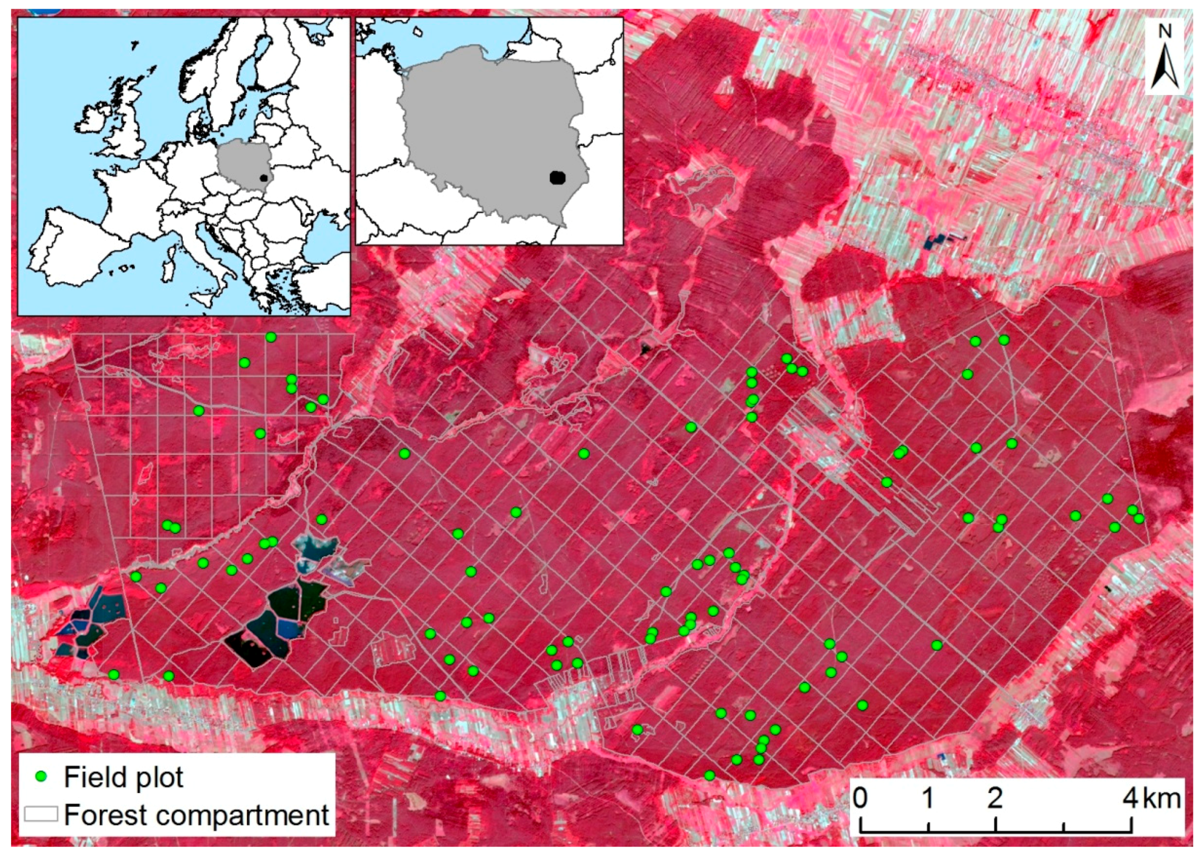
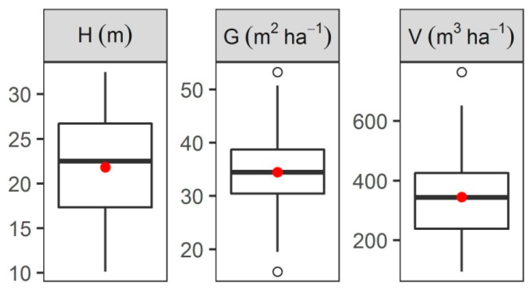
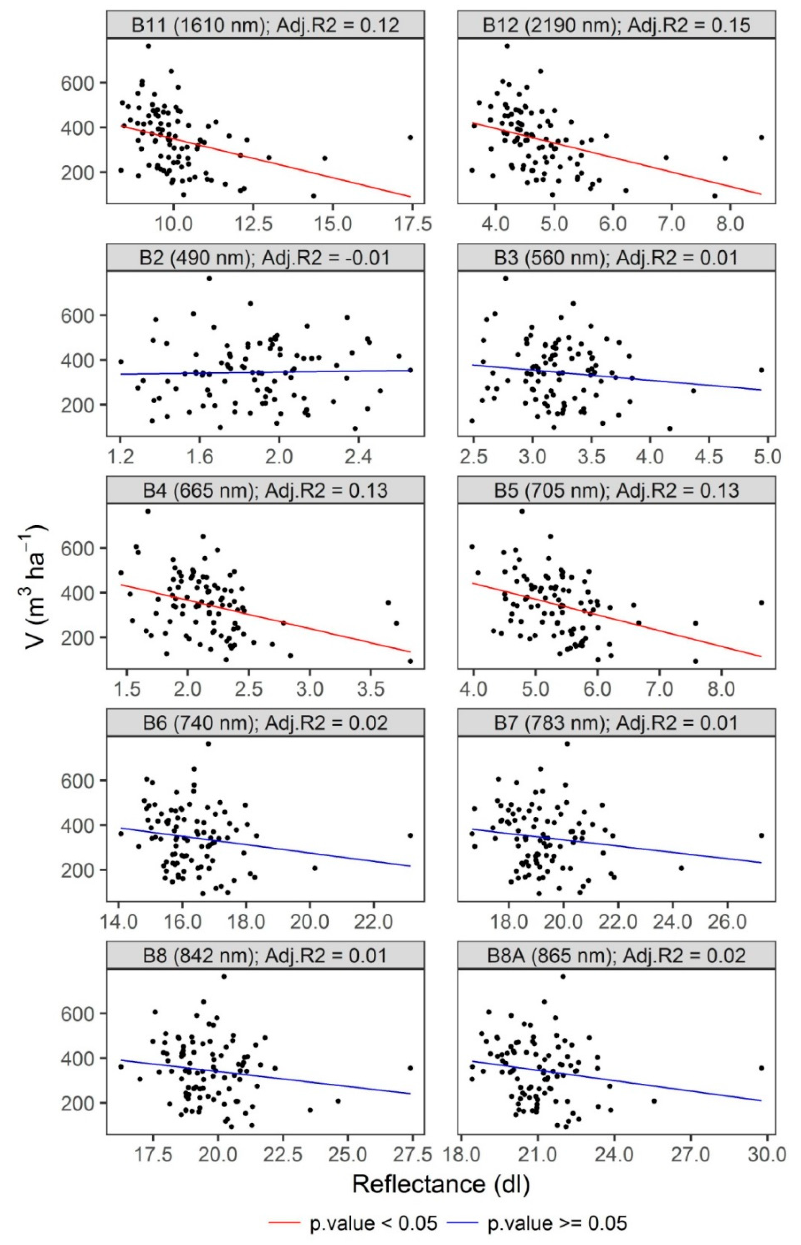
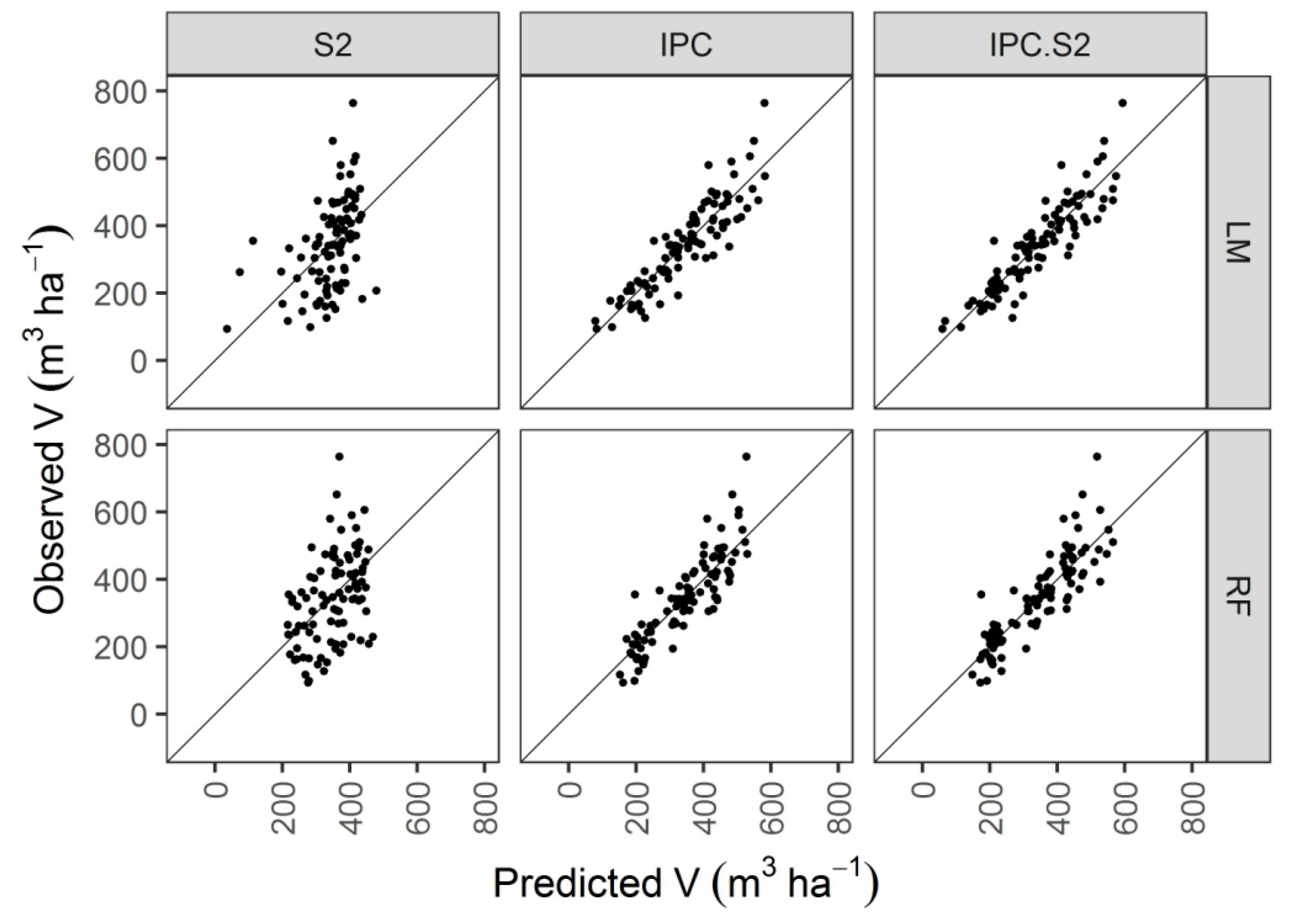
Predicting Growing Stock Volume of Scots Pine Stands Using Sentinel-2 Satellite Imagery and Airborne Image-Derived Point Clouds
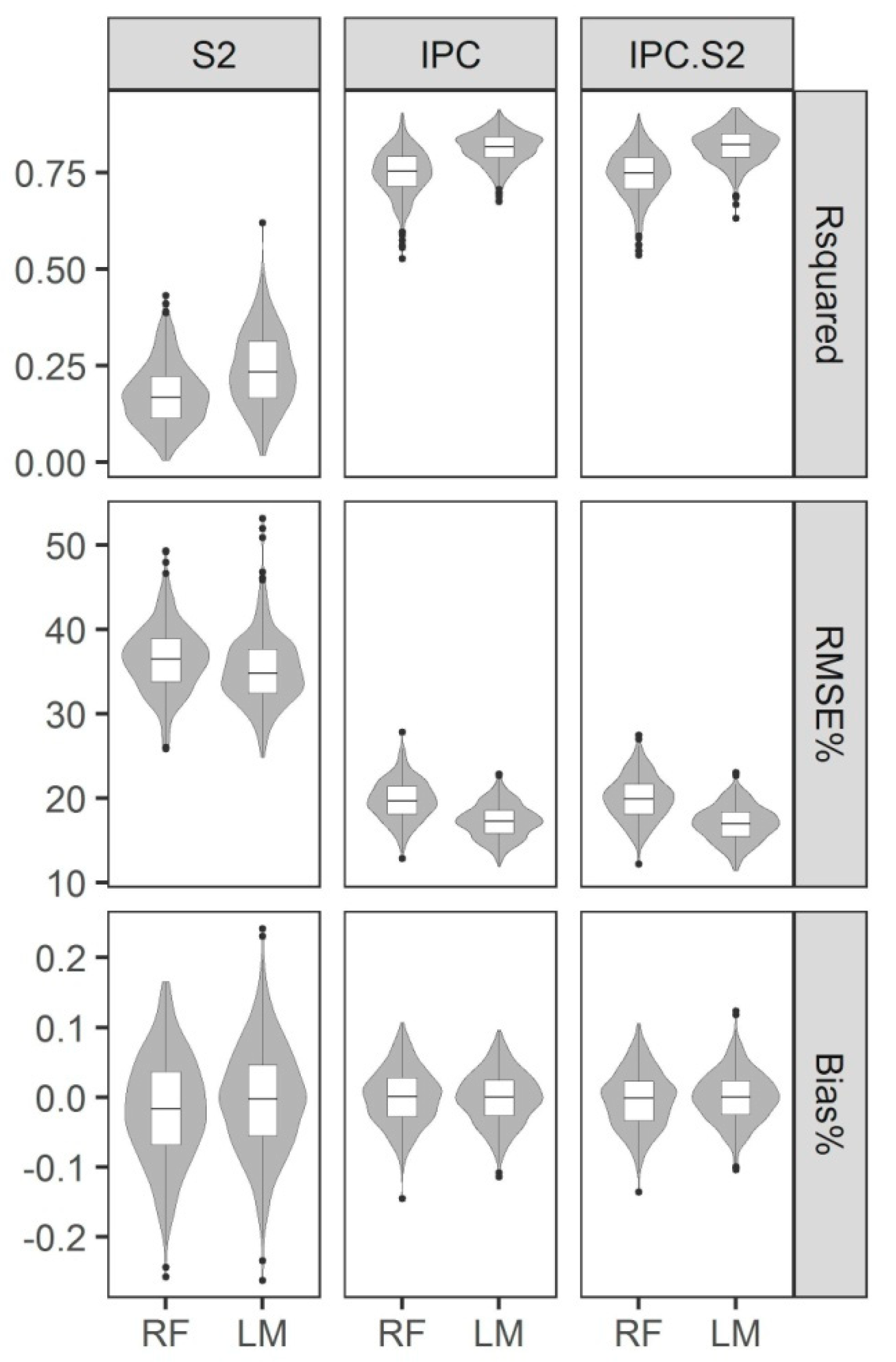
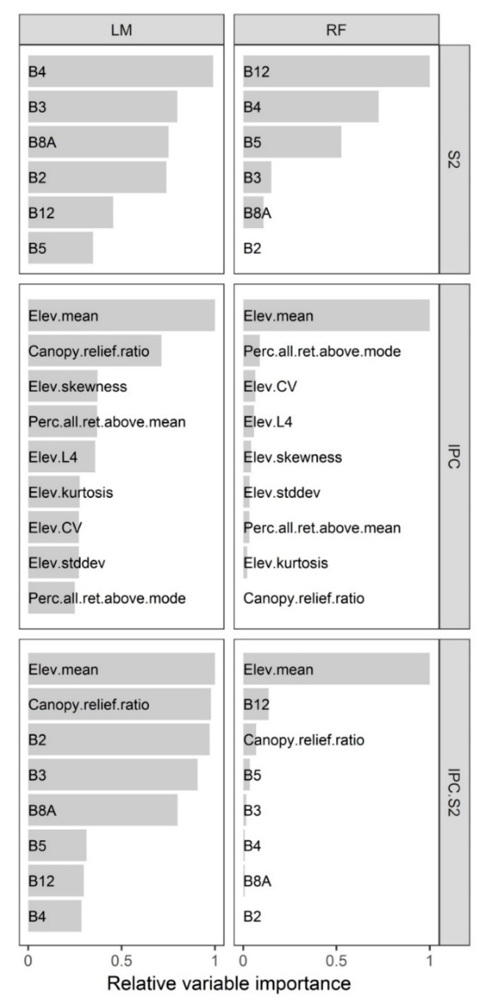
Department of Forest Management, Geomatics and Forest Economics, Institute of Forest Resources Management, Faculty of Forestry, University of Agriculture in Krakow, Al. 29 Listopada 46, 31-425 Krakow, Poland
*
Author to whom correspondence should be addressed.
Forests 2018, 9(5), 274; https://doi.org/10.3390/f9050274
Submission received: 16 April 2018 / Revised: 14 May 2018 / Accepted: 16 May 2018 / Published: 17 May 2018
(This article belongs to the Section Forest Inventory, Modeling and Remote Sensing)

Abstract

Estimation of forest stand parameters using remotely sensed data has considerable significance for sustainable forest management. Wide and free access to the collection of medium-resolution optical multispectral Sentinel-2 satellite images is very important for the practical application of remote sensing technology in forestry. This study assessed the accuracy of Sentinel-2-based growing stock volume predictive models of single canopy layer Scots pine (Pinus sylvestris L.) stands. We also investigated whether the inclusion of Sentinel-2 data improved the accuracy of models based on airborne image-derived point cloud data (IPC). A multiple linear regression (LM) and random forest (RF) methods were tested for generating predictive models. The measurements from 94 circular field plots (400 m2) were used as reference data. In general, the LM method provided more accurate models than the RF method. Models created using only Sentinel-2A images had low prediction accuracy and were characterized by a high root mean square error (RMSE%) of 35.14% and a low coefficient of determination (R2) of 0.24. Fusion of IPC data with Sentinel-2 reflectance values provided the most accurate model: RMSE% = 16.95% and R2 = 0.82. However, comparable accuracy was obtained using the IPC-based model: RMSE% = 17.26% and R2 = 0.81. The results showed that for single canopy layer Scots pine dominated stands the incorporation of Sentinel-2 satellite images into IPC-based growing stock volume predictive models did not significantly improve the model accuracy. From an operational point of view, the additional utilization of Sentinel-2 data is not justified in this context.
Keywords: area-based approach; image matching; structure from motion; random forest; timber volume area-based approach; image matching; structure from motion; random forest; timber volume

