4.1. Linear Relationship of Red Pine Trees with Burn Severity
The results of this study strongly support the findings of previous studies reporting close associations between red pine trees and burn severity. All of the analysis results in this study including the correlation analysis (
Table 1), estimated LM (
Table 2) and GAM (
Table 3) strongly suggested that higher percentages of red pine trees intensified the degree of burn severity, in agreement with numerous previous studies (e.g., [
3,
10,
18,
26]).
In particular, a comparison of the
β-values of independent variables in the estimated LM highlighted that the percentage of red pine trees was the primary determinant of burn severity. A few studies also reported a stronger association between burn severity and pre-fire forest cover type than topography or fire weather (e.g., [
19,
20]). For example, Lee et al. [
3] reported that the percentage of red pine trees was the most significant factor in explaining burn severity compared to topographic characteristics (i.e., elevation and slope) using regression tree analysis and landscape metrics. In their regression tree, the percentage of red pine trees appeared as the first-order variable in explaining burn severity, whereas the spatial configuration of red pine trees and topographic variables were the second and third order variables, respectively. Interestingly, Fang et al. [
19] quantified the relative importance of fire weather, fuel type and topography at the Great Xing’an Mountain fire site in northeast China. The authors reported that the spatial extent of burned area was determined primarily by the weather conditions during the fire event. However, burn severity was mostly influenced by fuel type and the weather condition during the fire event was a relatively less significant factor of burn severity than forest cover type and topography. Bigler et al. [
20] also reported that the most significant predictors of burn severity were pre-fire vegetation conditions and elevation in Rocky Mountain subalpine forests.
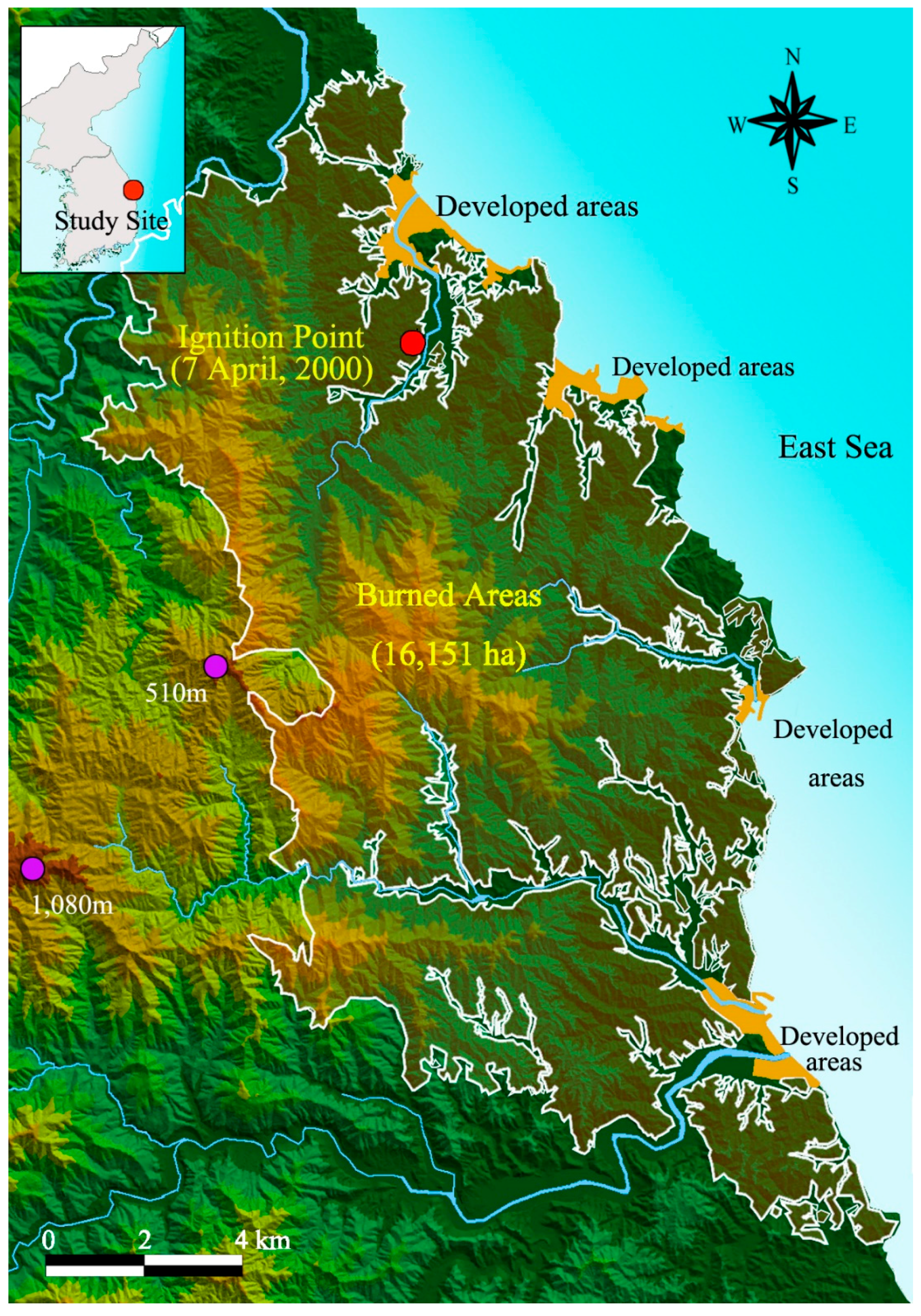
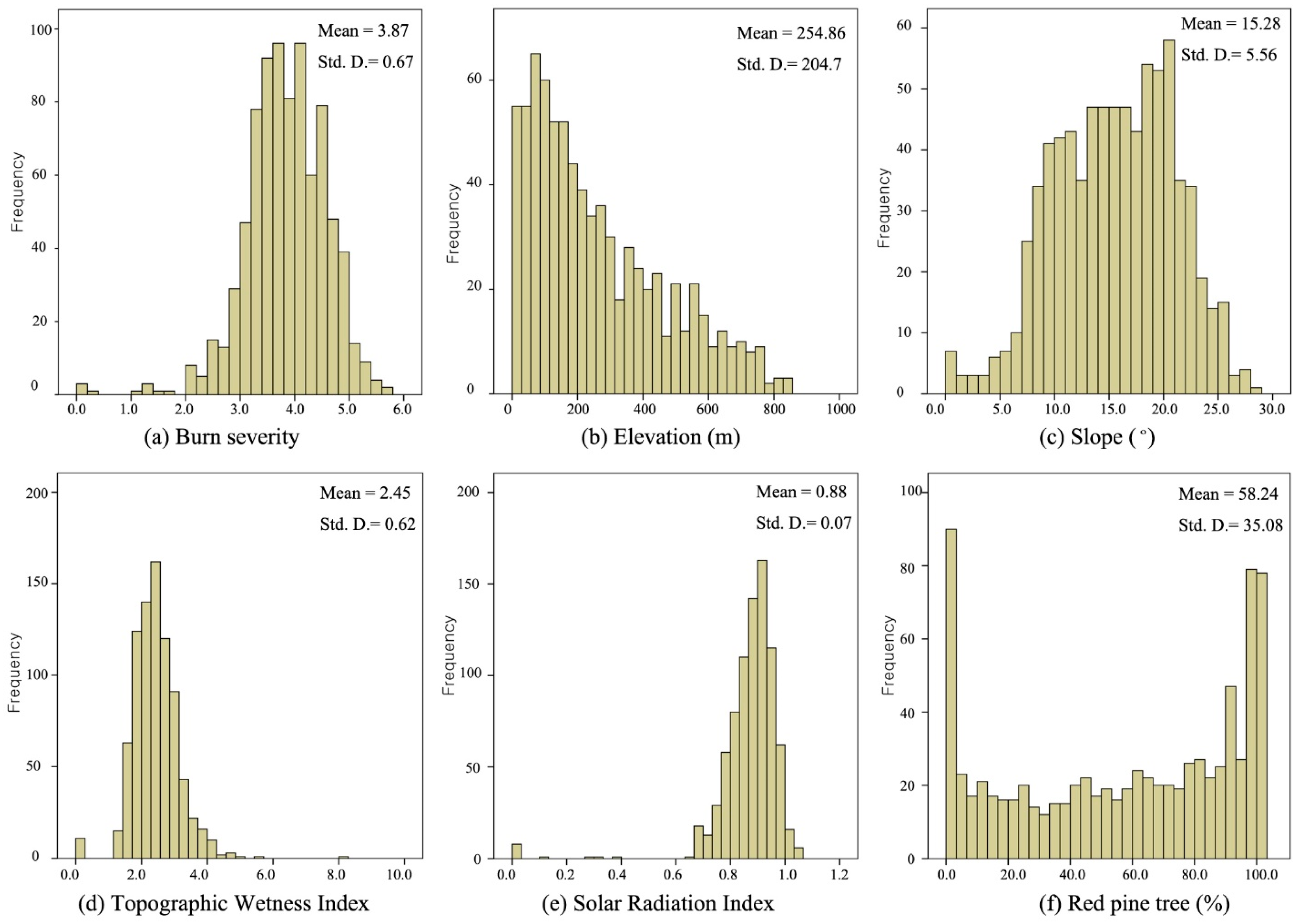
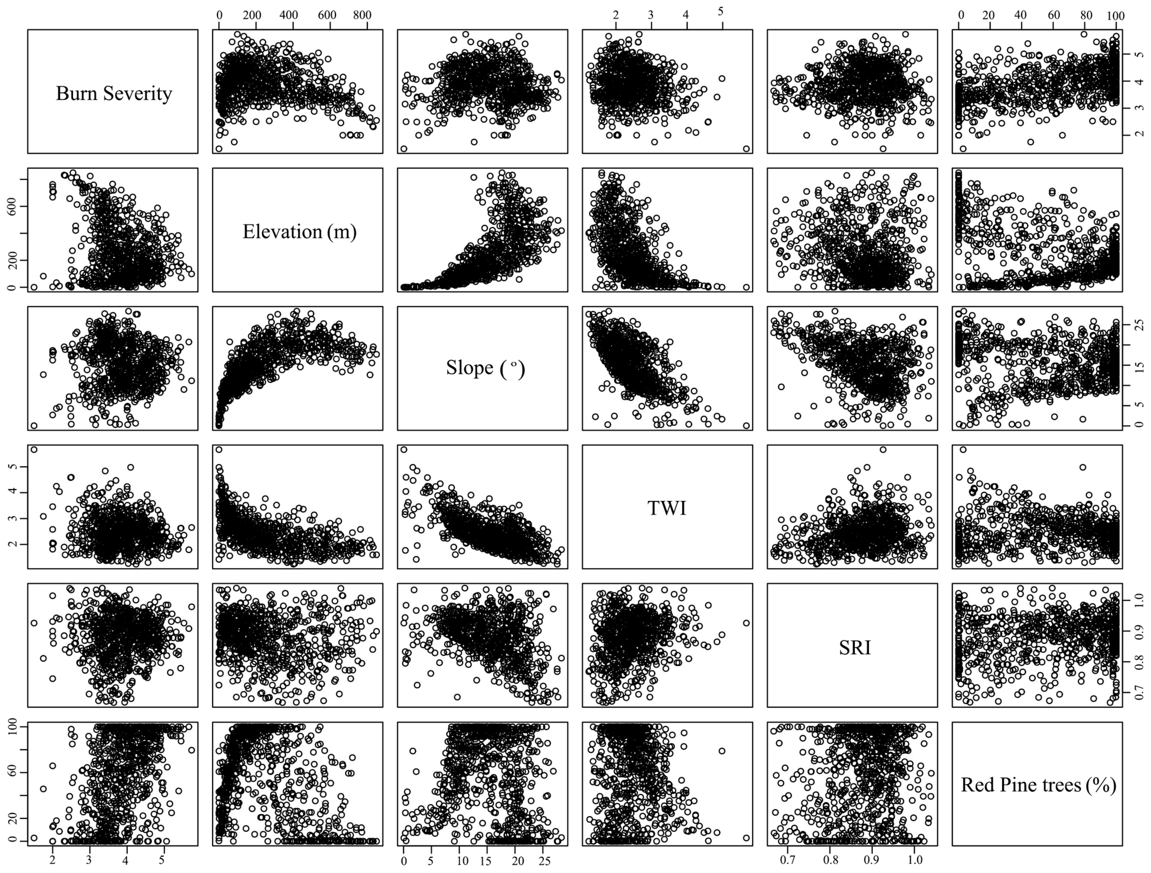
In addition, we found that the percentage of red pine trees in the grid cells was linearly associated with burn severity and a higher percentage of red pine trees in grids cells resulted in higher burn severity. The study area has complex and dynamic topographic characteristics, with great variation in elevation, slope, TWI and SRI (
Figure 3). According to the KFS [
31] fire report, there were substantial variations in wind speed and relative humidity during the fire event. Despite the variations in topographic characteristics and changes in weather conditions, forests with a higher percentage of red pine trees burned more severely than those with fewer pine trees.
However, we were unable to find many studies on the linear and nonlinear effects of susceptible tree cover types on burn severity. Ríos-Pena et al. [
50] modeled the occurrence of wildfires in Galicia, Spain, using binary structured additive regression. Although they did not directly examine the nonlinear effects of susceptible fuels on burn severity, their results suggested a linear relationship between red pine trees and burn severity. In addition, the study suggested that different fuel types had somewhat mixed linear and nonlinear effects on the occurrence of wildfire, where all tree-based fuels, including shrubs and wood residuals, had linear effects, while litter under trees had nonlinear effects. However, they did not provide clear explanations for the differences in the effects among fuel types. Moreover, elevation showed declining negative nonlinear effects on burn severity and the nonlinear effects of litter were due to the nonlinear effects of elevation. We observed similar linear effects of susceptible forest cover types. Considering that the burn process requires consumable fuels, this was unsurprising and emphasizes the importance of silviculture and forest management for fire-resilient forests, because fuel characteristics are the only manageable factors in the forest fire triangle (i.e., fuel, topography and fire weather).
The linear relationship between susceptible forest cover and burn severity in lowering the density of flammable trees in forests should be a priority in forest management, because the degree of burn severity is expected to rapidly decrease in response to a decrease in flammable trees in forests. However, severe fire weather conditions can overwhelm fuel and topographic characteristics due to a stronger association between weather and fire mechanisms and its higher variability compared to fuels [
19,
71]. Therefore, a strong linear relationship between red pine trees and burn severity might only occur under moderate weather conditions.
4.2. Non-Linear Relationship of Topographic Characteristics with Burn Severity
Topographic characteristics have direct impacts on burn severity and fire behavior during fire events. However, the relationships between burn severity and topographic characteristics (e.g., elevation, slope and aspect) remain somewhat controversial. For example, Lee et al. [
3] found negative correlations between burn severity and elevation in Samcheok, Korea. Similarly, Weatherspoon and Skinner [
72] reported that higher elevation was associated with lower burn severity because of cooler temperatures and higher humidity. In contrast, other studies have reported a positive association of burn severity with elevation and slope [
34,
73,
74]. For example, Fang et al. [
19] reported a strong association of severe burning with high elevations and steep slopes in the boreal forest of the Great Xing’an Mountains, China. The contradictory results of the effects of topography on burn severity are in part due to the complex interactions of topography with fuels and fire weather [
26,
29,
74], spatially varying effects [
30] and indirect effects. In addition, topography and burn severity may be associated in a nonlinear manner [
10]. Bigler et al. [
20] reported that the local effects of topography declined with increasingly severe fire weather, particularly across short elevation gradients. Therefore, it is difficult to generalize or simplify the relationships of topography with burn severity due to contradictory evidence from studies of forest fires and the complex nature of these relationships.
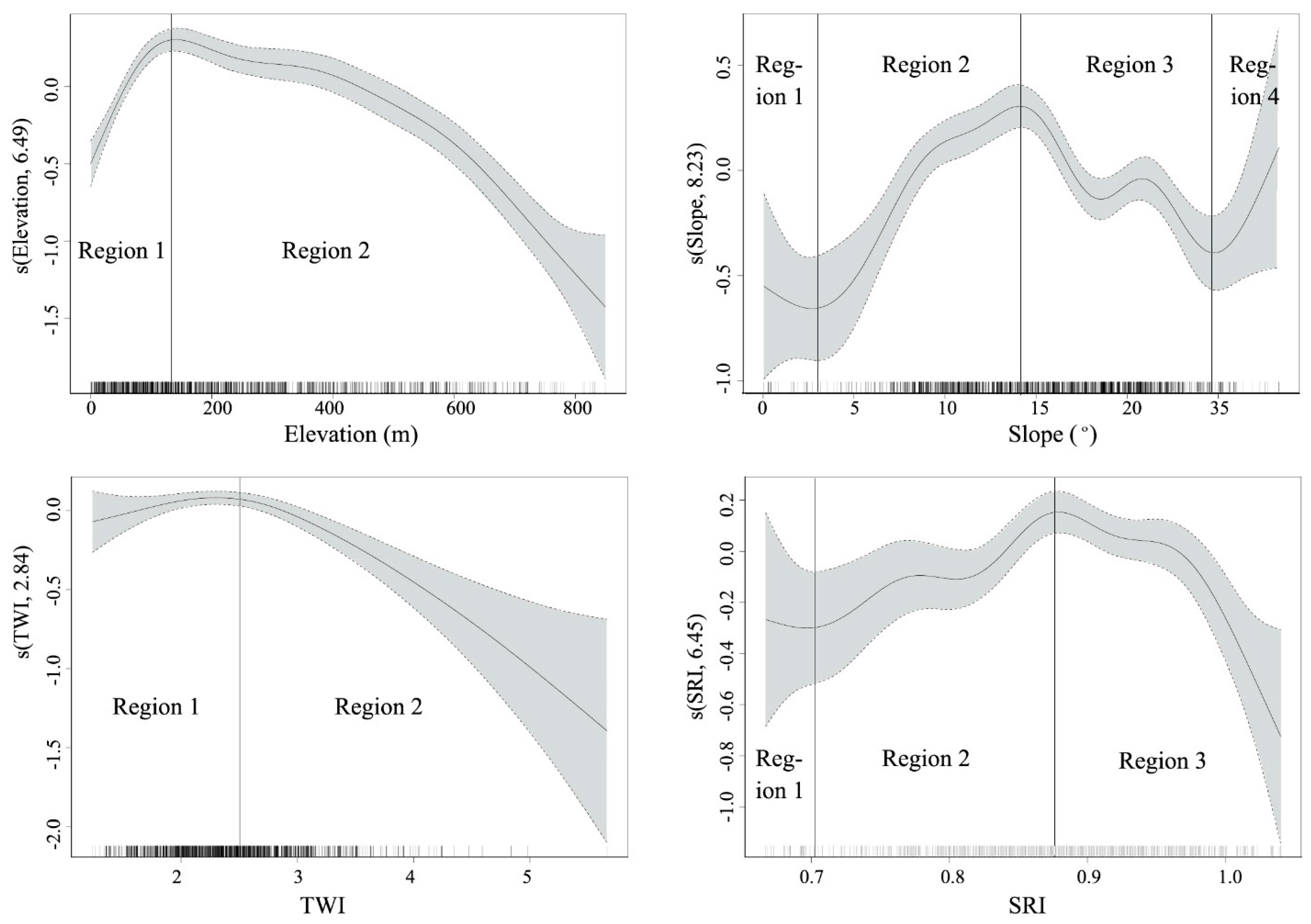
The effects of topographic variables including elevation, slope, TWI and SRI on burn severity in this study showed nonlinear relationships with burn severity, even changing from negative to positive relationships in some cases. The nonlinear effects of topographic characteristics in this study indicate that their influences on burn severity are not constant but rather, significantly vary in terms of the direction and degree of their influences. For example, the influences on burn severity at one location might differ from those at different locations at the same fire site. Therefore, the influences of topographic characteristics on burn severity should not be over-generalized to different studies performed at different geographic locations and other fire sites. The non-linear effects of topographic characteristics have been reported in several other studies (e.g., [
3,
66]). We considered two components of the effects of topography on burn severity, direct and indirect effects, although there are no clear-cut criteria to distinguish between these types of effects. Direct effects can be considered the physical settings, such as convex/concave terrain [
75] and slope gradient [
75], of a fire event. Meanwhile, indirect effects can be considered to affect the pre-fire conditions of fuel (e.g., composition, configuration, density, average stand diameter and long-term moisture) [
19,
76]. As Lee et al. [
3] discussed, it is neither clear nor well documented in fire research why topographic variables are nonlinearly associated with burn severity. However, these two components of topographic effects are involved in the relationship between topographic characteristics and burn severity. From the perspective of direct effects, the effects of susceptible tree cover might become too great, overriding the effects of topographic characteristics [
3]. Thus, burn severity could become more or less severe due to the availability of susceptible tree cover under the same topographic characteristics. Extending this rationale, additional causes of nonlinear effects of topographic variables could include the spatial variation in fuel distribution, fuel moisture, moisture content, temperature, precipitation and compounding effects [
3,
30,
66].
From the perspective of indirect effects, topographic characteristics could alter the long-term pre-fire conditions of fuels, in turn affecting direct effects. As confirmed in many other studies, pre-fire stand conditions such as tree density, canopy coverage, average stand diameter and beetle outbreak history have notable influences on the spatial patterns of fire severity [
20,
26,
77]. Therefore, burn severity should be understood based on the long-term interactions between topographic characteristics and fuels conditions and the spatial and temporal dimensions must be considered together; however, such a highly complex nonlinear relationship was beyond the scope of this study. Typically, the spatial distribution of fire severity is not linear with elevation and slope [
78,
79]. We observed similar patterns of red pine trees with elevation, slope, TWI and SRI at the study site, although we could not consider the temporal dimension. We estimated the GAM for the percentage of red pine trees with all topographic characteristics. The R
2 of the model was 0.578 and an identity link function was used to estimate the model (
Table 6). Therefore, elevation, slope, TWI and SRI explained about 57.8% of the percentage of red pine trees and the effects of the topographic variables were nonlinear. Elevation (EDF = 5.82) and slope (EDF = 6.94) showed stronger nonlinear patterns, while TWI (EDF = 1.59) exhibited a weaker nonlinear pattern. These results were consistent with the findings of Miller and Urban [
78], who reported nonlinear distributions
In Equation (4), the burn severity at a given location is defined by the constant, linear positive effects of red pine trees and the sum of the covariates of elevation, slope, TWI and SRI. From
Table 5, the linear effects of red pine trees in Equation (4) could be defined by the constant and the sum of the covariates of topographic variables, as shown in Equation (5).
where
g is the link function (identity) and s is the smooth function of each variable.
Nonetheless, elevation showed the strongest non-linear effect on burn severity, whereas slope, TWI and SRI appeared to have weak effects on burn severity. In addition, the separate GAMs for the percentage of red pine trees with each topographic variable indicated that elevation (Adj. R
2 = 0.50) was the primary factor affecting the distribution of red pine trees, while slope (Adj. R
2 = 0.22), TWI (Adj. R
2 = 0.07) and SRI (Adj. R
2 = 0.06) were less significant factors in the distribution of red pine trees. Elevation showed the strongest nonlinear effect on burn severity, whereas slope, TWI and SRI had weak effects on burn severity. However, the role of elevation on burn severity is somewhat confusing in fire research. Some studies have reported that elevation intensifies burn severity because surface fuels at high elevations typically dry more quickly due to good drainage and increased solar exposure [
19,
26,
80]. By contrast, other studies have reported negative effects of elevation on burn severity due to the higher productivity, vegetation density and fuel accumulation (e.g., [
3,
81]). However, our results suggested that the role of elevation on burn severity cannot be simplified, as suggested in previous studies and elevation can either increase or decrease burn severity at a given location depending the availability of susceptible fuels, overriding their effects and the pre-fire effects of elevation on the distribution on susceptible fuels.


