Urban Regeneration Projects Bound to Water, along and towards the Tagus Estuary (Portugal)

Abstract
1. Introduction
2. Materials and Methods
2.1. Reading the River as a Tool for the Planning of Urbanised Territories
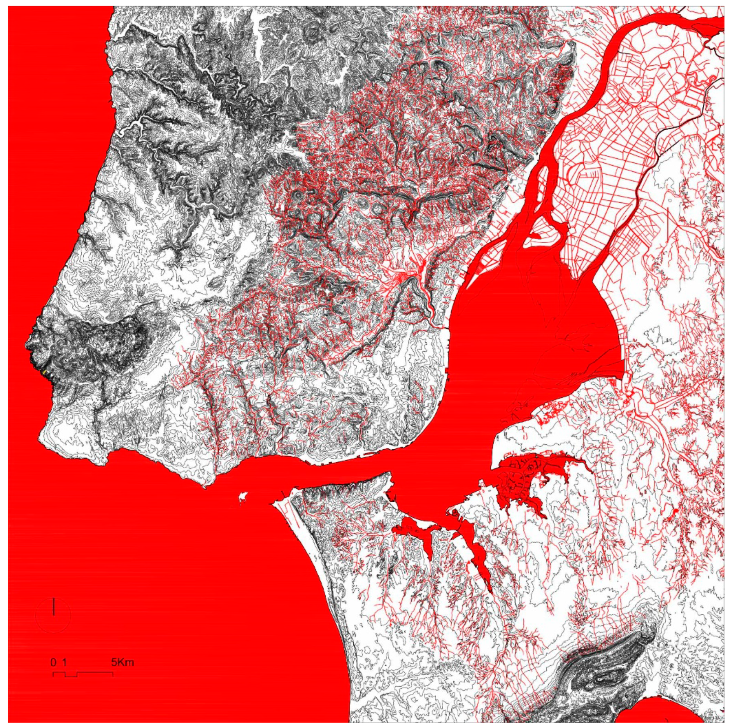
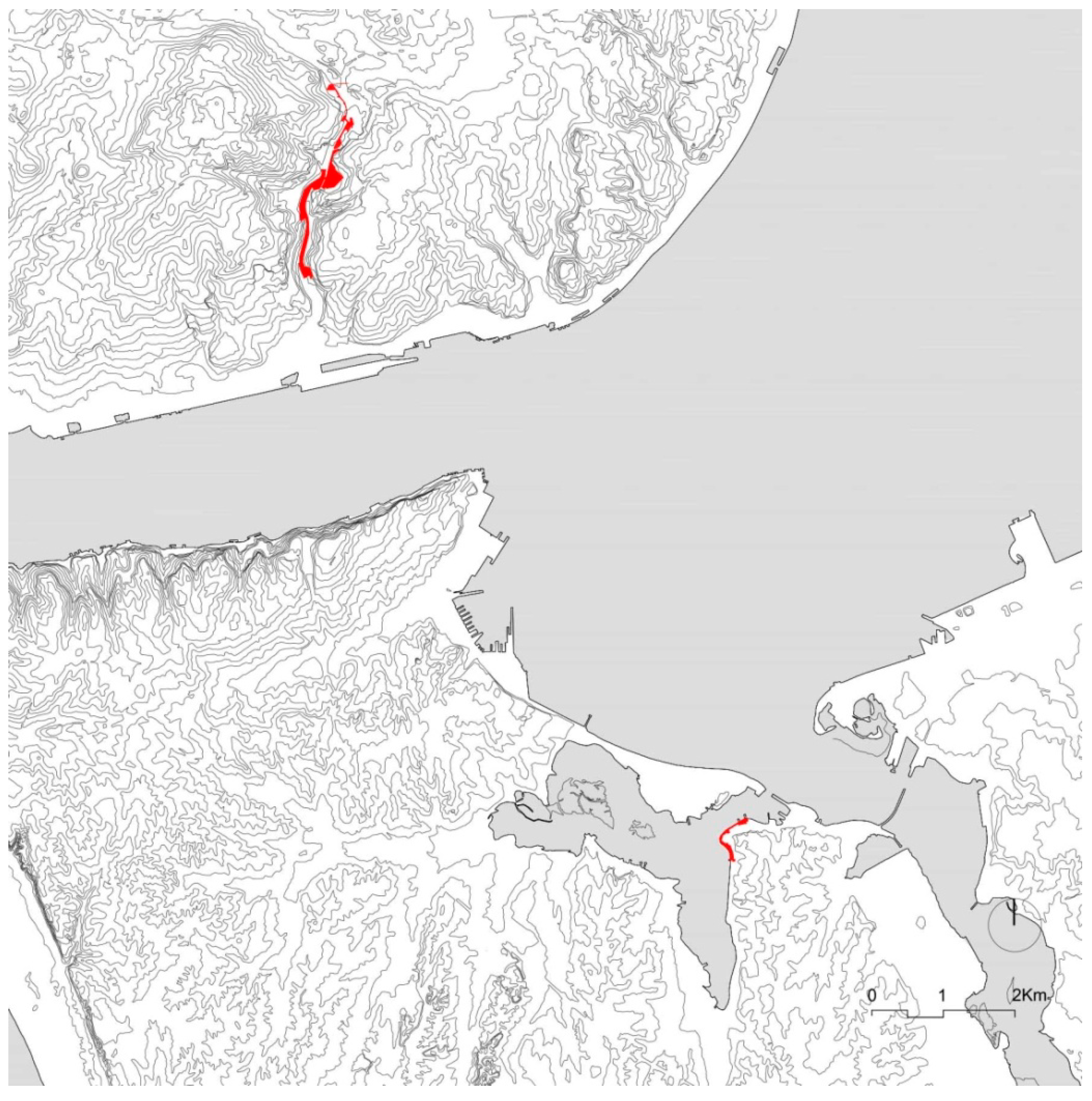
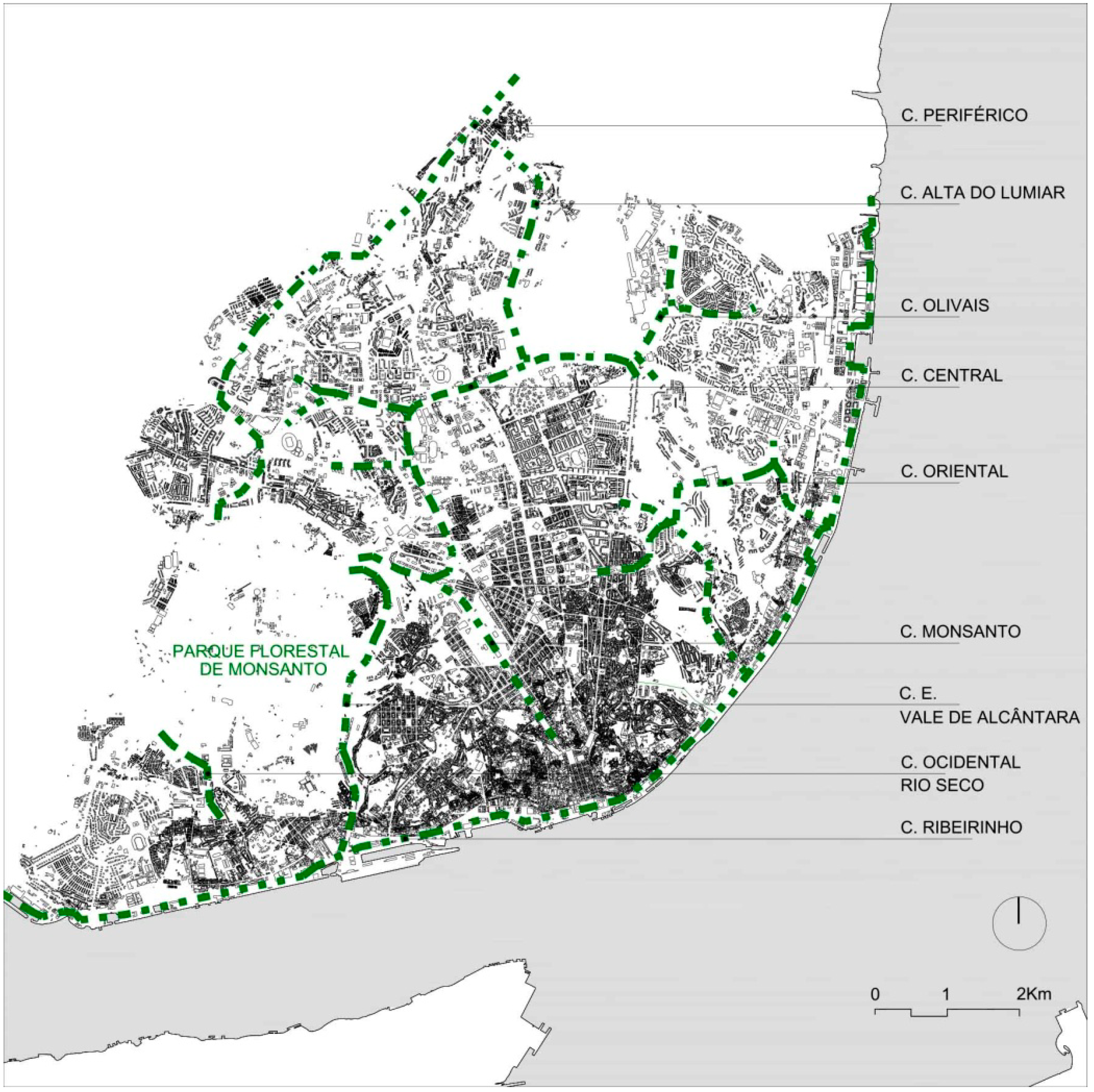
2.2. Along and towards the Main Watercourse (the Tagus Estuary)
- We place out attention first in understanding how the interventions aim to formulate or re-formulate the local urban relationship with water.
- Given the fact that an urban regeneration process leads to a new image of the city that often becomes ground for investors, the purpose of this work is to understand if water facilitates to the construction of a greener, more habitable, and safer CTE.
- From a broader point of view, the focus is on revealing how public actions can contribute to the enhancement of the riverbanks’ local identity as well as a wider Tagus Estuary’s identity.
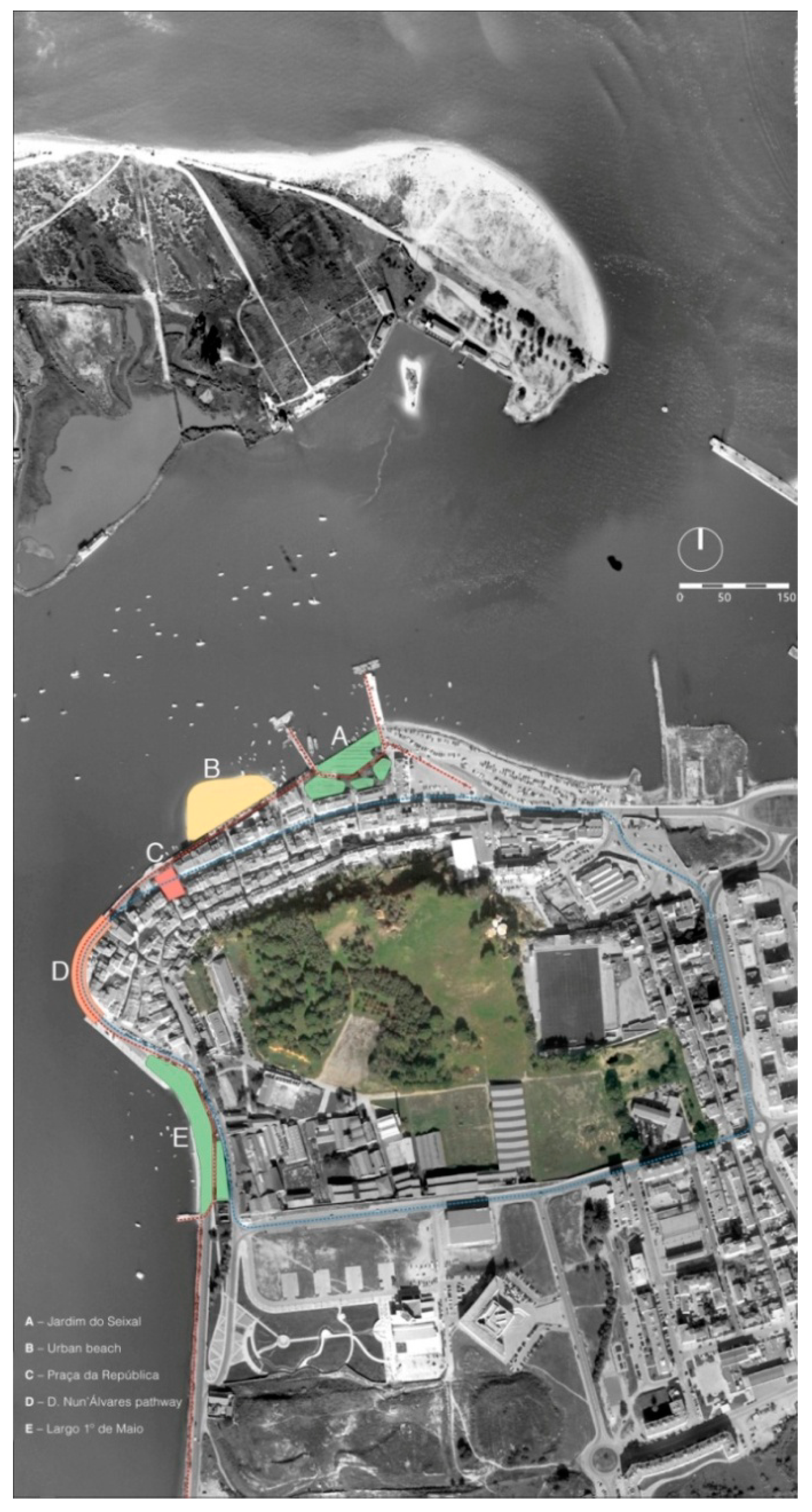
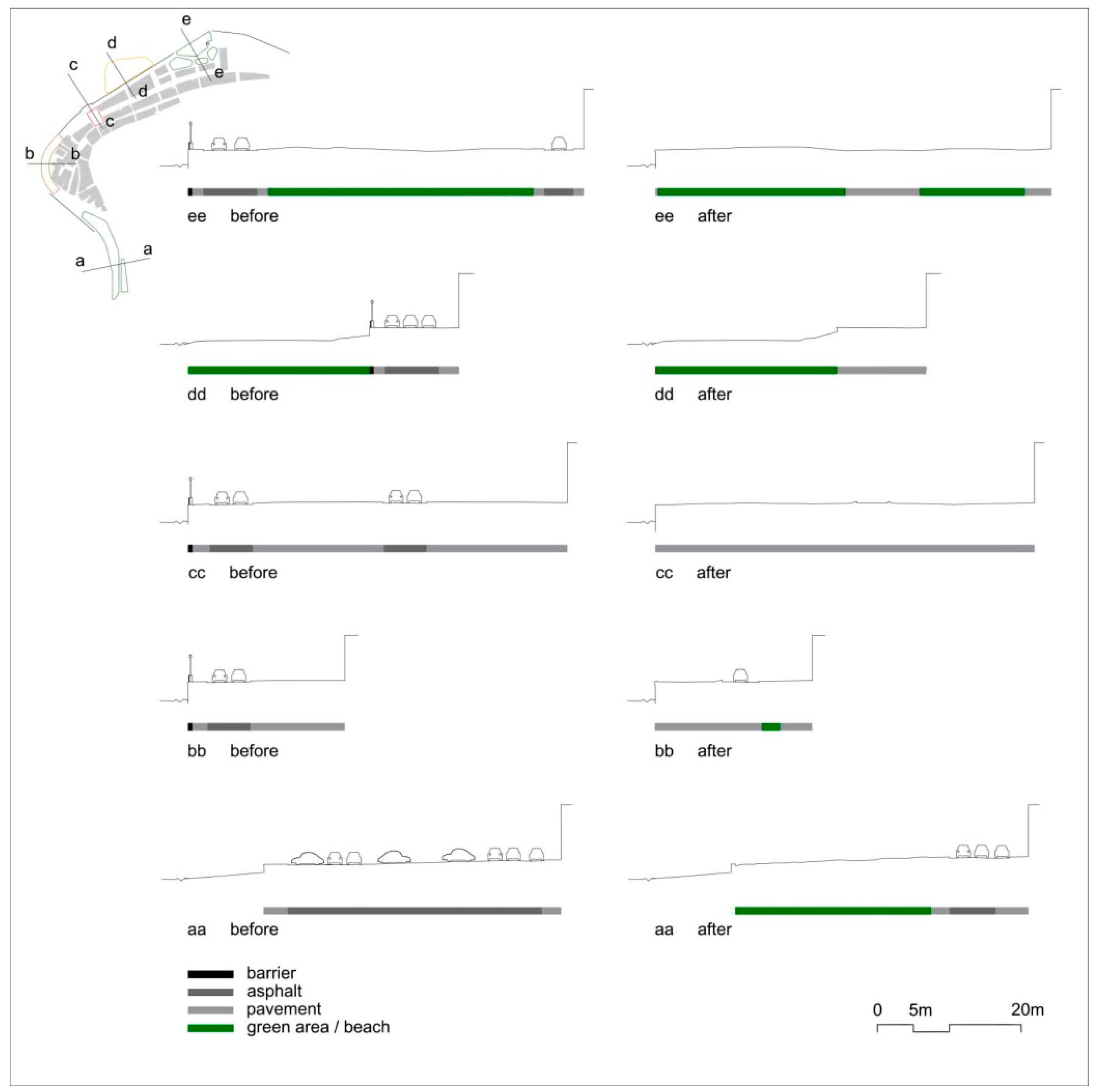
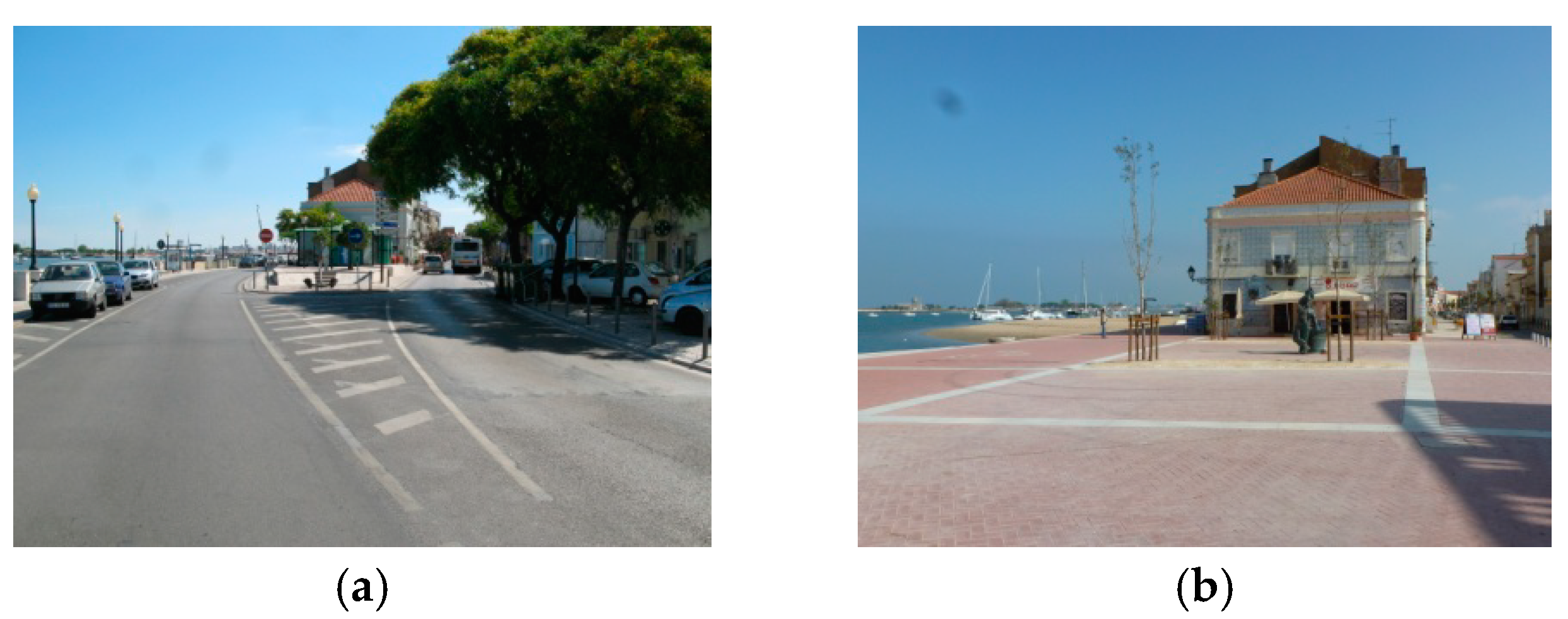
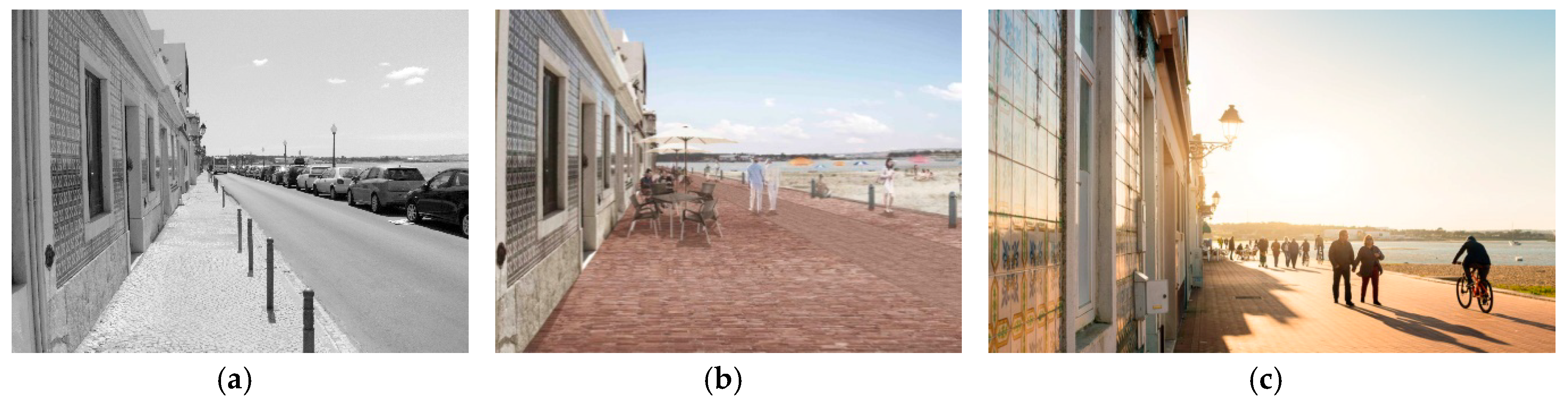
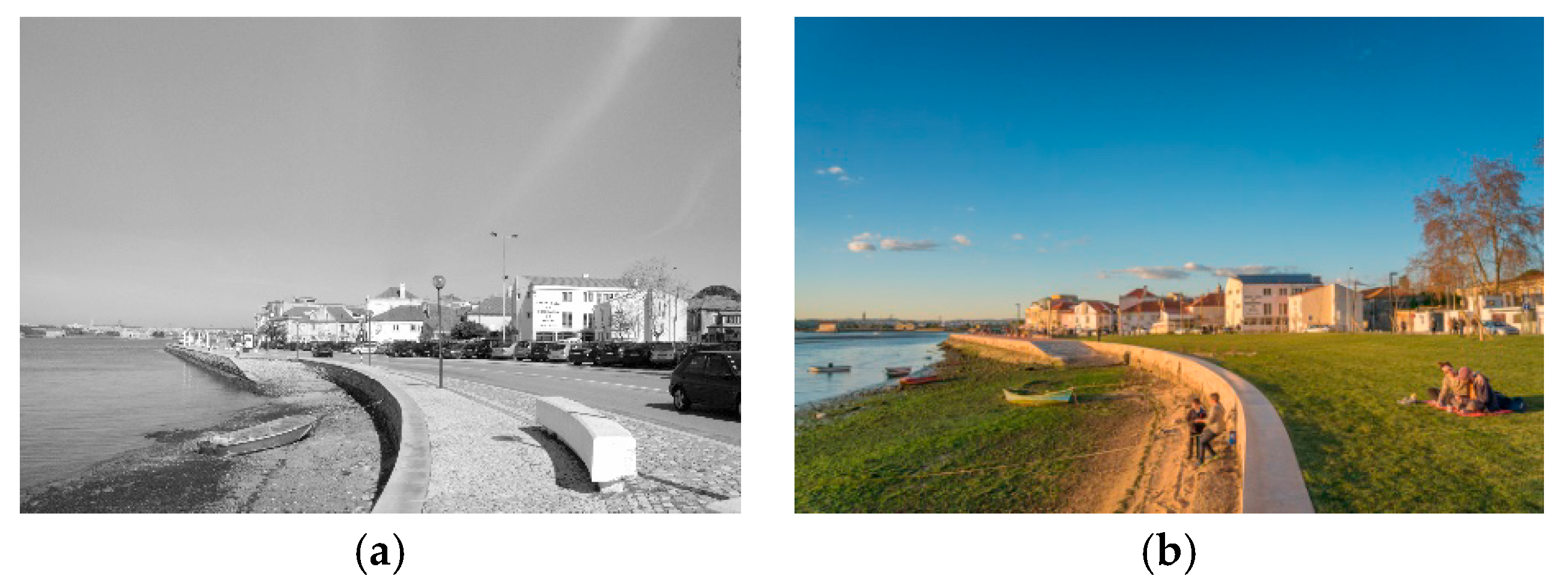
2.2.1. Seixal Riverside Promenade (SRP)
- to create a riverfront for pedestrians and cyclists in contact with the river;
- to redesign the road accesses and parking facilities in order to preserve the historic centre;
- to improve different existing public open spaces along the riverside belt, namely two squares (Largo 1° de Maio and Praça da República) as well as a public garden (Jardim do Seixal);
- to implement accessibility solutions in compliance with legal standards;
- to increase the presence of natural elements and green areas;
- to mitigate the impact of seasonal flooding by improving drainage infrastructures and increasing permeable soil surfaces and vegetation.
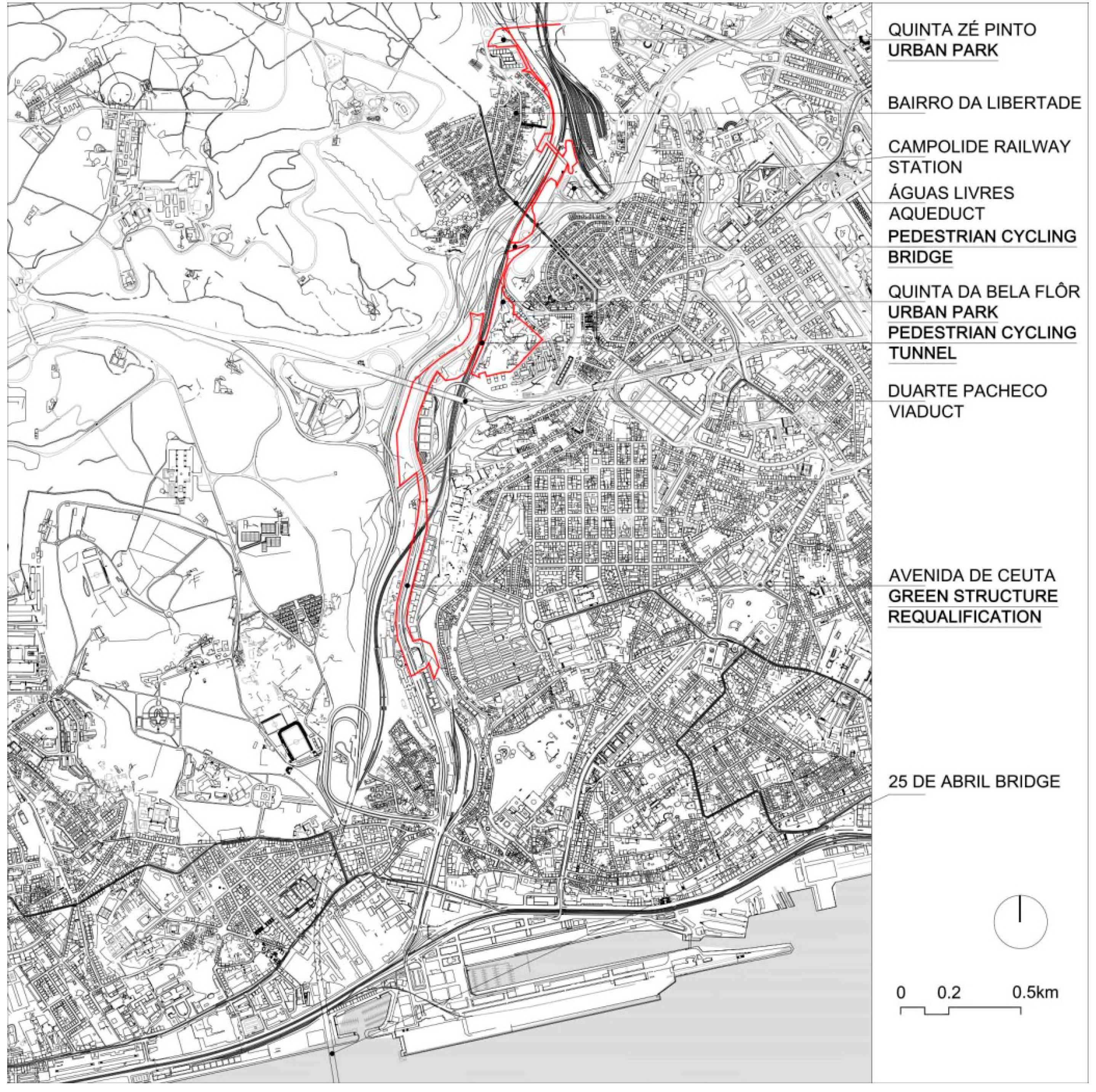
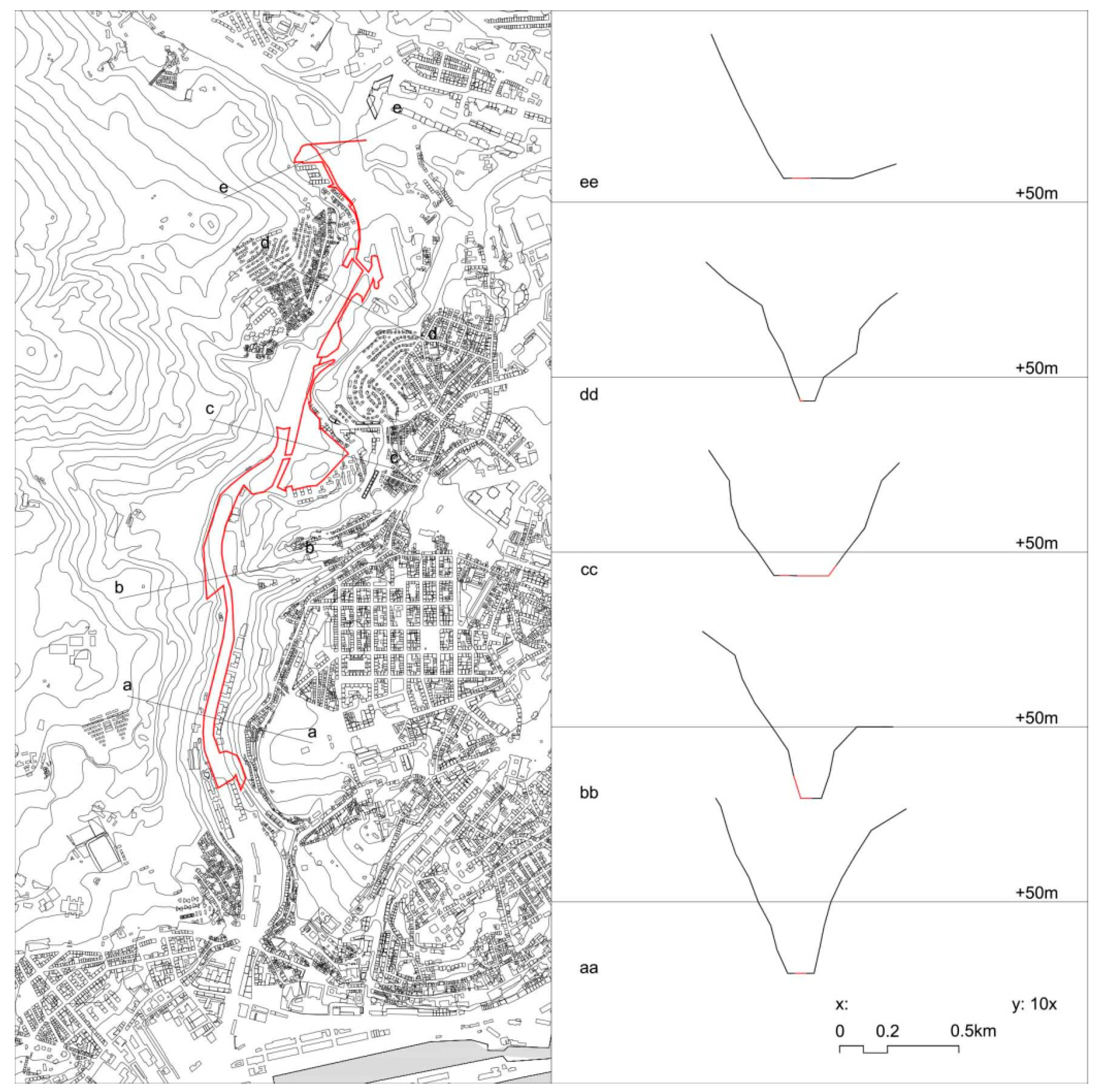
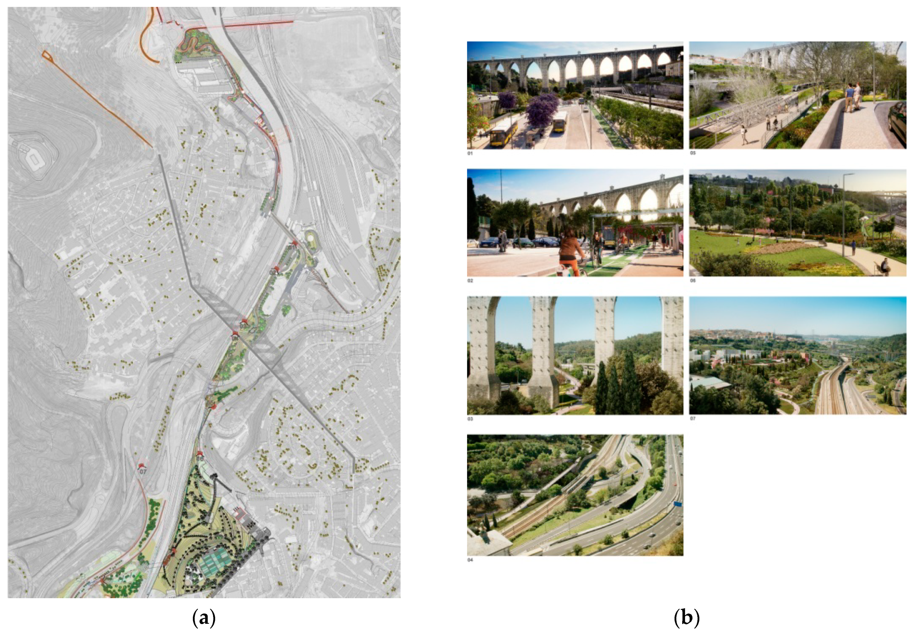
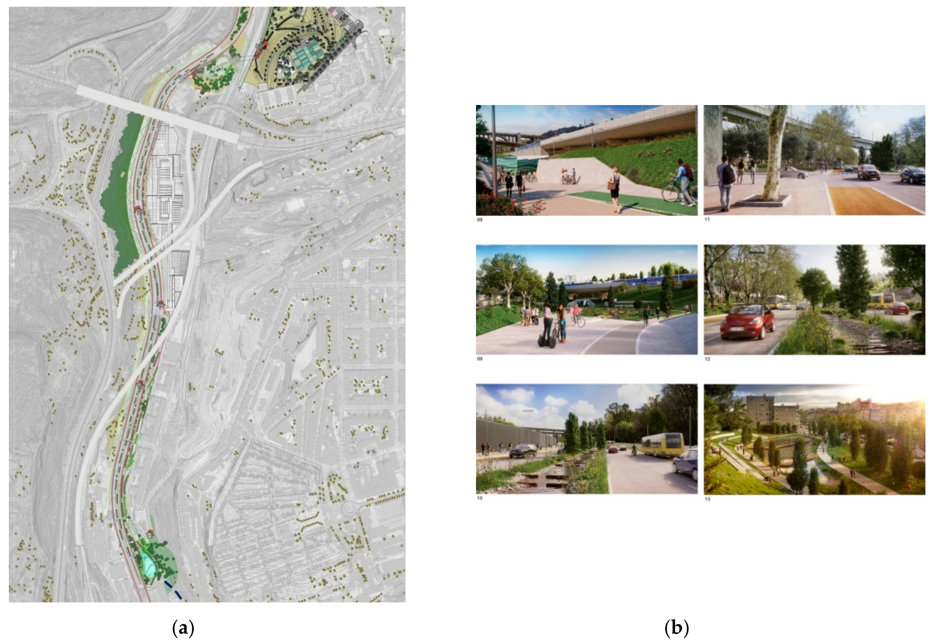
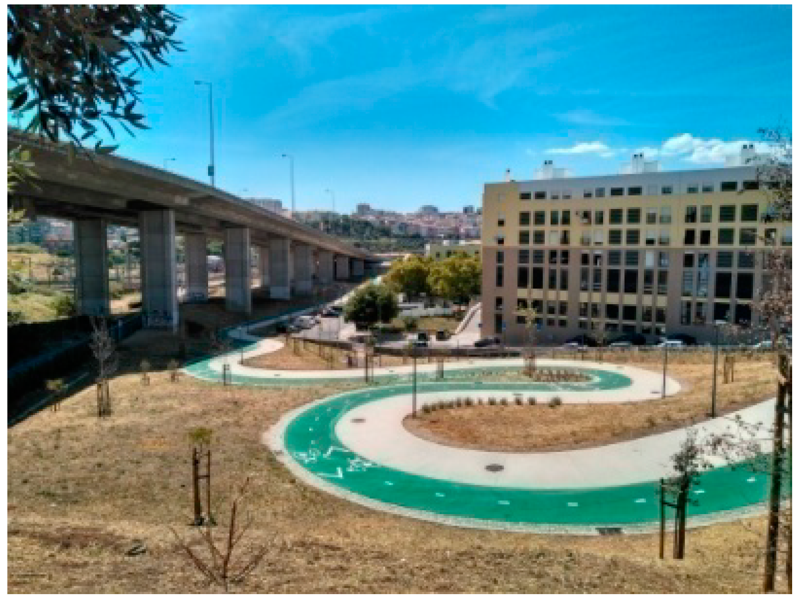
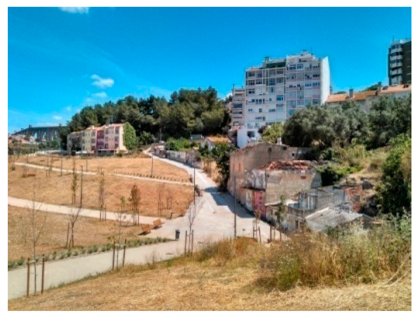
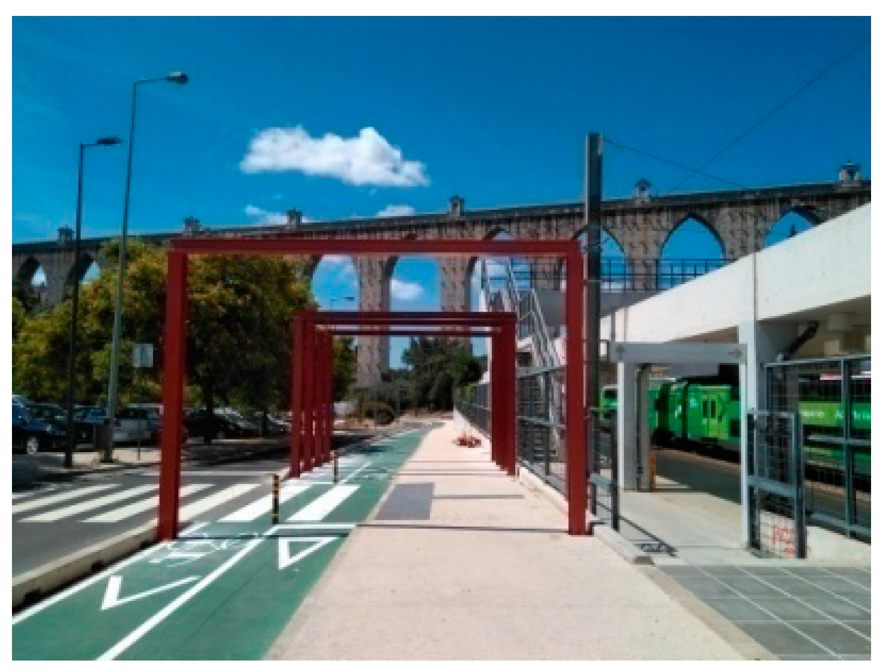
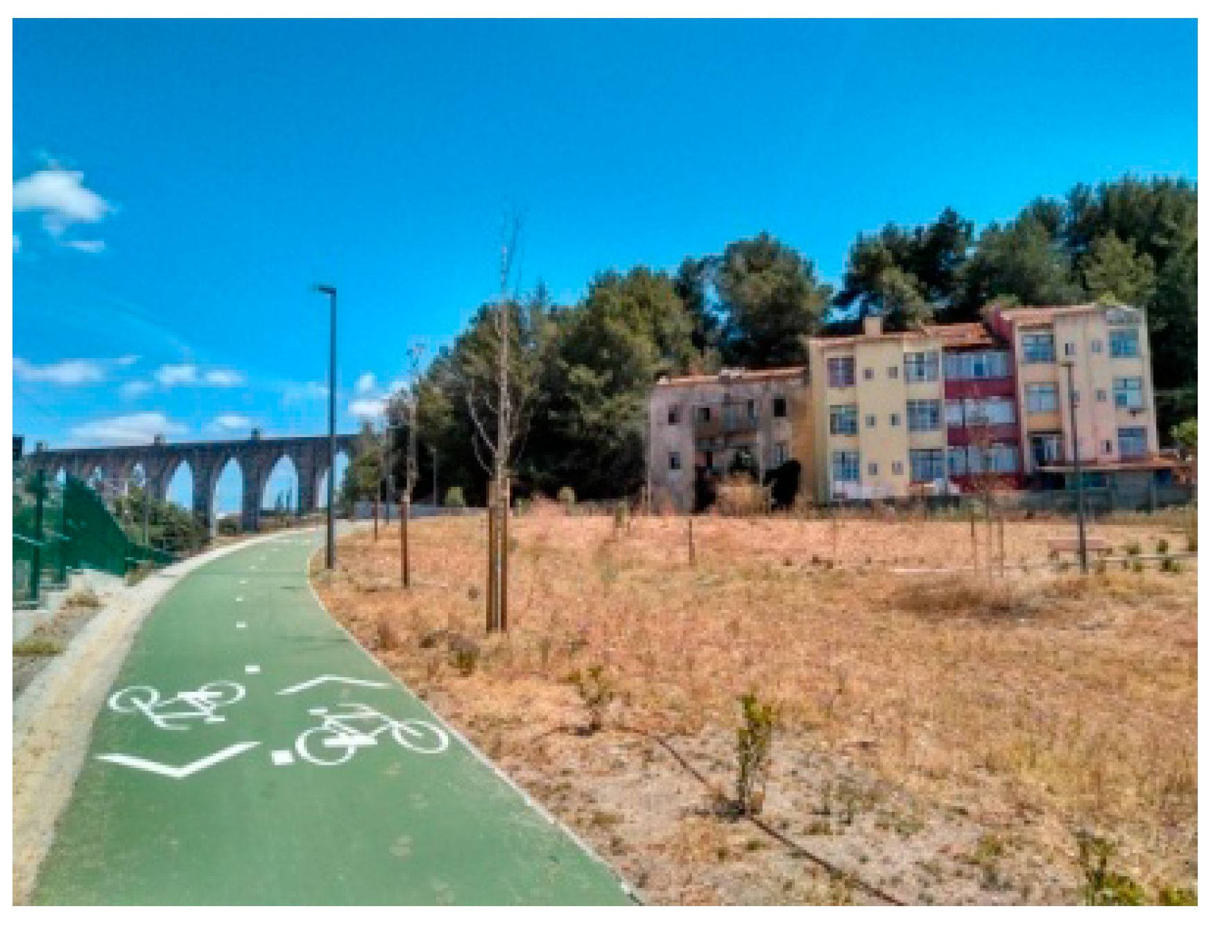
2.2.2. Structural Green Corridor of the Alcântara Valley (SGCAV)
- to create a pedestrian and cycling route among the four intervened areas—the construction of a pedestrian and cycling bridge and a tunnel would guarantee the continuity of the route;
- to minimize the isolation of some closer neighborhoods that were locked due to the road and rail networks, and (re)qualify them;
- to correct, reinforce, and install vegetation cover;
- to recover the memory of the Alcântara River by introducing water into the Avenida de Ceuta area;
- to use, for scenic effect and for irrigation, water coming from the Alcântara Wastewater Treatment Plant (ETAR), settled in the intervened area;
3. Results and Discussion
3.1. New-Found Estuary Promenade of an Attractive Old City Centre—SRP
3.2. New-Found Slow Pathway, a Way to Link and Promote the Regeneration of Surrounding Urban Areas—SGCAV
3.3. Towards a Planned Adaptation of the Ground Level Project to the Specific Site, Starting from the Tagus Estuary
4. Final Considerations
4.1. Water (in Urban Project) as a Binder that Refers to the Idea of Continuity
4.2. Water (in Urban Projects) as a ‘Thick’ Element of Public Space Able to Redesign Surroundings Areas
Funding
Acknowledgments
Conflicts of Interest
References
- Anastasia, C. Attraverso il Fiume: Segni Idraulici e Territori Abitati del Basso Corso del Fiume Ter. Ph.D. Thesis, Departamento de Urbanismo y Ordenación del Territorio, Universidad Politécnica de Cataluña, Barcelona, Spain, 2013. [Google Scholar]
- George, P. Précis de géographie urbaine; Presses Universitaires de France: Paris, France, 1961. [Google Scholar]
- Besse, J.M. La Sombra de Las Cosas. Sobre Paisaje y Geografía; Biblioteca Nueva: Madrid, Spain, 2010. [Google Scholar]
- Busquets, J.; Correa, F. Catalunya continental: Infraestructura ferroviària com a espina dorsal del territori; Harvard Design School: Cambridge, MA, USA, 2008. [Google Scholar]
- Pavia, R. Eco-logiche. Piano Progetto Città 2012, 25/26, 4–23. [Google Scholar]
- Angrilli, M. Design and ecology. Eco-town. Piano Progetto Città 2012, 25/26, 24–35. [Google Scholar]
- UN Water. Climate Change Adaptation: The Pivotal Role of Water, Policy Brief. 2010. Available online: http://www.unwater.org/publications/climate-change-adaptation-pivotal-role-water/ (accessed on 2 October 2018).
- Vallerani, F. Il Brenta a Bassano, l’acqua, il ponte, le case. In La memoria dell’acqua: Conoscenza e valorizzazione dei sistemi idrici nel paesaggio veneto; Spiazzi, A.M., Zucconi, G., Eds.; Unipress: Padua, Italy, 2004; pp. 91–106. [Google Scholar]
- Swyngedouw, E. Modernity and Hydridity. Nature “Regeneracionismo” and the Production of the Spanish Waterscape, 1880–1930. Ann. Assoc. Am. Geogr. 1999, 89, 443–465. [Google Scholar] [CrossRef]
- Martins Ochoa de Castro, A.R. Cidade e frente de água. Papel Articulador do Espaço Público. Ph.D. Thesis, Universidad de Barcelona, Barcelona, Spain, 2011. Available online: http://www.tdx.cat/handle/10803/52893 (accessed on 4 May 2019).
- Fernandes, A. Dinâmicas de revitalização de frentes Ribeirinhas no período Pós-Industrial: O Arco Ribeirinho Sul do Estuário do Tejo. Ph.D. Thesis, Departamento de Geografia e Planeamento Regional, Faculdade de Ciências Sociais e Humanas, Lisbon, Portugal, 2014. Available online: http://run.unl.pt/handle/10362/13090 (accessed on 10 December 2017).
- Fernandes, A.; Sousa, J. A definição de frente ribeirinha: Subsídios para uma delimitação conceptual e espacial. GOT. J. Geogr. Spat. Plan. 2016, 10, 113–131. [Google Scholar] [CrossRef][Green Version]
- Motta, G.; Pizzigoni, A. La Máquina De Proyecto; Universidad Nacional de Colombia: Bogota, Colombia, 2008. [Google Scholar]
- Grumbach, A. Associés. Seine Métropole Paris-Rouen-Le Havre. Le diagnostic prospectif de l’agglomération parisienne; Archibooks: Paris, France, 2009. [Google Scholar]
- Busquets, J.; Correa, F. New Orleans: Strategies for a City in Soft Land; Harvard University Graduate School of Design: Cambridge, MA, USA, 2005. [Google Scholar]
- De Wit, S. Dutch Lowlands: Morphogenesis of a Cultural Landscape; Sun: Amsterdam, The Netherlands, 2009. [Google Scholar]
- Mathur, A.; Da Cunha, D. Mississippi Floods: Designing a Shifting Landscape; Yale University Press: New Haven, CT, USA, 2001. [Google Scholar]
- Room for the River for a Safer and More Attractive River Landscape. Available online: https://www.ruimtevoorderivier.nl/english/ (accessed on 6 October 2019).
- Viganò, P.; Secchi, B.; Fabian, L. (Eds.) Water and Asphalt: The Project of Isotropy; Park Books: Zurich, Switzerland, 2016. [Google Scholar]
- Rinaldo, A. Il governo dell’acqua. Ambiente naturale e ambiente costruito; Marsilio: Venice, Italy, 2009. [Google Scholar]
- Geddes, P. Ciudades en evolución; Infinito: Buenos Aires, Argentina, 1960. [Google Scholar]
- Quadro de Referência Estratégico Nacional–QREN. Available online: http://www.qren.pt (accessed on 12 May 2019).
- Risco. Available online: https://www.risco.org/ (accessed on 12 May 2019).
- Risco; NPK. Seixal Riverside Promenade. Panels for the 2018 European Prize for Urban Public Space; Centre of Contemporary Culture of Barcelona: Barcelona, Spain, 2018; Available online: https://www.publicspace.org/es/obras/-/project/k120-seixal-riverside-promenade (accessed on 14 May 2019).
- Risco. Concurso de conceoção para elaboração do Programa Base do Projecto de Execução do Passeio Ribeirinho do Seixal–QREN. Report of the Competition Proposal. Unpublished work; 2009. [Google Scholar]
- Câmara Municipal de Lisboa. Plano Diretor Municipal de Lisboa; Diário da República, 2.a série—N.° 168 de 30 de agosto de 2012; Departamento de Planeamento e Reabilitação Urbana: Lisbon, Portugal, 2012. [Google Scholar]
- Câmara Municipal de Lisboa. Corredores Verdes. Available online: http://www.cm-lisboa.pt/viver/ambiente/corredores-verdes (accessed on 20 April 2019).
- Câmara Municipal de Lisboa. Corredor Estructurante Vale de Alcântara: Programa Preliminar; Direcção Municipal de Estrutura Verde Ambiente e Energia, Gabinete de projecto de Estructura Verde: Lisbon, Portugal, Unpublished work; 2015. [Google Scholar]
- Marques De Abreu, B.R. A Avenida de Ceuta: De limite a caminho para o crescimento de Lisboa. Cad. Do Arq. Munic. 2015, 4, 219–237. Available online: http://arquivomunicipal.cm-lisboa.pt/fotos/editor2/Cadernos/2serie/4/4_art8.pdf (accessed on 5 August 2019).
- Câmara Municipal de Lisboa. Corredor verde estruturante do Vale de Alcântara. Available online: http://www.cm-lisboa.pt/viver/ambiente/corredores-verdes/vale-de-alcantara (accessed on 20 April 2019).
- Salgado, M. Reconquista da Frente Ribeirinha de Lisboa. Portusplus 2012, 3. Available online: http://retedigital.com/wp-content/themes/rete/pdfs/portus_plus/3_2012/Contribuciones/Manuel_Salgado.pdf (accessed on 14 May 2019).
- Brandão, P. As ribeirinhas—paisagens globais? Sobre “waterfronts”, marca de cidade, design urbano e “beautiful people”. AML Estuarium 2004, 5, 5–8. [Google Scholar]
- Anastasia, C. More Tourism? Mass Tourism? Mars Tourism? Esempi di Archit. Int. J. 2019, 6, 9–18. [Google Scholar]
- Brandão, P. As ribeirinhas—Paisagens globais? O espaço temático—Waterfront/Disney—e o consumo. AML Estuarium 2004, 6, 5–8. [Google Scholar]
- Lisbon South Bay. Available online: http://www.lisbonsouthbay.com/en (accessed on 15 April 2019).
- Baia do Tejo. Available online: http://www.baiadotejo.pt/en (accessed on 4 May 2019).
- Câmara Municipal de Seixal. Investir No Seixal. Available online: http://www.cm-seixal.pt/investir-no-seixal/ (accessed on 4 May 2019).
- Câmara Municipal de Lisboa. Estratégia de reabilitação urbana de Lisboa–2011/2024; Câmara Municipal de Lisboa: Lisbon, Portugal, 2011; Available online: http://habitacao.cm-lisboa.pt/documentos/1324397213U4nVZ1uw7Or33TP1.pdf (accessed on 18 December 2018).
- Leboeuf, Y.; Fernandes, Z.; Guimarães, J.; Simões, J.; Ribeiro, P.; Ferreira, F.; Proença de Oliveira, R.; Monteiro, A.; Saldanha Matos, J. Plano Geral de Drenagem de Lisboa 2016–2030: Relatorio, Versão 2; Câmara Municipal de Lisboa: Lisbon, Portugal, 2015; Available online: http://www.cm-lisboa.pt/participar/lisboa-em-debate/plano-drenagem (accessed on 12 May 2019).
- Matos Silva, M.; Costa, J.P. Urban Flood Adaptation through Public Space Retrofits: The Case of Lisbon (Portugal). Sustainability 2017, 9, 816. [Google Scholar] [CrossRef]
- Vervšek, Š.; Čavić, L. Expressions of spatial quality and local identity in urban riverfronts. Ann. Ser. Hist. et Sociol. 2017, 27, 349–362. [Google Scholar] [CrossRef]
- Anastasia, C. El agua del estuario del Tajo biencomúnvehículo de identidad. In Congreso nacional del agua Orihuela: Innovación y sostenibilidad; Melgarejo, J., Ed.; Universitat d’Alacant: Orihuela, Alicante, Spain, 2019. [Google Scholar] [CrossRef]
- Ranzato, M. Water Vs Urban Scape. Exploring integrated Water-Urban Arrangements; Jovis: Berlin, Germany, 2017. [Google Scholar]
- Brandão, A.L.; Brandão, P. Public Space, Infrastructure, Landscape: An interdisciplinary matrix for urban spatial continuity. J. Public Space 2017, 2, 123–134. [Google Scholar] [CrossRef]
- Desvigne, M. The Landscape as Precondition. Lotus 2012, 150, 20–27. [Google Scholar]
- Dematteis, G. The Territorial Sustainability of Development. Lotus 2009, 140, 84–88. [Google Scholar]


© 2019 by the author. Licensee MDPI, Basel, Switzerland. This article is an open access article distributed under the terms and conditions of the Creative Commons Attribution (CC BY) license (http://creativecommons.org/licenses/by/4.0/).
Share and Cite
Anastasia, C. Urban Regeneration Projects Bound to Water, along and towards the Tagus Estuary (Portugal). Sustainability 2019, 11, 6578. https://doi.org/10.3390/su11236578
Anastasia C. Urban Regeneration Projects Bound to Water, along and towards the Tagus Estuary (Portugal). Sustainability. 2019; 11(23):6578. https://doi.org/10.3390/su11236578
Chicago/Turabian StyleAnastasia, Caterina. 2019. "Urban Regeneration Projects Bound to Water, along and towards the Tagus Estuary (Portugal)" Sustainability 11, no. 23: 6578. https://doi.org/10.3390/su11236578
APA StyleAnastasia, C. (2019). Urban Regeneration Projects Bound to Water, along and towards the Tagus Estuary (Portugal). Sustainability, 11(23), 6578. https://doi.org/10.3390/su11236578