Article

Phased Reverse Engineering Framework for Sustainable Cultural Heritage Archives Using Laser Scanning and BIM: The Case of the Hwanggungwoo (Seoul, Korea)

Department of Digital Architecture and Urban Engineering, Hanyang Cyber University, 220 Wangsimni-ro, Seongdong-gu, Seoul 04763, Korea
*
Author to whom correspondence should be addressed.
Sustainability 2020, 12(19), 8108; https://doi.org/10.3390/su12198108
Submission received: 27 August 2020 / Revised: 23 September 2020 / Accepted: 28 September 2020 / Published: 1 October 2020
(This article belongs to the Special Issue Integration of BIM and ICT for Sustainable Building Projects)

Abstract

:
This study proposed a phased reverse engineering framework to construct cultural heritage archives using laser scanning and a building information model (BIM). This framework includes acquisition of point cloud data through laser scanning. Unlike previous studies, in this study, a standard for authoring BIM data was established through comparative analysis of existing archives and point cloud data, and a method of building valuable BIM data as an information model was proposed. From a short-term perspective, additional archives such as member lists and drawings can be extracted from BIM data built as an information model. In addition, from a long-term perspective, a scenario for using the cultural heritage archive consisting of historical records, point cloud data, and BIM data was presented. These scenarios were verified through a case study. In particular, through the BIM data building and management method, relatively very light BIM data (499 MB) could be built based on point cloud data (more than 917 MB), which is a large amount of data.

1. Introduction

Cultural heritage plays an important role in regaining the footsteps of the country. In addition, cultural heritage is very important as a means to generate profits for the country and local governments. Therefore, it is necessary to continuously maintain the original form of cultural heritage through accurate historical evidence, investigation, repair, and restoration [1]. To this end, each local government and affiliated organizations order cultural heritage conservation services every year. The number of repairs and maintenance of cultural heritage in 2020 was 1557, and the project cost reached 68.1 billion won [2]. The existing cultural heritage management method goes through the process of applying and executing a budget based on visual inspections 2–3 times a year. The limitation of the existing method is that it is a post management method that repairs cultural heritage after damage or loss. In addition, if the official in charge is changed, it is difficult to find the detailed management history necessary for the preservation of cultural heritage.
Prior research for the preservation of cultural heritage include the system for building and utilizing the inventory of cultural properties [3], preservation and utilization of repair records [4,5,6], precise measurement and repair of dismantling, etc. [7,8,9]. In particular, the actual survey is the only opportunity to directly access the cultural heritage and investigate all parts over a long period of time. The actual survey includes not only the physical status survey, but also the survey and arrangement of related literature and academic research data. For this reason, the Cultural Heritage Administration has provided guidelines for precise measurement of national treasures and treasure buildings, and guidelines for constructing 3D scan data of cultural heritage in order to advance the survey [10,11].
In addition, various application studies such as the building information model (BIM) [5,12], 3D scanning technology [9,13], and 3D printing [14] are being conducted to preserve cultural properties. In Korea, studies on the application of BIM to the traditional house, Han-Ok, were conducted. Yun [15] conducted a study to analyze the work breakdown structure (WBS) of a Han-Ok in order to implement a construction simulation targeting a BIM-based modern Han-Ok. Jung et al. [16] defined and developed the BIM object breakdown structure (OBS) and verified this through the case of a new Han-Ok construction. Shin et al. [17] built a database of Han-Ok members through a case study on how to apply BIM and reflected the member library in the Han-Ok design process. Jeon and Seo [18] developed a Han-Ok design automation program and applied it to parametric modeling of the tiled roof. Kim et al. [19] proposed an integrated information system for the Han-Ok project including a method for classifying and converting information into a database, a system for inputting and managing Han-Ok information, and an integrated information management framework. Jang et al. [20] analyzed the main factors for revitalizing the introduction of BIM in the Han-Ok construction project. Park et al. [21] applied social network analysis (SNA) techniques to identify the factors that hindered the spread of new Han-Ok and established a BIM strategy to reduce them. The distinct limitation of BIM application studies on Han-ok is not the purpose of preserving existing cultural heritage, but more focused on improving productivity of new projects and building a database.
As such, BIM alone has a clear limit in establishing a new methodology for preserving cultural properties. Therefore, many studies have been introduced that combine laser scanning that can accurately measure and investigate cultural heritage and BIM that can manage information. Reinoso-Gordo et al. [22] applied the Scanning process and the photogrammetry process through a case study and proposed the Heritage Building Information Modeling (HBIM) methodology for building maintenance based on the measured data generated through this process. Ham and Lee [23] proposed a process for diagnosing the structural safety of large-scale infrastructure using laser scanning and BIM and analyzed the economic feasibility of the proposed method. In addition, Jung et al. [24] proposed a revamping process for aged steel structures using laser scanning and BIM. The commonality of these previous studies is that the advantages of laser scanning and BIM are used complementarily and can provide an approach for building cultural heritage archives from a long-term and continuous perspective.
However, in the case of research on cultural heritage, there is a problem in that there are no raw data for preservation of cultural heritage, so an actual survey is necessary, or the reliability of the data is low even if the actual measured data already exists. The root cause is the limitation of very low access to acquiring research data other than those in charge of cultural heritage. For this reason, it has a common limitation that it is difficult to verify a new process. Therefore, it is important to select an appropriate target for conducting case analysis.
This study aims to propose a phased reverse engineering framework for building archives capable of continuous management as well as advance management of cultural heritage. This framework includes a step-by-step reverse engineering process for cultural heritage to be preserved using laser scanning and BIM. In addition, this framework aims to build a sustainable cultural heritage archives by providing a database construction method that can efficiently manage data and a practical method for capacity management and utilization of scanning data and BIM data. Finally, by applying the proposed framework to the case of the constructed cultural heritage, this study will discuss the practical implications of this framework from a short-term and long-term perspective.

2. Literature Review

2.1. Country Cases for Cultural Heritage Archives

Since 1933, the United States has operated the Historic American Building Survey (HABS) to record and preserve historical buildings through the “Heritage Documentation Program”. In 1969, HEAR (Historic American Engineering Record) was prepared for recording and preserving industrial heritage and relics, and HALS (Historic American Landscape Survey) was prepared for survey and recording of historical landscapes in 2000 [25]. HABS includes not only researching, cataloging, and collecting records of historical assets, but also accumulating comprehensive and contextual information and establishing national standards for systematic records. The survey method of HABS centers on field surveys that are directly measured by hand, but when it is a large structure or inaccessible, it is measured using a 3D laser scanner [26]. The findings of HABS are composed of three documents: Drawings (e.g., field notes, sketching and measuring structures, drawing), historical reports (e.g., name, location, significance, description, history, sources, historian(s), project information), and photographs (e.g., film, equipment, view required, processing, prints, labeling, index to photographs), and ‘HABS Guide to Field Documentation’ for preparing each document are provided. The UK enacted the National Heritage Law in 1983 and established English Heritage, a legal advisory body related to historical preservation [27]. English Heritage registers and protects historic places, monuments, and structures across the UK, creates archives for historical heritage, and opens them to the public to increase the efficiency of record management.
Cultural Heritage Administration of Korea was established to expand the foundation for preservation and management of cultural heritage by improving the quality of research and research on cultural properties and fostering specialized personnel. Cultural Heritage Administration conducts various surveys and studies for the designation and registration of cultural heritage, preservation and financial support for cultural heritage, and scientific conservation management of cultural heritage [28]. The State-designated heritage is divided into seven categories of the following: National Treasure, Treasure, Historic Site, Scenic Site, Natural Monument, National Intangible Cultural Heritage, National Folklore Cultural Heritage. Cultural Heritage Administration uses 3D scanning technology to produce 3D data to restore the original form when cultural heritage is lost or damaged. In addition, ‘3D cultural heritage’ service is provided so that the 3D data can be easily used by the private sector in various fields [29]. The types of 3D data provided through this service include 3D printing (e.g., ply, stl, etc.), 3D modeling (e.g., ply, icf, pdf, etc.), scan data (e.g., asc, imp, pts, etc.), and video (e.g., mp4) format. However, in most cases, 3D data provided by Cultural Heritage Administration are provided as various types of files for a single cultural property (e.g., Jinheung King Pure Monument) or as a number of scanning data taken at each location of a historic site. These data are difficult to use as archives to preserve cultural heritage from a long-term perspective. The ‘3D cultural heritage’ service provides 3D data in a variety of formats, but mostly focuses on the use of cultural property promotion and virtual tourism. Therefore, 3D data cannot provide an archive function for institutions and personnel who directly manage cultural properties. In particular, in the case of 3D scanning data for historical sites, the surrounding environment and the cultural heritage in the historical site are included as one-point cloud data. In the case of a built cultural heritage, information management for each member constituting a building is important. Since it is provided as one-point cloud data, there is a limit to information management.

2.2. Reverse Engineering for Cultural Heritage Archives

The problem with on-site surveys for preservation of existing cultural properties is that it is difficult to create archives that reflect the sites as they are, and there is waste of having to repeat the on-site survey whenever there is a preservation issue. In addition, the way that humans directly measure cultural heritage with the naked eye has no choice but to have errors in the records. This method makes it difficult to recycle the 2D drawings accumulated through the previous site survey at the next site survey. Scanning method, which can acquire precise information on the current situation, is a very important factor in the actual survey, but it is not suitable for input and management of historical data generated in the long-term preservation process. In particular, in the case of cultural heritage that require dismantling and reassembly processes for repair and preservation work, it is difficult to utilize them except to keep accurate records of the original cultural heritage. Due to these problems, it is difficult to establish a reverse engineering process to continuously build and manage historical information on cultural heritage from a long-term perspective.
On the other hand, the development of technologies such as information and communication technology (ICT) in the architectural field due to the fourth industrial revolution can make the already existing reverse engineering process more advanced. ICT technologies such as BIM, scanning, and drones have matured a lot in terms of hardware and software. In particular, a lot of research is being done using scanning and drone, which are technologies that enable reverse engineering. Among them, many studies using laser scanner with high precision are found [30,31,32]. In addition to laser scanning, technologies such as photogrammetry [33,34], multi-light imaging [35], and airborne lidar [36] are being applied to reverse engineering. In addition, drone can be applied to various fields such as construction land surveying, construction logistics management, on-site construction management (e.g., safety management, quality management, time management, site management), construction facilities management, demolition management [37]. Although there are various reverse engineering techniques for surveying and recording cultural heritage, there seems to be little possibility that it can be used in the long term. This is because even if the current situation is accurately measured through precise scanning, no specific method for information management essential for the persistence of the archive has been presented.
Therefore, there is a need for a framework that links these advanced technologies (e.g., laser scanning, BIM) with the existing reverse engineering process. The role of laser scanning and BIM in the reverse engineering process is clear. Laser scanning can acquire as-built data or existing conditions data for buildings, and BIM can build as-planned data. The role of each technology in the reverse engineering process through prior research is as follows. Kim et al. [38] proposed a method to track construction progress by acquiring construction completion data through laser scanning and comparing separately constructed BIMs. Mahmood et al. [39] implemented augmented reality to improve construction and facility management by registering one visual datum (e.g., point cloud data) to another visual datum. Adán et al. [40] applied scan to BIM to identify and inspect building components and objects, not existing structural elements, and conducted research focusing on object recognition. Bosché et al. [41] conducted a study to automate the processing of completed point cloud data and sought to improve quality through technology that recognizes and identifies objects that were not constructed at the planned location.
In previous studies, point cloud data were used as reference information to accurately grasp the current situation. Creating BIM directly from point cloud data takes a lot of time and is prone to errors. In previous research, studies to convert the scanning data of structural and structured objects such as mechanical, electrical, and plumbing (MEP) into BIM can be found. However, it is difficult to find a study for converting scanning data into BIM targeting unstructured objects. Rather, research that independently construct point cloud data and BIM data and compare them in the reverse engineering process are generally found.
A proposed framework should include step-by-step database construction and utilization contents, and utilization scenarios from a long-term perspective. In addition, it is necessary to present a framework that considers the problem of the capacity of scanning data of cultural heritage and the problem of converting scan data on atypical member into BIM. Therefore, this study proposes a phased reverse engineering framework for the establishment of cultural heritage archives using laser scanning and BIM.

2.3. Functions of BIM in Cultural Heritage Achives

Sacks et al. [42] define BIM as a modeling technology and associated set of processes to produce, communicate, and analyze building models. Building models have three characteristics: Building components that are represented with digital representations (objects) that carry computable graphic and data attributes that identify them to software applications, as well as parametric rules that allow them to be manipulated in an intelligent fashion. Components include data that describe how they behave, as needed for analyses and work processes, such as quantity takeoff, specification, and energy analysis. Consistent and nonredundant data such that changes to component data are represented in all views of the component and the assemblies of which it is a part.
In terms of construction project management, the fields of use of BIM are diverse [43]. Ham et al. [44] analyzed the economic impact of design errors through BIM-based design verification of high-rise projects and calculated ROI. Lee et al. [45], Moon et al. [46], and Ham and Lee [47] analyzed the digital fabrication process and effects for Off-Site Construction (OSC). Yoo and Ham [48] compared and analyzed productivity with the documentation method using the 3D BIM model and the documentation method using the existing 2D CAD drawing. Ham et al. [49] analyzed how the service performance of the BIM staff for BIM RFI affects the waiting of project participants and calculated the waiting cost through this. In addition, some studies are being conducted to apply BIM for facility management [50,51].
There is a great deal of research on building cultural heritage archives based on BIM. Hull and Ewart [52] conducted a study on conservation data parameters for cultural asset management using BIM. Reinoso-Gordo et al. [22] reproduced the entire structure of the building through laser scanning, and documented related architectural elements using photogrammetry. In addition, a method for managing information on architectural elements using HBIM built with specific BIM software was proposed. López et al. [53] classified and reviewed HBIM-related studies into data capture and processing (e.g., photogrammetry, laser scanning, point cloud, etc.), and BIM. In addition, various alternatives on how to apply the BIM platform for the preservation of cultural properties were suggested. Jordan-Palomar et al. [54] proposed a holistic HBIM protocol that considers various stakeholders and considers the entire life cycle of historical buildings. This protocol enables non-technical stakeholders to become active stakeholders within the HBIM model and platform. Fadli and AlSaeed [55] proposed the transfer of the semantics of Qatar’s buildings and cities to a structured digital database through Qatar historic buildings information modeling (Q-HBIM). This Q-HBIM platform can be flexibly extended to various uses as well as record preservation functions through convergence with technologies of the fourth industrial revolution (e.g., virtual reality, artificial intelligence). Prizeman et al. [56] provided environmental standards to support those involved in the valorization, repair, refurbishment, energy retrofit, or re-use of built heritage through HBIM. It demonstrates an approach to cost-efficient knowledge-sharing structures through relevant open source pathways. In addition, Historic England has published guidelines such as ‘BIM for Heritage (2019)’, ‘3D Laser Scanning for Heritage (2018)’, and ‘Photogrammetric Applications for Cultural Heritage (2017)’ to develop an asset information model for cultural heritage [57].
As such, the role of BIM in preserving cultural heritage is to provide archives for information management from a long-term perspective. In addition, it is necessary to consider the accessibility that non-professionals who are the subject of preservation of cultural properties can easily use information from archives. This has always been an essential consideration in improving the usability of BIM, and it is important to make the database lighter to solve this problem. From this point of view, this study did not directly utilize commercial BIM software for initial 3D model construction. This is because when using the basic modeling tools provided by commercial BIM software, all parameters set as default values are included in BIM. This approach not only increases the capacity of the BIM model, but also weakens the accessibility of information to non-experts who do not know how to handle BIM. Existing studies have mainly focused on the role of BIM as a long-term platform for preserving cultural heritage. This study also paid attention to the role of commercial BIM software as a database for inputting and managing only information necessary for preservation of cultural heritage.

3. Research Method for Sustainable Cultural Heritage Archives

3.1. Research Method

The research method for creating sustainable cultural heritage archives based on literature review is shown in Figure 1. First, a phased reverse engineering framework was presented. For this, point cloud data (PCD) must be acquired through laser scanning, and standards for building BIM data that can be used in the long term by comparing and analyzing this data with existing archives must be established. Second, from the perspective of the subject of use of cultural heritage archives, the BIM authoring method, that is easy to access and uses BIM data, was suggested. As seen in previous studies related to HBIM construction, the value of BIM as an information model is sufficient. An important point is to strengthen the accessibility of data from the perspective of the subject using the HBIM being built. Third, to verify a phased reverse engineering framework, a case analysis was performed on the cultural assets built in 1899.

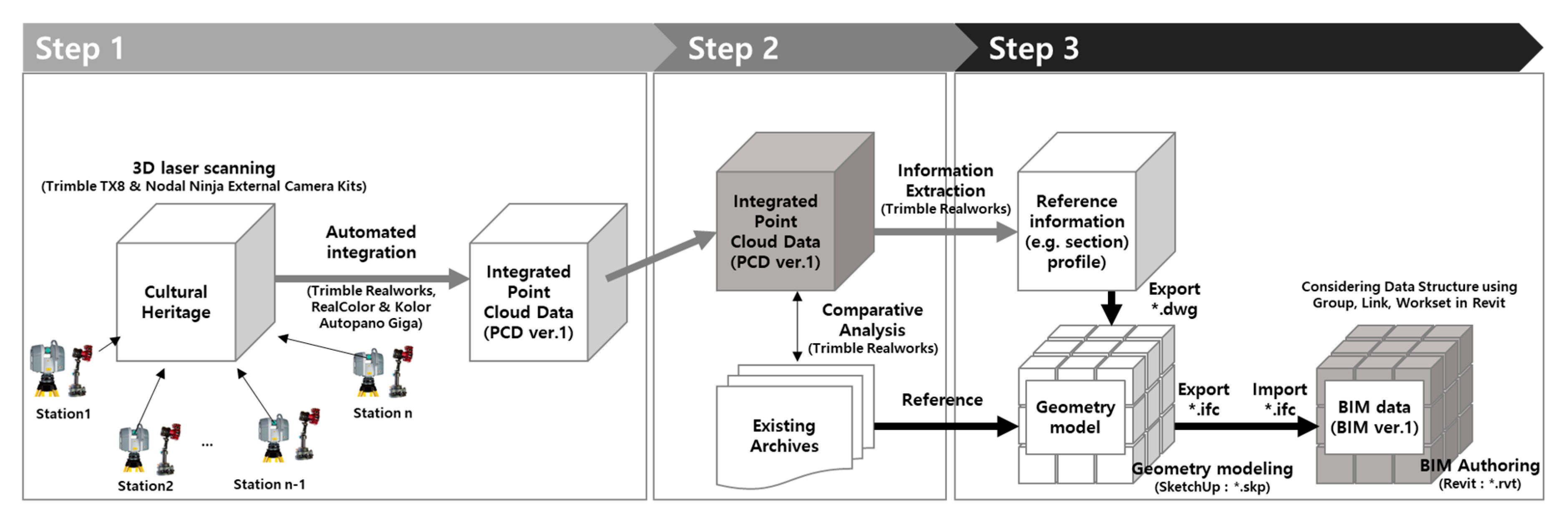
3.2. Phased Reverse Engineering Framework

Due to the characteristics of cultural heritage that has been preserved for a long time, it is necessary to construct archives that can be utilized from a long-term and continuous perspective. In this study, as shown in Figure 2, a phased reverse engineering framework for cultural heritage archives was presented.
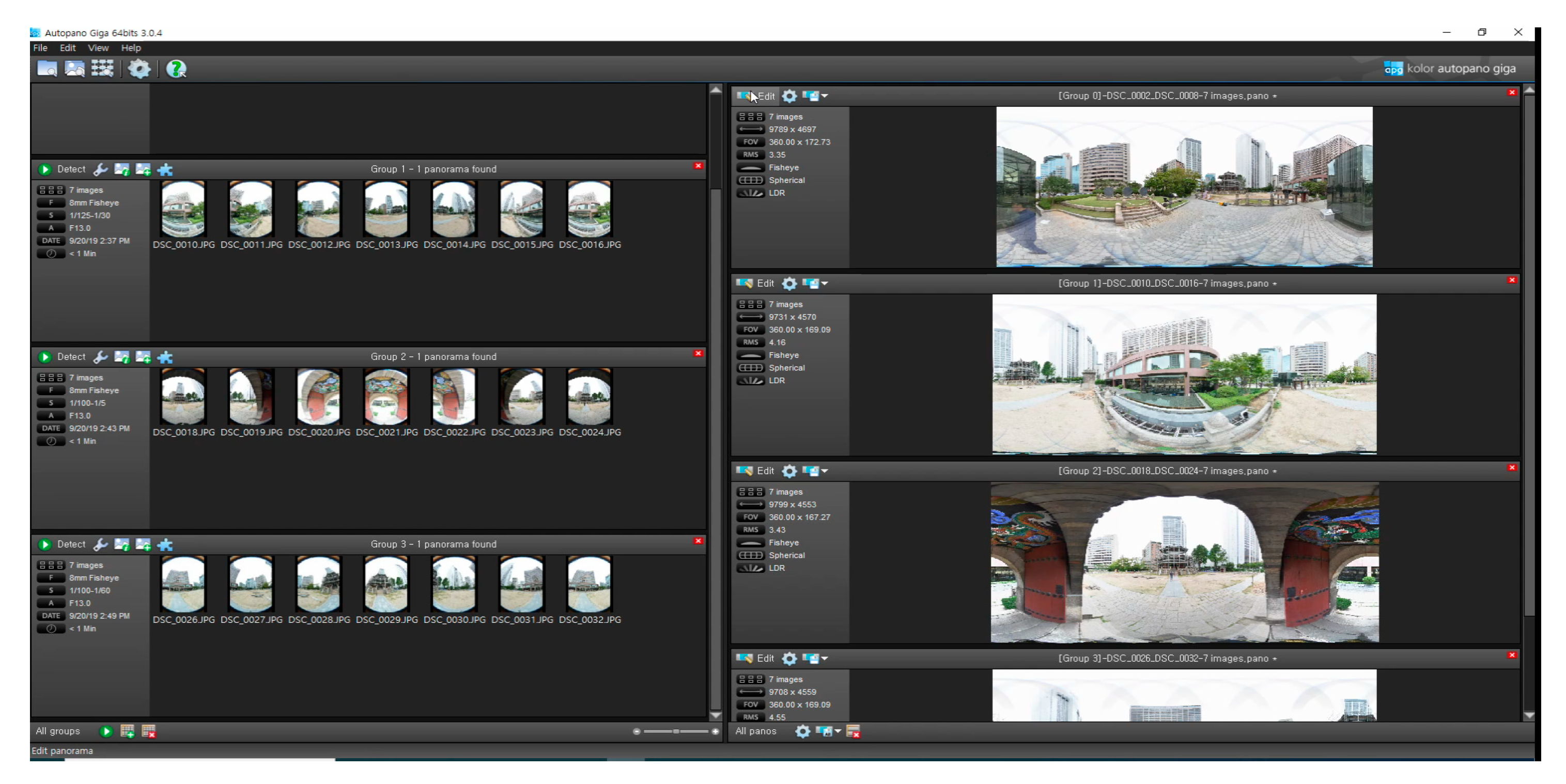
The first step is to acquire status information through 3D laser scanning at the stage where there are no 3D data (e.g., BIM data, point cloud data, etc.) on cultural heritage. At this stage, a 3D laser scanner is used to scan cultural heritage at various locations. It also acquires images through a fisheye lens camera at the same location(station). Scanning data acquired from multiple stations are consolidated into a single file. In the past, it took a lot of time and effort to integrate and post-process point cloud data (PCD). However, technological advances in laser scanners and software that generates and processes PCD have significantly improved this work. The quality of the integrated PCD is determined by the number of 3D laser scanning and scan location. In this way, the first database for building cultural heritage archives is created.
The second step is to compare and analyze the PCD with various drawings and actual data recorded in the existing archives. That is, the purpose is to review the quality of the existing data by comparing the existing data with the PCD that contains the current state. This process is a preliminary work to integrate existing data through BIM. Analyzing the quality and error of the currently existing measured data provides a guideline for establishing a plan for building BIM Data.
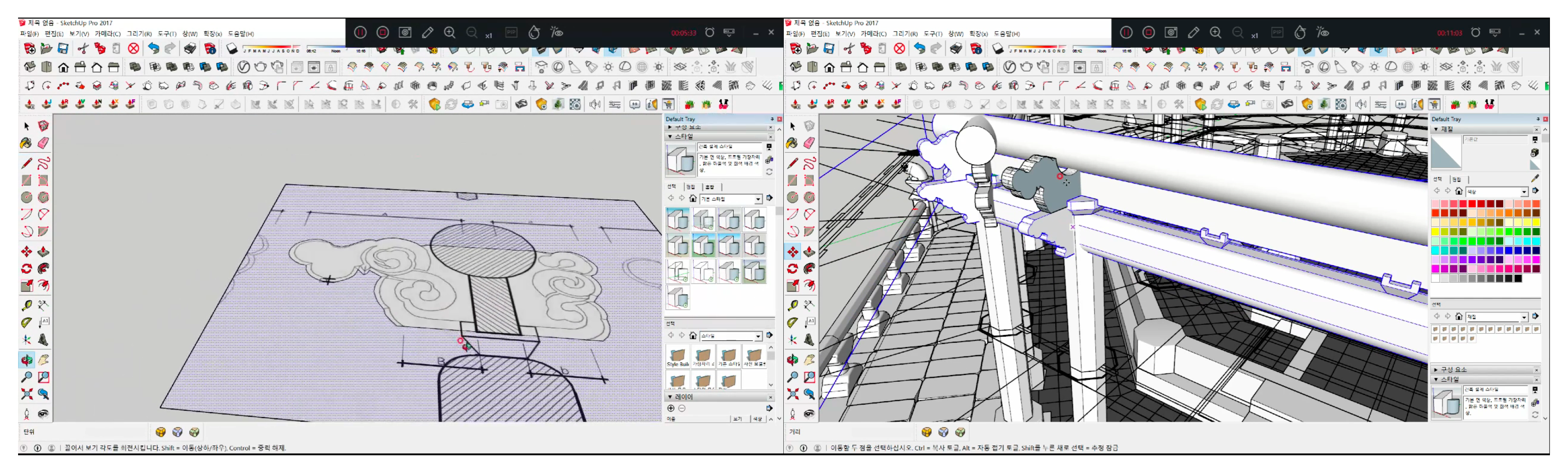
The third step is to build BIM data through PCD and existing archives. Accurate physical shape information on cultural heritage is extracted from PCD, and member names of cultural heritage and on-site investigation records are checked from existing archives. This creates the first BIM data in which physical shape and record are integrated. The main issue at this stage is to accurately build the shape of cultural heritage into 3D geometry model by referring to a large-capacity PCD, and convert this 3D geometry model into BIM data that can be managed. The reason for creating a 3D geometry model with PCD reference first is to minimize the model’s capacity by removing useless information. If BIM data is built using commercial BIM software with reference to PCD, default information included in the modeling tool remains in archives as it is. This information is the cause of making BIM data into an information lump and weakens the user’s access to information. Since the initially created geometry model only represents the shape of cultural heritage, the level of detail (LOD) is not high. LOD can be increased by creating BIM data by inputting information in existing archives to this geometry model from the user’s point of view. In the process of authoring a geometry model as BIM data, it is important to define and input only information necessary for archives from existing historical data. And also, in order to convert into BIM data capable of information management, the structure of cultural heritage should be identified, and BIM data should be constructed so that it can be managed by dividing it by element, part, and level rather than a single mass like PCD. Cultural heritage archives created through this framework can be used for a long time and continuously.

3.3. BIM Modeling Method for Cultural Heritage Archives

The role of integrated PCD in the proposed framework provides accurate information on the current situation. However, since the integrated PCD is a single file, it is inevitable that its utility is degraded when it is necessary to preserve and manage cultural heritage composed of various types of members. Therefore, it is necessary to perform BIM modeling work by referring to the data extracted from PCD. BIM modeling to build cultural heritage archives can be classified in three ways.
The first method is to clean the data from the BIM generated in the design and construction stage in a form suitable for cultural heritage archives [30]. This method is suitable for a cultural heritage that already has BIM data or a newly created cultural heritage. For cultural heritage that already has BIM data, the BIM data may not be accurate compared to the current status information. Therefore, it is necessary to update the BIM data through scanning at a specific maintenance point. When BIM is applied to newly established cultural heritage, information that is not necessary for maintenance and preservation in the design and construction process is often accumulated in BIM data. In this case, due to information that is useless for maintenance and preservation, data operation efficiency may decrease, or unwanted information may be generated when using BIM data. Therefore, cleaning work to make BIM data for maintenance and preservation is essential.
The second method is to automatically convert data acquired through laser scanning to BIM (e.g., scan to BIM) [49,50]. This method requires high-end software (e.g., Trimble Realworks) that can operate a large amount of scan data because it is necessary to integrate PCDs from multiple stations acquired through laser scanning. In order to improve the efficiency for building BIM data, it is necessary to post-process a large amount of scan data. In addition, a software that provides a function to automatically create a BIM object by referring to the post-processed integrated PCD is required. In the case of Korea, the function of automatically generating objects based on scan data is not useful because most of the cultural heritages built are irregular-shaped. In the case of cultural heritages built with a combination of various members, the hierarchy of BIM objects should be reflected in BIM data, but it is difficult to construct systematic BIM data in this way.
The third method is to construct BIM data by using the scan data as an accurate reference. This method extracts main reference data such as plane, cross section, and elevation of scan data, and sets the standard for constructing BIM data by comparing these data with actual data from existing archives. When the standard is set, the shape is accurately authored as BIM data based on the information extracted from the PCD. Through this, a large-capacity PCD can be made into light BIM data. This method has the burden of properly building BIM data once at the beginning, but BIM data referring to PCD from a long-term and continuous perspective is highly useful. Once light BIM data on the shape of a cultural property is constructed, it is necessary to input historical data accumulated previously and convert it into BIM data that contains information that can be managed. BIM data containing information can be used to manage large amounts of data, clarify the hierarchy of BIM objects, and extract various types of information necessary for maintenance and preservation. BIM data composed of various members can be classified through workset and link functions of commercial BIM SWs, so that data necessary for repair and preservation work of specific parts can be selectively utilized [51,52]. Through this method, unlike the integrated PCD, which is a single block, a large amount of data can be efficiently managed. Finally, historical data (e.g., company information, maintenance history, cost, status photos, etc.) through BIM data can be entered as information and managed.
In this study, a phased reverse engineering framework was proposed to construct cultural heritage archives that complement the laser scanning method through the third BIM modeling method. This study applied the proposed a phased reverse engineering framework for a real cultural heritage case.

4. Case Study

4.1. Project Description

The number of nationally designated cultural assets possessed by Seoul is 164 national treasures, 674 treasures, 67 historic sites, 3 scenic spots, 1 natural monument, 13 intangible cultural properties, and 41 folk cultural properties, for a total of 973. Hwangudan, historical site No. 157, is a place for offering sacrifices to the sky [53]. Currently, Hwanggungwoo and three plaster figures remain on the site of Hwangudan. Hwanggungwoo is a three-story, octagonal building built in 1899, and each plaster figure is carved with a colorful dragon pattern in the shape of a musical instrument. In 2016, a total budget of 320 million won was allocated for the repair work of Hwangudan, including government and local expenses, and restoration and maintenance work in 2019 was also carried out, and flame-retardant work is planned in 2020. For the preservation and management of cultural heritage in which continuous costs are invested, archives that can be used continuously and for a long time are essential. This study aims to conduct a case study on the phased reverse engineering framework for Hwanggungwoo. The image in Figure 3 shows the appearance of Hwanggungwoo at the time of survey. The image on the left of Figure 3 is viewed from the front, and the image on the right shows the shape of the main elements of Hwanggungwoo. In addition, this paper intends to discuss long-term use of archives created through case study.

4.2. Phased Reverse Engineering Framework

4.2.1. Laser Scanning to Acquire Physical Status (Step 1)

Prior to performing the laser scanning work at the example site, the Jung-gu Office’s permission was obtained. This area is a no-fly zone in downtown Seoul, and drone flying is prohibited for reasons of defense and security. 3D laser scanning for Hwanggungwoo was conducted over two days on 20 and 21 September 2019. Before performing 3D laser scanning, a temporary scaffolding was installed in Hwanggungwoo as shown in Figure 4 due to the restoration and maintenance work of the Hwangudan.
When performing the existing 3D laser scanning operation, it was effective for post-processing that there were no interference elements other than the scan target. However, with the development of PCD processing software (e.g., Trimble Realworks), it is faster than before to remove points with the same material value at once. The temporary scaffolding installed at this site supported 3D laser scanning work. It was possible to scan the outside of Hwanggungwoo not only at the ground level, but also at various levels with temporary scaffolding installed. In Figure 5, the yellow triangles represent the 3D laser scanning location. This point is called a station, and it takes about 3 min per station, including 2 min for laser scanning and 1 min for image acquisition using a fisheye lens camera. Scanning data and image data for Hwanggungwoo were acquired from 90 stations outside and inside for 2 days. Trimble TX8 was used for 3D laser scanning in this case study. Trimble TX8 is a high-performance 3D laser scanner for precise data acquisition, and its basic point cloud acquisition speed is 1 million points/s. Separate high-resolution camera images and point cloud data can be combined and utilized.
Point cloud data (PCD) measured at multiple locations were integrated through Trimble Realworks. Trimble Realworks have function for point cloud processing and analysis. Especially, this software provides automated tools for point cloud cleanup. The registration process to obtain one PCD is as follows. First, PCD obtained through scanning and images taken with fisheye lenses are acquired. Import PCDs (e.g., *.fls) previously acquired in Trimble Realworks. After importing PCD files and saving the project work data (e.g., *.rwp), the registration work can be managed through this file. Images taken with a fisheye lens are organized through panorama software and converted into picture files (Figure 6). Figure 7 and Figure 8 show the process of attaching images to PCD through Trimble RealColor and the result of matching images to PCD in Trimble Realworks, respectively.
To integrate individual PCDs, the auto-register using planes function of Realworks software was used. Integrated PCD files should be converted to TZF files (e.g., *.e57). After the registration, only the main building was extracted, and noise was removed. The error can be checked by generating a registration report (e.g., *.rtf) using TZF scans. The registration error of nine stations of this case project was confirmed as 2.9 mm as shown in Figure 9. It took more than 10 registration operations to match PCDs shot at a total of 90 stations.
Figure 10 shows the comparison between the unregistered PCD (left) and the registered PCD (right). Figure 11 shows the temporary scaffolding that can be noise in integrated PCD. In this example project, the temporary scaffolding provided stations of various levels in areas where aerial photography was not possible. In addition, through the noise removal function of Trimble Realworks, the temporary scaffolding with the same material value could be quickly removed.
Figure 12 shows images from various views of point cloud data (PCD) that have been registered without noise. Realworks has a 3D modeling function based on point cloud data. However, in the case of Hwanggungwoo, there are many curved members and irregular members. These characteristics are common characteristics of Korean cultural heritages, which is why it is difficult to apply an automated modeling function. In addition, it is necessary to confirm the difference between archives built through existing surveys and PCDs acquired through scanning. This is because historical records that have been investigated for a long time should also be reflected in constructing the cultural heritage archive.

4.2.2. Quality Inspection of Existing Archives (Step 2)

The registered PCD contains all the internal and external shapes of the visible part. Based on this PCD, the quality of archives recorded in the previous Hwanggungwoo dismantling and repair report [58] was inspected. To this end, a section (yellow line in Trimble Realworks) for extracting plane and cross-section information was set from the PCD as shown in Figure 13 (left), and a profile (green lines in AutoCAD) for the section was extracted as shown in Figure 13 (right). These profiles not only serve as a standard for inspecting the quality of existing archives but can also be used as a reference for accurately constructing 3D models of shapes.
In the Hwanggungwoo dismantling and repair report, there is information on the plane, elevation, and section recorded through the actual survey. This information is recorded in CAD format (e.g., *.dwg) and attached as images to the report. In this study, in order to compare and analyze the existing archive and the new archive, the drawing information in image format as shown in Figure 14 and the profile information (green lines) of the plane and section extracted from the PCD were compared. In the case of a plane (left), a difference in shape was found between the information measured in the vertical column (e.g., octagonal column) and the profile extracted from the PCD. In the case of the cross section (right), a difference in shape was found between the information measured in the main horizontal member (e.g., Changbang) and the profile extracted from the PCD. Analysis of these existing archives should precede when constructing a new archive. As such, PCD can be used for quality inspection of existing archives.

4.2.3. BIM Authoring and Management Plan (Step 3)

3D Modeling of Geometry Information

The PCD on the status of cultural heritage does not have perfect symmetry and proportion. In addition, cultural heritage has the potential to undergo shape transformation for a very long time in the future. If such information is reflected in the 3D model as it is, too much effort is put into the modeling work to build the cultural heritage archive. It is very inefficient to construct PCD and BIM data every time for maintenance. For this reason, this study does not aim to perfectly match PCD and BIM data. In this study, in order to construct a 3D model, the part with the least error in shape between the existing archive and PCD was set as the modeling criterion. Figure 15 shows a reference plane for constructing a 3D model of an octagonal Hwanggungwoo through comparative analysis between the existing archive and PCD.
In addition to Hwanggungwoo, many of the cultural heritages built in Korea consist of very many members. PCD, acquired through the input of very expensive equipment and software, is very accurate information, but it is a single chunk. Therefore, it is not suitable as an information model that can be utilized from a continuous and long-term perspective by reflecting the characteristics of the built cultural heritage. In the 3D modeling work to build the information model, the following should be considered. First, the characteristics (e.g., member composition) of cultural heritages must be reflected in the data structure of the 3D model. The availability of the information model depends on how systematically the database is built. If the data structure is not organized in the process of constructing the 3D model, the final BIM data will inevitably be less useful. Second, a large-capacity PCD is not referenced for 3D modeling, but only the reference profile required for 3D modeling is extracted from the PCD to author a 3D model for the member. Figure 16 shows the method of modeling the member based on the reference profile (left) and the image of placing the member in the 3D model (right). Third, the reason it is difficult to directly utilize PCD is that it is not only in a mass, but also has a very large capacity, so it is less efficient in manipulating data. For this reason, the 3D model to be built must have a very small capacity compared to PCD. Figure 17 shows the result of 3D modeling considering the above three points.
In this case study, sketchup was used for 3D modeling. Including information other than the shape information in the 3D model becomes a major factor in increasing the capacity of the model. In particular, in the case of a commercial BIM authoring tool (e.g., Revit) that creates an information model, functions for modeling basic elements are provided. These functions are not optimized for modeling cultural heritages. In addition, the capacity of the software itself is large as it includes a number of functions that are not necessary to build a 3D model for cultural heritages. To manage capacity and prevent input of useless information, a lightweight 3D model was built using Sketchup. A lightweight 3D model was transformed into an building information model (BIM).

Transformation from 3D Geometry Model to BIM Data

A neutral format (e.g., *.ifc) was used to convert the 3D model into a BIM model. As shown in Figure 18, the created 3D model was exported as an ifc file for each part in Sketchup (upper left), and this ifc file was imported in Revit (upper right). The imported 3D model is recognized as a general model (lower left), and it is necessary to record the name of the member by referring to the information recorded in the existing archives (lower right). Through these records, 3D model can be converted to BIM.
Figure 19 shows the BIM model, which was converted to other parts of Hwanggungwoo. BIM is valuable as an information model depending on whether it can be used as a database. Hwanggungwoo is a built cultural property and contains various elements such as stone materials at the base, members made of wood, windows, and tiles. One type of element, such as a tile, is placed on the first, second, and roof of cultural properties. It is effective in terms of utilization to group elements of the same type and manage them as one information.
In this study, to systematically manage numerous members, members of the same type were managed with the group function provided by Revit. This method has the advantage of being able to manage multiple elements as one. These functions provided by commercial BIM authoring tools upgrade the 3D model to an information model so that it can be used as a database. By constructing a systematic database using these functions, the efficiency of utilizing the constructed cultural heritage archives can be maximized. In particular, when a group is used repeatedly several times, when information of all groups needs to be modified, the result of modifying one group can update information of all groups. Figure 20 shows the result of checking the same type of parts through the group function. Visual representation and information about a specific part are checked together in BIM. A list of 108 elements was made by referring to a total of 800 pages of the actual survey and dismantling repair report [58]. As shown in Figure 20, the public officials in charge, who use archives, can grasp the location and information of each elements at a glance. Based on these BIM data, it is possible to know when, what elements, where, and why they were replaced or repaired. These BIM data enable continuous and efficient management.
Like PCD, if BIM data are also in one file, there may be problems in capacity management and partial utilization. The member information classified through the group function can be converted into a separate link file. After saving the group as a separate Revit file (e.g., *.rvt) and linking the link file created in the current project file, the grouped members can be placed in the same location. This function is used when the size of the group is large or it is difficult to manage because there are too many elements in the group [59,60]. If there is a change in the shape or information of the 3D model after converting it to a link file, this independent link file can be modified and loaded the link file in the project file again. This can be used when managing large groups. In particular, it is possible to solve the capacity problem that occurs when multiple groups are managed in one file.

4.3. Scenario Using Cultural Heritage Archives

From a short-term perspective, PCD and BIM data accurately contain current status information on cultural properties. Through these two data, various information on cultural properties can be additionally extracted. Even if you do not go to the site, you can accurately grasp the situation through PCD. In addition, member information included in BIM data can be extracted, or drawings that have not been previously drawn can be extracted into various plane, elevation, and cross-sectional views. In addition, if maintenance is considered in the future, the work of dismantling and reassembling cultural heritages may occur. When the work breakdown structure for disassembly and reassembly is input in BIM data, the disassembly and reassembly process can be implemented with 4D simulation.
From a long-term perspective, the scenario for building cultural heritage archives is shown in Figure 21. First of all, whenever there is an issue with the maintenance of cultural properties, historical records are accumulated in the form of various documents in cultural heritage archives. The PCD, which is the scan data, does not need to be scanned unless it is destroyed or lost every maintenance. In this case, the previously investigated PCD is referred to. Since BIM data are constructed so that historical records can be entered into the shape, information such as problems and current status photos found in the field survey can be linked with the BIM model. Therefore, BIM data do not change significantly in shape, but various records on cultural properties can be accumulated to provide useful information. Historical records, PCD, and BIM data constituting the cultural heritage archives proposed in this study are independent but can be used complementarily. In addition, by managing the information recorded in the previous survey through BIM data, it is possible to prevent loss of information and reduce the effort involved in re-investigation.

5. Practical Implications

This study aims to propose archives for the preservation of cultural heritage from a long-term and continuous perspective. For this, a phased reverse engineering framework was proposed. This framework goes beyond the data acquisition generally dealt with in previous studies and provides a quality inspection method to compare and analyze existing archives and PCD acquired through laser scanning. In addition, a methodology for constructing valuable BIM data as an information model was also presented.
The practical implications of this study are summarized as follows. The first is a method of extracting and utilizing the criteria for geometry modeling from PCD in consideration of the characteristics of cultural properties built in an atypical form. Through this method, high-precision BIM data can be constructed. Second, the file transformation process for managing large amounts of data was presented. The initial 3D model was created based on mass to minimize the capacity, and this model was converted into an information model through the ifc format. Through this, it was possible to compress a lot of large-capacity PCDs. Figure 22 shows the data file size of each software. The size of a part of the PCD file (e.g., Japsang) in a single chunk was 917 MB, whereas 3D geometry model (LOD 200) and BIM data (LOD 300) were analyzed as 40 MB and 499.7 MB, respectively. In the case of a 3D geometry model, it is judged to be at the level of LOD 200 because very accurate shape information referring to PCD is authored. In the case of BIM data, the 3D geometry model data contain only minimal information on cultural properties, so it is judged to be at the level of LOD 300. However, the LOD of BIM data may increase if the information required by the subjects in charge of preserving and managing cultural properties in the future is included. With the development of commercial BIM software and hardware, a very large amount of BIM data can be operated. However, in order to build archives that can be used continuously, BIM data that can be used by defining only necessary information from the perspective of the end user must be built. This can solve the problem of information accessibility of the existing HBIM.
Third, the construction and management method of BIM data for the built cultural heritages was suggested. The built cultural heritages are made up of a wide variety of elements. Therefore, it should be possible to manage this information independently. However, since there are many members of the same type, a method of managing them as groups and links was proposed. In this way, it is possible to provide a database that can record historical records from a long-term perspective. This is the value of BIM data as an information model.
The limitation of this study is that a case analysis of the proposed framework was performed for a single project. Also, a step-by-step framework can be seen as fragmented rather than a process integration. With the development of hardware and commercial software functions, the framework can be developed in a more integrated direction. For example, it is possible to acquire scanning data, inspect quality, and construct BIM data with only one software. Nevertheless, the results of this study can provide insights for constructing digital archives from a long-term and sustainable perspective to public institutions that manage cultural heritages.

6. Conclusions

This paper has dealt with an important issue called a phased reverse engineering framework for building cultural heritage archives using laser scanning and BIM. A standard for BIM data authoring was established by comparing and analyzing PCDs acquired through laser scanning and existing archives. In addition, a method of constructing BIM data for capacity management and information accessibility enhancement was presented. These findings can contribute to establishing a system for preserving many cultural properties from a long-term and sustainable perspective. In particular, cultural heritage archives with enhanced accessibility can provide accurate digital information to public officials in charge of official preservation in the short term. In addition, even if the official person in charge of conservation work changes in the long-term, information loss can be minimized by providing manuals and guidelines for cultural heritage archives.
Finally, this study can be an important basis for further research. Cultural heritage archives built through the proposed framework can be managed in advance by linking with various ICT technologies such as internet of things (IoT), virtual reality (VR), and augmented reality (AR). For example, it is possible to propose a system for monitoring cultural properties by linking sensor data with cultural heritage archives. In addition, when PCD and BIM data are linked with AR/VR, it can have a sufficient ripple effect not only in the construction industry, but also in content industries such as culture and tourism.

Author Contributions

Conceptualization, N.H.; methodology, N.H. and B.-I.B.; validation, N.H. and B.-I.B.; formal analysis, N.H. and B.-I.B.; investigation, N.H. and B.-I.B.; resources, N.H., B.-I.B., and O.-K.Y.; data curation, N.H.; writing—original draft preparation, N.H. and B.-I.B.; writing—review and editing, N.H., B.-I.B., and O.-K.Y.; visualization, N.H., B.-I.B., and O.-K.Y.; supervision, N.H., B.-I.B., and O.-K.Y. All authors have read and agreed to the published version of the manuscript.

Funding

This work was supported by the National Research Foundation of Korea(NRF) grant funded by the Korea government(MSIT) (NRF-2020R1F1A1075751).

Conflicts of Interest

The authors declare that there are no conflict of interest regarding the publication of this paper.

Data Availability

Data generated or analyzed during the study are available from the corresponding author upon request.

References

  1. Cho, H.; Kang, Y. A Study on the Order Status of the Cultural Properties Repair Works in Seoul. J. Korean Inst. Landsc. Archit. 2019, 47, 10–25. [Google Scholar] [CrossRef]
  2. Cultural Heritage Administration, Guideline for National Treasury Subsidy Project for Cultural Heritage Repair and Maintenance. Available online: https://opengov.seoul.go.kr/sanction/19561326?from=cis&tid=24123 (accessed on 28 August 2020).
  3. Sim, K.; Tchah, J. A study on Systems for Compile the List of Architectural Asset and Use of the Inventory; Architecture & Urban Research Institute: Sejong, South Korea, 2013; ISBN 978-89-97468-8-1. [Google Scholar]
  4. Kim, J. The Plan of Repair Information Management through Analysis of Fraudulent Repair and Problems of RepairWork of Architectural Cultural Properties. J. Reg. Assoc. Archit. Inst. Korea 2009, 11, 225–232. [Google Scholar]
  5. Choi, H.; Kim, S. Classification System of BIM based Spatial Information for the Preservation of Architectural Heritage—Focused on the Wooden Structure. Korean Inst. Inter. Des. J. 2015, 24, 207–215. [Google Scholar]
  6. Kim, S.; Song, Y. A Study on the Preservation and Utilization of Repair Records Architectural Cultural Properties. J. Archit. Hist. Autumn Conf. 2019, 271–274. [Google Scholar]
  7. An, D. A Description Method of the Survey Report of Wooden Architectural Heritage. J. Archit. Hist. Autumn Conf. 2019, 305–308. [Google Scholar]
  8. Jeon, M.; Ryoo, S. An Analysis of Classification according to the Timing of the Survey Report on Wooden Architecture Heritage Building. In Proceedings of the Annual Conference of the Architectural Institute of Korea, Chungnam National University, Daejeon, Korea, 24–25 October 2019; Volume 39, pp. 184–187. [Google Scholar]
  9. Yoon, J.; Ryoo, S. A Study on the Advancement of Wooden Cultural Heritage Documentation through 3D Scanning. J. Archit. Inst. Korea 2020, 36, 97–105. [Google Scholar]
  10. Cultural Heritage Administration. National Treasures and Treasure Buildings Cultural Heritage Precision Measurement Guidelines. Available online: http://116.67.83.213/NEW_PDF/20150427_1.pdf (accessed on 30 August 2014).
  11. Cultural Heritage Administration. Guidelines for Building Cultural Heritage 3D Scan Data. Available online: http://www.cha.go.kr/cmm/fms/BoardFileDown.do?atchFileId=FILE_000000000036408&fileSn=0&dwldHistYn=N&bbsId=BBSMSTR_1045 (accessed on 2 September 2018).
  12. Garagnani, S.; Manferdini, A.M. Parametric Accuracy: Building Information Modeling Process Applied to the Cultural Heritage Preservation. Int. Archiv. Photogramm. Remote Sens. Spat. Inform. Sci. 2013, 5, W1. [Google Scholar] [CrossRef] [Green Version]
  13. Marco, L.; Fabrizio, A.; Stefano, C.; Renzo, G.; Alessandro, M.; Domenico, M.; Luca, P.; Lorenzo, S.; Andrea, L. Cultural Heritage Documentation and Conservation: Three-Dimensional (3D) Laser Scanning and Geographical Information System (GIS) Techniques for Thematic Mapping of Facade Stonework of St. Nicholas Church (Pisa, Italy). Int. J. Archit. Herit. 2016, 10, 9–19. [Google Scholar] [CrossRef]
  14. Neumüller, M.; Reichinger, A.; Rist, F.; Kern, C. 3d Printing for Cultural Heritage: Preservation, Accessibility, Research and Education. 3D Res. Chall. Cultural Herit. 2014, 8355, 119–134. [Google Scholar]
  15. Yun, S. Construction Process Analysis of Han-Ok for BIM Based Modern Han-Ok Construction Simulation. Korean J. Constr. Eng. Manag. 2011, 12, 3–10. [Google Scholar] [CrossRef]
  16. Jung, Y.; Kim, Y.; Kim, M.; Ju, T. Concept and Structure of Parametric Object Breakdown Structure (OBS) for Practical BIM. Korean J. Constr. Eng. Manag. 2013, 14, 88–96. [Google Scholar] [CrossRef] [Green Version]
  17. Shin, B.; Kim, Y.; Nam, H. A Case Study on the BIM Application Technique in the Process of Hanok Design by Structuring the Building Materials Data Base. J. Reg. Assoc. Archit. Inst. of Korea 2016, 18, 101–110. [Google Scholar]
  18. Jeon, B.; Seo, H. The New Han-ok and BIM Application—Automatic Hanok Design Software, Magazine of KIBIM. 2016. Summer, Special Issue. pp. 10–17. Available online: http://kibim.or.kr/publication/publication01_1.asp (accessed on 28 September 2020).
  19. Kim, I.; Park, S.; Lee, J. A Framework of the Open BIM-based Integrated Information System for the Korean Traditional House. J. Archit. Inst. Korea Plan. Des. 2012, 28, 13–20. [Google Scholar]
  20. Jang, H.; Lee, J.; Seo, H.; Oh, J.; Kim, J. Analysis of significant factors for successful BIM technology application to Korean traditional house projects. Korean J. Constr. Eng. Manag. 2013, 14, 71–81. [Google Scholar] [CrossRef] [Green Version]
  21. Park, W.; Park, J.; Jeong, S. Application of Building Information Modeling (BIM) for the Activation of Industrialized Wooden Buildings—Focused on the Proposal of Reduction Strategies for Inhibiting Factors of the Spread of New Hanok through Social Network Analysis. KIEAE J. 2017, 17, 113–118. [Google Scholar] [CrossRef] [Green Version]
  22. Reinoso-Gordo, J.F.; Rodríguez-Moreno, C.; Gómez-Blanco, A.J.; León-Robles, C. Cultural Heritage Conservation and Sustainability Based on Surveying and Modeling: The Case of the 14th Century Building Corral del Carbón (Granada, Spain). Sustainability 2018, 10, 1370. [Google Scholar] [CrossRef] [Green Version]
  23. Ham, N.; Lee, S. Empirical study on structural safety diagnosis of large-scale civil infrastructure using laser scanning and BIM. Sustainability 2018, 10, 4024. [Google Scholar] [CrossRef] [Green Version]
  24. Jung, K.; Lee, B.; Kim, T. The Case Study of Revamping of Steel Structure through 3D Scanning Technology. Mag. Korean Soc. Steel Const. 2020, 21–26. [Google Scholar]
  25. National Park Service, HABS Guidelines. Available online: https://www.nps.gov/hdp/standards/habsguidelines.htm (accessed on 20 September 2020).
  26. National Park Service, HABS Guidelines: HABS Guide to Field Documentation. Available online: https://www.nps.gov/hdp/standards/habsfieldguide.html (accessed on 20 September 2020).
  27. English Heritage. Available online: https://www.english-heritage.org.uk/ (accessed on 20 September 2020).
  28. Cultural Heritage Administration. Available online: http://english.cha.go.kr/cha/idx/SubIndex.do?mn=EN (accessed on 21 September 2020).
  29. Cultural Heritage Administration. Available online: http://www.heritage.go.kr/heri/html/HtmlPage.do?pg=/threeD/3dInfomation.jsp&pageNo=6_1_1_1 (accessed on 21 September 2020).
  30. Yang, Y.; Fang, H.; Fang, Y.; Shi, S. Three-dimensional point cloud data subtle feature extraction algorithm for laser scanning measurement of large-scale irregular surface in reverse engineering. Measurement 2020, 151, 107220. [Google Scholar] [CrossRef]
  31. Thamir, Z.S.; Abed, F.M. How geometric reverse engineering techniques can conserve our heritage; a case study in Iraq using 3D laser scanning. MS E 2020, 737, 012231. [Google Scholar] [CrossRef]
  32. Yiliu, X.; Chunsheng, Y.; Kai, X.; Wei, W.; Xing, F.; Jun, H. Application of Reverse Engineering on Spacecraft Assembly Process Simulation. In IOP Conference Series: Materials Science and Engineering; IOP Publishing: Semarang, Indonesia, 2020; Volume 727, p. 012017. [Google Scholar]
  33. Nedelcu, D.; Gillich, G.R.; Gerocs, A.; Padurean, I. A comparative study between photogrammetry and laser technology applied on model turbine blades. In Journal of Physics: Conference Series; IOP Publishing: Bristol, UK, 2020; Volume 1426, p. 012026. [Google Scholar]
  34. Historic England, Photogrammetric Applications for Cultural Heritage. Available online: https://historicengland.org.uk/images-books/publications/photogrammetric-applications-for-cultural-heritage/heag066-photogrammetric-applications-cultural-heritage/ (accessed on 22 September 2020).
  35. Historic England, Multi-light Imaging, Highlight-Reflectance Transformation Imaging (H-RTI) for Cultural Heritage. Available online: https://historicengland.org.uk/images-books/publications/multi-light-imaging-heritage-applications/heag069-multi-light-imaging/ (accessed on 22 September 2020).
  36. Historic England, Using Airborne Lidar in Archaeological Survey. Available online: https://historicengland.org.uk/images-books/publications/using-airborne-lidar-in-archaeological-survey/heag179-using-airborne-lidar-in-archaeological-survey/ (accessed on 22 September 2020).
  37. Yan, L.; Chunlu, L. Applications of multirotor drone technologies in construction management, International. J. Constr. Manag. 2019, 19, 401–412. [Google Scholar] [CrossRef]
  38. Kim, S.; Kim, S.; Lee, D.-E. Sustainable Application of Hybrid Point Cloud and BIM Method for Tracking Construction Progress. Sustainability 2020, 12, 4106. [Google Scholar] [CrossRef]
  39. Mahmood, B.; Han, S.; Lee, D.-E. BIM-Based Registration and Localization of 3D Point Clouds of Indoor Scenes Using Geometric Features for Augmented Reality. Remote Sens. 2020, 12, 2302. [Google Scholar] [CrossRef]
  40. Adán, A.; Quintana, B.; Prieto, S.A.; Bosché, F. Scan-to-BIM for ‘secondary’ building components. Adv. Eng. Inform. 2018, 37, 119–138. [Google Scholar] [CrossRef]
  41. Bosché, F.; Ahmed, M.; Turkan, Y.; Haas, C.T.; Haas, R. The value of integrating Scan-to-BIM and Scan-vs-BIM techniques for construction monitoring using laser scanning and BIM: The case of cylindrical MEP components. Autom. Constr. 2015, 49, 201–213. [Google Scholar] [CrossRef]
  42. Sacks, R.; Eastman, C.; Lee, G.; Teicholz, P. BIM Handbook: A Guide to Building Information Modeling for Owners, Designers, Engineers, Contractors, and Facility Managers, 3rd ed.; John Wiley: Hoboken, NJ, USA, 2018; Available online: https://onlinelibrary.wiley.com/doi/book/10.1002/9781119287568 (accessed on 28 September 2020). [CrossRef]
  43. He, Q.; Wang, G.; Luo, L.; Shi, Q.; Xie, J.; Meng, X. Mapping the managerial areas of Building Information Modeling (BIM) using scientometric analysis. Int. J. Proj. Manag. 2017, 35, 670–685. [Google Scholar] [CrossRef] [Green Version]
  44. Ham, N.; Moon, S.; Kim, J.H.; Kim, J.J. Economic analysis of design errors in BIM-based high-rise construction projects: Case study of Haeundae L project. J. Constr. Eng. Manag. 2018, 144. [Google Scholar] [CrossRef]
  45. Lee, J.; Kwon, N.; Ham, N.; Kim, J.J.; Ahn, Y. BIM-based digital fabrication process for a free-form building project in South Korea. Adv. Civ. Eng. 2019, 2019, 4163625. [Google Scholar] [CrossRef] [Green Version]
  46. Moon, S.; Ham, N.; Kim, S.; Hou, L.; Kim, J.H.; Kim, J.J. Fourth industrialization-oriented offsite construction: Case study of an application to an irregular commercial building, Engineering. Constr. Archit. Manag. 2020. Available online: https://www.emerald.com/insight/content/doi/10.1108/ECAM-07-2018-0312/full/html (accessed on 28 September 2020). [CrossRef]
  47. Ham, N.; Lee, S. Project Benefits of Digital Fabrication in Irregular-Shaped Buildings. Adv. Civ. Eng. 2019, 2020, 372139. [Google Scholar] [CrossRef] [Green Version]
  48. Yoo, M.; Ham, N. Productivity Analysis of Documentation Based on 3D Model in Plant Facility Construction Project. Appl. Sci. 2020, 10, 1126. [Google Scholar] [CrossRef] [Green Version]
  49. Ham, N.; Moon, S.; Kim, J.H.; Kim, J.J. Optimal BIM staffing in construction projects using a queueing model. Autom. Constr. 2020, 113. [Google Scholar] [CrossRef]
  50. Dias, P.D.R.; Ergan, S. Owner requirements in as-built BIM deliverables and a system architecture for FM-specific BIM representation. Can. J. Civ. Eng. 2020, 47, 215–227. [Google Scholar] [CrossRef]
  51. Pishdad-Bozorgi, P.; Gao, X.; Eastman, C.; Self, A.P. Planning and developing facility management-enabled building information model (FM-enabled BIM). Autom. Constr. 2018, 87, 22–38. [Google Scholar] [CrossRef]
  52. Hull, J.; Ewart, I.J. Conservation data parameters for BIM enabled heritage asset management. Autom. Constr. 2020, 119, 103333. [Google Scholar] [CrossRef]
  53. López, F.J.; Lerones, P.M.; Llamas, J.; Gómez-García-Bermejo, J.; Zalama, E. A Review of Heritage Building Information Modeling (H-BIM). Multimodal Technol. Interact 2018, 2, 21. [Google Scholar] [CrossRef] [Green Version]
  54. Jordan-Palomar, I.; Tzortzopoulos, P.; García-Valldecabres, J.; Pellicer, E. Protocol to Manage Heritage-Building Interventions Using Heritage Building Information Modelling (HBIM). Sustainability 2018, 10, 908. [Google Scholar] [CrossRef] [Green Version]
  55. Fadli, F.; AlSaeed, M. Digitizing Vanishing Architectural Heritage; The Design and Development of Qatar Historic Buildings Information Modeling [Q-HBIM] Platform. Sustainability 2019, 11, 2501. [Google Scholar] [CrossRef] [Green Version]
  56. Prizeman, O.; Pezzica, C.; Taher, A.; Boughanmi, M. Networking Historic Environmental Standards to Address Modern Challenges for Sustainable Conservation in HBIM. Appl. Sci. 2020, 10, 1283. [Google Scholar] [CrossRef] [Green Version]
  57. Historic England. Available online: https://historicengland.org.uk/advice/technical-advice/recording-heritage (accessed on 5 August 2020).
  58. Cultural Heritage Adminstration. Hwangudan Repair Work: Dismantling Repair Report 2015–2017; Cultural Heritage Adminstration: Seoul, South Korea, 2017.
  59. Kilkelly, M. Stepping Up to Completing Extra Large Projects in Revit—Part 1. Available online: https://archsmarter.com/large-projects-in-revit-1/ (accessed on 25 August 2019).
  60. Brasiel, M.; Faria, D. A Practical Strategy and Workflow for Large Projects: A Realistic Solution. Available online: https://medium.com/autodesk-university/a-practical-strategy-and-workflow-for-large-projects-a-realistic-solution-9de05d0f6974 (accessed on 24 August 2018).
Figure 1. Research method.
Sustainability 12 08108 g001
Figure 2. Proposed phased reverse engineering framework.
Sustainability 12 08108 g002
Figure 3. Framework application examples: Hwanggungwoo.
Sustainability 12 08108 g003
Figure 4. Temporary scaffolding installation for Hwanggungwoo maintenance work.
Sustainability 12 08108 g004
Figure 5. 3D laser scanning and locations of 3D laser scanning.
Sustainability 12 08108 g005
Figure 6. Processing images shot with fisheye lenses using Autopano Giga.
Sustainability 12 08108 g006
Figure 7. Image matching to point cloud data in Trimble RealColor.
Sustainability 12 08108 g007
Figure 8. The result of image matching to point cloud data in Trimble Realworks.
Sustainability 12 08108 g008
Figure 9. Generation of registration report.
Sustainability 12 08108 g009
Figure 10. Comparison image before and after point cloud data (PCD) registration.
Sustainability 12 08108 g010
Figure 11. Temporary scaffolding in integrated PCD.
Sustainability 12 08108 g011
Figure 12. Images from various views of point cloud data (PCD) that have been registered without noise.
Sustainability 12 08108 g012
Figure 13. Extraction of reference information for quality inspection of existing archives.
Sustainability 12 08108 g013
Figure 14. Comparative analysis of existing archives and new archives.
Sustainability 12 08108 g014
Figure 15. Establishing reference information for 3D Modeling.
Sustainability 12 08108 g015
Figure 16. 3D modeling using reference information.
Sustainability 12 08108 g016
Figure 17. 3D model for the geometry information of Hwanggungwoo.
Sustainability 12 08108 g017
Figure 18. Transformation process from 3D geometry model to building information model (BIM) data.
Sustainability 12 08108 g018
Figure 19. BIM data of Hwanggungwoo.
Sustainability 12 08108 g019
Figure 20. Images confirming various types of absences from the BIM model.
Sustainability 12 08108 g020
Figure 21. Scenario for building cultural heritage archives from a long-term perspective.
Sustainability 12 08108 g021
Figure 22. Data file size of each software.
Sustainability 12 08108 g022

