
Vulnerability of the Landscape as a Tool for Determining a Suitable Model of Tourism Development


Abstract
:1. Introduction
2. Determining Landscape Vulnerability
3. Methodical Section
- Determination of the basic set of landscape receptors.
- Determination of vulnerability assessment criteria.
- Quantitative assessment of vulnerability criteria.
- Determination of the degree of receptor vulnerability.
- Expression of the reliability of the evaluation.
3.1. Determination of the Basic Set of Landscape Receptors
- Geophysical and biophysical receptors represent the basic abiotic and biotic characteristics of the landscape, including the receptors relief, rock environment, soil, air and local climate, water, and biota (flora, fauna, biotopes).
- Landscape receptors include aggregate parts of the landscape primarily perceived as receptors of change, namely the landscape structure, the landscape image, and the ecological stability of the landscape.
- Socio-economic receptors represent the requirements of society in a given area. They include the society’s activities in the area, such as settlements, cultural and historical values, protected areas, tourism and recreation, agriculture, industry and technical, and transport infrastructure.
3.2. Determination of Vulnerability Assessment Criteria
3.3. Quantitative Assessment of Vulnerability Criteria
- The degree of sensitivity of the criterion expresses its sensitivity to the effects of any external interventions; it is a numerical expression of the qualitative evaluation of the obtained characteristics of the criterion for the model area.
- The degree of significance of a criterion expresses the importance of that criterion in comparison to other criteria that together describe the receptor. It reflects the relevance of the criterion in the functioning the receptor as a unit.
3.4. Determining the Degree of Vulnerability
3.5. Degree of Reliability of Evaluation of the Selected Criteria
4. Results
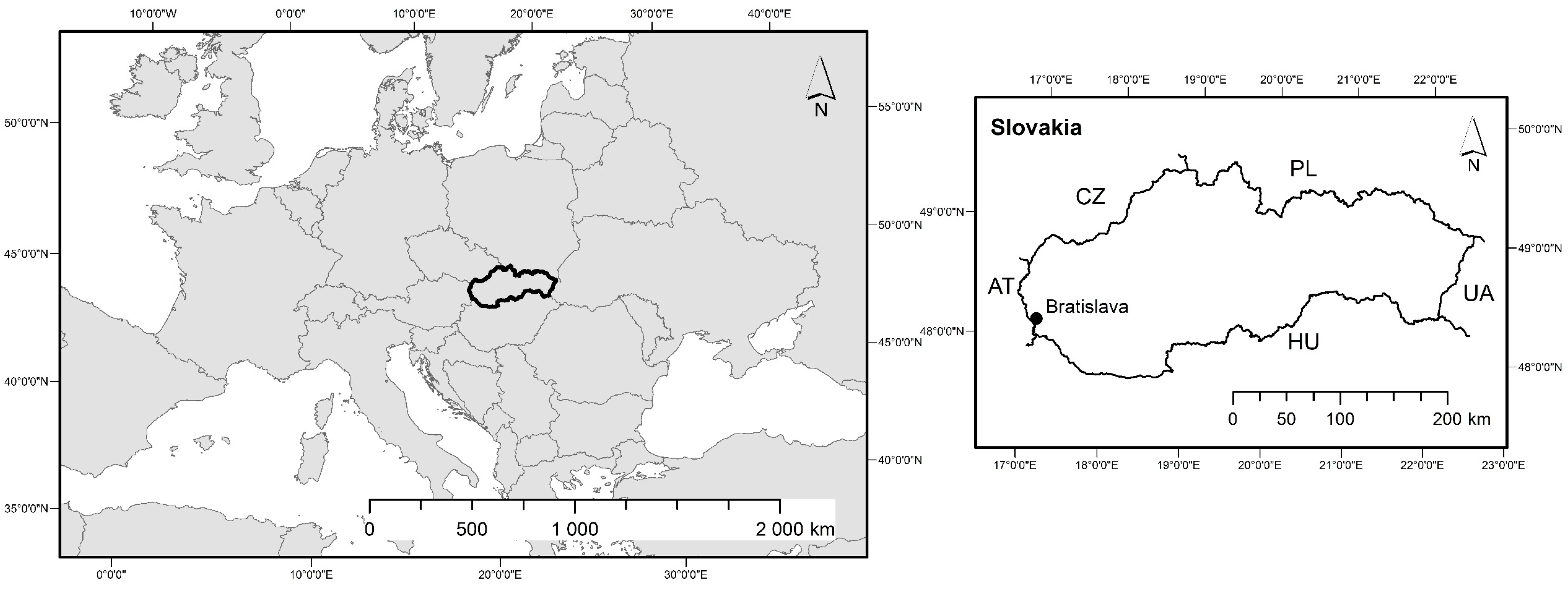
4.1. Study Site
4.2. Landscape Vulnerability Analysis of the Model Area
5. Discussion
6. Conclusions
Author Contributions
Funding
Institutional Review Board Statement
Informed Consent Statement
Data Availability Statement
Acknowledgments
Conflicts of Interest
References
- Oueslati, W.; Salanit, E. Landscape Valuation and Planning. J. Environ. Policy Plan. 2011, 54, 1–6. [Google Scholar] [CrossRef]
- Wu, J. Landscape Ecology, Cross-Disciplinarity, and Sustainable Science. Landsc. Ecol. 2006, 21, 1–4. [Google Scholar] [CrossRef]
- Grzywacz, R.; Žegleń, P. Principles of Tourism and Recreation; Wydawnictwo Uniwersytetu Rzeszowskiego Rzeszów: Rzeszów, Poland, 2014; 95p. [Google Scholar]
- Pavličková, K.; Vyskupová, M.; Igondová, E. Rajecká Dolina recreational landscape potential. J. Land. Manag. 2014, 5, 21–27. [Google Scholar]
- Sunlu, U. Environmental impacts of tourism. In Local Resources and Global Trades: Environments and Agriculture in the Mediterranean Region; Camarda, D., Grassini, L., Eds.; CIHEAM Options Méditerranéennes: Paris, France, 2003; pp. 263–270. [Google Scholar]
- Harris, R.; Griffin, T.; Williams, P. Sustainable Tourism: A Global Perspective; Routledge: Oxford, UK, 2002; 311p. [Google Scholar]
- Ravencroft, D. The environmental impact of recreation and tourism development: A review. Environ. Policy Gov. 1992, 2, 8–13. [Google Scholar]
- Anděl, J.; Balej, M.; Jeřábek, M.; Oršulák, T.; Raška, P. Comprehensive Geographical Research of the Cultural Landscape: II. Part Development of Environmental Stress in Northwestern Bohemia in the Period of Transformation; Komplexní geografický výzkum kulturní krajiny: II. díl Vývoj environmentálního stresu v severozápadních Čechách v období transformace; MINO: Ústí nad Labem, Czech Republic, 2008; 176p. [Google Scholar]
- Wu, J. Key concepts and research topics in landscape ecology revisited: 30 years after the Allerton Park workshop. Landsc. Ecol. 2013, 28, 1–11. [Google Scholar] [CrossRef]
- Forman, T.T.R.; Godron, M. Landscape Ecology; Krajinná Ekologie; Academia: Prague, Czech Republic, 1993; 583p. [Google Scholar]
- Varšavová, M. Vulnerability assessment of the abiotic complex of the alpine environment of the Belianske Tatras. Hodnotenie zraniteľnosti abiotického komplexu vysokohorského prostredia Belianskych Tatier. Oecol. Mont. 2002, 11, 19–23. [Google Scholar]
- Lindhjem, H.; Reinvang, R.; Zandersen, M. Landscape Experiences as a Cultural Ecosystem Service in a Nordic Context: Concepts, Values and Decision-Making; Rosendahls-Schultz Grafisk: Copenhagen, Denmark, 2015; 189p. [Google Scholar]
- Mlakar, A. Relevance of vulnerability analysis and environmental premises for comprehensive planning. Geod. Vestn. 2009, 53, 526–542. [Google Scholar]
- Golobič, M.; Žaucer, B. Landscape Planning and Vulnerability Assessment in the Mediterranean—Final Report; Regional Activity Center for the Priority Actions Program: Ljubljana, Slovenia, 2010; 92p. [Google Scholar]
- Vyskupová, M. Landscape evaluation methods within EIA in Slovakia. In Proceedings of the International Academic Symposium Planned and Normative Protection of Space and Environment, Palić, Subotica, Serbia, 4–6 April 2013; The Association of Spatial Planners of Serbia: Belgrade, Serbia; pp. 35–41. [Google Scholar]
- Minár, J. Geoecological (complex physical-geographical) research and mapping on a large scale. Geoekologický (komplexný fyzickogeografický)výskum a mapovanie vo veľkých mierkach. Geogr. Spectr. 2001, 3, 1–210. [Google Scholar]
- Toro, J.; Duarte, O.; Requena, I.; Zamorano, M. Determining vulnerability importance in environmental impact assessment. The case of Colombia. Environ. Impact Assess. Rev. 2012, 32, 107–117. [Google Scholar] [CrossRef]
- Eakin, H.; Luers, L. Assessing the vulnerability of social-environmental systems. Annu. Rev. Environ. Resour. 2006, 31, 365–394. [Google Scholar] [CrossRef] [Green Version]
- Tran, L.T.; Knight, C.G.; O’Neil, R.V.; Smith, E.R.; Ritters, K.H.; Wickham, J. Fuzzy decision analysis for integrated environmental vulnerability assessment of the mid-Atlantic Region. Environ. Manag. 2002, 29, 845–859. [Google Scholar] [CrossRef] [PubMed]
- Toro, J.; Requena, I.; Duarte, O.; Zamorano, M. A qualitative method proposal to improve environmental impact assessment. Environ. Impact Assess. Rev. 2013, 43, 9–20. [Google Scholar] [CrossRef]
- Luers, A.; Lobella, D.; Sklard, L.; Addamsa, L.; Matsona, M. A method for quantifying vulnerability applied to the agricultural system of the Yaqui Valley Mexico. Glob. Environ. Chang. 2003, 13, 255–267. [Google Scholar] [CrossRef]
- Li, A.; Wang, A.; Liang, S.; Zhuoa, W. Eco-environmental vulnerability evaluation in mountainous region using remote sensing and GIS—A case study in the Upper Reaches of Minjiang River, China. Ecol. Model. 2006, 192, 175–187. [Google Scholar] [CrossRef]
- Drdoš, J.; Mocik, A.; Ondrášik, R.; Soták, Š.; Vrana, K.; Bedrna, Z.; Kibíček, F.; Ružičková, H.; Kalivodová, E.; Hrnčiarová, T.; et al. Methodological Manual to the Act. of the National Council of the Slovak Republic No. 127/1994 Coll. on Environmental Impact Assessment, Part Ecological Carrying Capacity; MoE SR: Bratislava, Slovakia, 1996; 49p. [Google Scholar]
- Wilson, K.; Pressey, R.; Newton, A.; Burgman, M.; Possingham, H.; Weston, C.H. Measuring and incorporating vulnerability into conservation planning. Environ. Manag. 2005, 35, 527–543. [Google Scholar] [CrossRef]
- Janessen, R. On the use of multi-criteria analysis in Environmental impact assessment in the Netherlands. J. Multi-Criteria Decis. Anal. 2001, 10, 101–109. [Google Scholar] [CrossRef]
- Dodgson, J.S. Multi-Criteria Analysis: A Manual; Communities and Local Government Publications: London, UK, 2009; 168p.
- Ružička, M.; Miklós, L. Landscape-ecological planning (LANDEP) in the process of the territorial planning. Ecology 1982, 1, 297–312. [Google Scholar]
- Hrnčiarová, T.; Miklós, L.; Kalivodová, E.; Kubíček, F.; Ružičková, H.; Izakovičová, Z.; Drdiš, J.; Rosová, V.; Kovačevičová, S.; Midriak, R.; et al. Ecological Bearing Capacity of the Landscape: Methodology and Application to 3 Beneficial Areas; Ekologická únosnosť krajiny: Metodika a aplikácia na 3 benefičné územia. Part I.—IV. Ecological project; MoE SR, ILE SAS, GEF: Bratislava, Slovakia, 1997; 490p. [Google Scholar]
- Bastian, O.; Krönhert, R.; Lipský, Z. Landscape diagnosis on different space and time scales—A challenge for landscape planning. Landsc. Ecol. 2006, 21, 359–374. [Google Scholar] [CrossRef]
- Muradyan, V.S.; Asmaryan, S.G. Applying landscape-ecological concept and GIS modelling for assessing and mapping of ecological situation of mountainous landscapes (on the case of Syunik marz, Armenia). Geocarto Int. 2015, 30, 1077–1091. [Google Scholar] [CrossRef]
- Pavličková, K.; Vyskupová, M. A method proposal for cumulative environmental impact assessment based on the landscape vulnerability evaluation. Environ. Impact Assess. Rev. 2015, 50, 74–84. [Google Scholar] [CrossRef]
- Huang, I.B.; Keisler, J.; Linkov, I. Multi-criteria decision analysis in environmental sciences: Ten years of applications and trends. Sci. Total Environ. 2011, 409, 3578–3594. [Google Scholar] [CrossRef] [PubMed]
- Vyskupová, M.; Pavličková, K.; Baus, P. A landscape vulnerability analysis method proposal and its integration in EIA. J. Environ. Plann. Man. 2017, 60, 1193–1213. [Google Scholar] [CrossRef]
- Frederik, J. Statistical Methods in Experimental Physics; World Scientific Publishing: London, UK, 2006; 364p. [Google Scholar]
- Markechová, D.; Tirpáková, M.; Stehlíková, B. Basics of Statistics for Teachers; Základy štatistiky pre pedagógov. FNS; Constantine the Philosopher University in Nitra: Nitra, Slovakia, 2011; 405p. [Google Scholar]
- Bock, R.K.; Grote, H.; Notz, D.; Regler, M.; Früwirth, R. Data Analysis Techniques for High Energy Physics Experiments; Cambridge University Press: Cambridge, UK, 2000; 448p. [Google Scholar]
- Freedman, D.A. Statistical Models: Theory and Practice; Cambridge University Press: Cambridge, UK, 2009; 458p. [Google Scholar]
- Benyovszky, K. Železná Studnička; Marenčin PT: Bratislava, Slovakia, 2005; 96p. [Google Scholar]
- Loft, A.S. Evaluation of the Traffic Survey; Vyhodnotenie Prieskumu Návštevnosti: Bratislava, Slovakia, 2012; 28p. [Google Scholar]
- Turner, M.G.; Gardner, R.H.; O’Neil, R.V. Landscape Ecology in Theory and Practice: Pattern and Process; Springer: New York, NY, USA, 2003; 403p. [Google Scholar]
- Kolejka, J. The Landscape Theory. The Geographical Insight and Scope; Náuka o Krajine—Geografický Pohled a Východiska; Academia Praha: Prague, Czech Republic, 2013; 439p. [Google Scholar]
- Hobbs, R. Future landscapes and the future of landscape ecology. Landsc. Urban. Plan. 1997, 37, 1–9. [Google Scholar] [CrossRef]
- Vyskupová, M. Methodical Procedures for the Evaluation of Landscape Attributes in Environmental Impact Assessment; Metodické Postupy Hodnotenia Atribútov Krajiny v Posudzovaní Vplyvov na Životné Prostredie. Ph.D. Thesis, Faculty of Natural Sciences, Comenius University in Bratislava, Bratislava, Slovakia, 2015. [Google Scholar]
- De Groot, R.S. Functions of Nature: Evaluation of Nature in Environmental Planning, Management and Decision Making; Wolters-Noordhoff Gronigen: Wageningen, The Netherlands, 1992; 315p. [Google Scholar]
- Moldan, B. Captured Planet; Podmaněná planeta; Karolinum: Prague, Czech Republic, 2009; 420p. [Google Scholar]
- Van Der Heide, M.; Heijman, W. The Economic Value of Landscapes; Routledge: London, UK, 2013; 336p. [Google Scholar]
- Neuendorf, F.; von Haaren, C.; Albert, C. Assessing and coping with uncertainties in landscape planning: An overview. Landsc. Ecol. 2018, 33, 861–878. [Google Scholar] [CrossRef] [Green Version]
- Klopatek, J.M.; Gardner, R.H. (Eds.) Landscape Ecological Analysis—Issues and Applications; Springer: New York, NY, USA, 1999; 400p. [Google Scholar]
- Dudek, T. Recreational potential as an indicator of accessibility control in protected mountain forest areas. J. Mt. Sci. 2017, 14, 1419–1427. [Google Scholar] [CrossRef]
- Cetic, M.; Sevik, H.; Canturk, U.; Cakir, C. Evaluation of the recreational potential of Kutahya urban forest. Fresenius Environ. Bull. 2017, 27, 2629–2634. [Google Scholar]
- Hermes, J.; van Berkel, D.; Burkhard, B.; Plieninger, T.; Fagerholm, N.; von Haaren, C.; Albert, C. Assessment and evaluation of recreational ecosystem services of landscapes. Ecosyst. Serv. 2018, 31, 289–295. [Google Scholar] [CrossRef] [PubMed]
- Ivlev, V.; Ivleva, M.; Panyukov, A.; Zulfugarzade, T. Analysis of the Touristic Recreational Potential of a Territory as a Condition for Development of Ecological Tourism (the Southern Moscow Region Case Study). J. Environ. Manag. Tour. 2017, 2, 373–384. [Google Scholar]
- Aranzabal, I.; Schmitz, M.; Pineda, F. Integrating Landscape Analysis and Planning: A Multi-Scale Approach for Oriented Management of Tourist Recreation. Environ. Manag. 2009, 44, 938–951. [Google Scholar] [CrossRef] [PubMed]


| Receptor | Vulnerability Assessment Criteria |
|---|---|
| Geophysical and Biophysical Receptors | |
| Relief | Vertical division of the territory |
| Morphological-morphometric types of relief | |
| Altitude | |
| The slope of the territory | |
| Rock environment | Type of quaternary sediments |
| Subsoil thickness | |
| Engineering-geological properties | |
| Occurrence of seismic-tectonic phenomena | |
| Occurrence of geodynamic phenomena | |
| Presence of mineral resources | |
| Contamination of the rock environment | |
| Soil | Soil types |
| Textural soil types | |
| Soil depth | |
| Quality of agricultural land | |
| Susceptibility of soils to degradation | |
| Degree of soil pollution | |
| Air and local climate | Temperature |
| Amount of precipitation | |
| Wind direction and intensity | |
| Occurrence of extremes | |
| Level of air pollution | |
| Water | Occurrence of water management protected areas |
| Surface water flow | |
| Surface water quality | |
| Groundwater level | |
| Groundwater quality | |
| Occurrence of springs | |
| Biota | Type of vegetation cover |
| Shape and size of vegetation areas | |
| Forest health | |
| Species occurrence | |
| Origin of species | |
| Significant migration corridors | |
| Biotopes | Biotope type |
| Biotope condition | |
| Spatial representation of biotope | |
| Landscape receptors | |
| Landscape structure | Types of landscape elements |
| Land use | |
| Landscape mosaic | |
| Landscape image | Landscape image |
| Architectural trends | |
| Ecological stability of the landscape | Current state of landscape elements |
| Ecological significance of landscape elements | |
| Socioeconomic receptors | |
| Settlements | Population density |
| Degree of urbanization | |
| Development trends | |
| Cultural and historical values | Representation and status of cultural monuments |
| Local traditions and customs | |
| Protected areas | Areas protected by law |
| NATURA 2000 sites | |
| Biotopes of European and national importance | |
| Territorial system of ecological stability | |
| Tourism and recreation | Natural attractions of the area |
| Cultural and historical attractions of the area | |
| Tourism facilities | |
| Agriculture | Representation of arable land |
| The structure of the growing base | |
| Industry | Industrial base structure |
| Development trends | |
| Technical infrastructure | Elements of technical infrastructure |
| Network connection | |
| Transport infrastructure | Elements of transport infrastructure |
| Traffic intensity | |
| Interconnectedness of the territory | |
| Factor | Values | ||
|---|---|---|---|
| Sensitivity | 1 | very low sensitivity | The receptor is very insensitive to external influences. During the action of external influence, the receptor is almost unaffected, or it is only minimally affected, and is able to return to its initial state immediately. |
| 2 | low sensitivity | The sensitivity of the receptor to external influences is low, the receptor is able to return to its original state by its own autoregulatory mechanisms after the end of the action of disturbance. | |
| 3 | medium sensitivity | The sensitivity of the receptor to disturbances is moderate, i.e., the receptor is able to return to its original state at the end of their action, but usually aid measures are needed. | |
| 4 | high sensitivity | The sensitivity of the receptor to external influences is high, a strong degradation of its state and properties is expected. Return of the receptor to its original state is possible with the input of external forces, i.e., using an appropriate combination of measures and technical interventions. | |
| 5 | very high sensitivity | The sensitivity of the receptor to external influences is high, a strong degradation of its state and properties is expected. Restoration of the receptor is possible only with the help of demanding measures and technical interventions. | |
| Relevance | 0–100% | The sum of the significances of all criteria of a given receptor is 100%. | |
| Factor | Values | |
|---|---|---|
| Confidence Interval | 0.1 | The degree of sensitivity of a criterion is determined by an expert assessment of an expert in the given scientific field, on the basis of complete necessary data on the given criterion, or on the basis of a realized scientific assessment of the vulnerability of the given criterion, according to a recognized methodological procedure. |
| 0.3 | The degree of sensitivity of a criterion is determined by expert judgment on the basis of complete necessary data on the given criterion. | |
| 0.5 | The degree of sensitivity of a criterion is determined by expert judgment on the basis of obtained available data on the given criterion. | |
| 0.7 | The degree of sensitivity of a criterion is determined by estimation on the basis of incomplete data on the given criterion. | |
| 1 | The degree of sensitivity of a criterion is determined by estimation on the basis of missing data on the given criterion. | |
| Receptor | Assessment Criteria | SE | SI | IS |
|---|---|---|---|---|
| Natural values | Forest stands and non-forest woody vegetation | 4 | 45 | 0.3 |
| Watercourses and areas | 3 | 35 | 0.5 | |
| Biota | 3 | 20 | 0.3 | |
| Protected areas | Areas and elements protected by law | 2 | 30 | 0.3 |
| Natura 2000 Sites | 3 | 35 | 0.5 | |
| Biotopes of European and national importance | 4 | 35 | 0.5 | |
| Landscape structure | Landscape elements | 3 | 50 | 0.1 |
| Land use | 2 | 50 | 0.1 | |
| Landscape image | Visual character of the landscape | 2 | 50 | 0.1 |
| Architectural trends | 2 | 50 | 0.1 | |
| Ecological significance | Current state of landscape elements | 4 | 60 | 0.1 |
| Ecological stability of the landscape | 4 | 40 | 0.3 | |
| Cultural and historical values | Cultural sites and events | 2 | 50 | 0.5 |
| Historical sites | 3 | 30 | 0.1 | |
| Local traditions and values | 1 | 20 | 0.7 | |
| Tourist and recreational infrastructure | Recreation facilities | 3 | 40 | 0.1 |
| Sporting sites | 3 | 35 | 0.1 | |
| Tourist attractions | 4 | 25 | 0.1 | |
| Transport infrastructure | Site connectivity | 2 | 20 | 0.3 |
| Access roads | 2 | 35 | 0.1 | |
| Tourist trails | 3 | 15 | 0.1 | |
| Bicycle paths | 3 | 15 | 0.1 | |
| Nature trails | 4 | 15 | 0.1 |
| Receptor | V | R |
|---|---|---|
| Natural values | 3.45 | 0.730 |
| Protected areas | 3.05 | 1.021 |
| Landscape structure | 2.05 | 0.227 |
| Landscape image | 2.00 | 0.141 |
| Ecological significance | 4.00 | 0.268 |
| Cultural and historical values | 2.10 | 0.994 |
| Tourist and recreational infrastructure | 3.25 | 0.257 |
| Transport infrastructure | 2.45 | 0.552 |
Publisher’s Note: MDPI stays neutral with regard to jurisdictional claims in published maps and institutional affiliations. |
© 2021 by the authors. Licensee MDPI, Basel, Switzerland. This article is an open access article distributed under the terms and conditions of the Creative Commons Attribution (CC BY) license (https://creativecommons.org/licenses/by/4.0/).
Share and Cite
Vyskupová, M.; Krnáčová, Z.; Pavličková, K. Vulnerability of the Landscape as a Tool for Determining a Suitable Model of Tourism Development. Sustainability 2021, 13, 5622. https://doi.org/10.3390/su13105622
Vyskupová M, Krnáčová Z, Pavličková K. Vulnerability of the Landscape as a Tool for Determining a Suitable Model of Tourism Development. Sustainability. 2021; 13(10):5622. https://doi.org/10.3390/su13105622
Chicago/Turabian StyleVyskupová, Monika, Zdena Krnáčová, and Katarína Pavličková. 2021. "Vulnerability of the Landscape as a Tool for Determining a Suitable Model of Tourism Development" Sustainability 13, no. 10: 5622. https://doi.org/10.3390/su13105622