1. Introduction
Over the past few decades, climate change has caused social and economic damage worldwide, including heat waves, cold snaps, floods, heavy rains, and wildfires. As many major cities have grown up along coasts and rivers, disasters, particularly those involving water, have become closer to home [
1]. In New York City, Hurricane Sandy, an unprecedented storm of unprecedented magnitude, destroyed hundreds of thousands of homes and caused over
$65 billion in economic damage in October 2012. In 2021, precipitation in China’s Yangtze River Basin was the highest since 1961, displacing more than 3.8 million people [
2]. Korea is also being exposed more frequently to various disasters, especially as rainfall patterns change, making it more challenging to deal with heavy rainfall disasters [
3]. In August 2022, Seoul experienced the heaviest rainfall in its observation history. Over 30% of the average annual precipitation, 426.5 mm, fell during a half-day period. In particular, Dongjak-gu, Seoul, experienced the highest rainfall since weather observations began in the city in 1907 [
4].
Many post-industrial cities, including the United States and the Republic of Korea, have separated the waterfront from human life by viewing it only as urban infrastructure or a disaster area. Although past perspectives focused on quickly meeting the needs of the industrial era, urban waterfronts need to be reinvigorated through delicate and integrated planning to respond to disasters, become critical ecological habitats, and strengthen the social functions of cities [
5].
Resilience theory, studied in the 1970s, is concerned with how ecological systems can maintain and restore their original state in response to external crises. This theory is of great significance to today’s urban context, which is undergoing unprecedented change. In response, urban experts are exploring ways to develop sustainable cities by focusing on the autonomous resilience and future adaptability of urban ecosystems. In other words, resilience theory is being expanded and applied as a methodology to secure social and spatial systems that respond to disasters while providing ecological habitats and spaces for more diverse human activities [
6]. Towards the conclusion of the 20th century, there was a transformation in the perception of traditional urban forms. It became evident that cities are intricate, adaptable, and evolving, deviating from a rigid architectonic order [
7]. Researchers have discovered that urban and ecological systems can be fundamentally comprehended through a shared systemic framework.
These theoretical studies have been applied increasingly to urban space; the Resilient by Design challenge (RbD) is a typical example. The RbD, which has been running for a year since May 2017, differs from the usual design competition aimed at developing a specific site. It is a design initiative that responds from the resilience perspective to places already urbanized, even though the damage caused by sea level rise is predicted. This is an extension of the Rebuild by Design competition, which ended in 2014. On the other hand, there is a clear difference between the two projects. While the Rebuild by Design competition was inspired directly by the devastating Hurricane Sandy that struck the eastern United States in 2012 and its recovery, RbD is a design competition that considers disasters that are yet to occur or incremental disasters that occur slowly but go unnoticed [
8]. Another difference is that while the Rebuild by Design competition was driven federally and funded by the Rockefeller Foundation, RbD is driven by the power of local communities. The approach to climate change is relevant to Seoul, Republic of Korea, which is situated on the Hangang River.
The Hangang River flows westward from the northeastern part of the Korean Peninsula and is the primary river of the capital city. During the reconstruction and development phase of the city from the 1960s to the 1980s, the Korean government focused only on infrastructure. Many other values, such as cultural, ecological, and economic potentials, were underestimated. Despite constant efforts after 2006, the current riverfront design was not fully interrelated with its existing contexts, and it is not ready to respond to various environmental and urban changes.
This study aims to identify meaningful physical design and social system strategy elements that can be universally applied. It then intends to establish a framework for transforming the Hangang River into a more resilient public riverfront based on a critical review of the nine proposals of the RbD.
2. Methodology
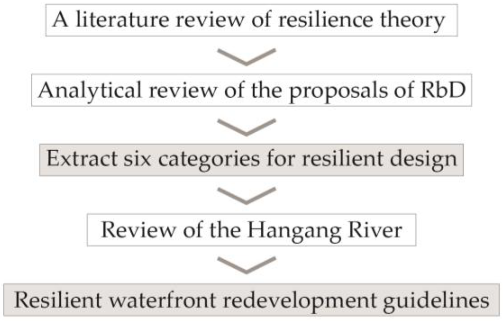
Initially, commence with a literature review to examine the evolution of resilience theory as a framework for understanding urban challenges. Grounded in urban resilience theory, the nine resilient design proposals of RbD were analyzed. While RbD comprises nine distinct proposals executed by various designers in different locations, they all share a common goal: the restoration of urban resilience. In the literature review of RbD, we aimed to extract common strategies prevalent in all these proposals. The common strategies are organized into six categories. The categories were an analytical framework for crafting socially and physically resilient urban waterfront spaces. Universally applicable guidelines for design and planning were also formulated. Subsequently, the Hangang River waterfront in Seoul, Republic of Korea, was analyzed using the analytical framework. The spatial scope covers 41.5 km of the Hangang River waterfront space within the boundaries of Seoul. A direction for a more resilient and sustainable redevelopment of the Hangang River waterfront is proposed based on the guidelines and the site analysis.
Figure 1 is a flow diagram of this study.
3. Urban Resilience
The concept of resilience was first mentioned in the field of ecology in Holling’s 1973 paper Resilience and Stability of Ecological Systems, in which he defined resilience as the ability of an ecosystem to maintain its essential functional characteristics in response to external disturbances [
9]. Holling distinguished between “engineering” resilience, which refers to the ability of a system to return to its pre-disturbance state, and dynamic “ecological” resilience, which focuses on maintaining the core functions. Understanding ecosystems through this framework has been instrumental in developing the socioecological system (SES) theory led by a group of multidisciplinary-minded ecologists [
10]. SES theory extends Holling’s ecological concept to the “social” by conceptualizing nature and society as intertwined and coevolving systems. According to SES, humans are complex, integrated systems that are a part of nature.
Moreover, there is a clear link between ecological and social resilience for social groups or communities that depend on ecological and environmental resources for their livelihoods [
11]. The concept of resilience has since been expanded as a “way of thinking” to analyze and address specific fields by applying ecological mechanisms to various empirical contexts [
12]. The concept has been applied to various fields, including urban systems, natural disaster management, psychology, sociology, geography, psychiatry, and public health, to study and utilize systems at various scales linked to physical conditions, including people, objects, and services. In the 2000s, resilience expanded outward from traditional socioecological resilience to urban planning [
13].
Meerow analyzed 172 papers on urban resilience from various disciplines over the 41 years from 1973, when Holling’s concept of resilience emerged, to 2013. He categorized 25 definitions of resilience and collated the different concepts to define urban resilience as follows: “Urban resilience refers to the ability of an urban system and all its constituent socioecological and socio-technical networks across temporal and spatial scales to maintain or rapidly return to the desired functions in the face of a disturbance, to adapt to change, and quickly transform systems that limit current or future adaptive capacity [
14]”.
Rapid urbanization has led to numerous social and economic challenges, including expanding flood zones, extreme weather events, and spreading infectious diseases. These are concentrated in densely populated urban areas, and responding to them requires a holistic approach to analyzing cities’ physical, social, and ecological vulnerabilities. This emphasizes the need to integrally manage and adapt to current shocks and stresses rather than changing existing political, economic, and social structures [
15]. Resilience requires a different approach to planning and design, including collaboration.
Across disciplines, broader user engagement, and the application of new technologies in response, academia and industry are developing urban response strategies based on resilience theory [
16]. Strategies to this end are being implemented in cities worldwide, whether at the national or city level or by networks of public, private, and nonprofit sectors. For example, U.S.-based philanthropic organizations like the Rockefeller Foundation have demonstrated macro-level problem-solving through Rebuild by Design (2014) and Resilient by Design (2017) competitions.
4. Resilient by Design Challenge
Launched in 2017, the RbD was a design challenge for the coastal neighborhoods of the San Francisco Bay Area, which are facing global warming-induced sea level rise and increasingly frequent and intense hurricanes, flooding, and earthquakes, to approach problems and design solutions from a resilience perspective. Supported by the Rockefeller Foundation, the competition, which is a collaboration of residents, government, and industry, is not just a design competition to develop a new destination but is part of a plan to change the situation and a movement to bring about a long-term, major transformation [
8].
Nine consortia (Permaculture + Social Equity, Bionic, Common Ground, The Home, All Bay Collective, Public Sediment, Field Operations Team, HASSELL, and BIG + ONE + Sherwood) proposed strategies to organize the community that the region needs and address the significant challenges that society will face in the future.
Table 1 summarizes the goals of each team and their main design strategies.
Each team’s strategies to implement urban resilience showed common characteristics that differed from those of previous conventional design competitions.
One notable aspect was that the RbD significantly emphasizes social issues, particularly regional disparities, rather than focusing solely on physical spatial reconfiguration. All teams participating in this competition fundamentally consider regional imbalances as the primary hurdle to achieving urban resilience. The Permaculture + Social Equity (P + SET) team prioritizes enhancing community capacity and local ecological literacy, specifically focusing on marginalized and vulnerable communities. The Bionic team presents a range of measures to bolster community resilience in a balanced manner. The Home and All Bay Collective teams similarly prioritize rectifying regional imbalances as the ultimate design objective, proposing strategic approaches to address this concern.
A second distinguishing characteristic of RbD is that the majority of teams strive to enhance accessibility through transportation infrastructure as a means to address regional disparities. The All Bay Collective team envisions a transportation scenario that extends into the long term, accounting for anticipated changes arising from a sea level rise. A central element of the team’s design is a looped trail that spans the entire area, fostering improved access to recreational spaces and bridging disconnected urban areas. The Common Ground team proposes an integrated planning system around Route 37. This comprehensive approach includes an upgraded transportation system encompassing rail, the Bay Trail, and open spaces for pedestrians and cyclists. The goal is to enhance accessibility in support of social equity. Equal access to socially vibrant spaces was also a focal point for the Hassel+ team. Their project’s physical design strategy prominently involved connecting Orange Memorial Park to the waterfront, enabling pedestrians and cyclists to engage with diverse forms of green open space.
Closely linked to the first point, the proactive involvement of all teams in engaging residents throughout the planning process is the third characteristic of the competition. This active engagement aims to provide a more realistic approach to addressing local challenges and uncovering the issues and opportunities within the area, as perceived by the users. For example, the P + SET team has developed a medium- to long-term project to pilot a capacity-building program with residents. This initiative aims to enhance their collaboration with municipalities, regulatory bodies, and local stakeholders. The project entails intercommunity partnerships, resilience-building activities through educational hands-on workshops, and a comprehensive watershed-level plan. This plan identifies six sites for physical remediation, achieved through citizen participation.
Similarly, the Bionic team conducted multiple public hearings and implemented visual aids, such as logos, stickers, brochures, and a 3D-printed flood kit. These measures have been taken to foster a more direct connection with the public and better comprehend community requirements. The Field Operations team has also taken an innovative approach by operating a mobile station named the “sponge hub.” This mobile unit toured churches, markets, and schools in South City, facilitating feedback collection from residents while disseminating information about disaster preparedness at a local level. The All-Bay Collective is actively engaged in comprehending the ramifications of climate change on the community. They introduced the “in it together game,” which serves as a sea level rise adaptation activity for residents, highlighting their commitment to involving the community.
Addressing the diverse needs of residents and reflecting on the local context naturally gives rise to the design of varied spaces and programs. As a result, most teams participating in this competition pursue diversity in terms of space, program, and participant actors. The BIG + ONE + Sherwood teams propose diverse programs and spaces to bolster local industry and ecology within the six pilot projects. These included a ferry terminal, arts district, vertical warehouse, education center, water plaza, natural watershed, and job training center. Similarly, the All Bay Collective team closely considered community preferences and, based on these insights, presented proposals encompassing affordable housing in the core, a community farm, a daycare center, a business incubator, a waterfront park, a grocery store, accessory dwelling units, a new transit center, and a vendor market. Pursuing diversity is not an isolated objective but rather an inherent outcome of accommodating multifaceted needs. Ecologically and culturally diverse spaces and programs are also integral to other teams’ plans.
Fifth, all teams recognize the limitations of existing management operations and are working to establish comprehensive governance systems to cultivate a more resilient social system capable of responding to disasters. The Field Operations team, for example, advocates establishing cross-jurisdictional governance to facilitate holistic management across a wide area. This network-based system begins with an MOU and proposes the development of a new South Bay Multi-Benefit Resiliency District. Similarly, the Common Ground team outlines a system for integrated planning, programming, and policymaking, uniting various entities around State Route 37. The All Bay Collective team proposes an Estuary Commons—an interconnected network of diverse entities to generate social, economic, and environmental co-benefits. The BIG + ONE + Sherwood team introduces the concept of an Islais Creek Authority (ICA) designed to manage and operate the Islais Creek watershed collectively.
Sixth, most proposals incorporate plans for long-term funding to establish a sustainable system directly and practically. The All Bay Collective envisions the development of a long-term leasehold housing complex called the “Resilient Equity Hub” to cover sustainable project costs. The Home team proposes the establishment of a “Green Mitigation Fund” to stimulate job growth and finance expenses through small subdivision development. Moreover, the team suggests institutional arrangements to enhance waste, energy, and water management efficiency, saving the county funds and imposing fees on new developments. The Field Operations team explores the potential of available upland sites through a “land swap” strategy to produce a sustainable funding source. The Common Ground team advocates for an integrated planning system centered around State Route 37, involving various entities, and encompassing funding mechanisms.
Finally, regarding physical design methodologies, the competition unsurprisingly accentuates ecological systems, with all teams proposing designs rooted in a long-term perspective on human adaptation to changing natural conditions. The bionic team presents architectural solutions that will remain viable after sea level rise inundates densely populated low-lying areas. Their proposals involve redesigning existing parks to accommodate climate change, developing new transportation networks, including underwater cities, and designing a series of artificial reefs to connect fragmented coastal ecosystems. The Public Sediment team devises a water edge to ensure continuous, long-term sediment transport from the upstream to the estuary, ensuring an adequate sediment supply at the mouth of the basin. Their design delineates the spaces that distinguish and combine sediment accumulation zones, ecological habitat areas, and spaces for human use. The Common Ground team also contributes to ecological restoration by designing sediment collectors and tracks to enhance sediment transport. The Field Operations team suggests developing a physically resilient space capable of withstanding climate change by organizing ponds, salt marshes, seasonal freshwater wetlands, floodplains, and other green spaces in a sponge-like arrangement to achieve the ecotone effect.
5. Guidelines for Resilience Design
Building on the nine strategies introduced in the previous chapter, this section categorizes the implications of the RbD proposals and guidelines for designing resilient waterfront spaces, organizing their features into governance systems, financial planning, public engagement, accessibility, ecology, and diversity (
Table 2).
6. Hangang River
This chapter assesses the present condition of the Hangang River based on the framework established in the prior analysis. The chapter examines the design, management, and operation of the Hangang River in terms of governance, financing, public engagement, accessibility, ecology, and diversity. This exercise identifies issues to guide the direction of the redevelopment plan of the river.
6.1. Governance
The Hangang Riverfront is currently under the management and operation of the Seoul Hangang Park Headquarters, a division of the Seoul Metropolitan Government. This centralized administrative body functions as a single optimized entity focused on efficient performance rather than a diverse network of actors. This traditional governance structure falls short of encompassing the extensive physical and social impacts of the river in the city. Accordingly, the Hangang River waterfront services supply is currently disjointed from the corresponding demand. This disconnect makes it challenging for providers to grasp consumer needs. It limits their capacity to cater to the diverse requirements of varied user groups involved in the public space’s redevelopment, management, and operation.
Therefore, the new governance paradigm should shift away from provider-driven operations and management. Instead, it should actively engage individuals and organizations linked to the Hangang River in the open space’s redevelopment, operation, and management. For example, consider the case of Seoul Forest, a pioneer in private partnership park operation and management in Korea. The park has been entrusted to a private nonprofit, Seoul Green Trust, solely for the operation and management program. Although it is widely acknowledged to have heightened park user satisfaction and diversified programs [
19], there are concerns regarding the separation of authority from the Korea Facilities Management Corporation, which oversees the physical environment of Seoul Forest. Drawing insights from such cases, achieving integrated management of the Hangang Riverfront necessitates establishing links between public and private organizations and bridging the functional gap between these entities.
Thirty-six tributaries flow into the river in Seoul. These tributaries are managed by an administrative department within the Seoul Metropolitan Government, separate from the aforementioned river management entity [
20]. Furthermore, rivers within the Hangang River basin outside Seoul fall under the jurisdiction of the river management division of the Ministry of Environment. Ideally, the ecological and functional aspects of the Hangang River would be best addressed through a watershed-based management approach rather than being constrained by administrative divisions. Therefore, the new governance system should establish a network structure that extends beyond the jurisdictional boundaries.
6.2. Financial Planning
Maintaining open spaces, including the Hangang River, is intricately linked to economic conditions, necessitating concrete and tangible financial resources. The management of the Hangang Riverfront falls under the purview of the Seoul Hangang Park Headquarters, an entity operating within the framework of Seoul Metropolitan City. The primary source of funding for this endeavor relies on tax collection. Ko’s research shows that despite the potential for Seoul’s budget to increase, the allocation for park creation and management remains limited [
21]. This constraint is attributed primarily to the fact that budgetary priorities are subject to change every four years in alignment with shifting government policies.
Moreover, the overarching budget is inherently tied to the prevailing economic climate, which has experienced persistent deterioration since the onset of the 2008 global financial crisis. In subsequent years, particularly the decade starting in 2010, slow growth and diminishing economic vitality were observed. In particular, external variables, such as the trade tensions between the United States and China and the onset of the COVID-19 pandemic, have heightened uncertainties, prompting concerns about the potential emergence of a global economic crisis [
22].
In this context, maintaining a consistent and sustainable budgetary commitment becomes apparent. Public parks and green areas are not designed to produce short-term results through temporary financial injections. A traditional and passive green open space would be ill-equipped to adapt proactively to fluctuating economic conditions. An autonomous system capable of generating substantial financial resources is essential to safeguard waterfront development and management plans from vulnerability to changing circumstances.
6.3. Public Engagement
In the case of Seoul, an administrative system offers several ways to engage users in urban public spaces’ design, maintenance, and management, including the ‘Resident Participation Budget System,’ ‘Resident Participation Regeneration Project,’ and ‘Resident Participation Supervision System.’ State-funded projects exceeding a certain size must undergo a public hearing process, often resulting in huge modifications or cancellations, particularly when met with opposition from residents. Therefore, in practice, government-organized public participation meetings often remain administrative exercises. According to Kim et al., public participation workshops for community facilities often employ an approach to override participants’ objections and achieve consensus rather than genuinely gathering opinions on residents’ needs [
23].
The ongoing “Great Hangang River” project (Hangang Renaissance 2.0) on the riverfront is a substantial endeavor pursued with an unwavering commitment by the current government. This plan is characterized by robust leadership from the Seoul Metropolitan Government, emphasizing landmarking significant facilities. This emphasis supersedes considerations for the ecology, diversity, and accessibility of the river. In particular, the landmarking plan for the Nodle Island district of the Hangang River seeks to replace the Nodle Village, constructed just five years ago through a design competition at 49 billion KRW (30 million USD), to establish a new foundation [
24]. While the construction of attention-grabbing facilities should not be opposed unconditionally, it is prudent to reevaluate whether such government-driven construction truly reflects the voices of diverse stakeholders. Therefore, in addition to the top-down approach, the bottom-up drive should also function as a driving force, shaping the overall trajectory of the project, particularly in the context of the Great Hangang River Project.
6.4. Accessibility
6.4.1. Highways along the River
The Gangbyeonbuk-ro roadway is a highway with eight to twelve lanes situated on the northern bank of the Hangang River. This thoroughfare extends over a distance of 37.37 km (23.22 miles) and serves as a connection between Seoul and Na-myangju. Likewise, the Olympic-daero, an eight-lane highway, is positioned along the southern riverbank. It extends 40.67 km (25.27 miles) and links Seoul with Gimpo, Hanam, and the Gimpo International Airport [
25]. Both roads are vital circulation routes connecting Seoul’s eastern and western parts. The mobility framework of the city centers around the river, forming a primary framework (
Figure 2).
The utilization rates of Hangang Parks are notably lower than those of prominent urban parks in Seoul, including Seoul Forest, Seoseoul Park, and Gangbuk Large Park. This disparity can be attributed to a prominent challenge facing the Hangang riverfront: limited accessibility. In the Hangang Renaissance project, only limited efforts were invested in constructing nine pedestrian underpasses. Although these measures were designed with a human-scale approach, they fell short in instigating large-scale urban transformation or establishing effective entrances to the riverfront.
Given the vital role of highways in city transportation, any viable plan to improve pedestrian accessibility to open space must consider the necessity to honor and preserve this framework without undertaking radical transformation or erasure.
6.4.2. Land Use along the River
A significant part of the riverbank is taken up by extensive residential complexes, leading to the privatization of public spaces. These high-density complexes, often exceeding 200 × 200 m in size, are typically inaccessible to the public. Historically, landowners and construction companies played pivotal roles in urban planning endeavors, prioritizing private profit over the public role of the site. Furthermore, the government exhibited apathy concerning the consequences of these short-sighted strategies, and there were no established guidelines or regulations for private entities to oversee public access to the Hangang River. As a result, the endeavor to create a regional-scale urban plan with a forward-looking vision for improving connectivity between the riverfront and the city remains a formidable challenge.
On the other hand, not the entire region is dedicated to residential developments. The remaining portion of the riverbank, comprising 24% of its total length, includes commercial zones, educational institutions, industrial facilities, green areas, sports complexes, and underutilized land. A substantial part of this underutilized land, notably the abandoned railroad depot, is situated in the central sector of the northern riverbank. This specific area remains dormant despite earlier intentions to transform it into an international business district known as the Yongsan International District (
Figure 3).
6.5. Ecology
Economic development took precedence under President Chung-hee Park in the 1970s. To address the increasing demand for residential areas, the city initiated an expansion project to the southern side of the Hangang River. This expansion involved the construction of flood-prevention embankments and the development of large-scale apartment complexes on both riverbanks, which, in turn, limited public access to the riverfront [
27]. During the 1980s and 1990s, the city government embarked on a series of proactive urban improvement and beautification initiatives in preparation for hosting the Asian Games in 1986 and the Olympic Games in 1988. Aligned with the Hangang General Development Plan, the government rejuvenated the riverfront by establishing multiple public parks between 1982 and 1987. As part of this plan, the construction of the Gangbyeonbuk-ro and Olympic-daero roads along the river was undertaken [
28]. A solid concrete levee was erected along the water’s edge, and construction materials like sand and gravel were excavated to improve the river’s capacity. The Hangang General Development Plan outlined a comprehensive urban planning strategy that resulted in substantial environmental alterations [
29]. Ecological concerns have intensified since that period. Such extensive development degraded the ecological habitats and reduced their ability to manage stormwater and flooding, particularly in light of climate change.
According to the comprehensive flood damage reduction plan by the Seoul Metropolitan Government, there are 80 designated river disaster risk zones, all situated near the Hangang River [
30]. Erratic rainfall patterns and increased intensity contribute to substantial damage in areas with population and infrastructure [
31]. 2011 Seoul experienced substantial damage due to heavy rainfall measuring 110.5 mm per hour [
32]. The intensity reached a higher level in 2022, recording 141.5 mm of rain per hour, resulting in an extensive and overwhelming flood [
4]. According to the findings of Park et al., their numerical simulations revealed the potential for floods to inundate a significant area measuring 2.179 km
2 in Yeouido, with water levels reaching a maximum depth of 5.054 m. This indicates the potential for extensive damage in the event of a river overflow [
5].
Beyond flood-related risks, the existing structure of the river shoreline proves highly unfavorable for post-flood riverfront restoration. Following a flood, clearing mud and restoring the affected space necessitates a significant allocation of human resources and equipment [
33]. This is primarily a result of the construction of concrete structures in line with the Hangang General Development Plan, which aimed to separate the natural flooding river from the urban area. More extreme rainfall patterns will emerge, leading to more severe local damage.
6.6. Diversity
First established in the 1980s, the initial concept of the Hangnag Riverfront centered around a sports park, primarily offering sports facilities such as soccer, basketball, and badminton [
34]. On the other hand, this strategy faced notable constraints in fully utilizing the river’s historical role as a dynamic cultural space that encapsulates public interests in its entirety. In response, the Seoul Metropolitan Government initiated a new Hangang River redevelopment project in 2006.
The Hangang Renaissance Project stands as the penultimate large-scale intervention devised by the Seoul government to address challenges accumulated during the rapid development phases by reconfiguring the spatial layout of the riverfront area [
35]. The project redesigned a total of eleven riverfront parks on both banks of the river. Previously dedicated to industrial purposes, these parks have been revitalized into public open spaces [
36]. Despite these efforts, the riverfront has not yet emerged as a dynamic catalyst for addressing diverse urban needs. With the exception of a few small commercial and recreational amenities, the present condition of these parks remains uninvolved and dull, primarily characterized by green areas and pathways. These parks lack integration with their surrounding environment and do not effectively cater to the requirements of urban dwellers. All eleven parks established along the Hangang River adhere to a standard public park design, offering limited functionalities and recreational options.
According to Kim et al., most visitors to the Hangang Riverfront are primarily interested in simple activities, such as walking, relaxation, and bicycling, while engaging in less frequent activities, such as camping and water sports [
37]. On the other hand, extensive research suggests that lifestyle and leisure behaviors are constantly evolving, driven by sociodemographic factors, increasing incomes, and reduced working hours. People are increasingly looking for a wider range of outdoor recreational spaces, and there has been a notable uptick in the frequency of festivals, performances, and events held in public areas [
38]. These findings suggest that potential users of the Hangang River are willing to enjoy the various facilities, but the space lacks activation because of poor accessibility and a deficiency of engaging programs. A range of appealing programs will require a comprehensive plan to activate the riverfront based on thorough research into the distinct local contexts of the open space and the desires of various user groups.
7. Result
This chapter reports the results of the guidelines to redevelop the Hangang River, focusing on governance, financing, user participation, accessibility, ecology, and diversity. These guidelines are derived from examining previous RbD proposals and the current condition of the Hangang River (
Table 3).
The governance section underscores the necessity of adopting a more comprehensive perspective, both spatially and administratively, shifting away from the current fragmented management and operational entities. This shift is crucial for ensuring the sustainable management and operation of the Hangang River. A self-sustaining economic circulation system is proposed in financing, contrasting with passive reliance on tax revenues. This can be achieved by strategic development and investment in real estate along the river. Regarding public participation, a more democratic design process can be actualized by diversifying workshop formats, devising effective communication methods, and developing an educational and outreach toolkit. To enhance accessibility, a more assertive approach to undergrounding or overpassing roads is suggested, building upon a meticulous assessment of the surrounding environment.
Regarding ecology, a shift towards a basin-level perspective, coupled with alterations in the structure of the concrete levee and a clear demarcation between spaces for people and nature, are needed. In terms of diversity, it is essential to observe users’ evolving patterns of open space usage and elevate the waterfront to a level that offers a more enriching experience and functions adeptly. Achieving this involves considering the diverse contexts of the site.
8. Discussion
Other studies that intersect with our research, which evaluates approaches to Hangang waterfront development by reviewing RbD through a resilience theory lens, investigate the theory, site, and project cases in ways that differ from our approach.
Choi et al. [
7] analyzed the process of urban open space design through the lens of urban resilience theory; Jun’s research [
26], proposed a solution through adaptability, a concept closely related to resilience, for the renovation of the Hangang River; and Lambrou’s research [
39], which examined RbD’s proposals from different frameworks, interpreted the theory, investigated the site, and analyzed the case project from alternative perspectives.
Choi et al. [
7] examined the design process of a large park in Seoul, specifically Yongsan Park, based on resilient theory. Their study developed a unique urban resilience framework, encompassing six categories: park infrastructure, social dynamics, economic dynamics, health and well-being, governance networks, and planning and institutions. Each category comprises three to five subcategories, and issues in the design process are evaluated using preliminary analysis criteria for each subcategory. The study’s findings propose a novel approach to the Yongsan Park project, differing from traditional methods. Our research and theirs are similar in emphasizing a holistic approach through resilience design compared to traditional generic methods. However, the two studies differ in that there are partial distinctions in the categories highlighted in the analysis framework, and our study presents more detailed design guidelines.
Additionally, Jun analyzes the Hangang River from the perspective of adaptability, proposing solutions to enhance the waterfront environment. In this study, Jun distinguishes the concepts of resilience and adaptability. Using adaptability, he categorizes the site into changeable and non-changeable factors, presenting a master plan to ensure urban resilience and sustainability. Consequently, the design strategies, such as expanding the ecological area, providing diverse spaces, introducing facilities for generating financial resources (commercial waterfront), and enhancing accessibility, align with our study. However, there is a difference in approach; Jun’s research focused primarily on proposing physical environmental changes through a site survey, while our study emphasised establishing a social and non-material urban system.
Meanwhile, Lambrou’s study examines the strategies proposed in RbD and derives meaningful implications for the urban design process. The research analyzes how resilience design aims to mitigate climate risks ecologically and socially, outlining the implications of resilient landscapes for equity [
39]. In contrast to our study, Lambrou’s research identifies public engagement, accessibility, and eco-based strategies as potential means of achieving social resilience or social equity. His study places socially and regionally balanced development at the forefront and offers substantial implications centered around this concept.
9. Conclusions
This study conducted a comprehensive review of RbD’s proposals as a basis for developing strategies to reorganize urban waterfront spaces capable of adapting to unpredictable changes. The outcome of the analytical review was employed as a framework for renovating Seoul’s Hangang River. To enhance waterfront spaces in major cities, such as the Hangang River, the following elements are of utmost importance: governance systems, financial planning, public engagement, accessibility improvements, ecological expansion, and diversification enhancements. In the study results, practical guidelines were derived from each category, offering actionable recommendations. The critical characteristics and implications of resilience design, as gleaned from previous studies, are as follows.
First, in the RbD competition for the San Francisco Bay Area, almost all teams set “regionally balanced development” as the ultimate goal, a universal direction that should be pursued in most cities worldwide that want to build resilient systems, including Seoul. Regional disparities are inevitable in the U.S., which is culturally more diverse than Korea, and the RbD seeks to mitigate them by accommodating diverse needs and improving accessibility through a systematic governance system and a process of user engagement. This is also the case in Korea. Regional disparities in real estate prices have widened considerably between the south and north of the Hangang River and between those with access to the riverfront and those without access. By applying the strategies that emerged from the RbD, the Hangang River can mitigate regional disparities and develop a more horizontal social structure by improving access to the riverfront and embracing diversity. As a city is a collection of different groups, every part cannot be perfectly socially healthy, and there will always be certain areas that are vulnerable to unpredictable changes. A resilient design acts as a countermeasure to prevent the system from experiencing severe disruptions caused by vulnerable points in the city through balanced development.
Second, urban ecological vulnerability shares its roots with social vulnerability, so designers must approach the problem with a holistic understanding of the dynamics between the two. The Bay Area and the Hangang River have seen their former ecological functions degraded by industrialization. The ecological functions of the Hangang River and the Bay Area have been neglected along with their cultural and social functions as cultivation activities have been carried out along the riverside, landfilled garbage, artificial dikes have been built, and infrastructure, such as highways, have been constructed. In Korea, real estate prices are relatively low in areas adjacent to landfills, hazardous waste storage facilities, sewage treatment facilities, and overpasses. In the United States, there is a clear correlation between race and the distribution of these aversive facilities [
40]. The fact that the radius of socially disadvantaged people and ecologically fragile areas overlap significantly suggests a significant correlation between the two values.
The third characteristic of resilience design, which builds on the previous point, is that resilience design must consider a much broader and more diverse frame of time and space than traditional design. Hence, the designer in charge must act as a generalist rather than a specialist, mediating and coordinating various situations. Rooted in ecology, resilience design is a theoretical framework that presupposes a “complex organic system in constant flux”, and analyzes that system with various actors and at different scales. The problems that resilience seeks to solve are complex and require complex solutions, so the six frameworks suggested in this study are far from exhaustive. Nevertheless, they must be addressed comprehensively and equally at a very detailed level. Establishing governance systems, securing financial resources, and increasing user participation can be considered for social resilience while improving accessibility, ecology, and diversity can be considered for physical resilience. Physical resilience is a means to realize social resilience and vice versa. These complement the relationship between hardware and software and have a very complex network-like relationship rather than a neat linear cause-and-effect relationship. Complex solutions can be proposed only by understanding the dynamics within each category and subcategories.
Finally, the waterfront space, considered a place to revitalize the city and provide a place of culture, needs to be reinterpreted with deeper significance in light of the unprecedented challenges we are currently facing. After the industrialization era, the waterfront space could function as a very beneficial space for human activity, and people can view it as a public open space in the city. Currently, the city’s waterfront space should be viewed as a space with more complex functions and meanings than just cultural functions. The waterfront areas, including those susceptible to flooding along the river, offer the opportunity for humans to harmonize with nature through thoughtful landscape planning and design. Such approaches can aid in mitigating the potential impacts of climate change while fully activating the space [
41]. Natural water spaces like oceans, rivers, and streams cannot be controlled anthropologically. This has become even more uncontrollable due to climate change, and water spaces must be managed differently. This forces a re-imagination of the relationship between humans and nature, and a tipping point must be sought to address this issue. Resilient design is part of that tipping point.


