Article

Spatial–Temporal Heterogeneity of Urbanization and Ecosystem Services in the Yellow River Basin

1
College of Geographic Science, Shanxi Normal University, Taiyuan 030031, China
2
Institute of Human Geography, Shanxi Normal University, Taiyuan 030031, China
3
Institute of Ecology and Environment of Yellow River Basin, Taiyuan 030031, China
*
Author to whom correspondence should be addressed.
Sustainability 2023, 15(4), 3113; https://doi.org/10.3390/su15043113
Submission received: 10 January 2023 / Revised: 3 February 2023 / Accepted: 7 February 2023 / Published: 8 February 2023
(This article belongs to the Special Issue Advances in Ecosystem Services and Urban Sustainability)

Abstract

:
Taking 736 counties in the Yellow River Basin of China as the research area, the comprehensive urbanization development level and ecosystem service capacity from 2000 to 2020 were measured. Combined with spatial autocorrelation, the spatial pattern evolution characteristics of the two systems in the Yellow River Basin were revealed. The spatio–temporal geographically weighted regression (GTWR) model was used to analyze the spatio–temporal heterogeneity of the impact of various elements of the system on urbanization and ecosystem service capacity. The results showed that (1) the urbanization level and ecosystem service capacity of the Yellow River Basin were on the rise but the urbanization level and ecosystem service capacity were low, while the spatial and temporal heterogeneity was significant. (2) The two systems are positively correlated in space, and the agglomeration characteristics are significant. The evolution trend of urbanization from an L–L agglomeration area to an H–H agglomeration area is occurring gradually. The spatial change in the ecosystem service agglomeration area is small, and the stability is strong. (3) The impact of ecosystem services on comprehensive urbanization is enhanced by time, and the spatial ‘center–periphery’ diffusion characteristics are significant. (4) The influence of urbanization on the comprehensive ecosystem service capacity is enhanced and shows the law of east–west differentiation in space. There are obvious transition zones in the spatial heterogeneity interval of the interaction between the two systems.

1. Introduction

China is the fastest developing country in the world regarding urbanization. The urbanization rate of the resident population has increased by 46.8% from 1978 (17.92%) to 2022 (64.72%) [1]. The urban spatial expansion and large-scale population agglomeration brought by rapid urbanization have caused multi-dimensional stress and even irreversible degradation of the ecosystem. The relationship between urbanization and ecological factors has aroused social concern [2]. In the 1960s, ecosystem services (ESs) were first proposed [3]. Urbanization is an important driving force affecting the trade-off and synergy of ecosystem services [4], the supply–demand relationship [5], functional capacity change, and value assessment [6]. Population agglomeration [7], urban land area expansion [8], urban–rural gap change, urban–rural energy resource consumption [9], etc., have promoted the evolution of the contradiction between the supply and demand of ecosystem services [10]. Domestic and foreign scholars use data space overlay [11], the coupling coordination model [12], the ‘state–pressure–response’ model of the ecological environment [13], the gray correlation model [14], and other methods to study the coupling coordination degree of urbanization and the ecosystem. The STIRPAT model [15], the system dynamics (SD) model [16], the interactive stress model [17], the geographical detector technique [18], the spatio–temporal geographically weighted regression model [19], the OLS least squares method [20], and other methods are used to study the interaction between the single factors and multi-factors of the system. Population urbanization is an important factor that disturbs changes in the ecosystem. Macro policies to control urban spatial expansion can effectively reduce ecological pressure. Scholars have explored the relationship and interaction mechanism between urbanization and ecosystem services on the global, national, provincial, and municipal scales and achieved good results. However, at the watershed and county scales, the research depth needs to be strengthened. Some scholars have studied a single city and some groups in the region for the counties in the Yellow River Basin [21], using the ecosystem service value equivalent table to quantitatively analyze the ecological level of the basin [22], but the relevant parameters lack regional characteristics. Strengthening the county scale of the whole Yellow River Basin and exploring the response mechanism between the elements of urbanization and the dimensions of ecosystem services from the spatial and temporal dimensions are conducive to the ecological protection and high-quality development of the Yellow River Basin [23]. This paper constructs a comprehensive index system of the urbanization level in the Yellow River Basin, calculates the comprehensive urbanization development level, uses the InVEST model to quantitatively measure the ecosystem service capacity, and analyzes the temporal changes and spatial agglomeration characteristics of the elements of the two systems in 736 counties in the Yellow River Basin from 2000 to 2020. The spatio–temporal heterogeneity of the interaction between ecosystem service function and comprehensive urbanization development in the Yellow River Basin is analyzed by using the spatio–temporal geographically weighted regression (GTWR) model, which provides a reference for urban development and ecological protection in the Yellow River Basin.

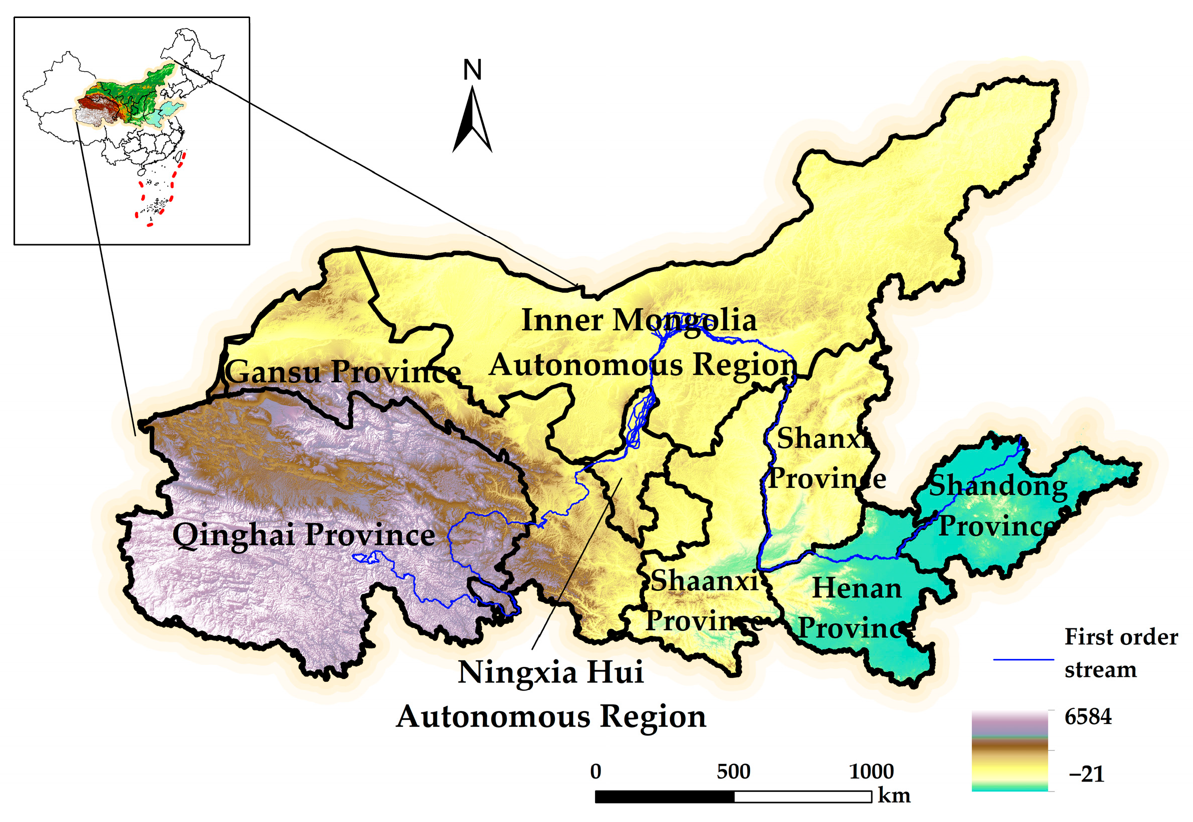
2. Overview of the Study Area

The Yellow River originates from the Bayan Har Mountains on the Qinghai–Tibet Plateau and flows through nine provinces (autonomous regions): Qinghai, Gansu, Sichuan, Ningxia, Inner Mongolia, Shaanxi, Shanxi, Henan, and Shandong. It is located between 32°6′53″ N–41°48′18″ N and 95°50′29″ E–119°06′53″ E [24], with a total length of 5464 km and a basin area of about 3.6 × 10⁶ km2. The Yellow River Basin is an important ecological barrier and economic zone in China. In 2019, ecological protection and high-quality development of the Yellow River Basin rose due to a national strategy. Based on the principles of the integrity of regional research units and socioeconomic relevance [25], the study area of this paper was determined to be eight provinces and 90 cities, except Sichuan (belonging to the Yangtze River Economic Belt); four cities (leagues) in eastern Inner Mongolia (Hulunbuir City, Chifeng City, Tongliao City, and the Xing’an League, which belongs to the northeast region); and 736 counties after processing due to the lack of data for some administrative division adjustments (Figure 1).
In 2021, the gross domestic products (GDPs) of Shandong and Henan were RMB 8.74 trillion and RMB 6.13 trillion, respectively, ranking first and second. The GDPs of Ningxia and Qinghai were the lowest at RMB 0.45 trillion and RMB 0.33 trillion, respectively. The urbanization rate of the Yellow River Basin is 61.3%, which is about three percentage points lower than the national average urbanization rate. The regional difference in urbanization in the Yellow River Basin is large. The highest is the Inner Mongolia Autonomous Region, where the urbanization rate is 62.71%. The lowest is Qinghai Province, which is about 12 percentage points lower than the national urbanization rate. The urbanization level and quality of cities along the Yellow River are also obvious [26].
In 2021, the Outline of the Yellow River Basin Ecological Protection and High-quality Development Plan promulgated by the Central Committee of the Communist Party of China and the State Council emphasized the exploration of an effective path for the construction of ecological civilization in the Yellow River Basin: implement the outlined ‘1 + N + X’ requirements; coordinate the upstream and downstream, trunk and tributaries, and left and right banks; and adjust measures to local conditions. In 2022, the proportion of surface water sections in the Yellow River Basin reached 87.5%, up 5.6% year-on-year, and the water quality of the main stream continued to improve. The proportion of excellent days in prefecture-level and above cities in the basin reached 80.3%, and the ecological environment was greatly improved [27].

3. Data Source and Research Method

3.1. Data Source and Preprocessing

Selecting 2000, 2005, 2010, 2015, and 2020 as the times, the urbanization data of the Yellow River Basin were obtained from the statistical yearbooks of provinces (autonomous regions) and cities from 2000 to 2020 and the statistical bulletin data of cities in the corresponding years.
Data sources of ecosystem services: The data obtained by the Resource and Environmental Science Data Center of the Chinese Academy of Sciences (http://www.resdc.cn/ (accessed on 20 October 2022)) mainly include land-use data (resolution of 30 m × 30 m), vector data (administrative area map and watershed boundaries), 1 km population grid data, etc. The meteorological data are from the National Meteorological Science Data Center (http://data.cma.cn/ (accessed on 24 October 2022)) and include precipitation data, evapotranspiration, sunshine, and average wind speed data in the study area. The soil data mainly come from the National Qinghai–Tibet Plateau Scientific Data Research Center (http://data.tpdc.ac.cn/ (accessed on 1 November 2022)) and mainly include soil type, soil organic matter content, and root depth; scale 1:1 million. The elevation data (DEM) and NDVI data are derived from the geospatial data cloud platform (http://www.gscloud.cn/ (accessed on 12 November 2022)); resolution: 30 m and 250 m.
Different source data are projected and transformed in ArcGIS10.8, and the unified projection coordinate is WGS_1984_World_Mercator. After resampling and projection transformation of the original raster data, the unified resolution is 300 m.

3.2. Research Method

3.2.1. Entropy Method and Analytic Hierarchy Process

Combined with relevant research results [29], the comprehensive index system of urbanization level in the Yellow River Basin was constructed from four dimensions: population, economy, land, and society (Table 1).
A combination of the analytic hierarchy process (AHP) and entropy method is used to assign subjective and objective weights. AHP is no longer repeated, with reference to [30]. The entropy method formula and comprehensive weight are as follows:
E j = ( 1 ln n ) i = 1 n p i j ln ( p i j )
ω i = 0.5 ω A i + 0.5 ω B i
where Ej is the index information entropy, n is the number of indicators (Formula (1)), and the weight of each factor is calculated by using the comprehensive weight (Table 1). ω A i , ω B i are the weights obtained by the ith index entropy method and the analytic hierarchy process, respectively.
From the weight score, in the current stage of urban development in the Yellow River Basin, economic urbanization (0.391) and land urbanization (0.335) are the main factors of urbanization development. Population urbanization (0.162) is the external symbol of urbanization development, and social urbanization (0.112) is the symbol of urbanization development quality, but the two elements have not yet received due attention.
According to Northam’s ‘S curve theory’ [31], the development level of urbanization in the Yellow River Basin is divided into the embryonic stage (0.00, 0.10), initial stage (0.10, 0.25), rapid development stage (0.25, 0.50), and highly developed stage (0.50, 1.00). According to the calculated comprehensive urbanization development score, the urban rate and stage change of counties in the Yellow River Basin from 2000 to 2020 are measured.
The InVEST model is used to evaluate the ecosystem services of the Yellow River Basin. The model avoids the problem of poor practicability of a set of system standards to a certain extent and considers the regionality of the actual ecosystem. Based on the relevant research on ecosystem services [26,32], this paper selects four modules, carbon sequestration service, habitat quality, soil conservation, and water conservation, to evaluate the ecosystem service capacity of the Yellow River Basin (Table 2).
Soil conservation (0.331) was the primary factor in the evaluation of ecosystem service capacity in the Yellow River Basin, followed by water conservation (0.235), habitat quality (0.262), and carbon sequestration services (0.172). Using SPSS 27 and other relevant statistical software, the ecosystem service capacity of the Yellow River Basin was divided into four categories, primary (0.00, 0.15), intermediate (0.15, 0.39), senior (0.39, 0.53), and advanced (0.53, 1.00), using the K-means clustering method [37]. Based on the comprehensive weight score of the entropy method and analytic hierarchy process, the comprehensive ecosystem service capacity was calculated to evaluate the spatial and temporal characteristics of the ecosystem service capacity of each county in the Yellow River Basin from 2000 to 2020.

3.2.2. Bivariate Spatial Autocorrelation

Moran’s I index is used to measure global spatial autocorrelation:
I = i = 1 n j 1 n W i j ( x i x ¯ ) ( x j x ¯ ) S 2 i = 1 n i = 1 n W i j
where I is the global autocorrelation index; xi and xj represent the observed values of unit i and unit j, respectively; n is the number of spatial samples; and wij is a spatial weight matrix. Moran’s I > 0 indicates a positive spatial correlation, so the greater the value is, the stronger the spatial similarity is; Moran’s I < 0 indicates a negative spatial correlation, so the greater the value is, the greater the spatial difference is; Moran’s I = 0 indicates that the spatial distribution pattern tends to be random. A LISA cluster map combined with unit significance was used to reflect the local spatial agglomeration area. The agglomeration was divided into four distributions: high–high (H–H), high–low (H–L), low–high (L–H), and low–low (L–L). High–high correlation means that high-level observations are surrounded by high-level adjacent units, and low–low correlation means that low-level observations are surrounded by low-level critical units, both of which are spatial-positive correlations, while low–high correlation and high–low correlation are spatial-negative correlations [38].

3.2.3. Geographically and Temporally Weighted Regression

In order to compare the goodness of fit of different models, SPSS 27 software was used to test the collinearity of each index of urbanization and each function of ecosystem services [39]. Excluding the expansion factor (VIF > 5), the selected factors were population density (X2), per capita GDP (X3), the proportion of urban land area (X7), urban spatial expansion intensity (X8), and the number of hospital beds (X11). Ordinary least squares (OLS), geographically weighted regression (GWR), time-weighted regression (TWR), and spatio–temporal geographically weighted regression (GTWR) were used for simulation estimation (Table 3).
Through model comparison, R2 (coefficient of determination) and adjusted R2 are as follows: OLS < TWR < GWR < GTWR; and the Akaike information criterion (AICc) is as follows: OLS > TWR > GWR > GTWR. The maximum coefficient of determination R2 of the GTWR model reaches 0.673, which is greater than that of the other three models. The maximum AICc drops to −12,556.2, which is significantly lower than that of the other three models, indicating that the fitting degree of the GTWR model is better than that of the other models.
The spatio–temporal geographically weighted regression (GTWR) model is based on the geographically weighted regression (GWR) model and introduces the time factor [40]. This can solve the problems of limited cross-sectional data samples and time and space non-stationarity and effectively estimate the factor parameters (Formula (4)):
Y i = β 0 ( u i , v i , t i ) + k = 1 p β k ( u i , v i , t i ) X i k + ε i
In the formula, ( u i , v i , t i ) denotes the space–time coordinates of the ith sample; x and Y are explanatory variables and explained variables, respectively; p is the number of explanatory variables; β 0 ( u i , v i , t i ) is the intercept, which is the estimated parameter; and β k ( u i , v i , t i ) is the model residual [35]. The GTWR model expresses the influence of each factor on the research system by using the regression coefficient. The regression coefficient is greater than 0, which is the promotion effect, and less than 0, which is the inhibition effect. The greater the absolute value of the regression coefficient is, the greater the impact intensity is. In this paper, the GTWR model is based on ArcGIS10.8 and uses the GTWR plug-in made by Huang et al.

4. Research Results and Analysis

4.1. Spatio–Temporal Evolution of Urbanization and Ecosystem Services in the Yellow River Basin

4.1.1. Spatial–Temporal Evolution Characteristics of Comprehensive Urbanization Level in the Yellow River Basin

(1)
Temporal dimension
The comprehensive urbanization level of the Yellow River Basin in 2000 (0.139), 2005 (0.165), 2010 (0.115), 2015 (0.161), and 2020 (0.187) showed an upward trend from 2000 to 2005 and a downward trend from 2005 to 2010 (Table 4). The level of urbanization increased by 34.53%. There were 242 counties in the whole basin from the low stage to the high stage, accounting for 32.9% of the counties in the whole basin. From 2015 to 2020, there was one highly developed urbanization county (Yanta District of Xi’an), 157 counties from the embryonic stage to the initial development stage, and 84 counties from the initial stage to the rapid development stage. Except for 2010, the development level of county comprehensive urbanization was concentrated in the initial stage, accounting for 84.6% of the total number for the basin (2020). By 2020, there were seven counties in the embryonic stage, which was 21.1% lower than in 2000, and the initial stage and rapid development stage accounted for the main positions (98.8%).
The number of counties in the initial stage is much larger than that in the other stages, reaching 83.7% in 2015, an increase of 32.4% and 8.8% compared with 2010 and 2000, respectively. In 2020, this continued to rise compared with 2015, and the average value of the initial stage increased by 0.025 and 0.011, respectively, compared with 2010 and 2015, indicating that the overall level of urbanization increased at this stage. The number of counties in the rapid development stage increased by 3.32 times from 2000 (22) to 2020 (105), but the average decreased by 0.002. The number of counties in the rapid urbanization stage decreased in 2010, and the average increased by 0.016.
(2)
Spatial scaling
The overall pattern of the comprehensive urbanization level in the Yellow River Basin is high in the southeast and gradually decreases to the northwest (Figure 2). The provincial and municipal regional units show that the central municipal districts of each province and city are high, the surrounding counties are low, and the spatial normal distribution is strong.
Moran’s I index showed a trend of decreasing first and then increasing. The p values were all less than 0.001, and the z scores were much larger than 2.58, showing a strong spatial positive correlation distribution.
A total of 157 counties have achieved cross-stage development of urbanization, with a uniform spatial distribution, indicating that the overall urbanization development of the Yellow River Basin has increased in a balanced manner. In the counties that have developed from the initial stage to the rapid development stage, the municipal districts of the prefecture-level cities in each province account for a large proportion, and the municipal districts are spread to the periphery. In 2020, 106 counties at or above the stage of rapid development gradually weakened from the southeast to the west and north. Among the 84 counties that have experienced rapid development, there are 71 urban municipal districts (including county-level cities), accounting for 84.5%. The comprehensive urbanization of counties in the Yellow River Basin presents the ‘core–edge’ law, that is, the urban municipal districts (county-level cities) are the core, and the surrounding counties are the edge (Figure 3).
From 2000 to 2020, the spatial agglomeration of the urbanization level in the Yellow River Basin is mainly manifested in the fact that the H–H agglomeration area is mainly distributed in the Shandong Peninsula and the eastern and central regions of Henan, showing a zonal extension trend; the L–H agglomeration area is distributed in the periphery of the high–high correlation area and is surrounded by the periphery of the high–high agglomeration area. The low–low agglomeration areas are widely distributed, mainly with a northeast–southwest distribution in 2000 to the central Yellow River Basin in 2020; the H–L negative correlation area is mainly distributed at the edge of the low–low agglomeration area, which is small.

4.1.2. Spatio–Temporal Evolution Characteristics of Ecosystem Service Capacity in the Yellow River Basin

(1)
Temporal dimension
The overall development trend of the ecosystem service capacity in the Yellow River Basin is obvious. The number distribution of counties from the primary stage to the advanced stage is a ‘pyramid’ (Table 5). The average value increased by 0.003 from 2000 (0.358) to 2020 (0.361), and the highest average value was in 2015 (0.364).
From 2000 to 2020, there were seven counties rising from the primary level to the intermediate level, two counties rising from the intermediate level to the senior level, seventeen counties falling from the intermediate level to the primary level, and nine counties falling from the senior level to the intermediate level. The primary and intermediate levels have a large number of reductions, indicating that the ecosystem service capacity at this stage is fragile.
(2)
Spatial scaling
The overall pattern of ecosystem services in the Yellow River Basin is high in the southwest and gradually decreases in the southeast. The lower reaches of the middle reaches of the Yellow River are the low-value areas of the ecosystem service capacity (Figure 4). The Weihe River Basin in Shaanxi Province, the Fenhe River Basin in Shanxi Province, and the Hexi Corridor in Gansu Province are all in low-value areas, with a weak ecosystem service capacity. The average ecosystem service capacities of Golmud City, Zhiduo County, Zaduo County, Qumalai County, and Yushu City in Qinghai Province are the high-value concentration area of the Yellow River Basin, and the average capacity value reaches 0.752.
The agglomeration characteristics of the ecosystem service capacity in the Yellow River Basin were high in the west and low in the east. From 2000 to 2020, Moran’s I index showed a fluctuating trend, but there was no significant increase or decrease, and the stability was strong. The p value of the spatial autocorrelation is less than 0.001, and the z value is much larger than 2.58. The normal distribution is strong, showing a strong spatial positive correlation distribution. Natural background factors determine the level of the ecosystem service capacity, and socioeconomic factors maintain the ecosystem service capacity.
The local LISA cluster diagram confirms that the change in the ecosystem service capacity is small. Different from the spatial distribution of the urbanization level, the H–H agglomeration area of the ecosystem service capacity is in Qinghai Province, Gansu Province, and southern Ningxia. The H–L and L–H agglomerations are scattered around, while the L–L agglomeration is mainly concentrated in Shanxi Province, Henan Province, and Shandong Province (Figure 5).

4.2. The Interaction Mechanism between Urbanization and Ecosystem Services in the Yellow River Basin

The regression coefficient changes of the impact factors in 2000, 2005, 2010, 2015, and 2020 were analyzed (Figure 6). The interaction strength of the two systems was evaluated by quartile Q1, lower quartile Q2, quartile difference (Q = Q1−Q2), mean, and range on the box plot. At the same time, the spatial characteristics of the impact of urbanization and ecosystem services were analyzed.

4.2.1. Impact of Ecosystem Services on Comprehensive Urbanization Level

(1)
Temporal dimension
The impact of ecosystem services on comprehensive urbanization, from the perspective of the intensity of action, was carbon sequestration services (Y1) > habitat quality (Y2) > water conservation (Y4) > soil conservation (Y3); thus, from 2000 to 2020, the impact increased.
Carbon sequestration services (Y1). The regions with a negative regression coefficient for carbon sequestration, found in 736 counties in the Yellow River Basin, showed an inhibitory effect from 2000 (91.99%) to 2020 (94.36%). The range of the coefficient increased from 2.23 in 2000 to 3.74 in 2020, and the quartile difference increased by 1.15, indicating that the numerical distribution of the box part (the area where the coefficient is concentrated) tended to be discrete, and the inhibitory effect of carbon sequestration service in the Yellow River Basin on comprehensive urbanization was enhanced.
Habitat quality (Y2). In 2020, the influence coefficient of the habitat quality of the whole basin on the comprehensive urbanization of the Yellow River Basin was positive, the influence of habitat quality on comprehensive urbanization was promoted, the mean value of the influence coefficient increased from 0.85 to 1.59, the quartile difference increased from 2000 (0.99) to 2015 (2.18) to 2020 (2.11), and the range increased by 1.32, indicating that the habitat quality function of the Yellow River Basin played a role in promoting the development level of comprehensive urbanization, while the time series changes of each region became larger.
Soil conservation (Y3). The areas showing inhibitory effects accounted for 99.61% of the counties in the whole basin. The absolute value of the regression coefficient was small, which was less than the intensity of the other three ecosystem service functions, indicating that the inhibitory effect was weak. The quartile difference of the coefficient increased slightly from 2000 (0.13) to 2020 (0.15), and the range decreased by 0.49 from 2000 (1.87) to 2020 (1.38). The distribution of outliers was discrete, indicating that the regional interaction coefficient changes were relatively large on the time scale.
Water conservation (Y4). The regions with a positive regression coefficient on the comprehensive urbanization of the Yellow River Basin accounted for 93.4%, and the influencing factors had a significant promoting effect. From 2000 (0.33) to 2020 (0.36), the coefficient quartile difference only increased by 0.03, with little change, indicating that the influence of the water conservation function on the development of comprehensive urbanization from the time scale was stable.
(2)
Spatial scaling
Carbon sequestration services (Y1). The impact on the comprehensive urbanization level was a north–south and east–west spatial differentiation (Figure 7). The influence coefficient of the upper reaches of the Yellow River, namely Qinghai Province, western Ningxia, and western Inner Mongolia, was positive and was promoted. The negative effect of the middle and lower reaches of the Yellow River gradually increased, and the intensity of the inhibitory effect reached −3.478 in the Shandong Peninsula and northeastern Henan. The boundary line of the positive and negative effects was at the junction of the upper and middle reaches of the Yellow River, which indicates that the lower the carbon sequestration stock in the middle and lower reaches of the Yellow River is, the higher the comprehensive urbanization development level is, while the upper reaches of the Yellow River were the opposite, showing that carbon sequestration inhibits urbanization development.
Habitat quality (Y2). The influence coefficient of urbanization on comprehensive urbanization showed a zonal distribution, and the influence coefficient was positive. It gradually increased from west to east, reaching a peak of 3.182 in the Shandong Peninsula. In 2000, 3.51% of the regional habitat quality inhibited the development of comprehensive urbanization. In 2020, the habitat quality of the whole basin promoted urbanization, indicating that the higher the habitat quality of the county is, the more conducive to the development of urbanization it is.
Soil conservation (Y3). The impact on urbanization was inhibitory, showing a zonal distribution in the southeast and northwest directions. The high value of negative effects was mainly concentrated in central Inner Mongolia, the northern part of Shanxi, and the northern part of Shaanxi. The inhibitory effect on the periphery of the basin gradually weakened, showing that the stronger the soil conservation function is, the weaker the comprehensive urbanization development level is. The positive and negative effect boundaries were in the upper reaches of the Yellow River in Qinghai and western Gansu, southeast of the Shandong Peninsula.
Water conservation (Y4). The spatial distribution of the positive effects on comprehensive urbanization showed that the stronger the water conservation function is, the higher the comprehensive urbanization development level is from the central part of Inner Mongolia, the northern part of Shanxi, and the central part of Shaanxi to the periphery. The boundary between the upper and middle reaches of the Yellow River was the boundary of the positive and negative effects. The negative effects were mainly concentrated in western Inner Mongolia, western Gansu, and Qinghai Province. The stronger the water conservation function is, the lower the level of urbanization development is.

4.2.2. Impact of Urbanization on Ecosystem Services

(1)
Temporal dimension
Urbanization in the Yellow River Basin has a significant effect on the ecosystem service capacity (Figure 6). From the perspective of the intensity of the action coefficient, the intensity of urban spatial expansion (X8) > per capita GDP (X3) > the number of beds in hospitals and hospitals (X11) > the proportion of urban construction land area (X7) > population density (X2).
Population density (X2). The area with a negative regression coefficient increased by 6.8% from 2000 (85.1%) to 2020 (91.9%). The greater the population density is, the stronger the inhibitory effect of the ecosystem service capacity is; the range of the action coefficient increased by 4.51 from 2000 (1.72) to 2020 (6.23), indicating that the regional differences in the inhibitory effect of population density on ecosystem service capacity became larger.
GDP per capita (X3). This has an inhibitory effect on the ecosystem service capacity. The area with a negative regression coefficient accounted for more than 70%. The higher the per capita GDP is, the greater the interference with the ecosystem service capacity is, and there is an obvious degradation of the ecosystem service capacity. The quartile difference decreased by 0.2 from 2000 (0.44) to 2020 (0.24), and the range decreased by 4.49 from 2000 (10.35) to 2020 (5.86), indicating that the regional differences in the inhibitory effect of per capita GDP on the ecosystem service capacity became smaller and the stability became stronger.
The proportion of construction land area (X7). This has an inhibitory effect on the ecosystem service capacity, and the regression coefficients were all negative, that is, the larger the urban construction land area is, the weaker the ecosystem service capacity is. The coefficient range decreased by 2.72 from 2000 (5.86) to 2020 (3.14), indicating that the regional differences in the impact of urban construction land area on ecosystem service capacity decreased.
Urban spatial expansion intensity (X8). The performance of ecosystem services was from promoting to inhibiting, and the intensity of action was greater than other urbanization indicators. The regions with positive regression coefficients decreased by 44.46% from 2000 and 2010 (100%) to 2020 (56.54%), and the average intensity of regional action decreased year by year from 2000 (2.68) to 2010 (1.69) to 2020 (−0.11). Although most regions are experiencing promotion, the intensity of urban spatial expansion has gradually evolved into a process of inhibition at this stage. The range of the effect coefficient reached 13.09, which was much higher than other factors, indicating that the regional difference in the impact of urban spatial expansion intensity on the comprehensive ecosystem service capacity was higher than other factors.
Number of beds in hospitals and clinics (X11). Although from the coefficient point of view, the impact on the comprehensive ecosystem services was inhibitory, the relationship between the two was invisible and subtle. The impact of simple hospitals and health centers on the ecological service capacity can be ignored, but with the development of urbanization as an essential infrastructure for urbanization [41], the number of hospitals and health centers is bound to increase, similar to the ‘urbanization economy’ mechanism, which inhibits the ecological service capacity. This problem needs to be further studied, as it is beyond the scope of this paper.
(2)
Spatial scaling
Population density (X2). The intensity of the effect on ecosystem services gradually decreased from east to west. The area with a strong negative effect was located in the western part of the Yellow River Basin, involving western Qinghai and northwestern Gansu, with an intensity of −6.231. The higher the population density is, the weaker the ecosystem service capacity is. The region connecting the positive and negative effects included most of the middle reaches of the Yellow River Basin, involving the central and western regions of Shandong Province, Henan Province, and Shanxi Province, and the southern part of Inner Mongolia, which has a large population. The positive effect area was concentrated in the eastern part of the Shandong Peninsula, and the effect coefficient was very small.
GDP per capita (X3). The impact on ecosystem services showed a positive and negative effect on interval distribution. The negative effect area spread from southern Ningxia and southern Shaanxi to Shandong and Henan, and the negative effect weakened from south to north. The positive effect area was massive and concentrated in the upper reaches of the Yellow River, with some of the area located at the junction of Shanxi, Shaanxi, and Inner Mongolia. The boundary area of positive and negative effects has a threshold that can be explored.
Proportion of construction area (X7). The inhibitory effect on the ecosystem gradually increased from east to west. In Shandong, Henan, Shanxi, Shaanxi, and central Inner Mongolia, the proportion of construction land area had a weak inhibitory effect on ecosystem services. In western Qinghai and northwestern Gansu, it was significantly enhanced, accounting for only 0.80% of the positive effect area, and was scattered between negative effect patches.
Space expansion strength (X8). The spatial distribution of the impact on ecosystem services was concentrated in southwestern Shanxi, central and southern Shaanxi, central and western Henan, most of Inner Mongolia, and western Qinghai. The area where the inhibition effect accounts for 43.54% was mainly concentrated in Shandong Province, eastern Henan, and northeastern Shanxi. The effect of spatial expansion intensity on the ecosystem service capacity evolved from promotion to inhibition.
Number of beds in hospitals and clinics (X11). From the perspective of the spatial distribution of the influence coefficient, most of the Yellow River Basin showed a trend of increasing inhibition from east to west, while most of Shandong and Henan showed a promoting effect. The boundary between the positive and negative effects coincided with the boundary between the middle and lower reaches of the Yellow River (Figure 8).

5. Discussion

The spatial and temporal differences in comprehensive urbanization in the Yellow River Basin are significant. The ecosystem service capacity along the Yellow River Basin is weaker than other spatial ranges, and most of the regional ecosystem service capacity is at the primary level, which is basically consistent with the conclusion of Zhang J.T. et al. [41] on the interaction between urbanization and ecosystem services nationwide, which is in the study area of the Yellow River Basin. On this basis, it deepens the research results of Zhang Y.S. et al. [42] on the relationship between social driving factors and ecosystem services in the Yellow River Basin and specifically discusses the impact of various elements of urbanization on ecosystem services.
From 2000 to 2020, the fluctuation of urbanization in the Yellow River Basin was obvious, and the trend of spatial transition existed from the central and western regions of the Yellow River Basin to the east, and the ‘edge–core’ characteristics of high-stage urbanization development were obvious. The change in the ecosystem service capacity was small, but the ecosystem service capacity in the primary level area had obvious fluctuation, with strong sensitivity and vulnerability. The above studies are all urban spatial scaling. This paper discusses the relationship between the two systems from the county scale. In the article on multi-spatial scale urbanization and ecosystem services [43], some scholars have also proved that the correlation and spatio–temporal heterogeneity between multi-systems at the county scale are obviously better than those at the city scale and smaller scale.
The conclusion of the interaction between urbanization and ecosystem services in this paper is consistent with Tian et al.’s study [44]: urbanization has a significant inhibitory effect on ecosystem services. The carbon sequestration service had a great effect on comprehensive urbanization, which was higher than the other three functions; habitat quality, soil conservation, and water conservation function had weak effects on the development of comprehensive urbanization, which is consistent with related research [33,45]. The impact of carbon sequestration on urbanization was inhibitory, weakening from west to east. The main reason for this is that the natural environments in Qinghai, Gansu, Ningxia, and Inner Mongolia are harsh, and agriculture and animal husbandry are sensitive to climate. This is consistent with the results of Liu P. et al. [46]. This paper is from the perspective of integrity to explore the corresponding relationship between the various elements of the system, rather than just a single element or single system internal mapping relationship, which is our part of the concern; of course, we still have shortcomings, and our team will strive to achieve in the future.
Urban spatial expansion had a greater impact on ecosystem service capacity, so relevant policies can effectively reduce ecological pressure. This is the same as the conclusion of relevant scholars [20]. In the comparison of many research results, we found that the effect of urban spatial expansion intensity on the comprehensive ecosystem showed a trend of transition from promotion to inhibition, indicating that there is a critical value for the relationship between urban spatial expansion intensity and ecosystem services. Urban spatial expansion intensity promotes ecosystem restoration efficiency within a certain range, but exceeding the critical value of expansion intensity inhibits ecosystem service capacity, which is worthy of attention.
This paper has limitations regarding its selection of the number of indicators. In subsequent research, more indicators can be used to more comprehensively and accurately judge the urbanization level and ecosystem service capacity of counties in the Yellow River Basin; at the same time, the critical value of the positive and negative effects in the relationship between urbanization and ecosystem services has not been obtained, which will be the direction of our team’s future work.

6. Conclusions

(1) From 2000 to 2020, the comprehensive urbanization and ecosystem service capacity of counties in the Yellow River Basin were low. In terms of time, comprehensive urbanization is currently transitioning from the embryonic stage to the initial stage, and the urbanization areas in the rapid development stage are unstable; the ecosystem service capacity is generally at the primary level, and the level of change is small. The number of ecosystem service counties at the primary level accounts for 56.5%. The sensitivity and vulnerability of the ecosystem are obvious. The ecosystem service capacity level along the main stream of the Yellow River is lower than that of other regions. In terms of space, comprehensive urbanization and ecosystem service capacity show significant spatial positive correlation and significant agglomeration characteristics. The comprehensive urbanization level is characterized by obvious ‘core-periphery’ characteristics. The comprehensive urbanization level of each municipal district is higher than that of the surrounding counties, and the L–L agglomeration area is gradually moving to the east. The agglomeration distribution of the ecosystem service capacity has no obvious migration process in space, and the stability is strong;
(2) The effect intensity of ecosystem services on comprehensive urbanization is carbon sequestration service > habitat quality > water conservation > soil conservation. In terms of time, the effect of each function on comprehensive urbanization shows a significant increasing trend. Spatially, the influence coefficient of ecosystem services on comprehensive urbanization shows obvious spatial heterogeneity; the urbanization mechanism influencing the ecosystem service capacity shows an inhibitory effect, and the intensity of action is urban spatial expansion intensity > per capita GDP > number of beds in hospitals and health centers > proportion of urban construction land area > population density. Among them, the factors of urban spatial expansion changed from a dominant role in 2000 to a dominant inhibition trend in 2020, and the influence of other factors showed inhibition and little change. Spatially, the inhibitory effect of urbanization on the comprehensive ecosystem service capacity is largely characterized by east–west differentiation, and there is obvious spatial heterogeneity.

Author Contributions

Writing original draft, J.Z.; funding acquisition, Z.Z.; supervision, J.G., J.L. and L.L.; technical support, L.K. All authors have read and agreed to the published version of the manuscript.

Funding

This study was supported by the Study on the Impact Mechanism of Near- and Long-range Spatial Transfer of Ecosystem Services on Regional High-quality Development in Fenhe River Basin (2022YD066); Report of Shanxi Provincial Department of Education on Organizing the Application for the Innovation Project of Postgraduate Education in 2022 (2022Y476); this study was funded by the Shanxi Provincial University Science and Technology Innovation Program (2020L0548).

Institutional Review Board Statement

Not applicable.

Informed Consent Statement

Not applicable.

Data Availability Statement

Not applicable.

Conflicts of Interest

The authors declare no conflict of interest.

References

  1. Bi, Y.Z.; Zheng, L.; Wang, Y. Coupling relationship between urbanization and water-related ecosystem services in China’s Yangtze River economic Belt and its socio-ecological driving forces: A county-level perspective. Ecol. Indic. 2023, 146, 109871. [Google Scholar] [CrossRef]
  2. Pao, H.T.; Chen, H.P.; Li, Y.Y. Competitive dynamics of energy, environment, and economy in the US. Energy 2015, 89, 449–460. [Google Scholar] [CrossRef]
  3. Robert, C.; Ralph, D.; Rudolf, G.; Farber, S.; Grasso, M.; Hannon, B.; Limburg, K.; Naeem, S.; O’Neill, R.V.; Paruelo, J.; et al. The value of the world’s ecosystem services and natural capital. Ecol. Econ. 1998, 25, 3–15. [Google Scholar]
  4. Katrine, G.; Turner, M.; Vestergaard, O.; Peder, K. Bundling ecosystem services in Denmark: Trade-offs and synergies in a cultural landscape. Landsc. Urban Plan. 2014, 125, 89–104. [Google Scholar]
  5. Wang, D.; Liang, Y.J.; Peng, S.Z.; Yin, Z.C.; Huang, J.J. Integrated assessment of the supply–demand relationship of ecosystem services in the Loess Plateau during 1992–2015. Ecosyst. Health Sustain. 2022, 8, 2130093. [Google Scholar] [CrossRef]
  6. Robert, C. Introduction to the special issue on the dynamics and value of ecosystem services: Integrating economic and ecological perspectives. Ecol. Econ. 2002, 41, 367–373. [Google Scholar]
  7. Xie, W.W.; Deng, H.B.; Chong, Z.H. The Spatial and Heterogeneity Impacts of Population Urbanization on Fine Particulate (PM2.5) in the Yangtze River Economic Belt, China. Int. J. Environ. Res. Public Health 2019, 16, 1058. [Google Scholar] [CrossRef]
  8. Alam, T.; Banerjee, A. Characterizing land transformation and densification using urban sprawl metrics in the South Bengal region of India. J. Sustain. Cities Soc. 2023, 89, 104295. [Google Scholar] [CrossRef]
  9. Liu, T.; Gao, Y.F.; Li, H.; Zhang, L.P.; Sun, J.J. Analysis of the Operational Efficiency of Basic Medical Insurance for Urban and Rural Residents: Based on a Three-Stage DEA Model. Int. J. Environ. Res. Public Health 2022, 19, 13831. [Google Scholar] [CrossRef]
  10. Zhang, Z.W.; Liu, Y.F. Spatial Expansion and Correlation of Urban Agglomeration in the Yellow River Basin Based on Multi-Source Nighttime Light Data. Sustainability 2022, 14, 9359. [Google Scholar] [CrossRef]
  11. Liu, Y.S.; Wang, Y.S. Rural land engineering and poverty alleviation: Lessons from typical regions in China. J. Geogr. Sci. 2019, 29, 643–657. [Google Scholar] [CrossRef]
  12. Xiong, J.X.; Wang, X.B.; Zhao, D. Spatiotemporal pattern and driving forces of ecological carrying capacity during urbanization process in the Dongting Lake area, China. Ecol. Indic. 2022, 144, 109486. [Google Scholar] [CrossRef]
  13. Wu, M.G.; Zhang, Z.H. Whether Urban Development and Ecological Protection Can Achieve a Win-Win Situation—The Nonlinear Relationship between Urbanization and Ecosystem Service Value in China. Sustainability 2019, 11, 3277. [Google Scholar] [CrossRef]
  14. Feng, Z.W.; Chen, Y.Y.; Yang, X.L. Measurement of Spatio-Temporal Differences and Analysis of the Obstacles to High-Quality Development in the Yellow River Basin, China. Sustainability 2022, 14, 14179. [Google Scholar] [CrossRef]
  15. Li, X.Y.; Tan, Y.X.; Tian, K. The Impact of Environmental Regulation, Industrial Structure, and Interaction on the High-Quality Development Efficiency of the Yellow River Basin in China from the Perspective of the Threshold Effect. Int. J. Environ. Res. Public Health 2022, 19, 14670. [Google Scholar] [CrossRef] [PubMed]
  16. Suryani, E.; Hendrawan, R.A.; Adipraja, P.F.E.; Indraswari, R. System Dynamics Simulation Model for Urban Transportation Planning: A Case Study. Int. J. Simul. Model. 2020, 19, 5–16. [Google Scholar] [CrossRef]
  17. Kong, X.X.; Li, W.J.; Jiang, J.; Dong, Z.X.; Wang, Z.Z. Dynamic characteristics of a simply supported elastic beam with three induction motors. J. Sound Vib. 2022, 520, 116603. [Google Scholar] [CrossRef]
  18. Yang, C.; Wei, T.X.; Li, Y.R. Simulation and Spatio-Temporal Variation Characteristics of LULC in the Context of Urbanization Construction and Ecological Restoration in the Yellow River Basin. Sustainability 2022, 14, 789. [Google Scholar] [CrossRef]
  19. Wu, W.J.; Li, H.J.; Feng, H.S. Precipitation dominates the transpiration of both the economic forest (Malus pumila) and ecological forest (Robinia pseudoacacia) on the Loess Plateau after about 15 years of water depletion in deep soil. Agric. For. Meteorol. 2020, 297, 108244. [Google Scholar] [CrossRef]
  20. Li, W.S.; Wang, Z.W.; Mao, Z.B. Spatially Non-Stationary Response of Carbon Emissions to Urbanization in Han River Ecological Economic Belt, China. Int. J. Environ. Res. Public Health 2023, 20, 363. [Google Scholar] [CrossRef]
  21. Maimaiti, B.; Chen, S.S.; Kasimu, A. Urban spatial expansion and its impacts on ecosystem service value of typical oasis cities around Tarim Basin, northwest China. Int. J. Appl. Earth Obs. Geoinf. 2021, 104, 102554. [Google Scholar] [CrossRef]
  22. Guo, X.M.; Fang, C.L.; Mu, X.F. Coupling and coordination analysis of urbanization and ecosystem service value in Beijing-Tianjin-Hebei urban agglomeration. Ecol. Indic. 2022, 137, 108782. [Google Scholar]
  23. Zhang, X.Y.; Shen, J.Y.; Sun, F.H.; Wang, S. Spatial-Temporal Evolution and Influencing Factors Analysis of Ecosystem Services Value: A Case Study in Sunan Canal Basin of Jiangsu Province, Eastern China. Remote Sens. 2022, 15, 112. [Google Scholar] [CrossRef]
  24. Zhang, Z.W.; Chang, T.Y.; Qiao, X.N. Eco-Economic Coordination Analysis of the Yellow River Basin in China: Insights from Major Function-Oriented Zoning. Sustainability 2021, 13, 2715. [Google Scholar] [CrossRef]
  25. Cheng, Z.; Tang, A.; Cai, J.M.; Song, T. Exploring the High-Quality County-Level Development and Governance Response for Farming–Pastoral Ecotone in China: A Case Study of Kulun. Agriculture 2022, 12, 2042. [Google Scholar] [CrossRef]
  26. Hu, Y.C.; Liu, Y.; Yan, Z.Y. Research Regarding the Coupling and Coordination Relationship between New Urbanization and Ecosystem Services in Nanchang. Sustainability 2022, 14, 15041. [Google Scholar] [CrossRef]
  27. Yang, M.H.; Gao, X.D.; Siddique, K. Spatiotemporal exploration of ecosystem service, urbanization, and their interactive coercing relationship in the Yellow River Basin over the past 40 years. Sci. Total Environ. 2022, 858, 159757. [Google Scholar] [CrossRef]
  28. Liu, H.L.; Zhang, L.P.; Wang, W.Q. Spatial Pattern and Influencing Factors of County Urbanization in China’s Provincial Border Regions. J. Geogr. Soc. China 2023, 77, 1–19. Available online: http://kns.cnki.net/kcms/detail/11.1856.P.20221108.1111.002.html (accessed on 9 January 2023).
  29. Aromal, V.; Naseer, M.A. Decision-Making Framework for Prioritizing the Improvement of Pedestrian Facilities in Urban Areas Using Integrated Delphi, AHP, and TOPSIS Approach. Transp. Res. Rec. 2023, 2677, 889–906. [Google Scholar]
  30. Zhang, C.; Han, F.; Wu, Y.; Huang, J.; Zeng, R.; Lin, D.; Yin, L.; Li, D.; Li, Z.; Liu, M. Research on Effectiveness Evaluation Method of Expressway Toll Station Based on Entropy Method and TOPSIS Method. J. Phys. Conf. Ser. 2023, 2424, 012006. [Google Scholar] [CrossRef]
  31. Zhang, J.T.; Jiao, W.X. Characteristics of coordination changes and spatial coupling relationship between urbanization and ecosystem service. Acta Ecol. Sin. 2020, 40, 3271–3282. [Google Scholar]
  32. Zarandian, A.; Mohammadyari, F.; Mirsanjari, M. Scenario modeling to predict changes in land use/cover using Land Change Modeler and InVEST model: A case study of Karaj Metropolis, Iran. Environ. Monit. Assess. 2023, 195, 273. [Google Scholar] [CrossRef] [PubMed]
  33. Liu, Z.Q.; Su, Z.J.; Chen, J.Y.; Zou, J.Y. Polyethylene microplastics can attenuate soil carbon sequestration by reducing plant photosynthetic carbon assimilation and transfer: Evidence from a 13C-labeling mesocosm study. J. Clean. Prod. 2023, 385, 135558. [Google Scholar] [CrossRef]
  34. Bamière, L.; Bellassen, V.; Angers, D. A marginal abatement cost curve for climate change mitigation by additional carbon storage in French agricultural land. J. Clean. Prod. 2023, 383, 135423. [Google Scholar] [CrossRef]
  35. Wu, D.; Zou, C.X.; Cao, W. Analysis of the Ecosystem Soil Conservation Function Based on the Major Function-Oriented Zones across the Yangtze River Economic Belt, China. Sustainability 2018, 10, 3425. [Google Scholar] [CrossRef]
  36. Gong, J.; Liu, D.Q.; Zhang, J.X. Tradeoffs/synergies of multiple ecosystem services based on land use simulation in a mountain-basin area, western China. Ecol. Indic. 2019, 99, 283–293. [Google Scholar] [CrossRef]
  37. Mussabayev, R.; Mladenovic, N.; Jarboui, B.; Mussabayev, R. How to Use K-means for Big Data Clustering? Pattern Recognit. 2023, 137, 109269. [Google Scholar] [CrossRef]
  38. DeWitt, T.J.; Fuentes, J.I.; Ioerger, T.R. Bishop. Rectifying I: Three point and continuous fit of the spatial autocorrelation metric, Moran’s I, to ideal form. Landsc. Ecol. 2021, 36, 2897–2918. [Google Scholar] [CrossRef]
  39. Hu, J.Y.; Zhang, J.X.; Li, Y.Q. Exploring the spatial and temporal driving mechanisms of landscape patterns on habitat quality in a city undergoing rapid urbanization based on GTWR and MGWR: The case of Nanjing, China. Ecol. Indic. 2022, 143, 109333. [Google Scholar] [CrossRef]
  40. Chen, Y.; Tian, W.T.; Zhou, Q. Spatiotemporal and driving forces of Ecological Carrying Capacity for high-quality development of 286 cities in China. J. Clean. Prod. 2021, 293, 126186. [Google Scholar] [CrossRef]
  41. Das, K.; Ramaswami, A.; Fan, Y.L. Connecting the dots between urban infrastructure, well-being, livability, and equity: A data-driven approach. Environ. Res. Infrastruct. Sustain. 2022, 2, 035004. [Google Scholar] [CrossRef]
  42. Zhang, Y.S.; Lu, X.; Liu, B.Y. Spatial relationships between ecosystem services and socioecological drivers across a large-scale region: A case study in the Yellow River Basin. Sci. Total Environ. 2020, 766, 142480. [Google Scholar] [CrossRef] [PubMed]
  43. Xia, C.Y.; Guo, H.; Zhao, J. Multi—spatial Scale Dynamic Response of Ecosystem Services to Urbanization in Beijing-Tianjin-Hebei Region. Acta Ecol. Sin. 2023, 43, 1–14. Available online: http://kns.cnki.net/kcms/detail/11.2031.Q.20221108.1709.004.html (accessed on 9 January 2023).
  44. Tian, Y.Y.; Jiang, G.H.; Zhou, D.Y.; Li, G.Y. Systematically addressing the heterogeneity in the response of ecosystem services to agricultural modernization, industrialization and urbanization in the Qinghai-Tibetan Plateau from 2000 to 2018. J. Clean. Prod. 2021, 285, 125323. [Google Scholar] [CrossRef]
  45. Cai, W.X.; Xu, L.; Li, M.X. Imbalance of inter-provincial forest carbon sequestration rate from 2010 to 2060 in China and its regulation strategy. J. Geogr. Sci. 2023, 33, 3–17. [Google Scholar] [CrossRef]
  46. Liu, P.; Cui, X.Y.; Zhang, Z.R.; Zhou, W.W. Pricing strategies of low-carbon enterprises in the Yellow River Basin considering demand information and traceability services. Kybernetes 2023, 52, 304–327. [Google Scholar] [CrossRef]
Figure 1. Location of the Yellow River Basin. Note: based on the standard map from the Ministry of Natural Resources standard map service website GS(2020)4619 [28], the map boundary has not been modified.
Sustainability 15 03113 g001
Figure 2. The evolution of urbanization level in the Yellow River Basin from 2000 to 2020.
Sustainability 15 03113 g002
Figure 3. Spatial agglomeration characteristics of urbanization level in the Yellow River Basin.
Sustainability 15 03113 g003
Figure 4. Spatial distribution of ecosystem service capacity in the Yellow River Basin from 2000 to 2020.
Sustainability 15 03113 g004
Figure 5. Spatial agglomeration characteristics of ecosystem service capacity in Yellow River Basin.
Sustainability 15 03113 g005
Figure 6. The time evolution of regression coefficient of urbanization and ecosystem services in the Yellow River Basin. (a) Regression coefficient of ecosystem services impact on comprehensive urbanization; (b) regression coefficient of urbanization impact on ecosystem services.
Sustainability 15 03113 g006
Figure 7. Spatial differentiation characteristics of the impact of ecosystem services on comprehensive urbanization level.
Sustainability 15 03113 g007
Figure 8. Spatial differentiation characteristics of the impact of urbanization on comprehensive ecosystem service capacity.
Sustainability 15 03113 g008
Table 1. Comprehensive evaluation index system of urbanization level.
IndicatorsWeightsSecondary IndicatorsEntropy MethodAnalytic Hierarchy ProcessComprehensive Weights
Population urbanization0.162Urbanization rate of resident population (%) X10.0710.0730.072
Population density (person/km2) X20.0510.1290.090
Economic urbanization0.391Per capita GDP (CNY) X30.0960.0880.092
Proportion of non-agricultural industries in the total GDP (%) X40.0660.1130.089
Per capita financial expenditure (CNY) X50.0830.1150.099
Savings balance of urban and rural residents (CNY) X60.1230.0990.111
Land-use urbanization0.335Proportion of urban built-up area in the total area of a city (%) X70.1810.1210.151
Urban spatial expansion intensity (%) X80.1050.0850.095
Transit network extent (km) X90.0990.0790.089
Social urbanization0.112Number of primary and secondary school students (person) X100.0640.0520.058
Number of hospital beds (beds) X110.0610.0460.054
Table 2. Quantitative module for ecosystem services assessment.
Ecosystem ServicesWeightsCalculation Formula and ContentEntropy MethodAnalytic Hierarchy ProcessComprehensive Weights
Carbon sequestration Y10.172Carbon sequestration parameters were determined according to the related literature, and carbon sequestration stock was calculated by using InVEST model with aboveground biomass carbon, belowground biomass carbon, soil carbon, death carbon, and land-use types [33].0.1730.1710.172
Habitat quality Y20.262The InVEST model analyzes the habitat suitability, habitat degradation degree, and habitat quality calculation formula of the Yellow River Basin by using the characteristics of threat and sensitivity under spatial and temporal changes and calculates the ecological security of biodiversity in the Yellow River Basin [34].0.2910.2330.262
Soil conservation Y30.331Soil conservation is a key project for sustainable development and high-quality ecological development in the Yellow River Basin. The InVEST model is based on the soil erosion force equation and is calculated based on data such as landform, precipitation, vegetation, and root depth. The specific parameter settings refer to the relevant literature [35].0.2970.3650.331
Water conservation Y40.235Water conservation is an indispensable part that affects biomass, carbon cycle, and other ecological functions. The evaluation standard of water conservation is of great significance to the shortage of water resources in the Yellow River basin. The water production module of the InVEST model links the ratio between actual evapotranspiration and precipitation to potential evapotranspiration for water production statistics [36].0.2390.2310.235
Table 3. Model regression coefficient results.
Regression SystemParameter CriterionOLSGWRTWRGTWR
Response of ecosystem services to comprehensive urbanization levelR20.0700.2490.2460.370
adjusted R20.0680.2480.2450.369
AICc−10,346−11,077−11,077.6−11,630.8
Response of urbanization to integrated ecosystem service capacityR20.2810.6500.3250.673
adjusted R20.2760.6490.320.672
AICc−9866−12,403−10,041.1−12,556.2
Table 4. Urbanization stage changes in the Yellow River Basin from 2000 to 2020.
Urbanization Level20002005201020152020Variable Quantity
AmountsProportionMean ValueAmountsProportionMean ValueAmountsProportionMean ValueAmountsProportionMean
Value
AmountsProportionMean
Value
Cross-
Stage
Number
Variation
Sprout stage1630.2210.082630.0860.0873430.4660.076710.0970.09170.010.0921 ↓ 157 ↑+0.010
Initial stage5510.7490.156170.8380.1613780.5130.1436170.8370.1576230.8460.1680 ↓ 84 ↑+0.018
Fast developing stage220.030.301560.0760.303150.0210.317470.0640.3051050.1420.2991 ↑−0.002
Highly developed stage00000000010.0020.55410.0020.511//
Total catchment73610.13973610.16573610.11573610.16173610.187242+0.048
The arrow ↑ indicates rise; the arrow ↓ indicates decline.
Table 5. Changes of ecosystem service capacity in the Yellow River Basin from 2000 to 2020.
Ecosystem Service20002005201020152020Variable Quantity
AmountsProportionMean
Value
AmountsProportionMean
Value
AmountsProportionMean
Value
AmountsProportionMean
Value
AmountsProportionMean
Value
Cross-Stage NumberVariation
Primary4060.5520.0224160.5650.0213950.5360.0213830.5210.0234160.5650.0217 ↑ 17 ↓−0.001
Intermediate2880.3910.2292780.3780.2302960.4010.2183080.4180.2282810.3820.2442 ↑ 9 ↓+0.015
Senior360.0490.431370.0500.401410.0550.444400.0530.445350.0480.4460 ↑ 2 ↓+0.015
Advanced60.0080.74850.0070.75360.0080.77460.0080.75340.0050.734/ ↑ 1 ↓−0.014
Total catchment73610.35873610.35173610.36473710.36273610.36138+0.003
The arrow ↑ indicates rise; the arrow ↓ indicates decline.
Disclaimer/Publisher’s Note: The statements, opinions and data contained in all publications are solely those of the individual author(s) and contributor(s) and not of MDPI and/or the editor(s). MDPI and/or the editor(s) disclaim responsibility for any injury to people or property resulting from any ideas, methods, instructions or products referred to in the content.

