Snow-Covered Soil Temperature Retrieval in Canadian Arctic Permafrost Areas, Using a Land Surface Scheme Informed with Satellite Remote Sensing Data

 , ,
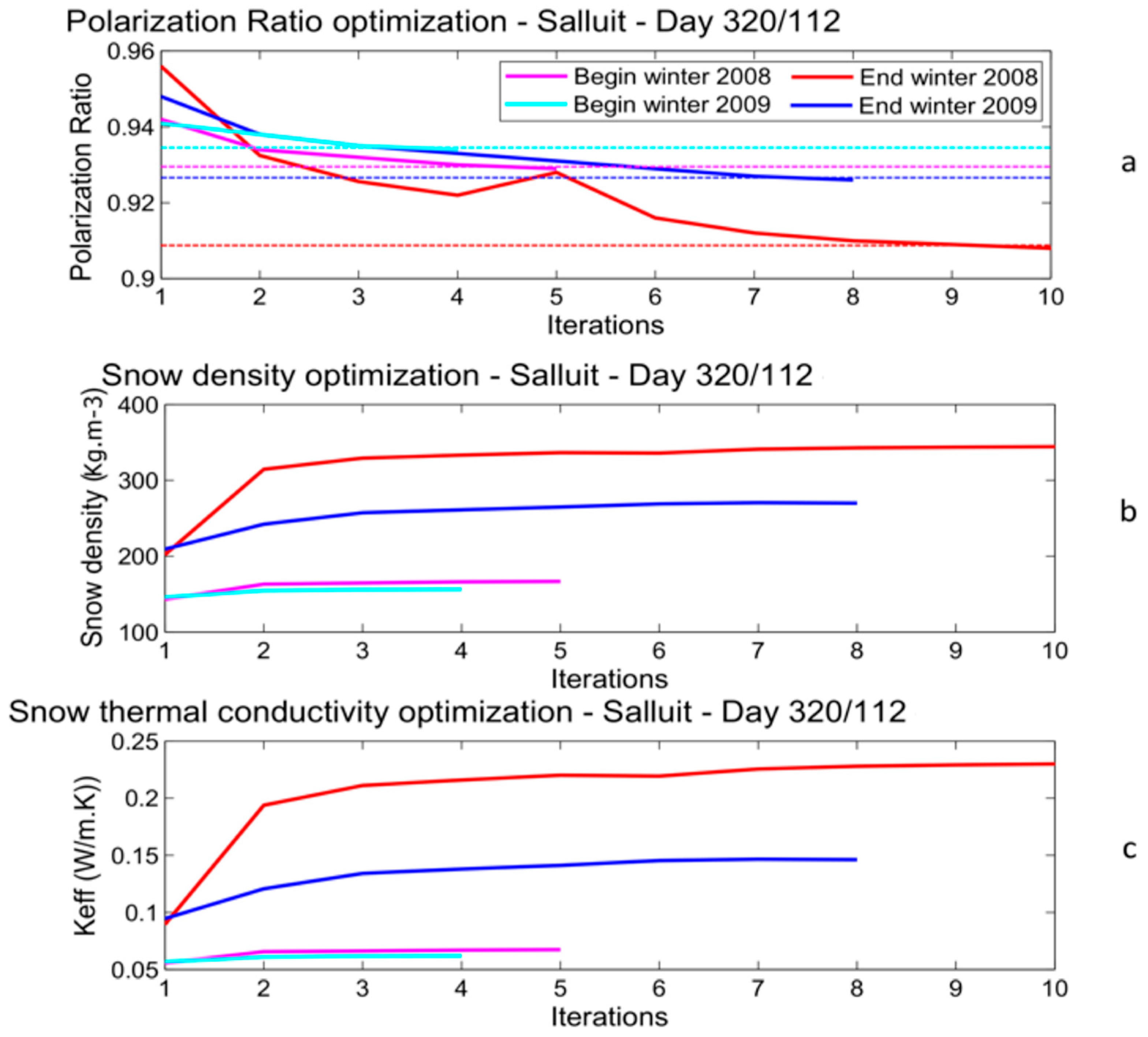
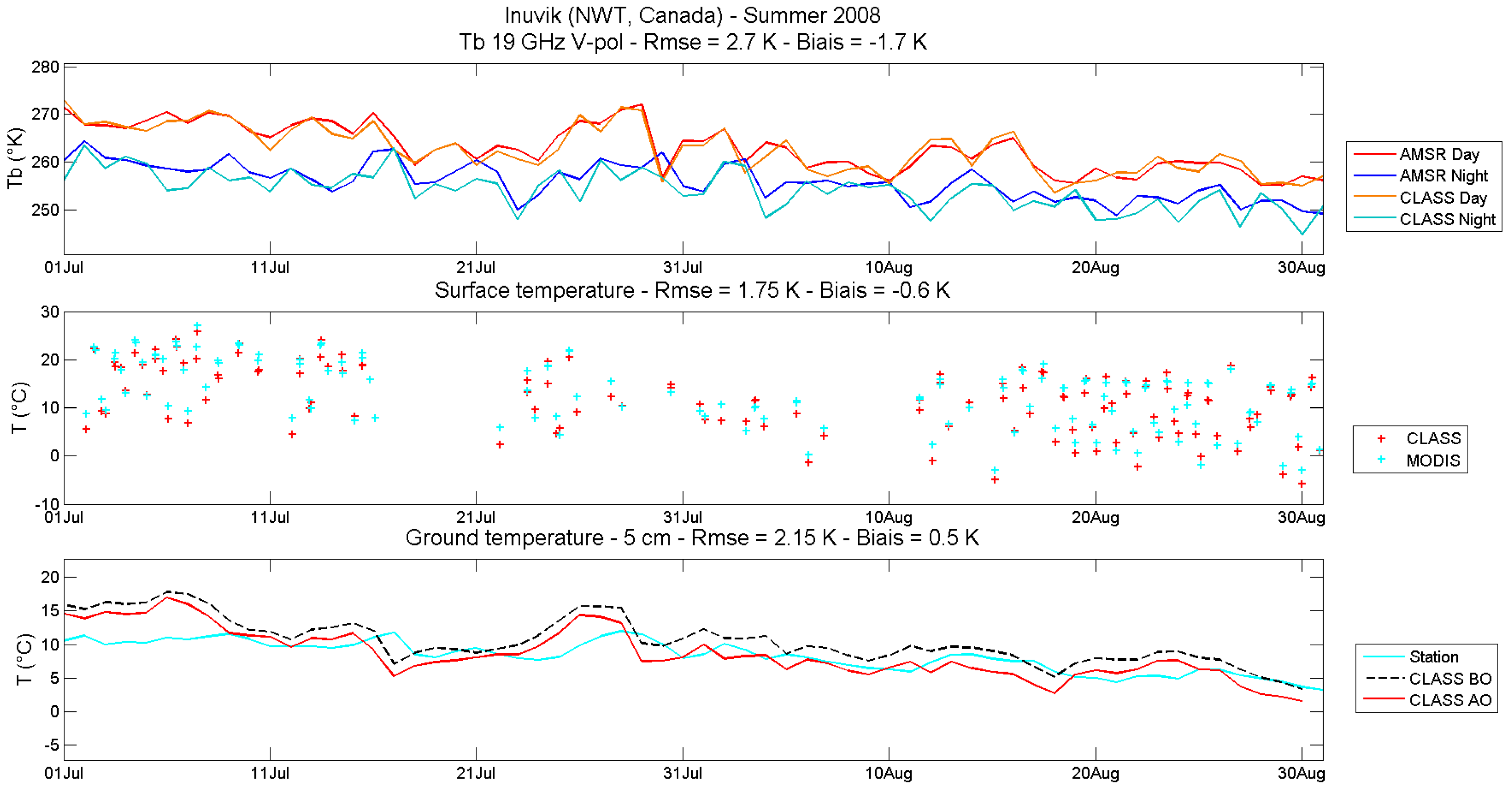
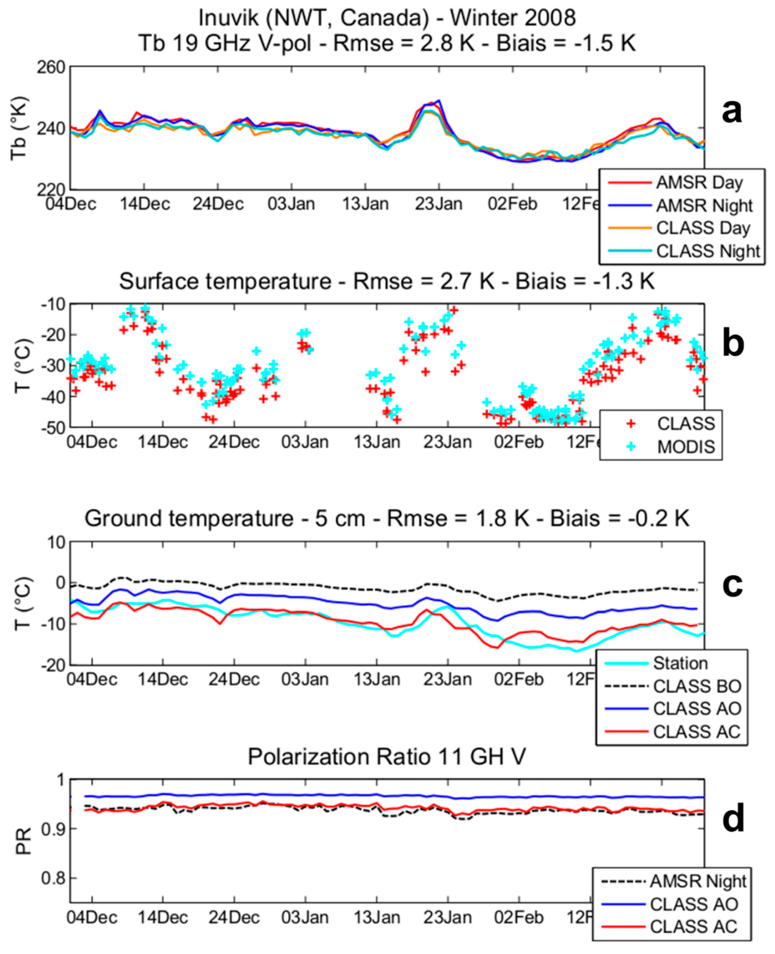
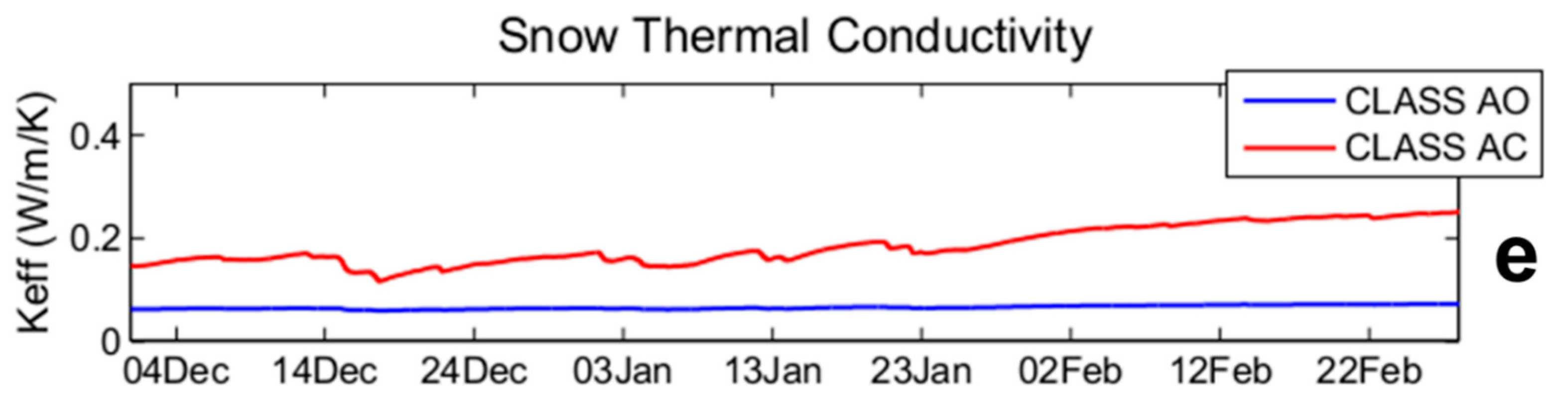
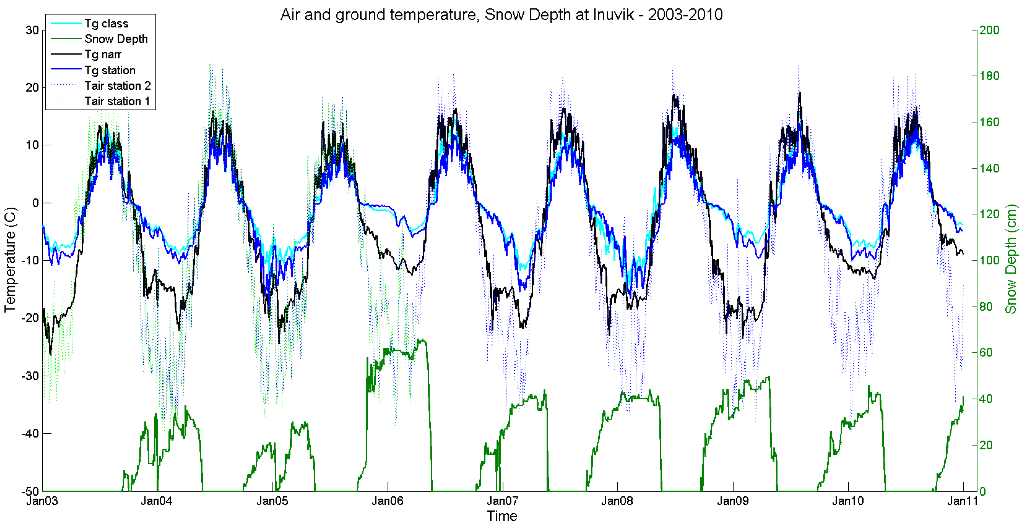
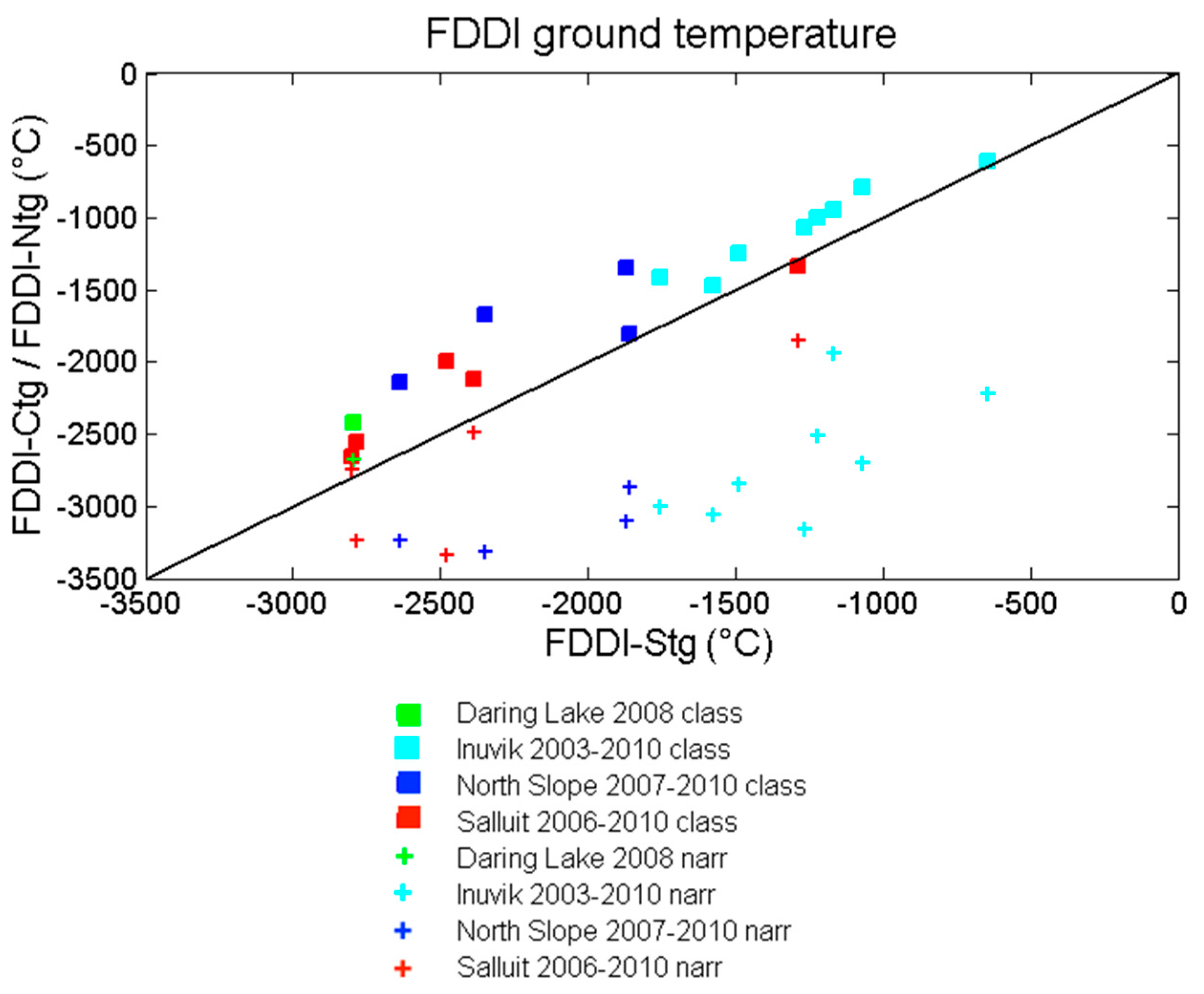
, , Abstract
Share and Cite
Marchand, N.; Royer, A.; Krinner, G.; Roy, A.; Langlois, A.; Vargel, C. Snow-Covered Soil Temperature Retrieval in Canadian Arctic Permafrost Areas, Using a Land Surface Scheme Informed with Satellite Remote Sensing Data. Remote Sens. 2018, 10, 1703. https://doi.org/10.3390/rs10111703
Marchand N, Royer A, Krinner G, Roy A, Langlois A, Vargel C. Snow-Covered Soil Temperature Retrieval in Canadian Arctic Permafrost Areas, Using a Land Surface Scheme Informed with Satellite Remote Sensing Data. Remote Sensing. 2018; 10(11):1703. https://doi.org/10.3390/rs10111703
Chicago/Turabian StyleMarchand, Nicolas, Alain Royer, Gerhard Krinner, Alexandre Roy, Alexandre Langlois, and Céline Vargel. 2018. "Snow-Covered Soil Temperature Retrieval in Canadian Arctic Permafrost Areas, Using a Land Surface Scheme Informed with Satellite Remote Sensing Data" Remote Sensing 10, no. 11: 1703. https://doi.org/10.3390/rs10111703
APA StyleMarchand, N., Royer, A., Krinner, G., Roy, A., Langlois, A., & Vargel, C. (2018). Snow-Covered Soil Temperature Retrieval in Canadian Arctic Permafrost Areas, Using a Land Surface Scheme Informed with Satellite Remote Sensing Data. Remote Sensing, 10(11), 1703. https://doi.org/10.3390/rs10111703