Article

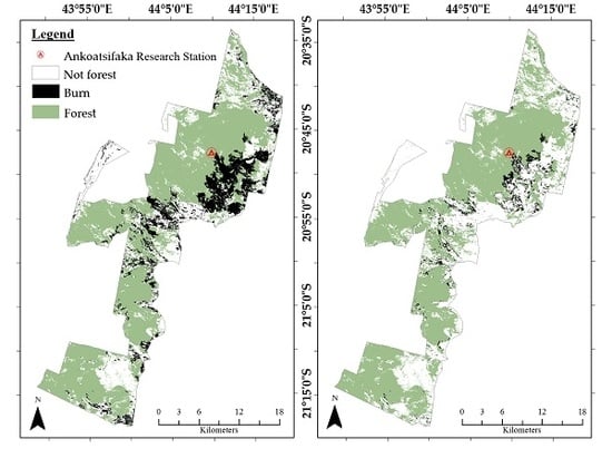
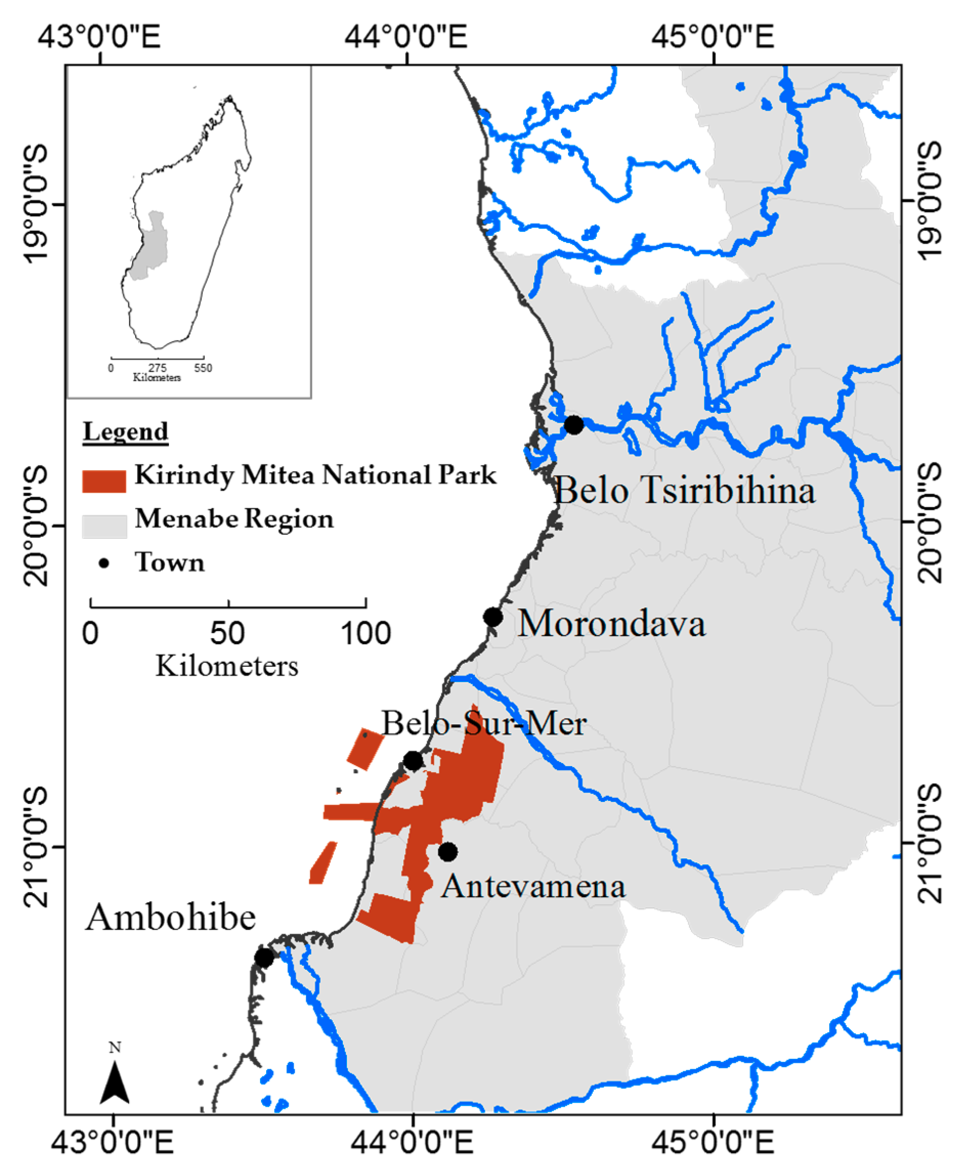
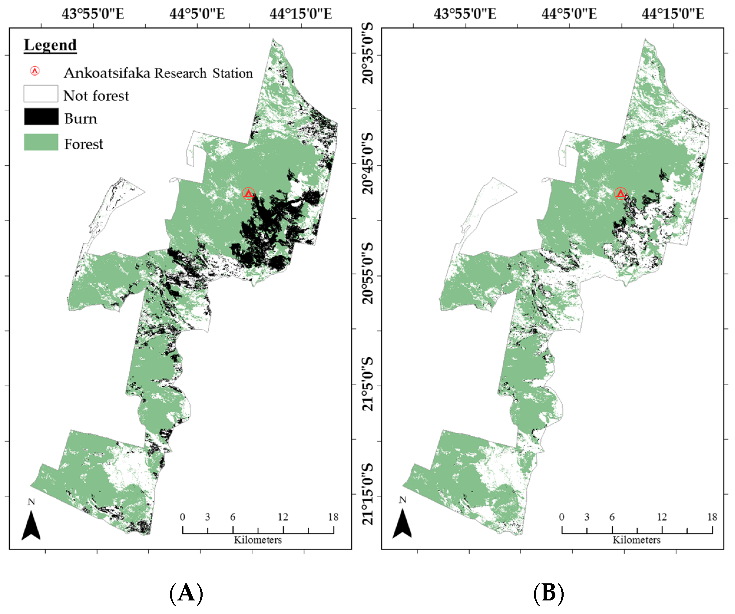
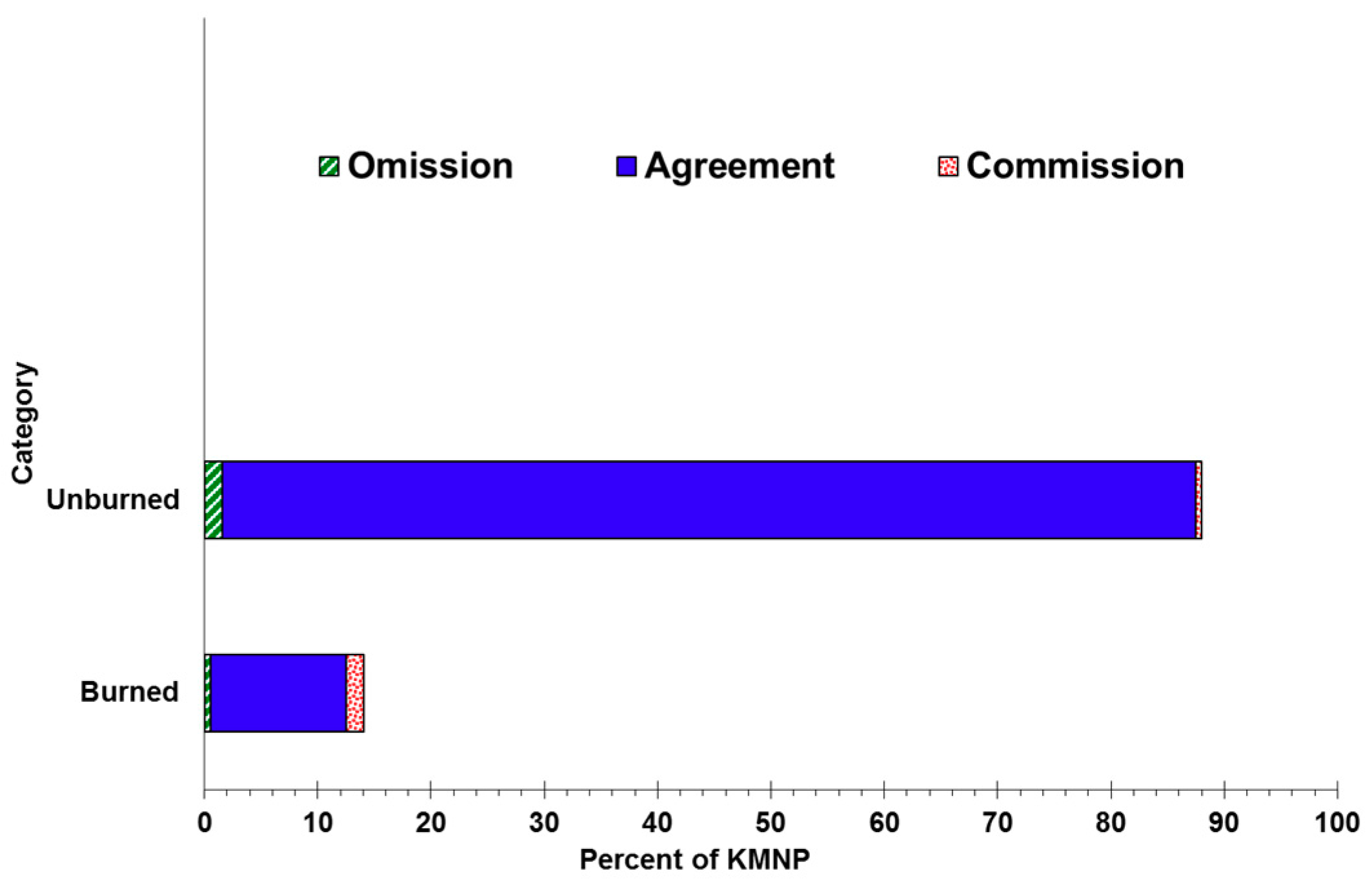
Burned Area Mapping of an Escaped Fire into Tropical Dry Forest in Western Madagascar Using Multi-Season Landsat OLI Data

Department of Biological Sciences, Marshall University, Huntington, WV 25755, USA
Remote Sens. 2018, 10(3), 371; https://doi.org/10.3390/rs10030371
Submission received: 27 December 2017 / Revised: 12 February 2018 / Accepted: 20 February 2018 / Published: 27 February 2018
(This article belongs to the Special Issue Remote Sensing of Wildfire)

Abstract

A human-induced fire cleared a large area of tropical dry forest near the Ankoatsifaka Research Station at Kirindy Mitea National Park in western Madagascar over several weeks in 2013. Fire is a major factor in the disturbance and loss of global tropical dry forests, yet remotely sensed mapping studies of fire-impacted tropical dry forests lag behind fire research of other forest types. Methods used to map burns in temperature forests may not perform as well in tropical dry forests where it can be difficult to distinguish between multiple-age burn scars and between bare soil and burns. In this study, the extent of forest lost to stand-replacing fire in Kirindy Mitea National Park was quantified using both spectral and textural information derived from multi-date satellite imagery. The total area of the burn was 18,034 ha. It is estimated that 6% (4761 ha) of the Park’s primary tropical dry forest burned over the period 23 June to 27 September. Half of the forest burned (2333 ha) was lost in the large conflagration adjacent to the Research Station. The best model for burn scar mapping in this highly-seasonal tropical forest and pastoral landscape included the differenced Normalized Burn Ratio (dNBR) and both uni- and multi-temporal measures of greenness. Lessons for burn mapping of tropical dry forest are much the same as for tropical dry forest mapping—highly seasonal vegetation combined with a mixture of background spectral information make for a complicated analysis and may require multi-temporal imagery and site specific techniques.
Keywords: burn scar mapping; tropical dry forest; Normalized Burn Ratio; Multitemporal Kauth-Thomas; texture; Madagascar burn scar mapping; tropical dry forest; Normalized Burn Ratio; Multitemporal Kauth-Thomas; texture; Madagascar
Graphical Abstract

