Article

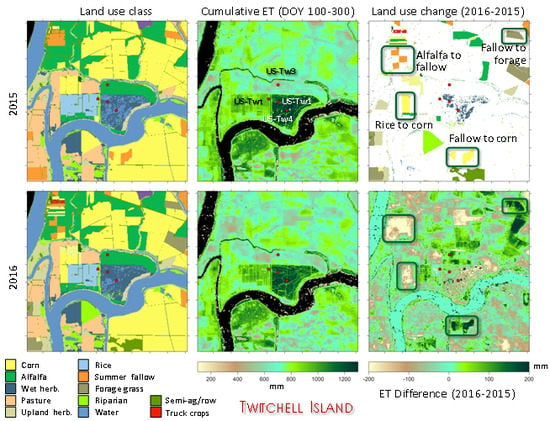
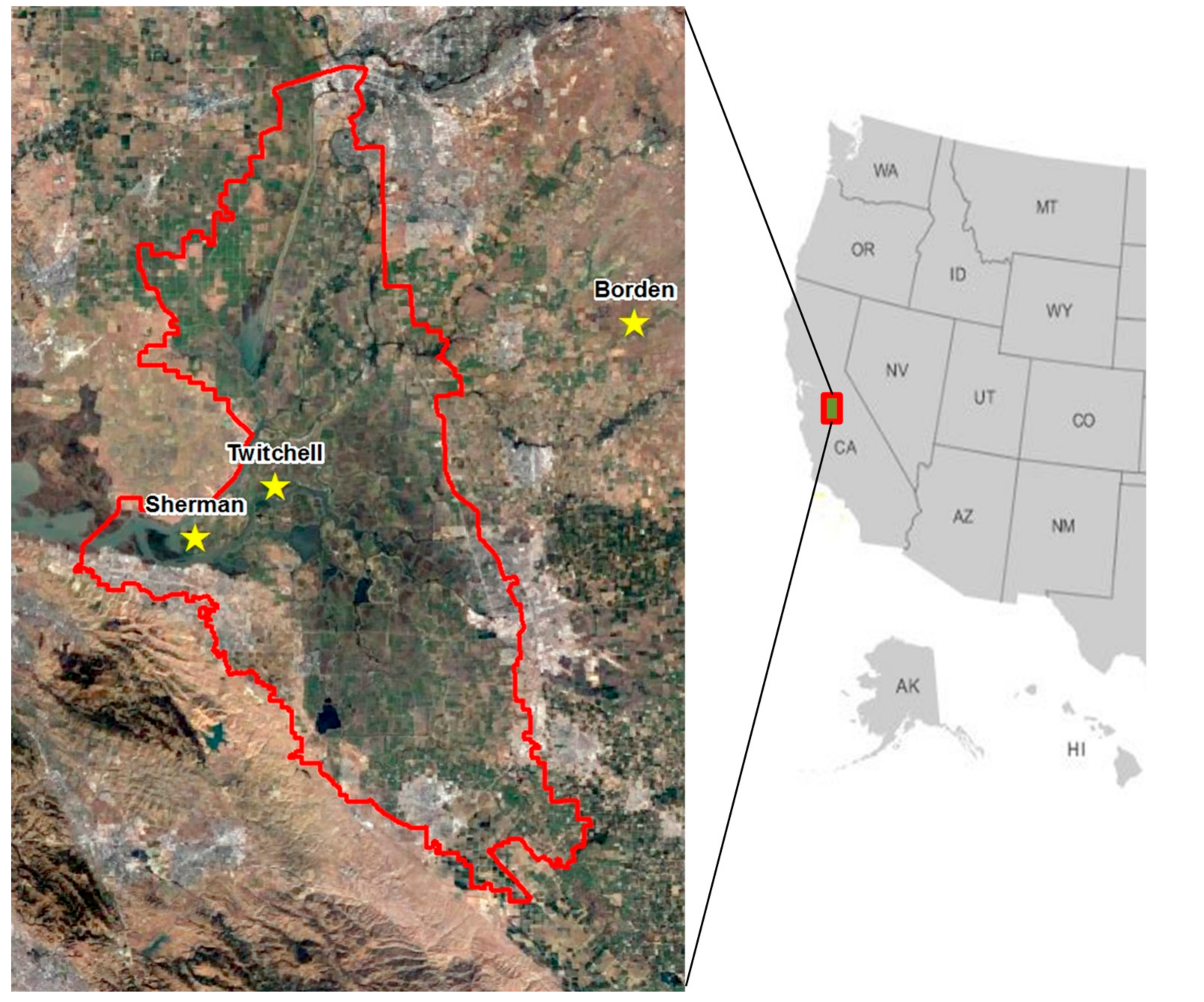
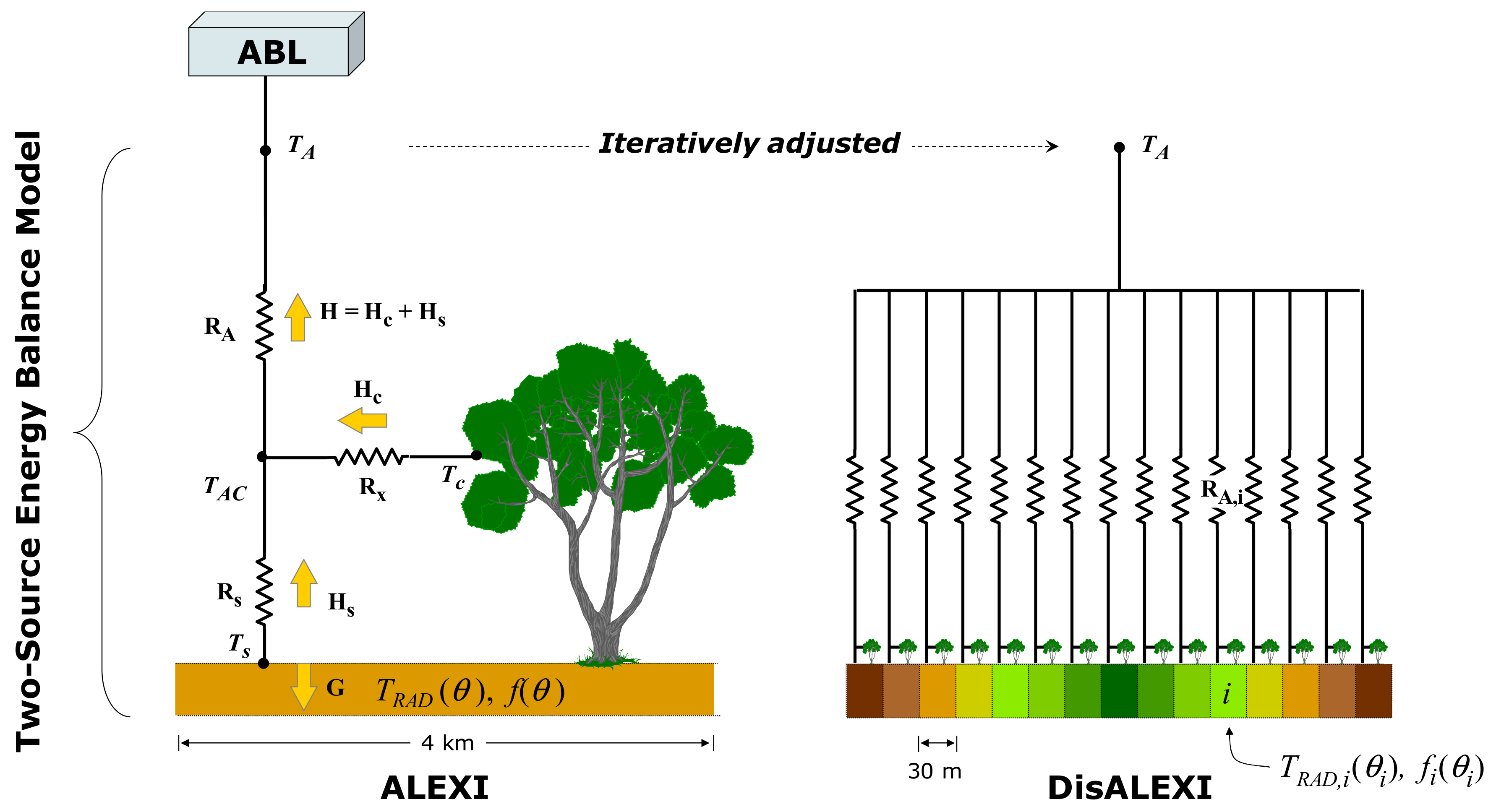
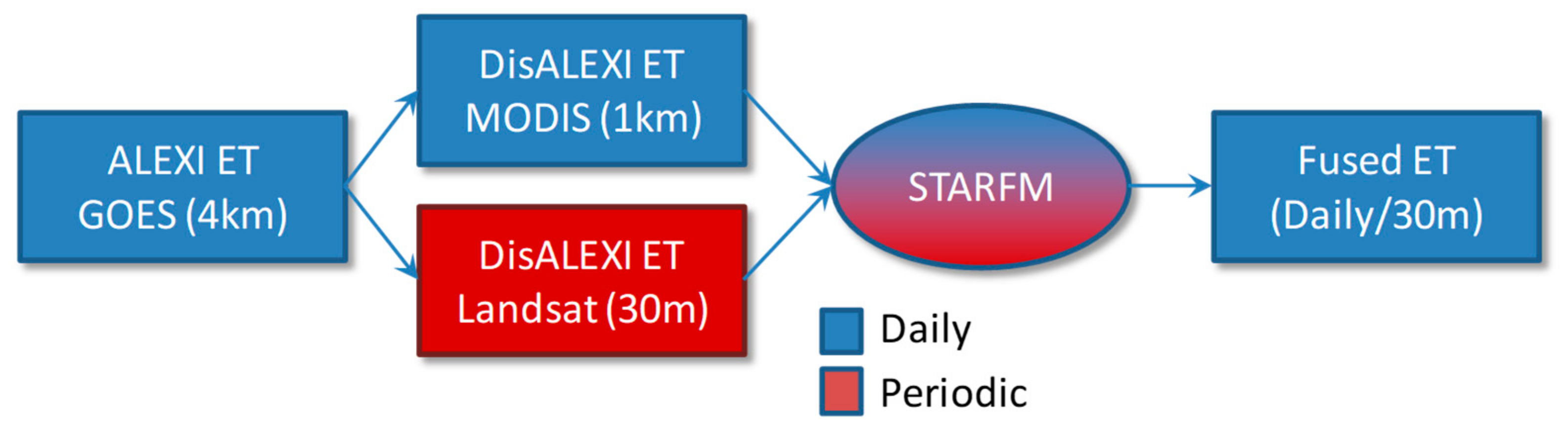
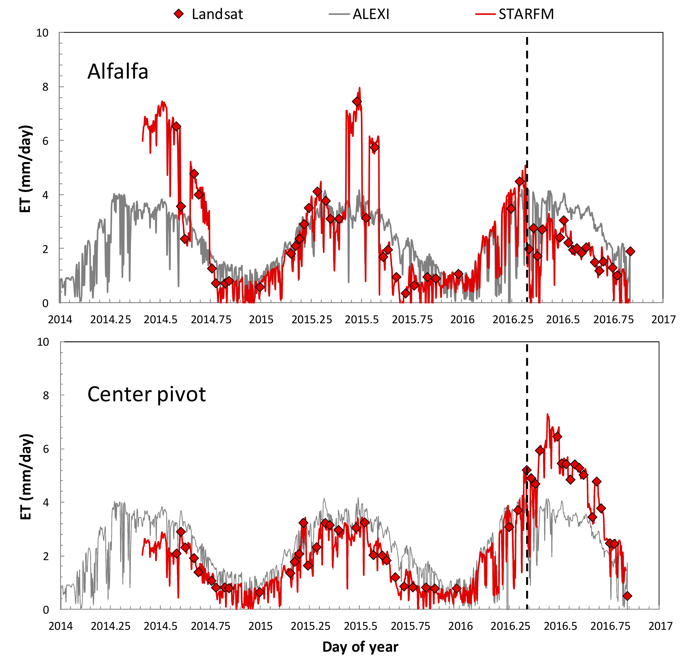
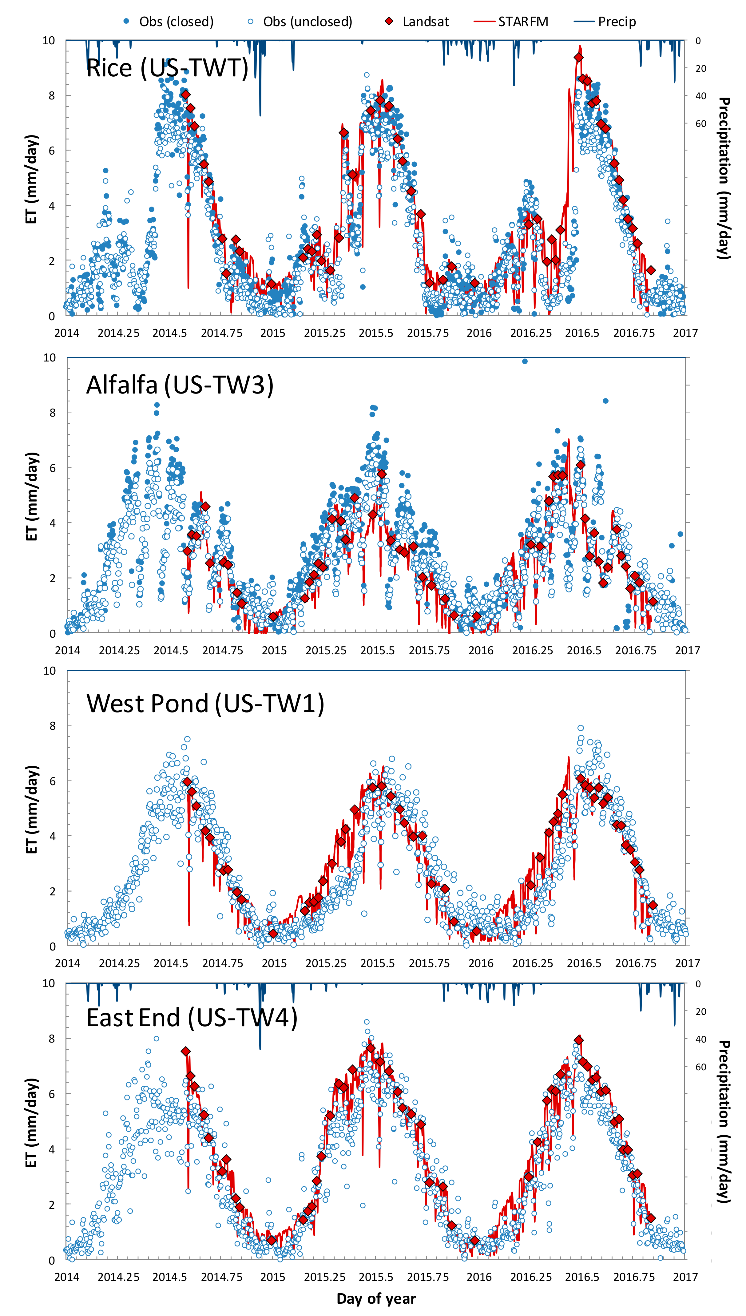
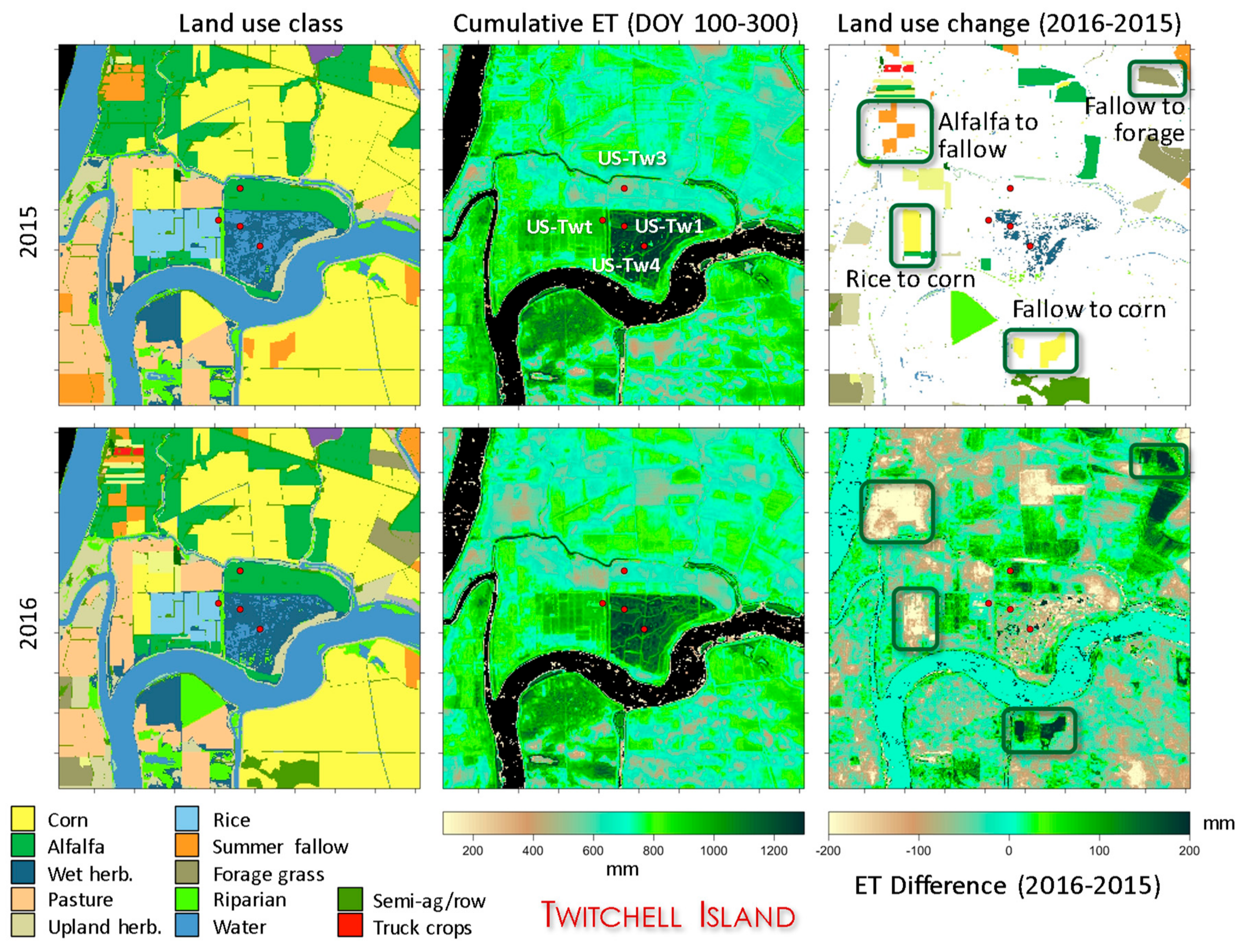
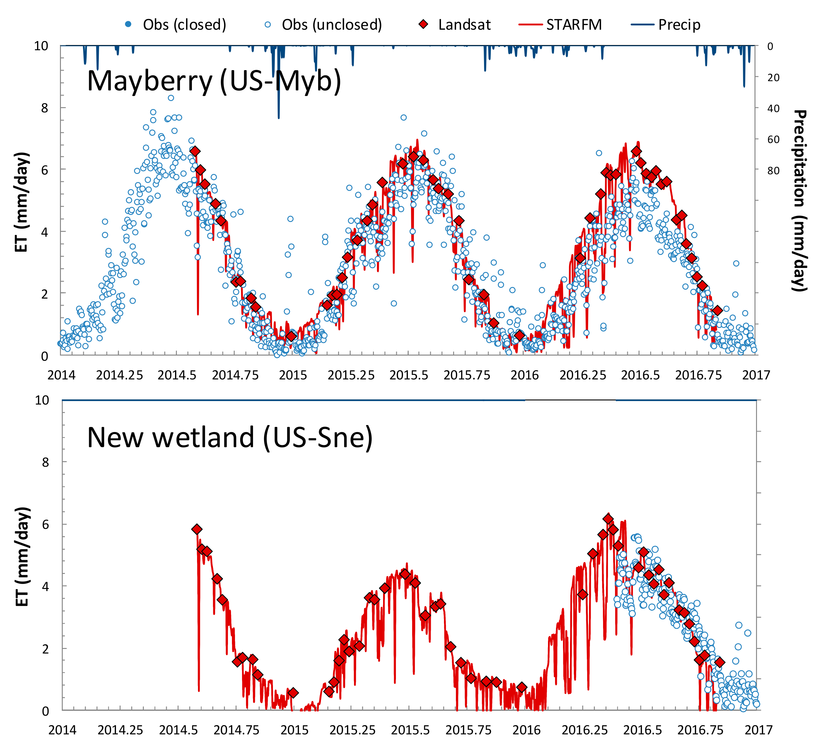
Field-Scale Assessment of Land and Water Use Change over the California Delta Using Remote Sensing

1
USDA-ARS, Hydrology and Remote Sensing Laboratory, Beltsville, MD 20705, USA
2
NASA Marshall Space Flight Center, Huntsville, AL 35805, USA
3
Department of Environmental Science, Policy and Management, University of California, Berkeley, CA 94720, USA
4
Department of Civil and Environmental Engineering, University of California, Merced, CA 95343, USA
*
Author to whom correspondence should be addressed.
Remote Sens. 2018, 10(6), 889; https://doi.org/10.3390/rs10060889
Submission received: 22 April 2018 / Revised: 23 May 2018 / Accepted: 28 May 2018 / Published: 7 June 2018
(This article belongs to the Special Issue Advances in the Remote Sensing of Terrestrial Evaporation)

Abstract

The ability to accurately monitor and anticipate changes in consumptive water use associated with changing land use and land management is critical to developing sustainable water management strategies in water-limited climatic regions. In this paper, we present an application of a remote sensing data fusion technique for developing high spatiotemporal resolution maps of evapotranspiration (ET) at scales that can be associated with changes in land use. The fusion approach combines ET map timeseries developed using an multi-scale energy balance algorithm applied to thermal data from Earth observation platforms with high spatial but low temporal resolution (e.g., Landsat) and with moderate resolution but frequent temporal coverage (e.g., MODIS (Moderate Resolution Imaging Spectroradiometer)). The approach is applied over the Sacramento-San Joaquin Delta region in California—an area critical to both agricultural production and drinking water supply within the state that has recently experienced stresses on water resources due to a multi-year (2012–2017) extreme drought. ET “datacubes” with 30-m resolution and daily timesteps were constructed for the 2015–2016 water years and related to detailed maps of land use developed at the same spatial scale. The ET retrievals are evaluated at flux sites over multiple land covers to establish a metric of accuracy in the annual water use estimates, yielding root-mean-square errors of 1.0, 0.8, and 0.3 mm day−1 at daily, monthly, and yearly timesteps, respectively, for all sites combined. Annual ET averaged over the Delta changed only 3 mm year−1 between water years, from 822 to 819 mm year−1, translating to an area-integrated total change in consumptive water use of seven thousand acre-feet (TAF). Changes were largest in areas with recorded land-use change between water years—most significantly, fallowing of crop land presumably in response to reductions in water availability and allocations due to the drought. Moreover, the time evolution in water use associated with wetland restoration—an effort aimed at reducing subsidence and carbon emissions within the inner Delta—is assessed using a sample wetland chronosequence. Region-specific matrices of consumptive water use associated with land use changes may be an effective tool for policymakers and farmers to understand how land use conversion could impact consumptive use and demand.
Keywords: evapotranspiration; surface energy balance; data fusion; water resource management; land-use change evapotranspiration; surface energy balance; data fusion; water resource management; land-use change
Graphical Abstract

