Fault Slip Model of the 2018 Mw 6.6 Hokkaido Eastern Iburi, Japan, Earthquake Estimated from Satellite Radar and GPS Measurements

 , ,
, , 
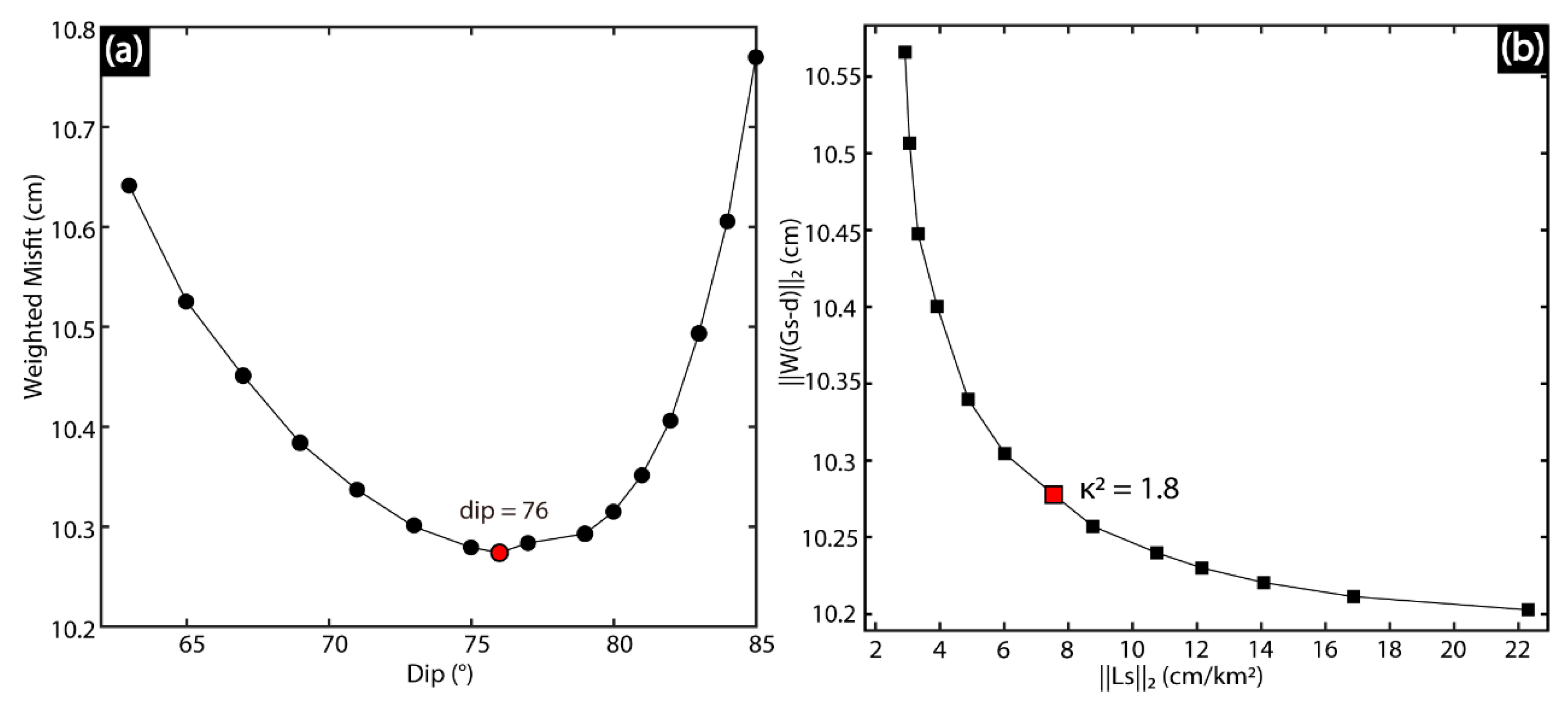
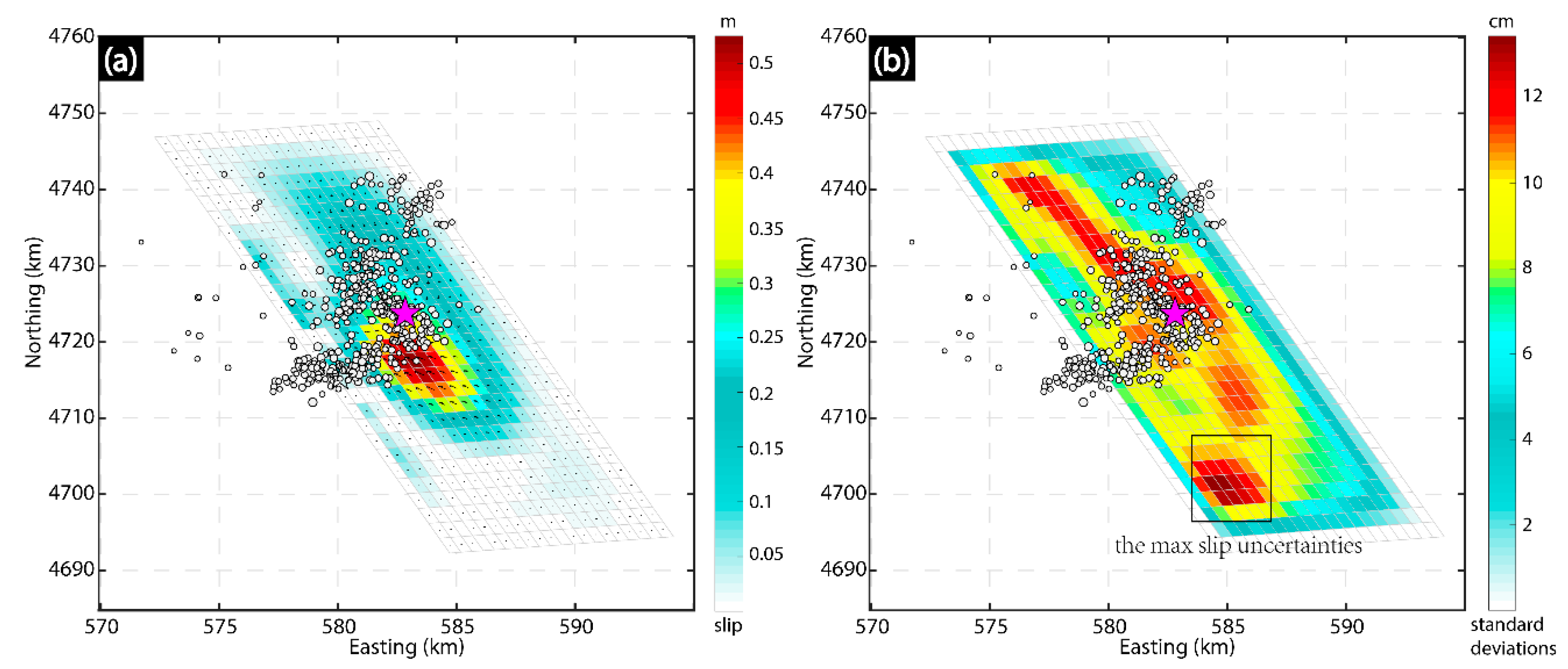
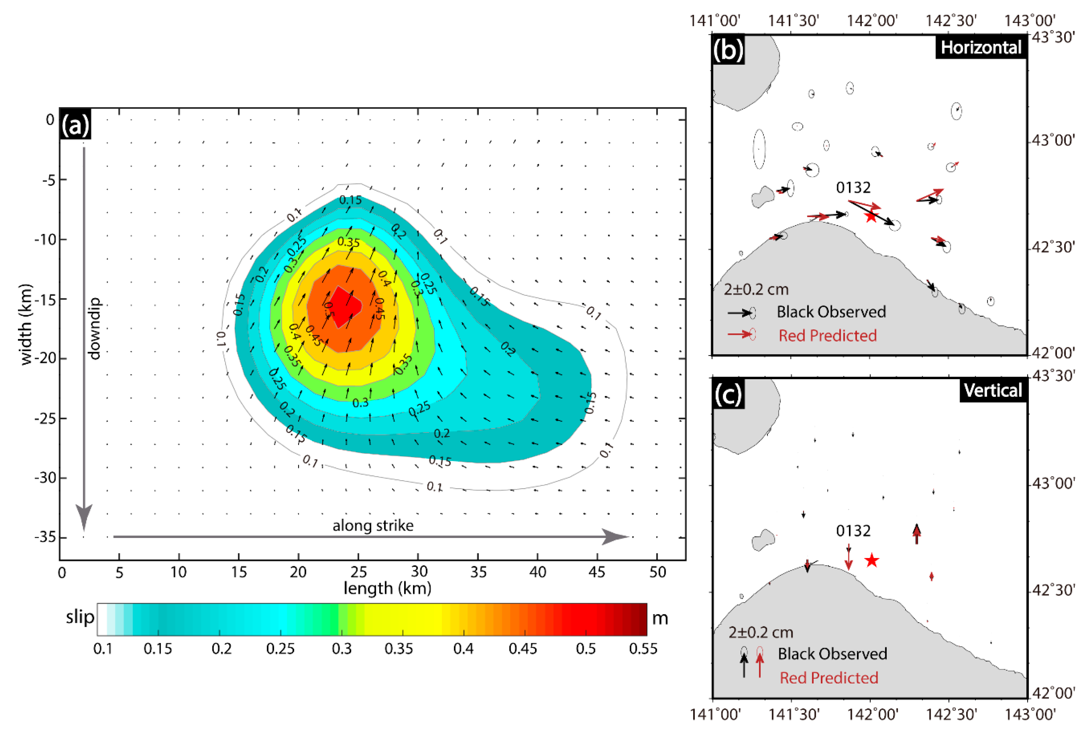
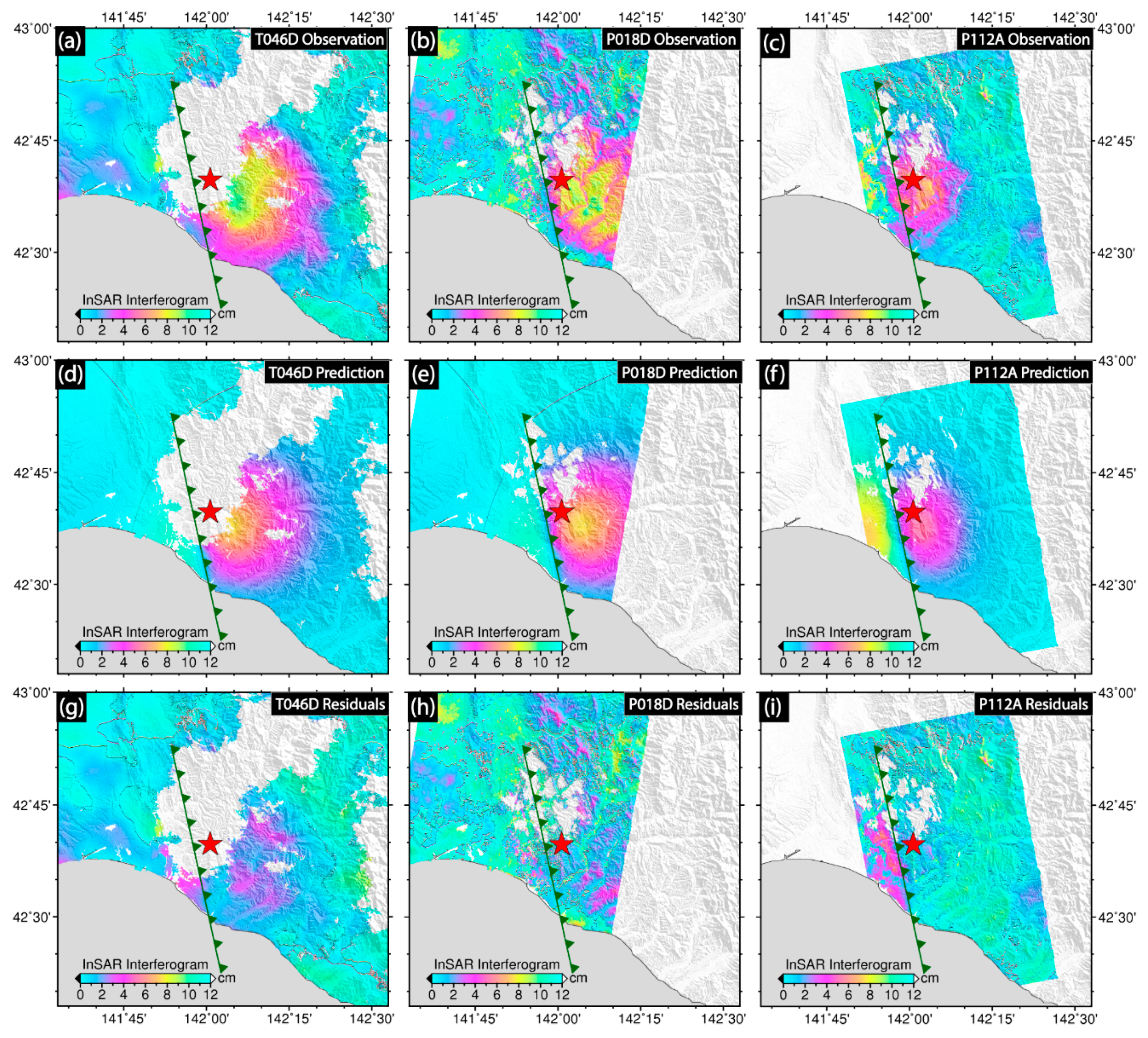
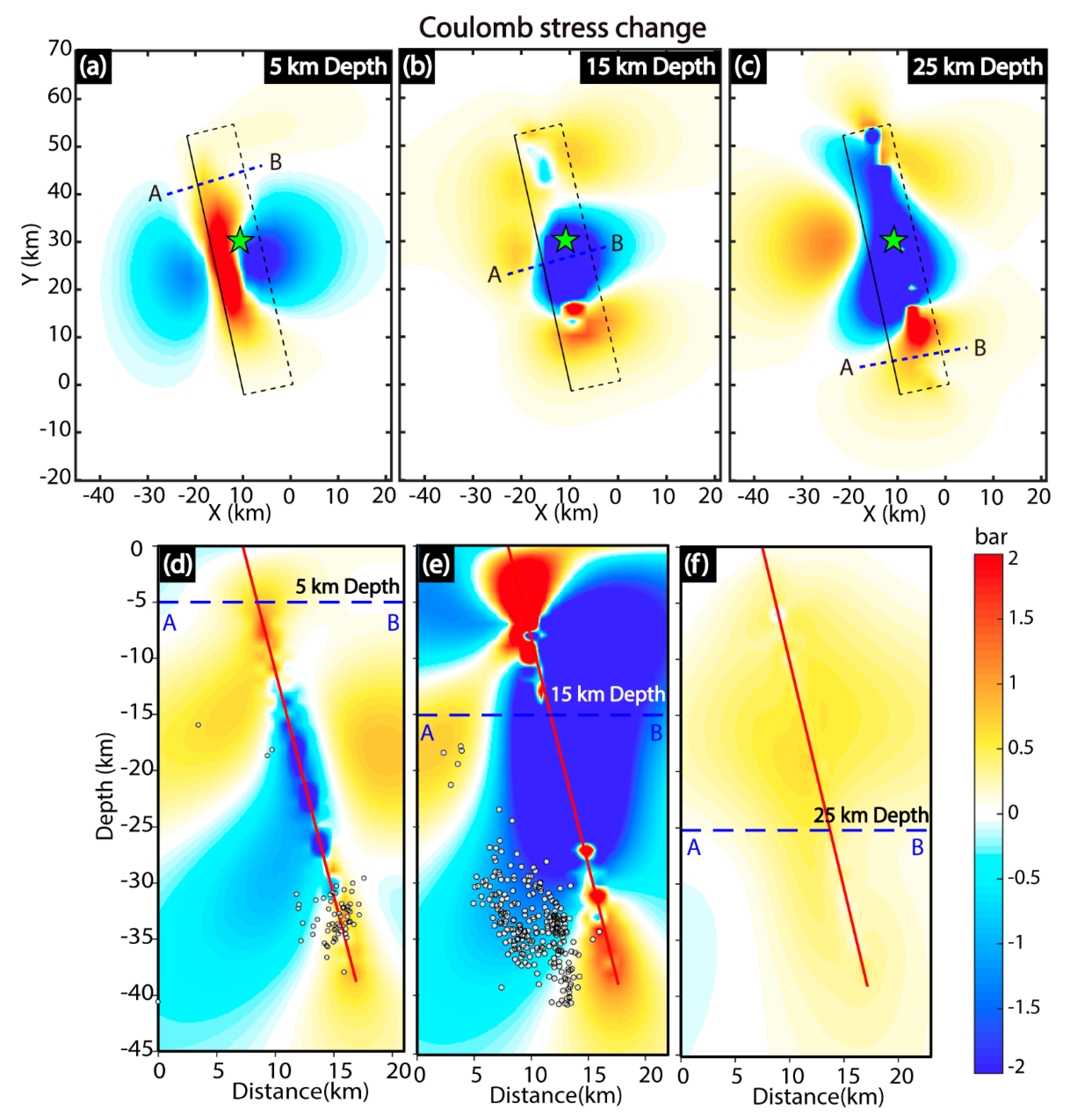
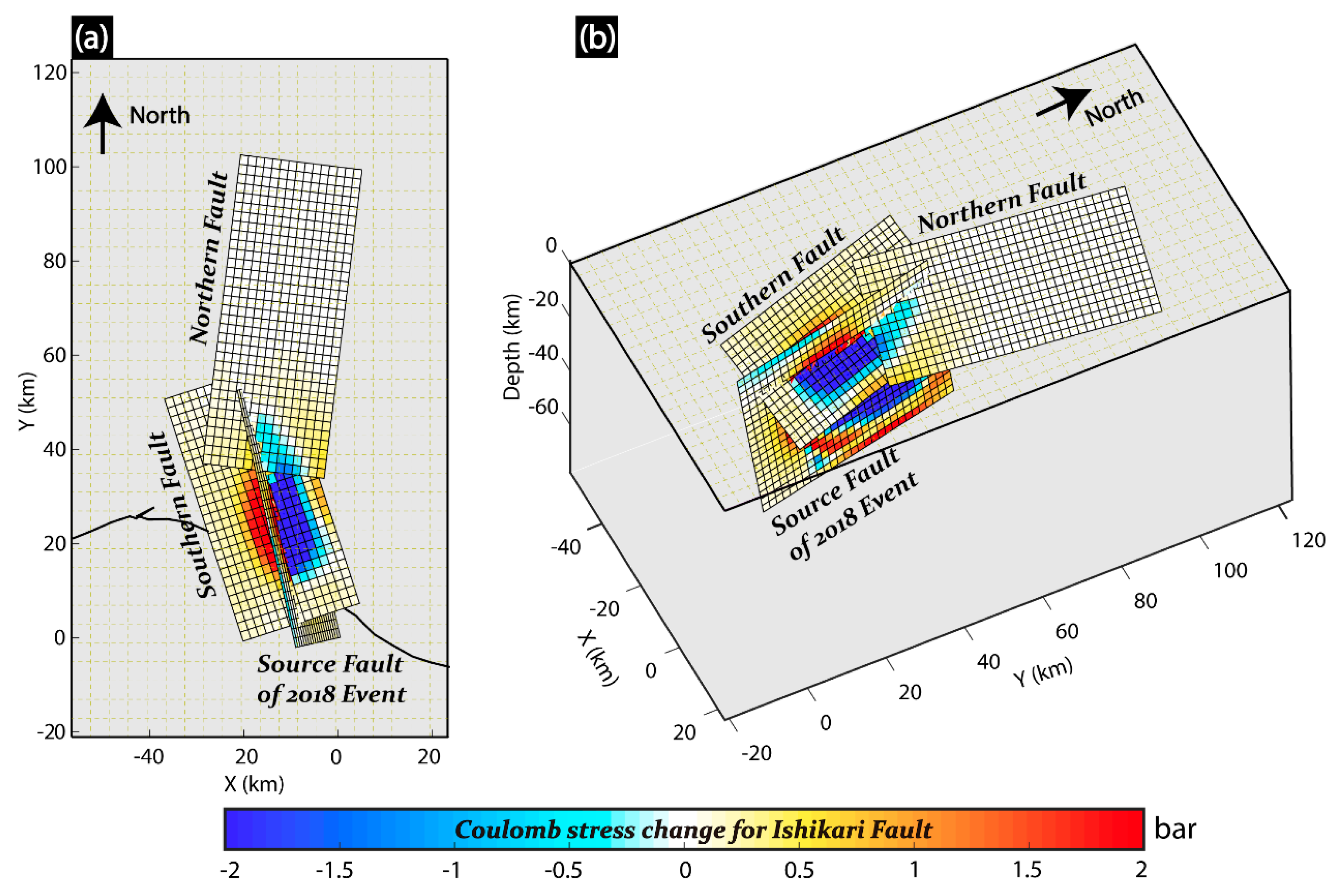
Abstract
Share and Cite
Guo, Z.; Wen, Y.; Xu, G.; Wang, S.; Wang, X.; Liu, Y.; Xu, C. Fault Slip Model of the 2018 Mw 6.6 Hokkaido Eastern Iburi, Japan, Earthquake Estimated from Satellite Radar and GPS Measurements. Remote Sens. 2019, 11, 1667. https://doi.org/10.3390/rs11141667
Guo Z, Wen Y, Xu G, Wang S, Wang X, Liu Y, Xu C. Fault Slip Model of the 2018 Mw 6.6 Hokkaido Eastern Iburi, Japan, Earthquake Estimated from Satellite Radar and GPS Measurements. Remote Sensing. 2019; 11(14):1667. https://doi.org/10.3390/rs11141667
Chicago/Turabian StyleGuo, Zelong, Yangmao Wen, Guangyu Xu, Shuai Wang, Xiaohang Wang, Yang Liu, and Caijun Xu. 2019. "Fault Slip Model of the 2018 Mw 6.6 Hokkaido Eastern Iburi, Japan, Earthquake Estimated from Satellite Radar and GPS Measurements" Remote Sensing 11, no. 14: 1667. https://doi.org/10.3390/rs11141667
APA StyleGuo, Z., Wen, Y., Xu, G., Wang, S., Wang, X., Liu, Y., & Xu, C. (2019). Fault Slip Model of the 2018 Mw 6.6 Hokkaido Eastern Iburi, Japan, Earthquake Estimated from Satellite Radar and GPS Measurements. Remote Sensing, 11(14), 1667. https://doi.org/10.3390/rs11141667