Semantic Segmentation-Based Building Footprint Extraction Using Very High-Resolution Satellite Images and Multi-Source GIS Data

 ,
, 

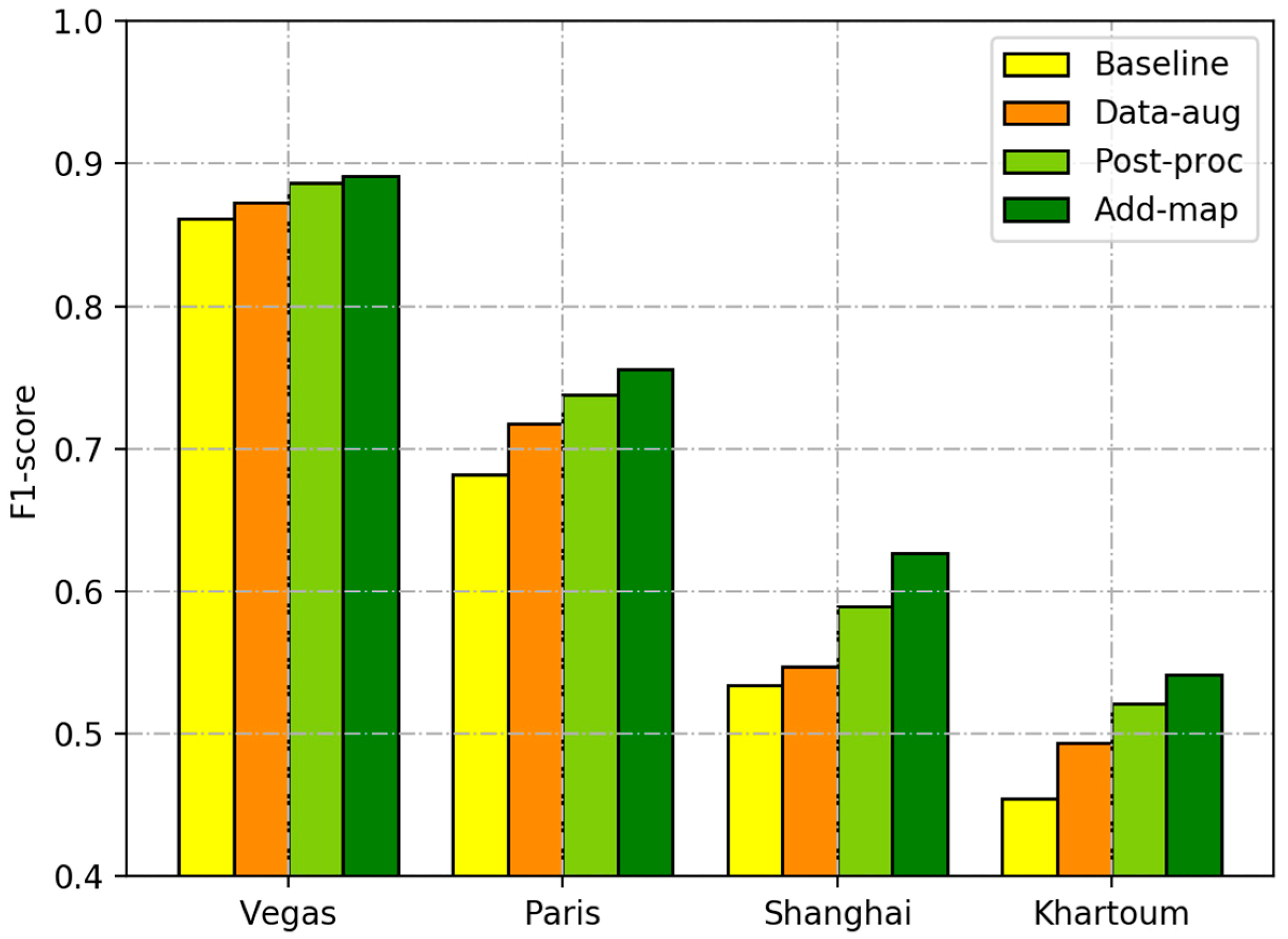
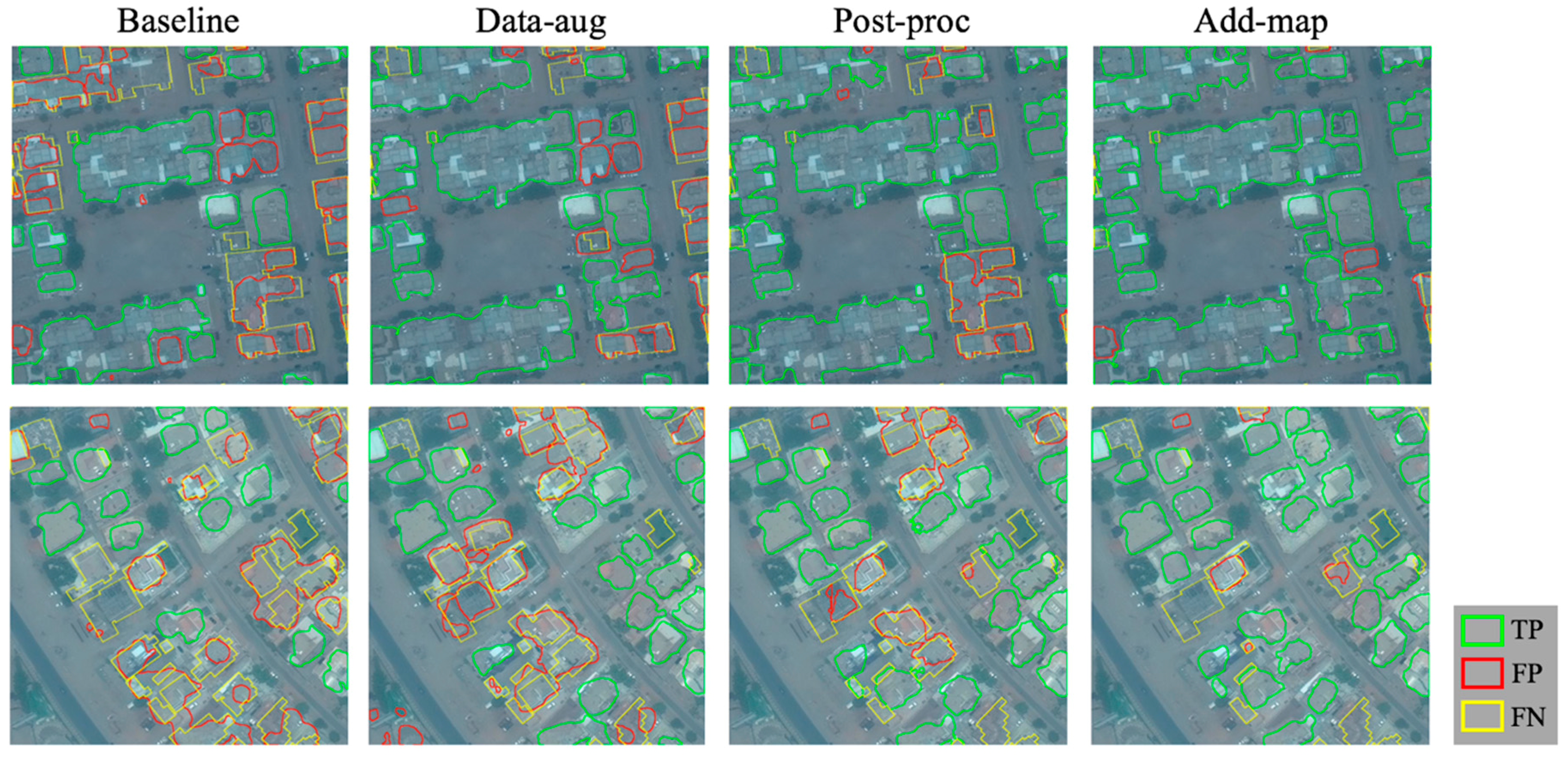
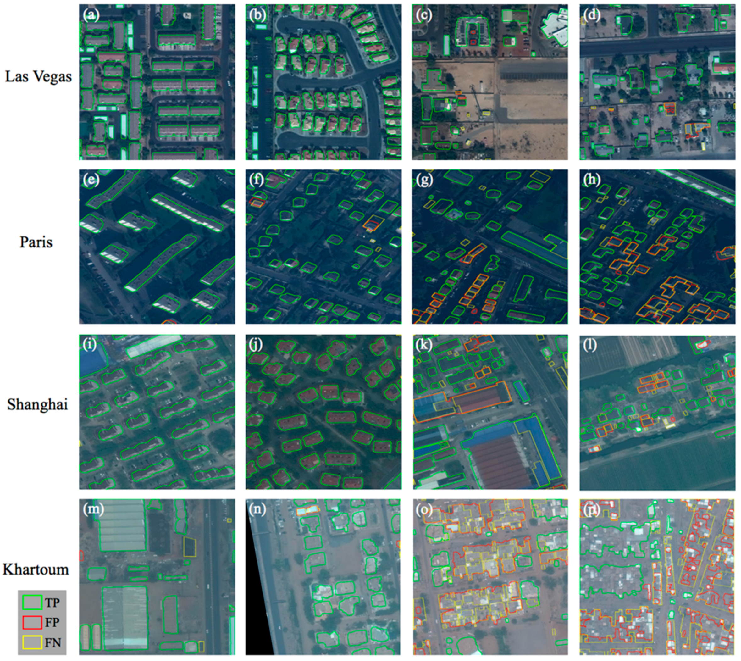
Abstract
Share and Cite
Li, W.; He, C.; Fang, J.; Zheng, J.; Fu, H.; Yu, L. Semantic Segmentation-Based Building Footprint Extraction Using Very High-Resolution Satellite Images and Multi-Source GIS Data. Remote Sens. 2019, 11, 403. https://doi.org/10.3390/rs11040403
Li W, He C, Fang J, Zheng J, Fu H, Yu L. Semantic Segmentation-Based Building Footprint Extraction Using Very High-Resolution Satellite Images and Multi-Source GIS Data. Remote Sensing. 2019; 11(4):403. https://doi.org/10.3390/rs11040403
Chicago/Turabian StyleLi, Weijia, Conghui He, Jiarui Fang, Juepeng Zheng, Haohuan Fu, and Le Yu. 2019. "Semantic Segmentation-Based Building Footprint Extraction Using Very High-Resolution Satellite Images and Multi-Source GIS Data" Remote Sensing 11, no. 4: 403. https://doi.org/10.3390/rs11040403
APA StyleLi, W., He, C., Fang, J., Zheng, J., Fu, H., & Yu, L. (2019). Semantic Segmentation-Based Building Footprint Extraction Using Very High-Resolution Satellite Images and Multi-Source GIS Data. Remote Sensing, 11(4), 403. https://doi.org/10.3390/rs11040403