Article

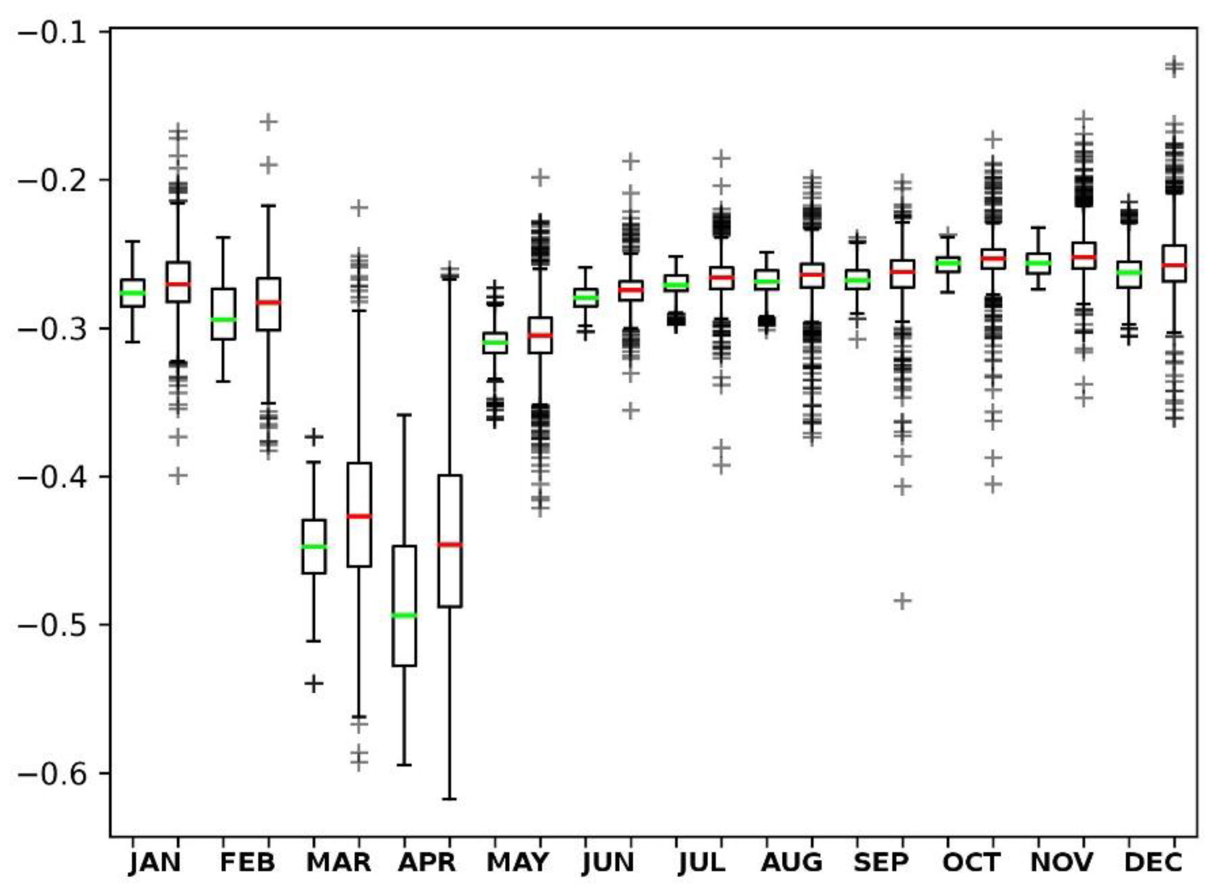
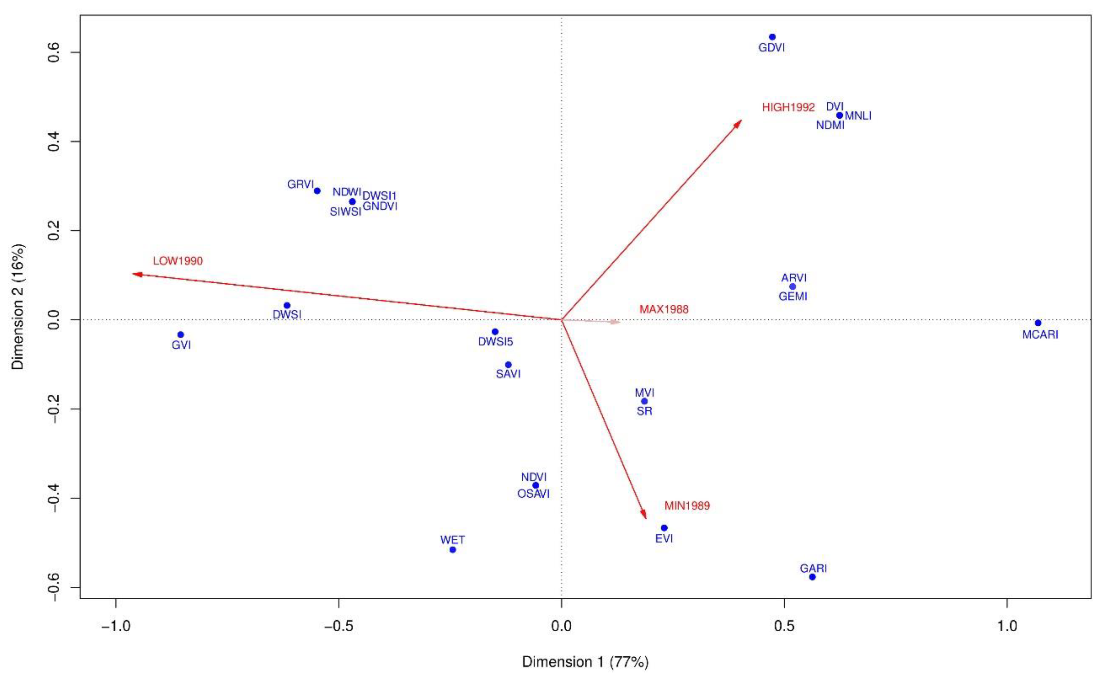
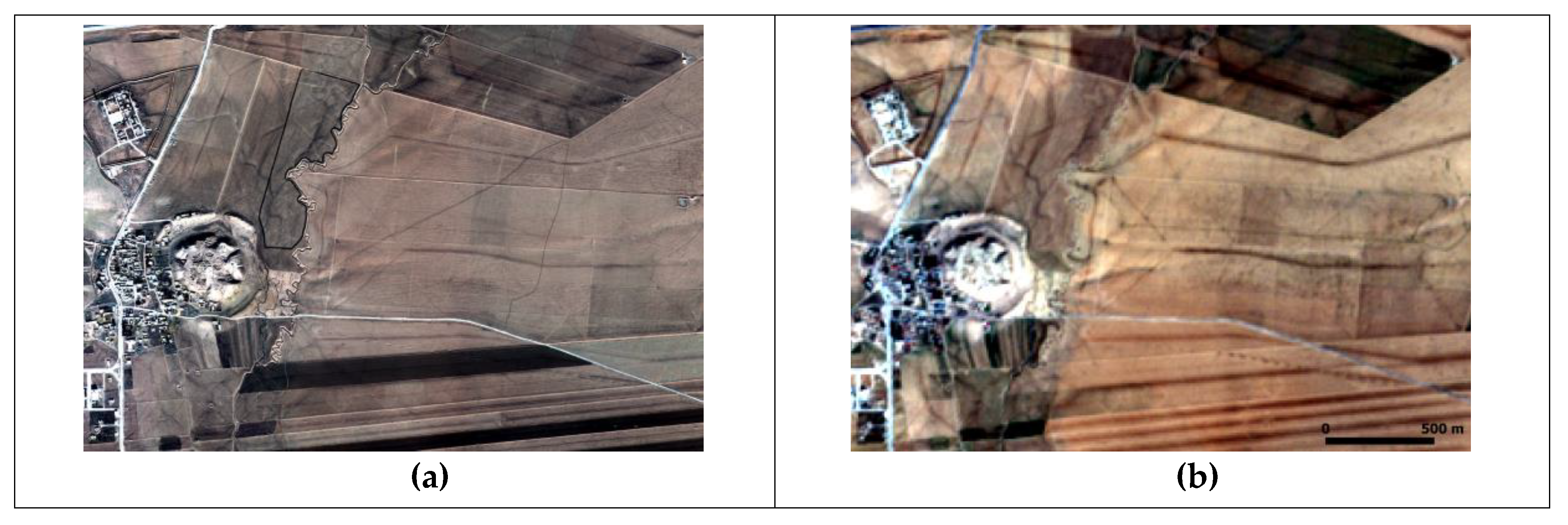
Multispectral Contrast of Archaeological Features: A Quantitative Evaluation

1
Institute for Archaeological and Monumental Heritage (IBAM), National Research Council (CNR), C.da Santa Loja, 85050 Tito Scalo (PZ), Italy
2
Institute of Methodologies for Environmental Analysis (IMAA), National Research Council (CNR), C.da Santa Loja, 85050 Tito Scalo (PZ), Italy
3
Department of Geography, Durham University, Lower Mountjoy, South Road, Durham, DH1 3LE, UK
*
Author to whom correspondence should be addressed.
Remote Sens. 2019, 11(8), 913; https://doi.org/10.3390/rs11080913
Submission received: 22 February 2019 / Revised: 25 March 2019 / Accepted: 8 April 2019 / Published: 15 April 2019
(This article belongs to the Special Issue 2nd Edition Advances in Remote Sensing for Archaeological Heritage)

Abstract

This study provides an evaluation of spectral responses of hollow ways in Upper Mesopotamia. Hollow ways were used for the transportation of animals, carts, and other moving agents for centuries. The aim is to show how the success of spectral indices varies in describing topologically simple features even in a seemingly homogeneous geographic unit. The variation is further highlighted under the changing precipitation regime. The methodology begins with an exploration of the relationship between the date of a multispectral scene and the visibility of hollow ways. The next step is to evaluate the impact of rainfall levels on numerous indices and to quantify spectral contrast. The contrast between a hollow way and its background is evaluated with Welch’s t-test and the association between precipitation regime and spectral responses of hollow ways are investigated with Correspondence Analysis and Fisher’s test. Results highlight an intrinsic relationship between the precipitation regime and the ways in which archaeological features reflects and/or emits electromagnetic energy. Next, the categorization of spectral indices based on different rainfall levels can be used as a guidance in future studies. Finally, the study suggests contrast becomes an even more fruitful concept as one moves from the spatial domain to the spectral domain.
Keywords: satellite remote sensing; spectral contrast; hollow ways; Upper Mesopotamia; precipitation regime satellite remote sensing; spectral contrast; hollow ways; Upper Mesopotamia; precipitation regime
Graphical Abstract

