Article

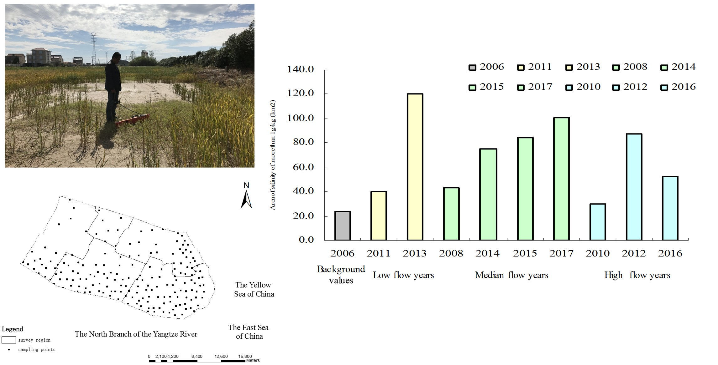
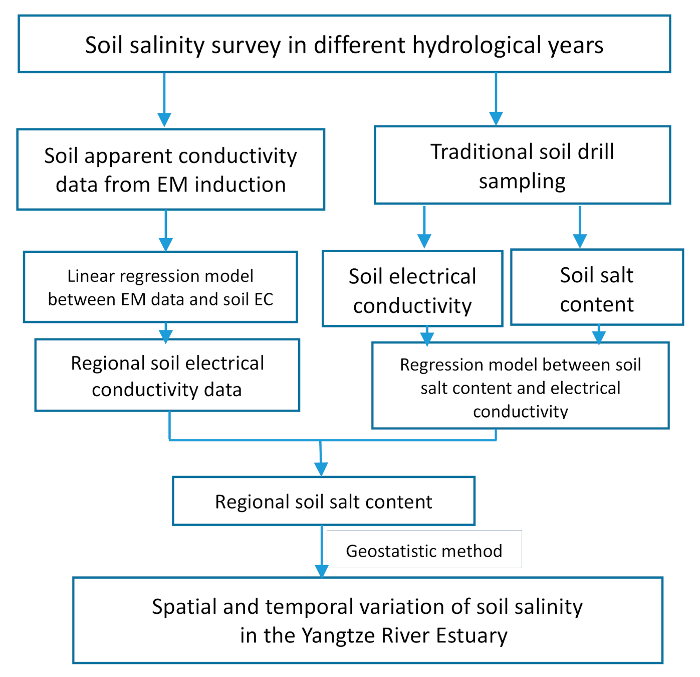
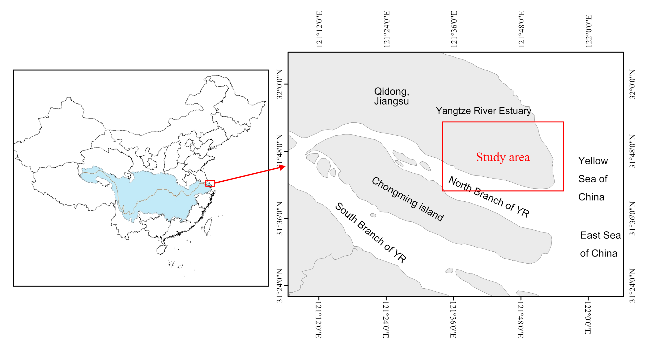
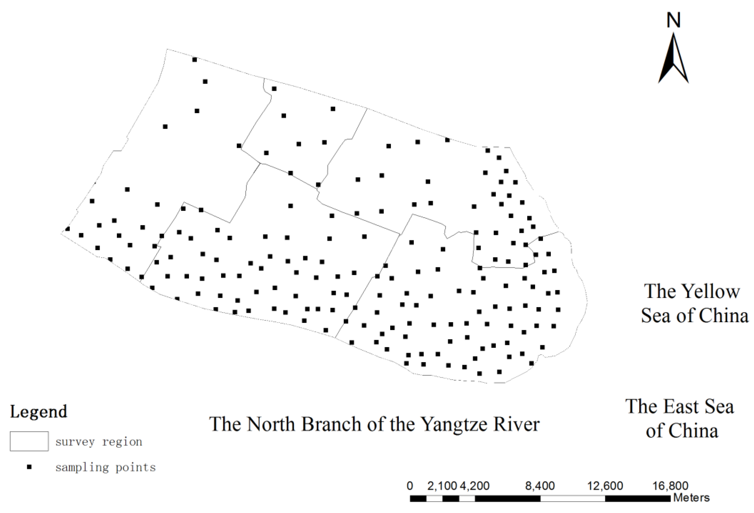
Spatial and Temporal Variability of Soil Salinity in the Yangtze River Estuary Using Electromagnetic Induction

State Key Laboratory of Soil and Sustainable Agriculture, Institute of Soil Science, Chinese Academy of Sciences (CAS), Nanjing 210008, China
*
Author to whom correspondence should be addressed.
Remote Sens. 2021, 13(10), 1875; https://doi.org/10.3390/rs13101875
Submission received: 19 March 2021 / Revised: 4 May 2021 / Accepted: 5 May 2021 / Published: 11 May 2021
(This article belongs to the Special Issue Advances of Proximal and Remote Sensing in Soil Salinity Mapping)

Abstract

Soil salt-water dynamics in the Yangtze River Estuary (YRE) is complex and soil salinity is an obstacle to regional agricultural production and the ecological environment in the YRE. Runoff into the sea is reduced during the impoundment period as the result of the water-storing process of the Three Gorges Reservoir (TGR) in the upper reaches of the Yangtze River, which causes serious seawater intrusion. Soil salinity is a problem due to shallow and saline groundwater under serious seawater intrusion in the YRE. In this research, we focused on the temporal variation and spatial distribution characteristics of soil salinity in the YRE using geostatistics combined with proximally sensed information obtained by an electromagnetic induction (EM) survey method in typical years under the impoundment of the TGR. The EM survey with proximal sensing method was applied to perform soil salinity survey in field in the Yangtze River Estuary, allowing quick determination and quantitative assessment of spatial and temporal variation of soil salinity from 2006 to 2017. We developed regional soil salinity survey and mapping by coupling limited laboratory data with proximal sensed data obtained from EM. We interpreted the soil electrical conductivity by constructing a linear model between the apparent electrical conductivity data measured by an EM 38 device and the soil electrical conductivity (EC) of soil samples measured in laboratory. Then, soil electrical conductivity was converted to soil salt content (soil salinity g kg−1) through established linear regression model based on the laboratory data of soil salinity and soil EC. Semivariograms of regional soil salinity in the survey years were fitted and ordinary kriging interpolation was applied in interpolation and mapping of regional soil salinity. The cross-validation results showed that the prediction results were acceptable. The soil salinity distribution under different survey years was presented and the area of salt affected soil was calculated using geostatistics method. The results of spatial distribution of soil salinity showed that soil salinity near the riverbanks and coastlines was higher than that of inland. The spatial distribution of groundwater depth and salinity revealed that shallow groundwater and high groundwater salinity influenced the spatial distribution characteristics of soil salinity. Under long-term impoundment of the Three Gorges Reservoir, the variation of soil salinity in different hydrological years was analyzed. Results showed that the area affected by soil salinity gradually increased in different hydrological year types under the impoundment of the TGR.
Keywords: soil salinity; spatiotemporal distribution; electromagnetic induction; Yangtze River Estuary; electrical conductivity; proximal sensing soil salinity; spatiotemporal distribution; electromagnetic induction; Yangtze River Estuary; electrical conductivity; proximal sensing
Graphical Abstract

