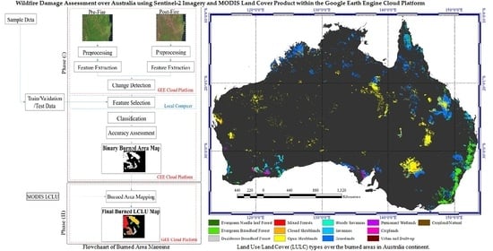
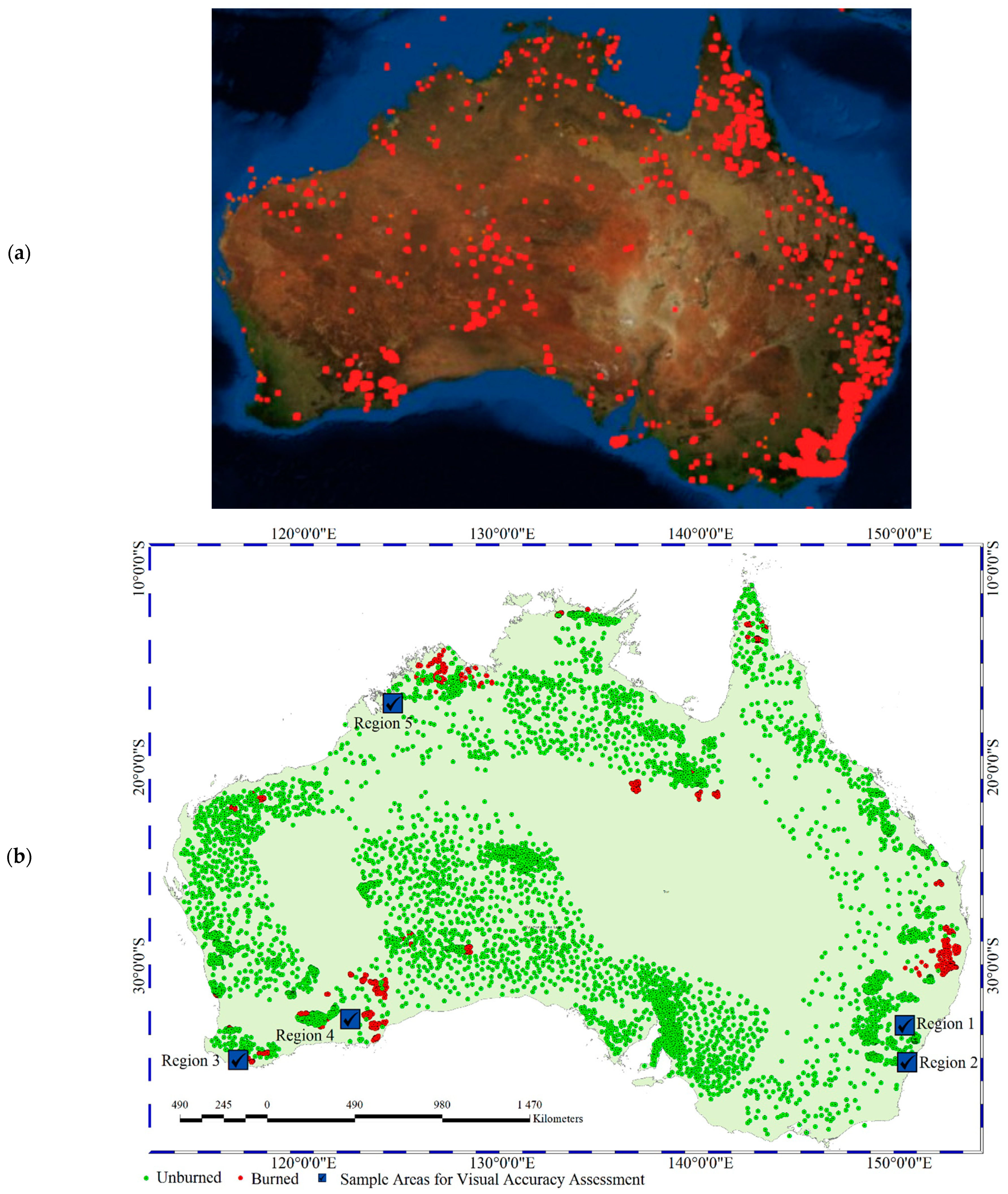
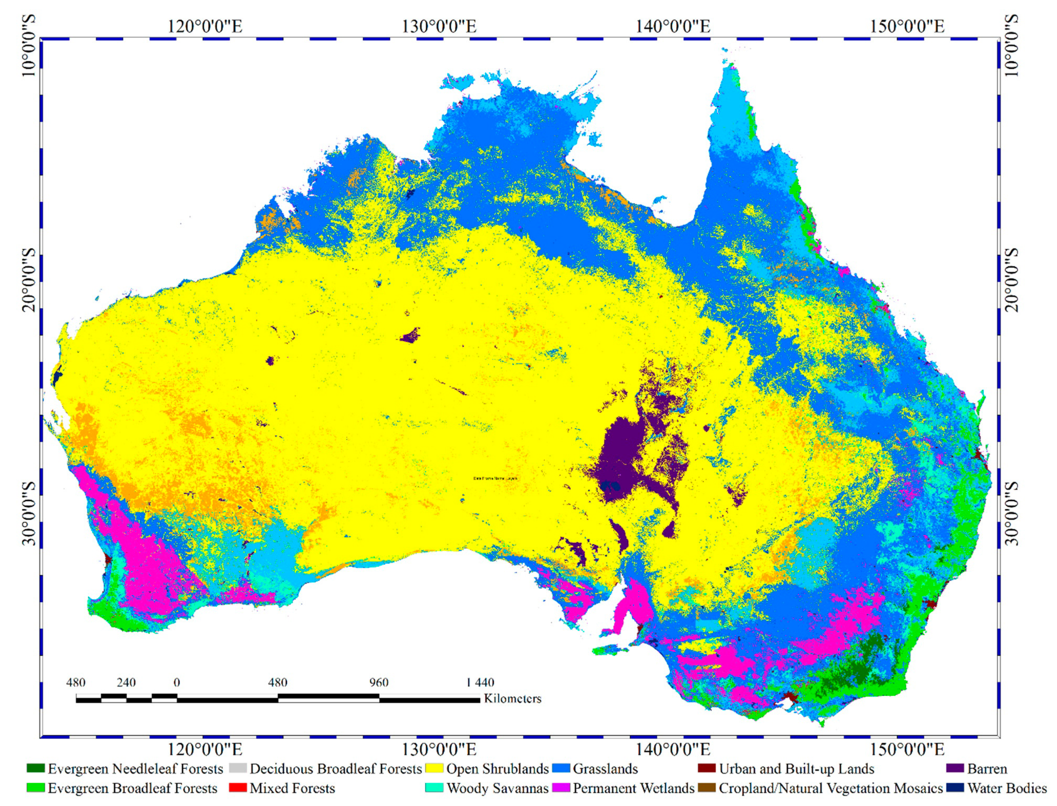
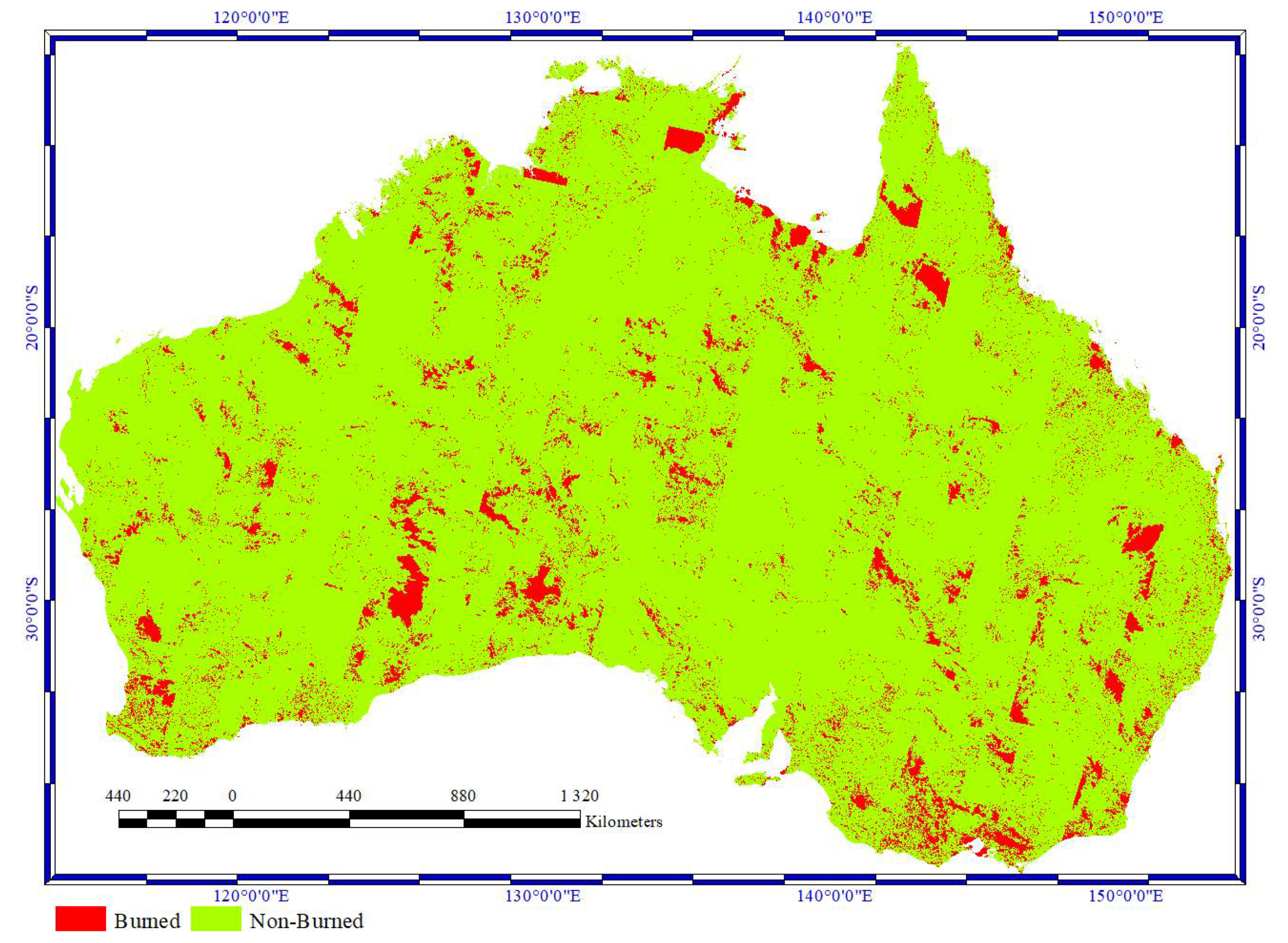
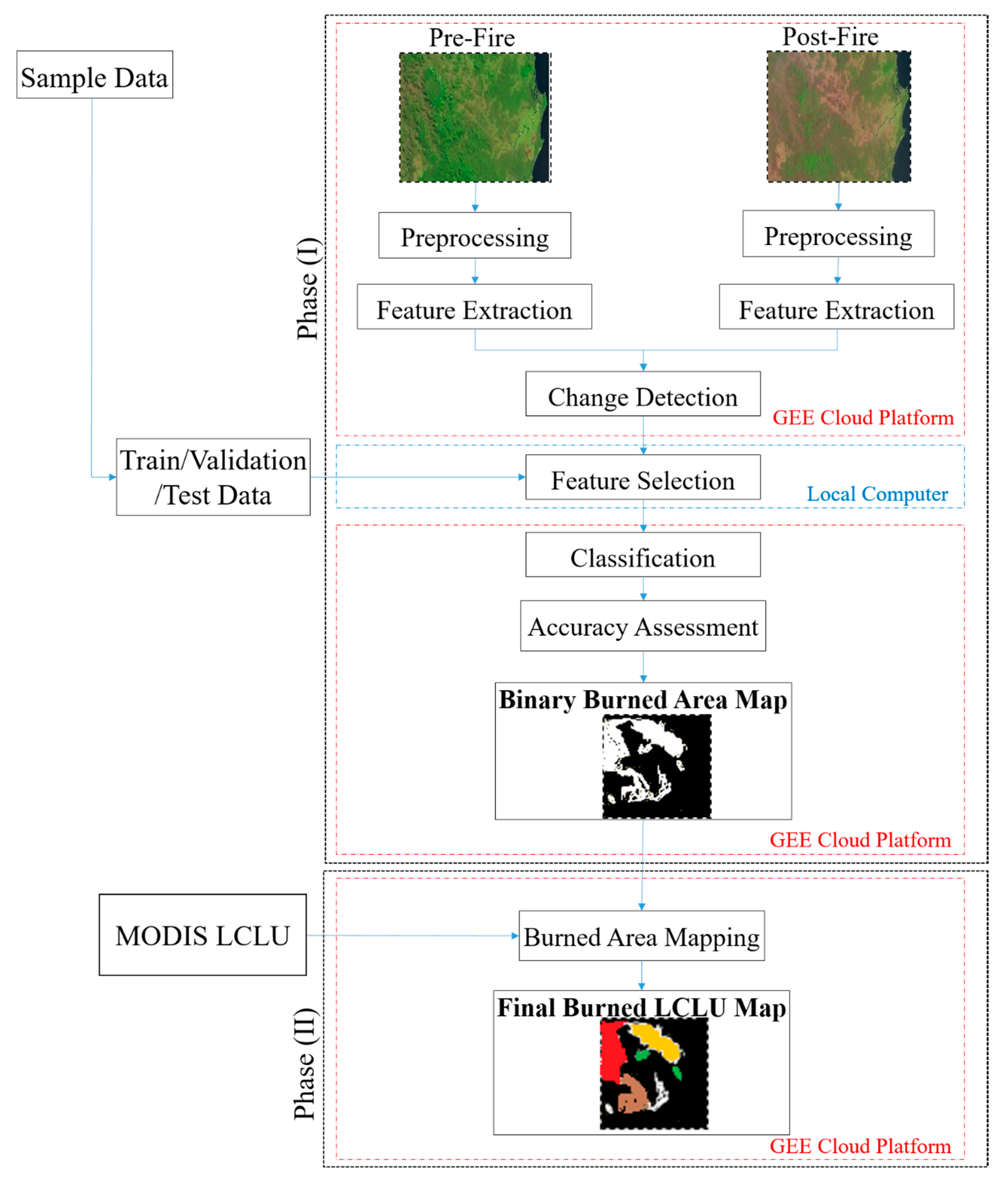
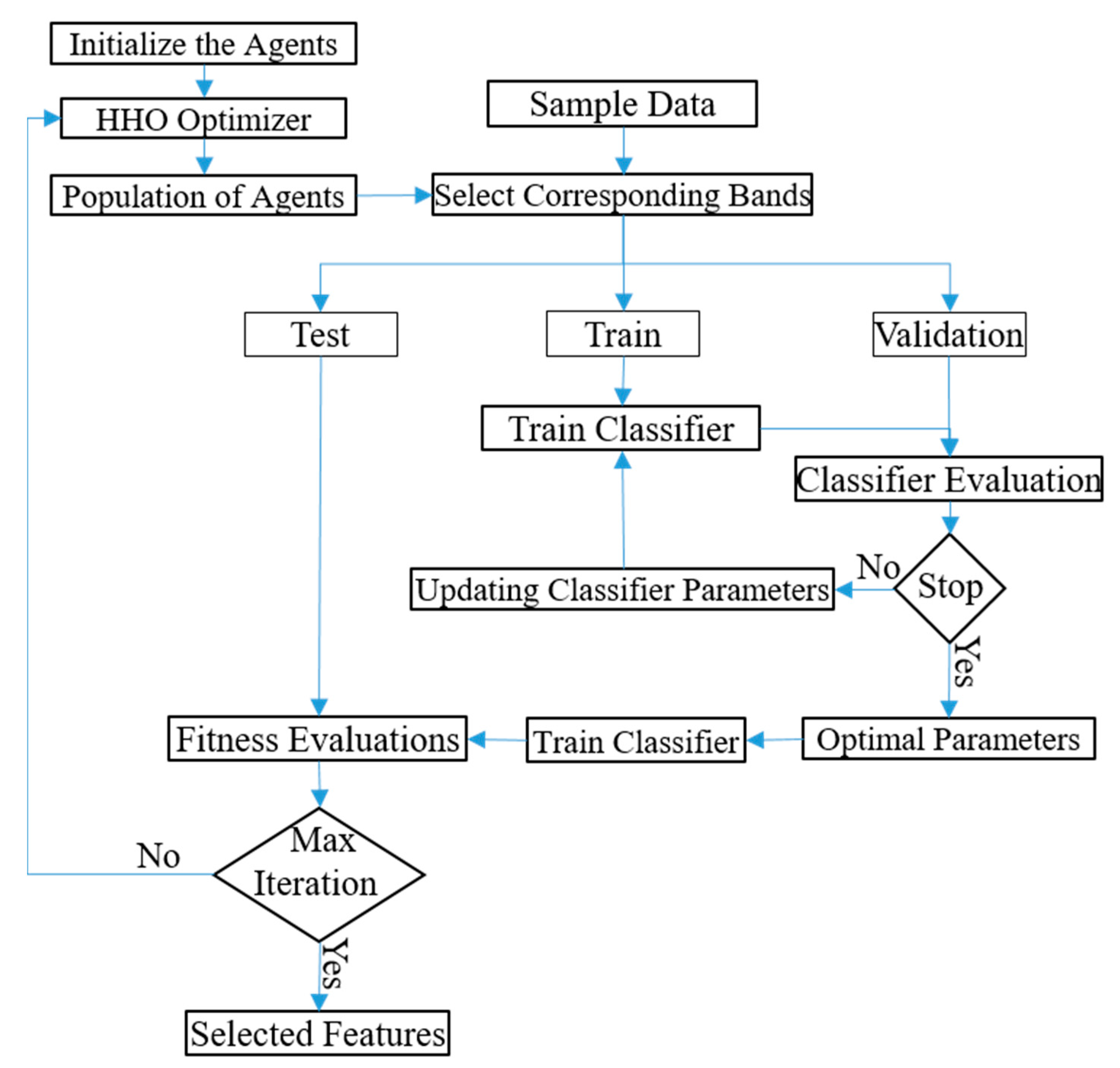
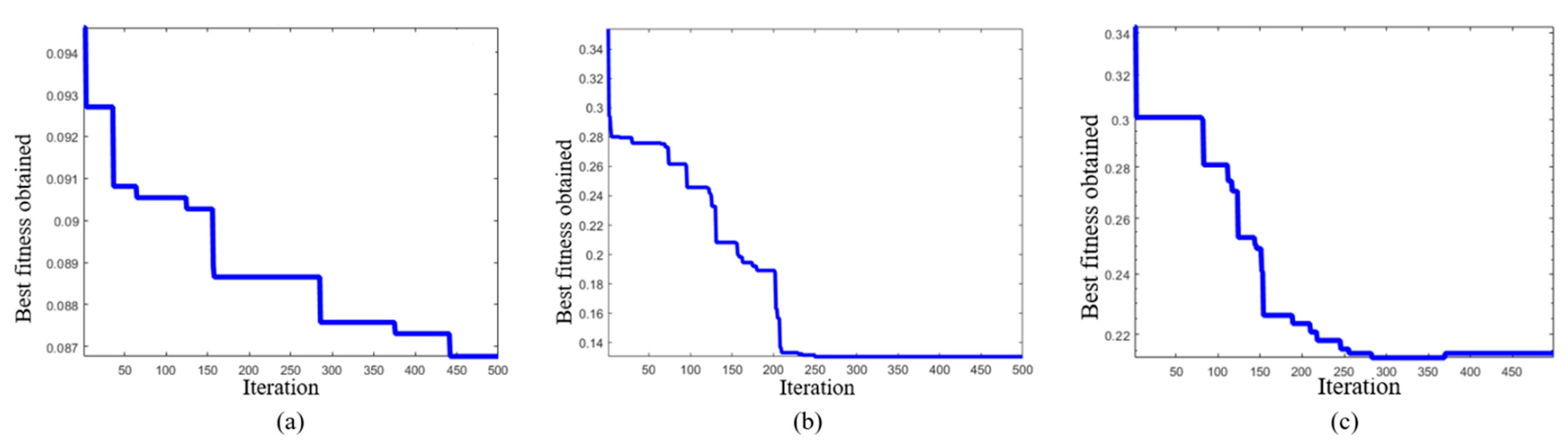
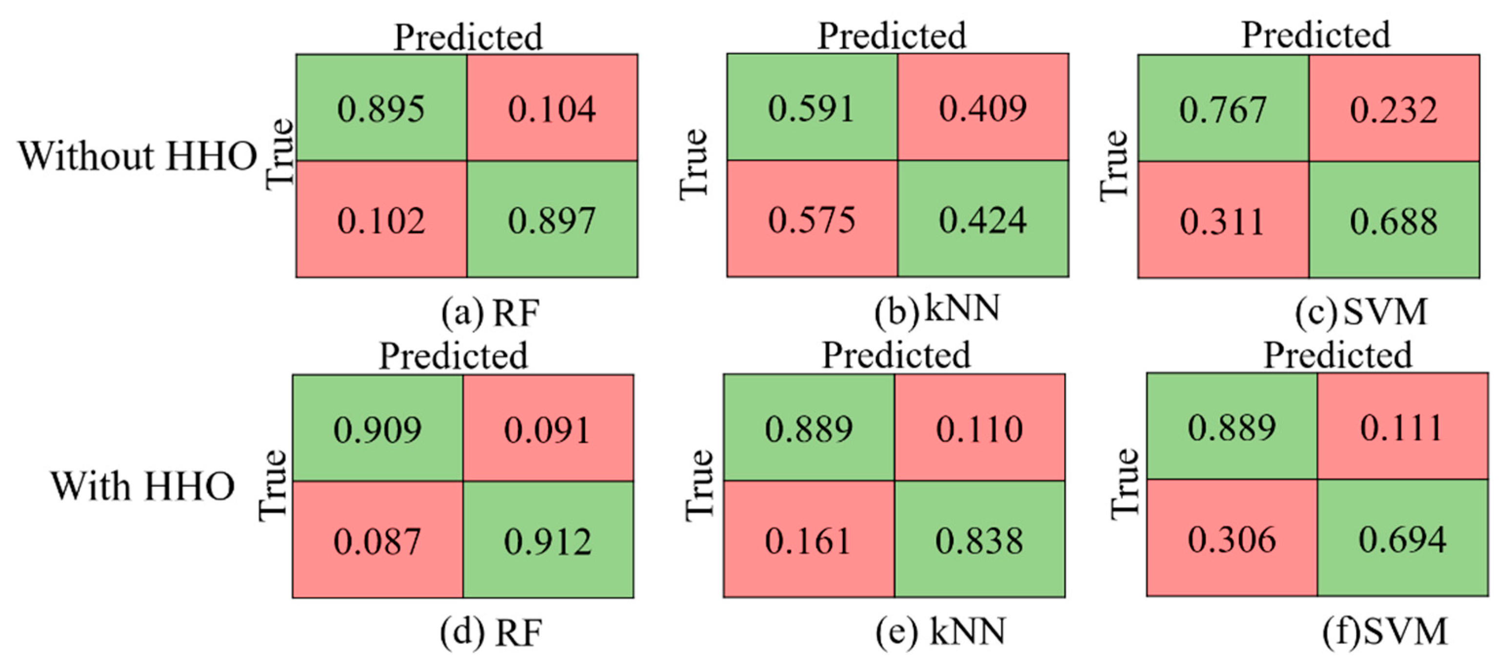
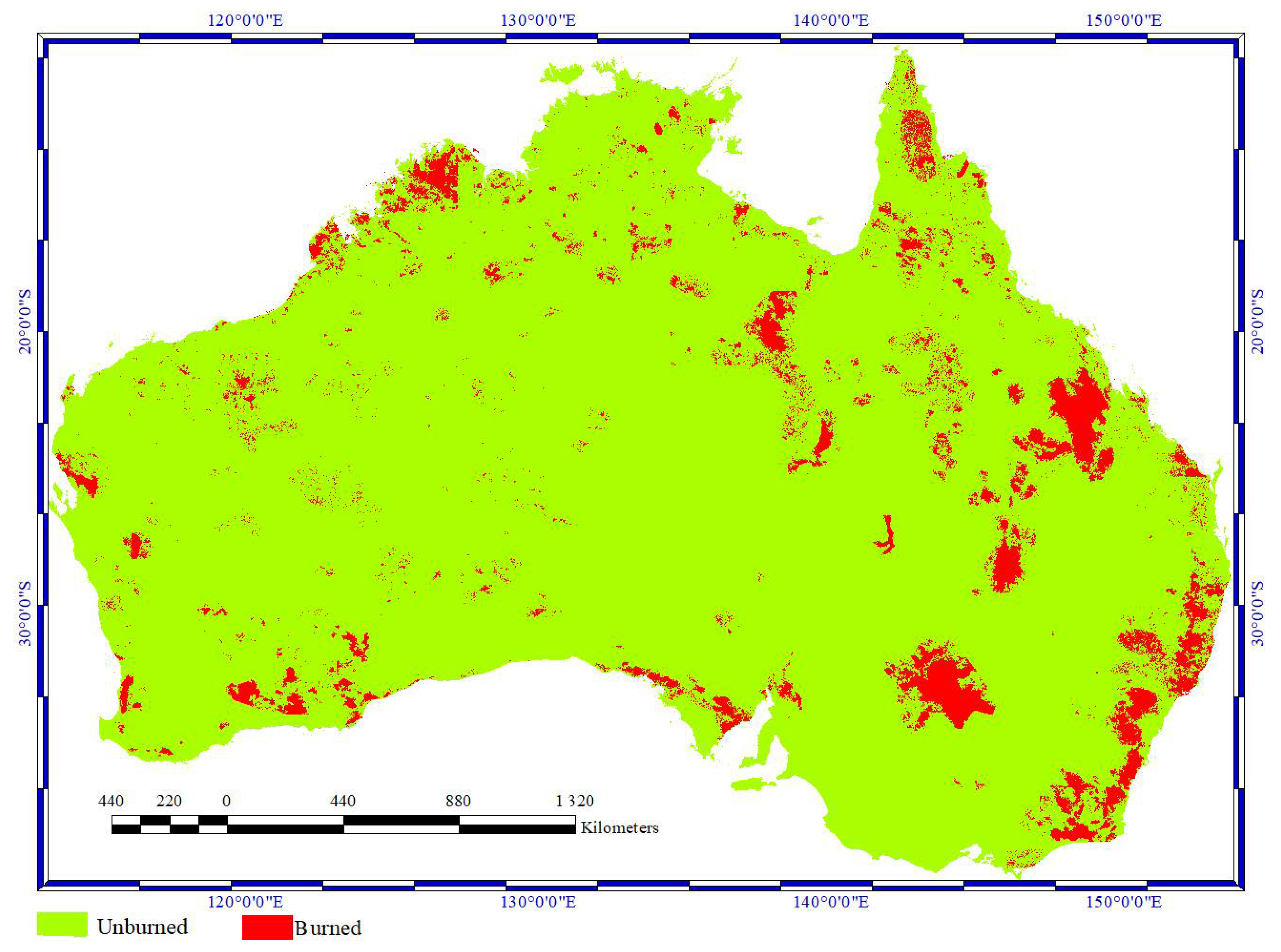
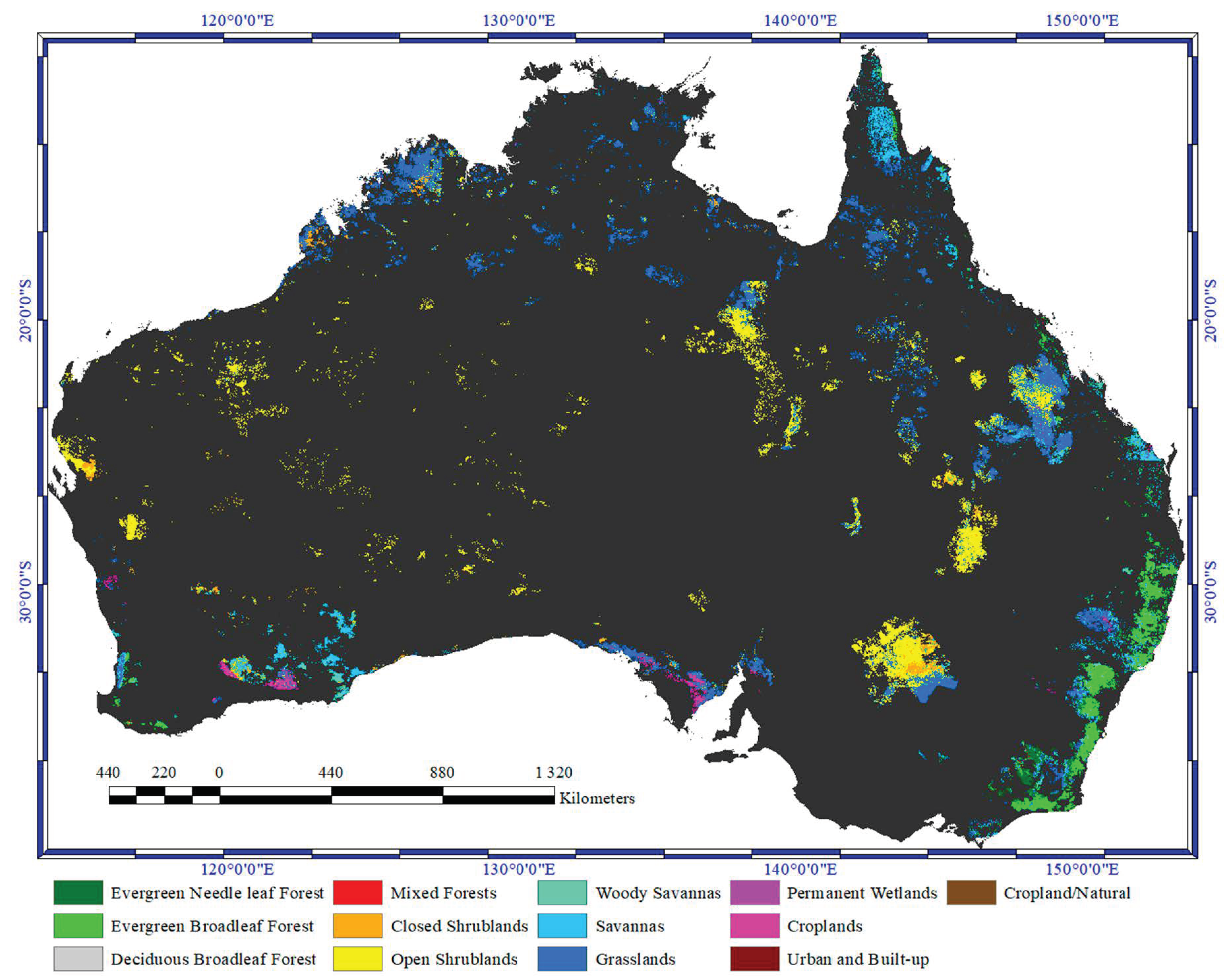
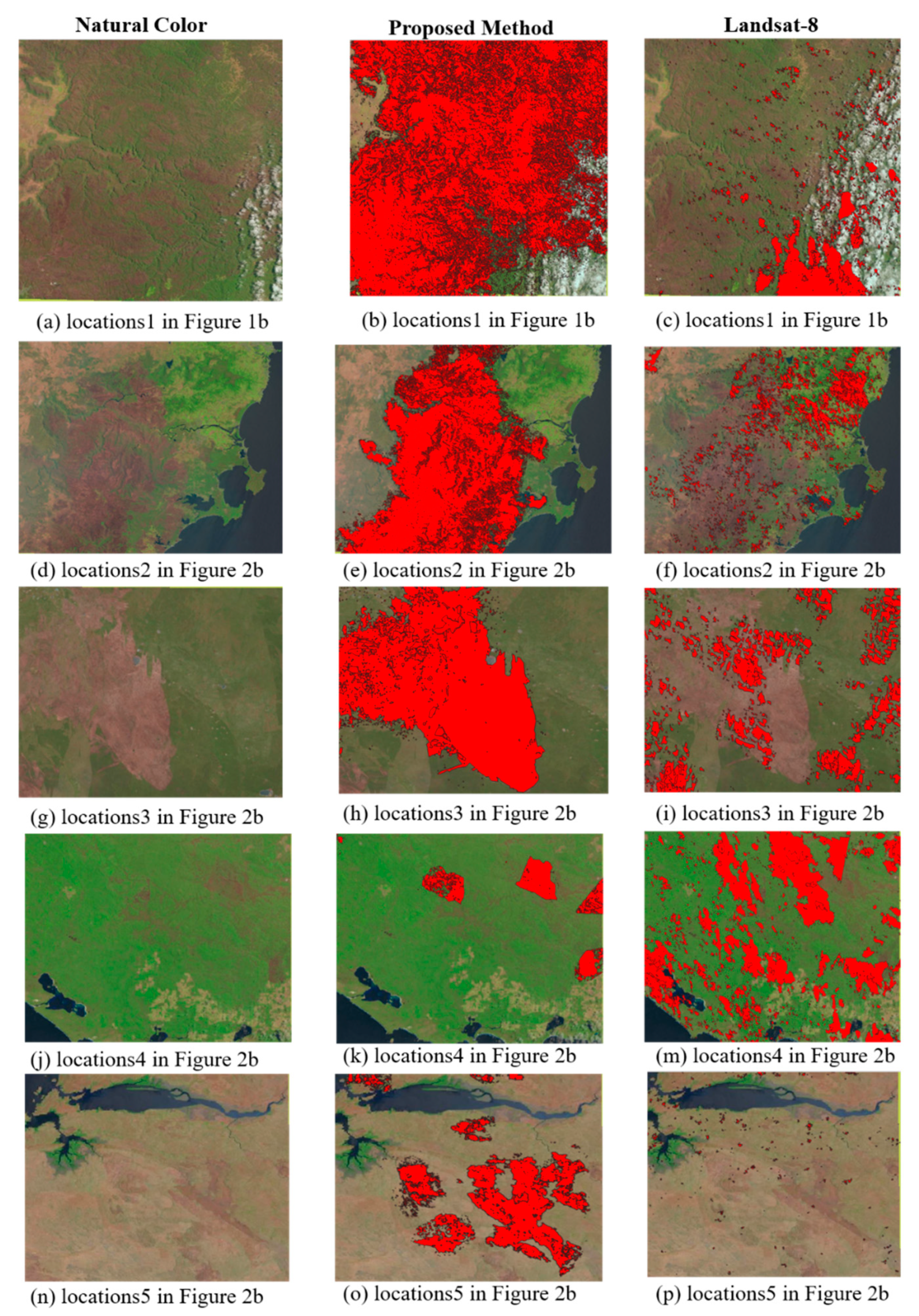
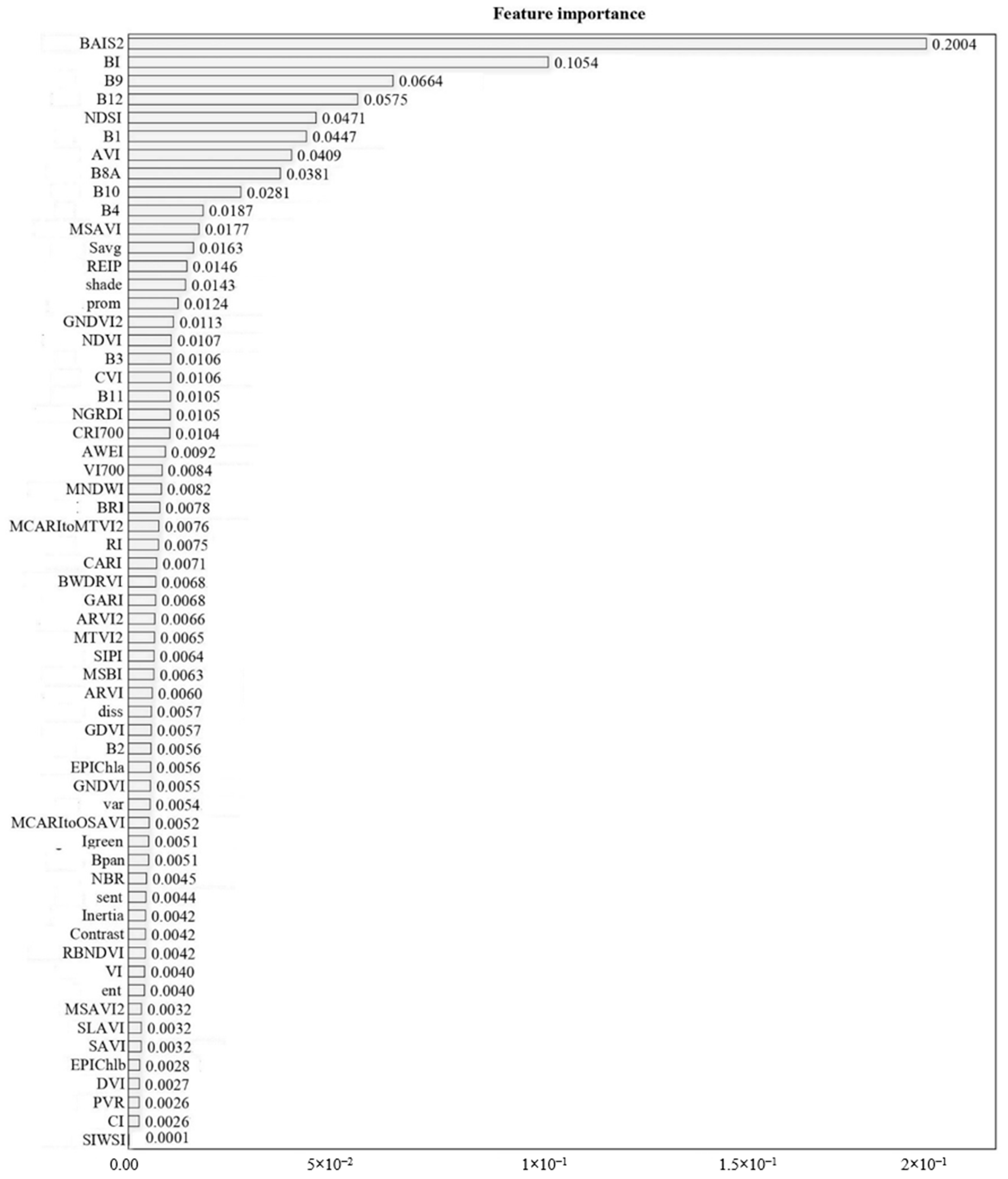
Wildfire Damage Assessment over Australia Using Sentinel-2 Imagery and MODIS Land Cover Product within the Google Earth Engine Cloud Platform


Abstract
Share and Cite
Seydi, S.T.; Akhoondzadeh, M.; Amani, M.; Mahdavi, S. Wildfire Damage Assessment over Australia Using Sentinel-2 Imagery and MODIS Land Cover Product within the Google Earth Engine Cloud Platform. Remote Sens. 2021, 13, 220. https://doi.org/10.3390/rs13020220
Seydi ST, Akhoondzadeh M, Amani M, Mahdavi S. Wildfire Damage Assessment over Australia Using Sentinel-2 Imagery and MODIS Land Cover Product within the Google Earth Engine Cloud Platform. Remote Sensing. 2021; 13(2):220. https://doi.org/10.3390/rs13020220
Chicago/Turabian StyleSeydi, Seyd Teymoor, Mehdi Akhoondzadeh, Meisam Amani, and Sahel Mahdavi. 2021. "Wildfire Damage Assessment over Australia Using Sentinel-2 Imagery and MODIS Land Cover Product within the Google Earth Engine Cloud Platform" Remote Sensing 13, no. 2: 220. https://doi.org/10.3390/rs13020220
APA StyleSeydi, S. T., Akhoondzadeh, M., Amani, M., & Mahdavi, S. (2021). Wildfire Damage Assessment over Australia Using Sentinel-2 Imagery and MODIS Land Cover Product within the Google Earth Engine Cloud Platform. Remote Sensing, 13(2), 220. https://doi.org/10.3390/rs13020220