Technical Note

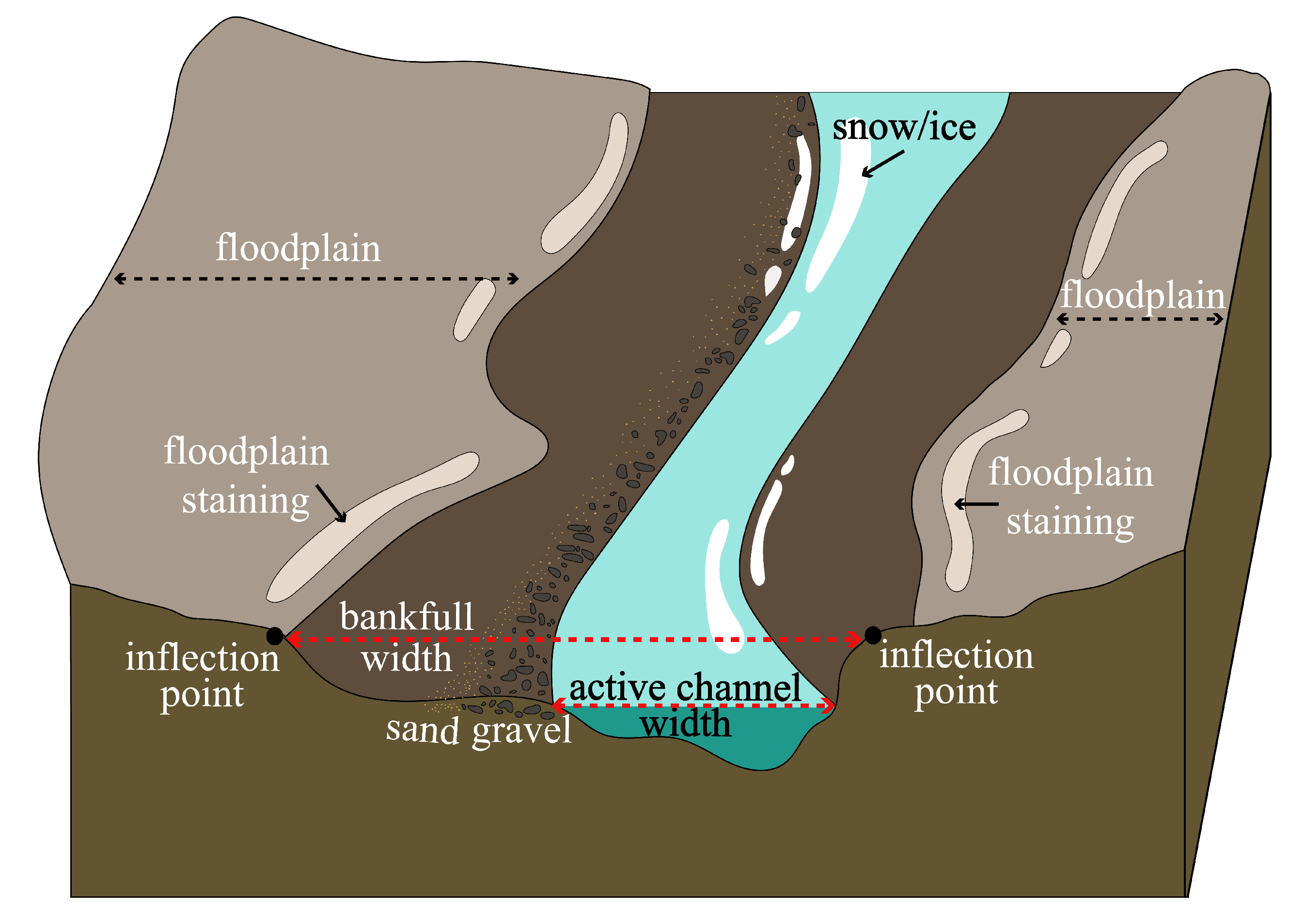
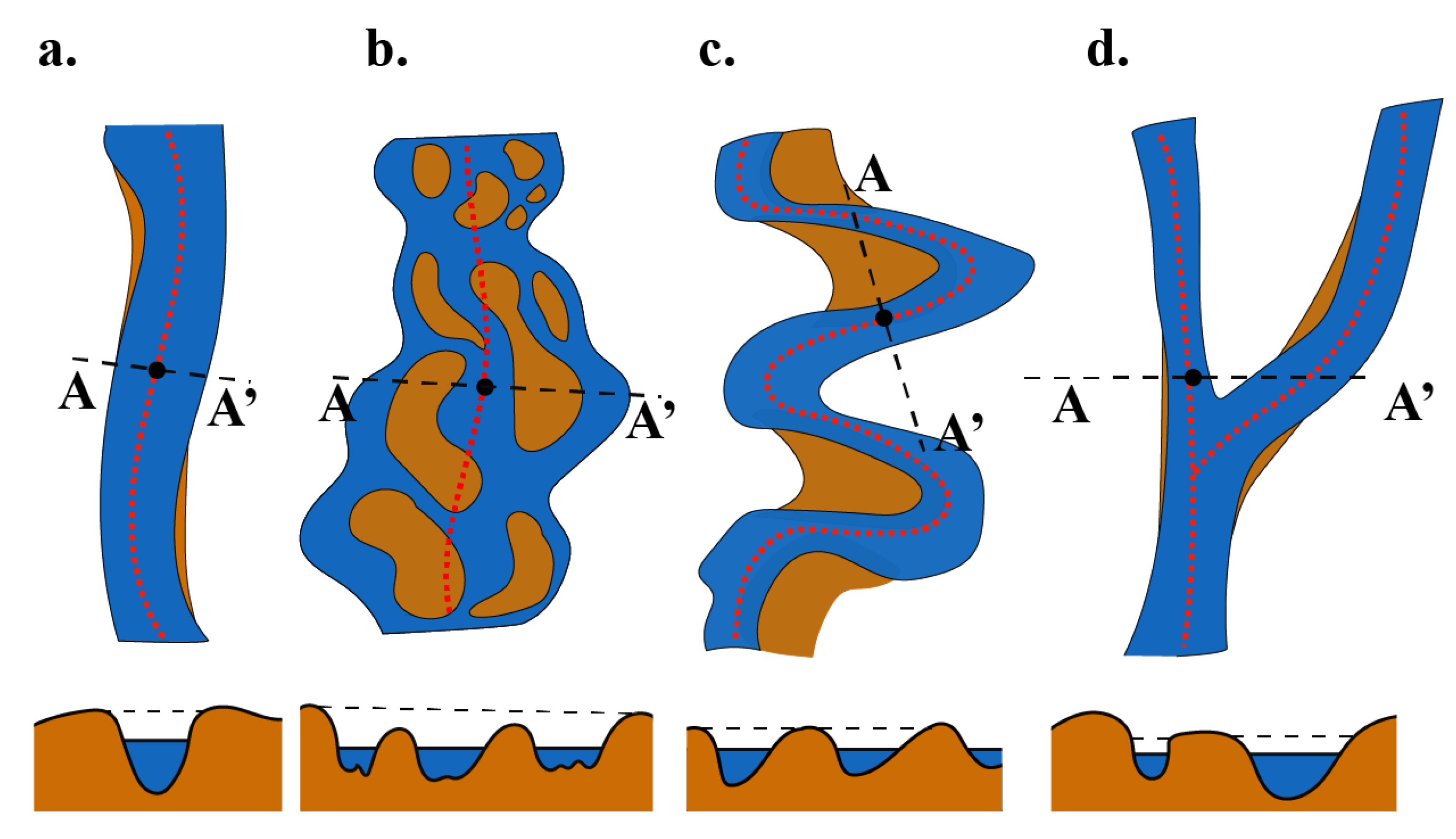
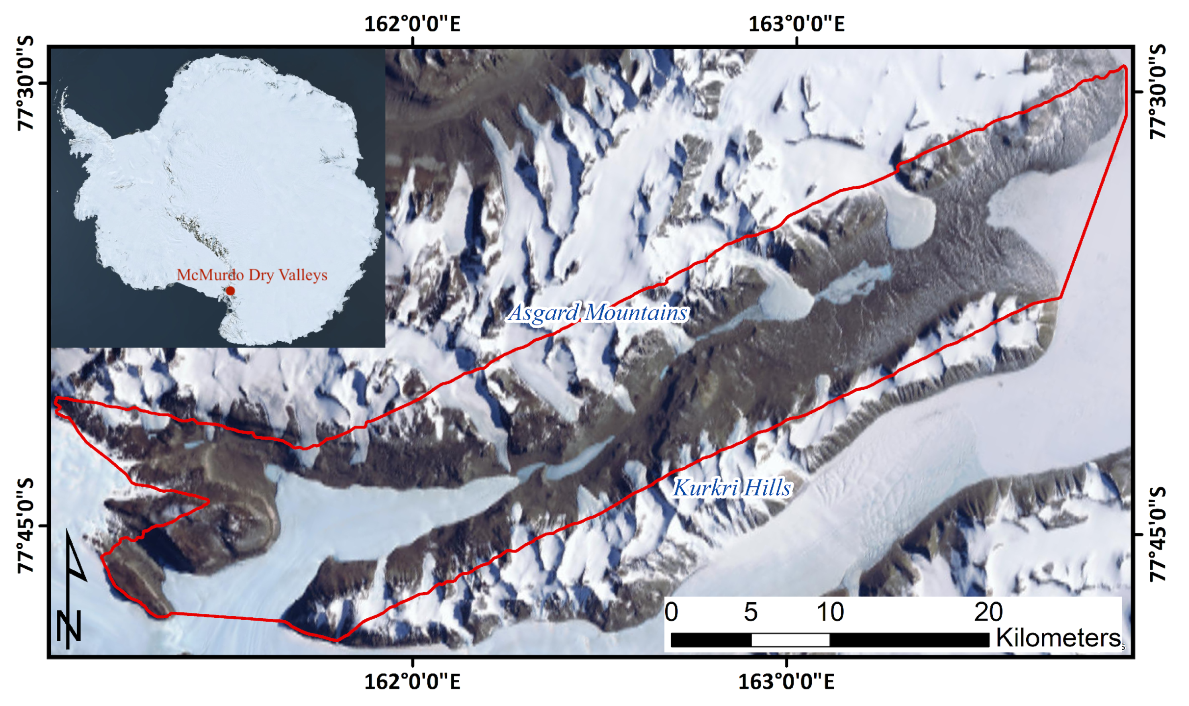
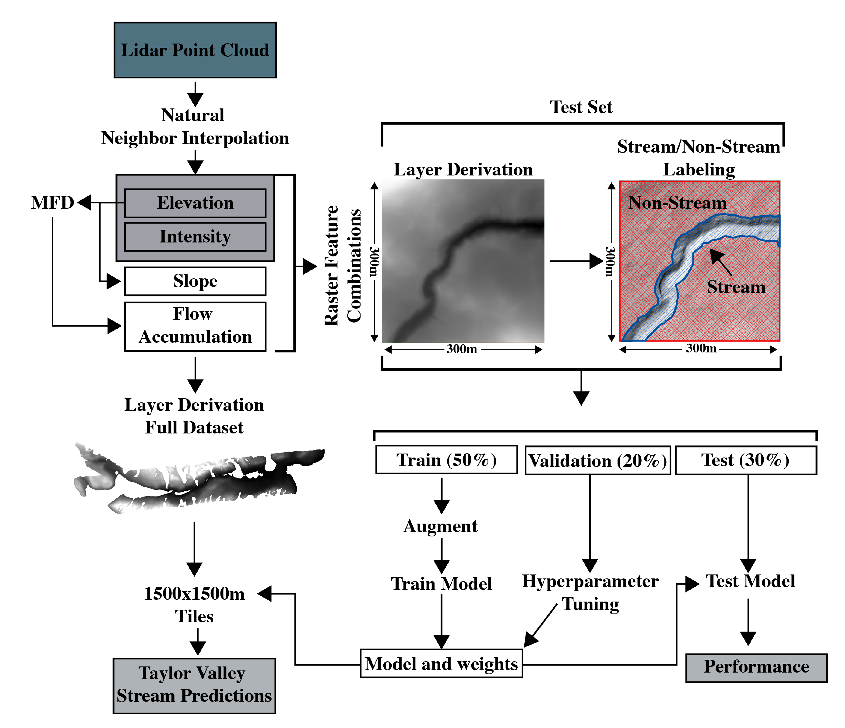
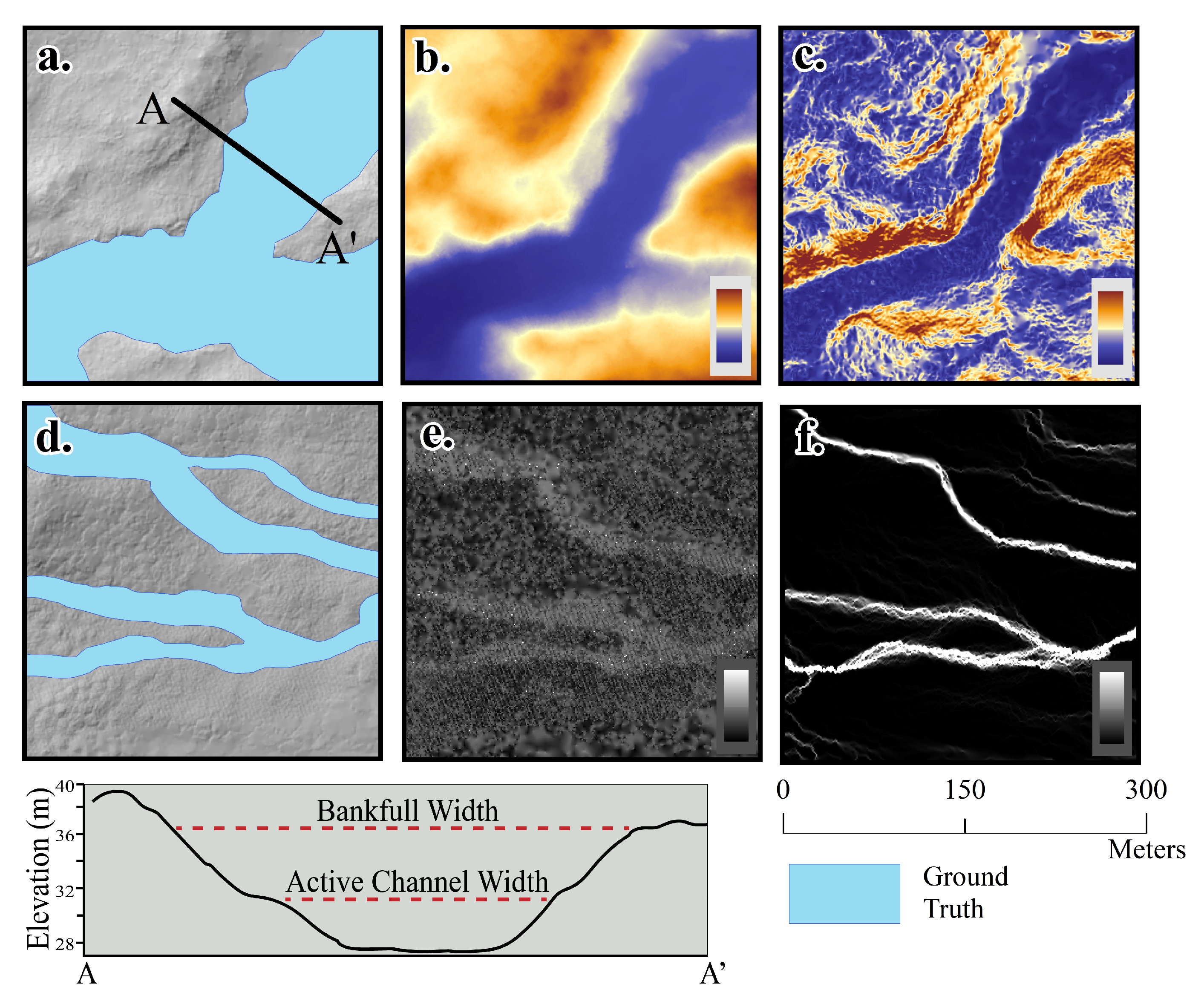
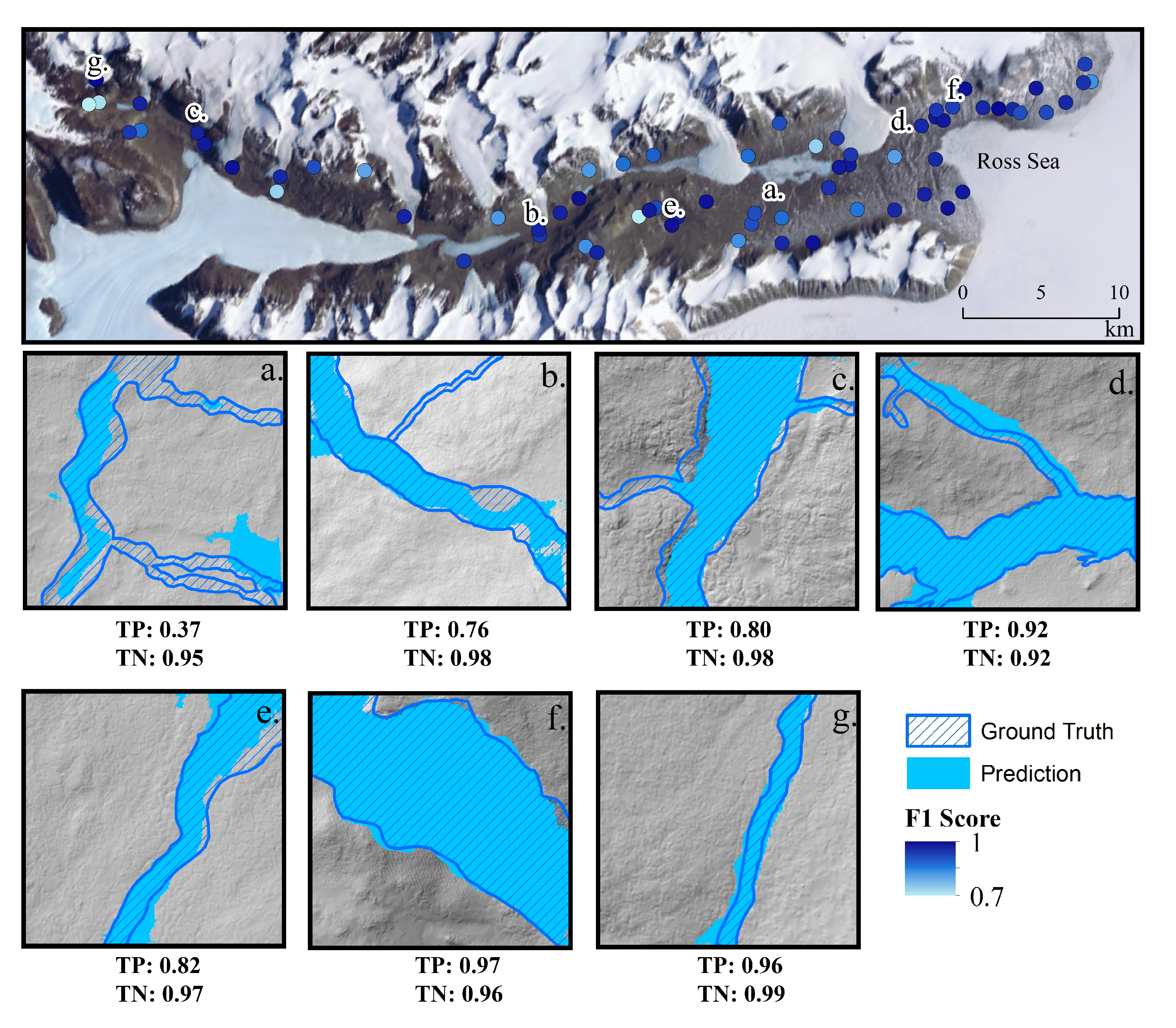
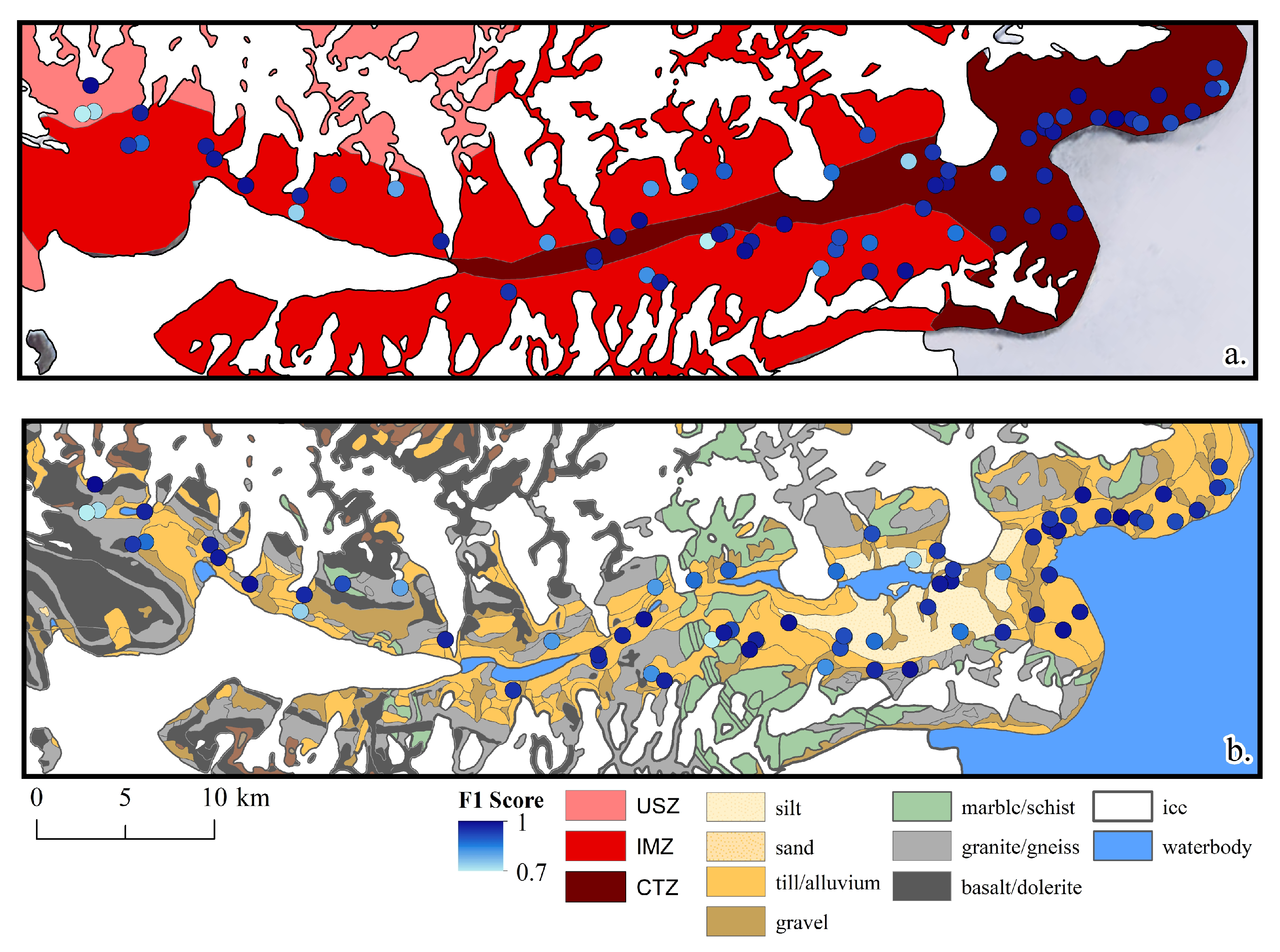
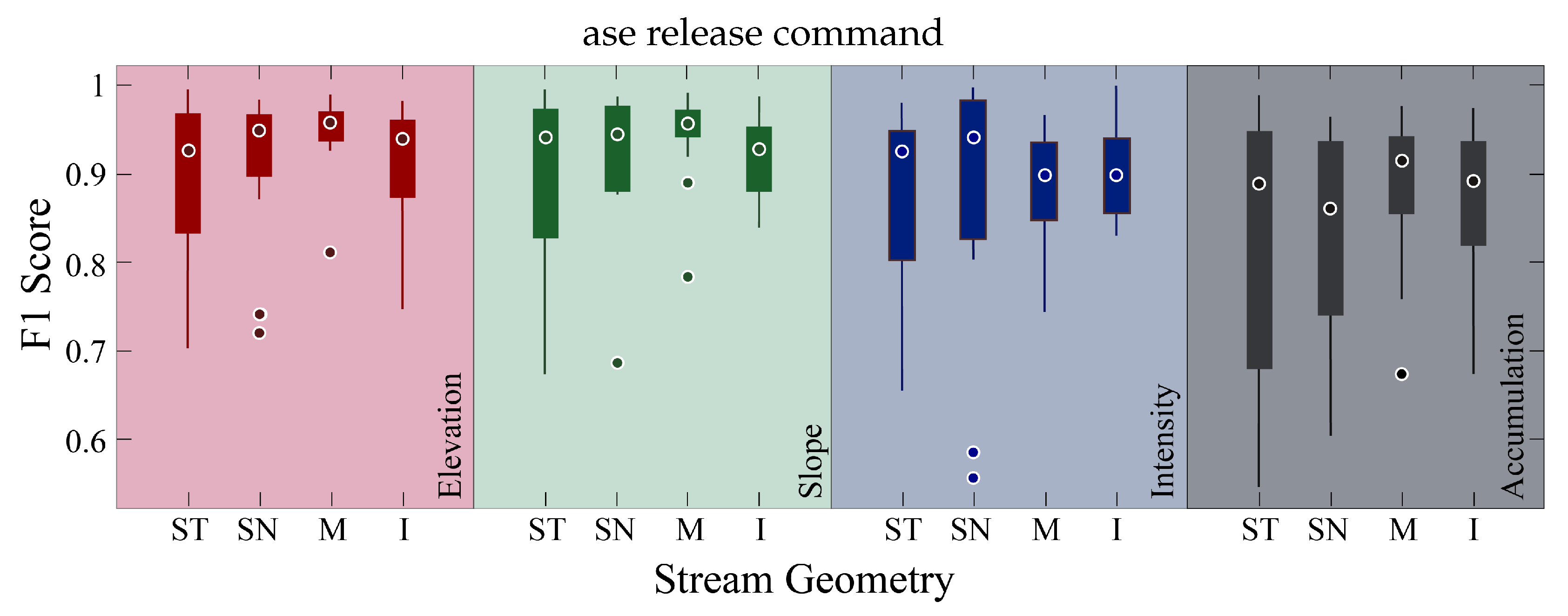
Stream Boundary Detection of a Hyper-Arid, Polar Region Using a U-Net Architecture: Taylor Valley, Antarctica

National Center for Airborne Laser Mapping, The University of Houston, 5000 Gulf Freeway, Building 4, Room 216, Houston, TX 77204-5059, USA
*
Author to whom correspondence should be addressed.
Remote Sens. 2022, 14(1), 234; https://doi.org/10.3390/rs14010234
Submission received: 1 November 2021 / Revised: 31 December 2021 / Accepted: 1 January 2022 / Published: 5 January 2022
(This article belongs to the Special Issue Remote Sensing of Dryland River Systems)

Abstract

Convolutional neural networks (CNNs) are becoming an increasingly popular approach for classification mapping of large complex regions where manual data collection is too time consuming. Stream boundaries in hyper-arid polar regions such as the McMurdo Dry Valleys (MDVs) in Antarctica are difficult to locate because they have little hydraulic flow throughout the short summer months. This paper utilizes a U-Net CNN to map stream boundaries from lidar derived rasters in Taylor Valley located within the MDVs, covering ∼770 km2. The training dataset consists of 217 (300 × 300 m2) well-distributed tiles of manually classified stream boundaries with diverse geometries (straight, sinuous, meandering, and braided) throughout the valley. The U-Net CNN is trained on elevation, slope, lidar intensity returns, and flow accumulation rasters. These features were used for detection of stream boundaries by providing potential topographic cues such as inflection points at stream boundaries and reflective properties of streams such as linear patterns of wetted soil, water, or ice. Various combinations of these features were analyzed based on performance. The test set performance revealed that elevation and slope had the highest performance of the feature combinations. The test set performance analysis revealed that the CNN model trained with elevation independently received a precision, recall, and F1 score of 0.94±0.05, 0.95±0.04, and 0.94±0.04 respectively, while slope received 0.96±0.03, 0.93±0.04, and 0.94±0.04, respectively. The performance of the test set revealed higher stream boundary prediction accuracies along the coast, while inland performance varied. Meandering streams had the highest stream boundary prediction performance on the test set compared to the other stream geometries tested here because meandering streams are further evolved and have more distinguishable breaks in slope, indicating stream boundaries. These methods provide a novel approach for mapping stream boundaries semi-automatically in complex regions such as hyper-arid environments over larger scales than is possible for current methods.
Keywords: lidar; fluvial geomorphology; stream width; remote sensing; deep learning lidar; fluvial geomorphology; stream width; remote sensing; deep learning

