Article

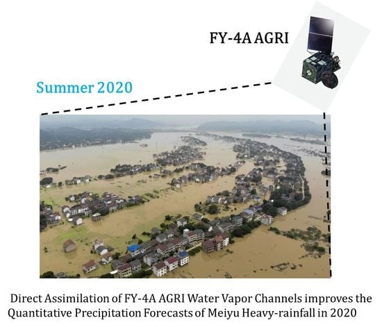
Effects of Direct Assimilation of FY-4A AGRI Water Vapor Channels on the Meiyu Heavy-Rainfall Quantitative Precipitation Forecasts

1
Key Laboratory of Numerical Modeling for Tropical Cyclone of the China Meteorological Administration, Shanghai Typhoon Institute, Shanghai 200030, China
2
CMA Earth System Modeling and Prediction Centre, Beijing 100081, China
*
Author to whom correspondence should be addressed.
Remote Sens. 2022, 14(14), 3484; https://doi.org/10.3390/rs14143484
Submission received: 20 June 2022 / Revised: 13 July 2022 / Accepted: 20 July 2022 / Published: 21 July 2022

Abstract

:
In this study, the regional Weather Research and Forecasting model (WRF)-based quantitative precipitation forecasts (QPFs) are conducted for an extreme Meiyu rainfall event over East Asia in 2020. The data of water vapor channels 9 and 10 from the Advanced Geosynchronous Radiation Imager (AGRI) onboard the Fengyun-4A (FY-4A) satellite are assimilated through the Gridpoint Statistical Interpolation (GSI) system. It shows that a reasonable amount of assimilated AGRI data can produce reasonable water vapor increments, compared to the too sparse or dense assimilated AGRI observations. In addition, the critical success indexes (CSIs) of the precipitation forecasts within 72 h are obviously improved. The enhanced variational bias correction (VarBC) scheme is applied to remove the air-mass and scan-angle biases, and the mean observation-minus-background (O − B) values before and after the VarBC of channel 9 are −1.185 and 0.02 K, respectively, and those of channel 10 are −0.559 and −0.01 K, respectively. Assimilating the upper-level channel 9 data of AGRI (EXP_WV9) lead to a neutral-to-positive effect on QPFs, compared to the control run (CTL), which is based on the assimilation of Advanced Microwave Sounding Unit-A (AMSU-A) data. In particular, the CSIs from 42 to 72 h are significantly improved. However, the assimilation of the AGRI channel 10 (EXP_WV10) shows a neutral-to-negative effect on QPFs in this study, probably due to the complicated surface situations. This study confirms the feasibility of assimilating the water vapor channel data of FY4A AGRI in the GSI system and highlights the importance of assimilating AGRI channel 9 data to improve the QPFs of the Meiyu rainfall event.

Graphical Abstract

1. Introduction

In the Meiyu season of 2020, an extreme heavy rainfall event occurred from the Yangtze-Huai River Valley (YHRV) in Central China to Japan and resulted in severe floods over the YHRV [1]. This Meiyu event is featured by early onset (1 June), late withdrawal (1 August), and long duration (about two months), which is much longer than the typical Meiyu season. The causes of this extreme Meiyu event are complex, including both climatic factors such as El Niño [2] and the atmospheric river, which contributes about 50%–80% of the total Meiyu precipitation [3]. An accurate forecast of the intensity and location of Meiyu rainfall is of great importance to disaster prevention and mitigation. Previous studies have shown that direct assimilation of high spatial–temporal resolution geostationary operational environmental satellite (GOES) observations can improve the quantitative precipitation forecast (QPF) in regional numerical weather prediction (NWP) [4,5,6,7]. Therefore, the impact of directly assimilating the water vapor (WV) infrared (IR) data from geostationary satellites, especially from the Fengyun-4A/B series satellites of China, on the Meiyu rainfall should be studied urgently. On 11 December 2016, the first of China’s new-generation geostationary meteorological satellites, Fengyun-4A (FY-4A), was launched into geostationary orbit at 104.7°E. FY-4A carries the Advanced Geosynchronous Radiation Imager (AGRI) and the first Geostationary Interferometric Infrared Sounder (GIIRS) in the world [8]. The FY-4A AGRI has a total of 14 channels, including 8 infrared channels and 6 visible and near-infrared channels [9], which is similar to the Advanced Himawari Imager (AHI) onboard the Japanese Himawari-8 and the Advanced Baseline Imager (ABI) onboard the GOES-R. FY-4A AGRI has two IR channels at water vapor bands with the center frequencies at 6.25 and 7.1 μm. Their weighting function peak (see Figure 1) at the upper troposphere and the middle troposphere, respectively. The weighting function peak indicates the layer where this channel receives the strongest atmospheric radiation signal. Both AHI and ABI have three water vapor channels (channel 8, 9, and 10), with frequencies centered at 6.2, 6.9, and 7.3 μm, respectively, and can probe the water vapor at the lower troposphere. A center wavelength at 7.92 μm was also added to FY-4B AGRI, which was launched in June 2021. The FY-4A AGRI observation temporal interval is 15 min, and the spatial resolution is 4 km. There are 2748 × 2748 (~7 million) fixed scan pixels for the AGRI full disk. The noise equivalent differential temperatures (NEDTs) for FY-4A AGRI channels 8–14 are 0.2, 0.3, 0.3, 0.2, 0.2, 0.2, and 0.5 K, respectively [10], which are acceptable for ensuring the accuracy of assimilations. Different from polar-orbiting satellites which only overpass the same target twice a day, the geostationary satellite can observe the same target at 15 min intervals. Both high spatial and temporal resolution has been proven to have promising positive impacts on high-resolution NWP models [11,12]. However, it is very challenging to effectively assimilate the near-surface water vapor IR channel data, especially over land where surface emissivity has a large variability and is difficult to estimate accurately. Nevertheless, the new-generation geostationary meteorological satellites, such as Himawari-8 and GOES-R, can play a key role in numerical weather prediction and data assimilation [13,14] and atmospheric parameter retrievals [15]. For example, the AHI radiances have been operationally assimilated into the National Centers for Environmental Prediction (NCEP) Gridpoint Statistical Interpolation (GSI) analysis system since 2015 [16]. However, the applications of the FY-4A AGRI in NWP have not yet been explored. Therefore, in this study, the FY-4A AGRI water vapor IR channel data are assimilated into the GSI system, and then the potential impacts of assimilating FY-4A AGRI observations on the QPF are assessed.
Almost all global operational models, such as the NCEP Global Forecast System (GFS) and European Centre for Medium-Range Weather Forecasts (ECMWF) Integrated Forecast System (IFS), assimilate many types of satellite observations. Satellite observations in clear-sky regions have played an indispensable role in the NWP system [17,18]. Recently, all-sky assimilation of satellite microwave observations, such as the most commonly used Advanced Microwave Sounding Unit-A (AMSU-A) data, has shown positive effects on NWP and has been operationalized in the ECMWF IFS [19]. However, there are still many uncertainties about the all-sky assimilation of satellite infrared observations [20]. Some studies [21,22] have proved that assimilating satellite observations can improve the atmospheric temperature and humidity forecasts at the mesoscale and even larger scales, but the effect in improving the forecasts of high-impact weather in regional models is still unclear. Compared to polar-orbiting satellite instruments such as AMSU-A, geostationary satellites have a higher spatio-temporal resolution. Moreover, the assimilation of geostationary satellite water vapor channels has been proven to have positive impacts on forecasting the upper-tropospheric water vapor [23,24]. Therefore, it is expected that assimilating FY-4A AGRI water vapor channels can bring added value to both global and regional NWP forecast skills. Some studies have shown that the assimilation of clear-sky radiation or retrieved cloud water path (CWP) from geostationary imagers can significantly improve forecasting skills [25,26]. A lot of work has been undertaken on the assimilation of the AHI and ABI data. Qin et al. [27] assimilated the Himawari-8 AHI channel 16 data (~13.3 μm) at the CO2 band to improve the short-term near-surface temperature and quantitative precipitation forecasts over land. Zhang et al. [28] assimilated the GORS-16 ABI IR channel data under all-sky conditions and found that it can improve the distribution of water vapor, thus improving thunderstorm forecasts. The data assimilation of FY-4A AGRI water vapor IR channels, especially in the GSI system, has not been carried out yet.
The remainder of this paper is organized as follows. Section 2 introduces the configurations of the WRF and the GSI system, and the characteristics of the FY-4A AGRI observations and products. Section 3 focuses on the setting of the data thinning and the enhanced variational bias correction (VarBC) scheme in the GSI system for the AGRI water vapor channels 9 and 10 data assimilation. Section 4 discusses the characteristics of the assimilated AGRI channels 9 and 10, and their impact on short-range (up to 72 h) QPFs in the Meiyu season. The summary and conclusions are provided in Section 5.

2. Data, Models, and Experiments

The WRF model (version 3.8) [29] and the NCEP GSI analysis system (version 3.7) [30] have been widely used for regional numerical weather prediction and data assimilation. Since this study focuses on the clear-sky data assimilation of FY-4A AGRI channels 9 and 10, the three-dimensional variational (3D-Var) data assimilation method was used. The model domain center was set at (110°E, 30°N) and the model top was set at 10 hPa to avoid gross errors in the assimilation of upper-level satellite data. The horizontal resolution was 9 km, with 760 × 600 grid points (see black lines in Figure 2a). Since 9 km is at the grey-zone scale, the cumulus parameterization was not used in this study. The details of the selected microphysics, land surface, shortwave/longwave radiation, and planetary boundary layer schemes are shown in Table 1 [31,32,33,34,35]. The WRF model was initialized by the GFS 6 h forecasts with a horizontal resolution of 0.5° × 0.5°. The observation operator was the Advanced Radiative Transfer Modeling System (ARMS) [36] which was coupled to the GSI system instead of the community radiative transfer model (CRTM) [37]. This study mainly focuses on evaluating the influences of assimilating satellite data on forecasting the Meiyu rainfall. Thus, the impacts of the conventional observations were not evaluated. The control experiment (CTL) was set to assimilate the clear-sky radiance from the AMSU-A onboard NOAA-15, NOAA-18, NOAA-19, MetOp-A, and Aqua satellites. The AMSU-A instrument includes 13 sounding channels and 3 window channels at 23.8, 31.4, and 89 GHz. It should be noted that some AMSU-A channels (shown in Table 2) were not used in data assimilation due to the instrument being broken at this time (as of mid-2021). As we know, the AMSU-A has a large impact on forecast skills of ECMWF IFS or GFS global models [38]; thus, the AMSU-A data was chosen for the CTL experiment in this study. The clear-sky brightness temperatures from FY-4A AGRI channel 9 (EXP_WV9) and channel 10 (EXP_WV10) were assimilated separately based on the CTL experiment to evaluate the impacts on Meiyu frontal systems (see Table 3). According to the statistics of two-week clear-sky observation-minus-background (O − B), the prespecified observation errors for the AGRI channels 9 and 10 were set to 1.20 and 1.30 K, respectively [6]. The static background error covariance matrix (BE) was employed in this study. In addition, the experiment without any data assimilation was noted as NoDA and the type of assimilation was a cold start.
The brightness temperatures and cloud mask products from the FY-4A AGRI were used in this study. The AGRI brightness temperatures of channels 8–14, the geographic information including latitude, longitude, satellite zenith angle and satellite azimuth angle, solar zenith angle and solar azimuth angle, and cloud mask flags are written into the WMO Binary Universal Form for the Representation (BUFR) file, which is the standard data input format in the GSI. Figure 1 shows the normalized weighting functions (WFs) of the FY-4A AGRI channels 8–14. The WF peaks (WFPs) of channels 8 and 11–14 are at the near-surface, which is more easily affected by surface emissivity and overcast clouds in data assimilation. Therefore, only the data from AGRI water vapor channels 9 and 10 were assimilated into the GSI to evaluate the impacts on the QPF. Figure 2a,b shows the spatial distributions of the brightness temperatures from the FY-4A AGRI channels 9 and 10 (unit: K) at 0000 UTC on 5 July 2020. Since the IR channels cannot penetrate the optical thick clouds, the AGRI channels 9 and 10 can only measure the temperatures of the cloud tops, so the brightness temperatures are very low (almost <230 K) in the deep convection regions. The Meiyu region (red box in Figure 2a) is also obviously indicated by the low brightness temperature area. Due to the lack of cloud water content and effective radius for different types of clouds as required in ARMS, it was difficult to simulate the IR brightness temperatures in cloudy regions accurately. Therefore, the cloud-affected IR data were removed through a cloud mask in the AGRI clear-sky assimilation. Figure 2c shows the cloud mask products from the FY-4A AGRI, and the cloud detection flags are classified as absolutely clear, possibly clear, probably cloud, and cloud. As shown in Figure 2c, the probably clear data points are near the cloud gaps and edges. Therefore, only absolutely clear data points were assimilated in the GSI.

3. Preparations for Data Assimilation

3.1. AGRI Data Representation

Data thinning or representation, cloud detection, and bias correction are the main procedures in satellite data assimilation. The purpose of data thinning is to reduce both the spatial correlation errors and the spectral correlation errors, especially for the FY-4A AGRI, which has a spatial resolution of 4 km. The spatial thinning process means the satellite data points are gridded with a mesh size of 60 or 120 km. Generally, 60 km is used for AMSU-A data, 120 km for the Advanced Technology Microwave Sounder (ATMS) data, and 60 km for the GOES instruments such as ABI and AHI [39]. In this study, sensitivity experiments were conducted at a 120, 60, and 30 km thinning grid to compare the QPFs on Meiyu rainfall. The QPF with a 30 km thinning grid has larger correlated errors, resulting in poor forecast skills (for brevity, figures are not shown). Therefore, we focus on the comparisons of the 120 and 60 km thinning grids. Figure 3 shows the spatial distributions of the bias-removed differences between observations (O) and model simulations (B) of AGRI channel 9 data points at 0000 UTC on 5 July 2020, with 120 and 60 km thinning grids. It is seen that the 60 km thinning-grid experiment can assimilate more AGRI clear-sky observations, but many of the assimilated data points are at the edge of the cloud area. The effect of assimilating AGRI channel 9 data may not be bad, as it is not sensitive to clouds below 300 hPa. However, the effect of assimilating AGRI channel 10 data is probably not good, as it is sensitive to most clouds. Therefore, it is very important to balance data quantity and data quality in data assimilation. An insufficient amount of data or poor data quality will both degrade the data assimilation accuracy. Figure 4 shows the spatial distributions of 500 hPa water vapor of the background (NoDA, Figure 4a) and the CTL (assimilating AMSU-A data, Figure 4b). Compared with NoDA, the water vapor in the CTL is significantly less over the ocean, which is mainly due to the effect of assimilating the AMSU-A data. Because of the small water vapor increments introduced by AGRI channel 9, we should analyze the differences between EXP_WV9 and CTL at 120 km (Figure 4c) and 60 km (Figure 4d) AGRI thinning gird. The water vapor increments of the 60 km thinning grid are significantly larger than those in the 120 km thinning grid. There are obvious negative water vapor increments in the Inner Mongolia and Hebei Province (blue boxes), which means the 500 hPa water vapors are analyzed as drier. The positive water vapor increments located near Taiwan Island (red boxes) indicate a wetter environment.
In this study, probability of detection (POD), false alarm ratio (FAR), bias score, and critical success index (CSI) were used to evaluate the QPFs, which are defined as follows:
P O D = a a + c , F A R = b a + b , B i a s = a + b a + c , C S I = a a + b + c ,
where a, b, and c stand for hit, false alarm, and miss, respectively. The CSI is between 0 and 1, and CSI = 1 is the best score and means the perfect forecast. Compared with the 120 km thinning grid, the CSIs of 6 h accumulated rainfall of the EXP_WV9 with a 60 km thinning grid show improvements at thresholds of 0.1, 4, 13, 25, and 60 mm in 42–72 h forecasts (Figure 5). Therefore, 60 km data thinning is applied for assimilating AGRI channels 9 and 10 in the GSI. It can be seen that there is a significant diurnal variation in CSI scores, which may be caused by the model’s inability to capture the diurnal variation in precipitation [40].

3.2. Enhanced Variational Bias Correction (VarBC) Scheme

In satellite data assimilation, the background innovation (observation-minus-background, O − B) should be unbiased Gaussian [41], so the systematic bias must be removed before data assimilation. The systematic bias can be from the instrument calibration, the radiative transfer model, and the model backgrounds. Sometimes, the systematic bias may be much larger than the signal itself [42], which will significantly degrade the NWP system. The original VarBC scheme in GSI version 3.5 has two components: one is the air-mass dependent component, which is updated inside the GSI, and the other is the scan-angle dependent component, which is calculated outside the GSI. In GSI version 3.7, the air-mass component and the scan-angle component are combined into a one-step VarBC scheme inside the GSI system as Equation (2) [43]:
h ˜ ( x , β ) = h ( x ) + k = 0 N + K β k p k ( x ) ,
where h ˜ ( x , β ) is the final observation operator, x is the model state, h ( x ) stands for the radiative transfer model which is ARMS in this study, p k ( x ) represents a set of predictors, β k denotes the predictor coefficients, N is the number of predictors of the air-mass component (N = 5), and K is the Kth-order polynomial of the scan angles (commonly K = 4). The stable predictor coefficients β k for AMSU-A and AGRI channels are obtained after 20 round-robin assimilations [39]. Figure 6 shows the zenith-angle dependent of the assimilated O − B biases before (red curves) and after (blue curves) bias correction of the FY-4A AGRI channel 9 and channel 10 from 0000 UTC to 2400 UTC (interval: 3 h) on 5 July 2020. One-standard deviations are indicated by the shaded colors. It shows significant negative mean O − B biases before bias correction for both AGRI channel 9 and channel 10, and O − B mean biases are both around 0 K after bias correction. In addition, there is a weaker scan-angle dependent bias before bias correction. Between 10° and 20° zenith angles (black dashed box) of channel 10, the slope of mean bias-corrected O − B biases is less than that before bias correction, indicating the scan-angle dependent bias is removed by the enhanced VarBC. It shows that the slope of the mean bias-corrected O − B bias of AGRI channel 9 does not change a lot, which indicates the scan-angle bias of channel 9 is small and thus difficult to remove. Figure 7 shows the spatial distributions of the assimilated FY-4A AGRI channel 9 and channel 10 O − B before and after bias correction, with the 60 km thinning box at 0000 UTC on 5 July 2020. The mean O − B values before and after bias correction of channels 9 and 10 are −1.185 and 0.02 K, and −0.559 and −0.01 K, respectively. The systematic negative O − B bias is significantly reduced, which is beneficial to data assimilation.

3.3. Increment Analysis

This study aimed to assess the impact of assimilating the AGRI water vapor channels 9 and 10 on the QPF in the Meiyu rainfall event based on the AMSU-A data. Therefore, it was important to investigate the changes in the model background fields caused by the assimilation of AGRI water vapor channels, and whether these changes were reasonable. Figure 8a,b gives the spatial distributions of the 500 hPa temperature field in the EXP_WV9 and the EXP_WV10. It can be seen that there are no large differences between EXP_WV9 and EXP_WV10. By comparing EXP_WV9 − CTL (Figure 8c) and EXP_WV10 − CTL (Figure 8d), the temperature increments for the EXP_WV10 are relatively large, while the increments for the EXP_WV9 are very small. It is because the WFP for channel 10 is around 500 hPa, while the WFP for channel 9 is around 350 hPa. Along the line AB in Figure 9, there are temperature and relative humidity increments mainly in the middle and upper troposphere in the EXP_WV9 (Figure 9a), while there are larger temperature and relative humidity increments in the middle and lower troposphere in the EXP_WV10 (Figure 9b). The increment of relative humidity (~20%) is more significant than the increment of temperature (~0.12 K), which indicates the sensitivity to water vapors. However, it does not mean that more water vapor increments are better. Channel 9 is an upper-troposphere channel, and it inherently produces less impact on the middle and lower troposphere. Channel 10 is a middle-troposphere channel, and it is easily affected by surface emissivity and optically thin clouds which are not screened out.
Figure 10 shows the vertical profiles of the WRF-domain averaged absolute increments for the temperature, water vapor, zonal wind (U), and meridional wind (V) of the EXP_WV9 and the EXP_WV10 versus the CTL, at 0000 UTC on 5 July 2020. Almost at each model level, the absolute increments of channel 10 for water vapor increments are much larger than those of channel 9, especially from surface to 500 hPa (Figure 10b). The absolute increments peak of channel 10 is near 350 hPa for the zonal wind increment (Figure 10c) and the meridional wind increment (Figure 10d), which are a bit higher than the absolute increments peak (~450 hPa) for the temperature and water vapor increment (Figure 10a,b). The lower WFP of channel 10 and large sensitivity to the surface and clouds may be the main reason for the not good performance of EXP_WV10 on the QPF (see Section 4). Furthermore, the radiosonde data were used to verify the initial analysis fields of EXP_WV9 and EXP_WV10. The location (118.1°E, 24.5°N) in Figure 8a is selected to show the effects of satellite data assimilations. Figure 11 shows the temperature (T) and dew point temperature (Td) profiles of the radiosonde, NoDA, CTL, EXP_WV9, and EXP_WV10 at the selected location at 0000 UTC on 5 July 2020. As shown in Figure 11, compared with the sounding data (black), the T of CTL (red) is slightly improved upon that of NoDA (light green). However, the Td of CTL is significantly improved upon that of NoDA from 500 hPa to the near-surface (Figure 11a). This is mainly because the assimilation of AMSU-A data increases the water vapor in the lower troposphere, bringing Td closer to T. The T is essentially the same between EXP_WV9 and EXP_WV10 due to small temperature increments. EXP_WV9 has a smaller Td in the upper troposphere (300–600 hPa), which is close to the Td of sounding data, but the Td of EXP_WV10 deviates from the observation because of the excited larger water vapor increments (Figure 11b). Therefore, more water vapor increments do not mean a better result in the EXP_WV10 experiment.

4. Impacts of AGRI Data Assimilation on Quantitative Precipitation Forecasts

The quantitative evaluation of the rainfall location and rainfall intensity forecasts can reflect the forecast skills of different experiments. This Meiyu heavy precipitation case was from 4 to 9 July 2020, and mainly occurred in the Yangtze-Huai River Valley (YHRV). Three time slots that have obvious positive impacts were selected to show the improvements of assimilating AMSU-A and AGRI data. Figure 12 and Figure 13 show the spatial distribution of 6 h accumulative rainfall in two time periods. One is from 1800 UTC on 5 July to 0000 UTC on 6 July 2021 (the forecast leading time of 18–24 h), and the other is from 1800 UTC on 6 July to 0000 UTC on 7 July 2020 (the forecast leading time of 42–48 h). In terms of the rainfall area, especially the heavy rainfall area (>60 mm), the assimilation experiments almost always perform better than the NoDA. For example, the heavy rainfall area of the NoDA appears in Zhejiang Province (black dashed boxes, Figure 12a), while the heavy rainfall area of the assimilation test (CTL, Figure 12b) and observations (Figure 12e) are basically in Jiangsu and Anhui Provinces. Therefore, the assimilation of satellite data, especially AMSU-A data, can change the large-scale mass fields (e.g., geopotential height and wind), thus changing the precipitation location and pattern and effectively reducing the false alarm ratio. In the 18–24 h forecasts, there are not too many differences in the size and shape of the rainfall area given by EXP_WV9 (Figure 12d), EXP_10 (Figure 12c), and CTL. However, in terms of the CSIs in the whole forecast domain, the performance of EXP_WV9 (red) and CTL (grey) are comparable, and EXP_WV10 (blue) performs slightly worse. In addition, the observations show that there is strong precipitation in southern Jiangsu and Shanghai Provinces. However, only EXP_WV9 can simulate a small size of heavy precipitation in this region. In the 42–48 h forecasts, compared with CTL (Figure 13b) and EXP_10 (Figure 13c), the rainfall area of EXP_WV9 (salmon dashed boxes, Figure 13d) is much closer to the observations (Figure 13e) in northern Zhejiang Province, while the precipitation of the NoDA (Figure 13a) is almost missed in this target area. Figure 14 and Figure 15 give the performance diagram of the 6 h accumulated precipitation from the NoDA (grey), CTL (blue), EXP_WV9 (magenta), and EXP_WV10 (cyan), with the thresholds of 0.1, 4, 13, and 25 mm at the 18–24 h, 42–48 h, and 48–54 h forecast leading times. It shows that the NoDA scores are worse than CTL, EXP_WV9, and EXP_WV10 at all precipitation thresholds, which demonstrates the effects of assimilating AMSU-A data. The EXP_WV9 scores are better at thresholds of 0.1 and 25.0 mm (Figure 14a,b) and are neutral at thresholds of 4.0 and 13.0 mm (Figure 14c,d). EXP_WV9 has an advantage at thresholds of 0.1 and 4.0 mm (Figure 15a,b), but EXP_WV10 is even worse than NoDA. For thresholds of 13.0 and 25.0 mm (Figure 15c,d), EXP_WV9 has comparable CSIs to the CTL, but the bias (black dashed line) is lower than that of the CTL, which indicates a better performance of EXP_WV9. EXP_WV9 also performs the best in the 48–54 h forecasts (Figure 15e–h), with high scores at all precipitation thresholds. However, the performance of EXP_WV10 is worse than CTL, especially at the thresholds of 13.0 mm (Figure 15g) and 25.0 mm (Figure 15h). Another heavy rainfall case of the 7.20 Zhengzhou, Henan Province, is carried out with the initial time at 0000 UTC on 19 July 2021. The 6 h accumulated precipitation distributions for the 30–36 h forecasts and 42–49 h forecasts are presented in Figure 16, respectively. In 30–36 h forecasts, it can be seen that the simulated heavy rainfall systems are not organized well in NoDA, CTL, and EXP_WV10, but the simulated heavy precipitation system from EXP_WV9 was organized in the north of Henan. In addition, the simulated locations of heavy rainfall in all experiments deviated from the observations. In 42–48 h forecasts, it is obvious that EXP_WV9 is consistent with the observation of north–south direction rainfall areas, and the precipitation intensity simulation is also improved, especially as the threshold of 250.0 mm is revealed, which plays an important early warning role.
To further examine the impact of assimilating AGRI water vapor channels on precipitation forecasts, the CSIs from experiment CTL, EXP_WV9, and EXP_WV10 within the 72 h forecast leading time were compared. Figure 17 presents the CSI variations of 6 h accumulative rainfall in the 0–72 h forecasts of the CTL, EXP_WV9, and EXP_WV10 for different rainfall thresholds. It can be seen that the EXP_WV10 has some negative effects for almost all rainfall magnitudes at all forecast times. The AGRI channel 10 is a middle-troposphere channel, which is easily affected by surface emissivity and optically thin clouds. It is also problematic to assimilate similar ABI water vapor IR radiances over complex surfaces or in dry regions [44]. EXP_WV9 has some neutral-to-positive effects, with a significant advantage in the 42–66 h forecasts. The AGRI channel 9 is an upper-troposphere channel, and it has a less direct influence on water vapor or precipitation. Meanwhile, this study is clear-sky assimilation and has only one cold-start assimilation of AGRI observations. Therefore, the neutral-to-positive effect is acceptable and indicates that the AGRI channel 9 data is correctly assimilated into the GSI. Moreover, from the overall CSIs of the Henan rainstorm (Figure 18), EXP_WV9 has a significant positive effect, especially for thresholds of 13.0, 25.0, 60.0, and 120.0 mm. EXP_WV10 shows a neutral effect overall. In addition, the CSI variations in the first 30 h of the Henan case are relatively obvious compared to the Meiyu case. The results of the two cases indicate that the influences of AGRI data assimilation on different weather systems are different: the data assimilation of AGRI mainly adjusts the model environment variables, such as temperature, wind, and water vapor field; the response time of weather systems at different scales to the adjustment of the model initial condition is different; and for the Meiyu case, the rainfall process is mainly influenced by the large-scale weather processes, so the effect of data assimilation is mainly reflected after a period of model integration. For the Henan rainstorm case, which is mainly dominated by the mesoscale weather processes, the response time to the adjustment of the model initial condition is shorter.

5. Discussion and Summary

This study first assimilated the data of FY-4A AGRI water vapor channels 9 and 10 into the GSI 3.7 system and assessed the impact of AGRI channels 9 and 10 data assimilation on the QPF. The results show that the 60 km thinning grid experiment could produce more water vapor increments and the CSIs were also improved compared to the 120 km thinning grid experiment. An enhanced VarBC scheme was also used to remove the air-mass biases and scan-angle biases for the AGRI channels 9 and 10. The EXP_WV9 and the EXP_WV10 were evaluated separately using radiosonde profiles. The results show that the assimilation of the AGRI channel 10 data produces larger water vapor and wind increments, leading to an overly dry or wet analysis field and resulting in negative effects on EXP_WV10 forecasts. The EXP_WV9 can correctly represent the precipitation distribution in northern Zhejiang Province and southern Anhui Province in the 42–48 h forecasts. The EXP_WV9 has a neutral-to-positive effect on the QPF. Especially, the CSIs for the 42–72 h forecasts are significantly improved upon the CTL experiment. This study is a guide to the selection of AGRI water vapor channels for operational assimilation in the GSI system.
This study is only a preliminary assessment of the FY4A AGRI water vapor channel data assimilation in the rainfall forecasts. In the future, some sensitivity experiments of surface emissivity will be carried out for AGRI channel 10, with the data points around the complex surface and topography excluded, to improve the quality of the EXP_WV10. In addition, most operational numerical weather prediction centers such as ECMWF have already carried out the all-sky assimilation of microwave observations, and there is also an all-sky assimilation module for microwave radiances in the GSI system. However, the all-sky assimilation of the geostationary infrared water vapor channels has not been conducted in the GSI system. In the future, all-sky assimilation of the AGRI water vapor channel data will be implemented in the GSI system, and the observation error in cloud areas will be correctly assessed so that the all-sky assimilation of AGRI data can be realized.

Author Contributions

Conceptualization, Z.N. and L.Z.; Data curation, Z.N. and L.Z.; Formal analysis, Z.N. and L.Z.; Funding acquisition, L.Z.; Investigation, Z.N. and L.Z.; Methodology, L.Z. and P.D.; Project administration, W.H. and F.W.; Resources, W.H. and F.W.; Writing—original draft, Z.N.; Writing—review and editing, L.Z., F.W. and J.Z. All authors have read and agreed to the published version of the manuscript.

Funding

This work was supported by the National Key R&D Program of China (Grant No. 2021YFB3900400), Shanghai Sailing Program (Grant No. 21YF1456800), the Natural Science Foundation of China Project (Grant No. 42175166), Research Program from Science and Technology Committee of Shanghai (Grant No. 19dz1200101), the National Natural Science Foundation of China (42075012), and the Natural Science Foundation of Jiangsu Province (Grant BK20201505).

Conflicts of Interest

The authors declare no conflict of interest.

References

  1. Li, H.; Sun, B.; Wang, H.; Yuan, X. Joint effects of three oceans on the 2020 super mei-yu. Atmos. Ocean. Sci. Lett. 2022, 15, 100127. [Google Scholar] [CrossRef]
  2. Chu, Q.; Lian, T.; Chen, D.; Wang, X.; Feng, J.; Feng, G.; Qu, S.; Zhang, Z. The role of El Niño in the extreme Mei-yu rainfall in 2020. Atmos. Res. 2022, 266, 105965. [Google Scholar] [CrossRef]
  3. Wang, T.; Wei, K.; Ma, J. Atmospheric rivers and mei-yu rainfall in China: A case study of summer 2020. Adv. Atmos. Sci. 2021, 38, 2137–2152. [Google Scholar] [CrossRef]
  4. Otkin, J.A. Assimilation of water vapor sensitive infrared brightness temperature observations during a high impact weather event. J. Geophys. Res. Atmos. 2012, 117, 12–30. [Google Scholar] [CrossRef]
  5. Qin, Z.; Zou, X.; Weng, F. Evaluating added benefits of assimilating GOES imager radiance data in GSI for coastal QPFs. Mon. Weather Rev. 2013, 141, 75–92. [Google Scholar] [CrossRef]
  6. Jones, T.A.; Wang, X.; Skinner, P.; Johnson, A.; Wang, Y. Assimilation of GOES-13 imager clear-sky water vapor (6.5 μ m) radiances into a Warn-on-Forecast system. Mon. Weather Rev. 2018, 146, 1077–1107. [Google Scholar] [CrossRef]
  7. Zhang, Y.; Zhang, F.; Stensrud, D.J. Assimilating all-sky infrared radiances from GOES-16 ABI using an ensemble Kalman filter for convection-allowing severe thunderstorms prediction. Mon. Weather Rev. 2018, 146, 3363–3381. [Google Scholar] [CrossRef]
  8. Yin, R.; Han, W.; Gao, Z.; Li, J. Impact of high temporal resolution FY-4A Geostationary Interferometric Infrared Sounder (GIIRS) radiance measurements on Typhoon forecasts: Maria (2018) case with GRAPES global 4D-Var assimilation system. Geophys. Res. Lett. 2021, 48, e2021GL093672. [Google Scholar] [CrossRef]
  9. Tang, F.; Zhuge, X.; Zeng, M.; Li, X.; Dong, P.; Han, Y. Applications of the Advanced Radiative Transfer Modeling System (ARMS) to Characterize the Performance of Fengyun–4A/AGRI. Remote Sens. 2021, 13, 3120. [Google Scholar] [CrossRef]
  10. Wang, F.; Min, M.; Xu, N.; Liu, C.; Wang, Z.; Zhu, L. Effects of Linear Calibration Errors at Low-Temperature End of Thermal Infrared Band: Lesson from Failures in Cloud Top Property Retrieval of FengYun-4A Geostationary Satellite. IEEE Trans. Geosci. Remote Sens. 2022, 60, 1–11. [Google Scholar] [CrossRef]
  11. Wu, Y.; Liu, Z.; Li, D. Improving forecasts of a record-breaking rainstorm in Guangzhou by assimilating every 10-min AHI radiances with WRF 4DVAR. Atmos. Res. 2020, 239, 104912. [Google Scholar] [CrossRef]
  12. Zhang, F.; Minamide, M.; Clothiaux, E.E. Potential impacts of assimilating all-sky infrared satellite radiances from GOES-R on convection-permitting analysis and prediction of tropical cyclones. Geophys. Res. Lett. 2016, 43, 2954–2963. [Google Scholar] [CrossRef] [Green Version]
  13. Sawada, Y.; Okamoto, K.; Kunii, M.; Miyoshi, T. Assimilating every-10-minute Himawari-8 infrared radiances to improve convective predictability. J. Geophys. Res. Atmos. 2019, 124, 2546–2561. [Google Scholar] [CrossRef]
  14. Skinner, P.S.; Wheatley, D.M.; Knopfmeier, K.H.; Reinhart, A.E.; Choate, J.J.; Jones, T.A.; Creager, G.J.; Dowell, D.C.; Alexander, C.R.; Ladwig, T.T.; et al. Object-based verification of a prototype Warn-on-Forecast system. Weather Forecast. 2018, 33, 1225–1250. [Google Scholar] [CrossRef] [PubMed]
  15. Zhang, P.; Zhu, L.; Tang, S.; Gao, L.; Chen, L.; Zheng, W.; Han, X.; Chen, J.; Shao, J. General comparison of FY-4A/AGRI with other GEO/LEO instruments and its potential and challenges in non-meteorological applications. Front. Earth Sci. 2019, 6, 224. [Google Scholar] [CrossRef] [Green Version]
  16. Ma, Z.; Maddy, E.S.; Zhang, B.; Zhu, T.; Boukabara, S.A. Impact assessment of Himawari-8 AHI data assimilation in NCEP GDAS/GFS with GSI. J. Atmos. Ocean. Technol. 2017, 34, 797–815. [Google Scholar] [CrossRef]
  17. Zou, X. Atmospheric Satellite Observations: Variational Assimilation and Quality Assurance; Academic Press: Cambridge, MA, USA; Elsevier Inc.: Amsterdam, The Netherlands, 2020; 313p, ISBN 9780128209509. [Google Scholar]
  18. McNally, A.P.; Watts, P.D.; Smith, J.A.; Engelen, R.; Kelly, G.A.; Thépaut, J.N.; Matricardi, M. The assimilation of AIRS radiance data at ECMWF. Q. J. R. Meteorol. Soc. 2006, 132, 935–957. [Google Scholar] [CrossRef] [Green Version]
  19. Geer, A.J.; Lonitz, K.; Weston, P.; Kazumori, M.; Okamoto, K.; Zhu, Y.; Liu, E.H.; Collard, A.; Bell, W.; Migliorini, S.; et al. All-sky satellite data assimilation at operational weather forecasting centres. Q. J. R. Meteorol. Soc. 2018, 144, 1191–1217. [Google Scholar] [CrossRef]
  20. Geer, A.J.; Bauer, P. Observation errors in all-sky data assimilation. Q. J. R. Meteorol. Soc. 2011, 137, 2024–2037. [Google Scholar] [CrossRef]
  21. Zou, X.; Weng, F.; Zhang, B.; Lin, L.; Qin, Z.; Tallapragada, V. Impacts of assimilation of ATMS data in HWRF on track and intensity forecasts of 2012 four landfall hurricanes. J. Geophys. Res. Atmos. 2014, 118, 558–576. [Google Scholar] [CrossRef]
  22. Niu, Z.; Zhang, L.; Dong, P.; Weng, F.; Huang, W. Impact of Assimilating FY-3D MWTS-2 Upper Air Sounding Data on Forecasting Typhoon Lekima (2019). Remote Sens. 2021, 13, 1841. [Google Scholar] [CrossRef]
  23. Li, X.; Zou, X.; Zhuge, X.; Zeng, M.; Wang, N.; Tang, F. Improved Himawari-8/AHI Radiance Data Assimilation with a Double Cloud Detection Scheme. J. Geophys. Res. Atmos. 2020, 125, e2020JD032631. [Google Scholar] [CrossRef]
  24. Okamoto, K. Assimilation of overcast cloudy infrared radiances of the geostationary MTSAT-1R imager. Q. J. R. Meteorol. Soc. 2013, 139, 715–730. [Google Scholar] [CrossRef]
  25. Jones, T.A.; Stensrud, D.; Wicker, L.; Minnis, P.; Palikonda, R. Simultaneous radar and satellite data storm-scale assimilation using an ensemble Kalman filter approach for 24 May 2011. Mon. Weather Rev. 2015, 143, 165–194. [Google Scholar] [CrossRef]
  26. Jones, T.A.; Stensrud, D.J.; Minnis, P.; Palikonda, R. Evaluation of a forward operator to assimilate cloud water path into WRF-DART. Mon. Weather Rev. 2013, 141, 2272–2289. [Google Scholar] [CrossRef]
  27. Qin, Z. Adding CO2 channel 16 to AHI data assimilation over land further improves short-range rainfall forecasts. Tellus A Dyn. Meteorol. Oceanogr. 2020, 72, 1–19. [Google Scholar] [CrossRef]
  28. Zhang, Y.; Stensrud, D.J.; Clothiaux, E.E. Benefits of the advanced baseline imager (ABI) for ensemble-based analysis and prediction of severe thunderstorms. Mon. Weather Rev. 2021, 149, 313–332. [Google Scholar] [CrossRef]
  29. Skamarock, W.C.; Klemp, J.B.; Dudhia, J.; Gill, D.O.; Liu, Z.; Berner, J.; Wang, W.; Powers, J.G.; Duda, M.G.; Barker, D.M.; et al. A description of the advanced research WRF model version 4. Natl. Cent. Atmos. Res. Boulder CO USA 2019, 145, 145. [Google Scholar]
  30. Zhu, Y.; Gayno, G.; Purser, R.J.; Su, X.; Yang, R. Expansion of the all-sky radiance assimilation to ATMS at NCEP. Mon. Weather Rev. 2019, 147, 2603–2620. [Google Scholar] [CrossRef]
  31. Thompson, G.; Field, P.R.; Rasmussen, R.M.; Hall, W.D. Explicit Forecasts of Winter Precipitation Using an Improved BulkMicrophysics Scheme. Part II: Implementation of a New Snow Parameterization. Mon. Weather Rev. 2008, 136, 5095–5115. [Google Scholar] [CrossRef]
  32. Dudhia, J. Numerical study of convection observed during the Winter Monsoon Experiment using a mesoscale two–dimensional model. J. Atmos. Sci. 1989, 46, 3077–3107. [Google Scholar] [CrossRef]
  33. Mlawer, E.J.; Taubman, S.J.; Brown, P.D.; Iacono, M.J.; Clough, S.A. Radiative transfer for inhomogeneous atmospheres: RRTM, avalidated correlated–k model for the longwave. J. Geophys. Res. 1997, 102, 16663–16682. [Google Scholar] [CrossRef] [Green Version]
  34. Tewari, M.; Chen, F.; Wang, W.; Dudhia, J.; LeMone, M.A.; Mitchell, K.; Ek, M.; Gayno, G.; Wegiel, J.; Cuenca, R.H. Implementation and verification of the unified NOAH land surface model in the WRF model. In Proceedings of the 20th Conference on Weather Analysis and Forecasting/16th Conference on Numerical Weather Prediction, Seattle, WA, USA, 12 January 2004; pp. 11–15. [Google Scholar]
  35. Zhang, X.; Bao, J.; Chen, B.; Grell, E. A Three-Dimensional Scale-Adaptive Turbulent Kinetic Energy Scheme in the WRF-ARW Model. Mon. Weather Rev. 2018, 146, 2023–2045. [Google Scholar] [CrossRef]
  36. Weng, F.; Yu, X.; Duan, Y. Advanced Radiative Transfer Modeling System (ARMS): A New-Generation Satellite Observation Operator Developed for Numerical Weather Prediction and Remote Sensing Applications. Adv. Atmos. Sci. 2020, 37, 131–136. [Google Scholar] [CrossRef] [Green Version]
  37. Han, Y.; Weng, F.; Liu, Q.; van Delst, P. A fast radiative transfer model for SSMIS upper atmosphere sounding channels. J. Geophys. Res. 2007, 112, 160–192. [Google Scholar] [CrossRef]
  38. Zhu, Y.; Gelaro, R. Observation sensitivity calculations using the adjoint of the Gridpoint Statistical Interpolation (GSI) analysis system. Mon. Weather Rev. 2008, 136, 335–351. [Google Scholar] [CrossRef]
  39. Qin, Z.; Zou, X. Direct assimilation of ABI infrared radiances in NWP models. IEEE J. Sel. Top. Appl. Earth Obs. Remote Sens. 2018, 11, 2022–2033. [Google Scholar] [CrossRef]
  40. Short, C.J.; Petch, J. Reducing the spin-up of a regional NWP system without data assimilation. Q. J. R. Meteorol. Soc. 2022, 16, 35–51. [Google Scholar] [CrossRef]
  41. Li, X.; Zou, X. Bias characterization of CrIS radiances at 399 selected channels with respect to NWP model simulations. Atmos. Res. 2017, 196, 164–181. [Google Scholar] [CrossRef]
  42. Niu, Z.; Zou, X. Development of a New Algorithm to Identify Clear Sky MSU Data Using AMSU-A Data for Verification. IEEE Trans. Geosci. Remote Sens. 2018, 57, 700–708. [Google Scholar] [CrossRef]
  43. Zhu, Y.; Derber, J.; Collard, A.; Dee, D.; Treadon, R.; Gayno, G.; Jung, J.A. Enhanced radiance bias correction in the National Centers for Environmental Prediction’s Gridpoint Statistical Interpolation data assimilation system. Q. J. R. Meteorol. Soc. 2014, 140, 1479–1492. [Google Scholar] [CrossRef]
  44. Lee, J.R.; Li, J.; Li, Z.; Wang, P.; Li, J. ABI water vapor radiance assimilation in a regional NWP model by accounting for the surface impact. Earth Space Sci. 2019, 6, 1652–1666. [Google Scholar] [CrossRef]
Figure 1. Normalized weighting functions (WFs) of the FY-4A AGRI channels 8–14. The black triangles stand for the WF peak levels.
Remotesensing 14 03484 g001
Figure 2. Spatial distributions of the FY-4A AGRI (a) channel 9, (b) channel 10 brightness temperatures (unit: K), and (c) cloud mask products at 0000 UTC on 5 July 2020. The black box indicates the WRF forecast domain.
Remotesensing 14 03484 g002aRemotesensing 14 03484 g002b
Figure 3. Spatial distributions of the bias-removed O − B of the assimilated AGRI channel 9 data points at 0000 UTC on 5 July 2020, with (a) 120 km and (b) 60 km thinning grids. The backgrounds are the brightness temperatures of the AGRI 10.7 µm IR channel.
Remotesensing 14 03484 g003
Figure 4. Spatial distributions of 500 hPa water vapor (g kg−1) of (a) the background (NoDA) and (b) the CTL; the 500 hPa water vapor increments (g kg−1) between EXP_WV9 and CTL, at (c) 120 km and (d) 60 km AGRI thinning grid at 0000 UTC on 5 July 2020.
Remotesensing 14 03484 g004
Figure 5. The CSI variations of 6 h accumulative rainfall in the 0–72 h forecasts of the EXP_WV9 at the 120 km (grey) and 60 km (light-red) thinning grid, for a threshold of (a) 0.1 mm, (b) 4 mm, (c) 13 mm, (d) 25 mm, (e) 60 mm, and (f) 120 mm.
Remotesensing 14 03484 g005
Figure 6. Zenith-angle dependent of the assimilated O − B biases (unit: K) before (red curves) and after (blue curves) bias corrections (BCs) of the FY-4A AGRI (a) channel 9 and (b) channel 10, from 0000 UTC to 2400 UTC (interval: 3 h) on 5 July 2020. One-standard deviations are indicated by the shaded colors.
Remotesensing 14 03484 g006aRemotesensing 14 03484 g006b
Figure 7. Spatial distributions of the assimilated FY-4A AGRI channel 9 (upper panel) and channel 10 (bottom panel) O − B before (left panel) and after (right panel) bias corrections, with the 60 km thinning box at 0000 UTC on 5 July 2020. The backgrounds are the brightness temperatures of the AGRI 10.7 µm IR channel.
Remotesensing 14 03484 g007
Figure 8. Spatial distributions of 500 hPa temperature field in the (a) EXP_WV9 and (b) EXP_WV10; (c) EXP_WV9 − CTL and (d) EXP_WV10 − CTL at 0000 UTC in 5 July 2020. The black markers stand for locations of radiosondes. The locations of A and B are (120°E, 20°N) and (110°E, 40°N), respectively. The location of the cyan cross is (118.1°E, 24.5°N).
Remotesensing 14 03484 g008
Figure 9. Cross-sections along with line AB of the relative humidity (shaded, units: %) and temperatures (black curves, units: K) for (a) EXP_WV9-CTL and (b) EXP_WV10-CTL at 0000 UTC on 5 July 2020.
Remotesensing 14 03484 g009
Figure 10. The vertical profiles of the domain averaged absolute increments for the (a) temperature, (b) water vapor, (c) U, and (d) V of the EXP_WV9 (red) and EXP_WV10 (light green) versus the CTL at 0000 UTC on 5 July 2020. The salmon and dodger-blue bars stand for 300 and 500 hPa, respectively.
Remotesensing 14 03484 g010
Figure 11. Skew-T diagram showing temperature (T) and dew point temperature (Td) profiles of (a) the radiosonde, NoDA, and CTL, (b) the radiosonde, EXP_WV9, and EXP_WV10 at the location of (118.1°E, 24.5°N) at 0000 UTC on 5 July 2020.
Remotesensing 14 03484 g011
Figure 12. The 6 h accumulated precipitation distribution from 1800 UTC 5 July to 0000 UTC 6 July 2020, for the forecast fields of the (a) NoDA, (b) CTL, (c) EXP_WV10, (d) EXP_WV9 experiments, and (e) observed 6 h accumulated rainfall.
Remotesensing 14 03484 g012
Figure 13. The 6 h accumulated precipitation from 1800 UTC 6 July to 0000 UTC 7 July 2020, for the forecast fields of the (a) NoDA, (b) CTL, (c) EXP_WV10, (d) EXP_WV9 experiments, and (e) observed 6 h accumulated rainfall.
Remotesensing 14 03484 g013
Figure 14. Performance diagram for the 6 h accumulated precipitation for the NoDA (grey), CTL (blue), EXP_WV9 (magenta), and EXP_WV10 (cyan), with a threshold of (a) 0.1 mm, (b) 4 mm, (c) 13 mm, (d) 25 mm, from 1800 UTC 5 July to 0000 UTC 6 July 2020.
Remotesensing 14 03484 g014
Figure 15. The same as Figure 14 except for the (ad) 42–48 h forecast leading times and (eh) 48–54 h forecast leading times.
Remotesensing 14 03484 g015aRemotesensing 14 03484 g015b
Figure 16. Comparison of the 6 h accumulated precipitation from different experiments and observations from (ae) 0600 UTC 20 July to 1200 UTC 20 July 2021, and (fj) 1800 UTC 20 July to 0000 UTC 21 July 2021.
Remotesensing 14 03484 g016
Figure 17. The CSI variations of 6 h accumulated precipitation in the 0–72 h forecasts of the CTL (grey), EXP_WV9 (red), and EXP_ WV10 (blue) for different rainfall thresholds with the initial time at 0000 UTC on 5 July 2020.
Remotesensing 14 03484 g017
Figure 18. The CSI variations of 6 h accumulated precipitation in the 0–72 h forecasts of the CTL (grey), EXP_WV9 (red), and EXP_ WV10 (blue) for different rainfall thresholds with the initial time at 0000 UTC on 19 July 2021.
Remotesensing 14 03484 g018
Table 1. Details of the WRF model configurations.
DetailsConfiguration
Dynamical coreAdvanced Research WRF (ARW) version 3.8
Grid points760 × 600 × 51
Model top10 hPa
Horizontal resolution9 km
Initial conditionGFS analysis (0.5° × 0.5°)
Boundary conditionGFS forecasts in 6 h interval
Time step45 s
Microphysics parameterizationThompson scheme [31]
Cumulus parameterization-
Shortwave radiationDudhia scheme [32]
Longwave radiationRapid Radiative Transfer Model [33]
Land surface parameterizationNoah Land surface model [34]
Planetary boundary layerScale-adaptive 3D-TKE [35]
Table 2. Broken channels onboard satellites holding AMSU-A sensors.
SatelliteBroken Channels
NOAA-156, 11, 14
NOAA-189, 14
NOAA-198, 14
MetOp-A7,14
Aqua1, 2, 3, 4, 7, 14, 15
Table 3. Experimental design for each experiment.
ExperimentData Assimilated
NoDAwithout data assimilation
CTLClear-sky AMSU-A data
EXP_WV9Clear-sky AMSU-A+AGRI channel 9
EXP_WV10Clear-sky AMSU-A+AGRI channel 10
Publisher’s Note: MDPI stays neutral with regard to jurisdictional claims in published maps and institutional affiliations.

