Article

Tree Species Classification of Backpack Laser Scanning Data Using the PointNet++ Point Cloud Deep Learning Method
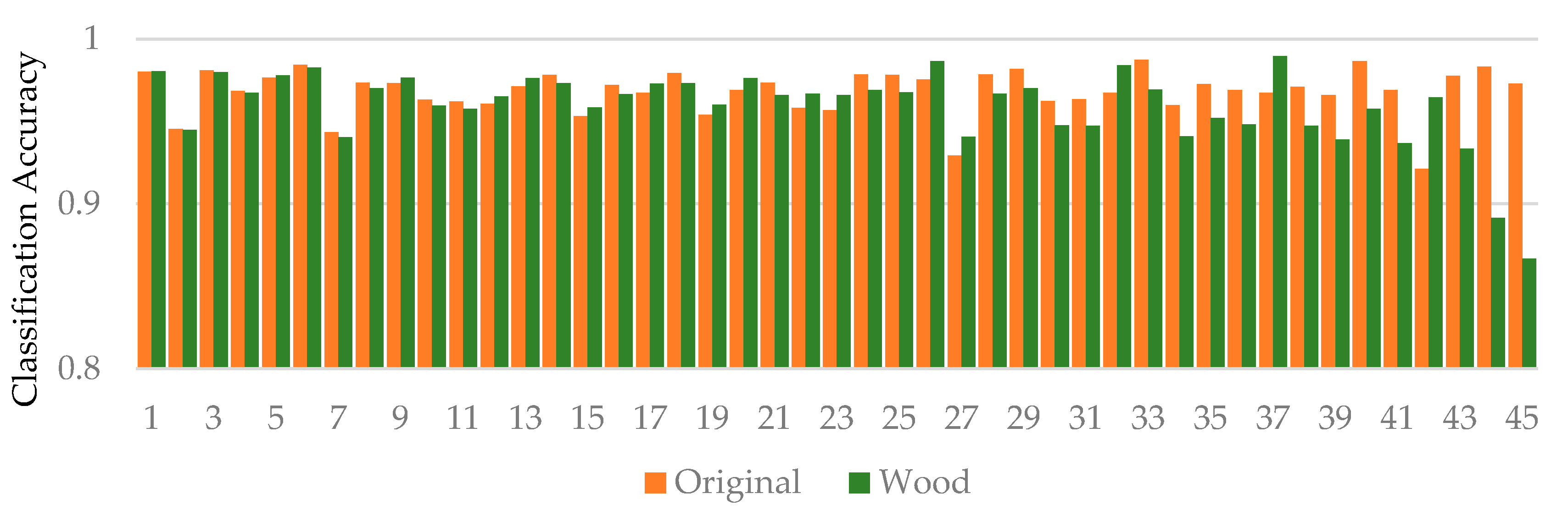
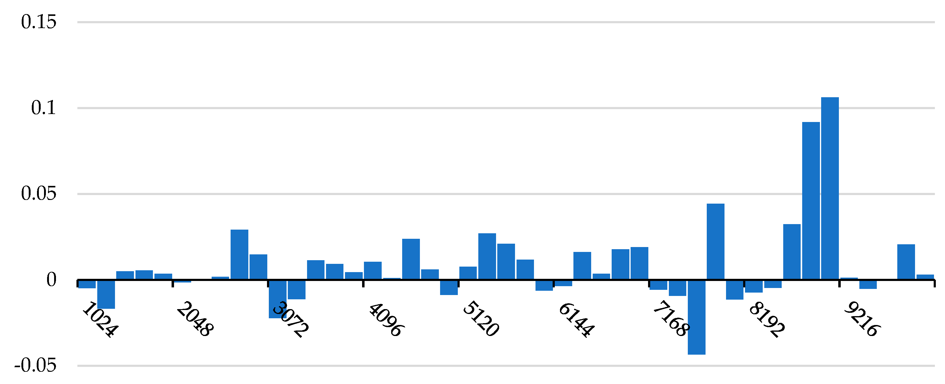
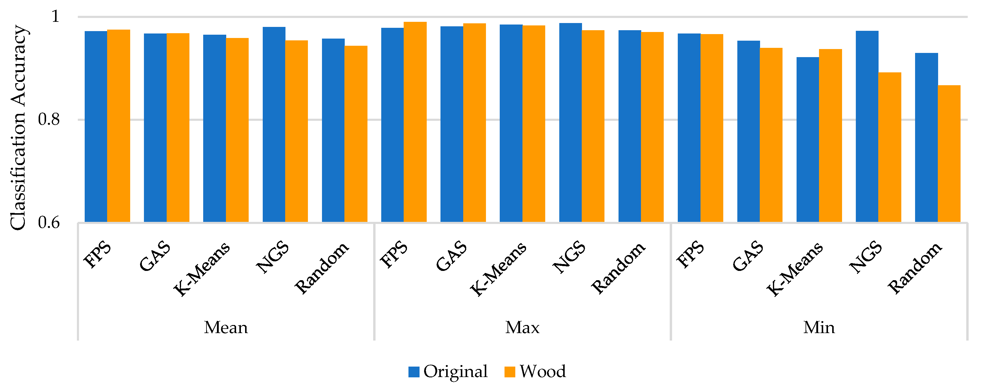
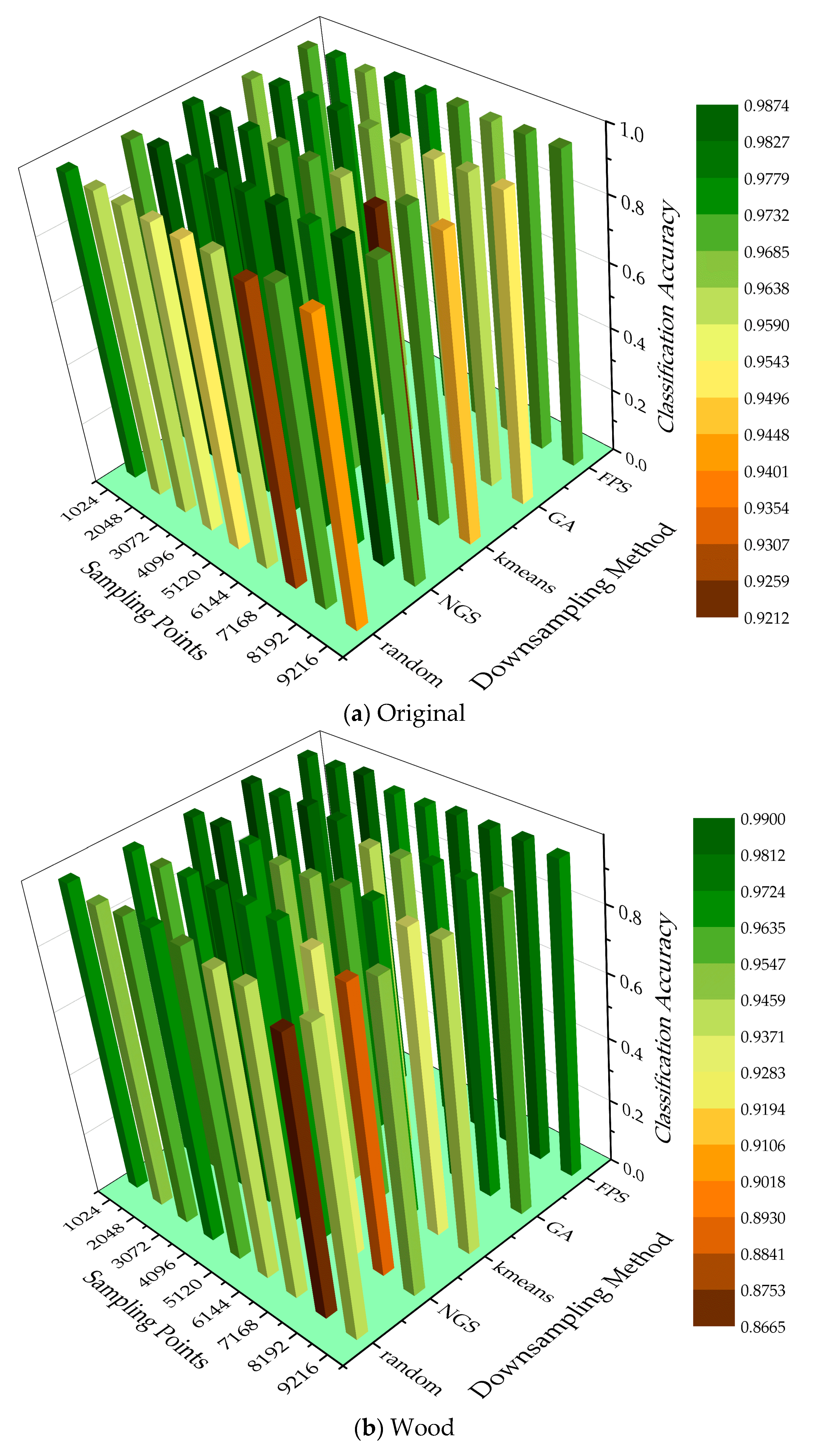
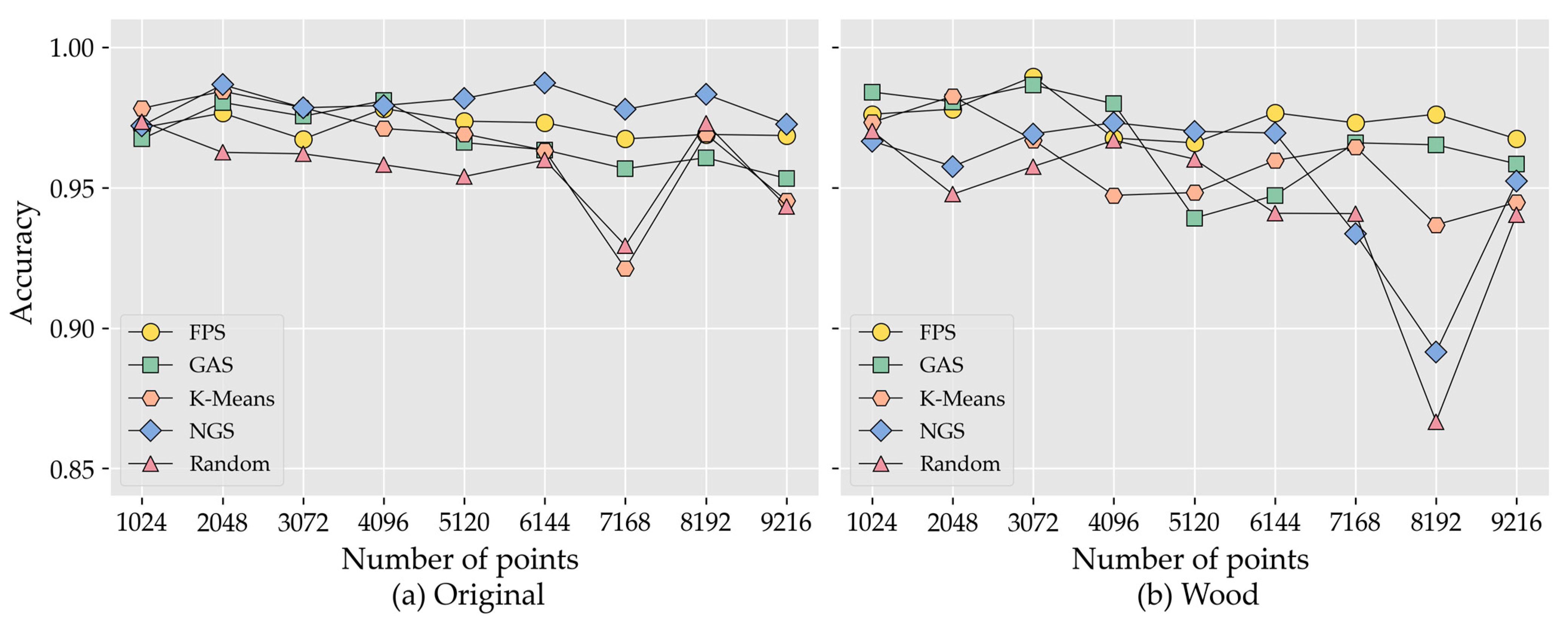
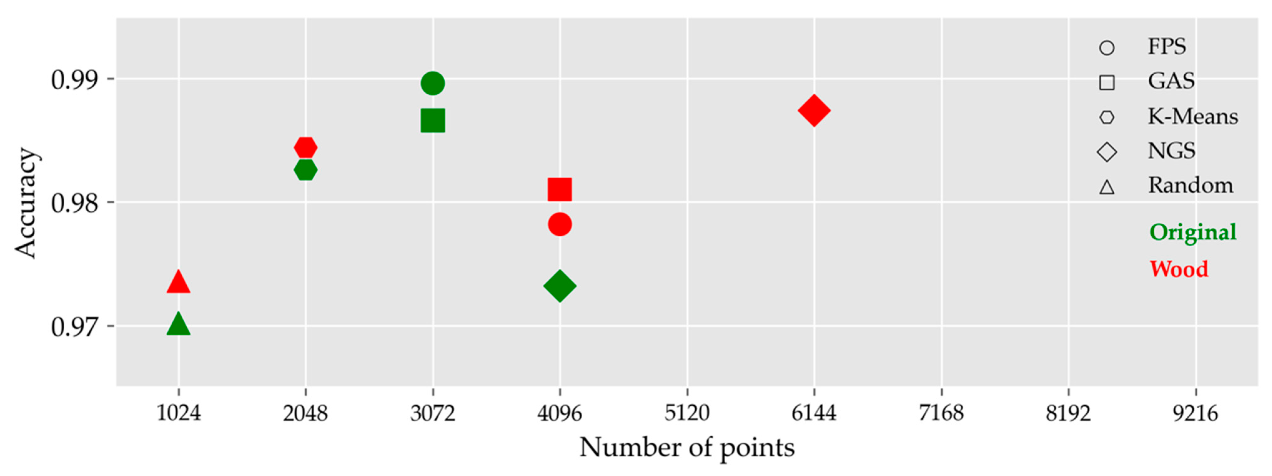
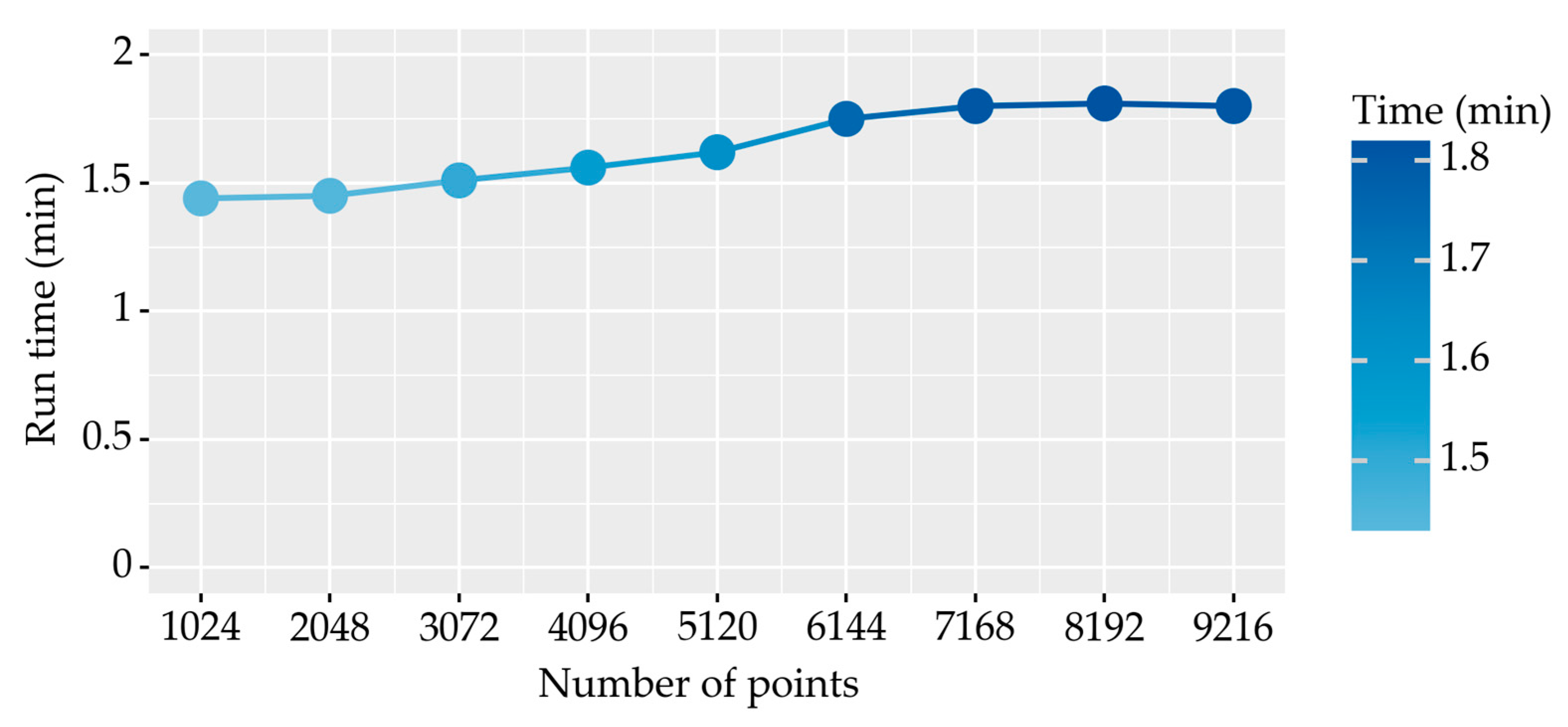
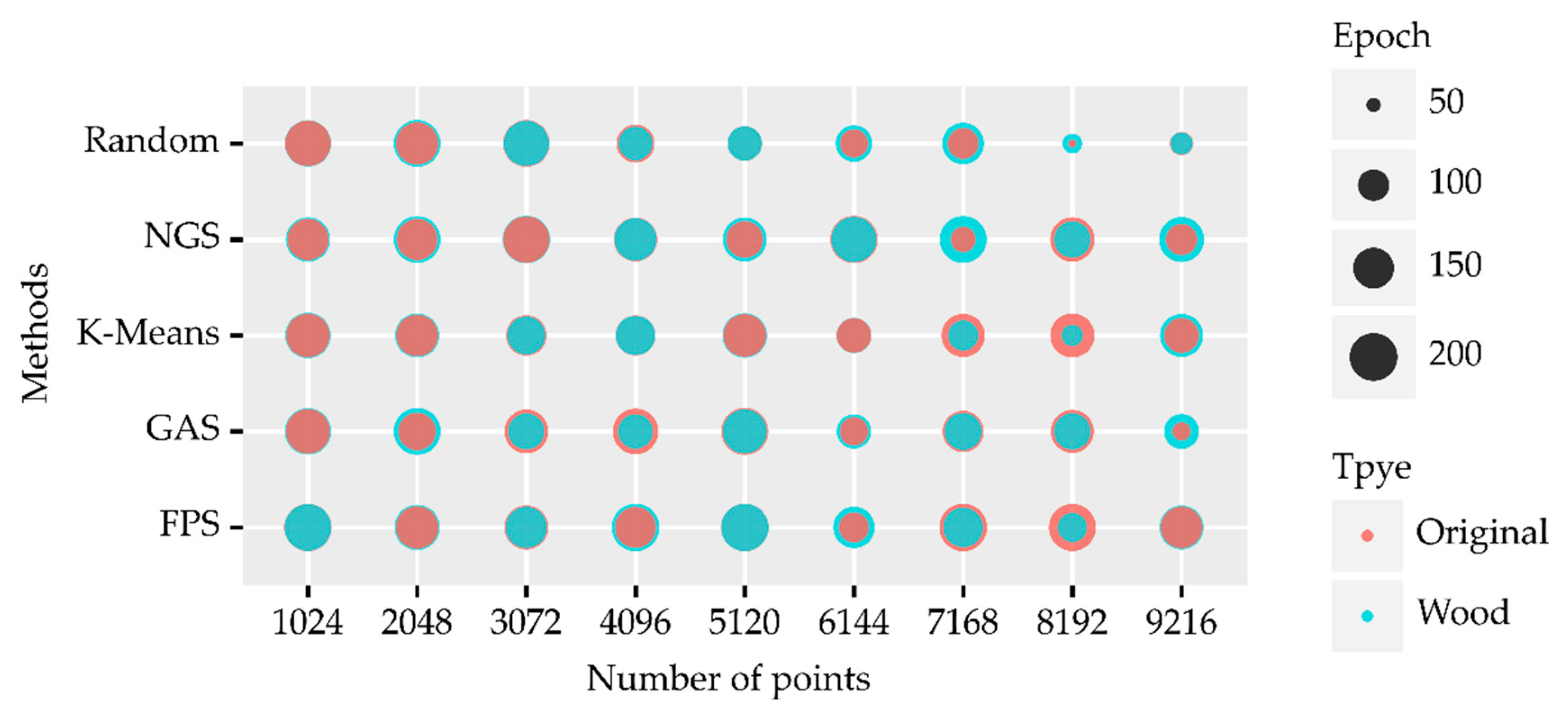
1
Research Center of Forest Management Engineering of State Forestry and Grassland Administration, Beijing Forestry University, Beijing 100083, China
2
Institute of Forest Resource Information Techniques, Chinese Academy of Forestry, Beijing 100091, China
*
Author to whom correspondence should be addressed.
Remote Sens. 2022, 14(15), 3809; https://doi.org/10.3390/rs14153809
Submission received: 29 June 2022 / Revised: 4 August 2022 / Accepted: 5 August 2022 / Published: 7 August 2022
(This article belongs to the Special Issue Quantitative Remote Sensing Product and Validation Technology)

Abstract

To investigate forest resources, it is necessary to identify the tree species. However, it is a challenge to identify tree species using 3D point clouds of trees collected by light detection and ranging (LiDAR). PointNet++, a point cloud deep learning network, can effectively classify 3D objects. It is important to establish high-quality individual tree point cloud datasets when applying PointNet++ to identifying tree species. However, there are different data processing methods to produce sample datasets, and the processes are tedious. In this study, we suggest how to select the appropriate method by designing comparative experiments. We used the backpack laser scanning (BLS) system to collect point cloud data for a total of eight tree species in three regions. We explored the effect of tree height on the classification accuracy of tree species by using different point cloud normalization methods and analyzed the effect of leaf point clouds on classification accuracy by separating the leaves and wood of individual tree point clouds. Five downsampling methods were used: farthest point sampling (FPS), K-means, random, grid average sampling, and nonuniform grid sampling (NGS). Data with different sampling points were designed for the experiments. The results show that the tree height feature is unimportant when using point cloud deep learning methods for tree species classification. For data collected in a single season, the leaf point cloud has little effect on the classification accuracy. The two suitable point cloud downsampling methods we screened were FPS and NGS, and the deep learning network could provide the most accurate tree species classification when the number of individual tree point clouds was in the range of 2048–5120. Our study further illustrates that point-based end-to-end deep learning methods can be used to classify tree species and identify individual tree point clouds. Combined with the low-cost and high-efficiency BLS system, it can effectively improve the efficiency of forest resource surveys.
Keywords: tree species; classification; deep learning; point cloud; backpack laser scanning (BLS) tree species; classification; deep learning; point cloud; backpack laser scanning (BLS)

