
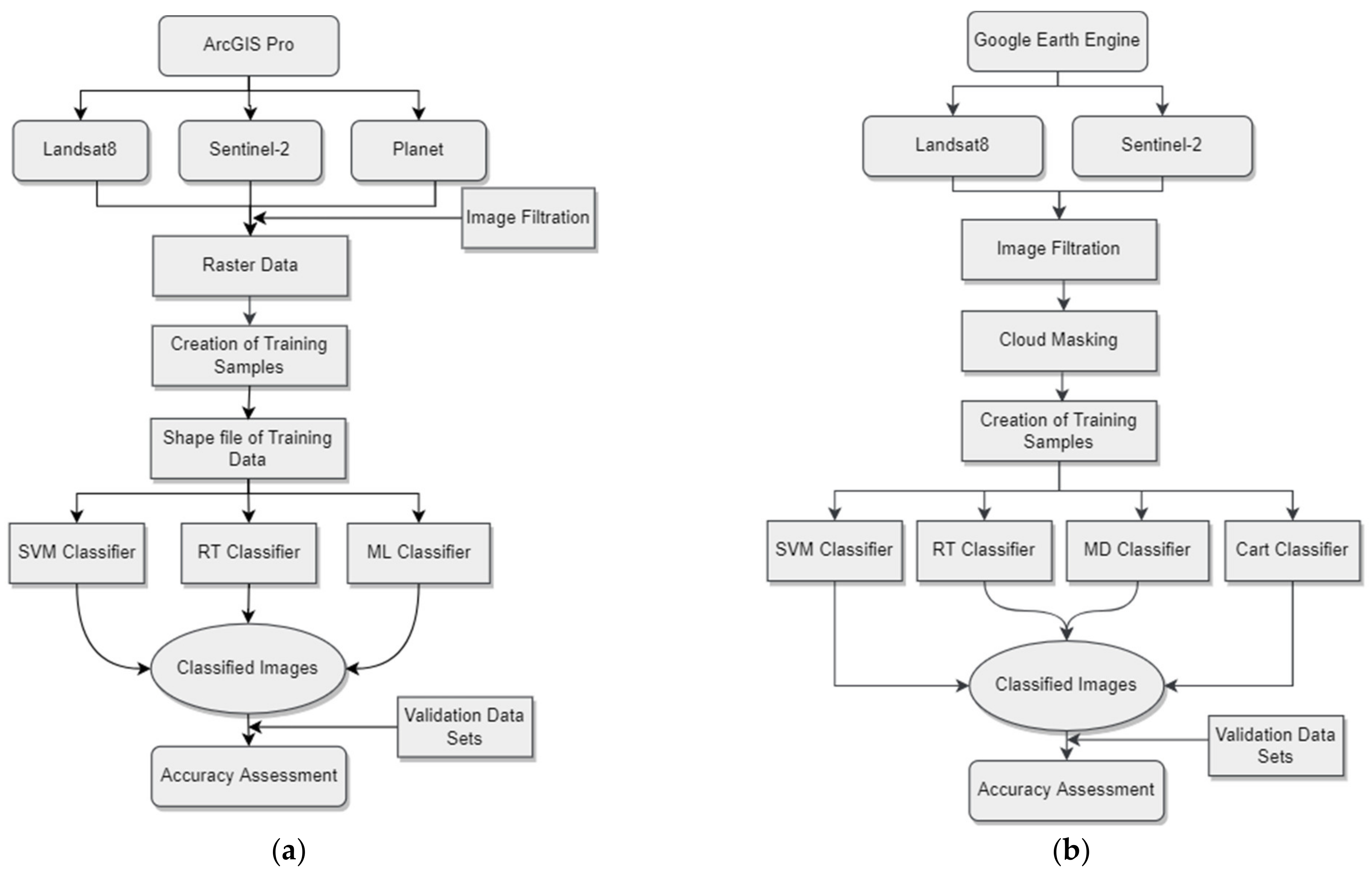
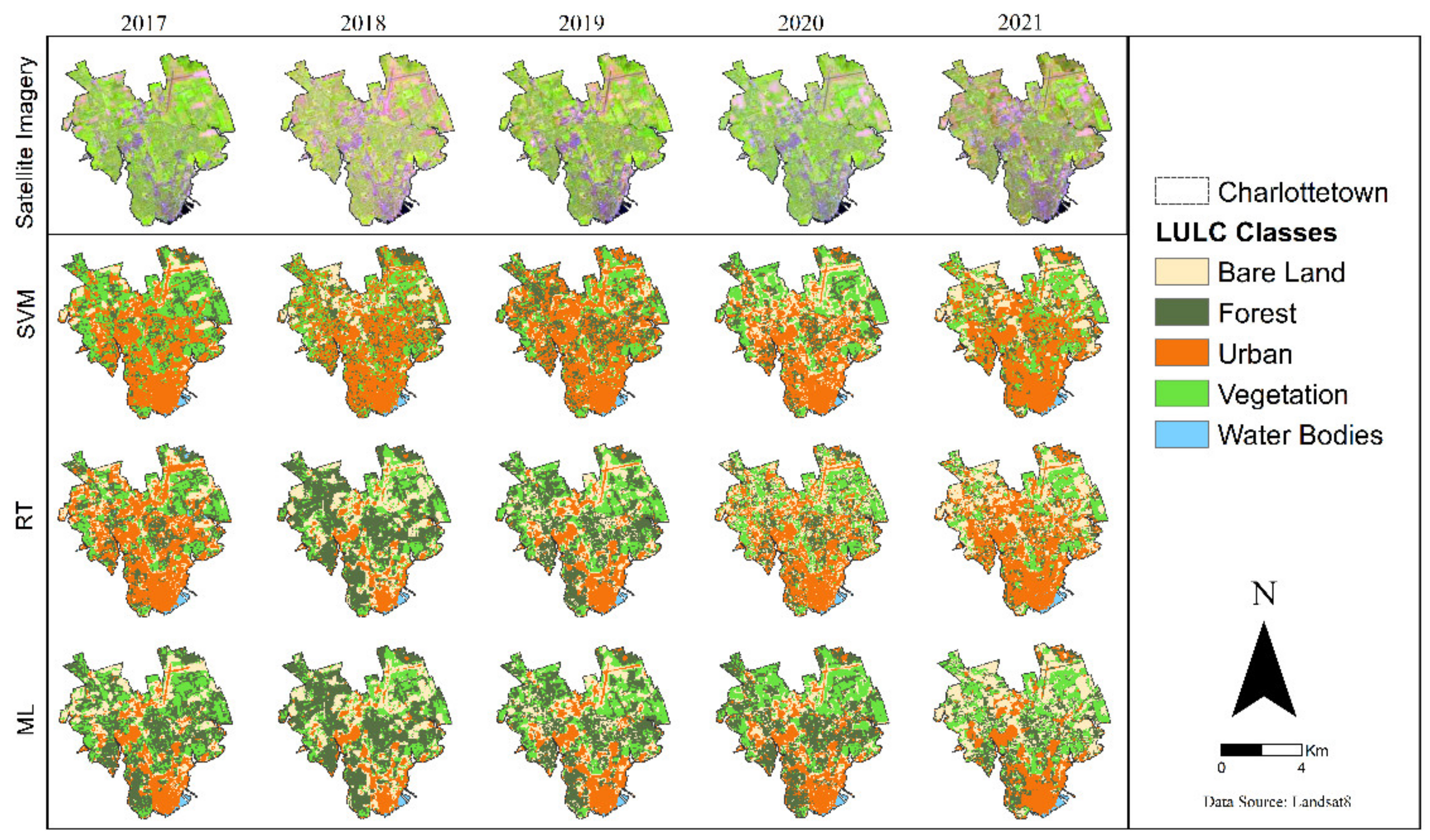
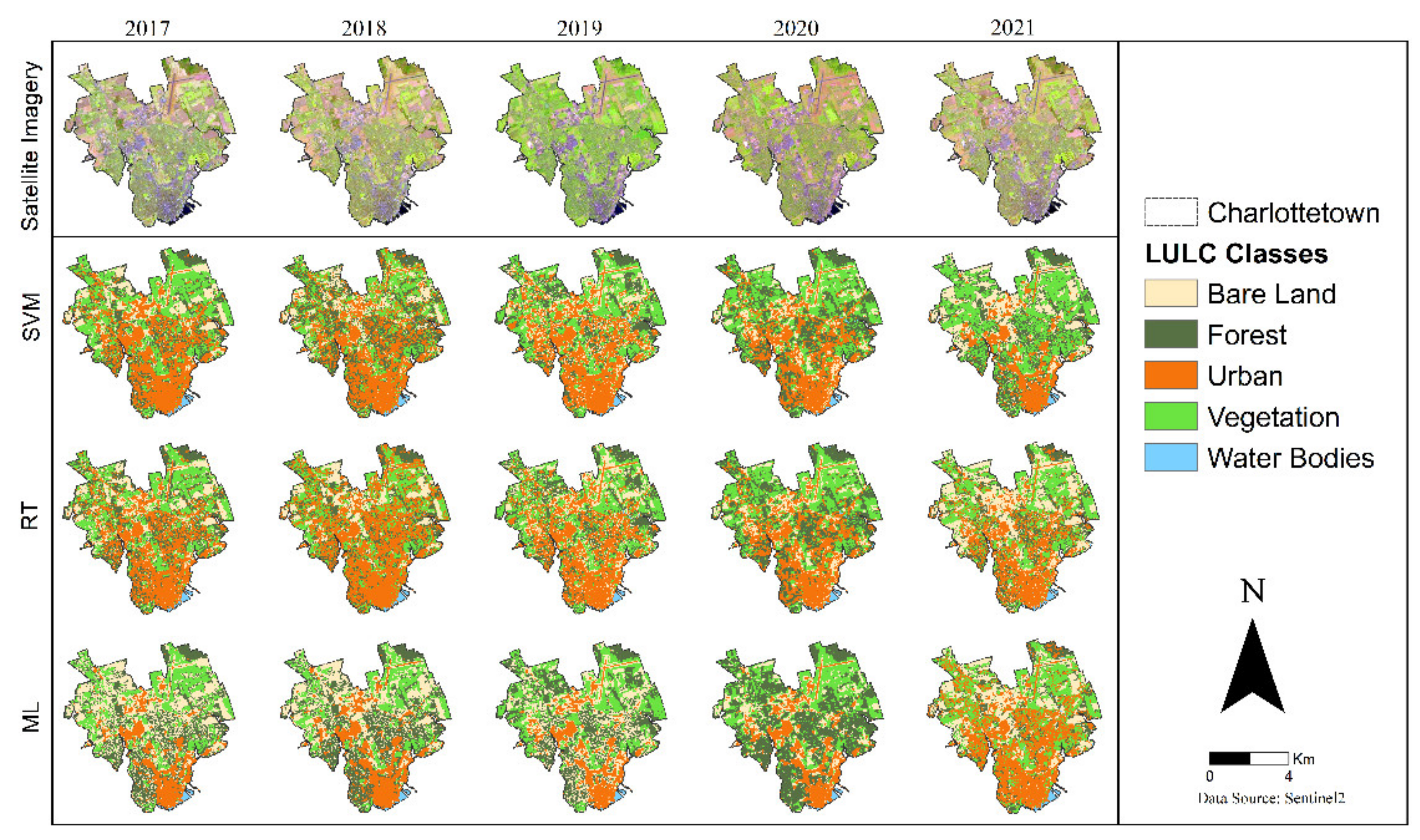
Comparison of Land Use Land Cover Classifiers Using Different Satellite Imagery and Machine Learning Techniques


 ,
,  , and
, and 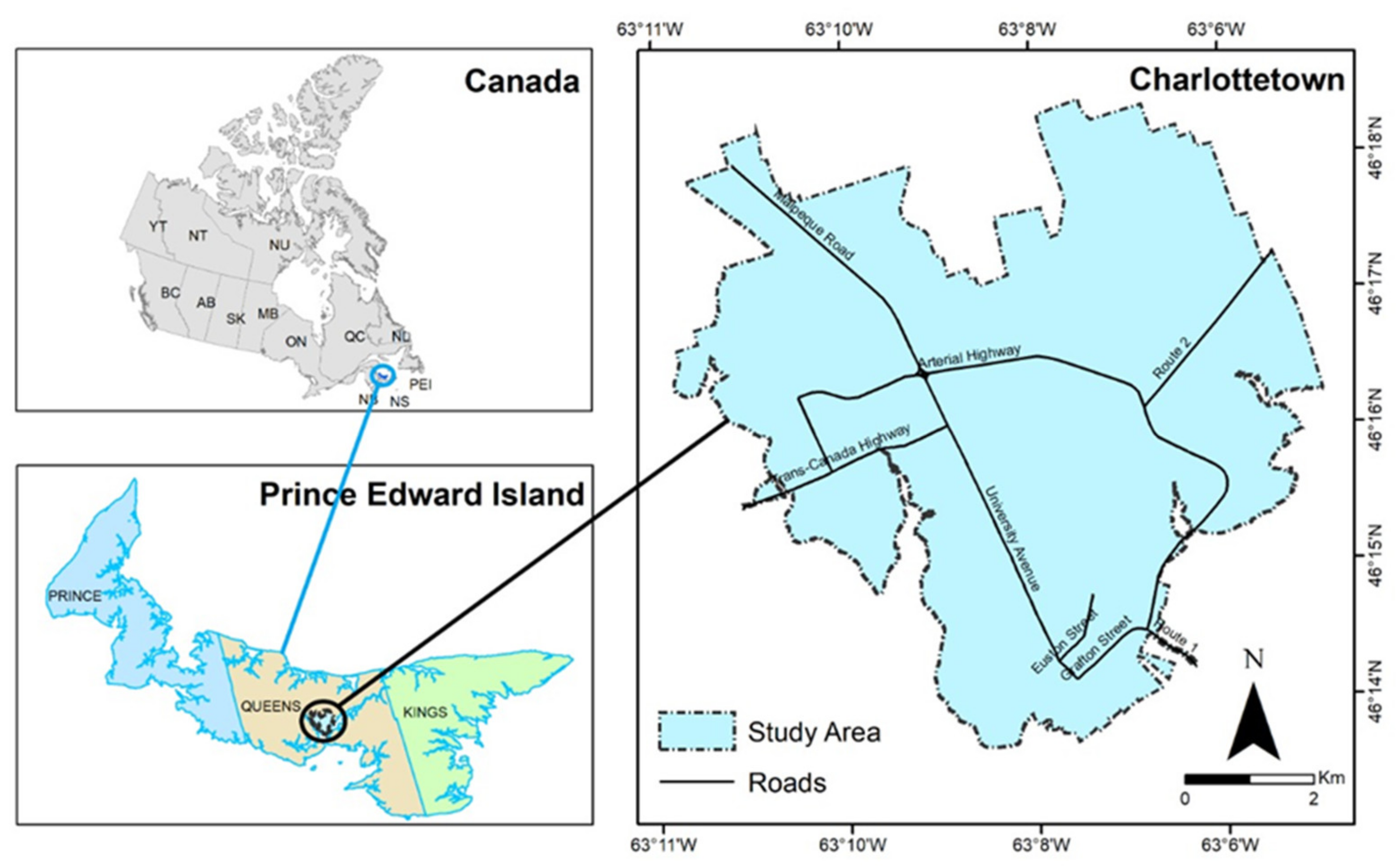
Abstract
Share and Cite
Basheer, S.; Wang, X.; Farooque, A.A.; Nawaz, R.A.; Liu, K.; Adekanmbi, T.; Liu, S. Comparison of Land Use Land Cover Classifiers Using Different Satellite Imagery and Machine Learning Techniques. Remote Sens. 2022, 14, 4978. https://doi.org/10.3390/rs14194978
Basheer S, Wang X, Farooque AA, Nawaz RA, Liu K, Adekanmbi T, Liu S. Comparison of Land Use Land Cover Classifiers Using Different Satellite Imagery and Machine Learning Techniques. Remote Sensing. 2022; 14(19):4978. https://doi.org/10.3390/rs14194978
Chicago/Turabian StyleBasheer, Sana, Xiuquan Wang, Aitazaz A. Farooque, Rana Ali Nawaz, Kai Liu, Toyin Adekanmbi, and Suqi Liu. 2022. "Comparison of Land Use Land Cover Classifiers Using Different Satellite Imagery and Machine Learning Techniques" Remote Sensing 14, no. 19: 4978. https://doi.org/10.3390/rs14194978
APA StyleBasheer, S., Wang, X., Farooque, A. A., Nawaz, R. A., Liu, K., Adekanmbi, T., & Liu, S. (2022). Comparison of Land Use Land Cover Classifiers Using Different Satellite Imagery and Machine Learning Techniques. Remote Sensing, 14(19), 4978. https://doi.org/10.3390/rs14194978