
Spatial and Temporal Characteristics of Drought Events in Southwest China over the Past 120 Years
 , and
, and 
Abstract
1. Introduction
2. Data and Methods
2.1. Study Area
2.2. Data
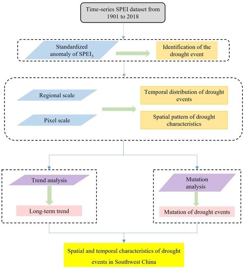
2.3. Methods
2.3.1. Identification of the Drought Event
2.3.2. Characterization of Drought Events with Run Theory
2.3.3. Trend Analysis
2.3.4. Mutation Analysis
3. Results
3.1. Temporal Distribution of Drought Events
3.2. Spatial Pattern of Drought Characteristics
3.3. Trend of Drought Events
3.3.1. Overall Interannual Trend
3.3.2. Spatial Trend Analysis
4. Discussion
5. Conclusions
Author Contributions
Funding
Data Availability Statement
Acknowledgments
Conflicts of Interest
References
- Richardson, A.D.; Hufkens, K.; Milliman, T.; Aubrecht, D.M.; Chen, M.; Gray, J.M.; Johnston, M.R.; Keenan, T.F.; Klosterman, S.T.; Kosmala, M.; et al. Tracking vegetation phenology across diverse North American biomes using PhenoCam imagery. Sci. Data 2018, 5, 180028. [Google Scholar] [CrossRef] [PubMed]
- Tang, X.; Xiao, J.; Ma, M.; Yang, H.; Li, X.; Ding, Z.; Yu, P.; Zhang, Y.; Wu, C.; Huang, J.; et al. Satellite evidence for China’s leading role in restoring vegetation productivity over global karst ecosystems. For. Ecol. Manag. 2022, 507, 120000. [Google Scholar] [CrossRef]
- Li, G.; Wu, C.; Chen, Y.; Huang, C.; Zhao, Y.; Wang, Y.; Ma, M.; Ding, Z.; Yu, P.; Tang, X. Increasing temperature regulates the advance of peak photosynthesis timing in the boreal ecosystem. Sci. Total Environ. 2023, 882, 163587. [Google Scholar] [CrossRef] [PubMed]
- Gong, H.; Cao, L.; Duan, Y.; Jiao, F.; Xu, X.; Zhang, M.; Wang, K.; Liu, H. Multiple effects of climate changes and human activities on NPP increase in the Three-north Shelter Forest Program area. For. Ecol. Manag. 2023, 529, 120732. [Google Scholar] [CrossRef]
- Min, S.; Zhang, X.; Zwiers, F.W.; Hegerl, G.C. Human contribution to more-intense precipitation extremes. Nature 2011, 470, 378–381. [Google Scholar] [CrossRef] [PubMed]
- Sur, K.; Lunagaria, M.M. Association between drought and agricultural productivity using remote sensing data: A case study of Gujarat state of India. J. Water Clim. Chang. 2020, 11, 189–202. [Google Scholar] [CrossRef]
- Liu, X.; Zhu, X.; Pan, Y.; Zhao, A.; Li, Y. Spatiotemporal changes of cold surges in Inner Mongolia between 1960 and 2012. J. Geogr. Sci. 2015, 25, 259–273. [Google Scholar] [CrossRef]
- Stocker, T. Climate Change 2013: The Physical Science Basis: Working Group I Contribution to the Fifth Assessment Report of the Intergovernmental Panel on Climate Change; Cambridge University Press: Cambridge, UK, 2014. [Google Scholar]
- Su, B.; Huang, J.; Fischer, T.; Wang, Y.; Kundzewicz, Z.W.; Zhai, J.; Sun, H.; Wang, A.; Zeng, X.; Wang, G. Drought losses in China might double between the 1.5 °C and 2.0 °C warming. Proc. Natl. Acad. Sci. USA 2018, 115, 10600–10605. [Google Scholar] [CrossRef]
- Zhang, R.; Wu, X.; Zhou, X.; Ren, B.; Zeng, J.; Wang, Q. Investigating the effect of improved drought events extraction method on spatiotemporal characteristics of drought. Theor. Appl. Climatol. 2022, 147, 395–408. [Google Scholar] [CrossRef]
- Wang, Q.; Qi, J.; Qiu, H.; Li, J.; Cole, J.; Waldhoff, S.; Zhang, X. Pronounced Increases in Future Soil Erosion and Sediment Deposition as Influenced by Freeze-Thaw Cycles in the Upper Mississippi River Basin. Environ. Sci. Technol. 2021, 55, 9905–9915. [Google Scholar] [CrossRef]
- Wang, Q.; Qi, J.; Wu, H.; Zeng, Y.; Shui, W.; Zeng, J.; Zhang, X. Freeze-Thaw cycle representation alters response of watershed hydrology to future climate change. Catena 2020, 195, 104767. [Google Scholar] [CrossRef]
- Wang, Q.; Qi, J.; Li, J.; Cole, J.; Waldhoff, S.T.; Zhang, X. Nitrate loading projection is sensitive to freeze-thaw cycle representation. Water Res. 2020, 186, 116355. [Google Scholar] [CrossRef]
- Wang, Q.; Zeng, J.; Leng, S.; Fan, B.; Tang, J.; Jiang, C.; Huang, Y.; Zhang, Q.; Qu, Y.; Wang, W.; et al. The effects of air temperature and precipitation on the net primary productivity in China during the early 21st century. Front. Earth Sci. 2018, 12, 818–833. [Google Scholar] [CrossRef]
- Todisco, F.; Mannocchi, F.; Vergni, L. Severity–duration–frequency curves in the mitigation of drought impact: An agricultural case study. Nat. Hazards 2013, 65, 1863–1881. [Google Scholar] [CrossRef]
- Giraldo Osorio, J.D.; Garcia Galiano, S.G. Non-stationary analysis of dry spells in monsoon season of Senegal River Basin using data from Regional Climate Models (RCMs). J. Hydrol. 2012, 450, 82–92. [Google Scholar] [CrossRef]
- Masson-Delmotte, V.; Zhai, P.; Pirani, A.; Connors, S.L.; Péan, C.; Berger, S.; Caud, N.; Chen, Y.; Goldfarb, L.; Gomis, M.I. Climate Change 2021: The Physical Science Basis: Contribution of Working Group I to the Sixth Assessment Report of the Intergovernmental Panel on Climate Change; Cambridge University Press: Cambridge, UK, 2021; p. 2. [Google Scholar]
- Zhang, A.; Jia, G. Monitoring meteorological drought in semiarid regions using multi-sensor microwave remote sensing data. Remote Sens. Environ. 2013, 134, 12–23. [Google Scholar] [CrossRef]
- Burke, E.J.; Brown, S.J.; Christidis, N. Modeling the recent evolution of global drought and projections for the twenty-first century with the Hadley Centre climate model. J. Hydrometeorol. 2006, 7, 1113–1125. [Google Scholar] [CrossRef]
- Zargar, A.; Sadiq, R.; Naser, B.; Khan, F.I. A review of drought indices. Environ. Rev. 2011, 19, 333–349. [Google Scholar] [CrossRef]
- Palmer, W.C. Meteorological Drought; US Department of Commerce, Weather Bureau: Washington, DC, USA, 1965.
- McKee, T.B.; Doesken, N.J.; Kleist, J. The relationship of drought frequency and duration to time scales. In Proceedings of the 8th Conference on Applied Climatology, Anaheim, CA, USA, 17–22 January 1993; Volume 17, pp. 179–183. [Google Scholar]
- Vicente-Serrano, S.M.; Beguería, S.; López-Moreno, J.I. A Multiscalar Drought Index Sensitive to Global Warming: The Standardized Precipitation Evapotranspiration Index. J. Clim. 2010, 23, 1696–1718. [Google Scholar] [CrossRef]
- Liu, Z.; Wang, Y.; Shao, M.; Jia, X.; Li, X. Spatiotemporal analysis of multiscalar drought characteristics across the Loess Plateau of China. J. Hydrol. 2016, 534, 281–299. [Google Scholar] [CrossRef]
- Yu, M.; Li, Q.; Hayes, M.J.; Svoboda, M.D.; Heim, R.R. Are droughts becoming more frequent or severe in China based on the Standardized Precipitation Evapotranspiration Index: 1951–2010? Int. J. Climatol. 2014, 34, 545–558. [Google Scholar] [CrossRef]
- Xu, X.; Piao, S.; Wang, X.; Chen, A.; Ciais, P.; Myneni, R.B. Spatio-temporal patterns of the area experiencing negative vegetation growth anomalies in China over the last three decades. Environ. Res. Lett. 2012, 7, 35701. [Google Scholar] [CrossRef]
- Wang, L.; Chen, W. A CMIP5 multimodel projection of future temperature, precipitation, and climatological drought in China. Int. J. Climatol. 2014, 34, 2059–2078. [Google Scholar] [CrossRef]
- Liu, M.; Xu, X.; Wang, D.; Sun, A.Y.; Wang, K. Karst catchments exhibited higher degradation stress from climate change than the non-karst catchments in southwest China: An ecohydrological perspective. J. Hydrol. 2016, 535, 173–180. [Google Scholar] [CrossRef]
- Heilman, J.L.; Litvak, M.E.; McInnes, K.J.; Kjelgaard, J.F.; Kamps, R.H.; Schwinning, S. Water-storage capacity controls energy partitioning and water use in karst ecosystems on the Edwards Plateau, Texas. Ecohydrology 2014, 7, 127–138. [Google Scholar] [CrossRef]
- Li, X.; He, B.; Quan, X.; Liao, Z.; Bai, X. Use of the Standardized Precipitation Evapotranspiration Index (SPEI) to Characterize the Drying Trend in Southwest China from 1982–2012. Remote Sens. 2015, 7, 10917–10937. [Google Scholar] [CrossRef]
- Jia, Y.; Zhang, B.; Ma, B. Daily SPEI Reveals Long-term Change in Drought Characteristics in Southwest China. Chin. Geogr. Sci. 2018, 28, 680–693. [Google Scholar] [CrossRef]
- Tang, H.; Wen, T.; Shi, P.; Qu, S.; Zhao, L.; Li, Q. Analysis of Characteristics of Hydrological and Meteorological Drought Evolution in Southwest China. Water 2021, 13, 1846. [Google Scholar] [CrossRef]
- Zhang, L.; Xiao, J.; Li, J.; Wang, K.; Lei, L.; Guo, H. The 2010 spring drought reduced primary productivity in southwestern China. Environ. Res. Lett. 2012, 7, 45706. [Google Scholar] [CrossRef]
- Nie, Y.; Chen, H.; Wang, K.; Yang, J. Water source utilization by woody plants growing on dolomite outcrops and nearby soils during dry seasons in karst region of Southwest China. J. Hydrol. 2012, 420, 264–274. [Google Scholar] [CrossRef]
- Xu, K.; Yang, D.; Yang, H.; Li, Z.; Qin, Y.; Shen, Y. Spatio-temporal variation of drought in China during 1961–2012: A climatic perspective. J. Hydrol. 2015, 526, 253–264. [Google Scholar] [CrossRef]
- Lloyd Hughes, B. A spatio-temporal structure-based approach to drought characterisation. Int. J. Climatol. 2012, 32, 406–418. [Google Scholar] [CrossRef]
- Li, X.; Li, Y.; Chen, A.; Gao, M.; Slette, I.J.; Piao, S. The impact of the 2009/2010 drought on vegetation growth and terrestrial carbon balance in Southwest China. Agric. For. Meteorol. 2019, 269–270, 239–248. [Google Scholar] [CrossRef]
- Wang, M.; Ding, Z.; Wu, C.; Song, L.; Ma, M.; Yu, P.; Lu, B.; Tang, X. Divergent responses of ecosystem water-use efficiency to extreme seasonal droughts in Southwest China. Sci. Total Environ. 2021, 760, 143427. [Google Scholar] [CrossRef] [PubMed]
- Saft, M.; Western, A.W.; Zhang, L.; Peel, M.C.; Potter, N.J. The influence of multiyear drought on the annual rainfall-runoff relationship: An Australian perspective. Water Resour. Res. 2015, 51, 2444–2463. [Google Scholar] [CrossRef]
- Yevjevich, V.M. An Objective Approach to Definitions and Investigations of Continental Hydrologic Droughts; Colorado State University Libraries: Fort Collins, CO, USA, 1967. [Google Scholar]
- Mishra, A.K.; Singh, V.P. A review of drought concepts. J. Hydrol. 2010, 391, 204–216. [Google Scholar] [CrossRef]
- Wu, R.; Zhang, J.; Bao, Y.; Guo, E. Run Theory and Copula-Based Drought Risk Analysis for Songnen Grassland in Northeastern China. Sustainability 2019, 11, 6032. [Google Scholar] [CrossRef]
- Mesbahzadeh, T.; Mirakbari, M.; Saravi, M.M.; Sardoo, F.S.; Miglietta, M.M. Meteorological drought analysis using copula theory and drought indicators under climate change scenarios (RCP). Meteorol. Appl. 2020, 27, e1856. [Google Scholar] [CrossRef]
- Liu, X.; Wang, S.; Zhou, Y.; Wang, F.; Li, W.; Liu, W. Regionalization and Spatiotemporal Variation of Drought in China Based on Standardized Precipitation Evapotranspiration Index (1961–2013). Adv. Meteorol. 2015, 2015, 950262. [Google Scholar] [CrossRef]
- Da Rocha Junior, R.L.; Dos Santos Silva, F.D.; Costa, R.L.; Gomes, H.B.; Cavalcante Pinto, D.D.; Herdies, D.L. Bivariate Assessment of Drought Return Periods and Frequency in Brazilian Northeast Using Joint Distribution by Copula Method. Geosciences 2020, 10, 135. [Google Scholar] [CrossRef]
- Caloiero, T.; Caroletti, G.N.; Coscarelli, R. IMERG-Based Meteorological Drought Analysis over Italy. Climate 2021, 9, 65. [Google Scholar] [CrossRef]
- Mann, H.B. Nonparametric tests against trend. Econom. J. Econom. Soc. 1945, 13, 245–259. [Google Scholar] [CrossRef]
- Zhang, H.; Zhang, Q.; Liu, X. Study on the main factors of aridity in Hetao area of North China. Adv. Clim. Chang. Res. 2016, 12, 20. [Google Scholar]
- Xiong, G.; Zhang, B.; Li, C.; Shang, K.; Wang, S. Characteristics of drought variations in Southwest China in 1961–2012 based on SPEI. Adv. Clim. Chang. Res. 2013, 9, 192. [Google Scholar]
- Huang, W.; Yang, X.; Li, M.; Zhang, X.; Wang, M.; Dai, S.; Ma, J. Evolution characteristics of seasonal drought in the south of China during the past 58 years based on standardized precipitation index. Trans. Chin. Soc. Agric. Eng. 2010, 26, 50–59. [Google Scholar]
- Steinemann, A. Drought indicators and triggers: A stochastic approach to evaluation. JAWRA J. Am. Water Resour. Assoc. 2003, 39, 1217–1233. [Google Scholar] [CrossRef]
- Yao, Y.; Liao, X.; Xiao, J.; He, Q.; Shi, W. The sensitivity of maize evapotranspiration to vapor pressure deficit and soil moisture with lagged effects under extreme drought in Southwest China. Agric. Water Manag. 2023, 277, 108101. [Google Scholar] [CrossRef]
- Deng, Y.; Wang, X.; Wang, K.; Ciais, P.; Tang, S.; Jin, L.; Li, L.; Piao, S. Responses of vegetation greenness and carbon cycle to extreme droughts in China. Agric. For. Meteorol. 2021, 298–299, 108307. [Google Scholar] [CrossRef]
- Li, Y.; Ren, F.; Li, Y.; Wang, P.; Yan, H. Characteristics of the regional meteorological drought events in Southwest China during 1960–2010. J. Meteorol. Res. 2014, 28, 381–392. [Google Scholar] [CrossRef]
- Wang, L.; Chen, W. Characteristics of multi-timescale variabilities of the drought over last 100 years in Southwest China. Adv. Meteorol. Sci. Technol. 2012, 2, 21–26. [Google Scholar]
- Cheng, Q.; Gao, L.; Zhong, F.; Zuo, X.; Ma, M. Spatiotemporal variations of drought in the Yunnan-Guizhou Plateau, southwest China, during 1960–2013 and their association with large-scale circulations and historical records. Ecol. Indic. 2020, 112, 106041. [Google Scholar] [CrossRef]
- Zhang, C. Moisture sources for precipitation in Southwest China in summer and the changes during the extreme droughts of 2006 and 2011. J. Hydrol. 2020, 591, 125333. [Google Scholar] [CrossRef]
- Sun, S.; Li, Q.; Li, J.; Wang, G.; Zhou, S.; Chai, R.; Hua, W.; Deng, P.; Wang, J.; Lou, W. Revisiting the evolution of the 2009–2011 meteorological drought over Southwest China. J. Hydrol. 2019, 568, 385–402. [Google Scholar] [CrossRef]
- Lin, W.; Wen, C.; Wen, Z.; Gang, H. Drought in Southwest China: A review. Atmos. Ocean. Sci. Lett. 2015, 8, 339–344. [Google Scholar]
- Liu, Y.; Ding, Z.; Chen, Y.; Yan, F.; Yu, P.; Man, W.; Liu, M.; Li, H.; Tang, X. Restored vegetation is more resistant to extreme drought events than natural vegetation in Southwest China. Sci. Total Environ. 2023, 866, 161250. [Google Scholar] [CrossRef] [PubMed]
- Lu, J.; Ju, J.; Ren, J.; Gan, W. The influence of the Madden-Julian Oscillation activity anomalies on Yunnan’s extreme drought of 2009–2010. Sci. China-Earth Sci. 2012, 55, 98–112. [Google Scholar] [CrossRef]
- Qiu, J. China drought highlights future climate threats: Yunnan’s worst drought for many years has been exacerbated by destruction of forest cover and a history of poor water management. Nature 2010, 465, 142–144. [Google Scholar] [CrossRef]
- Zhao, X.; Wei, H.; Liang, S.; Zhou, T.; He, B.; Tang, B.; Wu, D. Responses of Natural Vegetation to Different Stages of Extreme Drought during 2009–2010 in Southwestern China. Remote Sens. 2015, 7, 14039–14054. [Google Scholar] [CrossRef]
- Cui, L.; Zhang, C.; Yao, C.; Luo, Z.; Wang, X.; Li, Q. Analysis of the influencing factors of drought events based on GRACE data under different climatic conditions: A case study in Mainland China. Water 2021, 13, 2575. [Google Scholar] [CrossRef]
- Wang, S.; Duan, H.; Feng, J. Drought events and its influence in autumn of 2010 in China. J. Arid Meteorol. 2010, 32, 1031–1039. [Google Scholar]
- Wang, L.; Huang, G.; Chen, W.; Zhou, W.; Wang, W. Wet-to-dry shift over Southwest China in 1994 tied to the warming of tropical warm pool. Clim. Dyn. 2018, 51, 3111–3123. [Google Scholar] [CrossRef]
- Thomas, T.; Jaiswal, R.K.; Nayak, P.C.; Ghosh, N.C. Comprehensive evaluation of the changing drought characteristics in Bundelkhand region of Central India. Meteorol. Atmos. Phys. 2015, 127, 163–182. [Google Scholar] [CrossRef]
- Dai, A. Characteristics and trends in various forms of the Palmer Drought Severity Index during 1900–2008. J. Geophys. Res. Atmos. 2011, 116, D12115. [Google Scholar] [CrossRef]
- Liu, B.; Chen, C.; Lian, Y.; Chen, J.; Chen, X. Long-term change of wet and dry climatic conditions in the southwest karst area of China. Glob. Planet. Chang. 2015, 127, 1–11. [Google Scholar] [CrossRef]
- Han, L.Y.; Zhang, Q.; Yao, Y.B.; Li, Y.; Jia, J.; Wang, J. Characteristics and origins of drought disasters in Southwest China in nearly 60 years. Acta Geogr. Sin. 2014, 69, 632–639. [Google Scholar]
- Su, X.C.; Wang, L.; Li, Q.L.; Teng, C. Study of surface dry and wet conditions in Southwest China in recent 50 years. J. Nat. Resour. 2014, 29, 104–116. [Google Scholar]
- Wang, D.; Zhang, B.; An, M.; Zhang, T.; Ji, D.; Ren, P. Temporal and spatial distributions of drought in Southwest China over the past 53 years based on standardized precipitation evapotranspiration index. J. Nat. Resour. 2014, 29, 1003–1016. [Google Scholar]
- Mei, S.; Chen, S.; Li, Y.; Aru, H. Interannual Variations of Rainfall in Late Spring over Southwest China and Associated Sea Surface Temperature and Atmospheric Circulation Anomalies. Atmosphere 2022, 13, 735. [Google Scholar] [CrossRef]
- Li, G.; Li, C.; Zhou, W.; Wen, B. Climatic characteristics of rainfall over Southwest China during spring and spring months. Clim. Environ. Res. 2020, 25, 575–587. [Google Scholar]
- Brown, J.F.; Wardlow, B.D.; Tadesse, T.; Hayes, M.J.; Reed, B.C. The Vegetation Drought Response Index (VegDRI): A new integrated approach for monitoring drought stress in vegetation. Gisci. Remote Sens. 2008, 45, 16–46. [Google Scholar] [CrossRef]
- Quiring, S.M. Developing objective operational definitions for monitoring drought. J. Appl. Meteorol. Climatol. 2009, 48, 1217–1229. [Google Scholar] [CrossRef]
- Ines, A.V.; Das, N.N.; Hansen, J.W.; Njoku, E.G. Assimilation of remotely sensed soil moisture and vegetation with a crop simulation model for maize yield prediction. Remote Sens. Environ. 2013, 138, 149–164. [Google Scholar] [CrossRef]
- Mladenova, I.E.; Bolten, J.D.; Crow, W.T.; Anderson, M.C.; Hain, C.R.; Johnson, D.M.; Mueller, R. Intercomparison of soil moisture, evaporative stress, and vegetation indices for estimating corn and soybean yields over the US. IEEE J. Sel. Top. Appl. Earth Obs. Remote Sens. 2017, 10, 1328–1343. [Google Scholar] [CrossRef]
- Afshar, M.H.; Bulut, B.; Duzenli, E.; Amjad, M.; Yilmaz, M.T. Global spatiotemporal consistency between meteorological and soil moisture drought indices. Agric. For. Meteorol. 2022, 316, 108848. [Google Scholar] [CrossRef]
- Bergman, K.H.; Sabol, P.; Miskus, D. Experimental indices for monitoring global drought conditions. In Proceedings of the 13th Annual Climate Diagnostics Workshop, Cambridge, MA, USA, 31 October–4 November 1988; Volume 31, pp. 190–197. [Google Scholar]
- Dutra, E.; Viterbo, P.; Miranda, P.M. ERA-40 reanalysis hydrological applications in the characterization of regional drought. Geophys. Res. Lett. 2008, 35, L19402. [Google Scholar] [CrossRef]
- Sridhar, V.; Hubbard, K.G.; You, J.; Hunt, E.D. Development of the soil moisture index to quantify agricultural drought and its “user friendliness” in severity-area-duration assessment. J. Hydrometeorol. 2008, 9, 660–676. [Google Scholar] [CrossRef]
- Martínez-Fernández, J.; González-Zamora, A.; Sánchez, N.; Gumuzzio, A. A soil water based index as a suitable agricultural drought indicator. J. Hydrol. 2015, 522, 265–273. [Google Scholar] [CrossRef]
- Bulut, B.; Yilmaz, M.T.; Afshar, M.H.; Şorman, A.Ü.; Yücel, İ.; Cosh, M.H.; Şimşek, O. Evaluation of remotely-sensed and model-based soil moisture products according to different soil type, vegetation cover and climate regime using station-based observations over Turkey. Remote Sens. 2019, 11, 1875. [Google Scholar] [CrossRef]
- Li, Q.; Shi, G.; Shangguan, W.; Nourani, V.; Li, J.; Li, L.; Huang, F.; Zhang, Y.; Wang, C.; Wang, D.; et al. A 1 km daily soil moisture dataset over China using in situ measurement and machine learning. Earth Syst. Sci. Data 2022, 14, 5267–5286. [Google Scholar] [CrossRef]


| ID | Year | Start Time (Month) | End Time (Month) | Duration (Month) | S Value |
|---|---|---|---|---|---|
| 1 | 1901 | 9 | 11 | 3 | −1.7121 |
| 2 | 1902 | 8 | 9 | 2 | −1.4338 |
| 3 | 1906 | 7 | 8 | 2 | −1.0529 |
| 4 | 1909 | 3 | 4 | 2 | −1.1518 |
| 5 | 1910 | 6 | 7 | 2 | −1.19 |
| 6 | 1912 | 8 | 9 | 2 | −1.2542 |
| 7 | 1915 | 3 | 5 | 3 | −1.8304 |
| 8 | 1922 | 1 | 3 | 3 | −2.2424 |
| 9 | 1923 | 2 | 3 | 2 | −1.1955 |
| 10 | 1924 | 11 | 12 | 2 | −1.1969 |
| 11 | 1929 | 2 | 2 | 1 | −0.6134 |
| 12 | 1930 | 7 | 9 | 3 | −2.2326 |
| 13 | 1931 | 2 | 6 | 5 | −3.3202 |
| 14 | 1933 | 3 | 4 | 2 | −1.4099 |
| 15 | 1933 | 8 | 9 | 2 | −1.4713 |
| 16 | 1935 | 8 | 9 | 2 | −1.061 |
| 17 | 1936 | 6 | 8 | 3 | −2.1941 |
| 18 | 1936–1937 | 10 | 5 | 8 | −7.2346 |
| 19 | 1937 | 11 | 12 | 2 | −1.1268 |
| 20 | 1939–1940 | 7 | 1 | 7 | −5.5929 |
| 21 | 1940 | 6 | 8 | 3 | −2.3216 |
| 22 | 1941 | 2 | 4 | 3 | −1.5879 |
| 23 | 1942 | 8 | 11 | 4 | −3.2974 |
| 24 | 1943 | 4 | 8 | 5 | −4.3866 |
| 25 | 1943 | 12 | 12 | 1 | −0.5333 |
| 26 | 1945 | 5 | 7 | 3 | −2.3208 |
| 27 | 1945–1946 | 11 | 3 | 5 | −3.3344 |
| 28 | 1951 | 2 | 2 | 1 | −0.5272 |
| 29 | 1953 | 7 | 9 | 3 | −1.986 |
| 30 | 1955 | 4 | 5 | 2 | −1.324 |
| 31 | 1956 | 10 | 10 | 1 | −0.517 |
| 32 | 1958 | 4 | 6 | 3 | −3.2344 |
| 33 | 1958 | 11 | 12 | 2 | −1.3555 |
| 34 | 1960 | 3 | 6 | 4 | −3.2463 |
| 35 | 1962 | 4 | 4 | 1 | −0.554 |
| 36 | 1962–1963 | 10 | 7 | 10 | −8.6077 |
| 37 | 1966 | 3 | 5 | 3 | −3.1387 |
| 38 | 1969 | 1 | 6 | 6 | −7.284 |
| 39 | 1972 | 7 | 9 | 3 | −3.0389 |
| 40 | 1975 | 9 | 9 | 1 | −0.5691 |
| 41 | 1978 | 9 | 9 | 1 | −0.7142 |
| 42 | 1979 | 2 | 6 | 5 | −3.9129 |
| 43 | 1981 | 9 | 11 | 3 | −1.6323 |
| 44 | 1982 | 6 | 6 | 1 | −0.5065 |
| 45 | 1983 | 6 | 7 | 2 | −1.09676 |
| 46 | 1984 | 3 | 4 | 2 | −1.316 |
| 47 | 1984 | 11 | 12 | 2 | −1.6816 |
| 48 | 1986 | 1 | 6 | 6 | −3.2545 |
| 49 | 1987 | 1 | 6 | 6 | −5.5077 |
| 50 | 1988 | 5 | 7 | 3 | −2.3874 |
| 51 | 1989 | 7 | 9 | 3 | −2.0077 |
| 52 | 1990 | 9 | 9 | 1 | −0.8976 |
| 53 | 1992 | 8 | 11 | 4 | −4.5228 |
| 54 | 1994 | 1 | 2 | 2 | −1.267 |
| 55 | 1995 | 5 | 6 | 2 | −1.2403 |
| 56 | 1996 | 11 | 11 | 1 | −0.6344 |
| 57 | 1998–1999 | 11 | 4 | 6 | −5.377 |
| 58 | 2002 | 10 | 10 | 1 | −0.5428 |
| 59 | 2003 | 4 | 4 | 1 | −0.5691 |
| 60 | 2003 | 9 | 12 | 4 | −2.9458 |
| 61 | 2004 | 11 | 11 | 1 | −0.6352 |
| 62 | 2005 | 10 | 12 | 3 | −1.8395 |
| 63 | 2006 | 7 | 10 | 4 | −3.7594 |
| 64 | 2007 | 11 | 12 | 2 | −1.5976 |
| 65 | 2009 | 2 | 4 | 3 | −3.0694 |
| 66 | 2009–2010 | 8 | 5 | 10 | −11.5806 |
| 67 | 2011 | 5 | 11 | 7 | −7.169 |
| 68 | 2012 | 3 | 5 | 3 | −1.7632 |
| 69 | 2012–2013 | 11 | 4 | 6 | −5.7842 |
| 70 | 2013 | 8 | 9 | 2 | −1.1728 |
| 71 | 2014 | 4 | 6 | 3 | −2.3386 |
| 72 | 2015 | 4 | 4 | 1 | −0.5032 |
Disclaimer/Publisher’s Note: The statements, opinions and data contained in all publications are solely those of the individual author(s) and contributor(s) and not of MDPI and/or the editor(s). MDPI and/or the editor(s) disclaim responsibility for any injury to people or property resulting from any ideas, methods, instructions or products referred to in the content. |
© 2023 by the authors. Licensee MDPI, Basel, Switzerland. This article is an open access article distributed under the terms and conditions of the Creative Commons Attribution (CC BY) license (https://creativecommons.org/licenses/by/4.0/).
Share and Cite
Wang, Y.; Wang, Y.; Chen, Y.; Chen, H.; Li, X.; Ding, Z.; Han, X.; Tang, X. Spatial and Temporal Characteristics of Drought Events in Southwest China over the Past 120 Years. Remote Sens. 2023, 15, 3008. https://doi.org/10.3390/rs15123008
Wang Y, Wang Y, Chen Y, Chen H, Li X, Ding Z, Han X, Tang X. Spatial and Temporal Characteristics of Drought Events in Southwest China over the Past 120 Years. Remote Sensing. 2023; 15(12):3008. https://doi.org/10.3390/rs15123008
Chicago/Turabian StyleWang, Ying, Yuanmou Wang, Yanan Chen, Huan Chen, Xingting Li, Zhi Ding, Xujun Han, and Xuguang Tang. 2023. "Spatial and Temporal Characteristics of Drought Events in Southwest China over the Past 120 Years" Remote Sensing 15, no. 12: 3008. https://doi.org/10.3390/rs15123008
APA StyleWang, Y., Wang, Y., Chen, Y., Chen, H., Li, X., Ding, Z., Han, X., & Tang, X. (2023). Spatial and Temporal Characteristics of Drought Events in Southwest China over the Past 120 Years. Remote Sensing, 15(12), 3008. https://doi.org/10.3390/rs15123008