Article

Contributions of Climate Variability and Anthropogenic Activities to Confined Groundwater Storage in Hengshui, North China Plain

1
College of Geological Engineering and Geomatics, Chang’an University, Xi’an 710054, China
2
Key Laboratory of Loess, Xi’an 710054, China
3
Key Laboratory of Western China’s Mineral Resource and Geological Engineering, Ministry of Education, Xi’an 710054, China
4
Key Laboratory of Ecological Geology and Disaster Prevention, Ministry of Natural Resources, Xi’an 710054, China
5
Berkeley Seismological Laboratory, University of California, Berkeley, CA 94720-4760, USA
6
State Key Laboratory of Simulation and Regulation of Water Cycle in River Basin, China Institute of Water Resources and Hydropower Research, Beijing 100038, China
7
State Key Laboratory of Geodesy and Earth’s Dynamics, Innovation Academy for Precision Measurement Science and Technology, Chinese Academy of Sciences, Wuhan 430077, China
8
School of Water Resources and Environment, China University of Geosciences (Beijing), Beijing 100083, China
*
Author to whom correspondence should be addressed.
Remote Sens. 2023, 15(19), 4827; https://doi.org/10.3390/rs15194827
Submission received: 18 August 2023 / Revised: 27 September 2023 / Accepted: 3 October 2023 / Published: 5 October 2023

Abstract

:
Groundwater storage (GWS) in confined aquifer systems is often influenced by climate variability and anthropogenic activities, and it is vital to quantify their contributions for the purpose of groundwater management and surface water allocation plans. In this study, we characterize the spatiotemporal evolution of the GWS in confined aquifer systems across Hengshui, North China Plain, and investigate its relationships with changing climate conditions and human activities through the integration of InSAR-derived surface displacements with hydraulic head observations and precipitation data, during 2004–2010 and 2016–2020. Our results indicate that the GWS in confined aquifer systems decreased markedly by 4.59 ± 0.35 km3 with an accelerating trend during the study period. The GWS variations show a strong correlation with precipitation during irrigation periods (March to July), and hence, the climate and anthropogenic-driven GWS variations can be separated from each other with a linear model. We find that the GWS depletion caused by climate variability and anthropogenic activities were −0.31 ± 0.10 km3 and −4.28 ± 0.40 km3, respectively, during the study period. The mean contribution of anthropogenic activities to the GWS variations was −71.9%, implying that the GWS variations in confined aquifer systems were primarily anthropogenic driven. It is also found that the well observations alone poorly characterize the spatiotemporal evolution of the GWS due to their limited spatial density, and the integrated InSAR/well approach appears to be promising for overcoming this challenge.

1. Introduction

Groundwater is the most important water resource for sustaining human living and ecosystems in the North China Plain (NCP), supplying nearly 70% of the total water demand [1,2]. The long-term over-exploitation of groundwater in the NCP has led to severe groundwater storage (GWS) depletion at a rate of up to 8.3 km3/year during the period from 2003 to 2010 [3]. Both climate changes and anthropogenic activities influence the longer-term GWS loss [4]. Climate variability can either directly lead to changes in groundwater recharge and evapotranspiration or indirectly affect groundwater pumping for irrigation [5]. The growth of the region’s economy and population and the associated increasing demand for food and water can also cause a rapid increase in groundwater pumping. The precipitation rate in the NCP has shown a decreasing trend since the 1970s, and droughts have occurred with increasing frequency and intensity [6]. During the persistent droughts, reliable surface water sources were not available, and groundwater served as an essential water resource, thus further enhancing GWS depletion. Policies of groundwater exploitation restriction, such as those implemented in most cities in the NCP, can play positive roles in reducing groundwater pumping [2]. Quantifying the contributions of climate variability and anthropogenic activities to the GWS variations can offer important insights for groundwater management and surface water allocation in anticipation of increasing drought conditions in the NCP.
Aquifer systems often consist of two parts: an unconfined aquifer system in the upper layers and a confined aquifer system below a low-permeability layer at greater depths. The confined groundwater provides the primary water resources in most areas of the NCP since the unconfined groundwater is often saline [7]. However, the GWS variations in confined aquifer systems in many of these areas are virtually unknown.
Several recent studies have attempted to separate the climate and anthropogenic-driven components associated with the GWS depletion in Asia [5,8,9] and the USA [10,11]. These studies estimated the GWS variations using low-resolution GRACE (Gravity Recovery and Climate Experiment) data or sparse well observations, and they were not able to characterize the details of the spatial distribution of the GWS changes. Moreover, the relationship between climate variability and the GWS variations in confined aquifer systems remains poorly understood since the confined and unconfined GWS variations are often difficult to quantify separately.
Spaceborne repeat-pass Interferometric Synthetic Aperture Radar (InSAR), with the advantages of high precision, high spatial resolution, and short temporal sampling intervals of surface displacement measurements [12], provides a new opportunity to detect the spatial and temporal variability of GWS variations in confined aquifer systems [13,14,15,16]. In recent work [2], we presented a method to employ InSAR observations to estimate the GWS variations in confined aquifer systems, which is applicable in the NCP with limited in-situ deformation observations. Here, we apply this method to characterize the recoverable GWS variations and irreversible GWS depletion. Then, we investigate the influence of climate variability and anthropogenic activities on GWS depletion in confined aquifer systems and present a method to quantify their contribution rates to GWS variations.
In this study, Hengshui City, suffering the most severe GWS depletion in confined aquifer systems over the NCP, is selected as the study area. We make an integrated use of InSAR measurements, hydraulic head observations, and precipitation data to estimate the GWS variations in confined aquifer systems and to investigate its relationship with climate variability and anthropogenic activities. The major objectives of this study are (1) to characterize the spatiotemporal evolution of the GWS variations in confined aquifer systems across Hengshui during 2004–2010 and 2016–2020; (2) to analyze the relationships between the GWS variations and climate variability and anthropogenic activities respectively; and (3) to present a method to quantify the climate and anthropogenic-driven contribution rates to the GWS variations. The rest of this paper is organized as follows. Section 2 briefly describes the study area and the datasets used. Section 3 introduces the processing flow and methods. Section 4 presents all the results regarding InSAR land deformation, elastic skeletal storativity, spatial distributions of GWS variations in confined aquifer systems, and their relationships with climate changes and human activities. In Section 5, we discuss the limitations of well observations for GWS variations investigation. Finally, Section 6 summarizes this study.

2. Study Area and Datasets
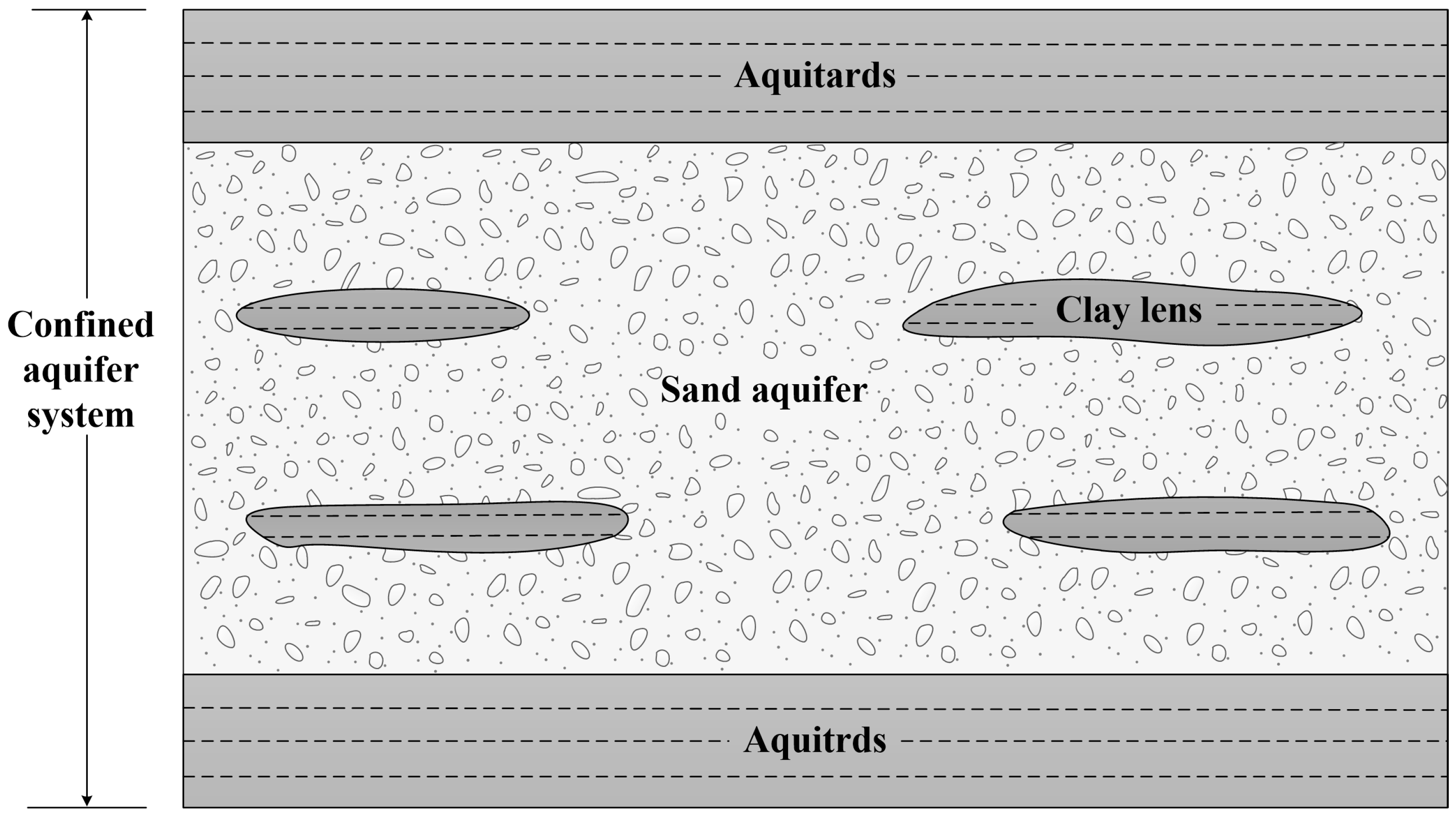
2.1. Study Area

Hengshui, located in the central NCP (Figure 1), is a highly productive agricultural area. The agricultural water accounts for ~80% of the total water consumption [17]. The agricultural irrigation heavily depends on groundwater resources, which provide ~85% of the total agricultural demand for water [18]. The aquifer system consists of unconsolidated Quaternary sediments (0 to 600 m) of alluvial fans and floodplain. There is a saline unconfined aquifer layer (40 m in the west to 120 m in the east) overlying the confined aquifer layers [7]. Therefore, more than 65% of groundwater is pumped from the confined aquifer system [18]. The exploitation of confined groundwater led to a substantial decline of the hydraulic head by ~127 m during the period from 1970 to 2016 [19], which in turn resulted in severe GWS depletion and land subsidence [3]. Moreover, since the primary recharge process for confined aquifers is leakage from the overlying unconfined aquifers, the interface between saline and fresh water in the unconfined aquifer has dropped by 12 m due to the hydraulic head decline since the 1970s [1]. To deal with the rising groundwater crisis, the government implemented the policy of groundwater pumping restrictions in 2014. Its purpose is to balance the recharge and discharge of groundwater by increasing the surface water supply and decreasing groundwater exploitation.

2.2. Datasets Used in the Study

A total of 46 descending Envisat/ASAR images collected during 2003~2010 and 142 ascending Sentinel-1A images collected during 2015~2020 are employed to estimate the surface displacements in the radar line of sight (LOS) across Hengshui. Monthly hydraulic head measurements in the confined aquifer system at 24 wells (white boxes in Figure 1) during 2000~2017 were collected to estimate the aquifer parameters and the GWS variations. Additionally, the average hydraulic heads across Hengshui in December from 2018~2020 are also collected. Daily precipitation observations from 1975 to 2020 at 29 meteorological stations located in Hengshui and the surrounding area are used to analyze the relationships between the GWS variations in confined aquifer systems and precipitation. The parameters and purpose of the used datasets are summarized in Table 1. Interventional studies involving animals or humans, and other studies that require ethical approval, must list the authority that provided approval and the corresponding ethical approval code.

3. Methods

This study aims to quantify the contributions of climate variability and anthropogenic activities to the GWS variations in confined aquifer systems over Hengshui. The major steps include (1) deriving the land deformation using Envisat/ASAR and Sentinel-1A data, (2) estimating the aquifer parameters and GWS variations (including the recoverable and irreversible parts) in confined aquifer systems using the land deformation and the head data, (3) quantifying the climatic and anthropogenic contribution to the GWS variations based on its linear relationship with precipitation. The key process steps will be presented in the following subsections.

3.1. Multi-Temporal InSAR Analysis and Seasonal Signal Extraction

To obtain the land deformation across Hengshui, we apply the InSAR time series analysis with Envisat/ASAR during 2003~2010 and Sentinel-1A images during 2015~2020 using the StaMPS method [20,21,22]. Assuming horizontal deformation is negligible, the InSAR results in LOS are converted to displacements in the vertical direction using the incidence angles. The seasonal deformation represents a near-synchronous, elastic response to the seasonal hydraulic head change [23]. To characterize the response of deformation to head change and calculate the skeletal storativity, we need to extract the seasonal displacements and seasonal head changes. We first fit and remove a linear trend from the InSAR displacement and head time series. Then, the seasonal signals are isolated from the de-trended displacement and head time series by fitting a sinusoidal model.
H t = A c o s 2 π T t t 0
where   H t is the de-trend InSAR displacement or head time series, A and t 0 are the amplitude and phase of the seasonal signals, T is the period, t is time.

3.2. Estimation of the GWS Variations in Confined Aquifer Systems

In a confined aquifer system, the GWS variations are approximately equivalent to the cumulative land deformation volume, and they can be divided into recoverable GWS variations caused by elastic skeletal compaction and expansion and irreversible GWS variations caused by inelastic skeletal compaction. We estimate the GWS variations in confined aquifer systems following the methods presented in our previous work [2]. This method is briefly introduced below.
The annual GWS variations (∆V) in confined aquifer systems can be estimated with the InSAR deformation results:
V = i = 1 N b i × A
where b i is the annual deformation for the ith pixel, A is the area of pixel, and N is the number of pixels. To reduce the influence of noise, we assume that the deformation is linear in each year, and the annual deformation is calculated using the linear rate for each year.
The recoverable GWS variations ( V r ) are caused by the elastic skeletal compaction and can be restored when the head returns to the original level. The recoverable GWS variations can be calculated:
V r = i = 1 N S k e × h i × A
where h i is the annual hydraulic head change for the ith pixel, S k e is the elastic skeletal storativity, indicating the water release capacity of a confined aquifer system due to the elastic skeletal compaction, which is defined as the amount of water yield in a unit area of a confined aquifer system as the hydraulic head decreases by one unit [24,25]. The elastic skeletal storativity can be calculated with seasonal deformation ( b s ) and head change ( h s ) [26,27]:
S k e = b s h s
The irreversible GWS depletion ( V i ) caused by the inelastic skeletal compaction when head drops below the pre-consolidation head, which is permanent, can be estimated by subtracting the recoverable component from the GWS variations in confined aquifer systems:
V i = V V r
Since the InSAR deformation results, well-head, and elastic skeletal storativity are discrete, we interpolate these datasets to maps with a cell resolution of 500 m using an inverse distance weighted (IDW) method when estimating the GWS depletion.

3.3. Relationship between Precipitation and GWS Variations in Confined Aquifer Systems

A confined aquifer system is composed of thick clay roof and floor, sand aquifer and clay lens between them (Figure 2). The precipitation recharge for the confined aquifer system needs to pass through the shallow, unconfined aquifers and thick clay aquitards, resulting in a long travel time (i.e., lag of centuries) [28]. Therefore, the influence of precipitation recharge on a confined aquifer system is negligible. Moreover, due to the overlying unconfined aquifers and thick clay aquitards, the influences of air temperature and evapotranspiration on confined aquifer systems are also ignorable [29]. The GWS variation in a confined aquifer system is driven by groundwater exploitation, which is used to meet the demand of agricultural, industrial and domestic sectors. The groundwater pumping for irrigation is controlled by the crop sown area, crop species and precipitation. The average sown area of farm crops in Hengshui is ~8.5 × 10⁵ hectares during 2007~2020. Winter wheat and summer maize are the main crops, accounting for ~80% of total sown area and ~98% of grain yield. The fluctuation of sown area in specific years compared with the average sown area is less than 5% during 2007~2020 [30], suggesting that the agriculture water demand in each year is roughly constant. Agricultural water mainly relies on rainwater and pumping groundwater. The amount of groundwater pumping for irrigation under the level of average precipitation during the irrigation period over a long-term period (1975~2020 in this study) is assumed to be constant. The precipitation change due to climate variability will significantly impact the groundwater pumping for irrigation. Therefore, we regard the precipitation-influenced pumping (fluctuation part of the total groundwater pumping for irrigation) as the climate-driven influence on GWS variations in confined aquifer systems. Removing the precipitation-driven contribution, the pumping due to industry, domestic usage, and the agricultural demand under the level of average precipitation during the irrigation period from 1975 to about 2020 is considered as the anthropogenic-driven influence.
The rate of precipitation is the most important factor controlling the rate of groundwater pumping for irrigation, which has an immediate influence on the confined groundwater. This causes a near-synchronous response of the GWS levels in confined aquifer systems to precipitation changes in irrigated areas [11]. Most of the groundwater pumping is applied for winter wheat and spring maize during the irrigation period (from March to July). The rapid groundwater extraction leads to the lowest hydraulic head in June or July (Figure 4b). On the other hand, most of annual precipitation falls in the following monsoon season, leading to head recovery. Generally, the hydraulic head continues rising and reaches its highest level from December to March of the following year (Figure 4b). Therefore, the accumulated precipitation during the irrigation period may be a more relevant measure than the annual precipitation for investigating the relationships between precipitation and GWS variations in confined aquifer systems. The correlation coefficients between annual GWS variations (January to December) and the accumulated precipitation during the irrigation period (March to July) and the annual precipitation (January to December) across Hengshui, respectively, are calculated. The results show that the GWS variations in a given year have higher correlations with the accumulated precipitation during the irrigation period than with the total annual precipitation (0.73 vs. 0.53, see right panel in Figure 7a and Figure S1a in the Supplementary Material). Moreover, the correlation between the GWS variations and the annual precipitation fails to pass a statistical significance test (Student’s t-test, significance level of 0.05), indicating that no significant correlation exists between them. This result supports our assumption above.
To quantify the influence of precipitation changes on the annual GWS variations in confined aquifer systems ( V ), a linear relationship is used [9]:
V   = a p p 0 + b
where a is the ratio of the GWS variations in confined aquifer systems and precipitation changes, representing the influence of precipitation on GWS variations, b is constant, representing the average annual GWS variations without the influence of precipitation, p is the accumulated precipitation during the irrigation period (from March to July) every year (in mm), and p 0 is the region-average accumulated precipitation during the irrigation period from 1975 to 2020 (in mm). When p is larger than p 0 , the climate-driven effect on the GWS variations is positive, resulting in GWS increase. In the case that p is smaller than p 0 , the influence of climate variability is negative, leading to GWS depletion. If p is equal to p 0 , the climate-driven influence is zero.
The parameters (a, b) can be obtained in a least squares sense. Then, the climate-driven GWS variations in the ith year ( V c i ) can be estimated:
V c i   = a p i p 0
where p i is the precipitation amount during the irrigation period in the ith year. The anthropogenic-driven GWS variations ( V a i ) can be calculated by subtracting the climate-driven part from the GWS variation in the ith year ( V i ):
V a i   = V i V c i  
To further describe the contributions of climate variability and anthropogenic activities to the GWS variations, a cluster index can be used:
ρ c = V c   V c   + V a   × 100 % ρ a = V a   V c   + V a   × 100 %
where ρ c and ρ a are the contribution rates of climate variability and anthropogenic activities to the GWS variations in confined aquifer systems, respectively. Note that a positive value of ρ indicates the positive influence on GWS, and vice versa.

4. Results

4.1. Land Deformation in Hengshui

We obtain the line-of-sight (LOS) surface displacement results using the Envisat/ASAR and Sentinel-1 datasets. The measured surface displacements in LOS are converted to vertical motions based on the incident angle, assuming the horizontal contribution is negligible. The vertical displacement rate maps reveal that Hengshui experienced severe subsidence at an increasing rate during the study period (Figure 3a,b). During 2003–2010, the zones of rapid subsidence were mainly distributed across the northern and eastern parts of the study area with maximum subsidence rates of ~10 cm/year/year. The linear distribution pattern of the stable zone can be easily found in the northwestern part of Hengshui. A similar phenomenon has been reported by a previous study in the NCP [2], suggesting that it is related to the distribution of paleochannel. During 2015–2020, the extent and rate of subsidence substantially increased, and the maximum subsidence rates reached up to more than 20 cm/year. This strongly enhanced subsidence is likely due to the accelerated decline in hydraulic head across the area. The mean head decline rate over Hengshui increased from 0.87 m/year during 2003–2010 to 1.35 m/year during 2015–2020 (Figure 3c).
Figure 3. Vertical displacement rate maps over Hengshui during (a) 2003–2010 and (b) 2015–2020. Head observation wells are shown with white squares. The black outline marks the extent of Hengshui. (c) Time series of the average hydraulic head across Hengshui in December from 2000 to 2020. The error bars show the standard deviations of average heads estimated using head observations at 24 well locations during 2000~2017. Since head data collected during 2018~2020 are region-average values, the standard deviations are not given.
Remotesensing 15 04827 g003
Given the long-term drop in the head since the 1970s, water levels are well below the preconsolidation head level, and the deformation is dominated by the inelastic deformation in aquitards. To further analyze the relationship between the head drop and land subsidence, the time series of head change at observation well D9 (location shown in Figure 3a) and mean displacements of pixels around the well location are compared. The trends of deformation and head change agree well with each other during both periods (Figure 4a,b), and the faster head decline during the latter period (−0.95 m/year vs. −1.55 m/year) consistently results in a higher subsidence rate (−55.3 mm/year vs. −80.7 mm/year). In addition to the inelastic deformation, the head changes also lead to elastic deformation. From Figure 4c, we can see that the seasonal fluctuation in the head of ±~10 m leads to seasonal elastic deformation of ±~40 mm. Note that a time delay of ~1 month between the detrended deformation and detrended head change is found. This is likely caused by the delayed drainage from aquitards since the head in aquitards needs more time to equilibrate with surrounding aquifers due to the low vertical hydraulic conductivity in aquitards [2].
Figure 4. (a) Mean displacement time series (grey triangles) for pixels within 500 m radius around well D9 (location is shown in Figure 3) during 2003–2010 and 2015–2020, and their linear trends (dashed black lines). (b) Hydraulic head changes during 2000–2020 at well D9. (c) Comparison between de-trended displacements and de-trended head changes.
Remotesensing 15 04827 g004

4.2. Elastic Skeletal Storativity

We collected the head observations at 24 wells from 2000 to 2017 for the estimation of elastic skeletal storativity. Since the temporal sampling of ASAR data before 2007 is sparse, only the deformation results derived by ASAR during 2007–2010 and Sentinel-1A during 2015–2017 are used to extract the seasonal signals to calculate the elastic skeletal storativity. To investigate the period of the seasonal signal, a fast Fourier transform (FFT) algorithm is applied [31]. Results indicate that the seasonal head change and consequent deformation are dominated by one-year cycles (Figure 5). Therefore, we isolate the seasonal signals from the de-trended deformation and head time series using a sinusoidal model with a one-year period.
Then, the elastic skeletal storativity is estimated using the isolated seasonal deformation and seasonal head change according to Equation (4). Figure 6 shows the S k e values derived from the two independent deformation results. Both results suggest that the S k e increases from south to north. Some differences exist: the values of S k e range from 0.39 × 10⁻³ to 4.45 × 10⁻³ (2007–2010 ASAR deformation) and from 0.56 × 10⁻³ to 6.69 × 10⁻³ (2015–2017 Sentinel-1A deformation), respectively. Overall, the two results are in good agreement except for a limited number of wells for which the correlations between the de-trended ASAR displacements and head time series are low. We compare the values of S k e at wells with high correlations between the de-trended displacement and head time series (>0.6). The mean values of S k e during 2007–2010 are slightly greater than those during 2015–2017, with an average difference of 16.5% (Figure 6c). These differences in S k e can likely be attributed to the improved temporal sampling of the Sentinel-1A data, which can more finely characterize the seasonal displacement and the net aquifer compaction due to the ~10 m head decline from the former period to the latter period [32]. The more reliable estimates of S k e from the Sentinel-1A observations are used to further estimate the recoverable GWS variations in this study.

4.3. Spatial and Temporal Patterns of GWS Variations in Confined Aquifer Systems

The ASAR data cannot cover the whole study; thus, we estimate the GWS variations in confined aquifer systems across the coverage of ASAR images by combining InSAR-derived deformation with hydraulic head observations and our estimates of elastic skeletal storativity. Since the ASAR images are too scarce to obtain reliable estimates of the annual GWS variations in 2003, 2005, and 2006, we only use them to estimate the annual GWS variations (January to December) in 2004, 2007, 2008, 2009, and 2010. For convenience, we refer to the GWS variations during 2004–2010 as those obtained from these 5 years. The results (left and middle panels in Figure 7a) indicate that the GWS in confined aquifer systems across Hengshui decreased markedly during 2004–2020 at a mean annual rate of −0.46 ± 0.04 km3/year. The total amount of GWS loss is −1.49 ± 0.18 km3 during 2004–2010, with a mean annual rate of −0.30 ± 0.04 km3/year. This result agrees well with the value of −0.29 km3/year reported in the previous literature [18] based on water statistical results of the Hengshui Hydrology and Water Resources Survey Bureau. Due to the accelerated head declines, the average annual GWS loss rate more than doubled to −0.62 ± 0.06 km3/year during 2016–2020, and the cumulative GWS change during this period reached −3.10 ± 0.30 km3. The minimum and maximum one-year GWS depletions are −0.05 ± 0.04 km3 in 2008 and −0.84 ± 0.17 km3 in 2019, which is consistent with the corresponding precipitation changes (see next section).
Figure 7. The spatial distribution of average annual (January to December) (a) GWS variations (left) during 2004–2010 and (middle) during 2016–2020, (b) recoverable GWS variations, and (c) irreversible GWS variations (left) during 2004–2010, and (middle) during 2016–2017 in Hengshui. All variations are expressed in equivalent water thickness (EWT), and GWS can be estimated by integrating EWT across the area. The linear relationships between the GWS variations in confined aquifer systems and precipitation (defined as the region-average accumulated precipitation during the irrigation period, i.e., March to July) are shown in the right panels.
Remotesensing 15 04827 g007
Since the head observations during 2018–2020 are not available, we only estimate the recoverable and irreversible GWS variations during 2004–2010 and 2016–2017. The recoverable GWS shows a slight depletion with a mean annual reduction of −0.02 ± 0.02 km3/year during 2004–2010, resulting in a cumulative depletion of −0.11 ± 0.08 km3 (left panel in Figure 7b). However, the recoverable GWS increased by 0.04 ± 0.05 km3 at a rate of 0.02 ± 0.02 km3/year during 2016–2017 (middle panel in Figure 7b). The small values of cumulative recoverable GWS variations are caused by the fact that the annual recoverable GWS variation changes greatly from year to year, showing positive and negative values alternately (Table 2). The average annual irreversible GWS variations show similar spatial patterns and temporal trends with the average total annual GWS variations (left and middle panels in Figure 7c). The cumulative irreversible GWS depletion is −1.37 ± 0.20 km3 with an average annual value of −0.28 ± 0.04 km3/year during 2004–2010. The depletion rate increased to −0.59 ± 0.05 km3/year during 2016–2017, and the cumulative irreversible GWS depletion during this period reached up to −1.18 ± 0.10 km3.

4.4. Spatial and Temporal Patterns of GWS Variations in Confined Aquifer Systems

Because of the strong correlation between the GWS variations in confined aquifer systems and precipitation during the corresponding year’s irrigation period (right panel in Figure 7a), we estimate the climate and anthropogenic-driven GWS variations with a linear relationship model (see Section 3.3). The annual water pumping and, thus, GWS variations are sensitive to precipitation changes. A 1 mm decrease in precipitation during irrigation will lead to an annual GWS depletion of −2.8 × 10⁻³ km3 due to increased pumping (right panel in Figure 7a). The cumulative GWS change in the Hengshui basin caused by climate variability and anthropogenic activities are −0.31 ± 0.1 km3 and −4.28 ± 0.40 km3 during 2004–2020, accounting for 6.7% and 93.3% of the total amount, respectively. To analyze the temporal variability of anthropogenic-driven GWS variations, we determine the annual anthropogenic-driven GWS depletion during the study period (Figure 8a). The annual anthropogenic-driven GWS depletion shows an accelerating trend at 0.025 ± 0.005 km3/year2. This documents that the annual groundwater demand from human activities continues to rise during the study period.
The correlation between the annual recoverable GWS variation and precipitation does not pass the significance test (right panel in Figure 7b), suggesting no significant correlation exists between them. This phenomenon will be discussed in more detail in the discussion. The highest correlation (0.79, p < 0.05) is observed between the annual irreversible GWS variation and precipitation (right panel in Figure 7c). A 1 mm decline in precipitation during the irrigation period results in irreversible GWS loss by 2.9 × 10⁻³ km3. The climate-driven and anthropogenic-driven irreversible GWS depletions are −0.15 ± 0.05 km3 and −2.40 ± 0.70 km3 during the study period, accounting for 5.9% and 94.1% of the total amount, respectively. Additionally, the annual anthropogenic-driven irreversible GWS depletion is accelerating at 0.027 ± 0.005 km3/year2 during the study period (Figure 8b).

4.5. Climatic and Anthropogenic Contribution Rates to the GWS Variations

To further quantify the contributions of climate variability and anthropogenic activities to the GWS variations in confined aquifer systems, their contribution rates are calculated. Table 3 shows that the contribution rates of climate variability are less than ±45% and show positive and negative values alternately. The anthropogenic activities offer negative contributions to the GWS variations, and the mean contribution rate is −71.9%, indicating that the GWS losses in Hengshui are primarily anthropogenic driven. Additionally, the annual anthropogenic contribution rate shows an increasing trend (Figure 9), and the mean rate increases from −67.3% during the earlier observation period to −76.5% during the latter period. The annual anthropogenic contribution rate to irreversible GWS depletion shows a similar value and temporal variability. These indicate that anthropogenic activities are playing an increasingly important role in the GWS depletion during the study period.

5. Discussion

The recoverable GWS variations have no significant correlation with annual precipitation and precipitation during the irrigation period (Figure S1b and right panel in Figure 7b). Additionally, an exceptional positive anthropogenic contribution rate to the recoverable GWS variations is found in Table 3 (bold texts), which is impossible since the increasing anthropogenic activities only lead to negative contributions to the GWS variations in confined aquifer systems, as mentioned earlier. Both recoverable GWS variations and anthropogenic contribution rate are estimated using the well-head observations. No correlation between recoverable GWS variations and precipitation and anomalous results of anthropogenic contribution rate to the recoverable GWS variations jointly suggest that the sparse well observations (one well per ~350 km2 in this study) cannot correctly characterize the spatiotemporal evolution of the GWS in confined aquifer systems across Hengshui, although the head changes agree well with the GWS variations at specific observation wells (Figure 4). This is most likely caused by the fact that the hydrological structure is complex, and the groundwater pumping varies greatly in space. In addition, it is likely that there is also a contribution from the delayed response of the GWS variations to head changes in confined aquifer systems caused by the low vertical hydraulic conductivity [2].
We further analyze the correlations among head change, precipitation, and GWS variations during 2001–2017. Head change has a moderate correlation (0.59, p < 0.05; Figure 10a) with the annual precipitation but has no significant correlation with precipitation during the irrigation period (0.37, p > 0.05; Figure 10b) and GWS variations (0.40, p > 0.05; Figure 10d). In contrast, the GWS variations show a strong correlation with precipitation during the irrigation period (0.87, p < 0.05; Figure 10c). The results support the inference above.
Previous studies have used the well observations to investigate the GWS variations [5,11,33] and validate the GRACE results [9,34] over the basin-wide aquifer system. However, our results indicate the limitation of using the well observations with poor spatial sampling to characterize the GWS variations. InSAR can directly detect the GWS variations in confined aquifer systems with high spatial sampling density. As noted in Section 4.3, the estimated GWS variations using InSAR results show good consistency with the water statistical results of Hengshui Hydrology and Water Resources Survey Bureau, indicating the InSAR results can be used for GWS variations in confined aquifer systems estimation. Integration well observations with InSAR measurements can improve the understanding of the response of confined aquifer systems to head change and enhance the spatiotemporal characterization of the GWS. Additionally, combining with other datasets, such as GRACE and GLDAS (Global Land Data Assimilation System), it is promising for isolating the GWS variations in the unconfined aquifer system, which is much more affected by climate variability (e.g., precipitation change and evapotranspiration).

6. Conclusions

In this study, we obtain the InSAR deformation in Hengshui, using the Envisat/ASAR datasets during 2003–2010 and Sentinel-1A datasets during 2015–2020. The study area is dominated by subsidence with increasing subsidence rates, which is consistent with the head changes. Then, two independent groups of elastic skeletal storativity are estimated by combining the head observations with 2007–2010 ASAR deformation and 2015–2017 Sentinel-1A deformation, respectively, which show good consistency.
We estimate the spatiotemporal GWS variations in confined aquifer systems. The results indicate that the GWS depletion in confined aquifer systems was 4.59 ± 0.35 km3 during the study period and showed an accelerating trend due to increasing groundwater demand from human activities. The GWS variations show a strong correlation with precipitation during the irrigation period (March to July), suggesting that the precipitation during the irrigation period, rather than annual precipitation, is the key climate factor influencing the GWS variations in a confined aquifer system. This can offer new insights for investigating the response of confined aquifer systems to climate changes in irrigated areas. Therefore, a linear relationship model is used to separate the climate and anthropogenic-driven GWS variations. The GWS variations caused by climate variability and anthropogenic activities were −0.31 ± 0.10 km3 and −4.28 ± 0.40 km3 during the study period, respectively. Furthermore, the mean contribution rate of anthropogenic activities to the GWS variations was −71.9%, suggesting that the GWS variations in Hengshui were primarily anthropogenic driven. No significant correlation is observed between the GWS variations and head changes. This implies that it is hard to correctly characterize the spatiotemporal evolution of the GWS variations in confined aquifer systems only with the sparse well observations, although the well observations have been frequently used to investigate the GWS variations and validate the GRACE results in previous studies.
Since there are large gaps in the datasets (e.g., SAR data during 2011–2015, head observations during 2018–2020) in this study, the contributions of climate and anthropogenic activities to GWS variations were estimated using datasets during two independent study periods. In the future, we will collect more acquisitions of SAR images (e.g., RADARSAT-2 during 2011–2015) and well head observations during 2018–2020 to further investigate the relationships between the GWS variations and climate variability and anthropogenic activities.
InSAR can provide direct observations of the GWS variations in confined aquifer systems with high point density (~100 PS points per km2 in this study) and short temporal intervals (as low as 6 days for Sentinel-1A/B). These advantages make InSAR an effective tool for groundwater resource management. Integration of InSAR results with well-head and precipitation observations allows us to quantify the climatic and anthropogenic contributions to the GWS variations. Our methods can also be utilized to enhance the understanding of the climate and anthropogenic influences on the GWS variations in other areas facing groundwater crisis, such as northern India and the Central Valley of California.

Supplementary Materials

The following supporting information can be downloaded at: https://www.mdpi.com/article/10.3390/rs15194827/s1, Figure S1: Relationships between (a) GWS variations, (b) Recoverable GWS variations and annual precipitation.

Author Contributions

Conceptualization, L.B., Z.L. and R.B.; methodology, L.B.; software, L.B.; validation, L.B. and R.B.; formal analysis, L.B., Z.L. and R.B.; investigation, L.B. and R.B.; resources, Y.Z. and G.C.; data curation, L.B.; writing—original draft preparation, L.B.; writing—review and editing, Z.L., R.B., L.J., C.Z., Q.Z. and J.P.; visualization, L.B. and R.B.; supervision, Z.L. and L.J.; project administration, Z.L.; funding acquisition, L.B. and Z.L. All authors have read and agreed to the published version of the manuscript.

Funding

This work was funded by the National Natural Science Foundation of China (Ref. 42004005). Part of this work was also supported by the Shaanxi Province Science and Technology Innovation Team (Ref. 2021TD-51), the Shaanxi Province Geoscience Big Data and Geohazard Prevention Innovation Team (2022), the Natural Science Basic Research Program of Shaanxi (Ref. 2020JQ-357), and the Fundamental Research Funds for the Central Universities, CHD (Refs. 300102262205 and 300102262902).

Data Availability Statement

The Envisat/ASAR data are freely available at https://esar-ds.eo.esa.int/oads/access/collection/ (accessed on 17 August 2023). The Sentinel-1A data are freely available at https://scihub.copernicus.eu/dhus/#/home (accessed on 17 August 2023).

Acknowledgments

The authors want to thank ESA for providing the Envisat/ASAR data (projects: Dragon-4 32388 and 32244, Dragon-5 59339, and Data Service Request 37777) and Sentinel-1A data. We also thank Hooper at the University of Leeds for providing the StaMPS software.

Conflicts of Interest

The authors declare no conflict of interest.

References

  1. Zhang, Z.; Fei, Y.; Chen, Z.; Zhao, Z.; Xie, Z.; Wang, Y.; Miao, J.; Yang, L.; Shao, J.; Jin, M.; et al. Investigation and Assessment of Sustainable Utilization of Groundwater Resources in the North China Plain; Geological Publishing House: Beijing, China, 2009. (In Chinese) [Google Scholar]
  2. Jiang, L.; Bai, L.; Zhao, Y.; Cao, G.; Wang, H.; Sun, Q. Combining InSAR and hydraulic head measurements to estimate aquifer parameters and storage variations of confined aquifer system in Cangzhou, North China Plain. Water Resour. Res. 2018, 54, 8234–8252. [Google Scholar] [CrossRef]
  3. Feng, W.; Zhong, M.; Lemoine, J.M.; Biancale, R.; Hsu, H.T.; Xia, J. Evaluation of groundwater depletion in North China using the Gravity Recovery and Climate Experiment (GRACE) data and ground-based measurements. Water Resour. Res. 2013, 49, 2110–2118. [Google Scholar] [CrossRef]
  4. Taylor, R.G.; Scanlon, B.; Döll, P.; Rodell, M.; Van Beek, R.; Wada, Y.; Longuevergne, L.; Leblanc, M.; Famiglietti, J.S.; Edmunds, M.; et al. Ground water and climate change. Nature Clim. Chang. 2013, 3, 322–329. [Google Scholar] [CrossRef]
  5. Asoka, A.; Gleeson, T.; Wada, Y.; Mishra, V. Relative contribution of monsoon precipitation and pumping to changes in groundwater storage in India. Nat. Geosci. 2017, 10, 109–117. [Google Scholar] [CrossRef]
  6. Zhou, D. Spatio-Temporal Changes and the Cause Analysis of Meteorological Drought in North China from 1961 to 2013. Master’s Thesis, Northwest Normal University, Lanzhou, China, 2015. (In Chinese). [Google Scholar]
  7. Hebei Bureau of Geology and Mineral Resources Exploration. Investigation Report of Groundwater Resources Assessment and Rational Development & Utilization in Hebei Plain (Heilonggang Area); Hebei Bureau of Geology and Mineral Resources Exploration: Shijiazhuang, China, 1977. [Google Scholar]
  8. Xie, J.; Xu, Y.; Wang, Y.; Gu, H.; Wang, F.; Pan, S. Influences of climatic variability and human activities on terrestrial water storage variations across the yellow river basin in the recent decade. J. Hydrol. 2019, 579, 124218. [Google Scholar] [CrossRef]
  9. Yi, S.; Sun, W.; Feng, W.; Chen, J. Anthropogenic and climate-driven water depletion in Asia. Geophys. Res. Lett. 2016, 43, 9061–9069. [Google Scholar] [CrossRef]
  10. Larochelle, S.; Chanard, K.; Fleitout, L.; Fortin, J.; Gualandi, A.; Longuevergne, L.; Rebischung, P.; Violette, S.; Sophie, A.J. Understanding the geodetic signature of large aquifer systems: Example of the Ozark Plateaus in Central United States. J. Geophys. Res. Solid Earth 2022, 127, e2021JB023097. [Google Scholar] [CrossRef]
  11. Russo, T.A.; Lall, U. Depletion and response of deep groundwater to climate-induced pumping variability. Nat. Geosci. 2017, 10, 105–108. [Google Scholar] [CrossRef]
  12. Hooper, A.; Bekaert, D.; Spaans, K.; Arıkan, M. Recent advances in SAR interferometry time series analysis for measuring crustal deformation. Tectonophysics 2012, 514, 1–13. [Google Scholar] [CrossRef]
  13. Chaussard, E.; Milillo, P.; Bürgmann, R.; Perissin, D.; Fielding, E.J.; Baker, B. Remote sensing of ground deformation for monitoring groundwater management practices: Application to the Santa Clara Valley during the 2012-2015 California drought. J. Geophys. Res. Solid Earth 2017, 122, 8566–8582. [Google Scholar] [CrossRef]
  14. Ojha, C.; Shirzaei, M.; Werth, S.; Argus, D.F.; Farr, T.G. Sustained groundwater loss in California’s Central Valley exacerbated by intense drought periods. Water Resour. Res. 2018, 54, 4449–4460. [Google Scholar] [CrossRef] [PubMed]
  15. Smith, R.G.; Knight, R.; Chen, J.; Reeves, J.A.; Zebker, H.A.; Farr, T.; Liu, Z. Estimating the permanent loss of groundwater storage in the southern San Joaquin Valley, California. Water Resour. Res. 2017, 53, 2133–2148. [Google Scholar] [CrossRef]
  16. Smith, R.G.; Majumdar, S. Groundwater storage loss associated with land subsidence in Western United States mapped using machine learning. Water Resour. Res. 2020, 56, e2019WR026621. [Google Scholar] [CrossRef]
  17. Department of Water Resources of Hebei Province. Hebei Water Resources Bulletin; Department of Water Resources of Hebei Province: Shijiazhuang, China, 2020.
  18. Zhang, J.; Zhang, X. Analysis on the Characteristics of Deep Groundwater Exploitation and Its Influence on Environment in HengShui City. Water Conserv. Sci. Technol. Econ. 2016, 22, 86–91. (In Chinese) [Google Scholar]
  19. Hebei Provincial Department of Land and Resources. Bulletin of Geological Environment of Hebei Province; Hebei Provincial Department of Land and Resources: Shijiazhuang, China, 2016.
  20. Hooper, A. A multi-temporal InSAR method incorporating both persistent scatterer and small baseline approaches. Geophys. Res. Lett. 2008, 35, 16. [Google Scholar] [CrossRef]
  21. Hooper, A.; Segall, P.; Zebker, H. Persistent scatterer interferometric synthetic aperture radar for crustal deformation analysis, with application to Volcán Alcedo, Galápagos. J. Geophys. Res. Solid Earth 2007, 112, B07407. [Google Scholar] [CrossRef]
  22. Hooper, A.; Zebker, H.; Segall, P.; Kampes, B. A new method for measuring deformation on volcanoes and other natural terrains using InSAR persistent scatterers. Geophys. Res. Lett. 2004, 31, L23611. [Google Scholar] [CrossRef]
  23. Hu, X.; Lu, Z.; Wang, T. Characterization of hydrogeological properties in Salt Lake Valley, Utah, using InSAR. J. Geophys. Res. Earth Surf. 2018, 123, 1257–1271. [Google Scholar] [CrossRef]
  24. Chaussard, E.; Bürgmann, R.; Shirzaei, M.; Fielding, E.; Baker, B. Predictability of hydraulic head changes and characterization of aquifer-system and fault properties from InSAR-derived ground deformation. J. Geophys. Res. Solid Earth 2014, 119, 6572–6590. [Google Scholar] [CrossRef]
  25. Hoffmann, J.; Galloway, D.L.; Zebker, H.A. Inverse modeling of interbed storage parameters using land subsidence observations, Antelope Valley, California. Water Resour. Res. 2003, 39, 1031. [Google Scholar] [CrossRef]
  26. Bai, L.; Jiang, L.; Zhao, Y.; Li, Z.; Cao, G.; Zhao, C.; Liu, R.; Wang, H. Quantifying the influence of long-term overexploitation on deep groundwater resources across Cangzhou in the North China Plain using InSAR measurements. J. Hydrol. 2022, 605, 127368. [Google Scholar] [CrossRef]
  27. Miller, M.M.; Shirzaei, M. Spatiotemporal characterization of land subsidence and uplift in Phoenix using InSAR time series and wavelet transforms. J. Geophys. Res. Solid Earth 2015, 120, 5822–5842. [Google Scholar] [CrossRef]
  28. Zhang, G.; Wang, J. Mechanism of confined groundwater recharge and release in the Middle-East Plain of Haihe River basin. Hydrology 2002, 22, 5–9. (In Chinese) [Google Scholar]
  29. Chen, Z.; Gao, H.; Wei, W.; Chen, J.; Zhang, F.; Wang, Y. Groundwater Renewal and Characteristics in the deep confined aquifer in North China Plain. Resour. Sci. 2009, 31, 388–393. (In Chinese) [Google Scholar]
  30. Hebei Provincial Bureau of Statistics. Hebei Statistical Yearbook; Hebei Provincial Bureau of Statistics: Shijiazhuang, China, 2021. [Google Scholar]
  31. Frigo, M.; Johnson, S.G. FFTW: An Adaptive Software Architecture for the FFT. In Proceedings of the 1998 IEEE International Conference on Acoustics, Speech and Signal Processing, Seattle, WA, USA, 15 May 1998; Volume 3, pp. 1381–1384. [Google Scholar] [CrossRef]
  32. Liu, R.; Cao, G.; Zhao, Y.; Lu, C.; Sun, Q.; Yan, L.; Peng, P. A study of the influence of land subsidence on hydraulic parameters and water supply capacity. Hydrogeol. Eng. Geol. 2019, 46, 47–54. (In Chinese) [Google Scholar] [CrossRef]
  33. Zhang, C.; Duan, Q.; Yeh, P.J.F.; Pan, Y.; Gong, H.; Moradkhani, H.; Gong, W.; Lei, X.; Liao, W.; Xu, L.; et al. Sub-regional groundwater storage recovery in North China Plain after the South-to-North water diversion project. J. Hydrol. 2021, 597, 126156. [Google Scholar] [CrossRef]
  34. Wang, H.; Jia, L.; Steffen, H.; Wu, P.; Jiang, L.; Hsu, H.; Xiang, L.; Wang, Z.; Hu, B. Increased water storage in North America and Scandinavia from GRACE gravity data. Nat. Geosci. 2013, 6, 38–42. [Google Scholar] [CrossRef]
Figure 1. Map of study area in the NCP. The brown line shows the boundary of the NCP. The gray line highlights the extent of Hengshui. Observation wells are shown with white squares, and meteorological stations are shown with blue circles. The red and purple rectangles mark the coverage of Envisat/ASAR and Sentinel-1A SAR datasets.
Remotesensing 15 04827 g001
Figure 2. A concept diagram of a confined aquifer system.
Remotesensing 15 04827 g002
Figure 5. Amplitude spectrum of (a) de-trended head changes and (b) de-trended deformation at well D9.
Remotesensing 15 04827 g005
Figure 6. Interpolated maps of elastic skeletal storativity estimated using (a) ASAR deformation during 2007–2010 and (b) Sentinel-1A deformation during 2015–2017. (c) The difference between the values obtained for the two time periods. The black circles mark the well locations used to estimate the S k e .
Remotesensing 15 04827 g006
Figure 8. Annual anthropogenic-driven (a) GWS variations and (b) irreversible GWS variations. Note that the black line shows the best-fitting linear trend.
Remotesensing 15 04827 g008
Figure 9. Time series of annual anthropogenic contribution rate to (a) GWS and (b) irreversible GWS variations during 2004–2020. The red dashed line shows the best-fitting linear trend. The anthropogenic contribution rate to GWS variations increases by 0.7% per year. The anthropogenic contribution rate to irreversible GWS variations increases by 1.1% per year.
Remotesensing 15 04827 g009
Figure 10. Relationships between region-average head changes and (a) annual precipitation as well as (b) precipitation during the irrigation period. Relationships between the GWS variations and (c) precipitation during the irrigation period, as well as (d) region-average head changes.
Remotesensing 15 04827 g010
Table 1. The parameters and purposes of datasets used in the study.
DataDate RangePurposes
Envisat/ASAR2003~2010Estimating surface displacements and GWS variations in confined aquifer systems.
Sentinel-1A2015~2020
Monthly hydraulic head measurements2000~2017Investigating the response of land deformation to head change and estimating elastic skeletal storativity and the recoverable GWS variations.
Region-average hydraulic heads across Hengshui2018~2020Investigating the response of land deformation to head change.
Daily precipitation observations1975~2020Quantifying the climatic and anthropogenic contribution to GWS variations.
Table 2. Annual GWS variations (km3) over the study area during study period.
DateGWS VariationsRecoverable GWS
Variations
Irreversible GWS
Variations
2004−0.15 ± 0.05−0.06 ± 0.04−0.09 ± 0.06
2007−0.32 ± 0.070.02 ± 0.03−0.34 ± 0.08
2008−0.06 ± 0.040.05 ± 0.04−0.11 ± 0.05
2009−0.36 ± 0.08−0.01 ± 0.03−0.35 ± 0.09
2010−0.61 ± 0.13−0.13 ± 0.05−0.48 ± 0.14
2016−0.38 ± 0.090.04 ± 0.03−0.42 ± 0.09
2017−0.76 ± 0.160.00 ± 0.03−0.76 ± 0.16
2018−0.54 ± 0.11----
2019−0.84 ± 0.17----
2020−0.57 ± 0.12----
Table 3. The contribution rates of climate variability ( ρ c ) and anthropogenic activities ( ρ a ) to the GWS variations in confined aquifer systems during study period. The abnormal positive anthropogenic contribution rates to recoverable GWS variations are marked with bold text.
YearGWS VariationsRecoverable GWS VariationsIrreversible GWS Variations
ρ c (%) ρ a (%) ρ c (%) ρ a (%) ρ c (%) ρ a (%)
200426.2 −73.8 16.4 −83.6 32.7 −67.3
2007−43.8 −56.2 −34.3 65.7−41.1 −58.9
200845.0 −55.0 81.3 18.741.0 −59.0
200910.4 −89.6 41.6 −58.4 10.5 −89.5
2010−38.1 −61.9 −33.3 −66.7 −48.4 −51.6
201614.6 −85.4 37.1 62.913.8 −86.2
2017−29.7 −70.3 −50.1 49.9−30.0 −70.0
201822.2 −77.8 --------
2019−28.9 −71.1 --------
2020−22.1−77.9--------
Disclaimer/Publisher’s Note: The statements, opinions and data contained in all publications are solely those of the individual author(s) and contributor(s) and not of MDPI and/or the editor(s). MDPI and/or the editor(s) disclaim responsibility for any injury to people or property resulting from any ideas, methods, instructions or products referred to in the content.

