Research on Scale Improvement of Geochemical Exploration Based on Remote Sensing Image Fusion
Abstract
:1. Introduction
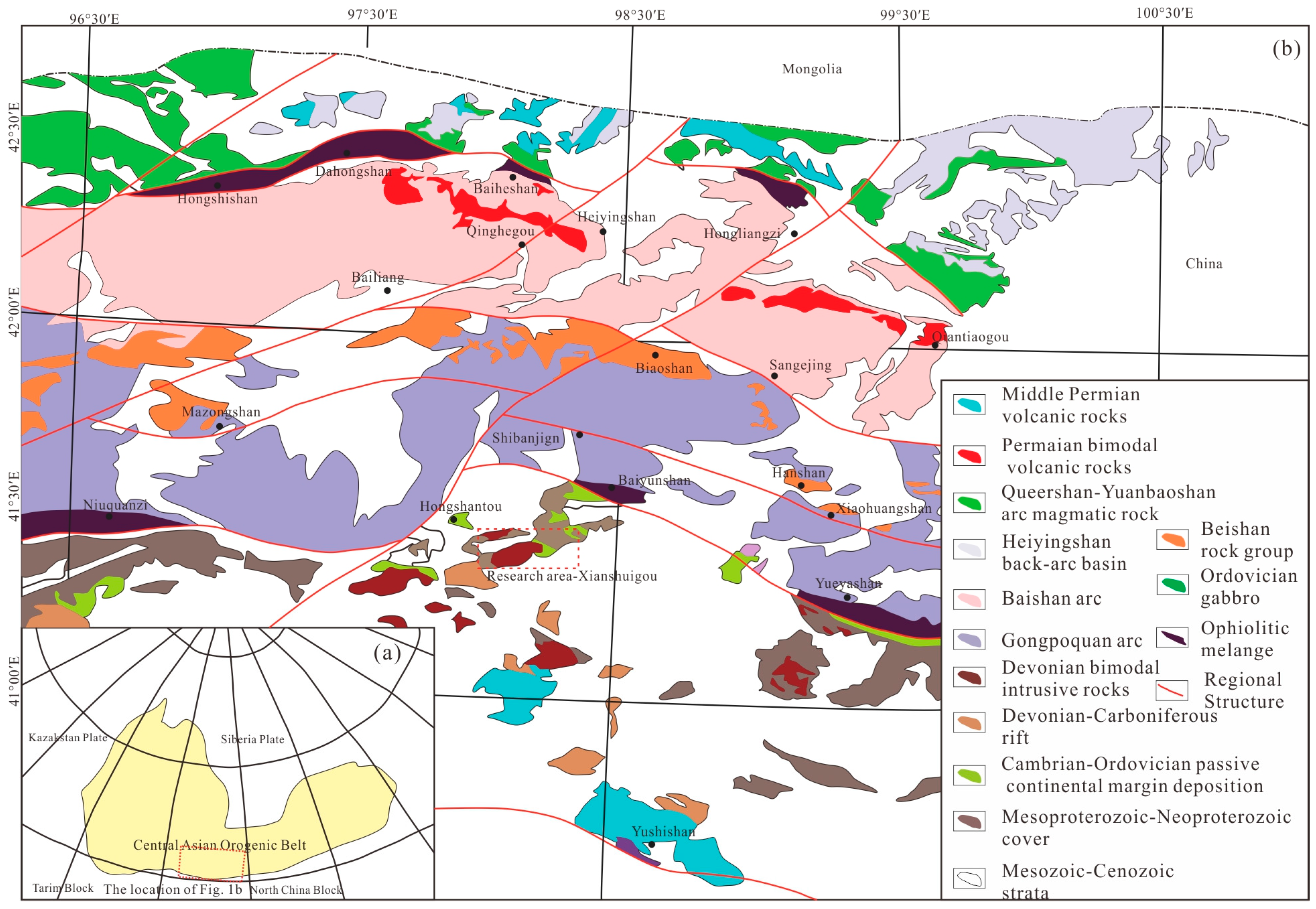
2. Geological Setting
3. Data
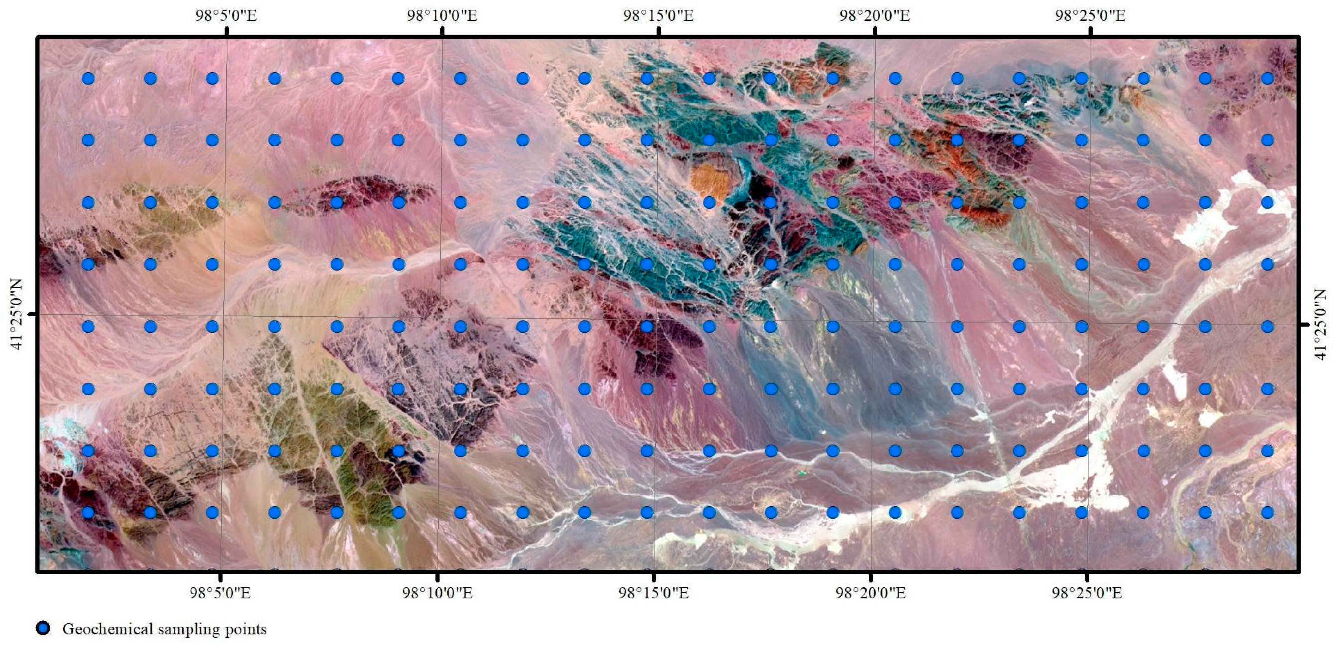
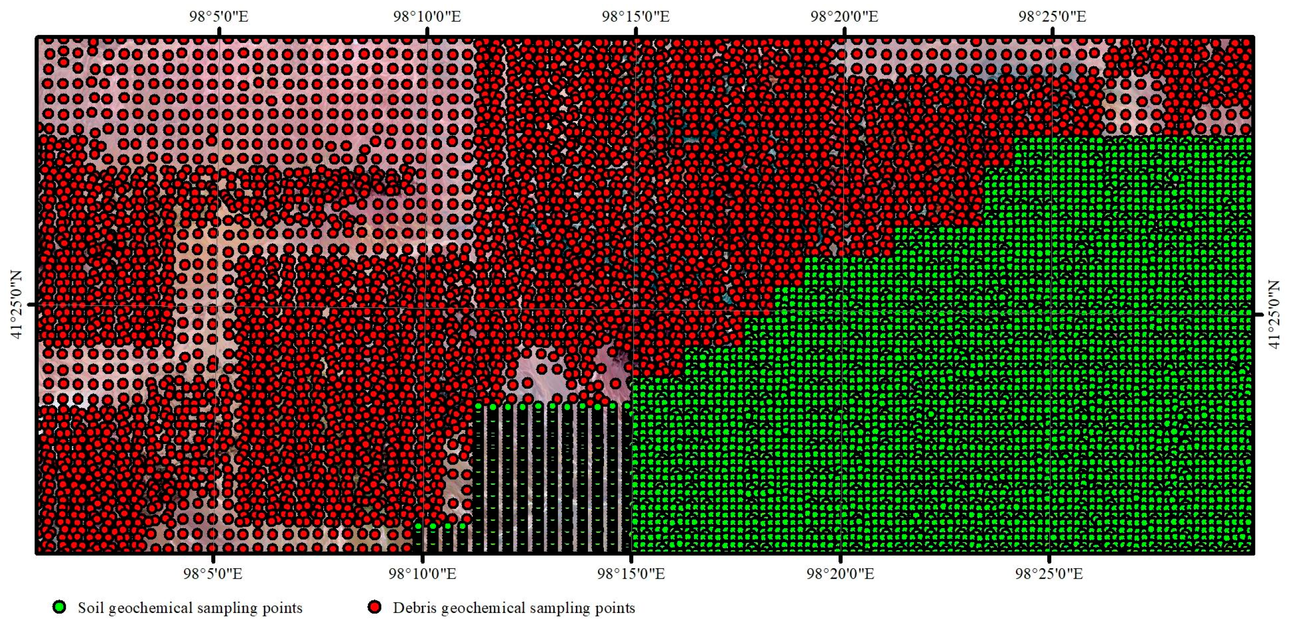
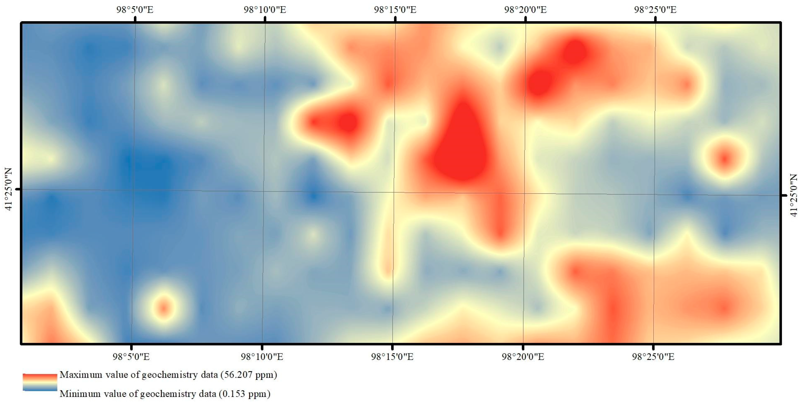
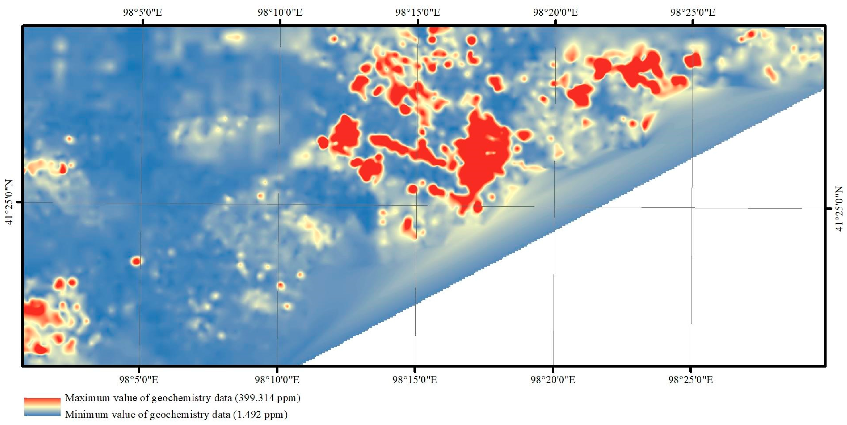
3.1. Geochemical Data
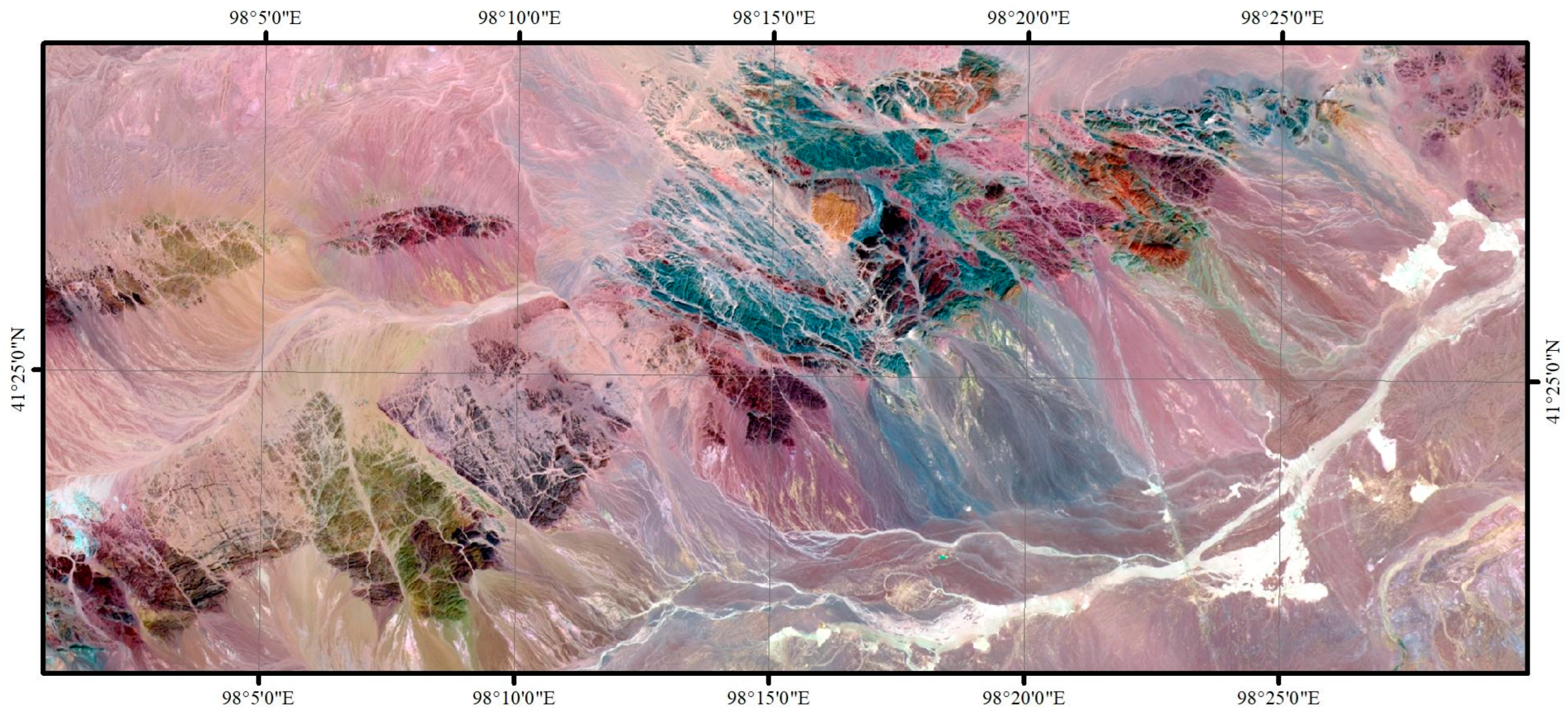
3.2. Remote Sensing Data
4. Methods
4.1. Remote Sensing
4.2. Geochemical Data
4.3. Regression Method
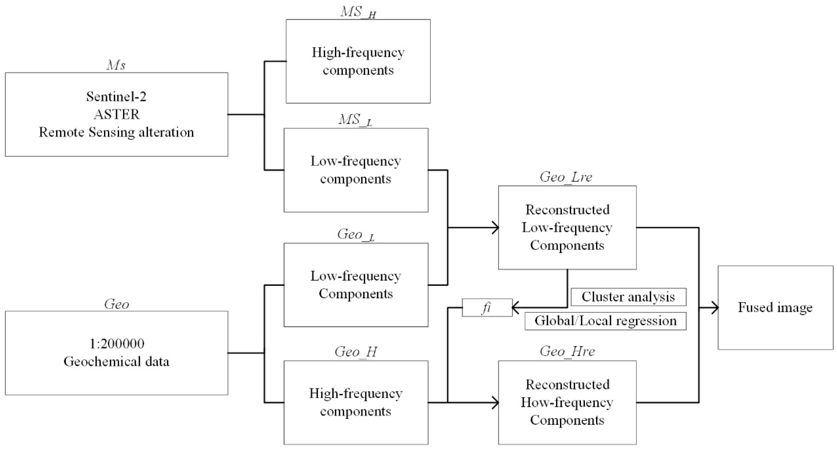
- Image decomposition
- 2.
- Geochemistry data scaling transformation
- 3.
- Cluster analysis
- 4.
- Establishment of the correlation function
- 5.
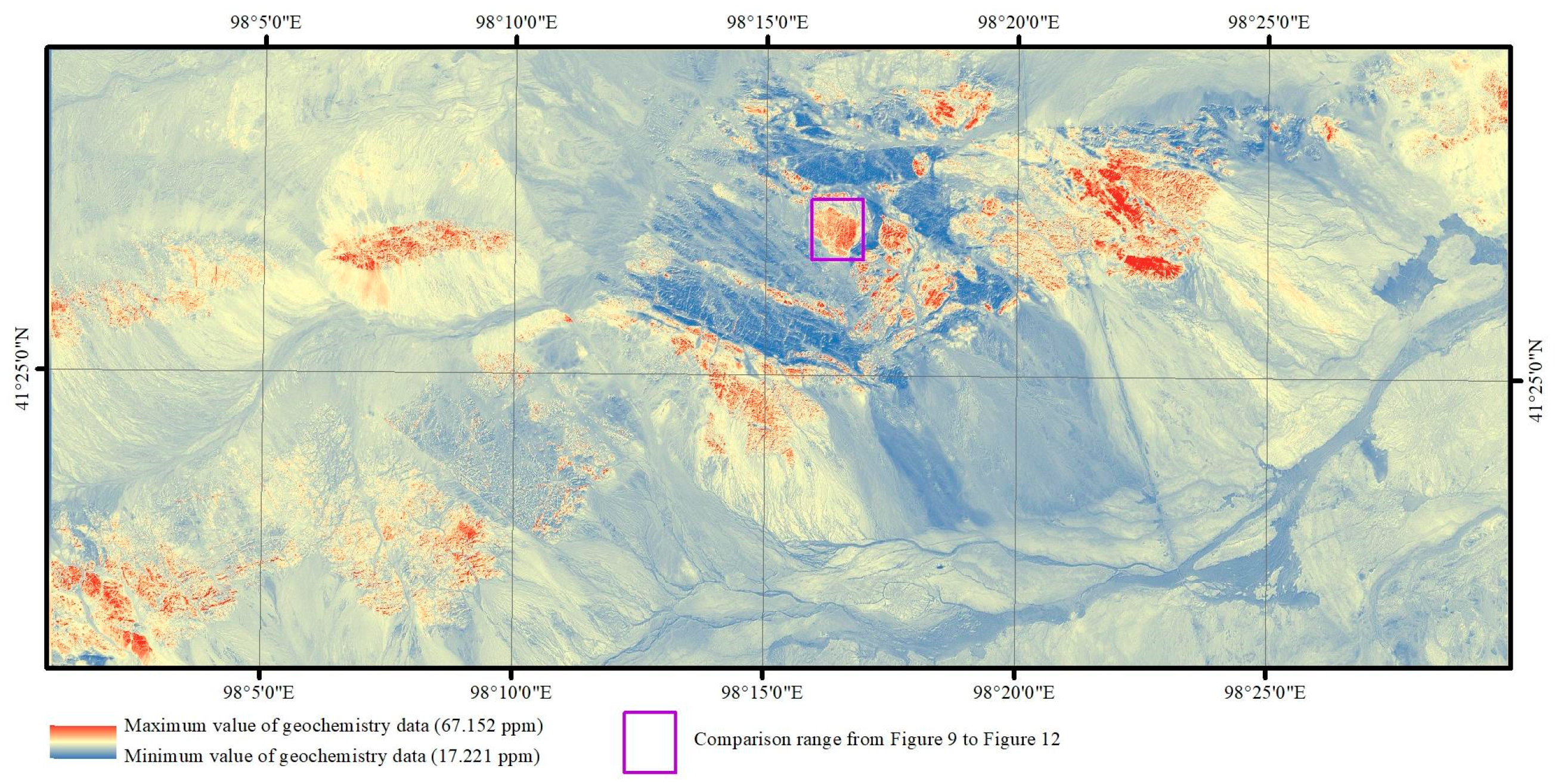
- Image fusion
4.4. Image Fusion Quality Evaluation
5. Research and Discussion
6. Conclusions
Author Contributions
Funding
Data Availability Statement
Conflicts of Interest
References
- Plant, J.; Smith, D.; Smith, B.; Williams, L. Environmental geochemistry at the global scale. Appl. Geochem. 2001, 16, 1291–1308. [Google Scholar] [CrossRef] [Green Version]
- Xie, X.; Wang, X.; Zhang, Q.; Zhou, G.; Cheng, H.; Liu, D.; Cheng, Z.; Xu, S. Multi-scale geochemical mapping in China. Geochem. Explor. Environ. Anal. 2008, 8, 333–341. [Google Scholar] [CrossRef]
- Zuo, R. Identifying geochemical anomalies associated with Cu and Pb–Zn skarn mineralization using principal component analysis and spectrum–area fractal modeling in the Gangdese Belt, Tibet (China). J. Geochem. Explor. 2011, 111, 13–22. [Google Scholar] [CrossRef]
- Li, M.; Xi, X.; Xiao, G.; Cheng, H.; Yang, Z.; Zhou, G.; Ye, J.; Li, Z. National multi-purpose regional geochemical survey in China. J. Geochem. Explor. 2014, 139, 21–30. [Google Scholar] [CrossRef]
- Wei, J.L.; Liu, X.N.; Ding, C.; Liu, M.L.; Jin, M.; Li, D.D. Developing a thermal characteristic index for lithology identification using thermal infrared remote sensing data. Adv. Space Res. 2017, 59, 74–87. [Google Scholar] [CrossRef] [Green Version]
- Radford, D.D.G.; Cracknell, M.J.; Roach, M.J.; Cumming, G.V. Geological Mapping in Western Tasmania Using Radar and Random Forests. IEEE J.-Stars 2018, 11, 3075–3087. [Google Scholar] [CrossRef]
- Wang, W.; Cheng, Q. Mapping Mineral Potential by Combining Multi-Scale and Multi-Source Geo-Information. In Proceedings of the IGARSS 2008—2008 IEEE International Geoscience and Remote Sensing Symposium, Boston, MA, USA, 7–11 July 2008; pp. II-1321–II-1324. [Google Scholar]
- He, H.; Yang, X.; Li, Y.; Li, Y.; Wang, L. Multi-source data fusion technique and its application in geological and mineral survey. J. Earth Sci. Environ. 2010, 32, 44–47. [Google Scholar]
- Wang, Z.; Zuo, R.; Jing, L. Fusion of Geochemical and Remote-Sensing Data for Lithological Mapping Using Random Forest Metric Learning. Math. Geosci. 2021, 53, 1125–1145. [Google Scholar] [CrossRef]
- Eldosouky, A.M.; Abdelkareem, M.; Elkhateeb, S.O. Integration of remote sensing and aeromagnetic data for mapping structural features and hydrothermal alteration zones in Wadi Allaqi area, South Eastern Desert of Egypt. J. Afr. Earth Sci. 2017, 130, 28–37. [Google Scholar] [CrossRef]
- Kuhn, S.; Cracknell, M.J.; Reading, A.M. Lithologic mapping using Random Forests applied to geophysical and remote-sensing data: A demonstration study from the Eastern Goldfields of AustraliaLithologic mapping with RF. Geophysics 2018, 83, B183–B193. [Google Scholar] [CrossRef]
- Windley, B.F.; Alexeiev, D.; Xiao, W.; Kröner, A.; Badarch, G. Tectonic models for accretion of the Central Asian Orogenic Belt. J. Geol. Soc. 2007, 164, 31–47. [Google Scholar] [CrossRef] [Green Version]
- Fu, Y.G.; Cai, Y.W.; Ma, S.M.; Xi, M.J.; Gao, J.W.; Wang, Z.L. Discovery of similar to 338 Ma Shibanjing Plagiogranite in the Beishan Area, NW China, and its Geological Significance. Acta Geol. Sin.-Engl. Ed. 2020, 94, 577–579. [Google Scholar] [CrossRef]
- Kroner, A.; Kovach, V.; Belousova, E.; Hegner, E.; Armstrong, R.; Dolgopolova, A.; Seltmann, R.; Alexeiev, D.V.; Hoffmann, J.E.; Wong, J.; et al. Reassessment of continental growth during the accretionary history of the Central Asian Orogenic Belt. Gondwana Res. 2014, 25, 103–125. [Google Scholar] [CrossRef]
- Zheng, R.G.; Wu, T.R.; Zhang, W.; Xu, C.; Meng, Q.P. Late Paleozoic subduction system in the southern Central Asian Orogenic Belt: Evidences from geochronology and geochemistry of the Xiaohuangshan ophiolite in the Beishan orogenic belt. J. Asian Earth Sci. 2013, 62, 463–475. [Google Scholar] [CrossRef]
- Niu, Y.Z.; Shi, G.R.; Ji, W.H.; Zhou, J.L.; Wang, J.Q.; Wang, K.; Bai, J.K.; Yang, B. Paleogeographic evolution of a Carboniferous-Permian sea in the southernmost part of the Central Asian Orogenic Belt, NW China: Evidence from microfacies, provenance and paleobiogeography. Earth-Sci. Rev. 2021, 220, 103738. [Google Scholar] [CrossRef]
- Xiao, W.J.; Mao, Q.G.; Windley, B.F.; Han, C.M.; Qu, J.F.; Zhang, J.E.; Ao, S.J.; Guo, Q.Q.; Cleven, N.R.; Lin, S.F.; et al. Paleozoic multiple accretionary and collisional processes of the Beishan orogenic collage. Am. J. Sci. 2010, 310, 1553–1594. [Google Scholar] [CrossRef]
- Li, M.; Xin, H.T.; Ren, B.F.; Ren, Y.W.; Liu, W.G. Early-Middle Permian post-collisional granitoids in the northern Beishan orogen, northwestern China: Evidence from U-Pb ages and Sr-Nd-Hf isotopes. Can. J. Earth Sci. 2020, 57, 681–697. [Google Scholar] [CrossRef]
- Zheng, R.; Li, J.; Xiao, W. Mid-Paleozoic ridge subduction in the Central Beishan of the southern Altaids: Evidence from geochemical, Sr–Nd and zircon U–Pb–Hf–O isotopic data of Gongpoquan volcanic rocks. J. Geol. Soc. 2019, 176, 755–770. [Google Scholar] [CrossRef]
- Li, M.; Xin, H.; Tian, J.; Meng, X.; Pang, Z.; Chen, C.; Liang, G. Composition, Age and Polarity of Gongpoquan Arc and Its Tectonic Significance in Beishan Orogen. Earth Sci. 2020, 45, 2393–2412. [Google Scholar]
- van der Meer, F.D.; van der Werff, H.M.A.; van Ruitenbeek, F.J.A.; Hecker, C.A.; Bakker, W.H.; Noomen, M.F.; van der Meijde, M.; Carranza, E.J.M.; de Smeth, J.B.; Woldai, T. Multi- and hyperspectral geologic remote sensing: A review. Int. J. Appl. Earth Obs. 2012, 14, 112–128. [Google Scholar] [CrossRef]
- Abrams, M.; Tsu, H.; Hulley, G.; Iwao, K.; Pieri, D.; Cudahy, T.; Kargel, J. The Advanced Spaceborne Thermal Emission and Reflection Radiometer (ASTER) after fifteen years: Review of global products. Int. J. Appl. Earth Obs. 2015, 38, 292–301. [Google Scholar] [CrossRef]
- Ge, W.Y.; Cheng, Q.M.; Jing, L.H.; Armenakis, C.; Ding, H.F. Lithological discrimination using ASTER and Sentinel-2A in the Shibanjing ophiolite complex of Beishan orogenic in Inner Mongolia, China. Adv. Space Res. 2018, 62, 1702–1716. [Google Scholar] [CrossRef]
- Rowan, L.C.; Mars, J.C.; Simpson, C.J. Lithologic mapping of the Mordor, NT, Australia ultramafic complex by using the Advanced Spaceborne Thermal Emission and Reflection Radiometer (ASTER). Remote Sens. Environ. 2005, 99, 105–126. [Google Scholar] [CrossRef]
- Yamaguchi, Y.; Kahle, A.B.; Tsu, H.; Kawakami, T.; Pniel, M. Overview of Advanced Spaceborne Thermal Emission and Reflection Radiometer (ASTER). IEEE T. Geosci. Remote 1998, 36, 1062–1071. [Google Scholar] [CrossRef] [Green Version]
- Liu, L.; Li, Y.; Zhou, J.; Han, L.; Xu, X.L. Gold-copper deposits in Wushitala, Southern Tianshan, Northwest China: Application of ASTER data for mineral exploration. Geol. J. 2018, 53, 362–371. [Google Scholar] [CrossRef]
- Rowan, L.C.; Mars, J.C. Lithologic mapping in the Mountain Pass, California area using Advanced Spaceborne Thermal Emission and Reflection Radiometer (ASTER) data. Remote Sens. Environ. 2003, 84, 350–366. [Google Scholar] [CrossRef]
- Drusch, M.; Del Bello, U.; Carlier, S.; Colin, O.; Fernandez, V.; Gascon, F.; Hoersch, B.; Isola, C.; Laberinti, P.; Martimort, P.; et al. Sentinel-2: ESA’s Optical High-Resolution Mission for GMES Operational Services. Remote Sens. Environ. 2012, 120, 25–36. [Google Scholar] [CrossRef]
- van der Werff, H.; van der Meer, F. Sentinel-2 for Mapping Iron Absorption Feature Parameters. Remote Sens. 2015, 7, 12635–12653. [Google Scholar] [CrossRef] [Green Version]
- van der Meer, F.D.; van der Werff, H.M.A.; van Ruitenbeek, F.J.A. Potential of ESA’s Sentinel-2 for geological applications. Remote Sens. Environ. 2014, 148, 124–133. [Google Scholar] [CrossRef]
- Yokoya, N.; Chan, J.C.W.; Segl, K. Potential of Resolution-Enhanced Hyperspectral Data for Mineral Mapping Using Simulated EnMAP and Sentinel-2 Images. Remote Sens. 2016, 8, 172. [Google Scholar] [CrossRef] [Green Version]
- Iwasaki, A.; Tonooka, H. Validation of a crosstalk correction algorithm for ASTER/SWIR. IEEE T. Geosci. Remote 2005, 43, 2747–2751. [Google Scholar] [CrossRef]
- Module, F. Atmospheric Correction Module: QUAC and FLAASH User’s Guide. Version 4, p. 44. 2009. Available online: https://scirp.org/reference/referencespapers.aspx?referenceid=2208171 (accessed on 23 February 2023).
- Adler-Golden, S.; Berk, A.; Bernstein, L.; Richtsmeier, S.; Acharya, P.; Matthew, M.; Anderson, G.; Allred, C.; Jeong, L.; Chetwynd, J. FLAASH, a MODTRAN4 atmospheric correction package for hyperspectral data retrievals and simulations. In Proceedings of the 7th Annual JPL Airborne Earth Science Workshop, Pasadena, CA, USA, 12 December 1998; pp. 9–14. [Google Scholar]
- Testa, F.J.; Villanueva, C.; Cooke, D.R.; Zhang, L. Lithological and Hydrothermal Alteration Mapping of Epithermal, Porphyry and Tourmaline Breccia Districts in the Argentine Andes Using ASTER Imagery. Remote Sens. 2018, 10, 203. [Google Scholar] [CrossRef] [Green Version]
- Eldosouky, A.M.; El-Qassas, R.A.Y.; Pour, A.B.; Mohamed, H.; Sekandari, M. Integration of ASTER satellite imagery and 3D inversion of aeromagnetic data for deep mineral exploration. Adv. Space Res. 2021, 68, 3641–3662. [Google Scholar] [CrossRef]
- De Keukelaere, L.; Sterckx, S.; Adriaensen, S.; Knaeps, E.; Reusen, I.; Giardino, C.; Bresciani, M.; Hunter, P.; Neil, C.; Van der Zande, D.; et al. Atmospheric correction of Landsat-8/OLI and Sentinel-2/MSI data using iCOR algorithm: Validation for coastal and inland waters. Eur. J. Remote Sens. 2018, 51, 525–542. [Google Scholar] [CrossRef] [Green Version]
- Sinaga, K.P.; Yang, M.S. Unsupervised K-Means Clustering Algorithm. IEEE Access 2020, 8, 80716–80727. [Google Scholar] [CrossRef]
- Liu, Y.; Yin, H.P.; Chai, Y. An Improved Kernel K-means Clustering Algorithm. pp. 275–280. 2016. Available online: https://link.springer.com/chapter/10.1007/978-981-10-2338-5_27 (accessed on 23 February 2023).
- Jain, A.K. Algorithms for Clustering Data; Prentice-Hall, Inc.: Hoboken, NJ, USA, 1988. [Google Scholar]
- Gentle, J.E. Finding Groups in Data: An Introduction to Cluster Analysis. Biometrics 1991, 47, 788. [Google Scholar] [CrossRef]
- Dempster, A.P.; Laird, N.M.; Rubin, D.B. Maximum Likelihood from Incomplete Data Via the EM Algorithm. J. R. Stat. Soc. Ser. B 1977, 39, 1–22. [Google Scholar] [CrossRef]
- Yu, J.; Chaomurilige, C.; Yang, M.-S. On convergence and parameter selection of the EM and DA-EM algorithms for Gaussian mixtures. Pattern Recognit. 2018, 77, 188–203. [Google Scholar] [CrossRef]
- MacQueen, J. Some methods for classification and analysis of multivariate observations. In Proceedings of the Fifth Berkeley Symposium on Mathematical Statistics and Probability, Los Angeles, CA, USA, 21 June–18 July 1965; pp. 281–297. [Google Scholar]
- Alhawarat, M.; Hegazi, M. Revisiting K-means and topic modeling, a comparison study to cluster arabic documents. IEEE Access 2018, 6, 42740–42749. [Google Scholar] [CrossRef]
- Cudahy, T.; Hewson, R. ASTER geological case histories: Porphyry-skarnepithermal, iron oxide Cu-Au and Broken hill Pb-Zn-Ag. In Proceedings of the Annual General Meeting of the Geological Remote Sensing Group ‘ASTER Unveiled’, Burlington House, Piccadilly, London, UK, 11–14 December 2002. [Google Scholar]

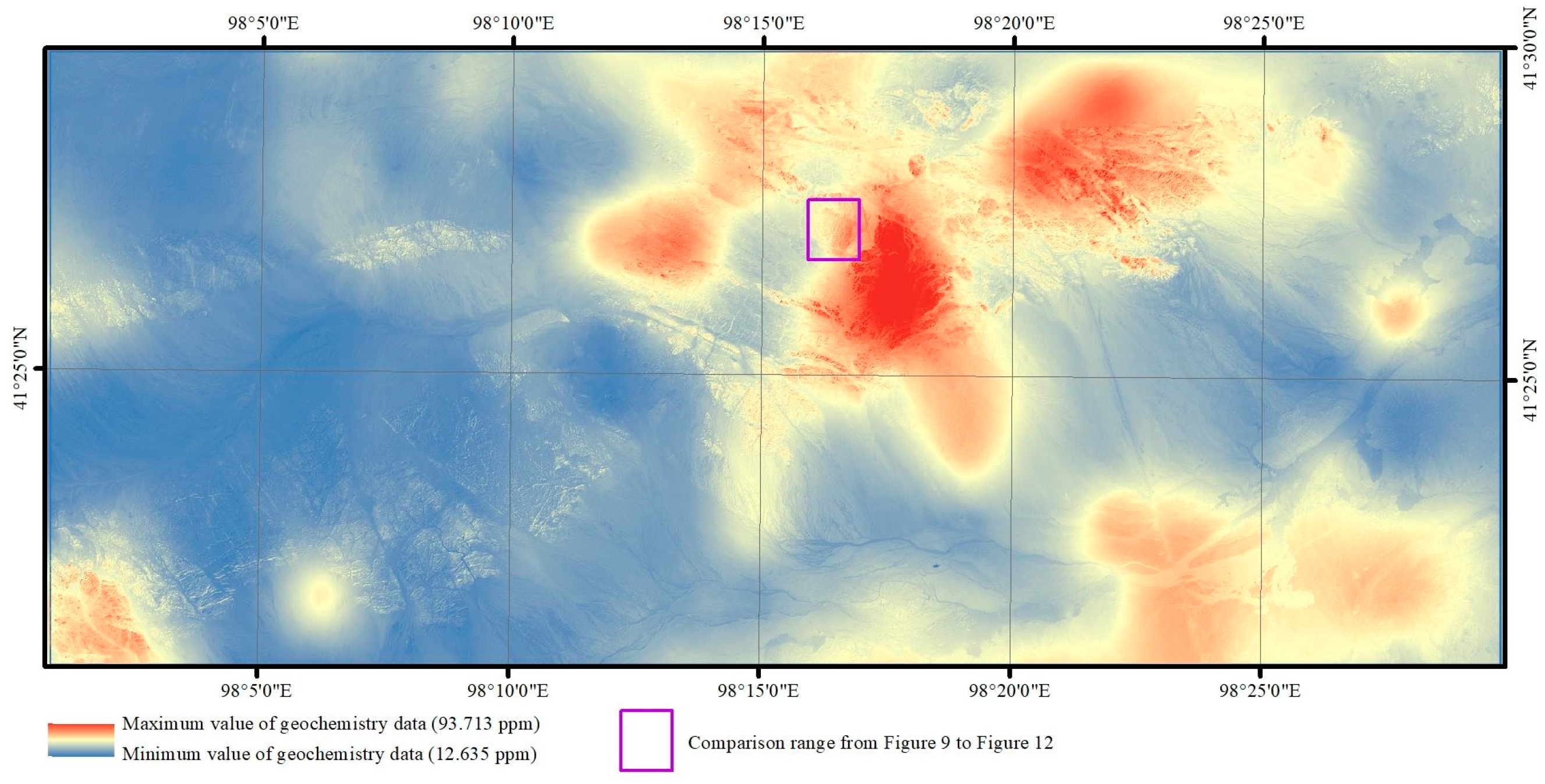
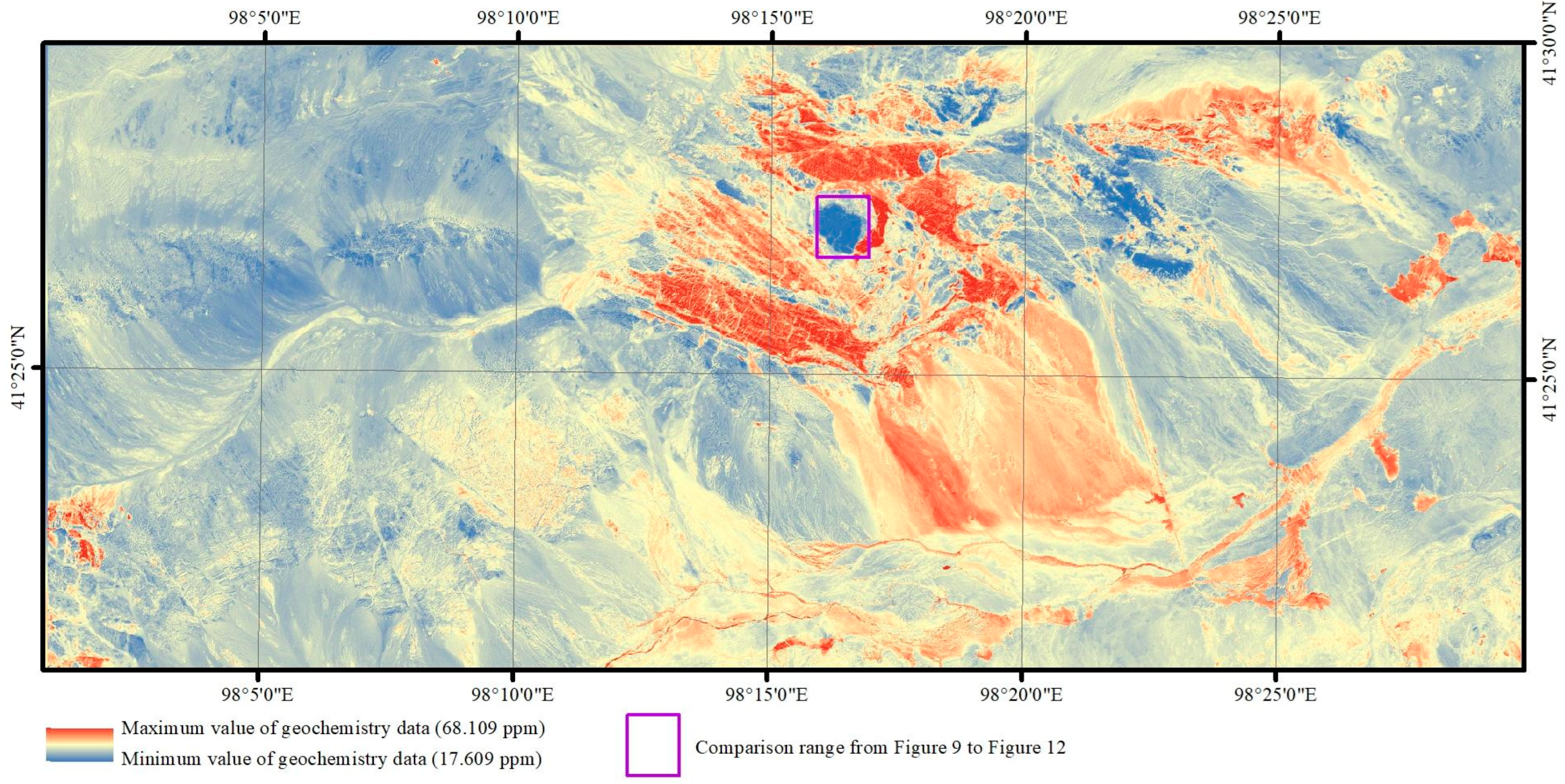


| Mineral Feature | ASTER Band Combination(s) |
|---|---|
| Ferric iron | 2/1 |
| Ferrous iron | 5/3 and 1/2 |
| Ferric oxide | 4/3 |
| Gossan | 4/2 |
| Carbonate/chlorite/epidote | (7 + 9)/8 |
| Epidote/Chlorite/Amphibole | (6 + 9)/(7 + 8) |
| Amphibole | (6 + 9)/8 and 6/8 |
| Dolomite | (6 + 8)/7 |
| Carbonate | 13/14 |
| Sericite/Muscovite/Illite/Smectite | (5 + 7)/6 |
| Alunite/Kaolinite/Pyrophyllite | (4 + 6)/5 |
| Phengite | 5/6 |
| Kaolinite | 7/5 |
| Silica | 11/10, 11/12, 13/10 |
| SiO2 | 13/12, 12/13 |
| Siliceous rocks | (11 × 11)/(10 × 12) |
| Mineral Feature | ASTER Band Combination(s) |
|---|---|
| Silica index | band 11/band 10, band 11/band 12, band 13/band 10 |
| Biotite-epidote–chlorite–amphibole index | (band 6 + band 9)/(band 7 + band 8) |
| Skarn carbonates–epidote index | (band 6 + band 9)/(band 7 + band 8), band 13/band 14 |
| Garnets-pyroxenes index | band 12/band 13 |
| Iron oxide index | band 2/band 1 |
| White micas Al-OH depth | (band 5 + band 7)/band 6 |
| Carbonates Mg-OH depth | (band 6 + band 9)/(band 7 + band 8) |
| Carbonate abundance | band13/band14 |
| Sentinel-2 Bands PC2 | ASTER Alteration Information PC2 | |
|---|---|---|
| Global | 0.12 | −0.17 |
| Local | 0.27 | −0.32 |
Disclaimer/Publisher’s Note: The statements, opinions and data contained in all publications are solely those of the individual author(s) and contributor(s) and not of MDPI and/or the editor(s). MDPI and/or the editor(s) disclaim responsibility for any injury to people or property resulting from any ideas, methods, instructions or products referred to in the content. |
© 2023 by the authors. Licensee MDPI, Basel, Switzerland. This article is an open access article distributed under the terms and conditions of the Creative Commons Attribution (CC BY) license (https://creativecommons.org/licenses/by/4.0/).
Share and Cite
Ding, H.; Jing, L.; Xi, M.; Bai, S.; Yao, C.; Li, L. Research on Scale Improvement of Geochemical Exploration Based on Remote Sensing Image Fusion. Remote Sens. 2023, 15, 1993. https://doi.org/10.3390/rs15081993
Ding H, Jing L, Xi M, Bai S, Yao C, Li L. Research on Scale Improvement of Geochemical Exploration Based on Remote Sensing Image Fusion. Remote Sensing. 2023; 15(8):1993. https://doi.org/10.3390/rs15081993
Chicago/Turabian StyleDing, Haifeng, Linhai Jing, Mingjie Xi, Shi Bai, Chunyan Yao, and Lu Li. 2023. "Research on Scale Improvement of Geochemical Exploration Based on Remote Sensing Image Fusion" Remote Sensing 15, no. 8: 1993. https://doi.org/10.3390/rs15081993
APA StyleDing, H., Jing, L., Xi, M., Bai, S., Yao, C., & Li, L. (2023). Research on Scale Improvement of Geochemical Exploration Based on Remote Sensing Image Fusion. Remote Sensing, 15(8), 1993. https://doi.org/10.3390/rs15081993


