Technical Note

Geolocalization from Aerial Sensing Images Using Road Network Alignment
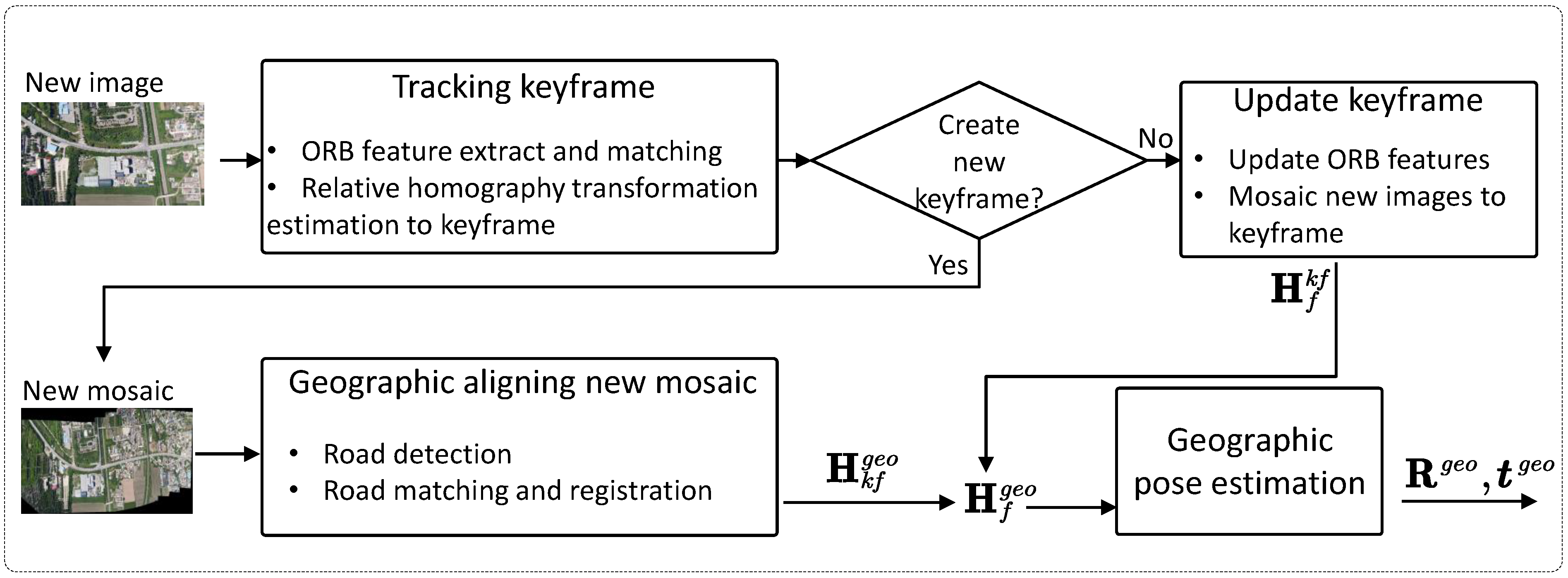
1
Xi’an Research Institute of Hi-Tech, Xi’an 710025, China
2
Rearch Institute for Mathematics and Mathematical Technology, Xi’an Jiaotong University, Xi’an 710049, China
*
Author to whom correspondence should be addressed.
Remote Sens. 2024, 16(3), 482; https://doi.org/10.3390/rs16030482
Submission received: 13 November 2023 / Revised: 18 January 2024 / Accepted: 20 January 2024 / Published: 26 January 2024
(This article belongs to the Special Issue Advanced Methods for Motion Estimation in Remote Sensing)

Abstract

Estimating the geographic positions in GPS-denied environments is of great significance to the safe flight of unmanned aerial vehicles (UAVs). In this paper, we propose a novel geographic position estimation method for UAVs after road network alignment. We discuss the generally overlooked issue, namely, how to estimate the geographic position of the UAV after successful road network alignment, and propose a precise robust solution. In our method, the optimal initial solution of the geographic position of the UAV is first estimated from the road network alignment result, which is typically presented as a homography transformation between the observed road map and the reference one. The geographic position estimation is then modeled as an optimization problem to align the observed road with the reference one to improve the estimation accuracy further. Experiments on synthetic and real flight aerial image datasets show that the proposed algorithm can estimate more accurate geographic position of the UAV in real time and is robust to the errors from homography transformation estimation compared to the currently commonly-used method.
Keywords: geographic position estimation; road network alignment; homography matrix decomposition geographic position estimation; road network alignment; homography matrix decomposition

