Abstract
The convergence zone of the Eurasian (EURA) and North Africa plate (NUBIA) is primarily marked by the activity between the Betics in south of Spain and the Rif and Atlas in Morocco. This area, where the diffuse tectonics between these plates are currently converging in a NW-SE direction, presents several continuous fault zones, such as the Betic–Alboran–Rif shear zone. The Royal Institute and Observatory of the Spanish Navy (ROA) currently operates geodetic stations in various parts of North Africa, some in particularly interesting locations, such as the Alhucemas (ALHU) rock, and also in more stable areas within the Nubian plate, such as Tiouine (TIOU). For the first time, the displacement velocities of the ROA CGNSS stations have been estimated to provide additional geodynamic information in an area with few stations. The obtained velocities have been compared with other recent studies in this field that included data older than 10 years or episodic campaigns without continuous stations. PRIDE (3.1.2) and SARI (February, 2025) software were used for processing, and the velocities were obtained by the ROA for international stations (RABT, SFER, MALA, HUEL, LAGO, TARI, and ALME). These initial results confirm the convergence trend between Eurasia and Nubia of approximately 4 mm/year in the NW-SE direction. It is also evident that there is independent behavior among the Atlas stations and those in the Moroccan Meseta compared to those located in the Rif mountain range, which could indicate the separation of smaller tectonic domains within the continental plate convergence zone. Along the Rif coast in Al Hoceima Bay, the faults are being approached; additionally, there is a slight clockwise displacement towards Melilla, which has also been demonstrated by stations in the Middle Atlas, such as TAZA. As for the stations in the Strait of Gibraltar, they exhibit a similar behavior until reaching the diffuse zone of the Guadalquivir basin where the diffuse convergence zone may exist. This may explain why stations to the north of the basin, such as LIJA or HUEL, change their behavior compared to nearby ones like SFER in the south. Furthermore, Alboran seems to follow the same displacement in direction and velocity as the other stations in North Africa and southern Spain.
1. Introduction
The study and understanding of active tectonics provide the scientific community with information on the movement of Earth’s plates. In this way, the monitoring of Global Navigation Satellite Systems (GNSS) signals through geodetic receivers in permanent monuments is the most accurate technique for the study and analysis of ground deformations in these hard-to-reach areas.
The Eurasia–Nubian plate convergence zone is an area of great interest due to its high geodynamic activity. The Strait of Gibraltar, the Alboran Sea domain, the Maghrebides, and the Betic Cordilleras are clear examples of this complex structure (Figure 1). This area is a North–South convergence zone of diffuse tectonics between the African and Eurasian plates whose limit is still under discussion [1]. Currently, the convergence between both plates is evolving in a NW-SE direction with an approximate rate of 4–5 mm per year [2,3,4,5,6,7,8,9,10,11].
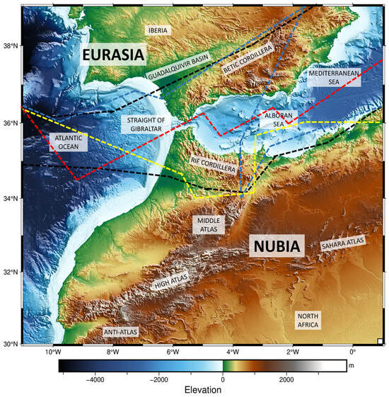
Figure 1.
Topographic/bathymetric map [12] of the western Mediterranean (WM). In black, the possible diffuse zone of the EURA-NUBIA convergence between North Africa and the south of the Iberian Peninsula is shown according to this study. Three possible hypotheses of the delimitation of this zone are drawn according to [13] in red, [14] in yellow, and [15] in blue.
The most updated studies in the GNSS field in this region, mainly in North Africa, include campaigns with data from continuous stations up to 2014, such as those presented in the Topo-Iberia project [10]. The rest of the studies have been carried out with episodic campaigns, for example [2,4,16,17], which could present significant drawbacks compared to continuous stations, mainly in the lack of data continuity, lower precision, and inability to monitor short-term phenomena or provide real-time data.
Within the confluence zone of the EURA-NUBIA, the active region between the Betics Mountain range and the northern Alboran Sea has been well defined by several studies that explain the tectonic behavior [17,18,19,20,21,22,23]. Those studies show, in general, that the velocity field in the Iberian Peninsula from the north of Betics mountain range forms part of the stable Eurasian plate, with a residual movement between 2 and 3 mm per year. Because of these exhaustive scientific studies, the deformation patterns and geodynamics of this area of the Gibraltar Arc are quite well established in areas of interest such as the Campo de Dalias [16], Granada Basin [21], or the eastern shear zone of the Betics Cordillera [20,22]. For the other part in Morocco, while the Rif can be considered within this diffuse zone, the Atlas Mountains’ range is already at the limit of the North African plate, according to recent studies in this region [10,18,24,25,26]. Furthermore, the stresses between plates are not accommodated in the same way, with the North African contact zone being the most active [19,20]. This shows a clear example of a complex incidence model that makes it possible to accommodate deformations.
The Royal Institute and Observatory of the Spanish Navy (ROA) is currently committed to maintaining continuous GNSS stations in the south of Spain and North Africa. For this purpose, precise geodetic devices were installed at strategic and interesting points, as seen in Figure 2. In addition, the maintenance of its own station is inherited from the Topo-Iberia Project [27], of which only the Tiouine (Station of TIOU) is preserved. At present, there are no other continuous GNSS networks in this interesting area of study. The interpretation of the data processed can contribute useful information to clarify the behavior of this confusing and poorly monitored region, as well as complement several previous studies, such as those cited above.
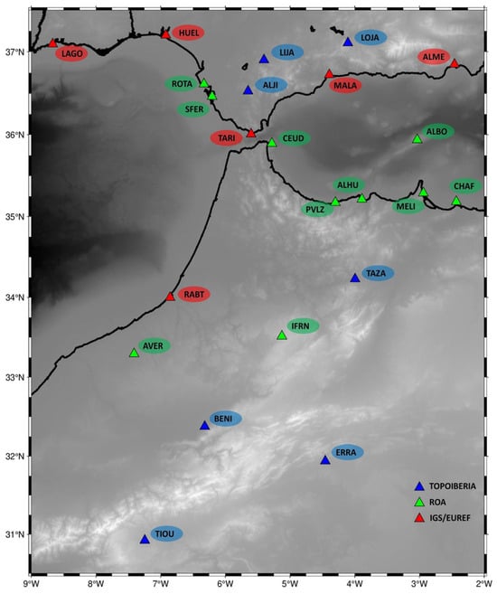
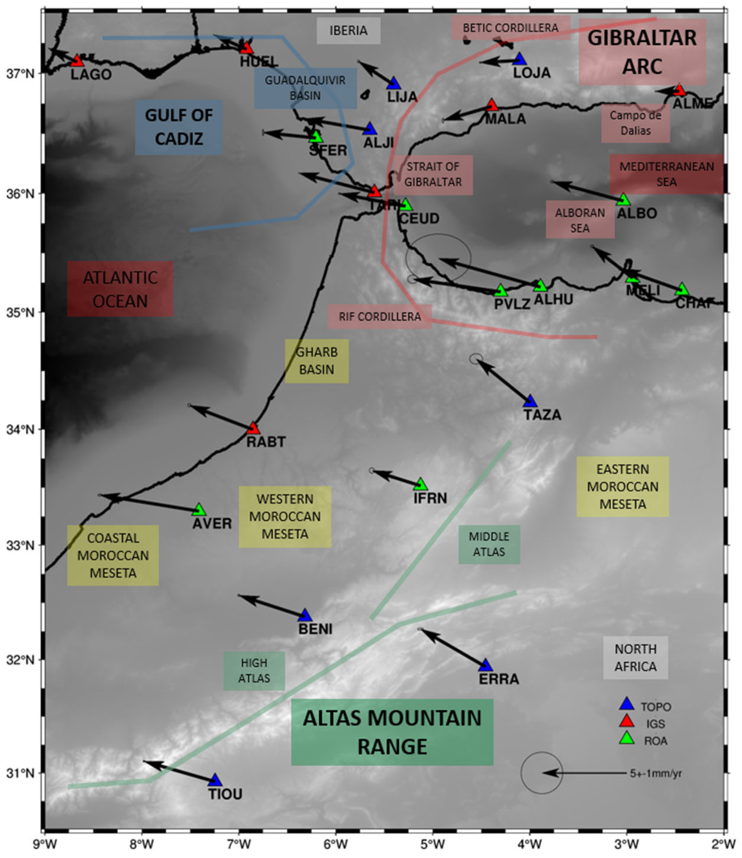
Figure 2.
Map of stations used in the research. In blue, the old Topo-Iberia Project Stations corresponding to the ROA; in red, the IGS/EUREF stations; and, in green, the ROA stations (including stations in collaboration with ISRABAT).
The objective of this paper is to present a new velocity field calculated from continuous GNSS stations located in southern Spain and North Africa. This velocity field includes, for the first time, CGNSS data from CEUD, PVLZ, ALHU, ALBO, MELI, CHAF, and AVER, but also complements the continuity of the data that have not yet been published for TIOU, LIJA, ALJI, LOJA, and IFRN (Figure 2). These stations belong to the ROA.
2. GNSS Stations and Data Processing
2.1. General Description of the Emplacements
The GNSS stations of the ROA have been installed at the different sites for more than 20 years, some through completed collaborative projects and others on the own initiative of the staff of the geophysics section. The main characteristics of the equipment and current status of these stations are summarized in Table 1; they are listed below in alphabetical order. For the stations belonging to IGS, the considered period ranges from the installation of the station to 16 June 2024. The station belonging to Topo-Iberia has observations from 2008 to 2 February 2014, the end of the research project [11]. The stations belonging to the ROA, along with those inherited from Topo-Iberia, do not have the same period of data since they were installed at different times, and some have had technical problems. In any case, all stations except ALHU have more than five years of data. Most have more than 10 years of data.

Table 1.
Information for the GNSS stations: Name, location, power supply, equipment, agency, and period of operation up to the time of analysis. Stations that are not part of the ROA network but have been used for this study are shown in red italics.
As can be observed, several of these continuous GNSS station sites exhibit a series of constraints that render them challenging to exploit. Power supply, vandalism, or weather conditions add to the difficulty in accessing them in some cases, making the maintenance and monitoring of these sites a daunting task. Therefore, to keep this type of station up to date, it is necessary to have the necessary infrastructure and good associated logistics. This means that the stations are exposed to periods of maintenance or failures that make it difficult for them to operate continuously. Communications also play a key role as real-time service is required. In stations where there is no internet network connection, satellite communications or multi-operator modems have been installed so that it is possible to access the equipment remotely. Due to the circumstances described above, all installed equipment must be robust and energy-efficient so as to ensure the reliability of the station over a long period of time. Some locations can be seen in Figure 3.
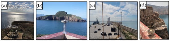
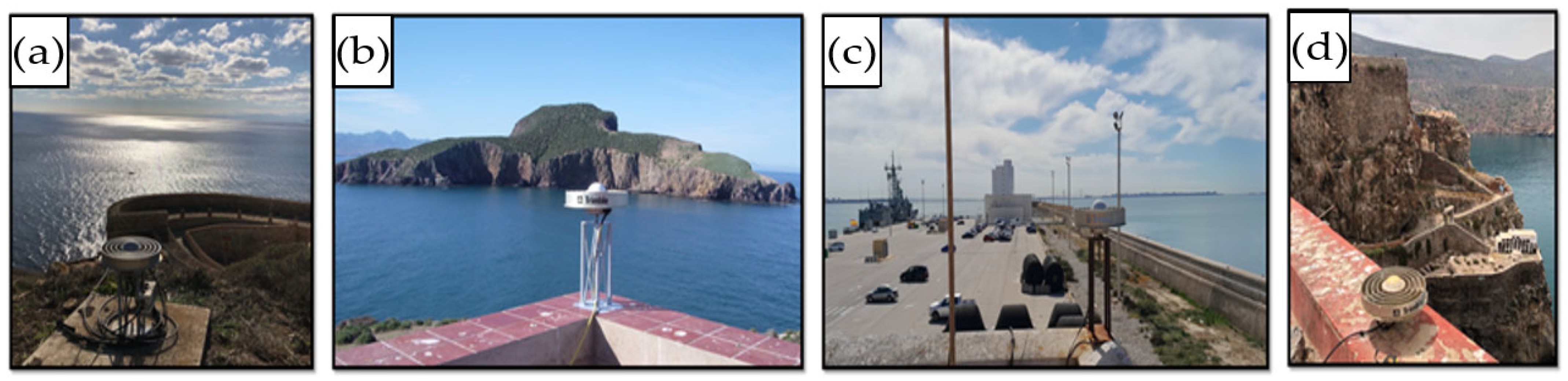
Figure 3.
Some of the continuous stations belonging to the ROA. (a) CEUD (Desnarigado Castle in Ceuta), (b) CHAF (Isabel II Island Lighthouse in the Chafarinas Archipelago), (c) ROTA (Rota Naval Base Dock), and (d) PVLZ (Vélez de la Gomera Rock Lighthouse).
2.2. Methodology Employed
A station log has been created for each station, documenting the maintenance activities carried out at the various sites as well as the instrumentation changes over the years. Data processing was performed with PRIDE-PPPAR (Precise Point Positioning with Ambiguity Resolution) software (3.1.2) [28], which was used to obtain the daily time series. This program allows us to obtain coordinate files, starting from the RINEX files of the observations with 30 s sampling intervals every 24 h. The observation period for every station is shown in Table 1. Daily position files are converted into an annual series of positions, in which we obtain the displacements that have occurred since the beginning of our time series. The data were processed using the PPP (Precise Point Positioning) technique [29]. The final combined-solution products (ephemeris, clock files, and Earth Rotation Parameters) used correspond to those provided by the IGS Central Office and the IGS Reference Framework Coordinator for the 3rd IGS reprocessing campaign land frame (repro3) [30], which form the IGS contribution to the ITRF2020 [31]. An ionosphere-free combination was used along with the application of High Order Ionosphere corrections. For the ZTD estimation, the Saastamoinen model [32] was used, and for the troposphere mapping performed every hour, the Global Mapping Function was selected [33]. The tidal model was calculated using [34], which refers to the FES2014 tidal model [35]. The LAMBDA (Least-squares Ambiguity Decorrelation Adjustment) method [36] has been used for the resolution of ambiguities.
SARI (February 2025) [37] is a software that allows users to visualize different formats of discrete time series data and also process and analyze the series individually, fit unidimensional models, and, finally, save the results. Coordinated time series of the stations were uploaded directly from the servers of the different GNSS data web servers (EUREF, IGS…) [38,39,40] if they were available, although they had also been processed by PRIDE-PPPAR (3.1.2) for a verification of the results. In our case, we entered a file in PBO format (ASCII file with .pos extension) which removes outliers with a residual threshold; also we could manually remove them. We were able to upload complementary information for the purpose of the GNSS signal analysis, and it was used to incorporate the site logs of the stations and to introduce the predefined plate motion model which it refers to [41]. For model fitting, the least-squares (LS) option was used [42]. From among the options, the linear trend was introduced. Discontinuities were detected in the series by defining the reference epochs of each one, or by using an external file. The periodic signals are modeled using sine and cosine terms, users also can manually define additional periods if needed (found by filtering out the annual periodic signals observed in the time series, as well as other significant periodic components that may be present). This correction had a reference epoch that is the average of the available measurement data, where the phase values are estimated accordingly. For velocity verification with SARI (February 2025), the Median Interannual Difference Adjusted for Skewness (MIDAS) algorithm [43] was used. SARI models stochastic noise in GNSS time series using Gaussian processes and optimizes the covariance matrix through Maximum Likelihood Estimation (MLE). We used a combination of white noise and random walk, adjusting their parameters and selecting the best model based on log-likelihood. It also estimates the impact of noise on trend uncertainty and offers an option to separate noise components using a Wiener filter. To improve efficiency, we validated the fit by comparing the power spectrum of the residuals with the estimated noise model. SARI was used to resolve the different offsets identified; other effects, as indicated in other studies such as [44,45], have not been considered.
The data were represented in Python 3 [46] thanks to PyGMT library (Python interface for the Generic Mapping Tools) [47]. The final strain-stress results were obtained with the Optimal Interpolation of Spatially Discretized Geodetic Data algorithm [48] from the previously calculated GNSS velocities. The Global Multi-Resolution Topography (GMRT) Synthesis databases were used to represent the topography of the maps [12].
3. GNSS Network Results
The final results can be visualized as a 2D time series for the East and North coordinates in Appendix A, where values are expressed in meters. Appendix A shows the time series of all stations in horizontal coordinates (East and North).
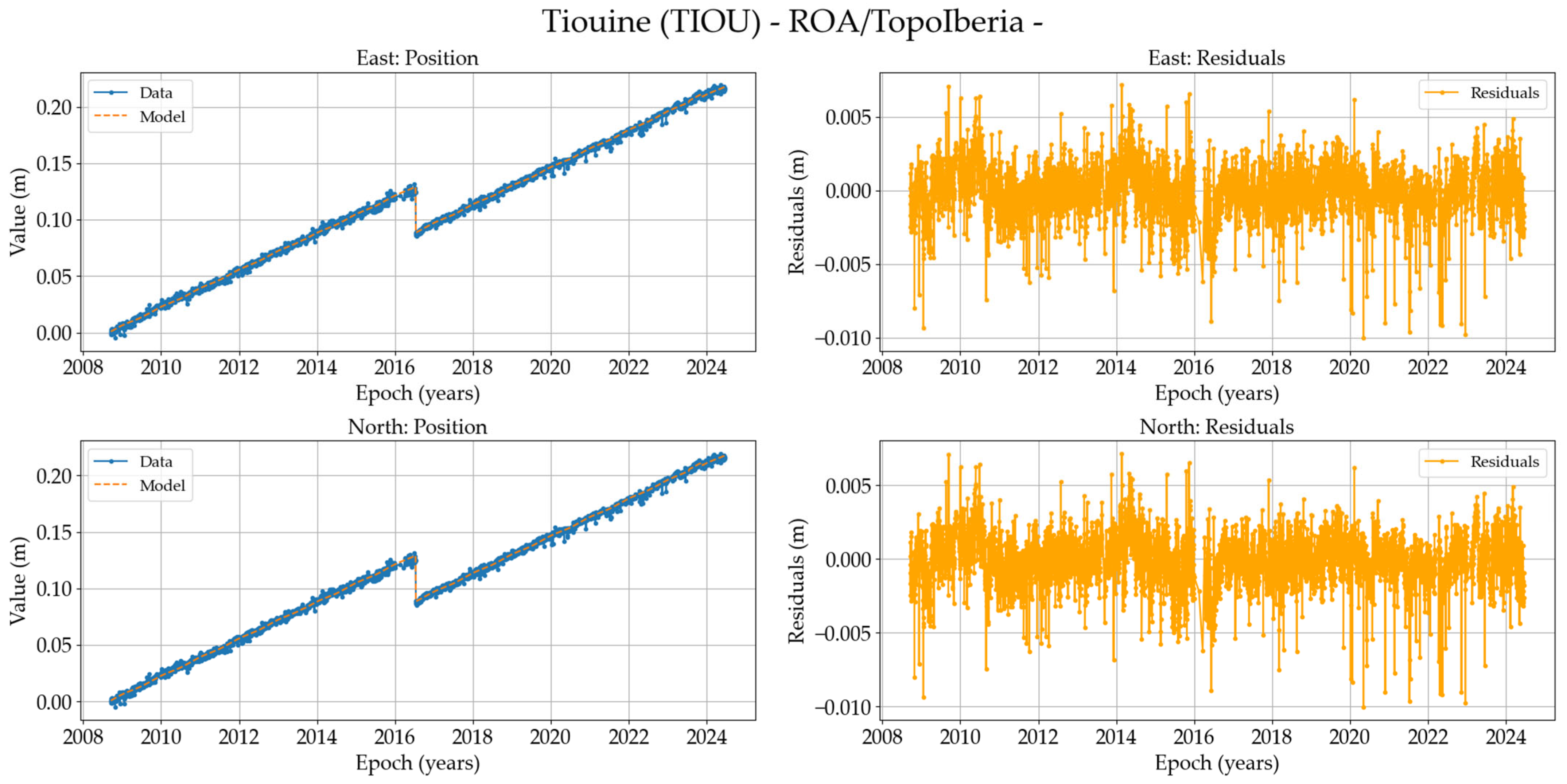
Analyzing time series from Appendix A, most exhibit a standard behavior; however, we will discuss those that may present any notable details. Some of the stations such as ALJI, BENI, ERRA, LIJA, LOJA, TAZA, and TIOU have already been exploited by other authors; The key contribution of our study is the inclusion of newly available data over the four-year period analyzed. For example, in the case of TIOU, an additional 10 years of uninterrupted data have been incorporated. ALHU is the newest station with two years of data collection; the abrupt change in result dispersion is due to an instrumentation upgrade to a higher-performance model. ALJI experienced a period of inactivity following the Topo-Iberia project; however, once reactivated and analyzed, the time series showed stability and validity, maintaining the trend observed previously. LIJA and LOJA have experienced communication issues but currently have real-time data available. Lastly, in TARI, there was a slight change in the antenna position, but the time series appears to remain completely stable.
The time series from Alborán Island, where the IGN and ROA stations are located, have also been compared. Given that the IGN station exhibits better stability, we have chosen to use it for the final results, even though both stations display fairly similar behavior. In Melilla, when encountering a similar situation, we proceeded to compare both stations. However, in this case, the time series are virtually identical even though the IGN time series was affected by the 2016 earthquake, and we opted to use the ROA station. Furthermore, it is important to highlight that a small co-seismic offset had to be introduced in both the Alborán and Melilla time series due to the 2016 Alborán earthquake, although this does not significantly affect the time series for this study.
An initial assessment suggests that if a highly noisy environment or complex errors were present, processing with MIDAS would offer significant advantages over least- squares. However, the results obtained indicate that this is not the case, as the final values are very similar. The differences found when comparing LS with MIDAS are within the range of tenths of a millimeter, which is consistent with the results published in [43]. Additionally, to verify PPP processing with PRIDE, the final results of the IGS stations have been cross-checked using SARI, obtaining satisfactory results across all stations confirming publications such as [49]. Table 2 shows the results obtained in SFER as an example.
Table 2.
Comparison between the results obtained by the PRIDE-PPPAR (3.1.2) processing and those provided by the IGS for the SFER station. Information: displacement velocity with respect to ITRF20 in mm/year and its standard deviation in mm/year, displacement velocity with respect to EURA, and its standard deviation in mm/year.
According to Appendix A, the velocities with respect to EURA have been plotted in Figure 4. Additionally, the stress tensors produced by these deformations at each point have been represented in Figure 5.

Figure 4.
Overview of the confluence zone of North Africa and the southern Iberian Peninsula. The velocities with respect to EURA (scale 5 mm/year) of continuous stations used for the study are plotted.
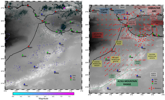
Figure 5.
In the image on the (left), the historical earthquake catalog from the IGN [50] is displayed; on the (right), strain/rate tensors are introduced on a scale of 20 nanostrains per year, with inward arrows indicating compression, while outward arrows represent dilation at the point depicted.
Regarding the observed annual deformations, three distinct behavior domains are identified, though all exhibit a predominant WNW motion. The first block could comprise the stations of LAGO, HUEL, and LIJA, located in the Gulf of Cádiz region in the southwestern Iberian Peninsula. In this area, it is evident that as the stations become closer to the Strait of Gibraltar, their velocity relative to the fixed Eurasian block increases, with the maximum recorded at LIJA exceeding 2 mm per year. The next tectonic group is known as the Gibraltar Arc, encompassing the Betic Cordillera up to SFER, the Alboran Sea, and northern Morocco, extending from the Rif to CHAF. In the Spanish sector, the data indicate a consistent westward motion of the Betic Cordillera with respect to the relatively stable Iberian Massif block. Displacement rates progressively increase toward the south and west, reaching maximum values in the Gibraltar Strait region (SFER, TARI, and CEUD with velocities ranging between 3.5 and 4.5 mm/yr) before gradually decreasing toward the northwestern mountain front (ALJI and ALME showing displacements between 1 and 2 mm/yr). Additionally, the dynamics in North Africa and the Alboran Sea follow a similar pattern to that observed in the Strait region. However, a small anomaly is noted at MELI to the north, where displacement rates more closely resemble those observed at TAZA in the Atlas Mountains. The ROA time series extends until 2015, but the IGN time series, which includes 2016, captures the earthquake that occurred in the Alboran Sea and affected the city of Melilla. The post-seismic period has been included in the processing of MELI. This displacement pattern aligns with the clockwise rotation of tectonic units within the Gibraltar Arc sector. The final domain is composed of the Moroccan Meseta and the Atlas Mountains. Here, a collective northwestward motion is observed, with velocities ranging between 4.5 and 3 mm/yr. There may be a differentiation in behavior among the stations more aligned with the Atlas Mountains domain (TIOU, BENI, IFRN, and RABT), with the station AVER located on the western Moroccan Meseta showing a slight eastward shift and an increase in velocity (5 mm/yr). This deformation observed at the AVER station, which generates an extension relative to the other stations in Morocco, requires further investigation; the results for this area must remain on hold. The time series from the Averroes station suggests a possible subsidence of the terrain that must be considered in detail. TAZA, located in the Middle Atlas, exhibits a rotation toward the NNW as previously noted, while ERRA, situated within the more stable portion of the NUBIA, displays a distinct pattern.
In Figure 5, the stress tensors at each point derived from these residual velocities are also displayed. Overall, it is evident that the region exhibits a continuously evolving plate collision regime with a dominant oblique horizontal compressional trend, following a NW-SE direction. The displacement is better seen in Figure 4 with respect to stable Eurasia. In Figure 5, it is observed mainly in the center-east of Alboran and Rif. Along the southwestern coast of the Iberian Peninsula, it is variable in the Gulf of Cadiz; as a result, there appear to be small arrows of NW-SE extension towards the N part of the Gulf and ENE-WSW compression towards the central zone. Between AlJI and LIJA, there is almost an N-S extension. The ENE-WSW compression in the Gulf of Cadiz is straightforward to interpret as it likely corresponds to the westward thrusting of the Gibraltar Arc. In contrast, in the Gibraltar Strait, the stress components rotate clockwise, showing more pronounced NW-SE compression and SW-NE extension. In the westernmost area, the behavior is similar to that of the rest of the Alboran Sea. The maximum stress values are observed in the eastern Rif region and in the Betics between LIJA and ALJI. A greater challenge arises between Rabat and the Rif, where NE-SW extension is observed due to the Gharb Basin, presumably aligning with the advancing direction of the mountain front. However, the issue likely stems from the lack of continuous stations in the area. The intense deformation around AVER station depicts an additional consideration on its stability because it is built on thick, poorly consolidated sediments and the apparent NE-SW extensional trends may be a consequence of local subsidence.
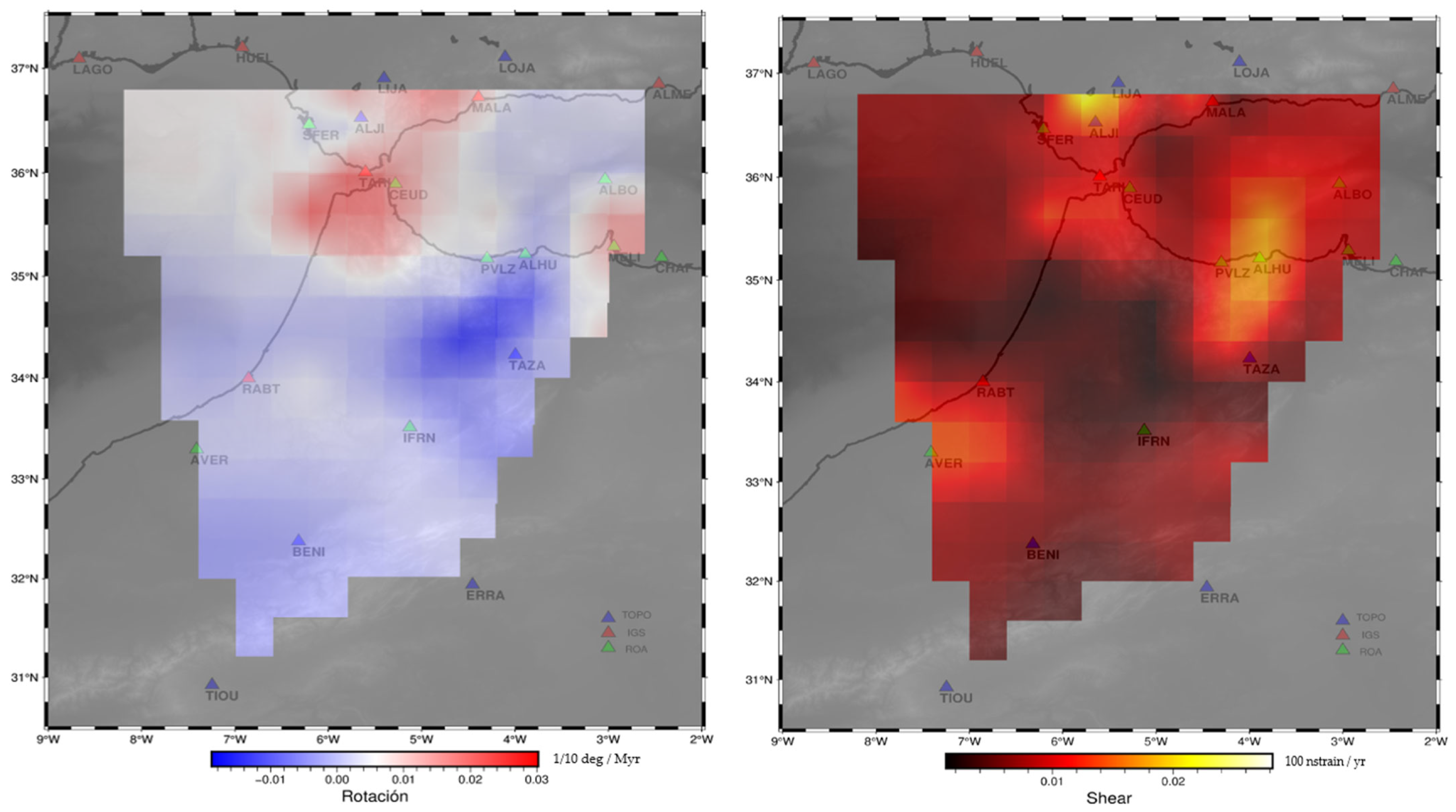
In Figure 6, rotations and strain stresses affecting the points are shown based on the deformations introduced in Table 3. The image highlights that the most extreme values are concentrated in the Gibraltar Arc region where counterclockwise (red) rotations are observed to dominate in the Betics and Gibraltar Strait, while clockwise (blue) rotations are more evident in the Rif. This suggests strong tectonic activity of the Gibraltar Arc that is localized in highly deformed areas.

Figure 6.
In the image of the (left), the rotation represents the rate at which a portion of the Earth’s crust rotates in the horizontal plane in milliradians. It indicates relative rotation due to local tectonic activity. In the image of the (right), the shear refers to the maximum deformation occurring when one part of the terrain shifts laterally relative to another, causing horizontal strain. This is critical in areas with strike-slip faults.
Table 3.
Information of the stations: Displacement velocity with respect to IGb20 in mm/yr and its standard deviation in mm/yr, displacement velocity with respect to EURA and its standard deviation in mm/yr. Additionally, we have introduced the results using MIDAS to enable comparison with LS (for simplification, they have only been provided with respect to EURA. The ALHU period is too short to be processed).
4. Discussion
From a global perspective, analyzing these preliminary results provides insight into the motion between the EURA and NUBIAs. It is possible to observe, based on the velocities of the GNSS stations located in the more tectonically stable areas of Ibero–Magrebi (LAGO and HUEL in EURA plate and TIOU and ERRA in NUBIA), that there is indeed a convergence in the NW-SE direction at a rate of approximately 4.5 mm/yr tending with clockwise rotation to N-S. This observation is consistent with previous studies referenced [2,3,4,5], where velocities ranging between 4 and 5 mm/yr are shown. Furthermore, a perpendicular heterogeneous extension, especially in the Alborán domain in the ENE-WSW direction, is associated with the previously mentioned convergence. As a consequence, there are regions where compressional shortening is primarily observed, while in others, extensional deformation predominates. This corroborates findings from several studies, such as [2,14,39,41]. It is true that, when compared with previous studies, it is important to consider that these were conducted in earlier reference frames [51,52], which could introduce a slight displacement; however, given the localized and nearby areas, this effect should be minimal.
To accurately compare the new insights provided by the analysis of the network used with previous studies in this region, Figure 7 displays the velocities relative to EURA from the most representative prior research, including [4,10,18].
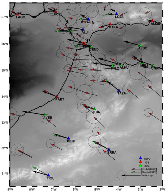
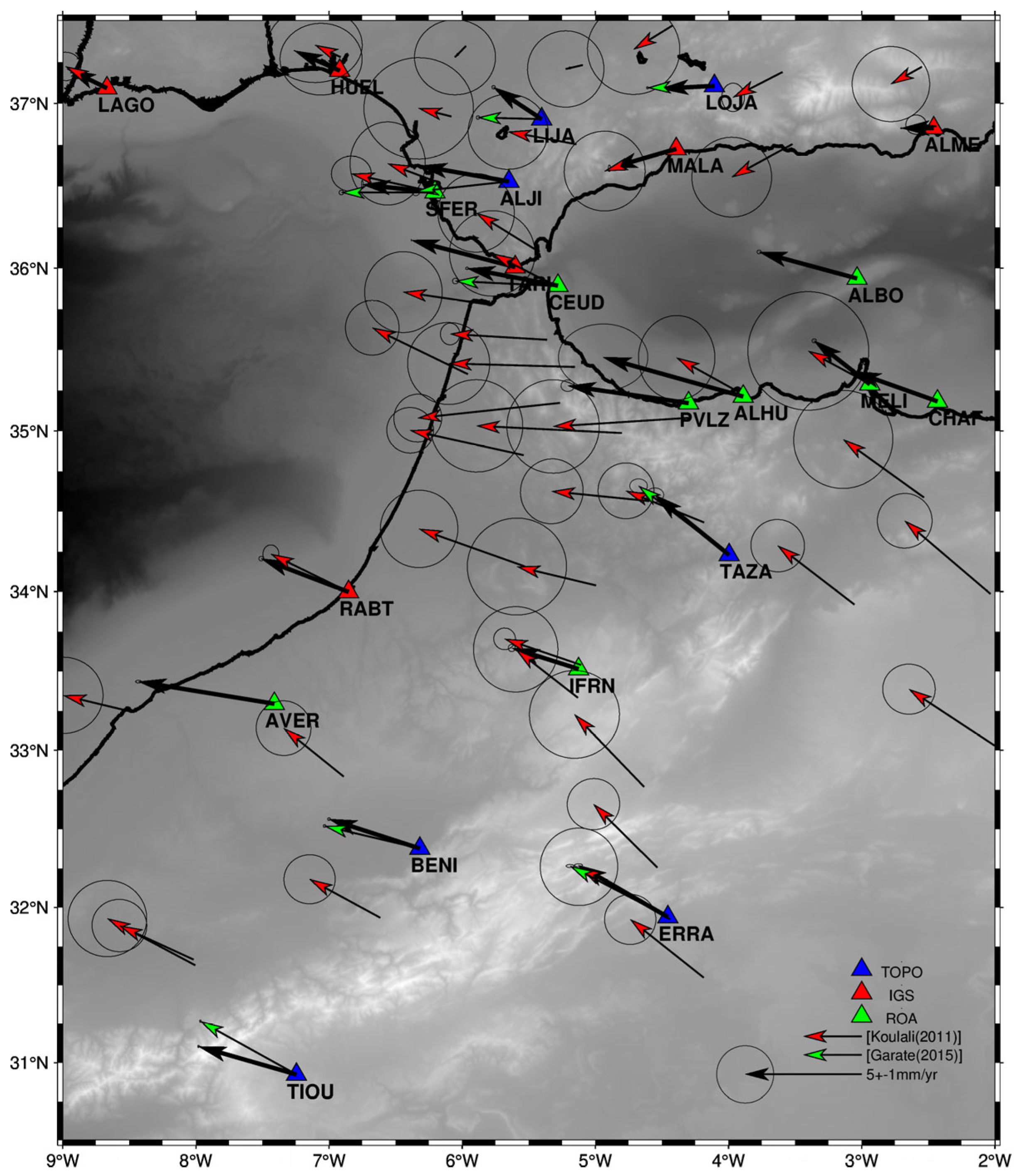
Figure 7.
Overview of the confluence zone of North Africa and the southern Iberian Peninsula. The velocities with respect to EURA (scale 5 mm/year) of continuous and episodic stations used for the study are plotted. Stations included in the study are plotted in black, red [4], and green [10,18] triangles.
Focusing a little more on the different blocks described in the results, the stations in the southwestern Iberian Peninsula exhibit similar results; these measurements consistently show a westward motion of the Betic Cordillera relative to the more stable Iberian Peninsula, which is consistent with previous studies [2,4,10,18,53]. However, there are no stations close to LIJA, which shows discrepancies compared to the analyses in [10], presenting a pronounced turn to the north. This may be attributed to the availability of longer time series. Both stations exhibit very similar dynamics in both velocity and direction, which also occur with LAGO or HUEL, although with lower magnitude. However, at SFER, the displacement is comparable to that observed at other stations in the Strait of Gibraltar and North Africa. LIJA may be highlighting part of the boundary of the diffuse convergence zone between the EURA and NUBIAs which could cross along the Guadalquivir Basin.
No further details will be provided on the results from the eastern Betics as the ROA only has the LOJA station in Granada. The aim was simply to corroborate previous results and the already analyzed behavior of this station by extending the time series for LOJA and ALBO, as well as MALA and ALME, for the study of the region. This area is under continuous analysis due to its high interest, given its constant tectonic and seismic activity. As our data align with previous findings, we will reference various studies as benchmarks for understanding its behavior. Refs. [16,17,54] present the recent behavior of NE-SW in the middle of the Betic Cordillera, verifying the results. Further south, as observed in the Campo de Dalías [11], a geological and geophysical comparison of active tectonic structures reveals a region affected by continuous deformation, which includes NNW-SSE convergence accommodated by ENE-WSW folds and orthogonal ENE-WSW extension accommodated by normal faults (with the Balanegra Fault standing out, showing a surface displacement of up to 1 mm/yr). This aligns perfectly with the results interpreted in this study, although it is true that the accommodation of the deformations is more interpretable as a NE-SW extension, as shown in Figure 5.
Another area of special interest is the Strait of Gibraltar. Several studies corroborate the presence of faults in this area, particularly to the west at Punta Camarinal [55,56]. When observing the relative velocities at the SFER, TARI, CEUD, and other stations in North Africa near the Strait of Gibraltar and the Bay of Cádiz, it is difficult to appreciate that these faults remain active. At first glance, it appears that the stations exhibit similar behavior, suggesting that the movement between both continents is quite stable and raising the possibility that this area is part of the same current tectonic domain, underlining that the plate boundary does not cross through the Gibraltar Strait.
Focusing now on South Iberia and North Africa, the first observation is that the stations in the southern Iberian Peninsula (SFER, TARI, and ALJI) exhibit similar behavior to those in North Africa (CEUD, PVLZ, ALHU, and CHAF), as well as the Alboran Island IGN station (ALBO). These could be part of the same tectonic domain, as indicated in [4,13]. However, it is noted that MELI shows a more northward trend, resembling TAZA. A lack of stations between RABT and CEUD is noted, which would enable a better understanding of the behavior between the Rif region and the western Moroccan Meseta. It is possible that these two stations are connected by the North–Middle–Atlas Fault, which could explain the similar behavior, as observed in [12], by extending the fault line of the Middle Atlas. At this point, it is important to highlight the possibility of an active compression zone between Alborán Island and Melilla that had not been previously detected. This has also been verified through the redundancy of ROA-IGN stations. Another peculiarity is the difference in the magnitude of the deformation velocity at the Alhucemas Rock (ALHU), which could aid in understanding the expansion of the Nekor Basin [24] with episodic campaigns in [19], as well as the geophysical and geological studies in [57].
As we move deeper into the Atlas, the stations show the movement of the NUBIA, with a clear NW trend of approximately 4–5 mm per year; this is especially verified by TIOU, which have long continuous data series. This result agrees with other recent studies, such as [4,20]. However, there are discrepancies, such as the case of AVER, which rotates slightly to the WNW and increases its velocity by more than 0.5 mm/yr compared to the others. One hypothesis may be that it belongs to the Coastal Meseta block, as shown in [20]; however, there is also the possibility of subsidence or an undetected local behavior at this station. On the other hand, IFRN shows less deformation than the others, which may further explain or verify the active faults in the Fez region, as studied in [12].
The highest stress zone is observed in the Gibraltar Arc, with the most significant shear points located in the Guadalquivir Basin and the Al Hoceima area. The results obtained are somewhat consistent with those previously presented in studies like [2,13,14,15], although in our case, an ENE-WSW in average compression trend is more evident. On the other hand, in the Guadalquivir Basin, a NW-SE extensional trend is observed, which requires further detailed investigation. Additionally, by incorporating more data, we have gained a better understanding of the Cádiz Bay area and North African coast. Moreover, this region is known for the potential subduction associated with the continental margin, probably located beneath the Betics and the eastern Rif. According to the hypothesized models presented in studies such as [58,59], the delamination front in the Alboran Sea is expected to propagate in a SW direction, which would help identify the active faults associated with the Al Hoceima earthquakes. However, it is essential to use combined models with different types of studies, as seen in [60], which aligns perfectly with our study’s results and provides a clear interpretation of the Gibraltar Arc’s behavior, suggesting that the uplift of the Betic–Rif chain is driven by the convergence of the EURA and NUBIAs.
5. Conclusions
The use of continuous geodetic stations is crucial due to the stability achieved through long and consistent time series. The objective of this study was to introduce a new velocity field calculated from cGNSS stations located in southern Spain and North Africa including, for the first time, data from CEUD, PVLZ, ALHU, ALBO, MELI, CHAF, and AVER and data not used before from TIOU, LIJA, ALJI, LOJA, and IFRN. The methodology used to process cGNSS data are based on the PPP technique. The software PRIDE has been used to estimate daily coordinates, and the program SARI has been used to analyze the corresponding coordinates time series.
This study has presented the final analysis of GNSS data from the ROA stations, which provide displacement velocities from new continuous stations that had not been processed until now, in contrast to previous studies based on episodic campaigns or more sparse CGNSS stations with a few years of processing. This new set of data adds precision to previously published research on tectonic deformations and enhances the detail of the present-day deformation of the region.
The results obtained from processing additional years at stations such as ALJI, ERRA, TAZA, BENI, LOJA, IFRN, and SFER have corroborated those of previous studies, even when using the PPP program from PRIDE with different processing methods, in addition to all the supplementary stations.
EURA-NUBIA convergence with a WNW-ESE trend at a rate of 4.5 mm/yr, as proposed by previous studies, as well as the anti-clockwise rotation in the Gibraltar Arc in the Betic Cordillera in addition to clockwise rotation of the Rif, have been confirmed. Several stations have provided specific insights. The ALHU station, located in the Rif region, has only been operational for two years but is in a key position. It provides valuable insights into the extension of the Nekor Basin.Eastwards and southwards, TAZA and MELI exhibited very similar velocities, which could link them as part of the same zone related to the Rif foreland. AVER was positioned alongside past studies regarding the behavior of stations in the Coastal Meseta of western Morocco, although its behavior suggests that it has an unstable position, and TIOU exhibited a more westerly trend, which may be attributed to the long data collection period. In Betics, LIJA, however, exhibited a behavior that varied to the NW. The most interesting and peculiar behavior revealed for the first time in this contribution is the shortening observed between Alborán Island and Melilla, suggesting that the Eastern Alboran Sea is a weak area deformed by the Betic–Alboran–Rif seismically active shear zone and also by folds that accommodate the Eurasian–Nubia convergence.
In summary, this study introduces a network of significant scientific interest in a sparsely instrumented area, providing valuable data that can complement previous studies. The analysis has also verified findings from studies conducted without permanent stations, such as the development of the Nekor Basin, the possible definition of the diffuse plate convergence zone between EURA and Nubia through the Gibraltar Arc, and various geological processes under discussion, including the potential connection of the North Middle Atlas Fault with the Melilla region. Additionally, this highlights the importance of maintaining such networks as they are essential for enhancing geophysical and geological research in the region.
Author Contributions
Conceptualization, D.R.C., A.B.H., M.C.d.L.P.d.l.C., J.G.-Z., A.J.G., M.Á.S.P., M.M. and I.O.; methodology, D.R.C., A.B.H., M.C.d.L.P.d.l.C., J.G.-Z., M.Á.S.P., M.M. and I.O.; software, D.R.C. and A.B.H.; validation, D.R.C., M.C.d.L.P.d.l.C., J.G.-Z. and A.J.G.; formal analysis, D.R.C., M.C.d.L.P.d.l.C. and A.B.H.; investigation, D.R.C., M.C.d.L.P.d.l.C. and A.B.H.; resources, D.R.C., A.B.H., M.C.d.L.P.d.l.C., J.G.-Z., M.Á.S.P., M.M. and I.O.; data curation, D.R.C., A.B.H. and M.C.d.L.P.d.l.C.; writing—original draft preparation, D.R.C.; writing—review and editing, D.R.C., A.B.H., M.C.d.L.P.d.l.C., J.G.-Z., A.J.G. and M.Á.S.P.; visualization, D.R.C.; supervision, D.R.C., M.C.d.L.P.d.l.C., A.J.G. and J.G.-Z. All authors have read and agreed to the published version of the manuscript.
Funding
Spanish Navy, Ministry of Defense. Grupo RNM148 of Junta de Andalucía. PID2022-136678NB-I00 AEI/FEDER (BARACA) financed by MICIU/AEI 10.13039/501100011033 FEDER, UE.
Data Availability Statement
The data are the property of the Royal Institute and Observatory of the Spanish Navy. For any inquiries or requests, please contact the lead author for possible arrangements.
Acknowledgments
We would like to thank the technical staff of the ROA’s geophysics section for their daily maintenance work, especially Antonio and Javier. Likewise, we would like to thank Nick Snow for his correction and translation work.
Conflicts of Interest
The authors declare no conflicts of interest.
Appendix A
This annex includes all the time series from the stations processed in the study. These time series correspond to horizontal positions in the east and north components.
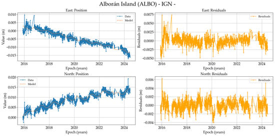
Figure A1.
On the (left), position time series of the ALBO-IGN station (North and East components in meters) in IGb2020, and on the (right), residuals of these data.
Figure A1.
On the (left), position time series of the ALBO-IGN station (North and East components in meters) in IGb2020, and on the (right), residuals of these data.
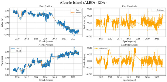
Figure A2.
On the (left), position time series of the ALBO-ROA station (North and East components in meters) in IGb2020, and on the (right), residuals of these data.
Figure A2.
On the (left), position time series of the ALBO-ROA station (North and East components in meters) in IGb2020, and on the (right), residuals of these data.

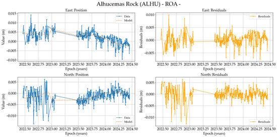
Figure A3.
On the (left), position time series of the ALHU station (North and East components in meters) in IGb2020, and on the (right), residuals of these data.
Figure A3.
On the (left), position time series of the ALHU station (North and East components in meters) in IGb2020, and on the (right), residuals of these data.
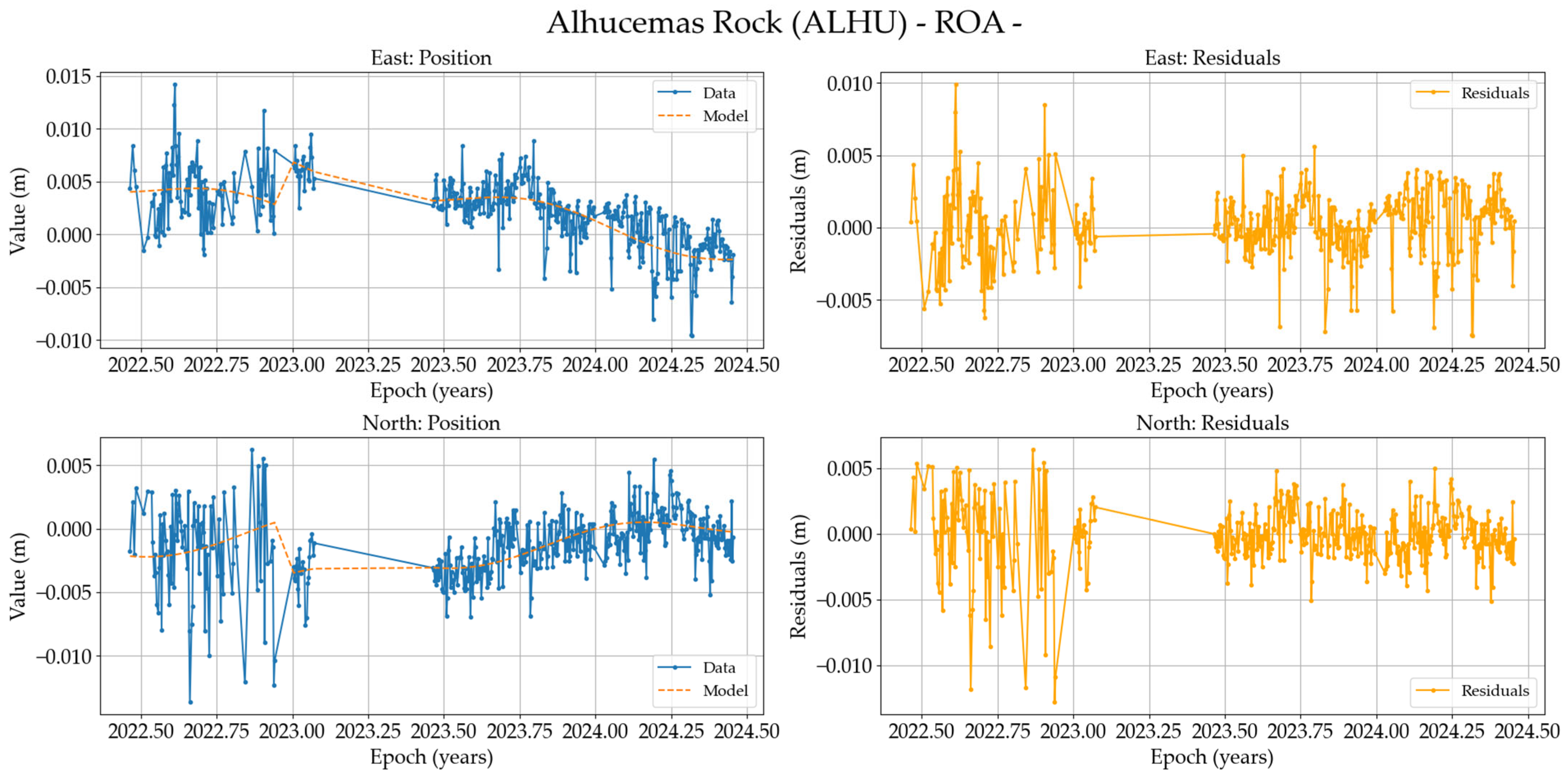

Figure A4.
On the (left), position time series of the ALJI station (North and East components in meters) in IGb2020, and on the (right), residuals of these data.
Figure A4.
On the (left), position time series of the ALJI station (North and East components in meters) in IGb2020, and on the (right), residuals of these data.
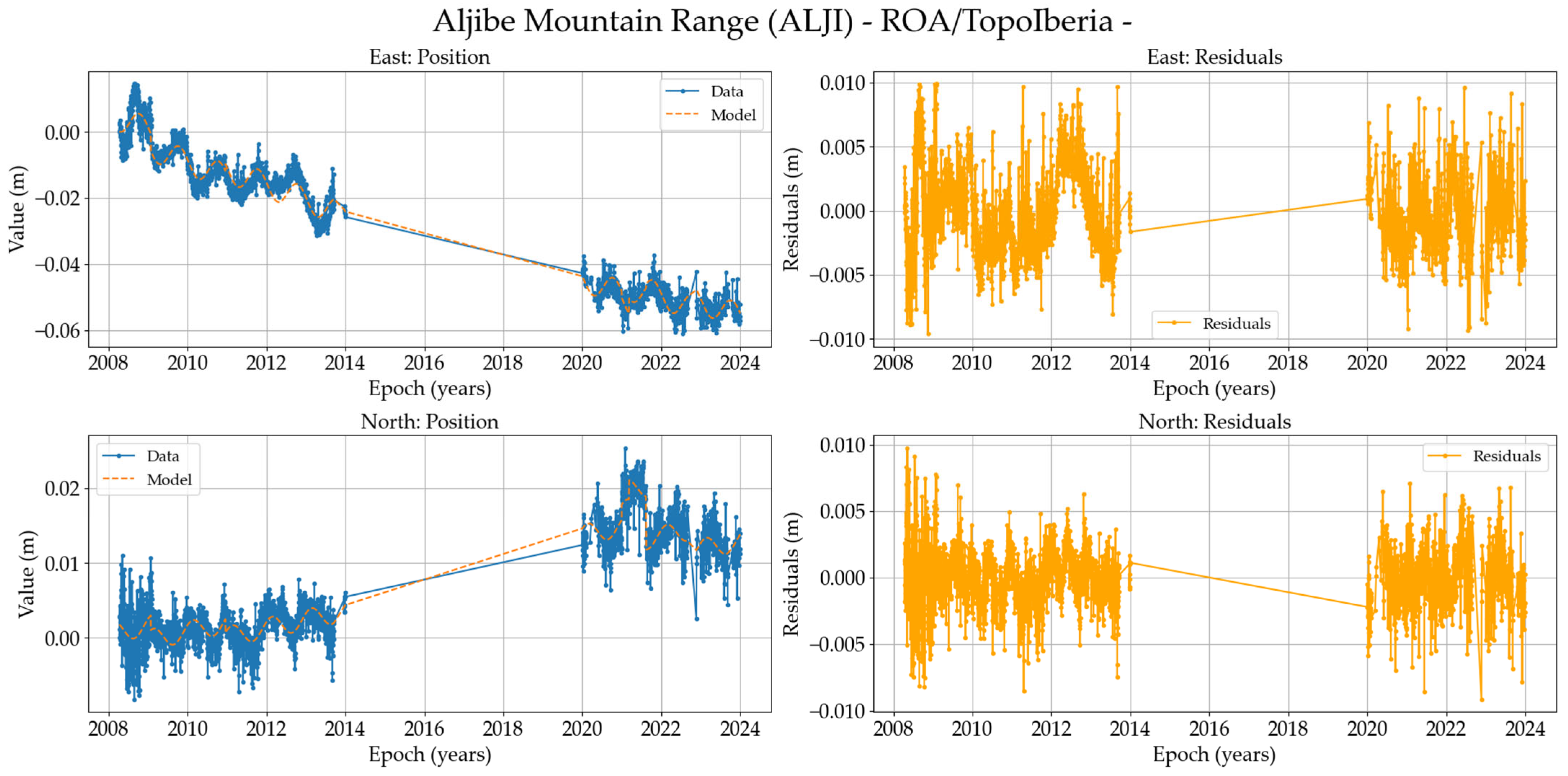

Figure A5.
On the (left), position time series of the ALME station (North and East components in meters) in IGb2020, and on the (right), residuals of these data.
Figure A5.
On the (left), position time series of the ALME station (North and East components in meters) in IGb2020, and on the (right), residuals of these data.
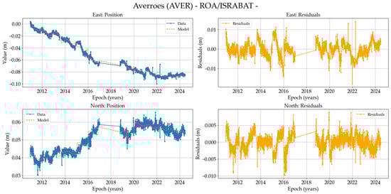
Figure A6.
On the (left), position time series of the AVER station (North and East components in meters) in IGb2020, and on the (right), residuals of these data.
Figure A6.
On the (left), position time series of the AVER station (North and East components in meters) in IGb2020, and on the (right), residuals of these data.
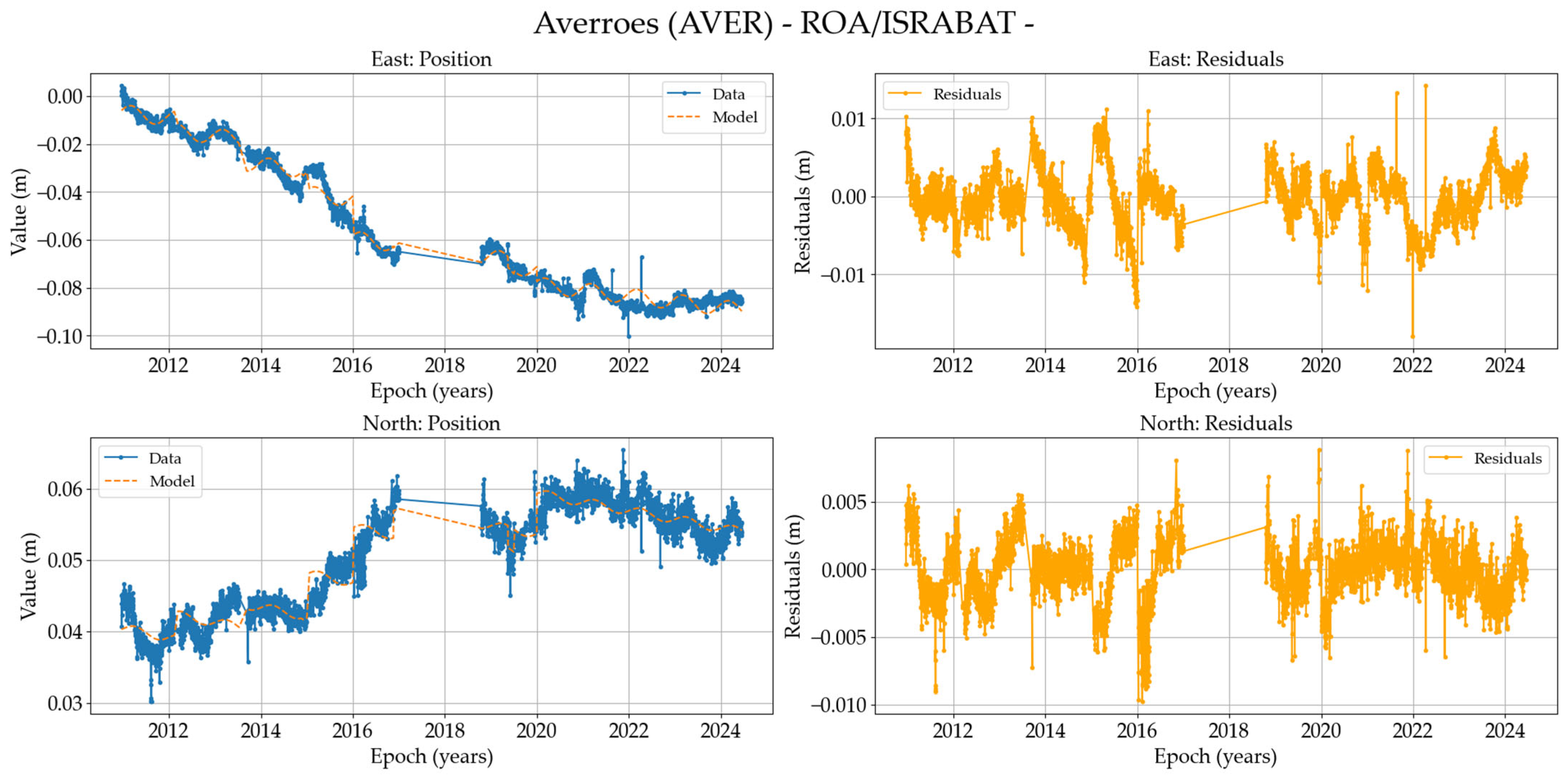

Figure A7.
On the (left), position time series of the BENI station (North and East components in meters) in IGb2020, and on the (right), residuals of these data.
Figure A7.
On the (left), position time series of the BENI station (North and East components in meters) in IGb2020, and on the (right), residuals of these data.
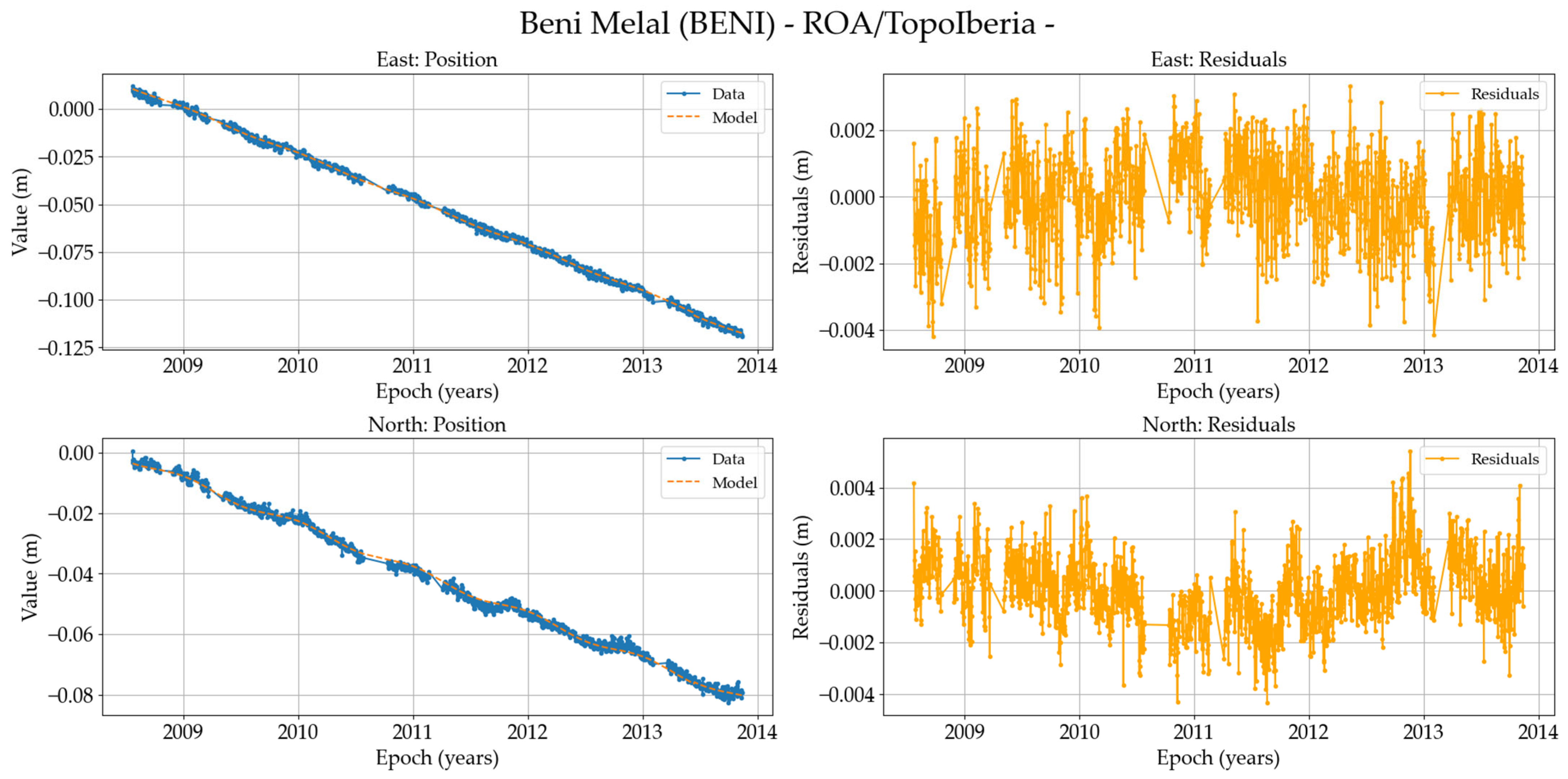

Figure A8.
On the (left), position time series of the CEUD station (North and East components in meters) in IGb2020, and on the (right), residuals of these data.
Figure A8.
On the (left), position time series of the CEUD station (North and East components in meters) in IGb2020, and on the (right), residuals of these data.
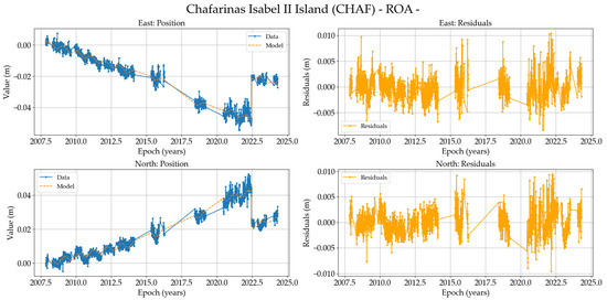
Figure A9.
On the (left), position time series of the CHAF station (North and East components in meters) in IGb2020, and on the (right), residuals of these data.
Figure A9.
On the (left), position time series of the CHAF station (North and East components in meters) in IGb2020, and on the (right), residuals of these data.
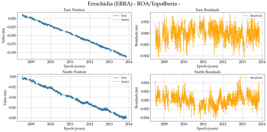
Figure A10.
On the (left), position time series of the ERRA station (North and East components in meters) in IGb2020, and on the (right), residuals of these data.
Figure A10.
On the (left), position time series of the ERRA station (North and East components in meters) in IGb2020, and on the (right), residuals of these data.
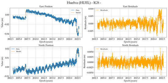
Figure A11.
On the (left), position time series of the HUEL station (North and East components in meters) in IGb2020, and on the (right), residuals of these data.
Figure A11.
On the (left), position time series of the HUEL station (North and East components in meters) in IGb2020, and on the (right), residuals of these data.
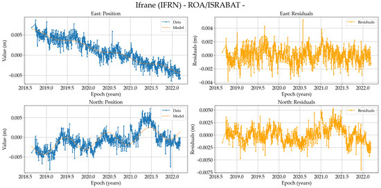
Figure A12.
On the (left), position time series of the IFRN station (North and East components in meters) in IGb2020, and on the (right), residuals of these data.
Figure A12.
On the (left), position time series of the IFRN station (North and East components in meters) in IGb2020, and on the (right), residuals of these data.
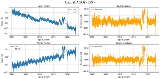
Figure A13.
On the (left), position time series of the LAGO station (North and East components in meters) in IGb2020, and on the (right), residuals of these data.
Figure A13.
On the (left), position time series of the LAGO station (North and East components in meters) in IGb2020, and on the (right), residuals of these data.
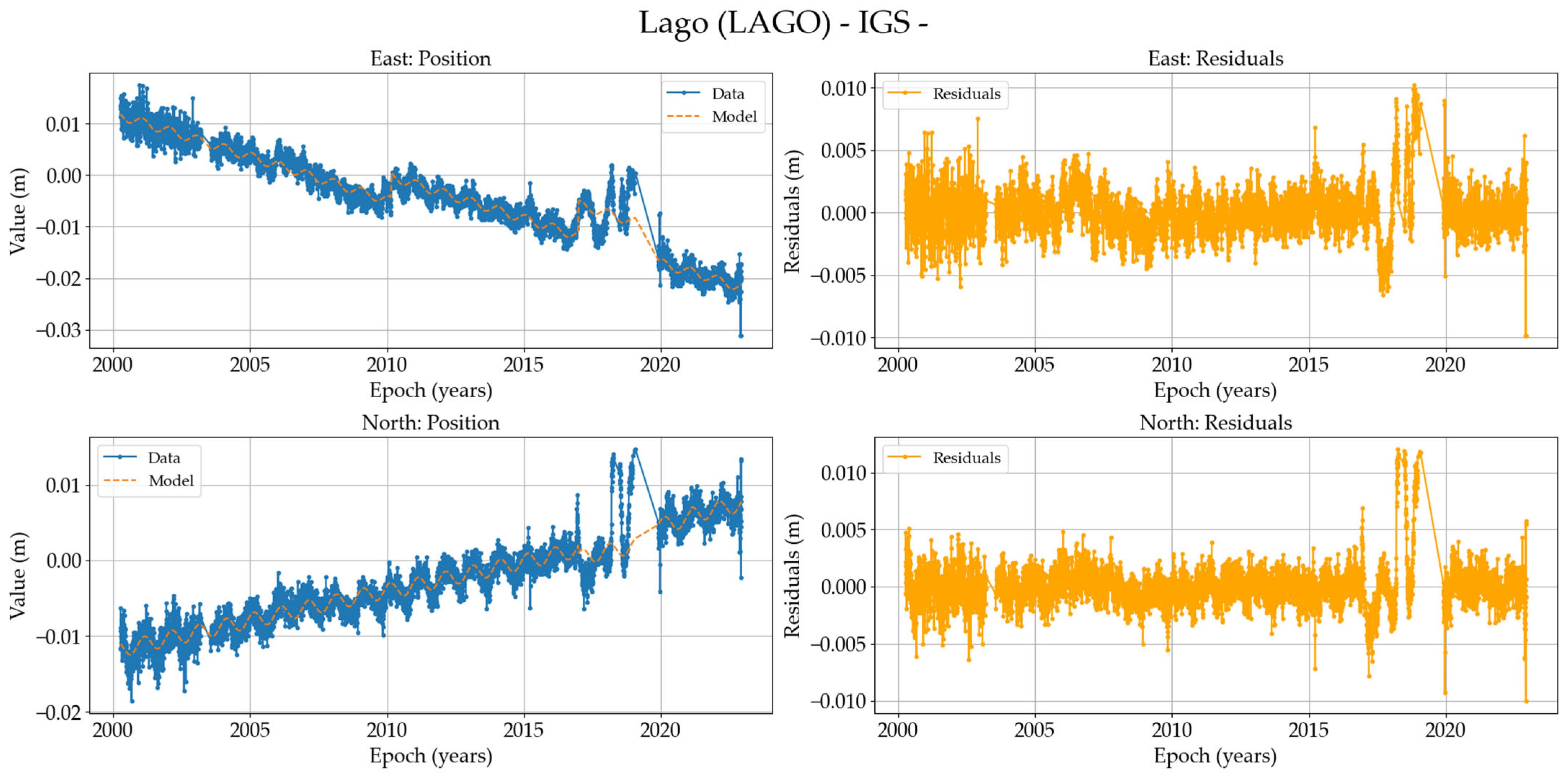
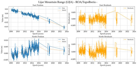
Figure A14.
On the (left), position time series of the LIJA station (North and East components in meters) in IGb2020, and on the (right), residuals of these data.
Figure A14.
On the (left), position time series of the LIJA station (North and East components in meters) in IGb2020, and on the (right), residuals of these data.

Figure A15.
On the (left), position time series of the LOJA station (North and East components in meters) in IGb2020, and on the (right), residuals of these data.
Figure A15.
On the (left), position time series of the LOJA station (North and East components in meters) in IGb2020, and on the (right), residuals of these data.
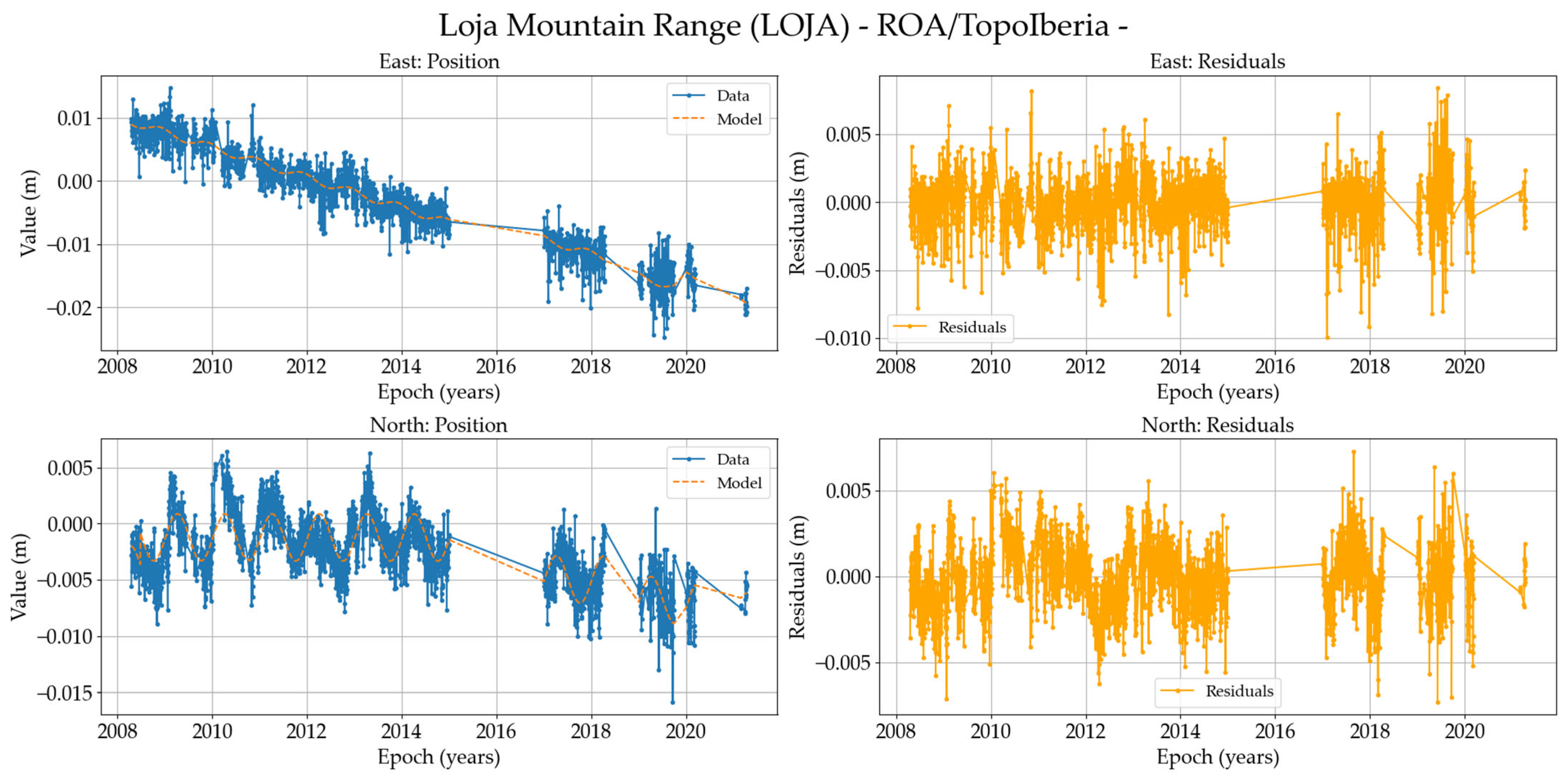
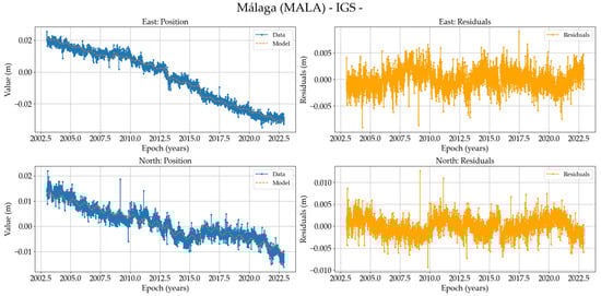
Figure A16.
On the (left), position time series of the MALA station (North and East components in meters) in IGb2020, and on the (right), residuals of these data.
Figure A16.
On the (left), position time series of the MALA station (North and East components in meters) in IGb2020, and on the (right), residuals of these data.

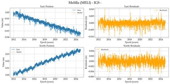
Figure A17.
On the (left), position time series of the MELI-IGS station (North and East components in meters) in IGb2020, and on the (right), residuals of these data.
Figure A17.
On the (left), position time series of the MELI-IGS station (North and East components in meters) in IGb2020, and on the (right), residuals of these data.
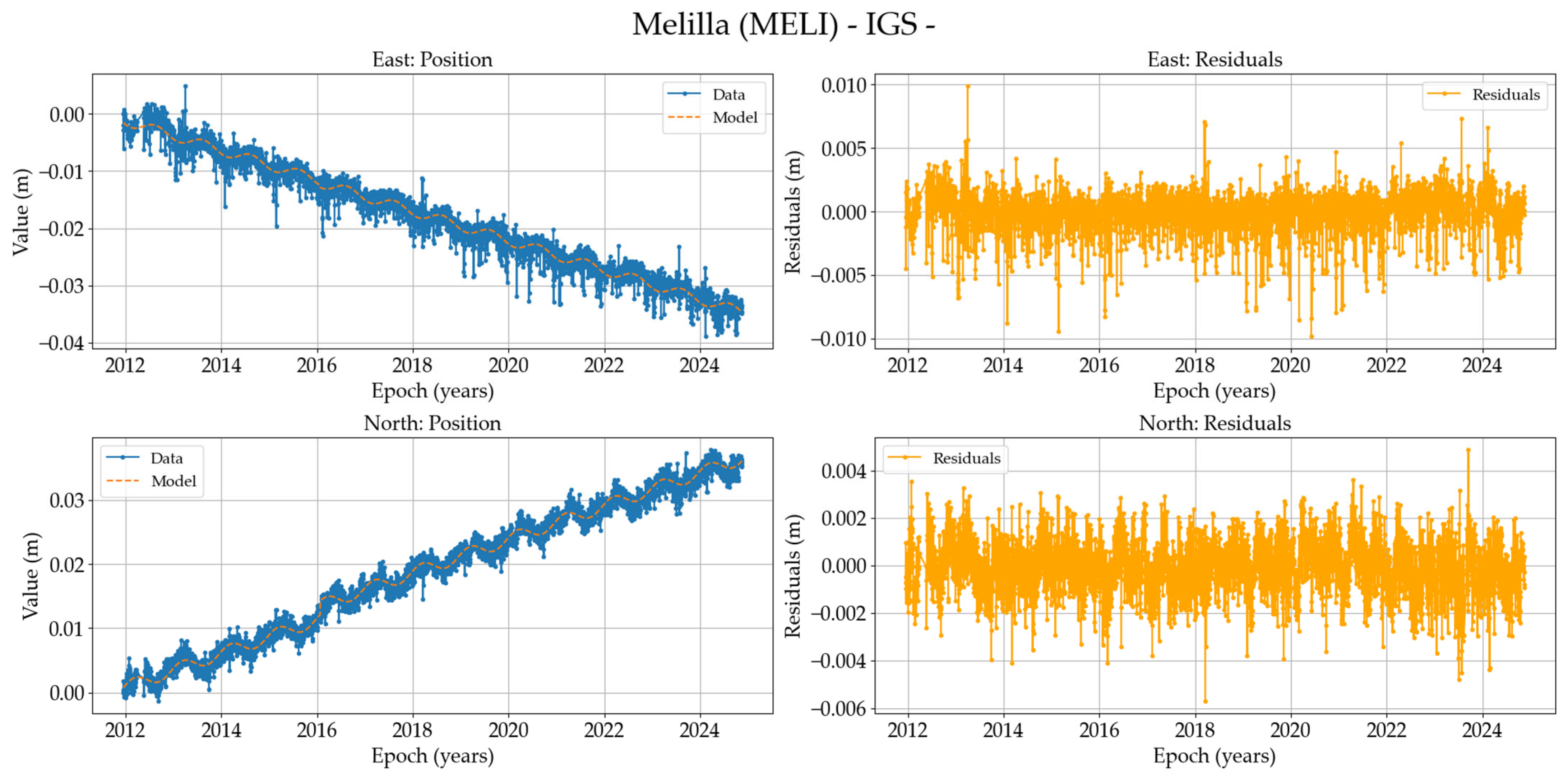
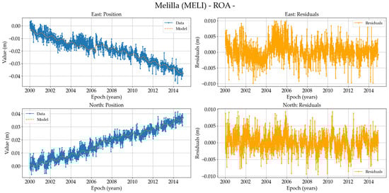
Figure A18.
On the (left), position time series of the MELI-ROA station (North and East components in meters) in IGb2020, and on the (right), residuals of these data.
Figure A18.
On the (left), position time series of the MELI-ROA station (North and East components in meters) in IGb2020, and on the (right), residuals of these data.
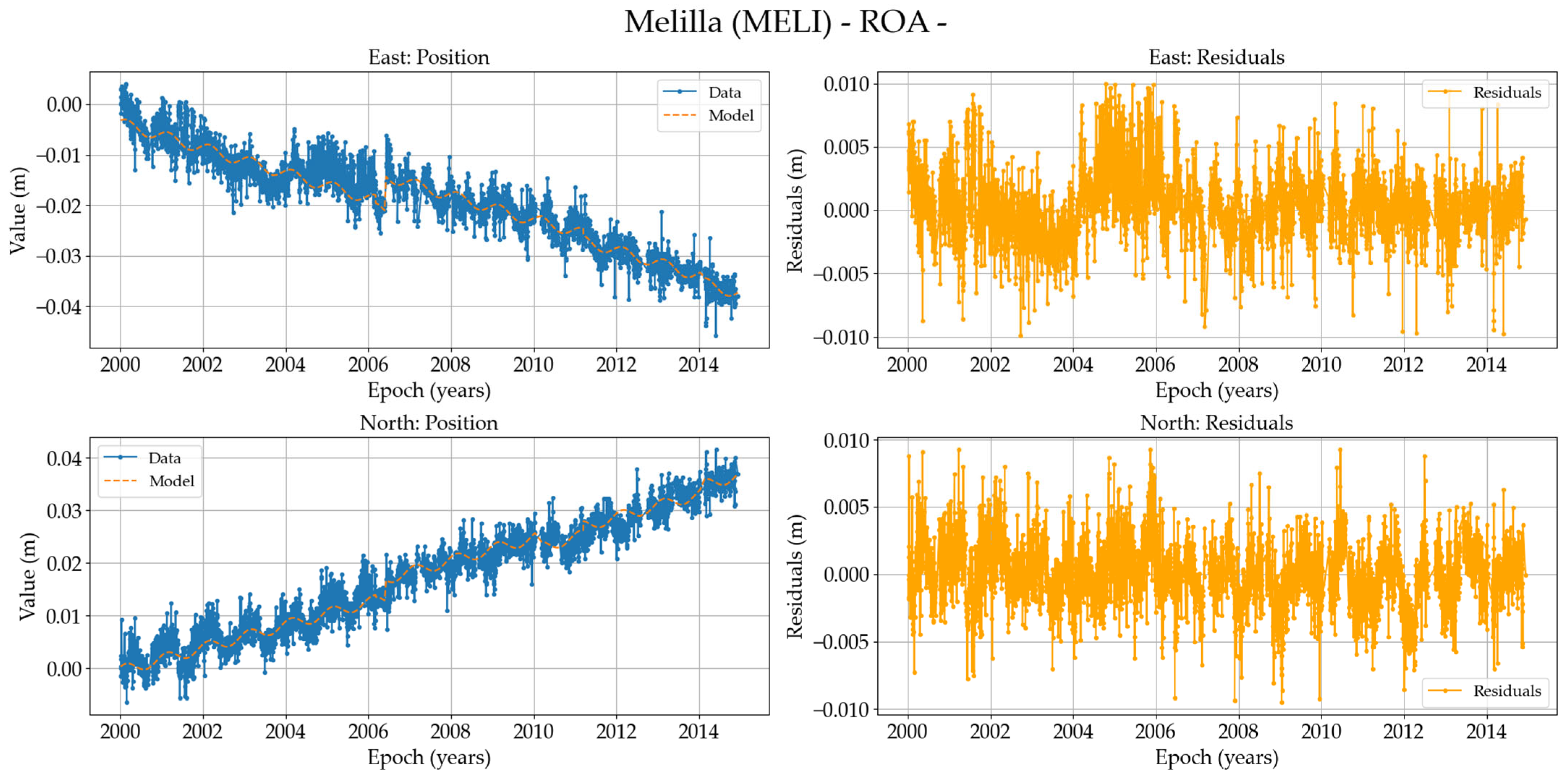
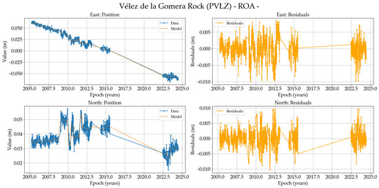
Figure A19.
On the (left), position time series of the PVLZ station (North and East components in meters) in IGb2020, and on the (right), residuals of these data.
Figure A19.
On the (left), position time series of the PVLZ station (North and East components in meters) in IGb2020, and on the (right), residuals of these data.
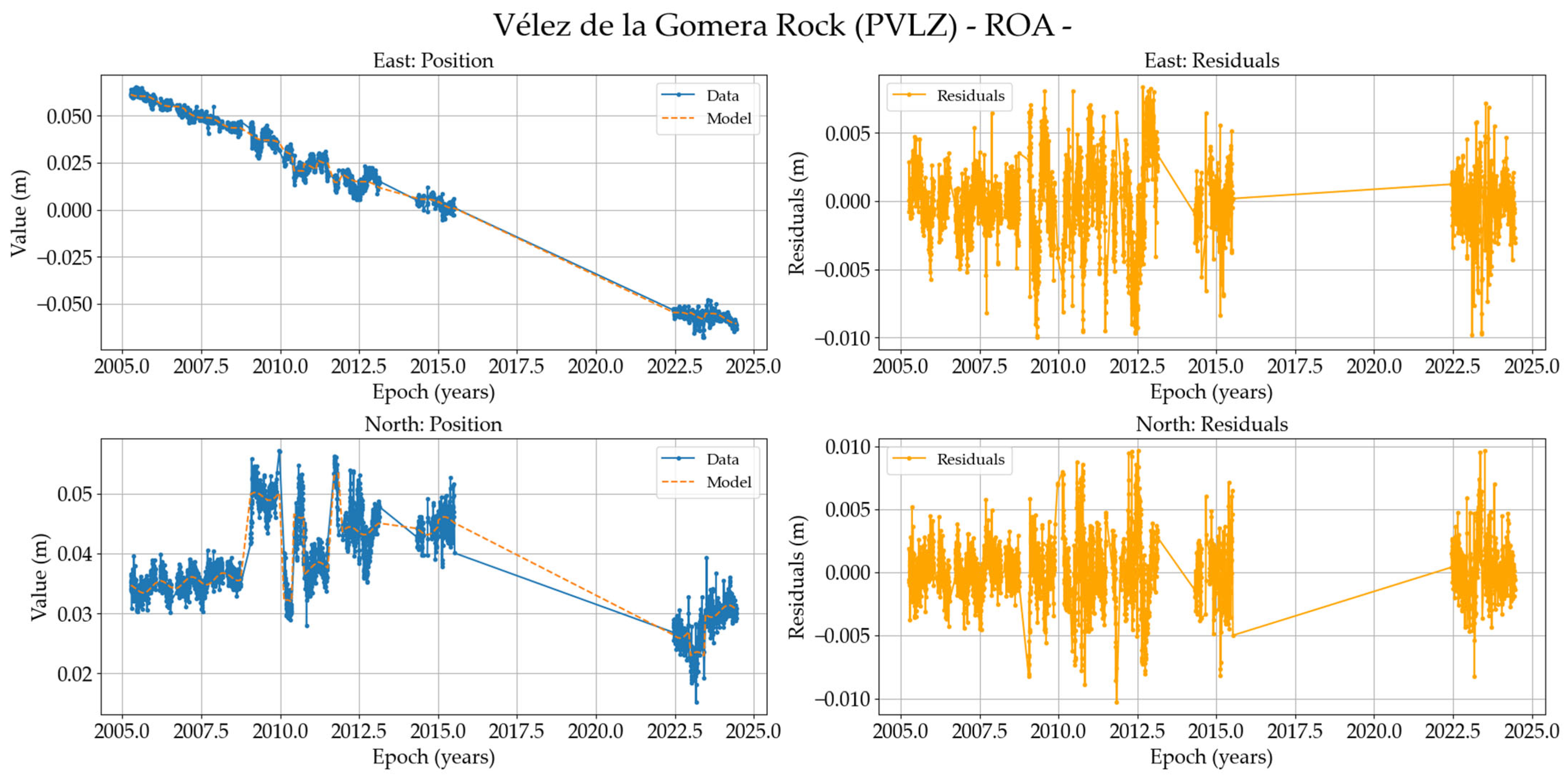
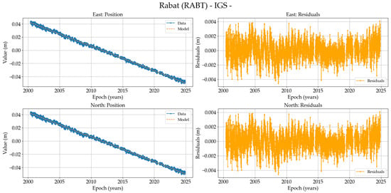
Figure A20.
On the (left), position time series of the RABT station (North and East components in meters) in IGb2020, and on the (right), residuals of these data.
Figure A20.
On the (left), position time series of the RABT station (North and East components in meters) in IGb2020, and on the (right), residuals of these data.
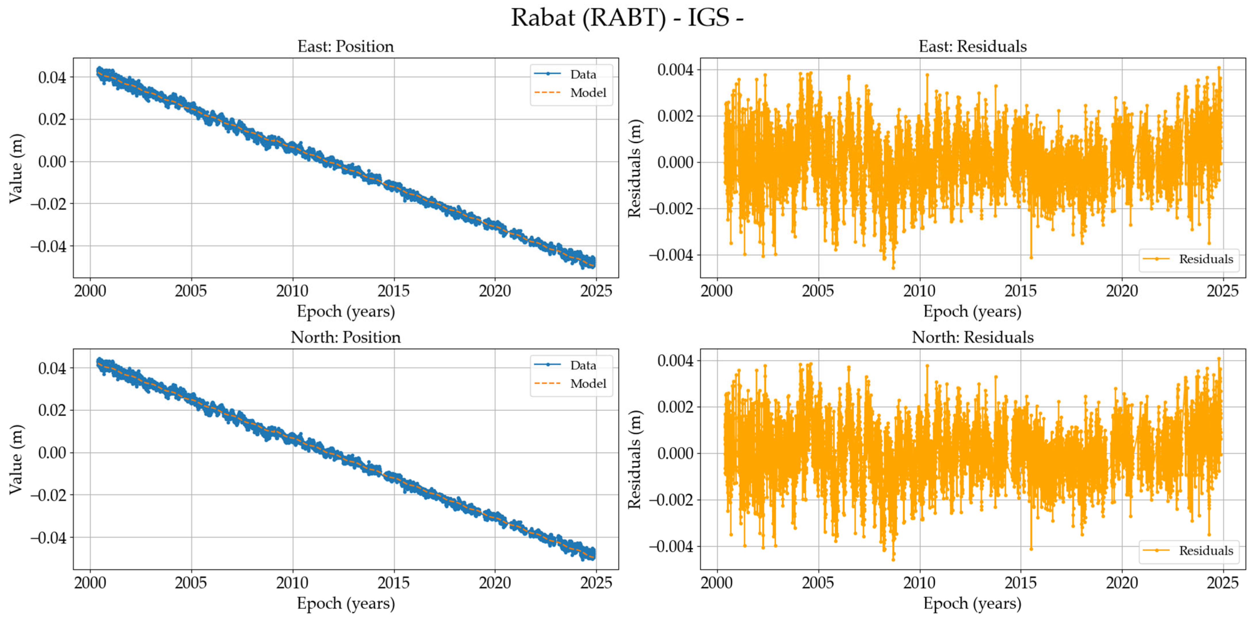
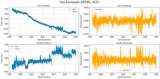
Figure A21.
On the (left), position time series of the SFER-IGS station (North and East components in meters) in IGb2020, and on the (right), residuals of these data.
Figure A21.
On the (left), position time series of the SFER-IGS station (North and East components in meters) in IGb2020, and on the (right), residuals of these data.
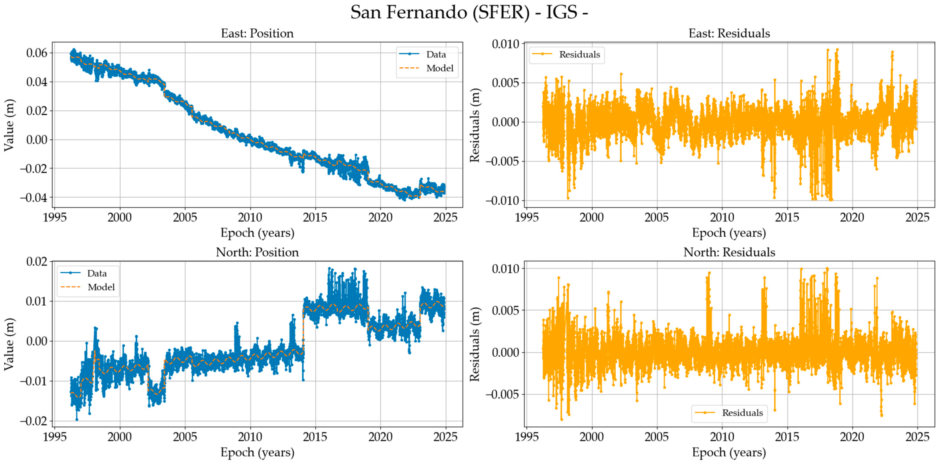
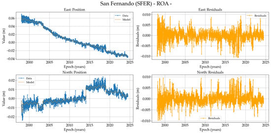
Figure A22.
On the (left), position time series of the SFER-ROA station (North and East components in meters) in IGb2020, and on the (right), residuals of these data.
Figure A22.
On the (left), position time series of the SFER-ROA station (North and East components in meters) in IGb2020, and on the (right), residuals of these data.
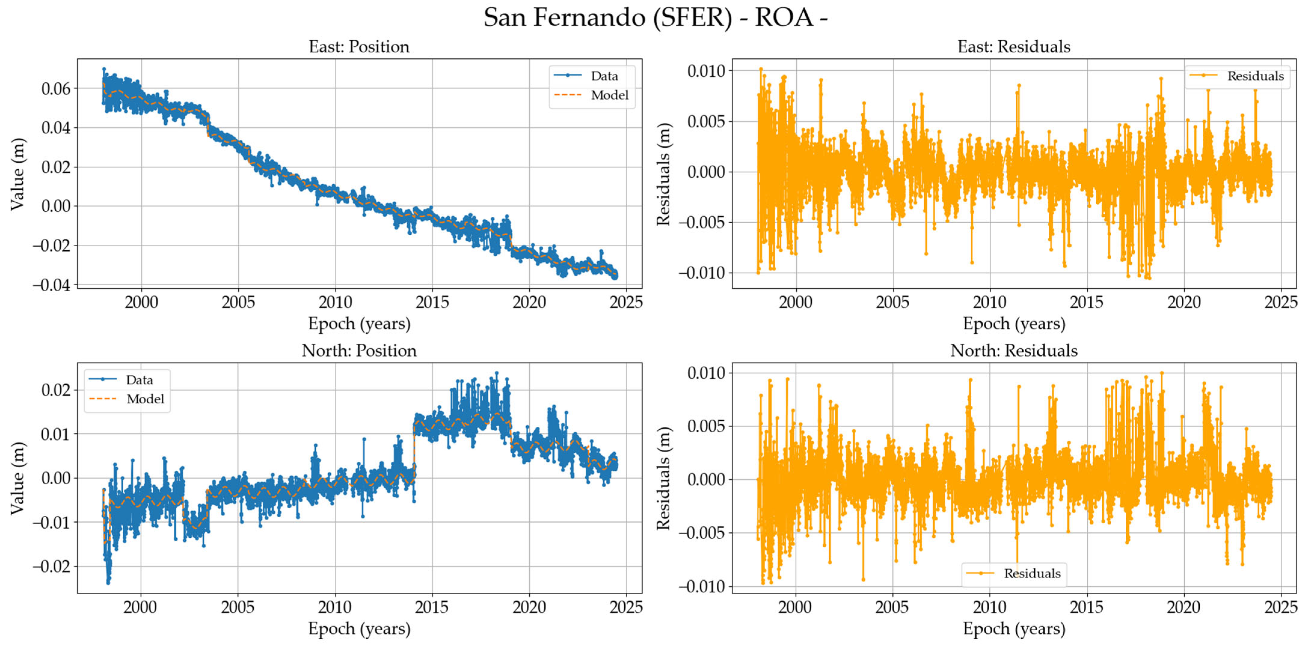
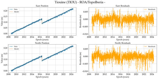
Figure A23.
On the (left), position time series of the TIOU station (North and East components in meters) in IGb2020, and on the (right), residuals of these data.
Figure A23.
On the (left), position time series of the TIOU station (North and East components in meters) in IGb2020, and on the (right), residuals of these data.
References
- Palano, M.; González, P.J.; Fernández, J. The Diffuse Plate boundary of Nubia and Iberia in the Western Mediterranean: Crustal deformation evidence for viscous coupling and fragmented lithosphere. Earth Planet. Sci. Lett. 2015, 430, 439–447. [Google Scholar] [CrossRef]
- Serpelloni, E.; Vannucci, G.; Pondrelli, S.; Argnani, A.; Casula, G.; Anzidei, M.; Baldi, P.; Gasperini, P. Kinematics of the Western Africa-Eurasia plate boundary from focal mechanisms and GPS data. Geophys. J. Int. 2007, 169, 1180–1200. [Google Scholar] [CrossRef]
- Nocquet, J.M. Present-day kinematics of the Mediterranean: A comprehensive overview of GPS results. Tectonophysics 2012, 579, 220–242. [Google Scholar] [CrossRef]
- Koulali, A.; Ouazar, D.; Tahayt, A.; King, R.W.; Vernant, P.; Reilinger, R.E.; McClusky, S.; Mourabit, T.; Davila, J.M.; Amraoui, N. New GPS constraints on active deformation along the Africa–Iberia plate boundary. Earth Planet. Sci. Lett. 2011, 308, 211–217. [Google Scholar] [CrossRef]
- Vernant, P.; Fadil, A.; Mourabit, T.; Ouazar, D.; Koulali, A.; Davila, J.M.; Garate, J.; McClusky, S.; Reilinger, R. Geodetic constraints on active tectonics of the Western Mediterranean: Implications for the kinematics and dynamics of the Nubia-Eurasia plate boundary zone. J. Geodyn. 2010, 49, 123–129. [Google Scholar] [CrossRef]
- Argus, D.F.; Gordon, R.G.; DeMets, C.; Stein, S. Closure of the Africa-Eurasia-North America plate motion circuit and tectonics of the Gloria fault. J. Geophys. Res. Solid Earth 1989, 94, 5585–5602. [Google Scholar] [CrossRef]
- DeMets, C.; Gordon, R.G.; Argus, D.F.; Stein, S. Current plate motions. Geophys. J. Int. 1990, 101, 425–478. [Google Scholar] [CrossRef]
- DeMets, C.; Gordon, R.G.; Argus, D.F.; Stein, S. Effect of recent revisions to the geomagnetic reversal time scale on estimates of current plate motions. Geophys. Res. Lett. 1994, 21, 2191–2194. [Google Scholar] [CrossRef]
- Sparacino, F.; Palano, M.; Peláez, J.A.; Fernández, J. Geodetic deformation versus seismic crustal moment-rates: Insights from the Ibero-Maghrebian region. Remote Sens. 2020, 12, 952. [Google Scholar] [CrossRef]
- Garate, J.; Martin-Davila, J.; Khazaradze, G.; Echeverria, A.; Asensio, E.; Gil, A.J.; de Lacy, M.C.; Armenteros, J.A.; Ruiz, A.M.; Gallastegui, J.; et al. Topo-Iberia project: CGPS crustal velocity field in the Iberian Peninsula and Morocco. GPS Solut. 2015, 19, 287–295. [Google Scholar] [CrossRef]
- Gallart, J. Geosciences in Iberia: Integrated studies of topography and 4-D evolution. ‘Topo-Iberia’ supported by the Spanish Government. Instituto de Ciencias de la Tierra ‘Jaume Almera’ del Consejo Superior de Investigaciones Científicas. CONSOLIDER-INGENIO 2010. 2006. Available online: https://web.igme.es/TopoIberia/default.html (accessed on 12 February 2025).
- Ryan, W.B.F.; Carbotte, S.M.; Coplan, J.O.; O’Hara, S.; Melkonian, A.; Arko, R.; Weissel, R.A.; Ferrini, V.; Goodwillie, A.; Niche, F.; et al. Global Multi-Resolution Topography synthesis. Geochem. Geophys. Geosyst. 2009, 10, Q03014. [Google Scholar] [CrossRef]
- Klitgord, K.D.; Schouten, H. Plate kinematics of the central Atlantic. In The Western North Atlantic Region; Vogt, P.R., Tucholke, B.E., Eds.; GeoScienceWorld: McLean, VA, USA, 1986; pp. 351–378. [Google Scholar] [CrossRef]
- Bird, P. An updated digital model of plate boundaries. Geochem. Geophys. Geosyst. 2003, 4, 1–52. [Google Scholar] [CrossRef]
- Gutscher, M.A. What caused the Great Lisbon earthquake? Science 2004, 305, 1247–1248. [Google Scholar] [CrossRef] [PubMed]
- Galindo-Zaldivar, J.; Gil, A.J.; Tendero-Salmerón, V.; Borque, M.J.; Ercilla, G.; González-Castillo, L.; Sánchez-Alzola, A.; Lacy, M.C.; Estrada, F.; Avilés, M.; et al. The Campo de Dalias GNSS Network Unveils the Interaction between Roll-Back and Indentation Tectonics in the Gibraltar Arc. Sensors 2022, 22, 2128. [Google Scholar] [CrossRef]
- Chalouan, A.; Gil, A.J.; Galindo-Zaldivar, J.; Ahmamou, M.; Ruano, P.; Lacy, M.C.; Ruiz-Armenteros, A.; Benmakhlouf, M.; Riguzzi, F. Active faulting in the frontal Rif Cordillera (Fes region, Morocco): Constraints from GPS data. J. Geodyn. 2014, 77, 110–122. [Google Scholar] [CrossRef]
- Fadil, A.; Vernant, P.; Mcclusky, S.; Reilinger, R.; Gomez, F.; Ben Sari, D.; Mourabit, T.; Feigl, K.L.; Barazangi, M. Active tectonics of the western Mediterranean: Geodetic evidence for rollback of a delaminated subcontinental lithospheric slab beneath the Rif Mountains, Morocco. Geology 2006, 34, 529–532. [Google Scholar] [CrossRef]
- Palano, M.; González, P.; Fernandez, J. Strain and stress fields along the Gibraltar Orogenic Arc: Constraints on active geodynamics. Gondwana Res. 2013, 23, 1071–1088. [Google Scholar] [CrossRef]
- Borque, M.J.; Sánchez-Alzola, A.; Martin-Rojas, I.; Alfaro, P.; Molina, S.; Rosa-Cintas, S.; Rodríguez-Caderot, G.; de Lacy, C.; García-Armenteros, J.A.; Avilés, M.; et al. How much Nubia-Eurasia convergence is accommodated by the NE end of the Eastern Betic Shear Zone (SE Spain) Constraints from GPS velocities. Tectonics 2019, 38, 1824–1839. [Google Scholar] [CrossRef]
- Alfaro, P.; Sánchez-Alzola, A.; Martin-Rojas, I.; García-Tortosa, F.J.; Galindo-Zaldívar, J.; Avilés, M.; López Garrido, A.C.; Sanz de Galdeano, C.; Ruano, P.; Martínez-Moreno, F.J.; et al. Geodetic fault slip rates on active faults in the Baza sub-Basin (SE Spain): Insights for seismic hazard assessment. J. Geodyn. 2021, 144, 101815. [Google Scholar] [CrossRef]
- Gil, A.J.; Borque, M.; Avilés, M.; Lacy, M.; Galindo-Zaldívar, J.; Alfaro, P.; García-Tortosa, F.J.; Sanchez-Alzola, A.; Martin-Rojas, I.; Medina-Cascales, I.; et al. Crustal velocity field in Baza and Galera faults: A new estimation from GPS position time series in 2009–2018-time span. In Proceedings of the 5th Joint International Symposium on Deformation Monitoring (JISDM), Valencia, Spain, 20–22 June 2022. [Google Scholar] [CrossRef]
- Gonzalez-Castillo, L.; Galindo-Zaldivar, J.; de Lacy, M.C.; Borque, M.J.; Martínez-Moreno, F.J.; García-Armenteros, J.A.; Gil, A.J. Active rollback in the Gibraltar Arc: Evidences from CGPS data in the western Betic Cordillera. Tectonophysics 2015, 663, 310–321. [Google Scholar] [CrossRef]
- Galindo-Zaldivar, J.; Azzouz, O.; Chalouan, A.; Pedrera, A.; Ruano, P.; Ruiz-Constán, A.; Sanz de Galdeano, C.; Marín-Lechado, C.; López-Garrido, A.; Anahnah, F.; et al. Extensional tectonics, graben development and fault terminations in the eastern Rif (Bokoya-Ras Afraou area). Tectonophysics 2015, 663, 140–149. [Google Scholar] [CrossRef]
- Chalouan, A.; Gil, A.J.; Chabli, A.; Bargach, K.; Liemlahi, H.; El Kadiri, K.; Tendero-Salmerón, V.; Galindo-Zaldívar, J. cGPS Record of Active Extension in Moroccan Meseta and Shortening in Atlasic Chains under the Eurasia-Nubia Convergence. Sensors 2023, 23, 4846. [Google Scholar] [CrossRef]
- Moussaid, B.; Hmidou, E.; Casas-Sainz, A.; Pocoví, A.; Román-Berdiel, T.; Oliva-Urcia, B.; Ruiz-Martínez, V.C.; Villalaín, J. The Geological Setting of the Moroccan High Atlas and Its Plate Tectonics Context. In Tectonic Evolution of the Moroccan High Atlas: A Paleomagnetic Perspective; Calvín, P., Casas-Sainz, A.M., Román-Berdiel, T., Villalaín, J.J., Eds.; Springer Geology; Springer: Cham, Switzerland, 2023. [Google Scholar] [CrossRef]
- Gallastegui, J.; Pulgar, J.; González-Cortina, J.; Garate, J.; Martín-Dávila, J.; Khazaradze, G.; Gil, A.J.; Ruiz-Armenteros, A.M.; Jiménez-Munt, I.; Ayala, C.; et al. Despliegue de estaciones GPS permanentes en el marco del proyecto Topo-Iberia. In Proceedings of the Conference: VII Congreso Geológico de España, Las Palmas de Gran Canarias, Spain, 14–18 July 2008; Geo-Temas: Salamanca, Spain, 2008. [Google Scholar]
- Geng, J.; Chen, X.; Pan, Y.; Mao, S.; Li, C.; Zhou, J.; Zhang, K. PRIDE PPP-AR: An open-source software for GPS PPP ambiguity resolution. GPS Solut. 2019, 23, 91. [Google Scholar] [CrossRef]
- Teunissen, P.; Montenbruck, O. Precise Point Positioning: A Powerful Technique with Applications in GPS, GLONASS, Galileo, and BeiDou Navigation Systems. GPS Solut. 2017, 21, 1–12. [Google Scholar] [CrossRef]
- Dach, R.; Selmke, I.; Villiger, A.; Arnold, D.; Prange, L.; Schaer, S.; Sidorov, D.; Stebler, P.; Jäggi, A.; Hugentobler, U. Review of recent GNSS modelling improvements based on CODEs Repro3 contribution. Adv. Space Res. 2021, 68, 1263–1280. [Google Scholar] [CrossRef]
- Altamimi, Z.; Rebischung, P.; Collilieux, X.; Métivier, L.; Chanard, K. ITRF2020: An augmented reference frame refining the modeling of nonlinear station motions. J. Geod. 2023, 97, 47. [Google Scholar] [CrossRef]
- Saastamoinen, J. Atmospheric correction for the troposphere and stratosphere in radio ranging satellites. Geophys. Monogr. Ser. 1972, 15, 247–251. [Google Scholar] [CrossRef]
- Boehm, J.; Werl, B.; Schuh, H. Troposphere mapping functions for GPS and very long baseline interferometry from European Centre for Medium-Range Weather Forecasts operational analysis data. J. Geophys. Res. 2006, 111, B02406. [Google Scholar] [CrossRef]
- Bos, M.S.; Scherneck, H.G. Ocean Tide Loading. 2024. Available online: http://holt.oso.chalmers.se/loading/ (accessed on 5 June 2024).
- Lyard, F.H.; Allain, D.J.; Cancet, M.; Carrère, L.; Picot, N. FES2014 global ocean tide atlas: Design and performance. Ocean Sci. 2021, 17, 615–649. [Google Scholar] [CrossRef]
- Teunissen, P.; Jonge, P.; Tiberius, C. The least-squares ambiguity decorrelation adjustment: Its performance on short GPS baselines and short observation spans. J. Geod. 1997, 71, 589–602. [Google Scholar] [CrossRef]
- Santamaría-Gómez, A. SARI: Interactive GNSS position time series analysis software. GPS Solut. 2019, 23, 52. [Google Scholar] [CrossRef]
- Bruyninx, C.; Legrand, J.; Fabian, A.; Pottiaux, E. GNSS Metadata and Data Validation in the EUREF Permanent Network. GPS Solut. 2019, 23, 106. [Google Scholar] [CrossRef]
- Johnston, G.; Riddell, A.; Hausler, G. The International GNSS Service. In Springer Handbook of Global Navigation Satellite Systems, 1st ed.; Teunissen, P.J.G., Montenbruck, O., Eds.; Springer International Publishing: Cham, Switzerland, 2017; pp. 967–982. [Google Scholar] [CrossRef]
- Fernandes, R.; Bruyninx, C.; Crocker, P.; Menut, J.; Socquet, A.; Vergnolle, M.; Avallone, A.; Bos, M.; Bruni, S.; Cardoso, R.; et al. A new European service to share GNSS Data and Products. Ann. Geophys. 2022, 65, DM317. [Google Scholar] [CrossRef]
- Altamimi, Z.; Métivier, L.; Rebischung, P.; Collilieux, X.; Chanard, K.; Barnéoud, J. ITRF2020 plate motion model. Geophys. Res. Lett. 2023, 50, e2023GL106373. [Google Scholar] [CrossRef]
- Strutz, T. Data Fitting and Uncertainty (A Practical Introduction to Weighted Least Squares and Beyond), 2nd ed.; Springer: Berlin/Heidelberg, Germany, 2016; ISBN 978-3-658-11455-8. [Google Scholar]
- Blewitt, G.; Kreemer, C.; Hammond, W.C.; Gazeaux, J. MIDAS robust trend estimator for accurate GPS station velocities without step detection. J. Geophys. Res. Solid Earth 2016, 121, 2054–2068. [Google Scholar] [CrossRef]
- Huang, J.; He, X.; Hu, S.; Ming, F. Impact of Offsets on GNSS Time Series Stochastic Noise Properties and Velocity Estimation. Adv. Space Res. 2024, in press. [CrossRef]
- Wang, L.; Herring, T. Impact of estimating position offsets on the uncertainties of GNSS site velocity estimates. J. Geophys. Res. Solid Earth 2019, 124, 13452–13467. [Google Scholar] [CrossRef]
- Van Rossum, G.; Drake, F.L. Python 3 Reference Manual; CreateSpace: Scotts Valley, CA, USA, 2009. [Google Scholar]
- Wessel, P.; Luis, J.F.; Uieda, L.; Scharroo, R.; Wobbe, F.; Smith, W.H.F.; Tian, D. The Generic Mapping Tools version 6. Geochem. Geophys. Geosystems 2019, 20, 5556–5564. [Google Scholar] [CrossRef]
- Geng, J.; Mao, S. Massive GNSS network analysis without baselines: Undifferenced ambiguity resolution. J. Geophys. Res. Solid Earth 2021, 126, e2020JB021558. [Google Scholar] [CrossRef]
- Shen, Z.; Wang, M.; Zeng, Y.; Wang, F. Optimal Interpolation of Spatially Discretized Geodetic Data. Bull. Seismol. Soc. Am. 2015, 105, 2117–2127. [Google Scholar] [CrossRef]
- Instituto Geográfico Nacional (IGN). Catálogo de Terremotos. Available online: https://www.ign.es/web/sis-catalogo-terremotos?utm_source=chatgpt.com (accessed on 12 February 2025).
- Altamimi, Z.; Collilieux, X.; Metivier, L. ITRF2008: An improved solution of the international terrestrial reference frame. J. Geod. 2011, 85, 457–473. [Google Scholar] [CrossRef]
- Altamimi, Z.; Collilieux, X.; Legrand, J.; Garayt, B.; Boucher, C. ITRF2005: A new release of the international terrestrial reference frame based on time series of station positions and earth orientation parameters. J. Geophys. Res. 2007, 112, B09401. [Google Scholar] [CrossRef]
- Fernandes, R.M.S.; Miranda, J.M.; Meijninger, B.M.L.; Bos, M.S.; Noomen, R.; Bastos, L.; Ambrosius, B.A.C.; Riva, R.E.M. Surface velocity field of the Ibero–Maghrebian segment of the Eurasia–Nubia plate boundary. Geophys. J. Int. 2007, 169, 315–324. [Google Scholar] [CrossRef]
- Martin-Rojas, I.; Alfaro, P.; Galindo-Zaldivar, J.; Borque-Arancón, M.J.; García-Tortosa, F.J.; Sanz de Galdeano, C.; Avilés, M.; Sánchez-Alzola, A.; González-Castillo, L.; Ruano, P.; et al. Insights of active extension within a collisional orogen from GNSS (Central Betic Cordillera, S Spain). Tectonics 2023, 42, e2022TC007723. [Google Scholar] [CrossRef]
- Grützner, C.; Reicherter, K.; Hübscher, C.; Silva, P.G. Active faulting and neotectonics in the Baelo Claudia area, Campo de Gibraltar (southern Spain). Tectonophysics 2012, 554–557, 127–142. [Google Scholar] [CrossRef]
- Luján, M.; Crespo-Blanc, A.; Comas, M. Morphology and structure of the Camarinal Sill from high-resolution bathymetry: Evidence of fault zones in the Gibraltar Strait. Geo-Mar. Lett. 2011, 31, 163–174. [Google Scholar] [CrossRef]
- Lafosse, M.; d’Acremont, E.; Rabaute, A.; Lépinay, B.; Tahayt, A.; Ammar, A.; Gorini, C. Evidence of Quaternary transtensional tectonics in the Nekor basin (NE Morocco). Basin Res. 2016, 29, 470–489. [Google Scholar] [CrossRef]
- Galindo-Zaldivar, J.; Ercilla, G.; Estrada, F.; Catalán, M.; d’Acremont, E.; Azzouz, O.; Casas, D.; Chourak, M.; Vazquez, J.T.; Chalouan, A.; et al. Imaging the growth of recent faults: The case of 2016–2017 seismic sequence sea bottom deformation in the Alboran Sea (western Mediterranean). Tectonics 2018, 37, 2513–2530. [Google Scholar] [CrossRef]
- Perouse, E.; Vernant, P.; Chery, J.; Reilinger, R.; McClusky, S. Active surface deformation and sub-lithospheric processes in the western Mediterranean constrained by numerical models. Geology 2010, 38, 823–826. [Google Scholar] [CrossRef]
- Civiero, C.; Custódio, S.; Duarte, J.C.; Mendes, V.B.; Faccenna, C. Dynamics of the Gibraltar arc system: A complex interaction between plate convergence, slab pull, and mantle flow. J. Geophys. Res. Solid Earth 2020, 125, e2019JB018873. [Google Scholar] [CrossRef]


Disclaimer/Publisher’s Note: The statements, opinions and data contained in all publications are solely those of the individual author(s) and contributor(s) and not of MDPI and/or the editor(s). MDPI and/or the editor(s) disclaim responsibility for any injury to people or property resulting from any ideas, methods, instructions or products referred to in the content. |
© 2025 by the authors. Licensee MDPI, Basel, Switzerland. This article is an open access article distributed under the terms and conditions of the Creative Commons Attribution (CC BY) license (https://creativecommons.org/licenses/by/4.0/).