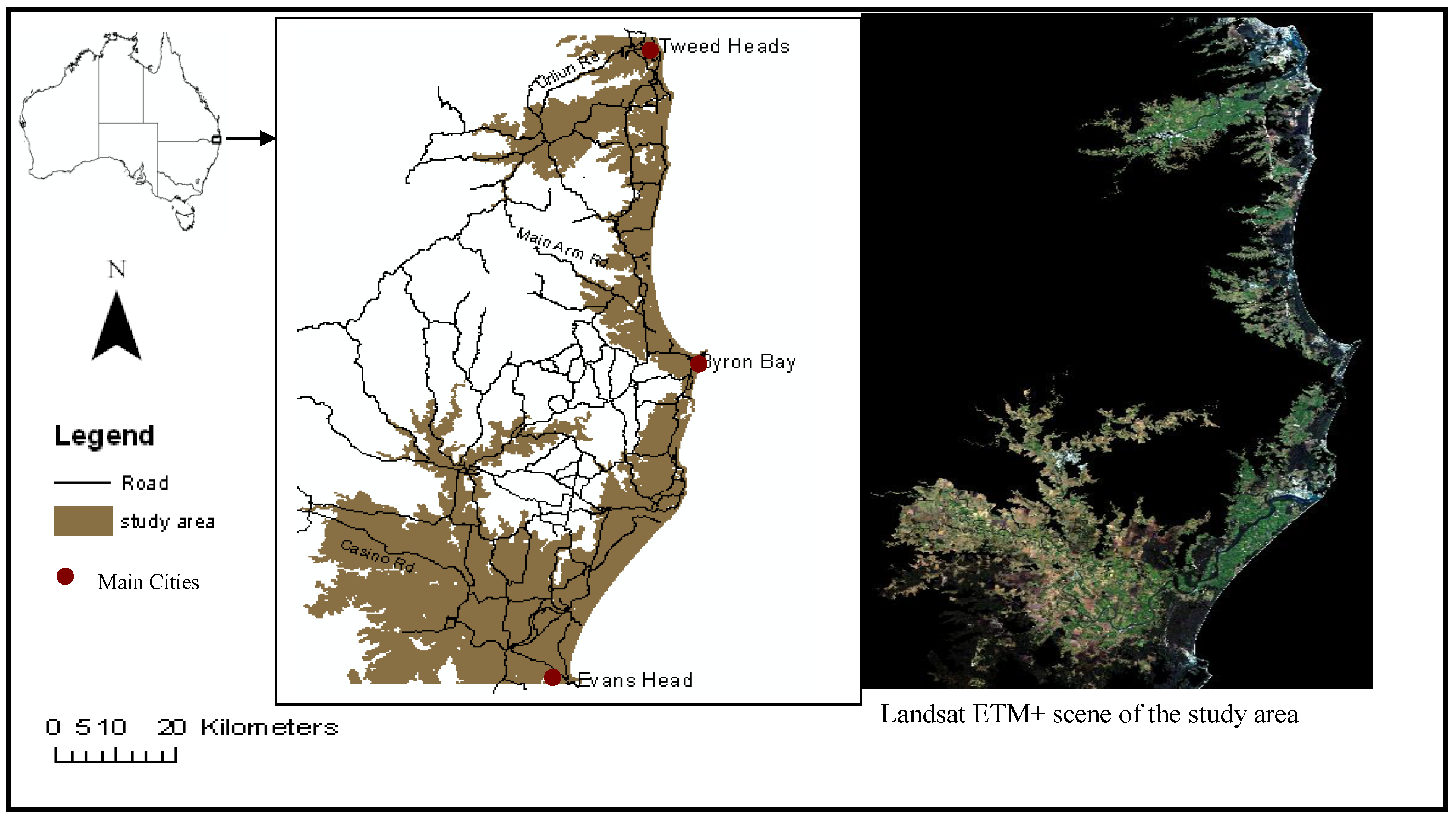
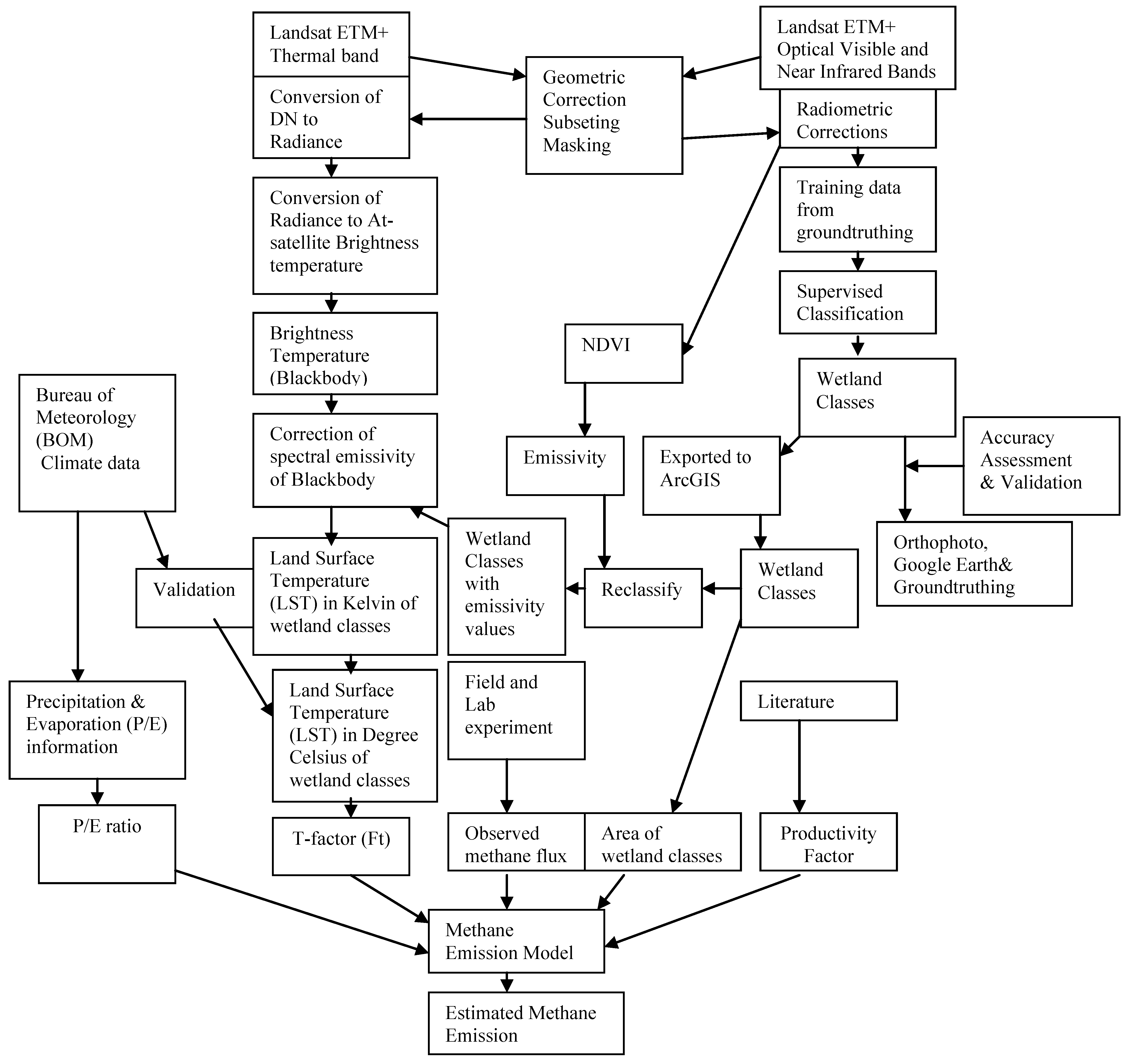
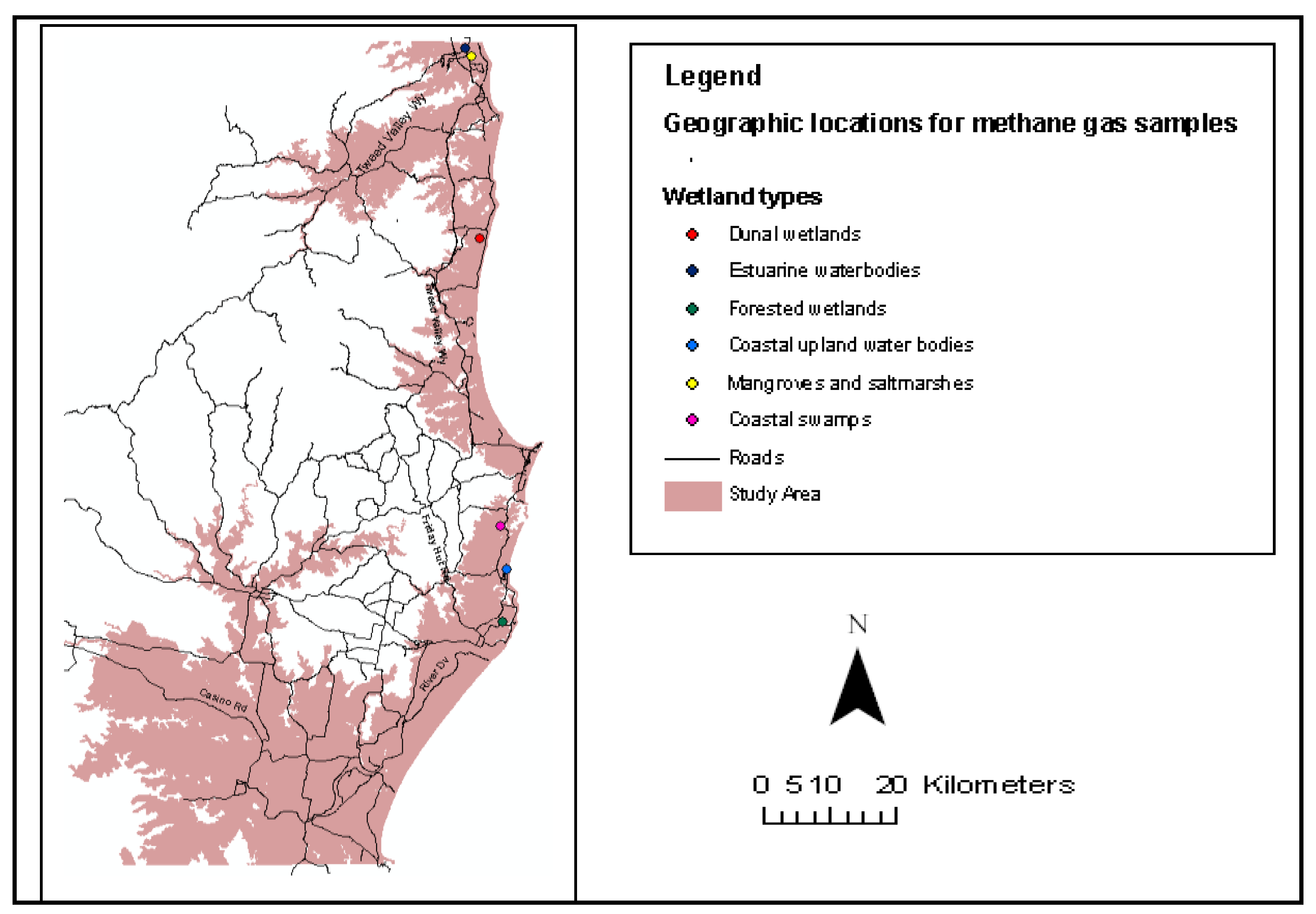
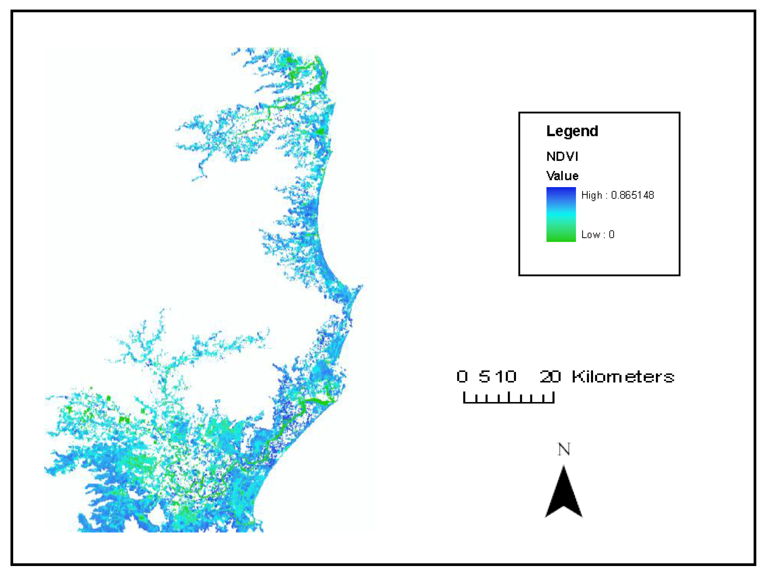
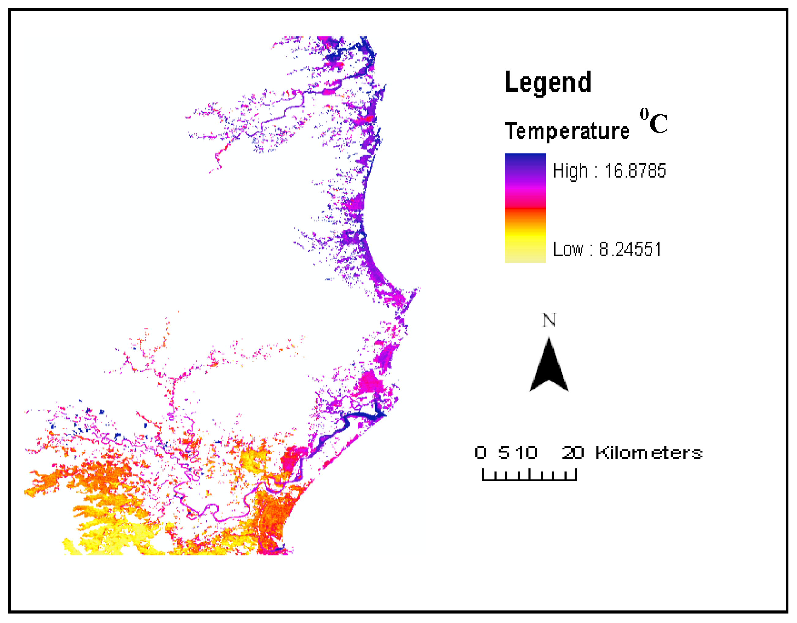
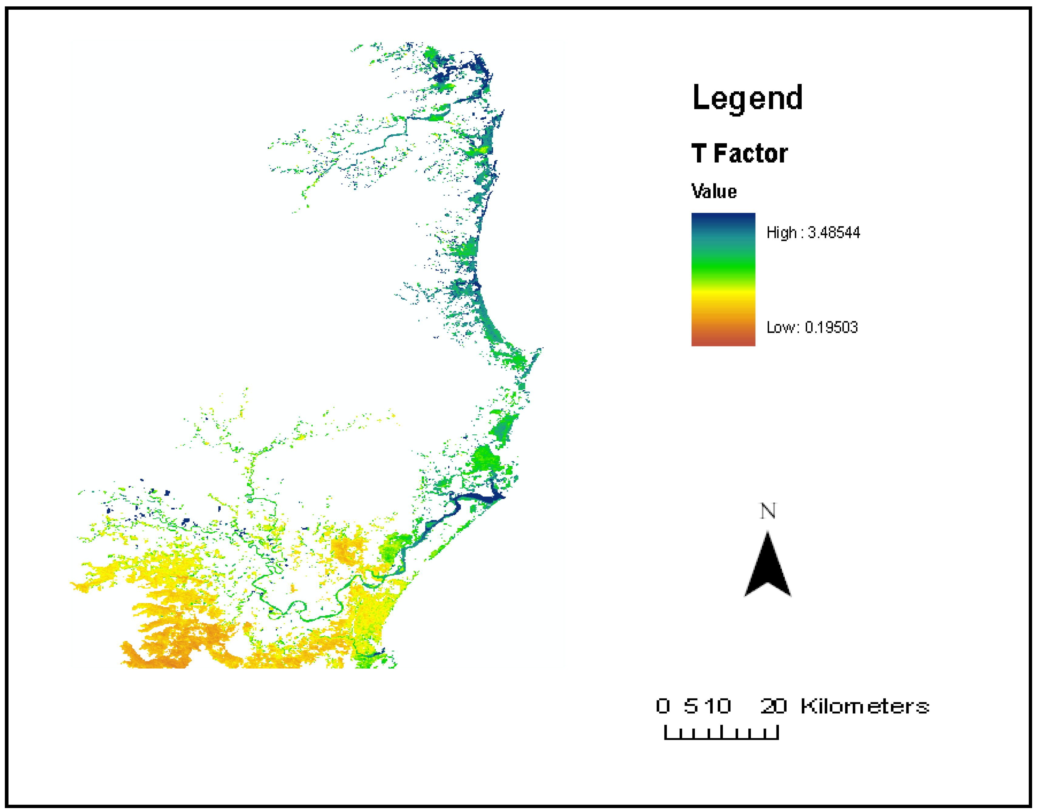
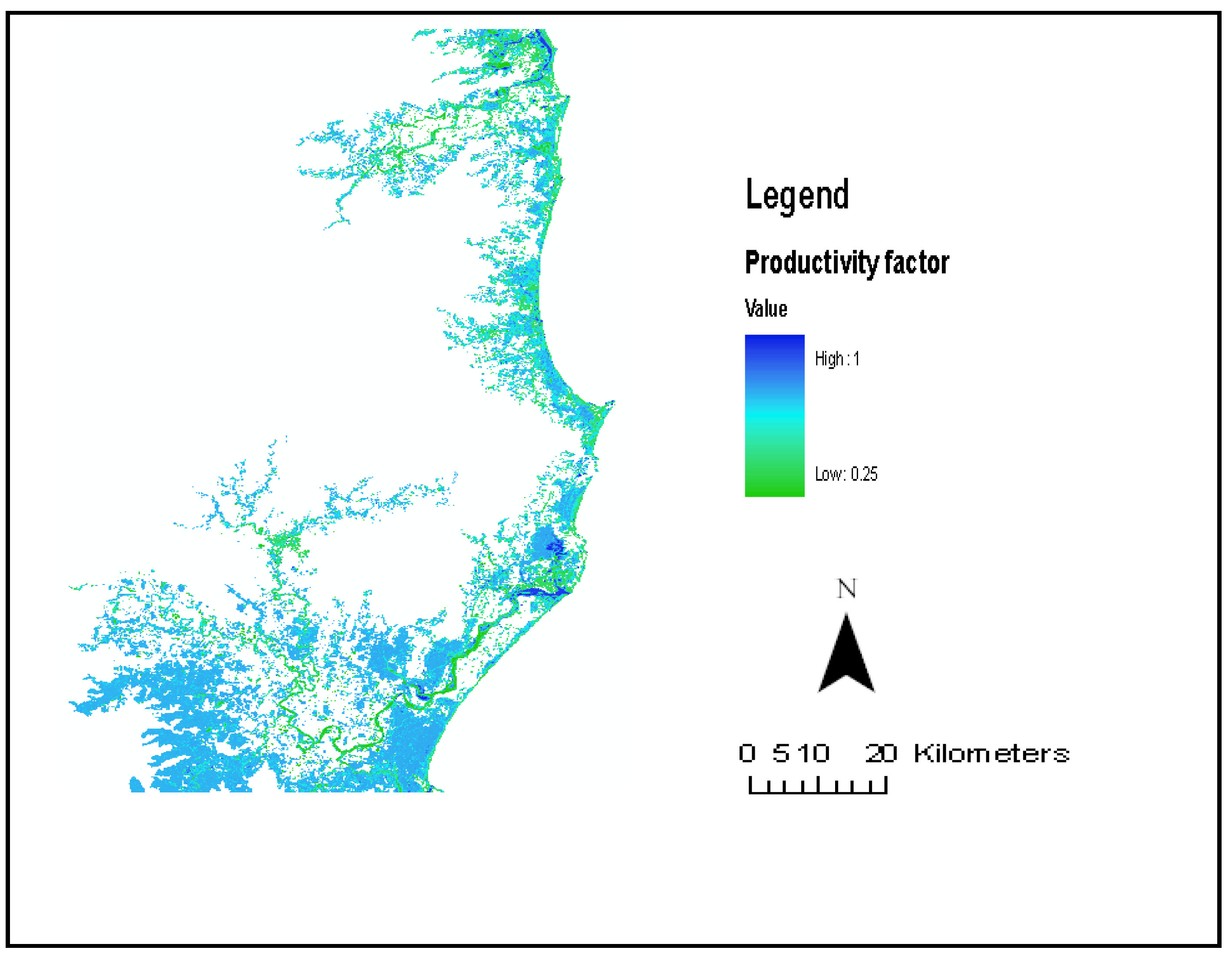
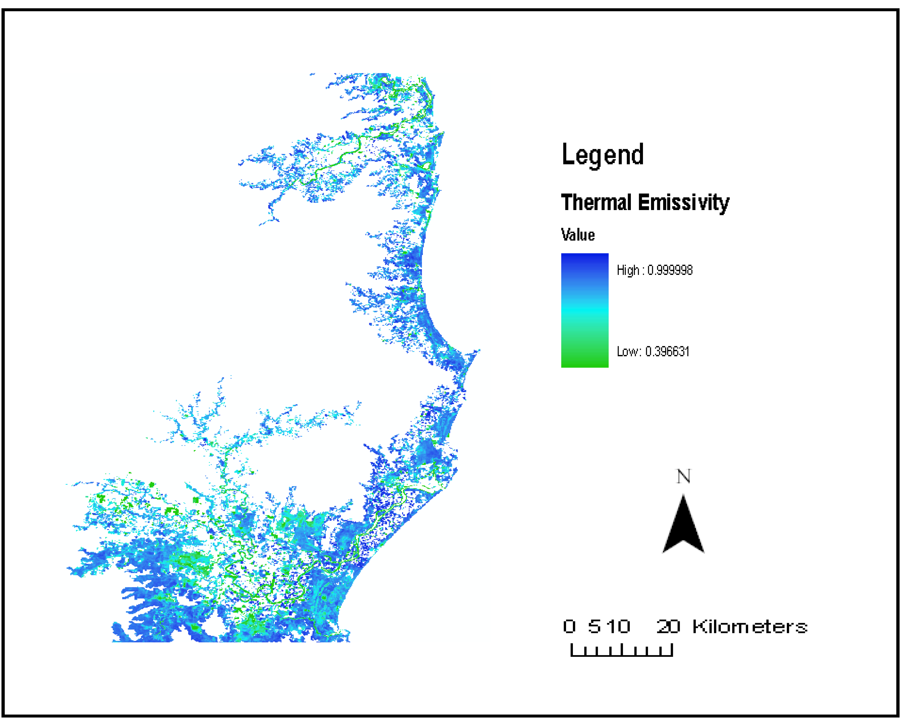
Modeling Methane Emission from Wetlands in North-Eastern New South Wales, Australia Using Landsat ETM+

Abstract
Share and Cite
Akumu, C.E.; Pathirana, S.; Baban, S.; Bucher, D. Modeling Methane Emission from Wetlands in North-Eastern New South Wales, Australia Using Landsat ETM+. Remote Sens. 2010, 2, 1378-1399. https://doi.org/10.3390/rs2051378
Akumu CE, Pathirana S, Baban S, Bucher D. Modeling Methane Emission from Wetlands in North-Eastern New South Wales, Australia Using Landsat ETM+. Remote Sensing. 2010; 2(5):1378-1399. https://doi.org/10.3390/rs2051378
Chicago/Turabian StyleAkumu, Clement E., Sumith Pathirana, Serwan Baban, and Daniel Bucher. 2010. "Modeling Methane Emission from Wetlands in North-Eastern New South Wales, Australia Using Landsat ETM+" Remote Sensing 2, no. 5: 1378-1399. https://doi.org/10.3390/rs2051378
APA StyleAkumu, C. E., Pathirana, S., Baban, S., & Bucher, D. (2010). Modeling Methane Emission from Wetlands in North-Eastern New South Wales, Australia Using Landsat ETM+. Remote Sensing, 2(5), 1378-1399. https://doi.org/10.3390/rs2051378