Article

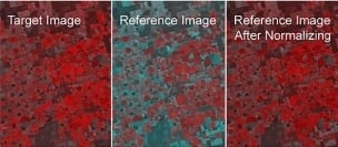
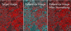
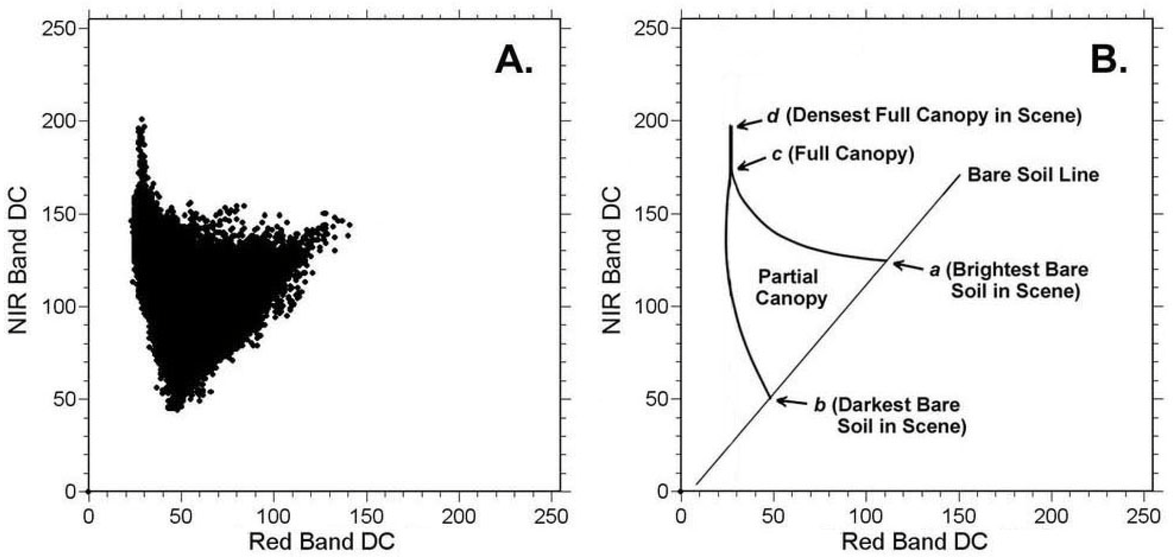
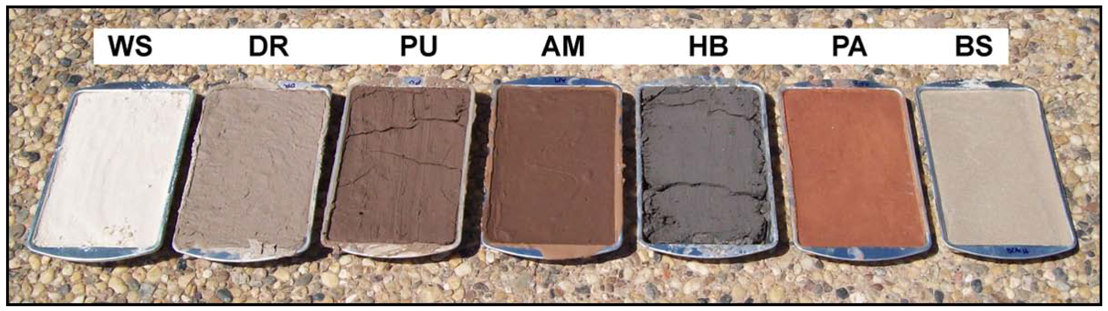
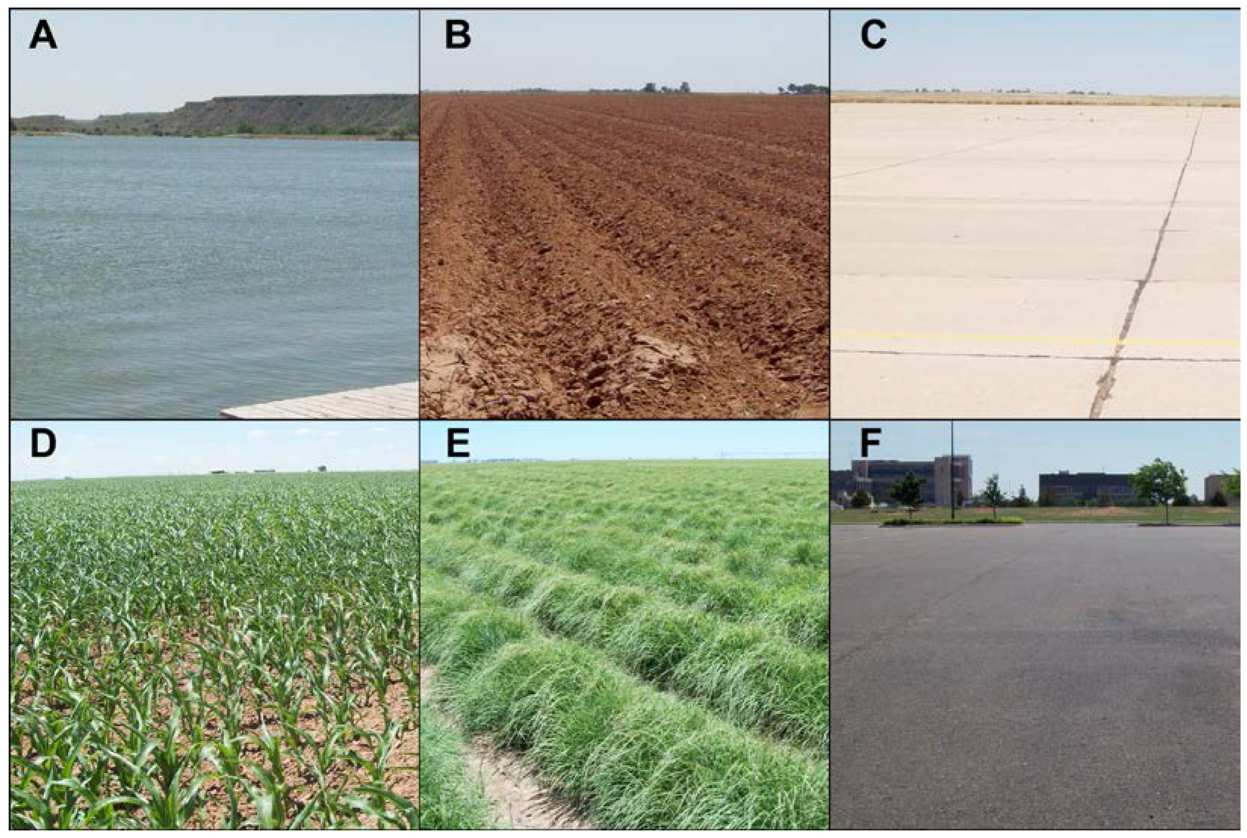
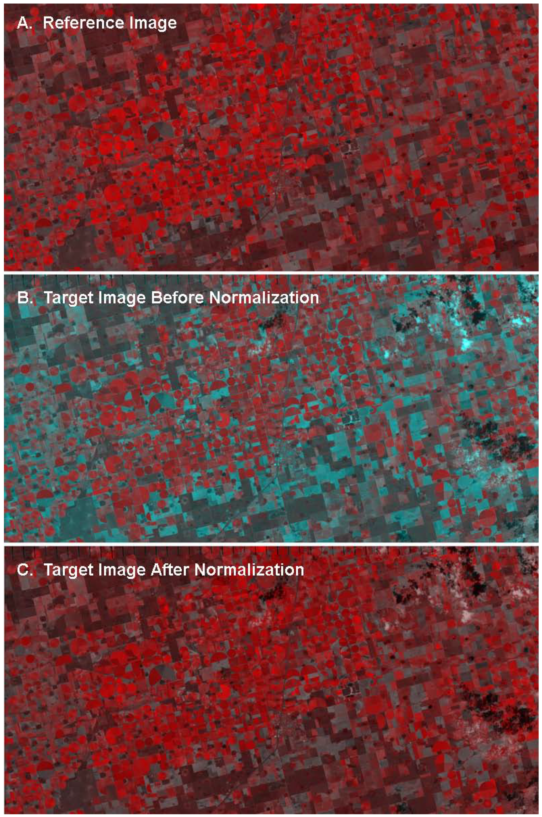
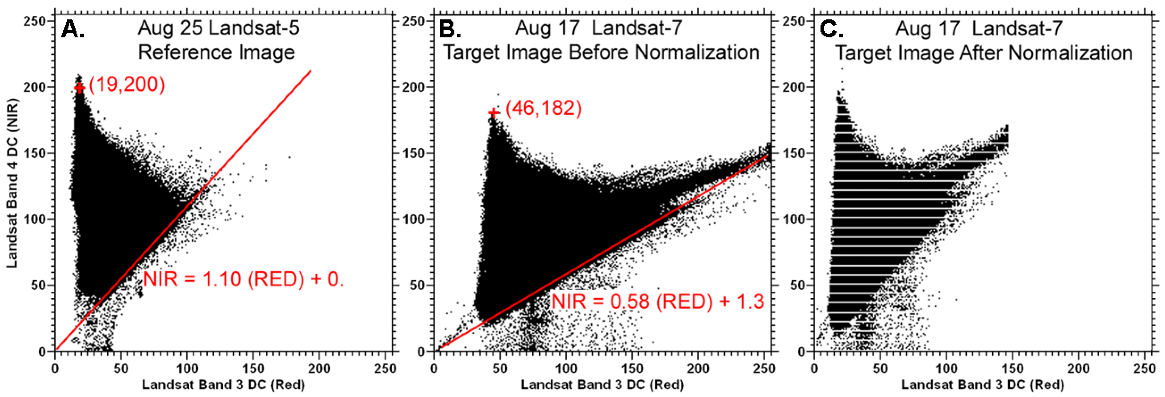
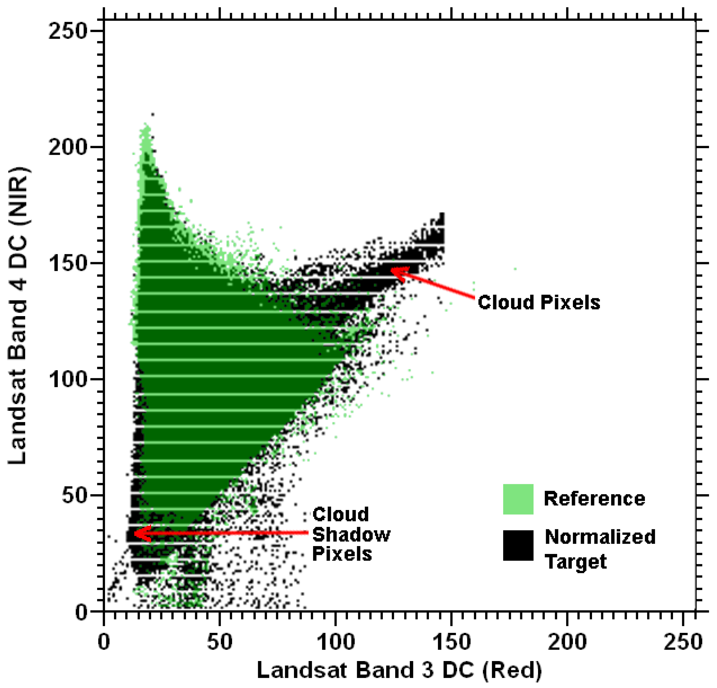
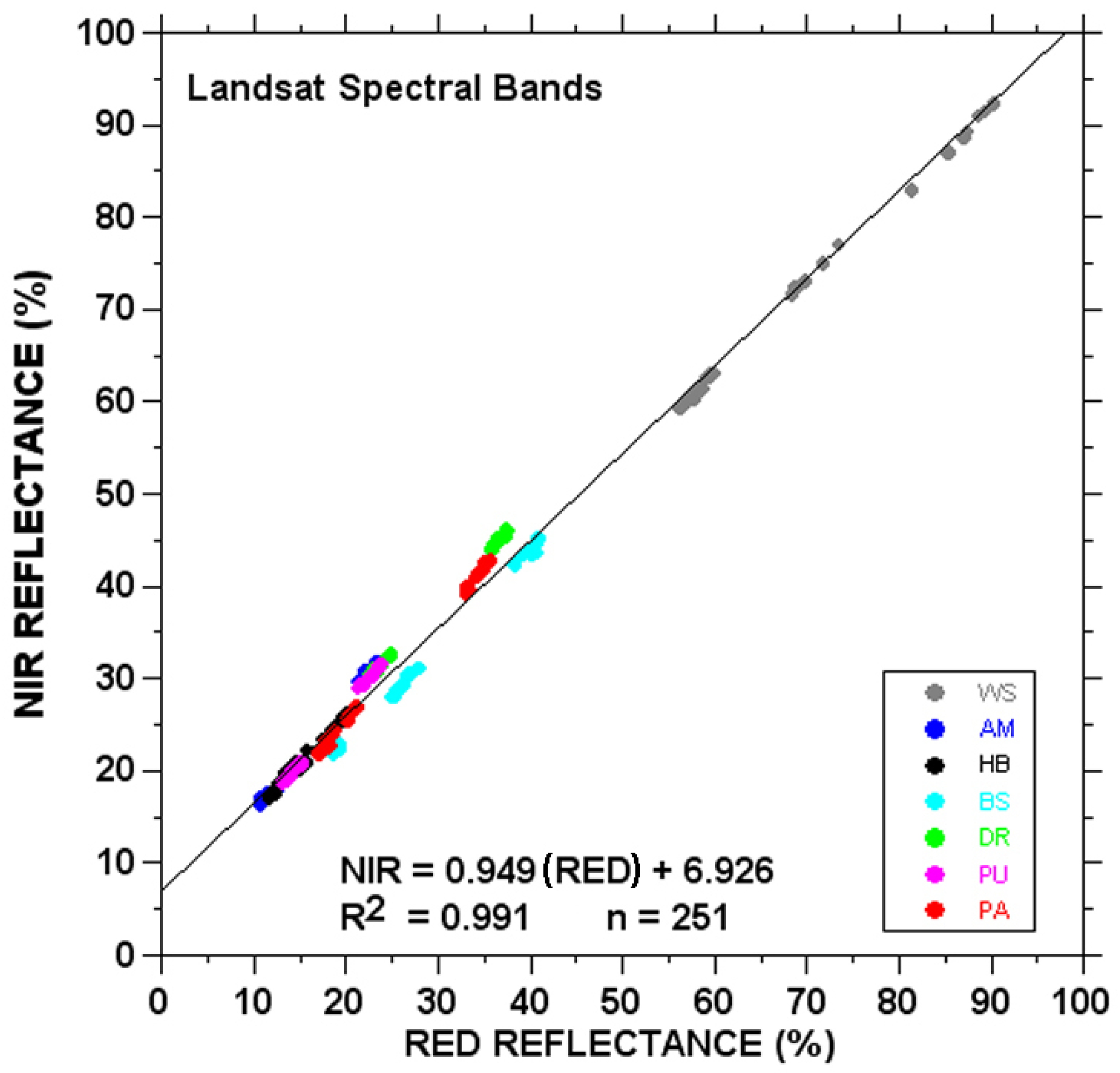
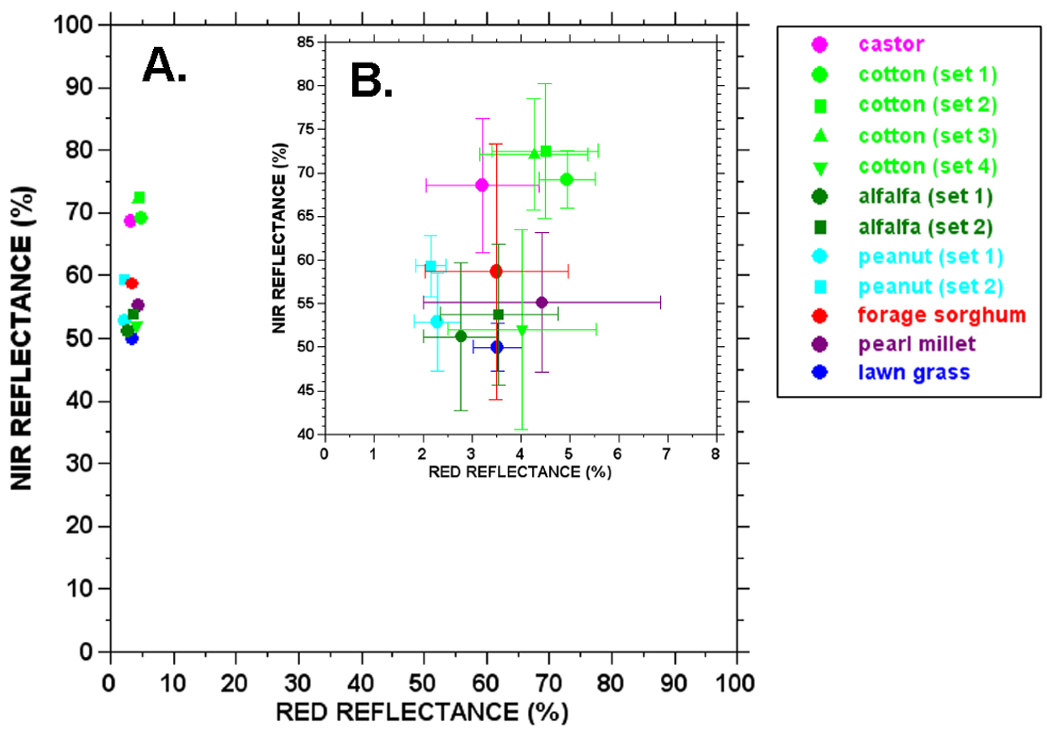
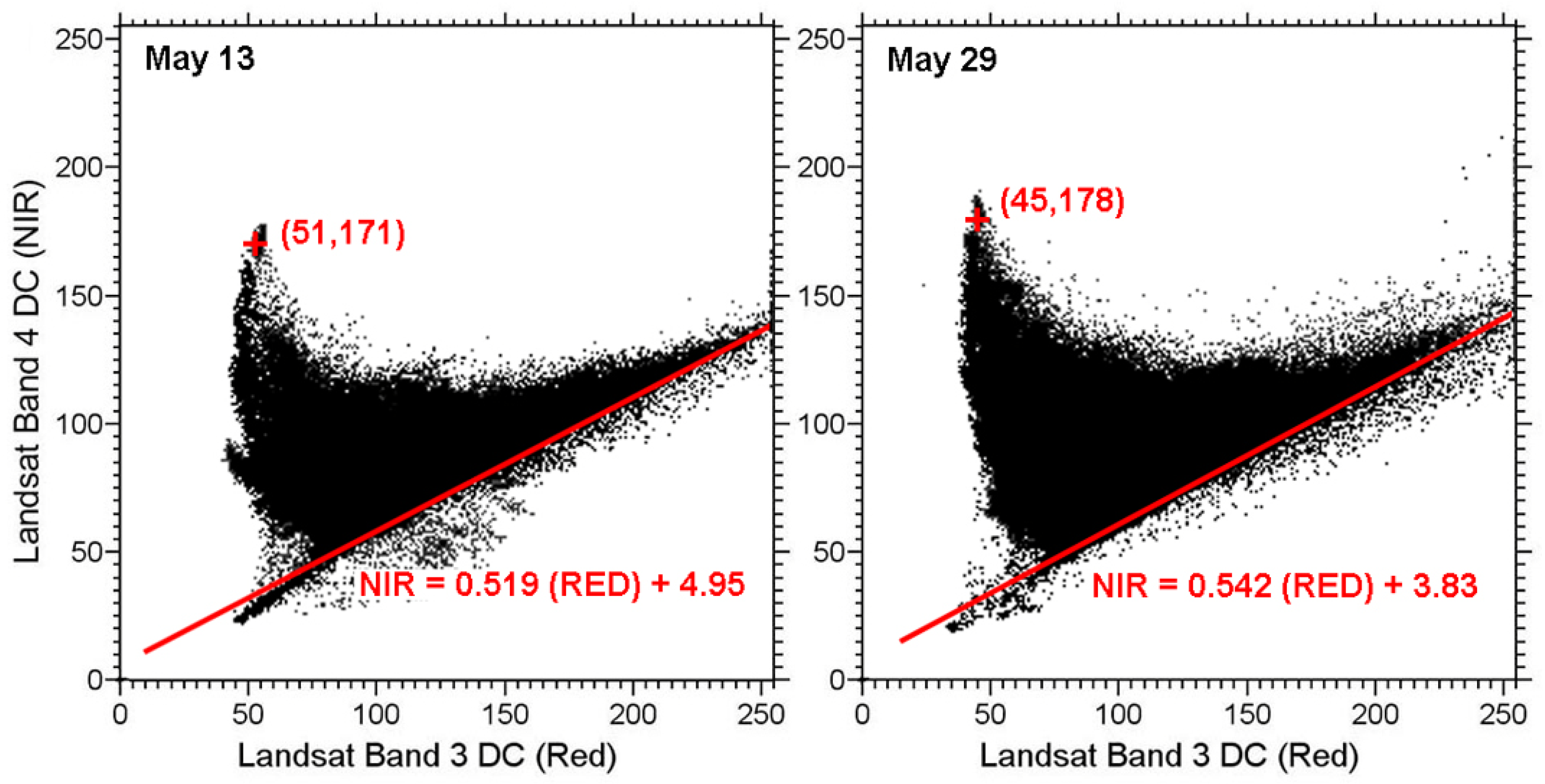
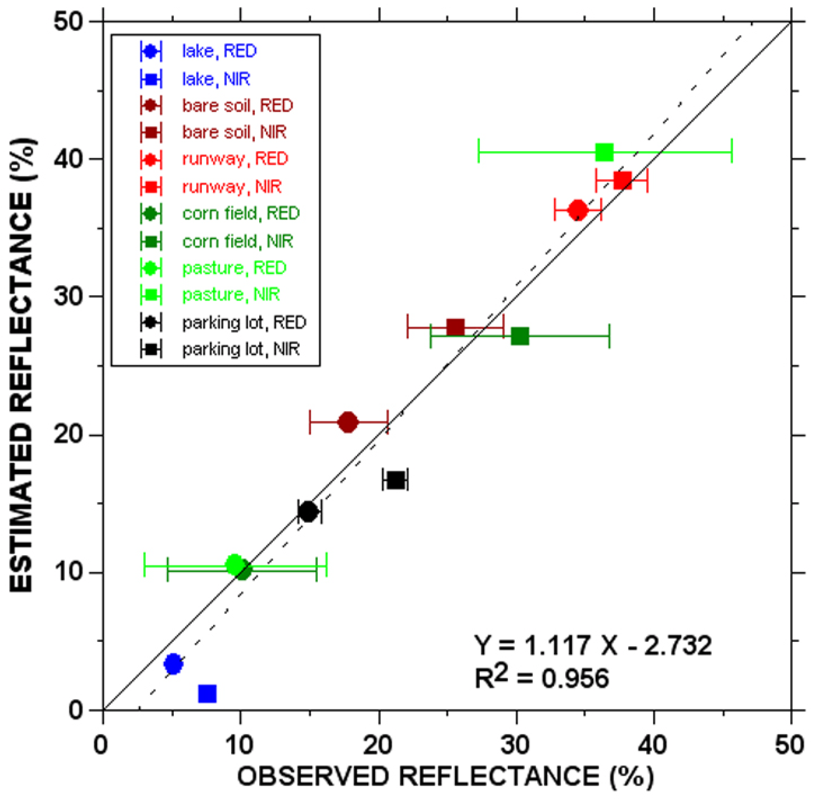
Normalizing and Converting Image DC Data Using Scatter Plot Matching

1
Department of Plant and Soil Science, Texas Tech University, and Texas AgriLife Research, 3810 4th Street, Lubbock, TX 79405, USA
2
Texas AgriLife Research and Extension Center, 11708 Highway 70 South, Vernon, TX 76384, USA
*
Author to whom correspondence should be addressed.
Remote Sens. 2010, 2(7), 1644-1661; https://doi.org/10.3390/rs2071644
Submission received: 20 April 2010 / Revised: 11 May 2010 / Accepted: 7 June 2010 / Published: 24 June 2010

Abstract

Remote sensing image data from sources such as Landsat or airborne multispectral digital cameras are typically in the form of digital count (DC) values. To compare images acquired by the same sensor system on different dates, or images acquired by different sensor systems, it is necessary to correct for differences in the DC values due to sensor characteristics (gain and offset), illumination of the surface (a function of sun angle), and atmospheric clarity. A method is described for normalizing one image to another, or converting image DC values to surface reflectance. This method is based on the identification of pseudo-invariant features (bare soil line and full canopy point) in the scatter plot of red and near-infrared image pixel values. The method, called “scatter plot matching” (SPM), is demonstrated by normalizing a Landsat-7 ETM+ image to a Landsat-5 TM image, and by converting the pixel DC values in a Landsat-5 TM image to values of surface reflectance. While SPM has some limitations, it represents a simple, straight-forward method for calibrating remote sensing image data.
Keywords: remote sensing; surface reflectance; ground cover; soil line; calibration; pseudo-invariant features; canopy reflectance; Landsat remote sensing; surface reflectance; ground cover; soil line; calibration; pseudo-invariant features; canopy reflectance; Landsat
Graphical Abstract

